Bowens Wood

Wood, Forest in Surrey

England

Bowens Wood

Farleigh Court Golf Course This looks down from a footpath at the edge of Frylands Wood. Frith Wood is on the other side of the golf course. This is just beyond the built-up area of Forestdale.
Farleigh Court Golf Course Credit: Marathon

Bowens Wood is a picturesque woodland located in the county of Surrey, England. It is situated near the village of Oxted, covering an area of approximately 10 hectares. The wood is a part of the wider Limpsfield Common and is managed by the National Trust.

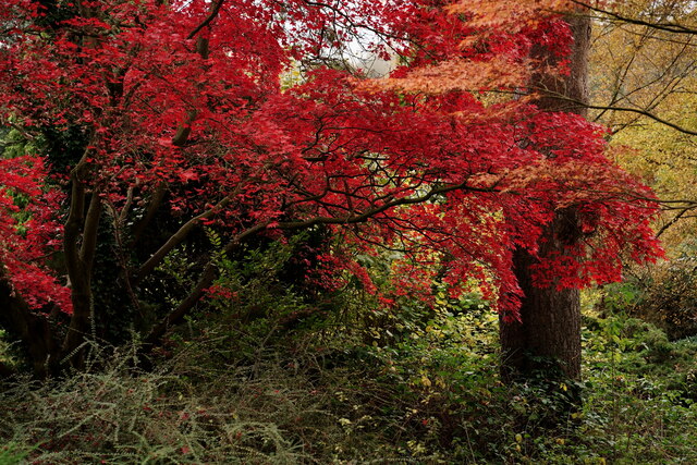
The woodland is characterized by a variety of tree species, including oak, beech, and birch. These trees form a dense canopy, creating a sheltered and serene environment within the wood. The forest floor is covered with a thick layer of leaf litter, providing a home to various small mammals, insects, and fungi.

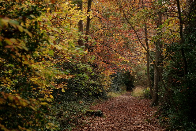
Bowens Wood offers a network of footpaths and trails, allowing visitors to explore its natural beauty. The paths wind through the woodland, leading to open areas where visitors can enjoy picnics or simply relax amidst the tranquil surroundings. Along the way, visitors may encounter diverse wildlife, such as squirrels, deer, and a wide variety of bird species.

The wood is particularly popular during spring when it comes alive with a vibrant display of bluebells. The forest floor transforms into a sea of blue, creating a stunning and ethereal sight. This attracts many visitors who come to witness this natural spectacle and capture it through photography.

Overall, Bowens Wood is a cherished natural treasure in Surrey. Its diverse ecosystem, peaceful ambiance, and scenic beauty make it a haven for nature enthusiasts and a delightful destination for all who seek solace in the tranquil embrace of the wood.

If you have any feedback on the listing, please let us know in the comments section below.
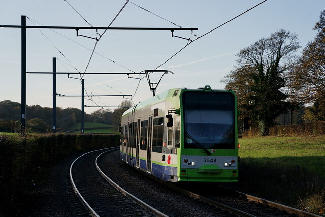
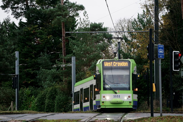
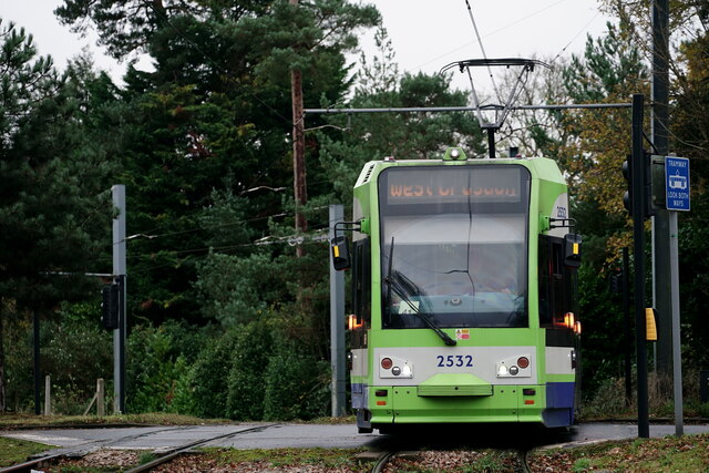
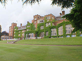
Bowens Wood Images

Images are sourced within 2km of 51.345826/-0.040779106 or Grid Reference TQ3662. Thanks to Geograph Open Source API. All images are credited.

Farleigh Court Golf Course This looks down from a footpath at the edge of Frylands Wood. Frith Wood is on the other side of the golf course. This is just beyond the built-up area of Forestdale.
Farleigh Court Golf Course
This looks down from a footpath at the edge of Frylands Wood. Frith Wood is on the other side of the golf course. This is just beyond the built-up area of Forestdale.
Farleigh Court Golf Course This looks down from a footpath at the edge of Frylands Wood. This is just beyond the built-up area of Forestdale.
Farleigh Court Golf Course
This looks down from a footpath at the edge of Frylands Wood. This is just beyond the built-up area of Forestdale.
Farleigh Court Golf Course This looks across the golf course from a bridleway between Frith Wood and Selsdon Wood which leads to the London Loop . This is just beyond the built-up area of Forestdale.
Farleigh Court Golf Course
This looks across the golf course from a bridleway between Frith Wood and Selsdon Wood which leads to the London Loop . This is just beyond the built-up area of Forestdale.
Bridleway alongside Farleigh Court Golf Course This bridleway leads down from Frith Wood and meets the London Loop and Selsdon Wood just ahead. The latter can be seen on the horizon. This is just beyond the built-up area of Forestdale.
Bridleway alongside Farleigh Court Golf Course
This bridleway leads down from Frith Wood and meets the London Loop and Selsdon Wood just ahead. The latter can be seen on the horizon. This is just beyond the built-up area of Forestdale.
The London Loop through Puplet Wood This section of the London Loop is like being right out in the countryside but is just beyond the housing of Forestdale. Selsdon Wood is just off to the right. The path here is also followed by the Vanguard Way and the Tandridge Border Path.
The London Loop through Puplet Wood
This section of the London Loop is like being right out in the countryside but is just beyond the housing of Forestdale. Selsdon Wood is just off to the right. The path here is also followed by the Vanguard Way and the Tandridge Border Path.
'Animal's head' in Puplet Wood This section of the London Loop is like being right out in the countryside but is just beyond the housing of Forestdale. The path here is also followed by the Vanguard Way and the Tandridge Border Path.
'Animal's head' in Puplet Wood
This section of the London Loop is like being right out in the countryside but is just beyond the housing of Forestdale. The path here is also followed by the Vanguard Way and the Tandridge Border Path.
Autumn Colour Acer in the garden at Heathfield.
Autumn Colour
Acer in the garden at Heathfield.
Autumn Colour Footpath bedside Coombe Lane.
Autumn Colour
Footpath bedside Coombe Lane.
Tramlink West Croydon service approaching the Gravel Hill stop, crossing the road of the same name.
Tramlink
West Croydon service approaching the Gravel Hill stop, crossing the road of the same name.
Tramlink West Croydon service at the Gravel Hill stop.
Tramlink
West Croydon service at the Gravel Hill stop.
Tramlink New Addington service arriving at the Gravel Hill stop.
Tramlink
New Addington service arriving at the Gravel Hill stop.
Tramlink Tram approaching the crossing at the top of Coombe Lane.
Tramlink
Tram approaching the crossing at the top of Coombe Lane.
Tramlink Tram on the Coombe Lane crossing.
Tramlink
Tram on the Coombe Lane crossing.
Tramlink Tram on the Coombe Lane crossing.
Tramlink
Tram on the Coombe Lane crossing.
Heathfield Looking across the terrace.
Heathfield
Looking across the terrace.
Fox in the sun Relaxing at the edge of Bowens Wood.
Fox in the sun
Relaxing at the edge of Bowens Wood.
Pond in the rock garden at Heathfield Heathfield was originally a Georgian estate and went through a number of ownership changes and extensions, but by the mid 1920s was very run down. The estate was bought by Raymond Riesco in 1927. In the 40 years that Riesco owned the land, he changed it from a run down farm to model estate set around the mansion and ornamental gardens. Riesco was a very keen gardener and in the 1920s employed a firm of landscape contractors to lay-out the rock garden and terraces, which were planted with a variety of alpines, small trees and shrubs. The walled garden provided fruit and vegetables for the kitchen and the small nursery on one side produced plants for the ornamental areas. On the death of Raymond Riesco in 1964, Croydon Corporation bought the house and gardens, and opened the gardens to the public. The house is now a training centre.

This view is of the rock garden looking across the frozen pond at its base. See also <a title="https://www.geograph.org.uk/photo/2797000" href="https://www.geograph.org.uk/photo/2797000">Link</a>
Pond in the rock garden at Heathfield
Heathfield was originally a Georgian estate and went through a number of ownership changes and extensions, but by the mid 1920s was very run down. The estate was bought by Raymond Riesco in 1927. In the 40 years that Riesco owned the land, he changed it from a run down farm to model estate set around the mansion and ornamental gardens. Riesco was a very keen gardener and in the 1920s employed a firm of landscape contractors to lay-out the rock garden and terraces, which were planted with a variety of alpines, small trees and shrubs. The walled garden provided fruit and vegetables for the kitchen and the small nursery on one side produced plants for the ornamental areas. On the death of Raymond Riesco in 1964, Croydon Corporation bought the house and gardens, and opened the gardens to the public. The house is now a training centre. This view is of the rock garden looking across the frozen pond at its base. See also Link
Show me another place!

Bowens Wood is located at Grid Ref: TQ3662 (Lat: 51.345826, Lng: -0.040779106)

Unitary Authority: Croydon

Police Authority: Metropolitan

What 3 Words

///tooth.wheels.land. Near West Wickham, London

Related Wikis

Forestdale, London

Forestdale is a residential neighbourhood of southeast London in the London Borough of Croydon. It is sometimes considered to be part of Addington, its...

John Ruskin College

John Ruskin College is a further education college in South Croydon offering full-time vocational courses and apprenticeships as well as part-time courses...

The Quest Academy, Croydon

The Quest Academy (formerly known as Selsdon High School and Monks Hill Comprehensive School) is a coeducational secondary school and sixth form with academy...

Selsdon

Selsdon is an area in South London, England, located in the London Borough of Croydon, in the ceremonial county of Greater London. Prior to 1965 it was...

Nearby Amenities

Located within 500m of 51.345826,-0.040779106
Ref GB Tflcid: RWG216538
Traffic Calming: yes
Lat/Long: 51.3447316/-0.0465616
Mini Roundabout
Lat/Long: 51.3460047/-0.0449949
Ref GB Tflcid: RWG216994
Traffic Calming: hump
Lat/Long: 51.3485335/-0.0372792
Mini Roundabout
Direction: clockwise
Source: ground survey 29.04.2011
Lat/Long: 51.346943/-0.042219
Ref GB Tflcid: RWG216526
Traffic Calming: hump
Lat/Long: 51.3455643/-0.0402995
Ref GB Tflcid: RWG216528
Traffic Calming: yes
Lat/Long: 51.3453445/-0.0405741
Ref GB Tflcid: RWG216536
Traffic Calming: hump
Lat/Long: 51.3446582/-0.0450802
Ref GB Tflcid: RWG216001
Traffic Calming: cushion
Lat/Long: 51.3495455/-0.0435615
Ref GB Tflcid: RWG216006
Traffic Calming: cushion
Lat/Long: 51.348849/-0.0454417
Ref GB Tflcid: RWG216978
Traffic Calming: table
Lat/Long: 51.3439162/-0.0372274
Bus Stop
Court Wood Lane / Bardolph Avenue
Bus: yes
Local Ref: U
Naptan AtcoCode: 490003594N
Naptan Bearing: N
Naptan CommonName: Court Wood LaneBardolph Ave
Naptan Indicator: Stop U
Naptan Street: COURTWOOD LANE
Naptan Verified: no
Public Transport: platform
Lat/Long: 51.3459778/-0.0363483
Bus Stop
Bears Wood
Bus: yes
Naptan AtcoCode: 490003719N
Naptan Bearing: N
Naptan CommonName: Bears Wood
Naptan Street: COURTWOOD LANE
Naptan Verified: no
Public Transport: platform
Ref: 77779
Source Ref: naptan
Lat/Long: 51.3426336/-0.037662
Bus Stop
Bears Wood
Bus: yes
Naptan AtcoCode: 490003719S
Naptan Bearing: N
Naptan CommonName: Bears Wood
Naptan Street: COURTWOOD LANE
Naptan Verified: no
Public Transport: platform
Ref: 50377
Source Ref: naptan
Lat/Long: 51.34273/-0.0374641
Bus Stop
Courtwood Primary School
Bus: yes
Naptan AtcoCode: 490005677S
Naptan Bearing: N
Naptan CommonName: Courtwood Primary School
Naptan Street: COURTWOOD LANE
Naptan Verified: no
Public Transport: platform
Ref: 50421
Source Ref: naptan
Lat/Long: 51.3446915/-0.0368159
Bus Stop
Crofters Mead
Bus: yes
Local Ref: M
Naptan AtcoCode: 490005783W
Naptan Bearing: W
Naptan CommonName: Crofters Mead
Naptan Indicator: Stop M
Naptan Street: BARDOLPH AVENUE
Naptan Verified: no
Public Transport: platform
Ref: 73478
Source Ref: naptan
Lat/Long: 51.3456119/-0.0370636
Bus Stop
John Ruskin College
Bench: no
Bin: no
Bus: yes
Local Ref: A
Naptan AtcoCode: 490008570E
Naptan Bearing: E
Naptan CommonName: John Ruskin College
Naptan Indicator: Stop A
Naptan Street: SELSDON PARK ROAD
Public Transport: platform
Ref: 72322
Shelter: no
Source Ref: naptan
Lat/Long: 51.349741/-0.0425494
Bus Stop
Farnborough Crescent
Bus: yes
Local Ref: X
Naptan AtcoCode: 490008570N
Naptan Bearing: N
Naptan CommonName: John Ruskin College
Naptan Indicator: Stop X
Naptan Street: FARNBOROUGH AVENUE
Naptan Verified: no
Public Transport: platform
Ref: 47457
Source Ref: naptan
Lat/Long: 51.3495719/-0.0437545
Bus Stop
John Ruskin College
Bench: yes
Bin: yes
Bus: yes
Local Ref: J
Naptan AtcoCode: 490008570W
Naptan Bearing: W
Naptan CommonName: John Ruskin College
Naptan Indicator: Stop J
Naptan Street: SELSDON PARK ROAD
Public Transport: platform
Ref: 74787
Shelter: yes
Source Ref: naptan
Lat/Long: 51.3492735/-0.043153
Bus Stop
Sorrel Bank
Bus: yes
Naptan AtcoCode: 490009197E
Naptan Bearing: N
Naptan CommonName: Sorrel Bank
Naptan Street: SORREL BANK
Naptan Verified: no
Public Transport: platform
Ref: 72655
Source Ref: naptan
Lat/Long: 51.3461553/-0.0446149
Bus Stop
Sorrel Bank
Bus: yes
Naptan AtcoCode: 490009197W
Naptan Bearing: N
Naptan CommonName: Sorrel Bank
Naptan Street: SORREL BANK
Naptan Verified: no
Public Transport: platform
Ref: 72670
Source Ref: naptan
Lat/Long: 51.3460331/-0.0446348
Bus Stop
Newlands Woods
Bus: yes
Local Ref: R
Naptan AtcoCode: 490010229E
Naptan Bearing: E
Naptan CommonName: Newlands Woods
Naptan Indicator: Stop R
Naptan Street: BARDOLPH AVENUE
Naptan Verified: no
Public Transport: platform
Ref: 52244
Source Ref: naptan
Lat/Long: 51.3468145/-0.0388916
Bus Stop
Newlands Woods
Bus: yes
Local Ref: N
Naptan AtcoCode: 490010229W
Naptan Bearing: W
Naptan CommonName: Newlands Woods
Naptan Indicator: Stop N
Naptan Street: BARDOLPH AVENUE
Naptan Verified: no
Public Transport: platform
Ref: 74666
Source Ref: naptan
Lat/Long: 51.3467156/-0.0397302
Bus Stop
Pixton Way
Bench: yes
Bin: yes
Bus: yes
Local Ref: Q
Naptan AtcoCode: 490011032N
Naptan Bearing: N
Naptan CommonName: Pixton Way
Naptan Indicator: Stop Q
Naptan Street: PIXTON WAY
Naptan Verified: no
Public Transport: platform
Ref: 52404
Shelter: yes
Source Ref: naptan
Lat/Long: 51.3466278/-0.0431021
Bus Stop
Pixton Way
Bench: yes
Bin: yes
Bus: yes
Local Ref: P
Naptan AtcoCode: 490011032S
Naptan Bearing: S
Naptan CommonName: Pixton Way
Naptan Indicator: Stop P
Naptan Street: PIXTON WAY
Naptan Verified: no
Public Transport: platform
Ref: 48597
Shelter: yes
Source Ref: naptan
Lat/Long: 51.3465098/-0.0430413
Bus Stop
The Green
Bus: yes
Local Ref: S
Naptan AtcoCode: 490013389N
Naptan Bearing: N
Naptan CommonName: The Green Courtwood Lane
Naptan Indicator: Stop S
Naptan Street: COURTWOOD LANE
Naptan Verified: no
Public Transport: platform
Lat/Long: 51.347509/-0.035587
Bus Stop
The Green
Bus: yes
Local Ref: L
Naptan AtcoCode: 490013389S
Naptan Bearing: S
Naptan CommonName: The Green Courtwood Lane
Naptan Indicator: Stop L
Naptan Street: COURTWOOD LANE
Naptan Verified: no
Public Transport: platform
Lat/Long: 51.3472577/-0.0355137
Post Box
Collection Plate: CP1
Collection Times: Mo-Fr 16:30; Sa 11:15
Operator: Royal Mail
Operator Wikidata: Q638098
Post Box Type: pillar
Ref: CR0 572
Royal Cypher: EIIR
Royal Cypher Wikidata: Q33102113
Lat/Long: 51.343398/-0.0373276
Post Box
Operator: Royal Mail
Operator Wikidata: Q638098
Ref: CR0 84
Lat/Long: 51.3467948/-0.0418369
Post Box
Operator: Royal Mail
Operator Wikidata: Q638098
Ref: CR0 327
Lat/Long: 51.3486524/-0.0357072
Turning Circle
Source: Bing
Lat/Long: 51.3466354/-0.0340594
Ref GB Tflcid: RWG216522
Traffic Calming: hump
Lat/Long: 51.3460761/-0.0414802
Ref GB Tflcid: RWG216514
Traffic Calming: hump
Lat/Long: 51.3444375/-0.0434812
Ref GB Tflcid: RWG216511
Traffic Calming: hump
Lat/Long: 51.3448835/-0.042703
Ref GB Tflcid: RWG216519
Traffic Calming: hump
Lat/Long: 51.3456606/-0.0420194
Ref GB Tflcid: RWG216516
Traffic Calming: yes
Lat/Long: 51.3452937/-0.0423278
Ref GB Tflcid: RWG216481
Traffic Calming: yes
Lat/Long: 51.3468383/-0.0448625
Ref GB Tflcid: RWG216484
Traffic Calming: hump
Lat/Long: 51.3467529/-0.045863
Ref GB Tflcid: RWG216489
Traffic Calming: yes
Lat/Long: 51.3470377/-0.0445996
Ref GB Tflcid: RWG216494
Traffic Calming: hump
Lat/Long: 51.3483495/-0.0443073
Ref GB Tflcid: RWG216490
Traffic Calming: hump
Lat/Long: 51.3473359/-0.0440847
Ref GB Tflcid: RWG216506
Traffic Calming: yes
Lat/Long: 51.3453751/-0.043888
Ref GB Tflcid: RWG216457
Traffic Calming: hump
Lat/Long: 51.3484021/-0.0416625
Traffic Calming: hump
Lat/Long: 51.3487816/-0.0427199
Ref GB Tflcid: RWG216458
Traffic Calming: hump
Lat/Long: 51.3486007/-0.0420221
Traffic Calming: hump
Lat/Long: 51.3479877/-0.0415774
Ref GB Tflcid: RWG216979
Traffic Calming: table
Lat/Long: 51.3447846/-0.0368679
Noexit: yes
Lat/Long: 51.3475674/-0.0426147
Noexit: yes
Lat/Long: 51.3484364/-0.0424698
Crossing
Crossing: traffic_signals
Crossing Island: no
Crossing Ref: pelican
Tactile Paving: yes
Lat/Long: 51.3495278/-0.042827
Ref GB Tflcid: RWG216450
Traffic Calming: cushion
Lat/Long: 51.3487365/-0.039689
Bar
The Forum
Addr City: Croydon
Addr Housename: The Forum
Addr Housenumber: 1
Addr Postcode: CR0 9BG
Addr Street: Bardolph Avenue
Fhrs Authority: Croydon
Fhrs Id: 5261
Lat/Long: 51.346574/-0.0420901
Ref GB Tflcid: RWG216979
Traffic Calming: table
Lat/Long: 51.3447225/-0.0368955
Post Box
Collection Times: Mo-Fr 16:15; Sa 11:00; Su off
Drive Through: no
Operator: Royal Mail
Operator Wikidata: Q638098
Post Box Type: pillar
Ref: CR2 354
Royal Cypher: GR
Royal Cypher Wikidata: Q33102273
Source: survey
Lat/Long: 51.348624/-0.0454688
Addr City: Croydon
Addr Housenumber: 1
Addr Postcode: CR0 9HY
Addr Street: Cascades
Source: survey;code-point open
Lat/Long: 51.3428491/-0.0378286
Addr City: Croydon
Addr Housenumber: 2
Addr Postcode: CR0 9HY
Addr Street: Cascades
Source: survey;code-point open
Lat/Long: 51.3427779/-0.0378345
Addr City: Croydon
Addr Housenumber: 44-48
Addr Postcode: CR0 9HZ
Addr Street: Cascades
Source: survey;code-point open
Lat/Long: 51.3432885/-0.0394649
Addr City: Croydon
Addr Housenumber: 3-7
Addr Postcode: CR0 9HY
Addr Street: Cascades
Source: survey;code-point open
Lat/Long: 51.342919/-0.0379072
Addr City: Croydon
Addr Housenumber: 8-12
Addr Postcode: CR0 9HY
Addr Street: Cascades
Source: survey;code-point open
Lat/Long: 51.3429558/-0.0380662
Addr City: Croydon
Addr Housenumber: 37
Addr Postcode: CR0 9HZ
Addr Street: Cascades
Source: survey;code-point open
Lat/Long: 51.3431778/-0.0392345
Addr City: Croydon
Addr Housenumber: 38
Addr Postcode: CR0 9HZ
Addr Street: Cascades
Source: survey;code-point open
Lat/Long: 51.3431103/-0.0392522
Addr City: Croydon
Addr Housenumber: 8-12
Addr Postcode: CR0 9HY
Addr Street: Cascades
Source: survey;code-point open
Lat/Long: 51.3429999/-0.0382194
Addr City: Croydon
Addr Housenumber: 13-17
Addr Postcode: CR0 9HY
Addr Street: Cascades
Source: survey;code-point open
Lat/Long: 51.3430465/-0.0383784
Addr City: Croydon
Addr Housenumber: 18-22
Addr Postcode: CR0 9HY
Addr Street: Cascades
Source: survey;code-point open
Lat/Long: 51.3430649/-0.0385865
Addr City: Croydon
Addr Housenumber: 23-27
Addr Postcode: CR0 9HY
Addr Street: Cascades
Source: survey;code-point open
Lat/Long: 51.3430993/-0.0387554
Addr City: Croydon
Addr Housenumber: 28-36
Addr Postcode: CR0 9HY
Addr Street: Cascades
Source: survey;code-point open
Lat/Long: 51.3431449/-0.0389255
Addr City: Croydon
Addr Housenumber: 39-43
Addr Postcode: CR0 9HZ
Addr Street: Cascades
Source: survey;code-point open
Lat/Long: 51.343246/-0.0393153
Addr City: Croydon
Addr Housenumber: 49-56
Addr Postcode: CR0 9HZ
Addr Street: Cascades
Source: survey;code-point open
Lat/Long: 51.3433192/-0.0396446
Addr City: Croydon
Addr Housenumber: 57-60
Addr Postcode: CR0 9HZ
Addr Street: Cascades
Source: survey;code-point open
Lat/Long: 51.3433699/-0.0399017
Addr City: Croydon
Addr Housenumber: 288
Addr Postcode: CR0 9HJ
Addr Street: Osward
Source: survey;code-point open
Lat/Long: 51.3424492/-0.0365467
Addr City: Croydon
Addr Housenumber: 289
Addr Postcode: CR0 9HJ
Addr Street: Osward
Source: survey;code-point open
Lat/Long: 51.3423255/-0.0370569
Addr City: Croydon
Addr Housenumber: 295
Addr Postcode: CR0 9HJ
Addr Street: Osward
Source: survey;code-point open
Lat/Long: 51.3420934/-0.0368208
Addr City: Croydon
Addr Housenumber: 272
Addr Postcode: CR0 9HJ
Addr Street: Osward
Source: survey;code-point open
Lat/Long: 51.3426937/-0.0362916
Addr City: Croydon
Addr Housenumber: 267
Addr Postcode: CR0 9HJ
Addr Street: Osward
Source: survey;code-point open
Lat/Long: 51.3427406/-0.0358739
Addr City: Croydon
Addr Housenumber: 260
Addr Postcode: CR0 9HJ
Addr Street: Osward
Source: survey;code-point open
Lat/Long: 51.3427793/-0.0367374
Addr City: Croydon
Addr Housenumber: 266
Addr Postcode: CR0 9HJ
Addr Street: Osward
Source: survey;code-point open
Lat/Long: 51.342934/-0.0363676
Addr City: Croydon
Addr Housenumber: 254
Addr Postcode: CR0 9HJ
Addr Street: Osward
Source: survey;code-point open
Lat/Long: 51.3426338/-0.0371824
Addr City: Croydon
Addr Housenumber: 259
Addr Postcode: CR0 9HJ
Addr Street: Osward
Source: survey;code-point open
Lat/Long: 51.3427566/-0.0368802
Addr City: Croydon
Addr Housenumber: 182
Addr Postcode: CR0 9HF
Addr Street: Osward
Source: survey;code-point open
Lat/Long: 51.3442595/-0.0368186
Addr City: Croydon
Addr Housenumber: 178
Addr Postcode: CR0 9HF
Addr Street: Osward
Source: survey;code-point open
Lat/Long: 51.3443559/-0.0365586
Addr City: Croydon
Addr Housenumber: 172
Addr Postcode: CR0 9HF
Addr Street: Osward
Source: survey;code-point open
Lat/Long: 51.3445316/-0.0363745
Addr City: Croydon
Addr Housenumber: 177
Addr Postcode: CR0 9HF
Addr Street: Osward
Source: survey;code-point open
Lat/Long: 51.3447281/-0.0365759
Addr City: Croydon
Addr Housenumber: 167
Addr Postcode: CR0 9HF
Addr Street: Osward
Source: survey;code-point open
Lat/Long: 51.3442798/-0.0362151
Addr City: Croydon
Addr Housenumber: 171
Addr Postcode: CR0 9HF
Addr Street: Osward
Source: survey;code-point open
Lat/Long: 51.3444489/-0.036334
Power: tower
Lat/Long: 51.3436316/-0.0399166
Power: tower
Lat/Long: 51.3433669/-0.038369
Noexit: yes
Lat/Long: 51.3486132/-0.0432189
Description: Cooling separator bay for National Grid's underground Beddington–Rowdown 400kV circuit.
Man Made: street_cabinet
Operator: National Grid
Ref: Cooling Section Z
Street Cabinet: power
Lat/Long: 51.3499724/-0.0416602
Description: Cooling separator bay for National Grid's underground Beddington–Rowdown 400kV circuit.
Man Made: street_cabinet
Operator: National Grid
Ref: Cooling Section Y
Street Cabinet: power
Lat/Long: 51.3499974/-0.0416127
Power: tower
Lat/Long: 51.3448557/-0.0476962
Power: tower
Lat/Long: 51.3440316/-0.0425524
Noexit: yes
Lat/Long: 51.3488121/-0.042139
Hiking: yes
Information: guidepost
Tourism: information
Lat/Long: 51.3494732/-0.0427552
Give Way
Direction: forward
Lat/Long: 51.3493484/-0.0432633
Traffic Signals
Crossing: no
Traffic Signals: pedestrian_crossing
Traffic Signals Direction: backward
Lat/Long: 51.3495478/-0.0427895
Traffic Signals
Crossing: no
Traffic Signals: pedestrian_crossing
Traffic Signals Direction: forward
Lat/Long: 51.3495068/-0.0428653
Tactile Paving: yes
Lat/Long: 51.349497/-0.0427831
Noexit: yes
Lat/Long: 51.3489025/-0.0418532
Hiking: yes
Information: guidepost
Tourism: information
Lat/Long: 51.3491659/-0.0423124
Street Lamp
Lamp Mount: straight_mast
Lamp Type: electric
Ref: F006
Lat/Long: 51.3485304/-0.0426334
Hiking: yes
Information: guidepost
Tourism: information
Lat/Long: 51.348533/-0.0426284
Noexit: yes
Lat/Long: 51.3483293/-0.0422721
Noexit: yes
Lat/Long: 51.3484951/-0.0419814
Street Lamp
Lamp Mount: straight_mast
Lamp Type: electric
Ref: F004
Lat/Long: 51.3488701/-0.0428231
Noexit: yes
Lat/Long: 51.3491799/-0.0424927
Noexit: yes
Lat/Long: 51.3488677/-0.043035
Crossing
Crossing: unmarked
Crossing Island: no
Lat/Long: 51.3490237/-0.0426176
Ref GB Tflcid: RWG216476
Traffic Calming: cushion
Lat/Long: 51.347602/-0.041267
Ref GB Tflcid: RWG216512
Traffic Calming: hump
Lat/Long: 51.3446121/-0.0430439
Ref GB Tflcid: RWG216451
Traffic Calming: cushion
Lat/Long: 51.3482275/-0.0403842
Ref GB Tflcid: RWG217005
Traffic Calming: cushion
Lat/Long: 51.3492731/-0.0386978
Ref GB Tflcid: RWG216478
Traffic Calming: cushion
Lat/Long: 51.3470724/-0.0420448
Ref GB Tflcid: RWG216976
Traffic Calming: hump
Lat/Long: 51.3432331/-0.0374267
Ref GB Tflcid: RWG216508
Traffic Calming: hump
Lat/Long: 51.3450403/-0.0437595
Ref GB Tflcid: RWG217008
Traffic Calming: cushion
Lat/Long: 51.3496613/-0.0376397
Ref GB Tflcid: RWG216469
Traffic Calming: hump
Lat/Long: 51.349668/-0.040987
Ref GB Tflcid: RWG216471
Traffic Calming: hump
Lat/Long: 51.3500357/-0.0403836
Ref GB Tflcid: RWG216524
Traffic Calming: hump
Lat/Long: 51.3459041/-0.0397349
Ref GB Tflcid: RWG216468
Traffic Calming: hump
Lat/Long: 51.3495735/-0.0412902
Information: guidepost
Tourism: information
Lat/Long: 51.3481855/-0.043247
Noexit: yes
Lat/Long: 51.3439266/-0.0442251
Crossing
Lat/Long: 51.3475667/-0.0452404
The data included in this document is from www.openstreetmap.org. The data is made available under ODbL.

Have you been to Bowens Wood?

Leave your review of Bowens Wood below (or comments, questions and feedback).