Belmont Plantation

Wood, Forest in Lincolnshire East Lindsey

England

Belmont Plantation

Moated site at Brinkhill: aerial 2021
Moated site at Brinkhill: aerial 2021 Credit: Simon Tomson

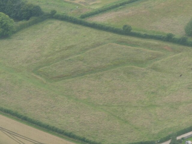
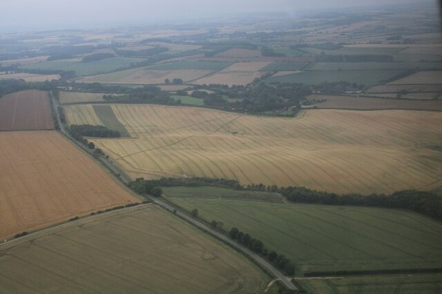
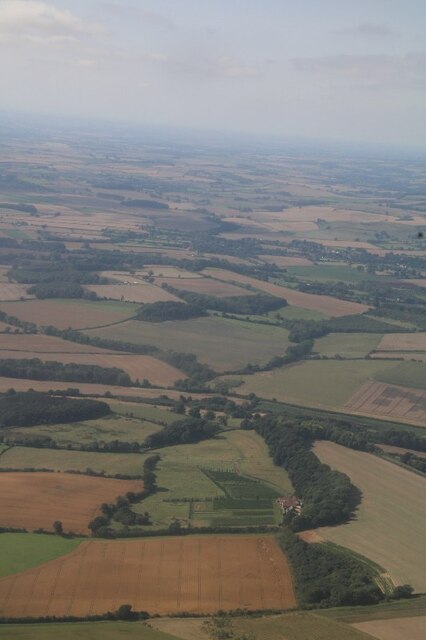
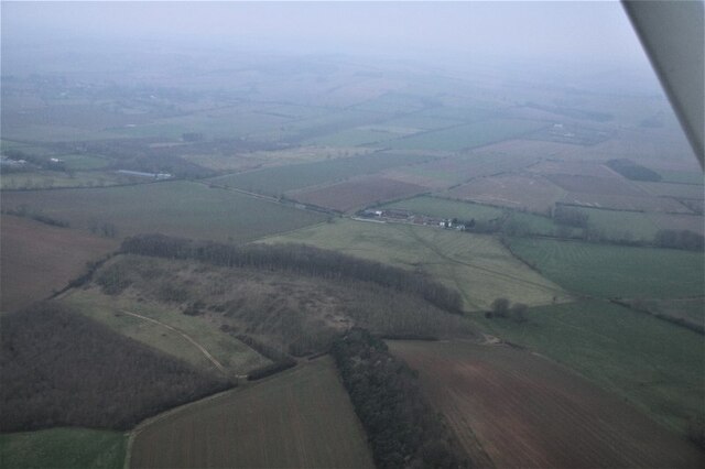
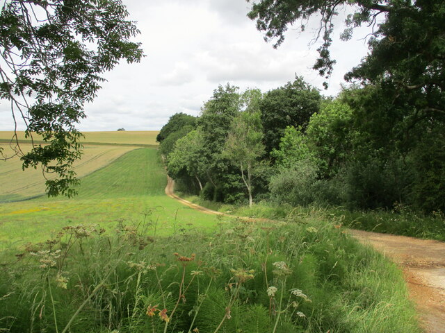
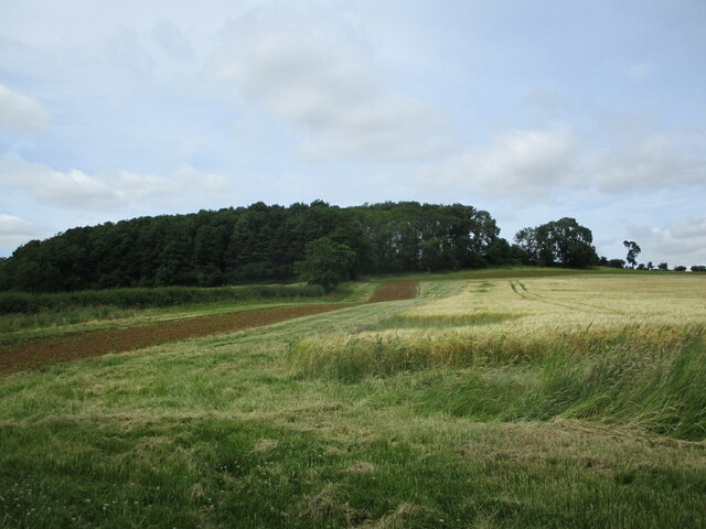
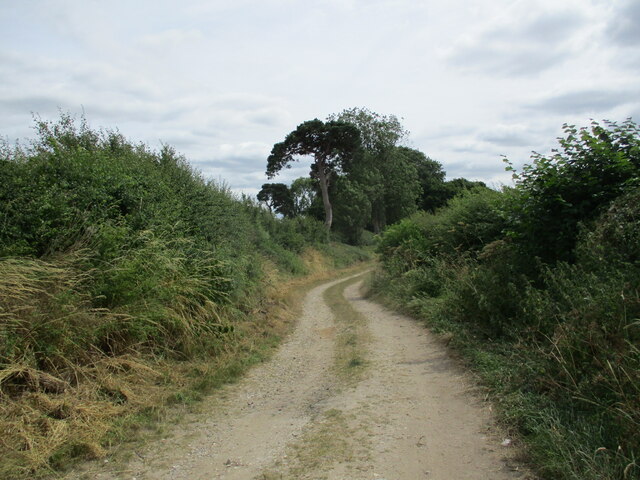
Belmont Plantation, located in Lincolnshire, is a picturesque estate nestled within a lush forest. It covers a significant area of land, providing a tranquil and serene environment for visitors to enjoy. The plantation is renowned for its beautiful woodlands, which are home to a diverse range of flora and fauna.

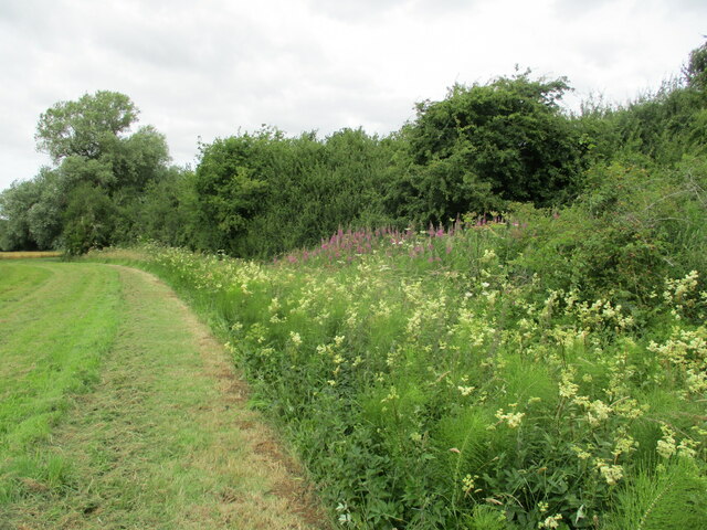
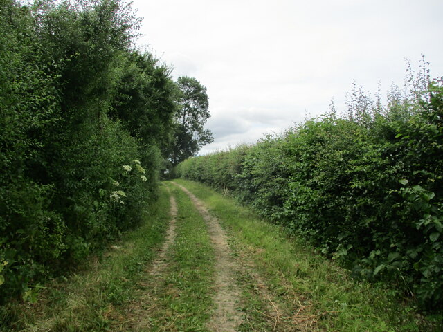
The forest surrounding Belmont Plantation is characterized by its dense foliage, including towering oak and beech trees that create a captivating canopy overhead. The woodlands are interspersed with winding pathways, allowing visitors to explore the area and immerse themselves in the natural surroundings.

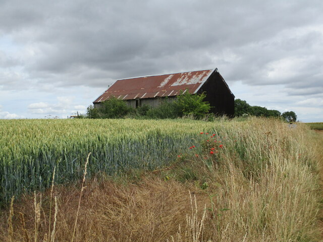
Belmont Plantation offers a variety of activities for nature enthusiasts and outdoor adventurers. Hiking and walking trails provide opportunities to explore the woodlands and discover hidden gems within the forest. There are also designated picnic areas, where visitors can relax and enjoy a meal amidst the peaceful ambiance.

The plantation is home to numerous animal species, including deer, rabbits, and a variety of bird species. Birdwatching enthusiasts can spot a range of feathered friends, including woodpeckers, owls, and thrushes, among others.

Belmont Plantation is committed to environmental preservation and conservation. It actively participates in sustainable practices, such as reforestation initiatives and wildlife conservation efforts.

Overall, Belmont Plantation in Lincolnshire offers a serene escape into nature, with its stunning woodlands and diverse wildlife. Whether visitors are seeking a peaceful stroll or an exciting wildlife encounter, this plantation provides an ideal destination for nature lovers.

If you have any feedback on the listing, please let us know in the comments section below.

Belmont Plantation Images

Images are sourced within 2km of 53.234131/0.043077184 or Grid Reference TF3672. Thanks to Geograph Open Source API. All images are credited.

Moated site at Brinkhill: aerial 2021
Fields SE of Brinkhill: aerial 2021
Direction Sign – Signpost in the centre of Brinkhill village Located on the west side of the T junction in the village, Brinkhill parish. 3 arms and no finial. See also <a title="https://www.geograph.org.uk/photo/6679438" href="https://www.geograph.org.uk/photo/6679438">Link</a>.

Milestone Society National ID: LI_TF3773
Direction Sign – Signpost in the centre of Brinkhill village
Located on the west side of the T junction in the village, Brinkhill parish. 3 arms and no finial. See also Link. Milestone Society National ID: LI_TF3773
Direction Sign – Signpost at the north end of Bag Enderby Located on the north side of a T junction at the north end of Bag Enderby in Greetham with Somersby parish. 3 arms and no finial. See also <a title="https://www.geograph.org.uk/photo/5747037" href="https://www.geograph.org.uk/photo/5747037">Link</a>.

Milestone Society National ID: LI_TF3572
Direction Sign – Signpost at the north end of Bag Enderby
Located on the north side of a T junction at the north end of Bag Enderby in Greetham with Somersby parish. 3 arms and no finial. See also Link. Milestone Society National ID: LI_TF3572
Ovens Farm Vineyard, near Harrington: aerial 2021 See <span class="nowrap"><a title="https://www.ovensfarmvineyard.com/" rel="nofollow ugc noopener" href="https://www.ovensfarmvineyard.com/">Link</a><img style="margin-left:2px;" alt="External link" title="External link - shift click to open in new window" src="https://s1.geograph.org.uk/img/external.png" width="10" height="10"/></span>
Ovens Farm Vineyard, near Harrington: aerial 2021
See LinkExternal link
Moated site at Brinkhill: aerial 2022
Cloven Hill, ESE of Tetford: aerial 2022
Shed at Wardenhill Farm
Bridleway alongside Fox Covert
Meadowsweet alongside a bridleway near Brinkhill
Bridleway to Bag Enderby
Wheat field and New Covert
Bridleway to Thornbury Hill A well used farm track.
Bridleway to Thornbury Hill
A well used farm track.
St. Mary's church, Harrington Largely rebuilt by S.S. Teulon <span class="nowrap"><a title="https://en.wikipedia.org/wiki/Samuel_Sanders_Teulon" rel="nofollow ugc noopener" href="https://en.wikipedia.org/wiki/Samuel_Sanders_Teulon">Link</a><img style="margin-left:2px;" alt="External link" title="External link - shift click to open in new window" src="https://s1.geograph.org.uk/img/external.png" width="10" height="10"/></span> in 1854-5 <span class="nowrap"><a title="https://historicengland.org.uk/listing/the-list/list-entry/1063676?section=official-list-entry" rel="nofollow ugc noopener" href="https://historicengland.org.uk/listing/the-list/list-entry/1063676?section=official-list-entry">Link</a><img style="margin-left:2px;" alt="External link" title="External link - shift click to open in new window" src="https://s1.geograph.org.uk/img/external.png" width="10" height="10"/></span>
St. Mary's church, Harrington
Largely rebuilt by S.S. Teulon LinkExternal link in 1854-5 LinkExternal link
Grass field and Ivy House Farm, Bag Enderby
Farm track (and footpath) to Stainsby
Ivy House, Bag Enderby Eighteenth century farmhouse <span class="nowrap"><a title="https://historicengland.org.uk/listing/the-list/list-entry/1063650?section=official-list-entry" rel="nofollow ugc noopener" href="https://historicengland.org.uk/listing/the-list/list-entry/1063650?section=official-list-entry">Link</a><img style="margin-left:2px;" alt="External link" title="External link - shift click to open in new window" src="https://s1.geograph.org.uk/img/external.png" width="10" height="10"/></span>
Ivy House, Bag Enderby
Eighteenth century farmhouse LinkExternal link
Farm track (and footpath) to Bag Enderby
Show me another place!

Belmont Plantation is located at Grid Ref: TF3672 (Lat: 53.234131, Lng: 0.043077184)

Administrative County: Lincolnshire

District: East Lindsey

Police Authority: Lincolnshire

What 3 Words

///consoled.shopping.sounds. Near Burwell, Lincolnshire

Related Wikis

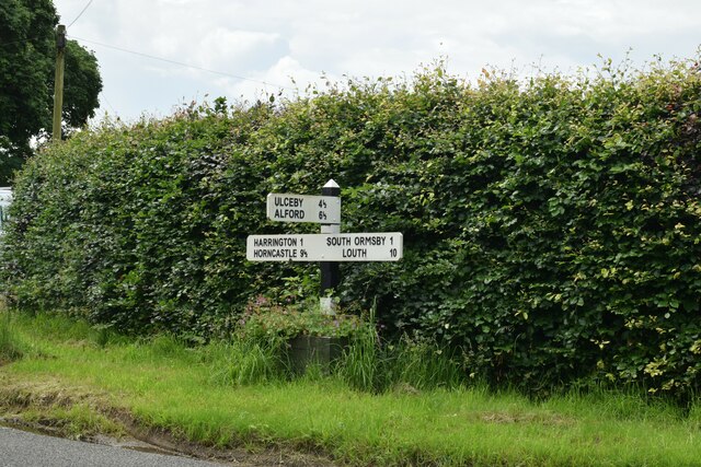
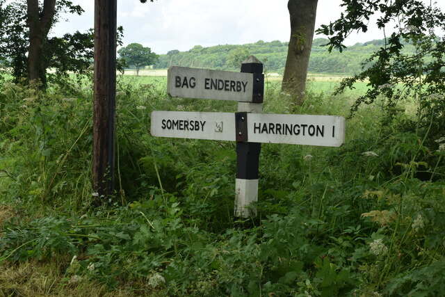
Harrington, Lincolnshire

Harrington is a hamlet and civil parish in the East Lindsey district of Lincolnshire, England. It is situated 6 miles (10 km) south-west from Alford, and...

Brinkhill

Brinkhill is a village and civil parish in the East Lindsey district of Lincolnshire, England. It is situated approximately 5 miles (8 km) west from the...

Somersby, Lincolnshire

Somersby is a village in the civil parish of Greetham with Somersby, in the East Lindsey district of Lincolnshire, England. It is situated 6 miles (9.7...

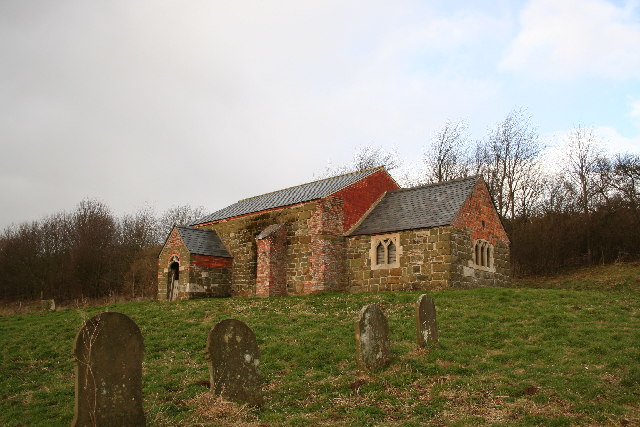
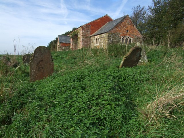
St John the Baptist's Church, Sutterby

St John the Baptist's Church is a redundant Anglican church in the village of Sutterby, Lincolnshire, England. It is recorded in the National Heritage...
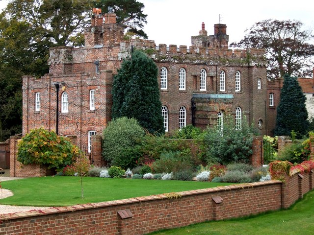
Somersby Grange

Somersby Grange is a Grade I listed Georgian country house in Somersby, Lincolnshire.The house was built in 1722 for Robert Burton, the local lord of the...

Sutterby

Sutterby is a hamlet in the civil parish of Langton by Spilsby, in the East Lindsey district of Lincolnshire, England. It is situated 9 miles (14 km) south...

Aswardby

Aswardby (pronounced "as-ard-bee") is a village situated 4 miles (6 km) north-west from Spilsby, in the East Lindsey district of Lincolnshire, England...

Bag Enderby

Bag Enderby is a village and former civil parish, now in the parish of Greetham with Somersby, in the East Lindsey district of Lincolnshire, England. It...

Nearby Amenities

Located within 500m of 53.234131,0.043077184
Harrington Hill
Place: locality
Source: Bing
Lat/Long: 53.2334391/0.0494171
Power: pole
Lat/Long: 53.2345973/0.0393418
Power: pole
Lat/Long: 53.2346634/0.0379648
Power: pole
Lat/Long: 53.2347331/0.0365936
Power: pole
Lat/Long: 53.2341794/0.0477168
Power: pole
Lat/Long: 53.2342372/0.0469014
Power: pole
Lat/Long: 53.2342837/0.0458714
Power: pole
Lat/Long: 53.2343287/0.0448119
Power: pole
Lat/Long: 53.2344073/0.043672
Power: pole
Lat/Long: 53.2344764/0.0421351
Power: pole
Lat/Long: 53.2345406/0.0407591
Power: pole
Lat/Long: 53.2352245/0.048854
Power: pole
Lat/Long: 53.2359999/0.0497579
The data included in this document is from www.openstreetmap.org. The data is made available under ODbL.

Have you been to Belmont Plantation?

Leave your review of Belmont Plantation below (or comments, questions and feedback).