Bridge Wood

Wood, Forest in Sussex Mid Sussex

England

Bridge Wood

Lindfield Pond When the fountain was working.
Lindfield Pond Credit: Peter Jeffery

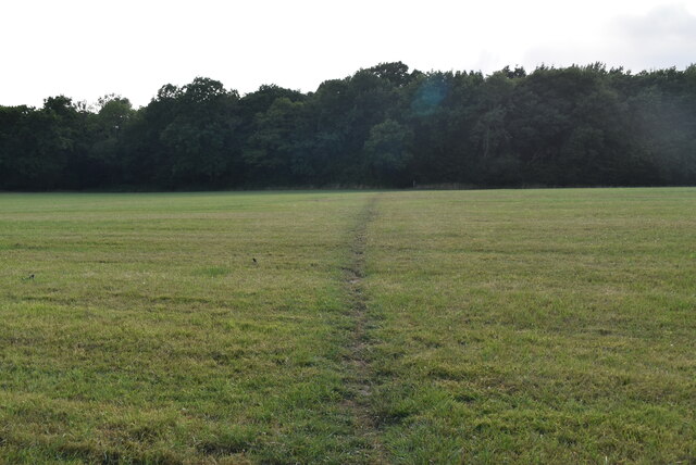
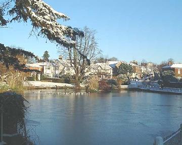
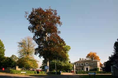
Bridge Wood is a picturesque woodland located in the county of Sussex, England. Covering an area of approximately 50 acres, it is situated near the small village of Bridge, just a few miles south of the bustling town of Lewes. The wood is nestled within the South Downs National Park, offering visitors a tranquil and scenic escape from the urban environment.

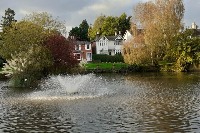
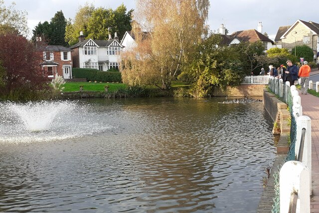
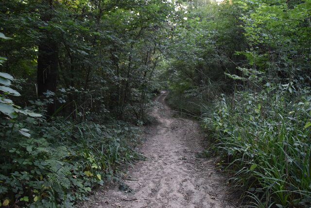
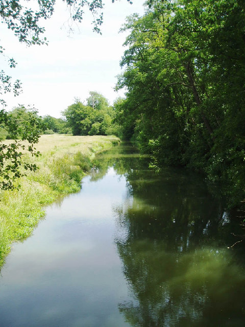
As its name suggests, Bridge Wood is characterized by its numerous bridges that span over the meandering streams and glistening ponds found throughout the forest. These bridges, made of wood and stone, add a charming and rustic touch to the landscape.

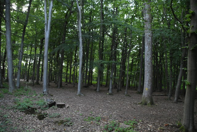
The wood itself is predominantly composed of native broadleaf trees such as oak, beech, and ash, creating a rich and diverse habitat for various wildlife species. Visitors to the wood can expect to encounter a wide array of flora and fauna, including red deer, foxes, rabbits, and a plethora of bird species.

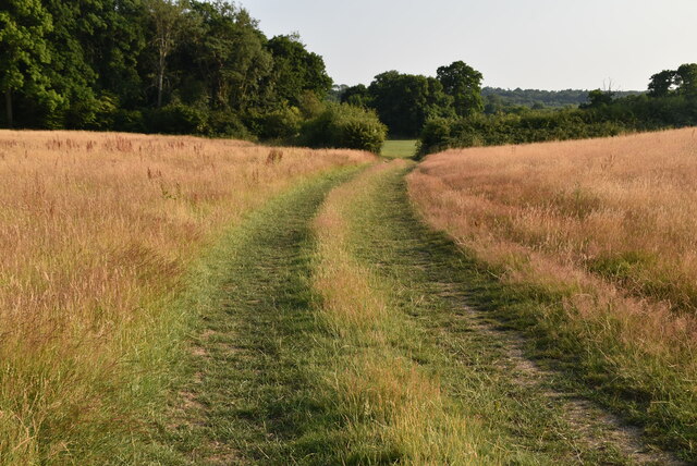
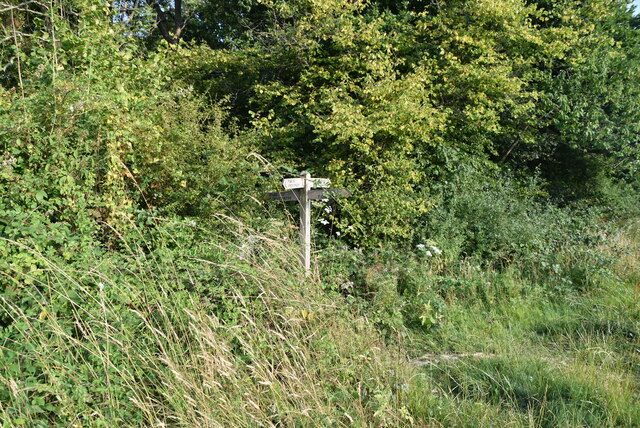
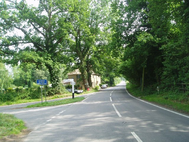
Bridge Wood is a popular destination for nature enthusiasts, hikers, and picnickers alike. Numerous walking trails wind their way through the woodland, providing opportunities for visitors to explore its beauty at their own pace. Along these trails, one can also find picnic areas, allowing visitors to relax and enjoy the tranquil surroundings.

Overall, Bridge Wood is a natural gem in Sussex, offering a peaceful retreat for those seeking to immerse themselves in the beauty of a traditional English woodland. Its idyllic setting, diverse wildlife, and charming bridges make it a must-visit destination for nature lovers and those in search of a serene escape.

If you have any feedback on the listing, please let us know in the comments section below.

Bridge Wood Images

Images are sourced within 2km of 51.023812/-0.074364605 or Grid Reference TQ3526. Thanks to Geograph Open Source API. All images are credited.

Lindfield Pond When the fountain was working.
Lindfield Pond
When the fountain was working.
Lindfield Pond When the fountain was working, and people were feeding the ducks.
Lindfield Pond
When the fountain was working, and people were feeding the ducks.
High Weald Landscape Trail The High Weald Landscape Trail (HWLT) is a 90 mile route between Horsham, West Sussex and Rye, East Sussex, designed to pass through the main landscape types of the High Weald Area of Outstanding Natural Beauty (AONB). It does not follow the highest ground, and the eastern section is only a few feet above sea level. It keeps to the northern edge of the High Weald except in the west where it runs close to the southern edge for a short distance.
It is a trail of regional importance supported by the High Weald Forum and local authorities in East and West Sussex, and Kent. The route is well signposted. It follows public rights of way and roads with the occasional permissive path.
The geology is alternating sandstones and clays, and the latter can be very muddy in wet conditions so boots are a must except in very dry weather. Some sections become very overgrown in summer with nettles and brambles.
High Weald Landscape Trail
The High Weald Landscape Trail (HWLT) is a 90 mile route between Horsham, West Sussex and Rye, East Sussex, designed to pass through the main landscape types of the High Weald Area of Outstanding Natural Beauty (AONB). It does not follow the highest ground, and the eastern section is only a few feet above sea level. It keeps to the northern edge of the High Weald except in the west where it runs close to the southern edge for a short distance. It is a trail of regional importance supported by the High Weald Forum and local authorities in East and West Sussex, and Kent. The route is well signposted. It follows public rights of way and roads with the occasional permissive path. The geology is alternating sandstones and clays, and the latter can be very muddy in wet conditions so boots are a must except in very dry weather. Some sections become very overgrown in summer with nettles and brambles.
High Weald Landscape Trail waymarker The High Weald Landscape Trail (HWLT) is a 90 mile route between Horsham, West Sussex and Rye, East Sussex, designed to pass through the main landscape types of the High Weald Area of Outstanding Natural Beauty (AONB). It does not follow the highest ground, and the eastern section is only a few feet above sea level. It keeps to the northern edge of the High Weald except in the west where it runs close to the southern edge for a short distance.
It is a trail of regional importance supported by the High Weald Forum and local authorities in East and West Sussex, and Kent. The route is well signposted. It follows public rights of way and roads with the occasional permissive path.
The geology is alternating sandstones and clays, and the latter can be very muddy in wet conditions so boots are a must except in very dry weather. Some sections become very overgrown in summer with nettles and brambles.
High Weald Landscape Trail waymarker
The High Weald Landscape Trail (HWLT) is a 90 mile route between Horsham, West Sussex and Rye, East Sussex, designed to pass through the main landscape types of the High Weald Area of Outstanding Natural Beauty (AONB). It does not follow the highest ground, and the eastern section is only a few feet above sea level. It keeps to the northern edge of the High Weald except in the west where it runs close to the southern edge for a short distance. It is a trail of regional importance supported by the High Weald Forum and local authorities in East and West Sussex, and Kent. The route is well signposted. It follows public rights of way and roads with the occasional permissive path. The geology is alternating sandstones and clays, and the latter can be very muddy in wet conditions so boots are a must except in very dry weather. Some sections become very overgrown in summer with nettles and brambles.
High Weald Landscape Trail The High Weald Landscape Trail (HWLT) is a 90 mile route between Horsham, West Sussex and Rye, East Sussex, designed to pass through the main landscape types of the High Weald Area of Outstanding Natural Beauty (AONB). It does not follow the highest ground, and the eastern section is only a few feet above sea level. It keeps to the northern edge of the High Weald except in the west where it runs close to the southern edge for a short distance.
It is a trail of regional importance supported by the High Weald Forum and local authorities in East and West Sussex, and Kent. The route is well signposted. It follows public rights of way and roads with the occasional permissive path.
The geology is alternating sandstones and clays, and the latter can be very muddy in wet conditions so boots are a must except in very dry weather. Some sections become very overgrown in summer with nettles and brambles.
High Weald Landscape Trail
The High Weald Landscape Trail (HWLT) is a 90 mile route between Horsham, West Sussex and Rye, East Sussex, designed to pass through the main landscape types of the High Weald Area of Outstanding Natural Beauty (AONB). It does not follow the highest ground, and the eastern section is only a few feet above sea level. It keeps to the northern edge of the High Weald except in the west where it runs close to the southern edge for a short distance. It is a trail of regional importance supported by the High Weald Forum and local authorities in East and West Sussex, and Kent. The route is well signposted. It follows public rights of way and roads with the occasional permissive path. The geology is alternating sandstones and clays, and the latter can be very muddy in wet conditions so boots are a must except in very dry weather. Some sections become very overgrown in summer with nettles and brambles.
HWLT, Standgrove Wood The High Weald Landscape Trail (HWLT) is a 90 mile route between Horsham, West Sussex and Rye, East Sussex, designed to pass through the main landscape types of the High Weald Area of Outstanding Natural Beauty (AONB). It does not follow the highest ground, and the eastern section is only a few feet above sea level. It keeps to the northern edge of the High Weald except in the west where it runs close to the southern edge for a short distance.
It is a trail of regional importance supported by the High Weald Forum and local authorities in East and West Sussex, and Kent. The route is well signposted. It follows public rights of way and roads with the occasional permissive path.
The geology is alternating sandstones and clays, and the latter can be very muddy in wet conditions so boots are a must except in very dry weather. Some sections become very overgrown in summer with nettles and brambles.
HWLT, Standgrove Wood
The High Weald Landscape Trail (HWLT) is a 90 mile route between Horsham, West Sussex and Rye, East Sussex, designed to pass through the main landscape types of the High Weald Area of Outstanding Natural Beauty (AONB). It does not follow the highest ground, and the eastern section is only a few feet above sea level. It keeps to the northern edge of the High Weald except in the west where it runs close to the southern edge for a short distance. It is a trail of regional importance supported by the High Weald Forum and local authorities in East and West Sussex, and Kent. The route is well signposted. It follows public rights of way and roads with the occasional permissive path. The geology is alternating sandstones and clays, and the latter can be very muddy in wet conditions so boots are a must except in very dry weather. Some sections become very overgrown in summer with nettles and brambles.
Standgrove Wood
Standgrove Wood
Standgrove Wood
Standgrove Wood
Standgrove Wood
Standgrove Wood
HWLT, Standgrove Wood The High Weald Landscape Trail (HWLT) is a 90 mile route between Horsham, West Sussex and Rye, East Sussex, designed to pass through the main landscape types of the High Weald Area of Outstanding Natural Beauty (AONB). It does not follow the highest ground, and the eastern section is only a few feet above sea level. It keeps to the northern edge of the High Weald except in the west where it runs close to the southern edge for a short distance.
It is a trail of regional importance supported by the High Weald Forum and local authorities in East and West Sussex, and Kent. The route is well signposted. It follows public rights of way and roads with the occasional permissive path.
The geology is alternating sandstones and clays, and the latter can be very muddy in wet conditions so boots are a must except in very dry weather. Some sections become very overgrown in summer with nettles and brambles.
HWLT, Standgrove Wood
The High Weald Landscape Trail (HWLT) is a 90 mile route between Horsham, West Sussex and Rye, East Sussex, designed to pass through the main landscape types of the High Weald Area of Outstanding Natural Beauty (AONB). It does not follow the highest ground, and the eastern section is only a few feet above sea level. It keeps to the northern edge of the High Weald except in the west where it runs close to the southern edge for a short distance. It is a trail of regional importance supported by the High Weald Forum and local authorities in East and West Sussex, and Kent. The route is well signposted. It follows public rights of way and roads with the occasional permissive path. The geology is alternating sandstones and clays, and the latter can be very muddy in wet conditions so boots are a must except in very dry weather. Some sections become very overgrown in summer with nettles and brambles.
College Rd
College Rd
Lindfield High Street near the church One of the prettiest and oldest villages in Sussex. The sign is that of the Bent Arms public house.
Lindfield High Street near the church
One of the prettiest and oldest villages in Sussex. The sign is that of the Bent Arms public house.
Lindfield Pond on a cold Xmas eve The classic pond at the bottom of the village high street attracts ducks and children !
Lindfield Pond on a cold Xmas eve
The classic pond at the bottom of the village high street attracts ducks and children !
Lywood Common This is a dangerous bend on the Lindfield Road leading from Ardingly to Lindfield. Fatalities have occurred. The houses are built over the disused railway tunnel that took the branch line to Horsted Keynes.
Lywood Common
This is a dangerous bend on the Lindfield Road leading from Ardingly to Lindfield. Fatalities have occurred. The houses are built over the disused railway tunnel that took the branch line to Horsted Keynes.
Lindfield Bridge Like most of the Sussex rivers, the Ouse was an agricultural waterway, with an upstream traffic of bulk goods such as chalk, coal and stone, and a return traffic of agricultural produce. At Lindfield there was also a mill near this bridge. The canal ran into financial difficulties primarily caused by the new railways and became disused after the 1860s. The Ouse river flows past Lewes and into the sea at Newhaven.
Lindfield Bridge
Like most of the Sussex rivers, the Ouse was an agricultural waterway, with an upstream traffic of bulk goods such as chalk, coal and stone, and a return traffic of agricultural produce. At Lindfield there was also a mill near this bridge. The canal ran into financial difficulties primarily caused by the new railways and became disused after the 1860s. The Ouse river flows past Lewes and into the sea at Newhaven.
Old station house The branch line from the main London to Brighton line was opened in September 1883 and closed in October 1963. The railway station at Ardingly is now the offices of Hanson who still use the short line to Haywards Heath for transporting aggregates.
Old station house
The branch line from the main London to Brighton line was opened in September 1883 and closed in October 1963. The railway station at Ardingly is now the offices of Hanson who still use the short line to Haywards Heath for transporting aggregates.
Haywards Heath Golf Course A private members club founded in 1922 and having a very active membership. 18 holes 6216 yards. S.S.S. 70   . <span class="nowrap"><a title="www.haywardsheathgolfclub.co.uk" rel="nofollow ugc noopener" href="http://www.haywardsheathgolfclub.co.uk">Link</a><img style="margin-left:2px;" alt="External link" title="External link - shift click to open in new window" src="https://s1.geograph.org.uk/img/external.png" width="10" height="10"/></span>
Haywards Heath Golf Course
A private members club founded in 1922 and having a very active membership. 18 holes 6216 yards. S.S.S. 70 . LinkExternal link
Kenwards Over the fields towards Kenwards from the Ardingly road. The newly cut hay is waiting collection before the summer storms.
Kenwards
Over the fields towards Kenwards from the Ardingly road. The newly cut hay is waiting collection before the summer storms.
Show me another place!

Bridge Wood is located at Grid Ref: TQ3526 (Lat: 51.023812, Lng: -0.074364605)

Administrative County: West Sussex

District: Mid Sussex

Police Authority: Sussex

What 3 Words

///pelting.mend.fetch. Near Ardingly, West Sussex

Related Wikis

All Saints Church, Lindfield

All Saints Church, Lindfield is a Grade II* listed Church of England church in Lindfield, West Sussex, England, built in the Middle Ages in the Early English...

Forest Way

The Forest Way is a linear Country park providing walking, cycling, horse riding and the quiet enjoyment of the countryside. It runs for around 16 km...

Lindfield, West Sussex

Lindfield is a village and civil parish in the Mid Sussex District of West Sussex, England. The parish lies 1 mile (2 km) to the north-east of Haywards...

Ardingly railway station

Ardingly was a railway station which served the West Sussex village of Ardingly in England. It was opened on 3 September 1883 by the London, Brighton and...

Eastern Road Nature Reserve

Eastern Road Nature Reserve is a 3.5-hectare (8.6-acre) Local Nature Reserve on the eastern outskirts of Haywards Heath in West Sussex. It is owned and...

Lindfield Cricket Club Ground

Lindfield Cricket Club Ground is a cricket ground in Lindfield, Sussex. The first recorded match on the ground was in 1948, when the Sussex Second XI...

Tavistock and Summerhill School

Tavistock and Summerhill School, located in Lindfield just 4 minutes from the heart of Haywards Heath, West Sussex was an independent day mixed nursery...

Walstead

Walstead is a hamlet located 1.5 kilometres (0.93 mi) south east of Lindfield, West Sussex, England. The hamlet is the home of Great Walstead School, Paxhill...

Related Videos

Walking the Best Kept Village in Sussex - Lindfield, UK Travel Vlog

Follow us as we walk around the winners of the best kept village in Sussex. We started off at Lindfield common, a historic common ...

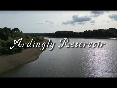
Solo Hiking the Ardingly Resevoir Circular - October 2022

Check out this 11.7-km loop trail near Haywards Heath, West Sussex. The Ardingly Resevoir Circular is generally considered a ...

Activity Centre ✅ : # reservoir sport

Are these boats racing across the main channel ?

Stanford King: Spring Holiday

Phillip Sear plays a fun piece from 1947 by the long-lived American pianist, composer and teacher Stanford KIng (1912-2010).

Nearby Amenities

Located within 500m of 51.023812,-0.074364605
B208 Buxshall Hill
Naptan AtcoCode: 4400EG0423
Naptan Bearing: S
Naptan BusStopType: CUS
Naptan CommonName: B208 Buxshall Hill
Naptan Indicator: HAR
Naptan Landmark: Hail & Ride
Naptan NaptanCode: wsxgawpg
Naptan Street: B208 Buxshall Hill
Naptan Verified: no
Source: naptan_import
Lat/Long: 51.0231455/-0.0720504
B208 Buxshall Hill
Naptan AtcoCode: 4400EG0424
Naptan Bearing: N
Naptan BusStopType: CUS
Naptan CommonName: B208 Buxshall Hill
Naptan Indicator: HAR
Naptan Landmark: Hail & Ride
Naptan NaptanCode: wsxgawpj
Naptan Street: B208 Buxshall Hill
Naptan Verified: no
Source: naptan_import
Lat/Long: 51.0232303/-0.0722893
Post Box
Brand: Royal Mail
Brand Wikidata: Q638098
Brand Wikipedia: en:Royal Mail
Operator: Royal Mail
Operator Wikidata: Q638098
Post Box Type: wall
Ref: RH16 71
Royal Cypher: EIIR
Royal Cypher Wikidata: Q33102113
Lat/Long: 51.0211214/-0.0728474
Grange Farm
Addr City: Haywards Heath
Addr Housename: Grange Farm
Addr Postcode: RH16 2QY
Addr Street: Ardingly Road
Addr Suburb: Lindfield
Is In: Lindfield; Haywards Heath
Place: isolated_dwelling
Lat/Long: 51.021783/-0.0732214
Addr City: Haywards Heath
Addr Housename: Grange Farm Cottages
Addr Postcode: RH16 2QY
Addr Street: Ardingly Road
Addr Suburb: Lindfield
Lat/Long: 51.0221904/-0.0730848
The data included in this document is from www.openstreetmap.org. The data is made available under ODbL.

Have you been to Bridge Wood?

Leave your review of Bridge Wood below (or comments, questions and feedback).