Acre Shaw

Wood, Forest in Surrey Tandridge

England

Acre Shaw

South Godstone South Godstone is 3 miles south of Godstone village and developed when the Tonbridge railway line was built in the 19th century.
South Godstone Credit: Nigel Freeman

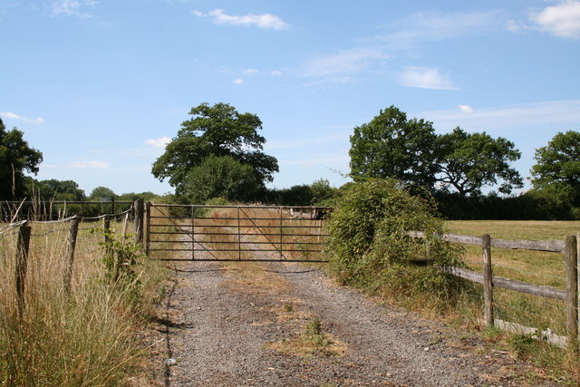
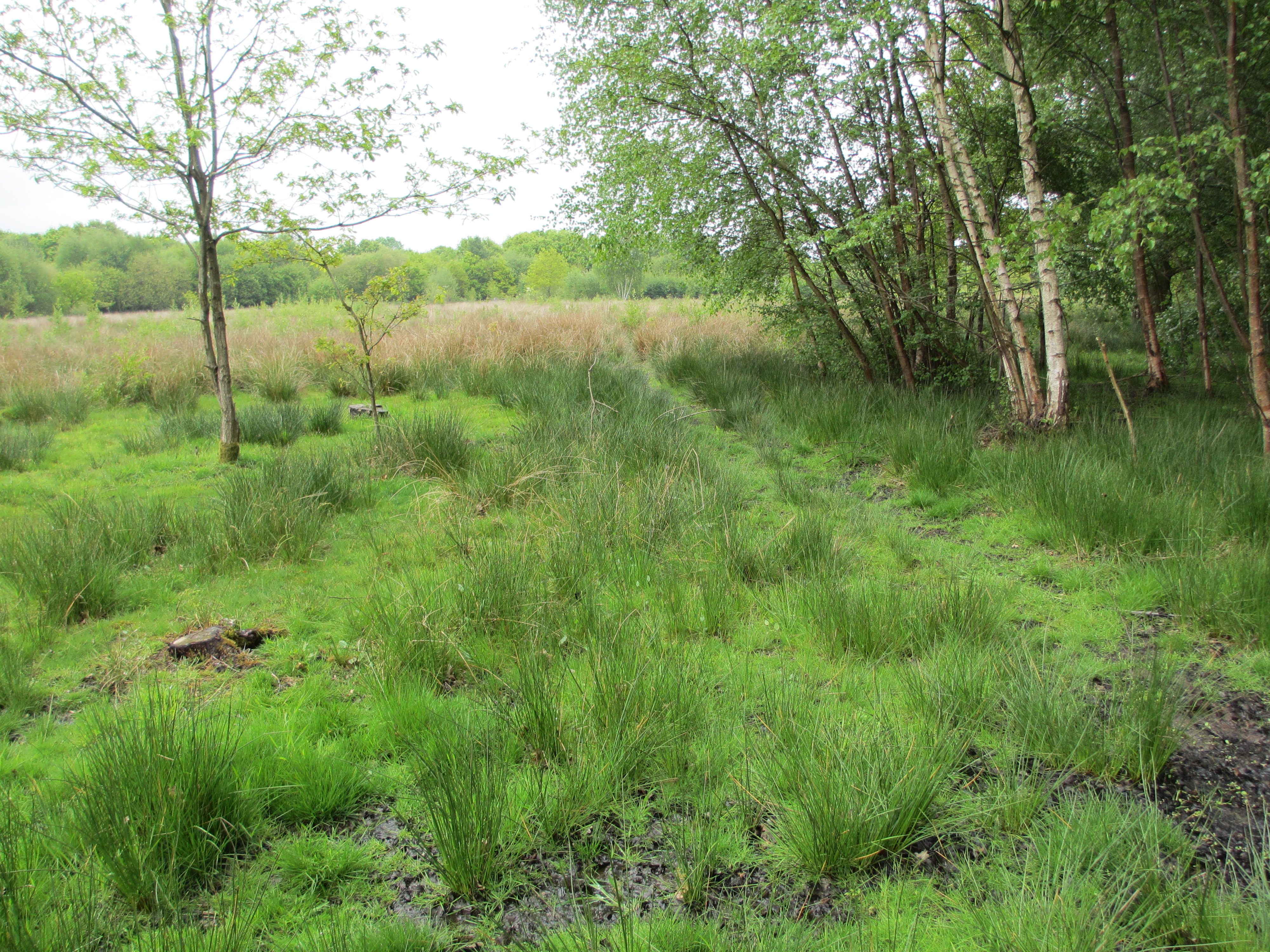
Acre Shaw is a picturesque woodland located in Surrey, England. Situated in the heart of the county, it is known for its lush greenery, towering trees, and abundant wildlife. Covering an area of approximately 100 acres, Acre Shaw offers a serene and peaceful escape from the hustle and bustle of everyday life.

The woodland is predominantly made up of deciduous trees, including oak, beech, and birch, which provide a stunning display of colors throughout the changing seasons. The forest floor is carpeted with a variety of wildflowers, creating a vibrant and diverse ecosystem.

Acre Shaw is a popular destination for nature lovers, hikers, and birdwatchers. The woodland is home to a wide array of bird species, including woodpeckers, owls, and various songbirds. Visitors can often spot squirrels, rabbits, and even deer roaming freely through the forest.

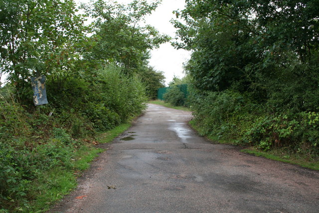
The woodland is crisscrossed with well-maintained walking trails, allowing visitors to explore its beauty at their own pace. These trails provide breathtaking views of the surrounding countryside, as well as access to several tranquil ponds and small streams that meander through the forest.

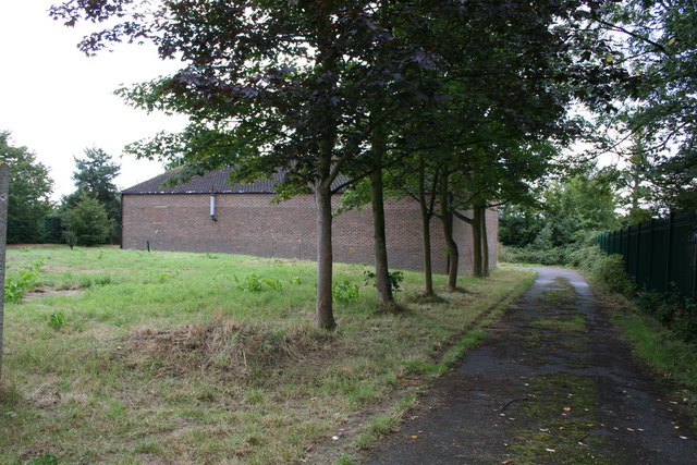
Acre Shaw is not only a haven for wildlife but also serves as an important conservation area. Efforts are made to preserve and protect the woodland, ensuring its sustainability for future generations to enjoy. The forest is managed by local authorities, who work closely with environmental organizations to maintain its natural beauty and promote biodiversity.

Overall, Acre Shaw is a true gem in Surrey's landscape, offering a serene and enchanting experience for those seeking a connection with nature.

If you have any feedback on the listing, please let us know in the comments section below.

Acre Shaw Images

Images are sourced within 2km of 51.208858/-0.068602928 or Grid Reference TQ3547. Thanks to Geograph Open Source API. All images are credited.

South Godstone South Godstone is 3 miles south of Godstone village and developed when the Tonbridge railway line was built in the 19th century.
South Godstone
South Godstone is 3 miles south of Godstone village and developed when the Tonbridge railway line was built in the 19th century.
St Mark's Foundation A private chapel at South Park Farm, listed grade II and occasionally used for public services.
St Mark's Foundation
A private chapel at South Park Farm, listed grade II and occasionally used for public services.
Lower South Park A substantial old property near Godstone, connected via a bridleway to South Park itself
Lower South Park
A substantial old property near Godstone, connected via a bridleway to South Park itself
S K Camping and Leisure, Anglefield Corner, Surrey On the A22 south of Godstone.  A vast range of equipment for the outdoor holiday enthusiast. There is also a garden centre adjoining.
S K Camping and Leisure, Anglefield Corner, Surrey
On the A22 south of Godstone. A vast range of equipment for the outdoor holiday enthusiast. There is also a garden centre adjoining.
Farmland near Byers Lane, Surrey Following the recent spell of good weather, the hay is already baled and ready for storage.
Farmland near Byers Lane, Surrey
Following the recent spell of good weather, the hay is already baled and ready for storage.
Bridleway alongside an oak wood, Surrey This lane is the western limb of a tangle of bridleways that straggle across country for many miles north and east of the village of Outwood.  This western section probably sees less use by riders than the main network, as it debouches onto the rather busy Outwood Lane, a motor road where, sadly, not all drivers show proper courtesy to equestrians.
Bridleway alongside an oak wood, Surrey
This lane is the western limb of a tangle of bridleways that straggle across country for many miles north and east of the village of Outwood. This western section probably sees less use by riders than the main network, as it debouches onto the rather busy Outwood Lane, a motor road where, sadly, not all drivers show proper courtesy to equestrians.
Grounds of Harewood House, Surrey The usually lush green parkland is brown and parched after record July temperatures and very little rain.
Grounds of Harewood House, Surrey
The usually lush green parkland is brown and parched after record July temperatures and very little rain.
Lane past Tanglewood Stables, Surrey Go for a ramble or cycle ride in this part of Surrey and you will very likely see more horses than cows, sheep or even motor cars.  And most of the animals will be in first-class condition as befits this important horse-breeding and rearing area.
Lane past Tanglewood Stables, Surrey
Go for a ramble or cycle ride in this part of Surrey and you will very likely see more horses than cows, sheep or even motor cars. And most of the animals will be in first-class condition as befits this important horse-breeding and rearing area.
The road to Nowhere, Surrey Surprisingly this lane does not appear in any form at all on the 1:25000 map, nor is there any indication of anywhere it could serve.  The gate is firmly padlocked.  No farm stock or arable crop is visible.
The road to Nowhere, Surrey
Surprisingly this lane does not appear in any form at all on the 1:25000 map, nor is there any indication of anywhere it could serve. The gate is firmly padlocked. No farm stock or arable crop is visible.
Houses in Terra Cotta Road, Surrey Terra Cotta Road leads westwards off Tilburstow Hill Road.  It continues past these houses to end in a small business park.  These houses are probably the nearest you will get to 'affordable' houses in the Godstone area - but you will get a shock if you enquire the price.
Houses in Terra Cotta Road, Surrey
Terra Cotta Road leads westwards off Tilburstow Hill Road. It continues past these houses to end in a small business park. These houses are probably the nearest you will get to 'affordable' houses in the Godstone area - but you will get a shock if you enquire the price.
Little Chef restaurant, South Godstone, Surrey On the west side of the A22.
I suppose some people must actually eat in these establishments, otherwise they would not be there.
Little Chef restaurant, South Godstone, Surrey
On the west side of the A22. I suppose some people must actually eat in these establishments, otherwise they would not be there.
Road and public footpath near Blindley Heath, Surrey This footpath is the southern leg of a group of paths which link the A22 eastwards across to Tandridge Lane.  The path is metalled at the western end to give access to a small number of properties.
Road and public footpath near Blindley Heath, Surrey
This footpath is the southern leg of a group of paths which link the A22 eastwards across to Tandridge Lane. The path is metalled at the western end to give access to a small number of properties.
Paddocks, Tanglewood Stables
Grounds of Tanglewood Stables
Pumping station This building would appear to have no door and no window.  It is surrounded by high-security fencing through which I had to poke the camera to take the photograph.
Pumping station
This building would appear to have no door and no window. It is surrounded by high-security fencing through which I had to poke the camera to take the photograph.
Bridleway towards Lower South Park A well used, fenced bridleway connecting two roads, that could better be described as a green lane, and perhaps surprisingly is not classified as a byway.
Bridleway towards Lower South Park
A well used, fenced bridleway connecting two roads, that could better be described as a green lane, and perhaps surprisingly is not classified as a byway.
Godstone Station, Surrey
The Lagham Public House, Eastbourne Road, South Godstone, Surrey
Show me another place!

Acre Shaw is located at Grid Ref: TQ3547 (Lat: 51.208858, Lng: -0.068602928)

Administrative County: Surrey

District: Tandridge

Police Authority: Surrey

What 3 Words

///note.until.inform. Near Blindley Heath, Surrey

Nearby Locations

Eight Acre Shaw Acre Shaw

Related Wikis

Godstone railway station

Godstone railway station is on the Redhill to Tonbridge Line and serves Godstone in Surrey, England. It is 28 miles 13 chains (28.16 miles, 45.32 km) measured...

Tilburstow Hill

Tilburstow Hill is a 9-hectare (22-acre) nature reserve south-east of Godstone in Surrey. It is managed by the Surrey Wildlife Trust.This is a semi-natural...

Outwood Windmill

Outwood Windmill is a Grade I listed post mill in Outwood, Surrey. Built in 1665 by Thomas Budgen, a miller from Nutfield in Surrey, it is Britain's oldest...

Graeme Hendrey Wood

Graeme Hendrey Wood is a 10-hectare (25-acre) nature reserve east of Bletchingley in Surrey. It is managed by the Surrey Wildlife Trust.This former sand...

Blindley Heath SSSI

Blindley Heath SSSI is a 26.3-hectare (65-acre) biological Site of Special Scientific Interest in the hamlet Blindley Heath, on the southern outskirts...

Horne, Surrey

Horne is a rural village and civil parish in the District of Tandridge in Surrey, England. The parish includes the hamlet of Newchapel, where the British...

Church of St John the Baptist, Outwood

The Church of St John the Baptist, Outwood, is the parish church of Outwood, Surrey, England. == Clergy and style of worship == Part of the Diocese of...

Outwood, Surrey

Outwood is a village and civil parish in the Tandridge district of the Surrey weald. == Geography == Outwood is separated from Redhill by the M23 which...

Nearby Amenities

Located within 500m of 51.208858,-0.068602928
Man Made: survey_point
Source: npe
Lat/Long: 51.2093654/-0.0673409
Barrier: stile
Lat/Long: 51.2118889/-0.0688956
Barrier: stile
Lat/Long: 51.2099543/-0.0706644
Barrier: stile
Lat/Long: 51.2082067/-0.0732181
Power: pole
Source: Bing
Lat/Long: 51.2129065/-0.0685854
Power: pole
Source: Bing
Lat/Long: 51.2118538/-0.0687598
Power: pole
Source: Bing
Lat/Long: 51.211154/-0.069606
Power: pole
Source: gps
Lat/Long: 51.2103155/-0.0705153
Power: pole
Source: gps
Lat/Long: 51.2095556/-0.0714051
The data included in this document is from www.openstreetmap.org. The data is made available under ODbL.

Have you been to Acre Shaw?

Leave your review of Acre Shaw below (or comments, questions and feedback).