Browns Leys Grove

Wood, Forest in Cambridgeshire South Cambridgeshire

England

Browns Leys Grove

Boxworth, St Peter <span class="nowrap"><a title="http://www.druidic.org/camchurch/churches/boxworth.htm" rel="nofollow ugc noopener" href="http://www.druidic.org/camchurch/churches/boxworth.htm">Link</a><img style="margin-left:2px;" alt="External link" title="External link - shift click to open in new window" src="https://s1.geograph.org.uk/img/external.png" width="10" height="10"/></span>
Boxworth, St Peter Credit: mym

Browns Leys Grove is a picturesque woodland area located in Cambridgeshire, England. Nestled within the county's lush countryside, this forested haven provides a tranquil escape from the hustle and bustle of urban life.

Covering an area of approximately 50 acres, Browns Leys Grove boasts a diverse range of tree species, including oak, beech, and birch. The dense canopy of foliage offers a cool respite during the summer months, while the vibrant hues of the leaves create a stunning display during the autumn season.

The grove is home to a variety of wildlife, making it a popular spot for nature enthusiasts and birdwatchers. Visitors may catch a glimpse of deer, foxes, and a myriad of bird species, including woodpeckers and owls. The tranquil atmosphere of the woodland provides the perfect setting for those seeking a peaceful walk or a place to connect with nature.

Walking trails meander through the grove, providing an opportunity to explore its natural beauty. These paths are well-maintained, ensuring a pleasant and safe experience for visitors of all ages. Additionally, there are designated picnic areas, allowing visitors to enjoy a leisurely lunch amidst the serene surroundings.

Browns Leys Grove is easily accessible, located just a short drive from the nearby town of Cambridge. Its proximity to the city makes it a popular destination for both locals and tourists alike, seeking a break from the urban environment.

Overall, Browns Leys Grove is a treasure trove of natural beauty, offering a peaceful retreat for those seeking solace in Cambridgeshire's wooded landscapes.

If you have any feedback on the listing, please let us know in the comments section below.

Browns Leys Grove Images

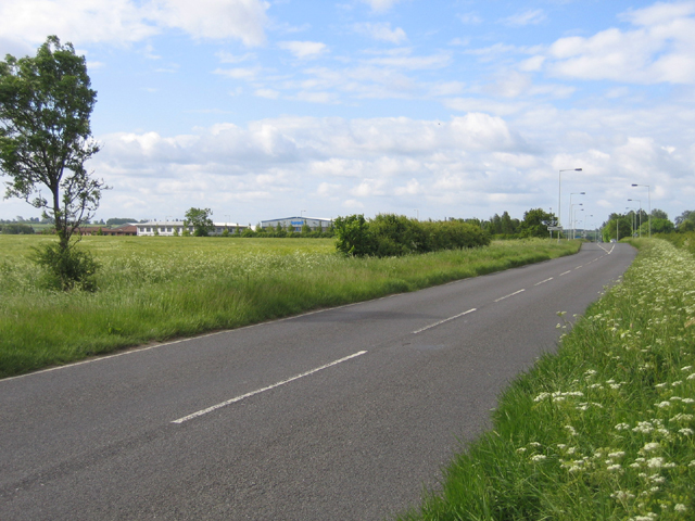
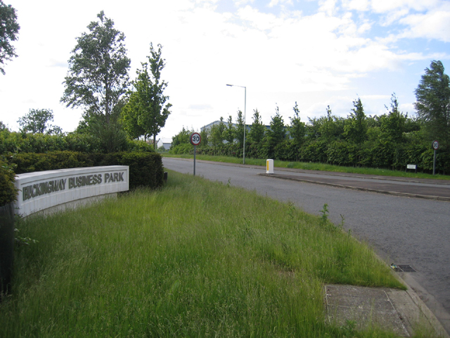
Images are sourced within 2km of 52.262903/-0.027555141 or Grid Reference TL3464. Thanks to Geograph Open Source API. All images are credited.

Boxworth, St Peter <span class="nowrap"><a title="http://www.druidic.org/camchurch/churches/boxworth.htm" rel="nofollow ugc noopener" href="http://www.druidic.org/camchurch/churches/boxworth.htm">Link</a><img style="margin-left:2px;" alt="External link" title="External link - shift click to open in new window" src="https://s1.geograph.org.uk/img/external.png" width="10" height="10"/></span>
Boxworth, St Peter
Rolling wheat fields An overview of the arable fields that cover much of this grid square (taken from just outside the square looking in).
Rolling wheat fields
An overview of the arable fields that cover much of this grid square (taken from just outside the square looking in).
Field bean cultivation, Boxworth A bit of relief from the wheat that currently covers most of the land round here.
Field bean cultivation, Boxworth
A bit of relief from the wheat that currently covers most of the land round here.
Cambridge services Busy services off the busy A14
Cambridge services
Busy services off the busy A14
Bucking Way Road, Swavesey, Cambs – view SSW towards the A14 road.
Bucking Way Road, Swavesey, Cambs
– view SSW towards the A14 road.
Buckingway Business Park, Swavesey, Cambs entrance from Bucking Way Road.
Buckingway Business Park, Swavesey, Cambs
entrance from Bucking Way Road.
Road from Boxworth to Elsworth Taken from the layby, this shows the Boxworth-Elsworth road on the top of a fenland "hill" dropping 10m in 500m distance is the dip. Beyond are further fields and gentle hills typical of the area.
Road from Boxworth to Elsworth
Taken from the layby, this shows the Boxworth-Elsworth road on the top of a fenland "hill" dropping 10m in 500m distance is the dip. Beyond are further fields and gentle hills typical of the area.
Hall Farm:  Meridian Zero The Greenwich Meridian passes through Hall Farm, the first prominent building in Lolworth as you approach along the track from Childerley.
Hall Farm: Meridian Zero
The Greenwich Meridian passes through Hall Farm, the first prominent building in Lolworth as you approach along the track from Childerley.
Memorial for Revd Arnold Kirke Smith Rector  of the Parish for 38 years before his death in 1927.
Memorial for Revd Arnold Kirke Smith
Rector of the Parish for 38 years before his death in 1927.
Boxworth
Boxworth
Footpath from Lolworth to Boxworth The footpath is wide and pleasant although there is an audible reminder of the  presence of A14 road less than a mile away.
Footpath from Lolworth to Boxworth
The footpath is wide and pleasant although there is an audible reminder of the presence of A14 road less than a mile away.
Footpath to nowhere The 1:25,000 OS map shows this footpath petering out as it approaches Boxworth. It is the only right of way in TL3563 and apparently come to a dead end.
Footpath to nowhere
The 1:25,000 OS map shows this footpath petering out as it approaches Boxworth. It is the only right of way in TL3563 and apparently come to a dead end.
Lolworth village The village hall is on the left and the wheelie bins show it's waste collection day.
Lolworth village
The village hall is on the left and the wheelie bins show it's waste collection day.
Field margin east of Conington With wildlife-friendly unmown grass left round the edge.
Field margin east of Conington
With wildlife-friendly unmown grass left round the edge.
Stubble field with hazy tree I carefully paced out the right point on the footpath, only to discover that due to the ridge in the landscape there is very little to see. So here it is.
Stubble field with hazy tree
I carefully paced out the right point on the footpath, only to discover that due to the ridge in the landscape there is very little to see. So here it is.
Trucks parked on the A14 Seen from the end of the Scotland Drove bridleway
Trucks parked on the A14
Seen from the end of the Scotland Drove bridleway
February Morning
February Morning
Leaving Knapwell Looking down towards the A14, with a distant church steeple which I think is <a href="https://www.geograph.org.uk/photo/462232">TL3268 : St. Peter & St. Paul's church at Fenstanton</a>.

Note: for 3 years <a href="https://www.geograph.org.uk/photo/32796">TL3363 : Rolling wheat fields</a> was the first and only geograph in this square. This photo was submitted after the old one was reclassified as supplemental.
Leaving Knapwell
Looking down towards the A14, with a distant church steeple which I think is TL3268 : St. Peter & St. Paul's church at Fenstanton. Note: for 3 years TL3363 : Rolling wheat fields was the first and only geograph in this square. This photo was submitted after the old one was reclassified as supplemental.
Show me another place!

Browns Leys Grove is located at Grid Ref: TL3464 (Lat: 52.262903, Lng: -0.027555141)

Administrative County: Cambridgeshire

District: South Cambridgeshire

Police Authority: Cambridgeshire

What 3 Words

///cost.districts.tens. Near Bar Hill, Cambridgeshire

Related Wikis

Boxworth

Boxworth is a village in South Cambridgeshire, situated about eight miles to the north-west of Cambridge. It falls under the Papworth Everard and Caxton...

Overhall Grove

Overhall Grove is a 17.4-hectare (43-acre) biological Site of Special Scientific Interest to the east of Knapwell in Cambridgeshire. It is a Nature Conservation...

Knapwell

Knapwell is a hamlet in Cambridgeshire situated about 10 miles (16 km) west of Cambridge. It is within the diocese of Ely. Its population was estimated...

Lolworth

Lolworth is a small village and civil parish in the district of South Cambridgeshire, in the county of Cambridgeshire, England, located approximately 8...

Nearby Amenities

Located within 500m of 52.262903,-0.027555141
Entrance: yes
Lat/Long: 52.2599509/-0.0250378
Post Box
Collection Times: Mo-Fr 16:00; Sa 09:15
Operator: Royal Mail
Post Box Type: lamp
Ref: CB23 238
Royal Cypher: EIIR
Royal Cypher Wikidata: Q33102113
Source: survey
Lat/Long: 52.2597695/-0.0259705
Pages Farm
Landuse: farm
Note Retag: CS #48756035
Lat/Long: 52.2587824/-0.0299397
Bus Stop
School Lane
Naptan AtcoCode: 0500SBOXW001
Naptan Bearing: SW
Naptan CommonName: School Lane
Naptan Indicator: opp
Naptan Landmark: School Lane
Naptan NaptanCode: cmbdtwam
Naptan ShortCommonName: School Lane
Naptan Street: High Street
Naptan Verified: no
Source: naptan_import
Lat/Long: 52.2600243/-0.0252735
Bus Stop
School Lane
Naptan AtcoCode: 0500SBOXW002
Naptan Bearing: NE
Naptan BusStopType: CUS
Naptan CommonName: School Lane
Naptan Indicator: near
Naptan Landmark: School Lane
Naptan NaptanCode: cmbdtwap
Naptan ShortCommonName: School Lane
Naptan Street: High Street
Naptan Verified: no
Source: naptan_import
Lat/Long: 52.2600516/-0.0253263
Power: pole
Lat/Long: 52.2604799/-0.0302525
Power: pole
Source: Bing
Lat/Long: 52.2607761/-0.0319572
Power: pole
Source: Bing
Lat/Long: 52.2607047/-0.0328316
Turning Circle
Lat/Long: 52.2598381/-0.027324
Power: pole
Source: Bing
Lat/Long: 52.2606332/-0.0337449
Power: pole
Lat/Long: 52.2596474/-0.0288767
Power: pole
Lat/Long: 52.264963/-0.0256165
Power: pole
Lat/Long: 52.265334/-0.0234492
Power: pole
Lat/Long: 52.263076/-0.0293716
Power: pole
Lat/Long: 52.2591582/-0.0283895
Power: pole
Lat/Long: 52.2637015/-0.0253496
Power: pole
Lat/Long: 52.265119/-0.0246254
Power: pole
Lat/Long: 52.2614217/-0.0302203
Power: pole
Lat/Long: 52.2601038/-0.0293246
Power: pole
Lat/Long: 52.2643594/-0.0267965
Power: pole
Lat/Long: 52.2637023/-0.0281163
Power: pole
Lat/Long: 52.2626451/-0.0302486
Power: pole
Lat/Long: 52.264409/-0.0264788
Traffic Calming: chicane
Lat/Long: 52.2611279/-0.0246506
Public Bookcase
Boxworth Book Exchange
Booth: K6
Colour: red
Disused Amenity: telephone
Man Made: telephone_box
Public Bookcase Type: phone_box
Lat/Long: 52.2600215/-0.0252331
Waste Basket
Lat/Long: 52.2603384/-0.025028
Information: guidepost
Tourism: information
Lat/Long: 52.2603326/-0.0250297
Abandoned Barrier: gate
Note: this gate is currently off its hinges and resting just over the fence to the east
Lat/Long: 52.2604835/-0.0246213
Information: guidepost
Tourism: information
Lat/Long: 52.2620138/-0.0209636
The data included in this document is from www.openstreetmap.org. The data is made available under ODbL.

Have you been to Browns Leys Grove?

Leave your review of Browns Leys Grove below (or comments, questions and feedback).