Lap Close Spinney

Wood, Forest in Cambridgeshire South Cambridgeshire

England

Lap Close Spinney

Boxworth, St Peter <span class="nowrap"><a title="http://www.druidic.org/camchurch/churches/boxworth.htm" rel="nofollow ugc noopener" href="http://www.druidic.org/camchurch/churches/boxworth.htm">Link</a><img style="margin-left:2px;" alt="External link" title="External link - shift click to open in new window" src="https://s1.geograph.org.uk/img/external.png" width="10" height="10"/></span>
Boxworth, St Peter Credit: mym

Lap Close Spinney is a small wood located in Cambridgeshire, England. Situated near the village of Woodhurst, it is part of the larger Forest of Cambridgeshire. The spinney covers an area of approximately 10 acres and is characterized by its dense, mature woodland.

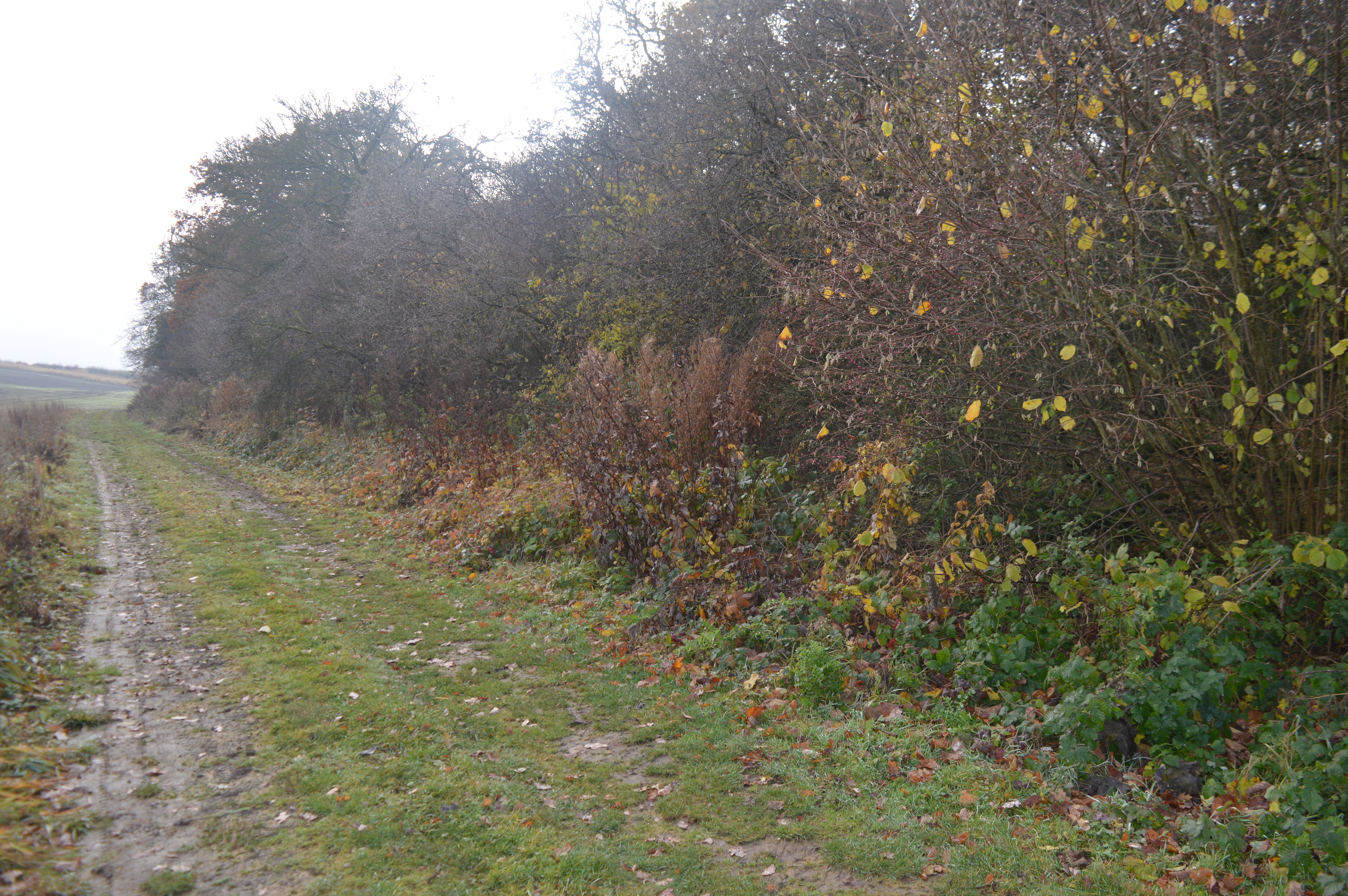
The trees in Lap Close Spinney are mainly broadleaf species, including oak, ash, and beech. The woodland floor is covered in a thick carpet of mosses, ferns, and wildflowers, creating a vibrant and diverse ecosystem. Small streams meander through the spinney, adding to its natural beauty.

The wood is a haven for wildlife, providing a habitat for a variety of bird species such as woodpeckers, tits, and thrushes. Mammals such as foxes, rabbits, and badgers can also be found here, along with a range of insects and amphibians.

Lap Close Spinney is a popular destination for nature enthusiasts and walkers, offering peaceful and scenic trails. The wood is easily accessible, with a parking area nearby, and there are well-maintained footpaths that lead visitors through the spinney.

The wood also holds historical significance, as it is believed to have been part of the ancient hunting grounds of the local nobility. Today, Lap Close Spinney offers a glimpse into Cambridgeshire's natural beauty and showcases the importance of preserving and protecting woodland habitats.

If you have any feedback on the listing, please let us know in the comments section below.

Lap Close Spinney Images

Images are sourced within 2km of 52.258863/-0.033859339 or Grid Reference TL3464. Thanks to Geograph Open Source API. All images are credited.

Boxworth, St Peter <span class="nowrap"><a title="http://www.druidic.org/camchurch/churches/boxworth.htm" rel="nofollow ugc noopener" href="http://www.druidic.org/camchurch/churches/boxworth.htm">Link</a><img style="margin-left:2px;" alt="External link" title="External link - shift click to open in new window" src="https://s1.geograph.org.uk/img/external.png" width="10" height="10"/></span>
Boxworth, St Peter
Knapwell, All Saints <span class="nowrap"><a title="http://www.druidic.org/camchurch/churches/knapwell.htm" rel="nofollow ugc noopener" href="http://www.druidic.org/camchurch/churches/knapwell.htm">Link</a><img style="margin-left:2px;" alt="External link" title="External link - shift click to open in new window" src="https://s1.geograph.org.uk/img/external.png" width="10" height="10"/></span>
Knapwell, All Saints
Rolling wheat fields An overview of the arable fields that cover much of this grid square (taken from just outside the square looking in).
Rolling wheat fields
An overview of the arable fields that cover much of this grid square (taken from just outside the square looking in).
Power line north of Childerley Hall Probably the most interesting feature of this square! Cambridgeshire certainly has its fair share of flat cornfields.
Power line north of Childerley Hall
Probably the most interesting feature of this square! Cambridgeshire certainly has its fair share of flat cornfields.
Field scale lysimeters A lysimeter measures water penetration in the soil, apparently. The things you learn through Geograph.
Field scale lysimeters
A lysimeter measures water penetration in the soil, apparently. The things you learn through Geograph.
Knapwell village street Showing the handmade sign that is de rigueur for all villages in this area.
Knapwell village street
Showing the handmade sign that is de rigueur for all villages in this area.
Field bean cultivation, Boxworth A bit of relief from the wheat that currently covers most of the land round here.
Field bean cultivation, Boxworth
A bit of relief from the wheat that currently covers most of the land round here.
Cambridge services Busy services off the busy A14
Cambridge services
Busy services off the busy A14
Road from Boxworth to Elsworth Taken from the layby, this shows the Boxworth-Elsworth road on the top of a fenland "hill" dropping 10m in 500m distance is the dip. Beyond are further fields and gentle hills typical of the area.
Road from Boxworth to Elsworth
Taken from the layby, this shows the Boxworth-Elsworth road on the top of a fenland "hill" dropping 10m in 500m distance is the dip. Beyond are further fields and gentle hills typical of the area.
Terrace houses A view along the main road through Knapwell, showing terrace houses backing onto the street. The road tarmac is coloured red to help drivers remember that the village is a 30mph zone - a technique used often in local rural villages.
Terrace houses
A view along the main road through Knapwell, showing terrace houses backing onto the street. The road tarmac is coloured red to help drivers remember that the village is a 30mph zone - a technique used often in local rural villages.
Memorial for Revd Arnold Kirke Smith Rector  of the Parish for 38 years before his death in 1927.
Memorial for Revd Arnold Kirke Smith
Rector of the Parish for 38 years before his death in 1927.
Elsworth Mill, Elsworth, Cambs A capless tower mill (also known East Mill, Papworth's Mill or the Black Mill) nestling amongst trees along Boxworth Road east of the village. It replaced an earlier wooden smock mill, probably dating from around 1800 and destroyed by fire in 1854. It was converted into a house around 1935.
Elsworth Mill, Elsworth, Cambs
A capless tower mill (also known East Mill, Papworth's Mill or the Black Mill) nestling amongst trees along Boxworth Road east of the village. It replaced an earlier wooden smock mill, probably dating from around 1800 and destroyed by fire in 1854. It was converted into a house around 1935.
Boxworth
Boxworth
Footpath from Lolworth to Boxworth The footpath is wide and pleasant although there is an audible reminder of the  presence of A14 road less than a mile away.
Footpath from Lolworth to Boxworth
The footpath is wide and pleasant although there is an audible reminder of the presence of A14 road less than a mile away.
Footpath to nowhere The 1:25,000 OS map shows this footpath petering out as it approaches Boxworth. It is the only right of way in TL3563 and apparently come to a dead end.
Footpath to nowhere
The 1:25,000 OS map shows this footpath petering out as it approaches Boxworth. It is the only right of way in TL3563 and apparently come to a dead end.
Field margin east of Conington With wildlife-friendly unmown grass left round the edge.
Field margin east of Conington
With wildlife-friendly unmown grass left round the edge.
Stubble field with hazy tree I carefully paced out the right point on the footpath, only to discover that due to the ridge in the landscape there is very little to see. So here it is.
Stubble field with hazy tree
I carefully paced out the right point on the footpath, only to discover that due to the ridge in the landscape there is very little to see. So here it is.
February Morning
February Morning
Show me another place!

Lap Close Spinney is located at Grid Ref: TL3464 (Lat: 52.258863, Lng: -0.033859339)

Administrative County: Cambridgeshire

District: South Cambridgeshire

Police Authority: Cambridgeshire

What 3 Words

///ranks.digestion.sporting. Near Bar Hill, Cambridgeshire

Related Wikis

Boxworth

Boxworth is a village in South Cambridgeshire, situated about eight miles to the north-west of Cambridge. It falls under the Papworth Everard and Caxton...

Overhall Grove

Overhall Grove is a 17.4-hectare (43-acre) biological Site of Special Scientific Interest to the east of Knapwell in Cambridgeshire. It is a Nature Conservation...

Knapwell

Knapwell is a hamlet in Cambridgeshire situated about 10 miles (16 km) west of Cambridge. It is within the diocese of Ely. Its population was estimated...

Lolworth

Lolworth is a small village and civil parish in the district of South Cambridgeshire, in the county of Cambridgeshire, England, located approximately 8...

Childerley

Childerley, also known as Great Childerley and Little Childerly, was a small rural village in the county of Cambridgeshire in the East of England, United...

Elsworth

Elsworth is a village and civil parish in South Cambridgeshire, England, 9 miles northwest of Cambridge and 7 miles southeast of Huntingdon. At the 2011...

Conington, South Cambridgeshire

Conington (Conington St Mary, or Coningtom-juxta-Cantab) is a small village in the South Cambridgeshire district of Cambridgeshire with about 50 houses...

Elsworth Wood

Elsworth Wood is a 6.9-hectare (17-acre) biological Site of Special Scientific Interest between Cambourne and Elsworth in Cambridgeshire.This site has...

Nearby Amenities

Located within 500m of 52.258863,-0.033859339
Pages Farm
Landuse: farm
Note Retag: CS #48756035
Lat/Long: 52.2587824/-0.0299397
Barrier: kissing_gate
Source: survey
Lat/Long: 52.2566456/-0.0309398
Barrier: kissing_gate
Lat/Long: 52.256158/-0.0322414
Bus Stop
Elsworth Road
Naptan AtcoCode: 0500SBOXW003
Naptan Bearing: NE
Naptan BusStopType: CUS
Naptan CommonName: Elsworth Road
Naptan Indicator: near
Naptan Landmark: Elsworth Road
Naptan NaptanCode: cmbdtwaw
Naptan ShortCommonName: High Street
Naptan Street: High Street
Naptan Verified: no
Source: naptan_import
Lat/Long: 52.2584669/-0.0300417
Bus Stop
Elsworth Road
Naptan AtcoCode: 0500SBOXW004
Naptan Bearing: SW
Naptan BusStopType: CUS
Naptan CommonName: Elsworth Road
Naptan Indicator: opp
Naptan Landmark: Elsworth Road
Naptan NaptanCode: cmbdtwda
Naptan ShortCommonName: Elsworth Road
Naptan Street: High Street
Naptan Verified: no
Source: naptan_import
Lat/Long: 52.2584215/-0.0300145
Bench
Note: circule seat space for 12 people
Tree: yes
Lat/Long: 52.2580429/-0.0316231
Power: pole
Source: Bing
Lat/Long: 52.2607899/-0.0372868
Power: pole
Lat/Long: 52.2604799/-0.0302525
Power: pole
Source: Bing
Lat/Long: 52.2607761/-0.0319572
Power: pole
Source: Bing
Lat/Long: 52.2607359/-0.0361093
Power: pole
Source: Bing
Lat/Long: 52.2607047/-0.0328316
Power: pole
Source: Bing
Lat/Long: 52.2606809/-0.0349331
Line Management: split
Power: pole
Source: Bing
Lat/Long: 52.2608317/-0.0384469
Turning Circle
Lat/Long: 52.2598381/-0.027324
Power: pole
Source: Bing
Lat/Long: 52.2606332/-0.0337449
Power: pole
Source: Bing
Lat/Long: 52.2608818/-0.0394433
Power: pole
Lat/Long: 52.2596474/-0.0288767
Power: pole
Lat/Long: 52.2591582/-0.0283895
Power: pole
Lat/Long: 52.2614217/-0.0302203
Power: pole
Lat/Long: 52.2601038/-0.0293246
Power: pole
Lat/Long: 52.2626451/-0.0302486
Traffic Calming: chicane
Lat/Long: 52.2585289/-0.0346398
Power: pole
Lat/Long: 52.2558191/-0.0332809
Power: pole
Lat/Long: 52.2559427/-0.0320987
Power: pole
Lat/Long: 52.2552859/-0.0344402
Power: pole
Lat/Long: 52.2548443/-0.0353978
Power: pole
Lat/Long: 52.2602291/-0.0386729
Power: pole
Lat/Long: 52.259645/-0.0388384
Power: pole
Lat/Long: 52.2588331/-0.0388142
Power: pole
Lat/Long: 52.2579613/-0.0383207
Power: pole
Lat/Long: 52.2570665/-0.0378165
Power: pole
Lat/Long: 52.2561697/-0.0373068
Power: pole
Lat/Long: 52.2552785/-0.0367945
Boxworth
Man Made: village_sign
Source: survey
Tourism: artwork
Lat/Long: 52.2581022/-0.0311497
The data included in this document is from www.openstreetmap.org. The data is made available under ODbL.

Have you been to Lap Close Spinney?

Leave your review of Lap Close Spinney below (or comments, questions and feedback).