Fox Covert
Wood, Forest in Lincolnshire East Lindsey
England
Fox Covert
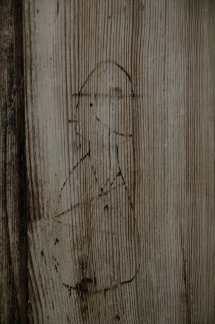
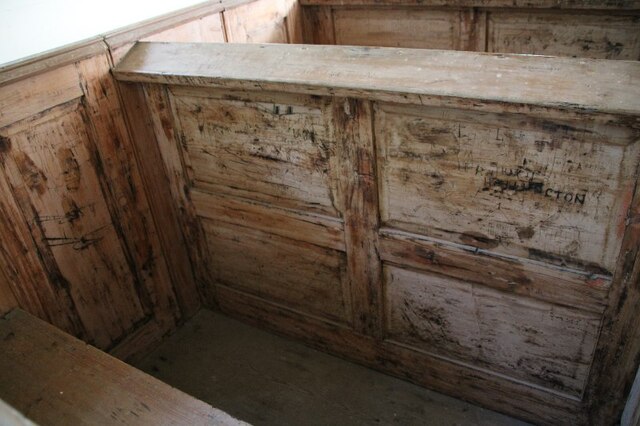
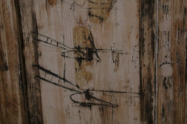
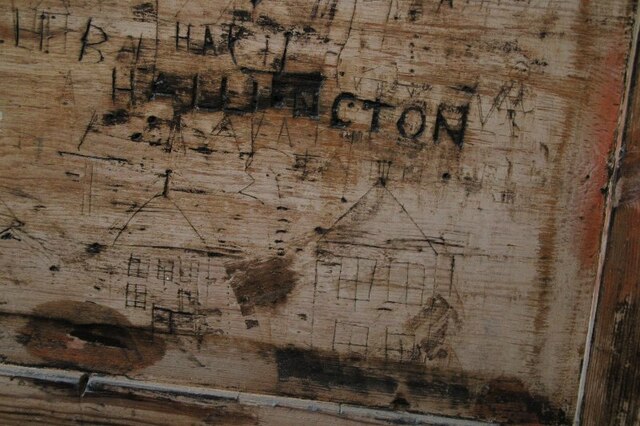
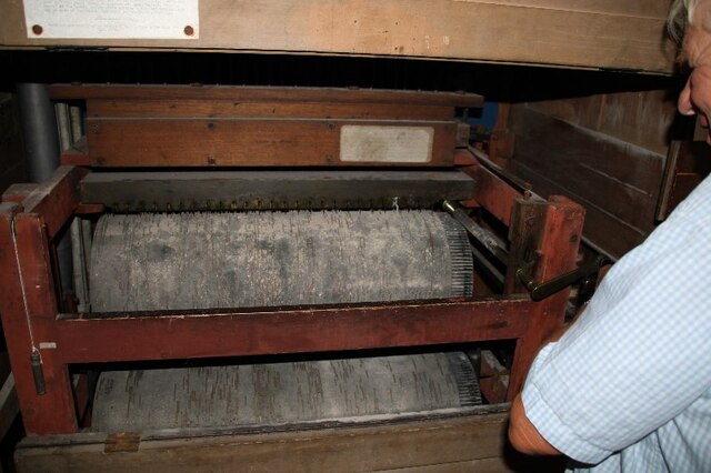
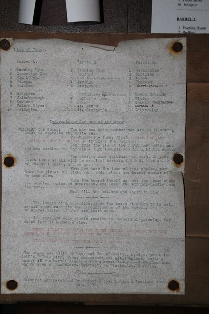
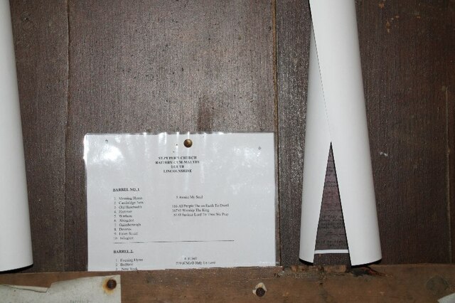
![Box Pews in Church of St. Peter, Raithby The one in the foreground contains multiple graffiti. For details see <a href="https://www.geograph.org.uk/photo/6975284">TF3184 : Graffiti in box pew in Raithby Church (3)</a>, <a href="https://www.geograph.org.uk/photo/6975278">TF3184 : Graffito in box pew, Raithby Church (1)</a>, <a href="https://www.geograph.org.uk/photo/6975279">TF3184 : Graffiti in box pew in Raithby Church (2)</a>] and <a href="https://www.geograph.org.uk/photo/6975282">TF3184 : Graffiti in box pew in Raithby Church (4)</a>.](https://s0.geograph.org.uk/geophotos/06/97/52/6975276_2e4327f9.jpg)
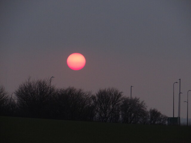
Fox Covert is a woodland area located in Lincolnshire, England. Covering an approximate area of 100 acres, it is a well-known spot for nature lovers and outdoor enthusiasts. The woodland is characterized by its dense cover of trees, primarily consisting of oak, beech, and birch.
Situated in the heart of Lincolnshire, Fox Covert offers a peaceful and serene environment, making it an ideal destination for those seeking a break from the hustle and bustle of city life. The woodland provides numerous walking trails and paths, allowing visitors to explore its natural beauty and observe the diverse wildlife that call it home.
As the name suggests, Fox Covert is particularly known for its fox population. These elusive creatures can often be spotted during the early morning or late evening hours, adding an element of excitement to any visit. In addition to foxes, the woodland is also home to a variety of other animals such as deer, rabbits, and a wide array of bird species.
The woodland is managed by the local authorities, ensuring its preservation and maintenance. It is a popular location for educational visits and school trips, offering opportunities for students to learn about the importance of conservation and the natural environment.
Overall, Fox Covert in Lincolnshire is a charming woodland area that provides a tranquil retreat for nature enthusiasts. With its diverse flora and fauna, it offers a unique and immersive experience for anyone looking to reconnect with nature.
If you have any feedback on the listing, please let us know in the comments section below.
Fox Covert Images
Images are sourced within 2km of 53.34058/-0.006004691 or Grid Reference TF3284. Thanks to Geograph Open Source API. All images are credited.


Fox Covert is located at Grid Ref: TF3284 (Lat: 53.34058, Lng: -0.006004691)
Administrative County: Lincolnshire
District: East Lindsey
Police Authority: Lincolnshire
What 3 Words
///narrow.gave.nurse. Near Louth, Lincolnshire
Nearby Locations
Related Wikis
Tathwell
Tathwell is a village in the East Lindsey district of Lincolnshire, England. Tathwell is situated approximately 3 miles (5 km) south from the market town...

Maltby, Lincolnshire
Maltby is a hamlet in the East Lindsey district of Lincolnshire, England. It forms part of Raithby cum Maltby civil parish, and is situated on the A153...

Raithby cum Maltby
Raithby cum Maltby is a civil parish in the East Lindsey district of Lincolnshire, England. It is situated about 1 mile (1.6 km) south-west from the market...
Maltby Preceptory
Maltby Preceptory was a house of the Knights Hospitaller in the village of Maltby, Lincolnshire, England. There are two differing accounts regarding its...

Louth Cemetery
Louth Cemetery on London Road (also known as London Road Cemetery) is the cemetery for Louth in Lincolnshire. Opened in 1855, the cemetery's distinctive...

Hubbard's Hills
Hubbard's Hills is an area of natural beauty directly to the west of Louth, Lincolnshire, England and is popular for family picnics, school field trips...

Hallington railway station
Hallington railway station was a station in Hallington, Lincolnshire. == History == The Great Northern Railway planned and built a branch line from Bardney...
King Edward VI Grammar School, Louth
King Edward VI Grammar School (sometimes abbreviated to KEVIGS) is a grammar school located in Louth, Lincolnshire, England. == History == As early as...
Nearby Amenities
Located within 500m of 53.34058,-0.006004691Have you been to Fox Covert?
Leave your review of Fox Covert below (or comments, questions and feedback).