The Belt

Wood, Forest in Lincolnshire East Lindsey

England

The Belt

Part of Brackenborough DMV: aerial 2022 See: <span class="nowrap"><a title="https://www.heritagegateway.org.uk/Gateway/Results_Single.aspx?uid=MLI43572&resourceID=1006" rel="nofollow ugc noopener" href="https://www.heritagegateway.org.uk/Gateway/Results_Single.aspx?uid=MLI43572&resourceID=1006">Link</a><img style="margin-left:2px;" alt="External link" title="External link - shift click to open in new window" src="https://s1.geograph.org.uk/img/external.png" width="10" height="10"/></span> and
<span class="nowrap"><a title="http://web.archive.org/web/20170225235146/http://cwr.defra.gov.uk/mapboards/pdfs/247010012.pdf" rel="nofollow ugc noopener" href="http://web.archive.org/web/20170225235146/http://cwr.defra.gov.uk/mapboards/pdfs/247010012.pdf">Archive Link</a><img style="margin-left:2px;" alt="External link" title="External link - shift click to open in new window" src="https://s1.geograph.org.uk/img/external.png" width="10" height="10"/></span>
Part of Brackenborough DMV: aerial 2022 Credit: Simon Tomson

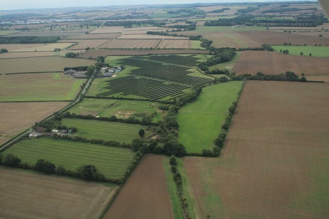
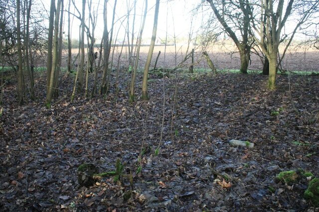
The Belt is a wooded area located in Lincolnshire, England. Spanning over a vast expanse, it is often referred to as The Belt Wood or The Belt Forest due to its dense and extensive tree cover. The Belt is situated in a rural setting, surrounded by picturesque landscapes and rolling hills.

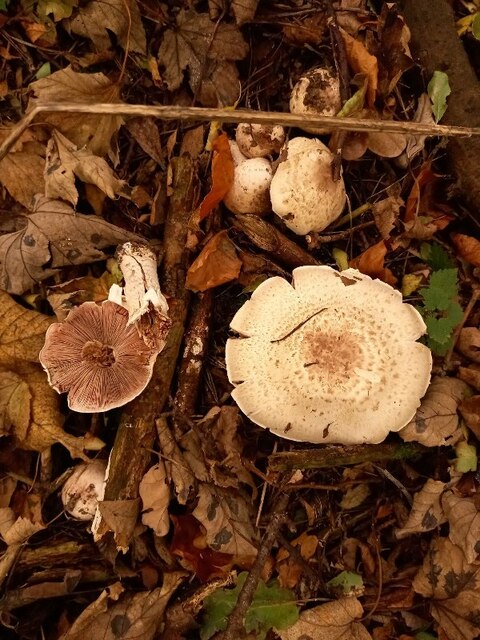
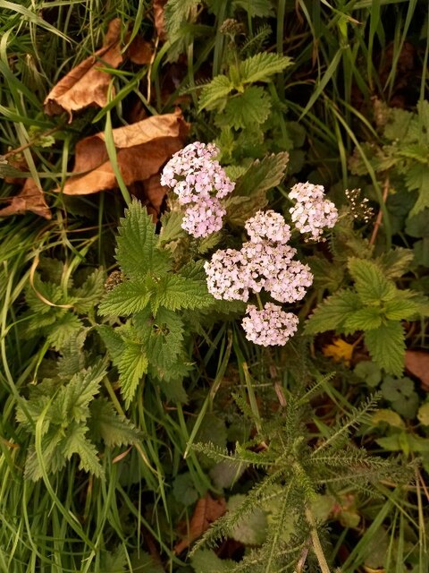
This woodland area is known for its rich biodiversity, hosting a wide variety of flora and fauna. The forest is home to several species of trees, including oak, birch, and beech, creating a diverse and lush green canopy. The undergrowth is teeming with wildflowers and ferns, adding to the overall beauty of the landscape.

The Belt is a popular destination for nature enthusiasts, hikers, and wildlife photographers. The tranquil trails winding through the woods provide an excellent opportunity for visitors to immerse themselves in nature and enjoy the peaceful surroundings. The forest also attracts birdwatchers, as it serves as a habitat for various bird species, including woodpeckers, owls, and songbirds.

In addition to its natural beauty, The Belt holds historical significance. It is believed to have been part of the medieval woodland that once covered the area. Today, remnants of ancient pathways and boundaries can still be found, evoking a sense of the past.

Overall, The Belt in Lincolnshire offers a serene escape from the hustle and bustle of daily life. With its lush greenery, diverse wildlife, and historical charm, it is a true gem for nature lovers and history enthusiasts alike.

If you have any feedback on the listing, please let us know in the comments section below.

The Belt Images

Images are sourced within 2km of 53.405849/-0.005510829 or Grid Reference TF3291. Thanks to Geograph Open Source API. All images are credited.

Part of Brackenborough DMV: aerial 2022 See: <span class="nowrap"><a title="https://www.heritagegateway.org.uk/Gateway/Results_Single.aspx?uid=MLI43572&resourceID=1006" rel="nofollow ugc noopener" href="https://www.heritagegateway.org.uk/Gateway/Results_Single.aspx?uid=MLI43572&resourceID=1006">Link</a><img style="margin-left:2px;" alt="External link" title="External link - shift click to open in new window" src="https://s1.geograph.org.uk/img/external.png" width="10" height="10"/></span> and
<span class="nowrap"><a title="http://web.archive.org/web/20170225235146/http://cwr.defra.gov.uk/mapboards/pdfs/247010012.pdf" rel="nofollow ugc noopener" href="http://web.archive.org/web/20170225235146/http://cwr.defra.gov.uk/mapboards/pdfs/247010012.pdf">Archive Link</a><img style="margin-left:2px;" alt="External link" title="External link - shift click to open in new window" src="https://s1.geograph.org.uk/img/external.png" width="10" height="10"/></span>
Part of Brackenborough DMV: aerial 2022
See: LinkExternal link and Archive LinkExternal link
Fotherby and earthworks: aerial 2022 You are looking from right to left across what seems, on the right, to be a moated site. On the left two further (parallel linear) depressions.

The Heritage Environment Record relates to this area, but refers only to "fishponds":

<span class="nowrap"><a title="https://www.heritagegateway.org.uk/Gateway/Results_Single.aspx?uid=af841456-659c-4f64-8b04-069e869e6e06&resourceID=19191" rel="nofollow ugc noopener" href="https://www.heritagegateway.org.uk/Gateway/Results_Single.aspx?uid=af841456-659c-4f64-8b04-069e869e6e06&resourceID=19191">Link</a><img style="margin-left:2px;" alt="External link" title="External link - shift click to open in new window" src="https://s1.geograph.org.uk/img/external.png" width="10" height="10"/></span>

For ground shots see <a href="https://www.geograph.org.uk/photo/7383309">TF3191 : Moated platform at Fotherby (2)</a> and <a href="https://www.geograph.org.uk/photo/7383305">TF3191 : Moated platform at Fotherby (1)</a>.

"Sunken Field" <a href="https://www.geograph.org.uk/photo/4128340">TF3191 : Sunken field</a> also shows the "moated site".
Fotherby and earthworks: aerial 2022
You are looking from right to left across what seems, on the right, to be a moated site. On the left two further (parallel linear) depressions. The Heritage Environment Record relates to this area, but refers only to "fishponds": LinkExternal link For ground shots see TF3191 : Moated platform at Fotherby (2) and TF3191 : Moated platform at Fotherby (1). "Sunken Field" TF3191 : Sunken field also shows the "moated site".
Yarburgh Beck, Brackenborough to Little Grimsby: aerial 2022 (1)
Yarburgh Beck, Brackenborough to Little Grimsby: aerial 2022 (2)
Yarburgh Beck, Brackenborough to Little Grimsby: aerial 2022 (3)
Solar array at Grove Farm, Yarburgh: aerial 2022
Free Range egg unit at Grange Farm, Little Grimsby: aerial 2022 No hens seen, we are still in the grips of an Avian Flu epidemic.
Free Range egg unit at Grange Farm, Little Grimsby: aerial 2022
No hens seen, we are still in the grips of an Avian Flu epidemic.
Railway sign by disused Louth-Grimsby line at Fotherby
Mushrooms in Yalta Wood, Fotherby (1)
Mushrooms in Yalta Wood, Fotherby (2)
Mushrooms in Yalta Wood, Fotherby (3)
Pink-tinged yarrow by Yalta Wood, Fotherby Achillea millefolium.
Pink-tinged yarrow by Yalta Wood, Fotherby
Achillea millefolium.
Pine "washing dolly" in Yalta Wood, Fotherby (1) A lot of the pine trees in this relatively young wood have died, their shortened, radially arranged branches making them look like washing dollies.

See also <a href="https://www.geograph.org.uk/photo/7383294">TF3191 : Pine "washing dolly" in Yalta Wood, Fotherby (2)</a>].
Pine "washing dolly" in Yalta Wood, Fotherby (1)
A lot of the pine trees in this relatively young wood have died, their shortened, radially arranged branches making them look like washing dollies. See also TF3191 : Pine "washing dolly" in Yalta Wood, Fotherby (2)].
Yalta Wood, Fotherby, 2023 See <a href="https://www.geograph.org.uk/photo/319645">SP3205 : Farm buildings off Mount Owen Road.</a>.

Dates from around 1980. The trees are planted in rows and die to be thinned. This part of the wood is almost impassable because of the mostly sycamore seedlings or suckers. The ground is littered with dead pine trees.
Yalta Wood, Fotherby, 2023
See SP3205 : Farm buildings off Mount Owen Road.. Dates from around 1980. The trees are planted in rows and die to be thinned. This part of the wood is almost impassable because of the mostly sycamore seedlings or suckers. The ground is littered with dead pine trees.
Pine "washing dolly" in Yalta Wood, Fotherby (2) Detail of <a href="https://www.geograph.org.uk/photo/7383296">TF3191 : Pine "washing dolly" in Yalta Wood, Fotherby (3)</a> and <a href="https://www.geograph.org.uk/photo/7383298">TF3191 : Pine "washing dolly" in Yalta Wood, Fotherby (4)</a>].

A lot of the pine trees in this relatively young wood have died, their shortened, radially arranged branches making them look like washing dollies.

Dates from around 1980. The trees are planted in rows and die to be thinned. This part of the wood is almost impassable because of the mostly sycamore seedlings or suckers. The ground is littered with dead pine trees.

See also <a href="https://www.geograph.org.uk/photo/7383285">TF3191 : Pine "washing dolly" in Yalta Wood, Fotherby (1)</a>].
Pine "washing dolly" in Yalta Wood, Fotherby (2)
Detail of TF3191 : Pine "washing dolly" in Yalta Wood, Fotherby (3) and TF3191 : Pine "washing dolly" in Yalta Wood, Fotherby (4)]. A lot of the pine trees in this relatively young wood have died, their shortened, radially arranged branches making them look like washing dollies. Dates from around 1980. The trees are planted in rows and die to be thinned. This part of the wood is almost impassable because of the mostly sycamore seedlings or suckers. The ground is littered with dead pine trees. See also TF3191 : Pine "washing dolly" in Yalta Wood, Fotherby (1)].
Pine "washing dolly" in Yalta Wood, Fotherby (3) Looking towards Fotherby. Pine "dolly" in the foreground.
Pine "washing dolly" in Yalta Wood, Fotherby (3)
Looking towards Fotherby. Pine "dolly" in the foreground.
Pine "washing dolly" in Yalta Wood, Fotherby (4) Looking towards Fotherby. Pine "dolly" in the foreground. See <a href="https://www.geograph.org.uk/photo/7383294">TF3191 : Pine "washing dolly" in Yalta Wood, Fotherby (2)</a> and <a href="https://www.geograph.org.uk/photo/7383285">TF3191 : Pine "washing dolly" in Yalta Wood, Fotherby (1)</a>] for details
Pine "washing dolly" in Yalta Wood, Fotherby (4)
Looking towards Fotherby. Pine "dolly" in the foreground. See TF3191 : Pine "washing dolly" in Yalta Wood, Fotherby (2) and TF3191 : Pine "washing dolly" in Yalta Wood, Fotherby (1)] for details
Gravestone in Fotherby churchyard
Show me another place!

The Belt is located at Grid Ref: TF3291 (Lat: 53.405849, Lng: -0.005510829)

Administrative County: Lincolnshire

District: East Lindsey

Police Authority: Lincolnshire

What 3 Words

///firms.cubs.immediate. Near Louth, Lincolnshire

Related Wikis

Fotherby Halt railway station

Fotherby Halt was a railway halt on the East Lincolnshire Railway which served the village of Fotherby in Lincolnshire between 1905 and 1961. The station...

Brackenborough with Little Grimsby

Brackenborough with Little Grimsby is a civil parish in the East Lindsey district of Lincolnshire, England. According to the 2001 census, the parish had...

Fotherby

Fotherby is a village and civil parish in the East Lindsey district of Lincolnshire, England. It is situated just east from the A16 road, 13 miles (21...

Brackenborough, Lincolnshire

Brackenborough is a hamlet in the civil parish of Brackenborough with Little Grimsby, in the East Lindsey district of Lincolnshire, England. At the census...

Nearby Amenities

Located within 500m of 53.405849,-0.005510829
Little Grimsby
Is In: Lincolnshire, England, UK
Place: hamlet
Source: npe
Lat/Long: 53.4033535/-0.0058537
Manor Farm
Place: farm
Source: Bing
Lat/Long: 53.4039759/-0.003969
The data included in this document is from www.openstreetmap.org. The data is made available under ODbL.

Have you been to The Belt?

Leave your review of The Belt below (or comments, questions and feedback).