Belt Plantation

Wood, Forest in Lincolnshire East Lindsey

England

Belt Plantation

Direction Sign – Signpost on Bluestone Heath Road in Belchford parish Located on the northeast side of the T junction of Bluestone Heath Road and Lowfield Lane in Belchford parish. 3 arms and no finial. See also <a title="https://www.geograph.org.uk/photo/3261197" href="https://www.geograph.org.uk/photo/3261197">Link</a>.

Milestone Society National ID: LI_TF3076
Direction Sign – Signpost on Bluestone Heath Road in Belchford parish Credit: A Riley

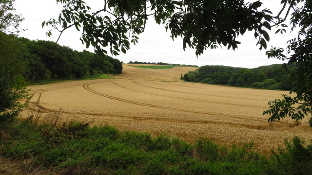
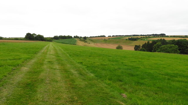
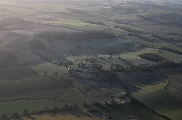
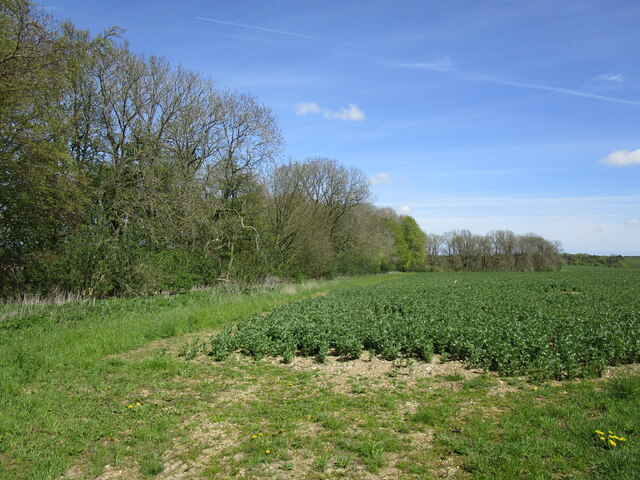
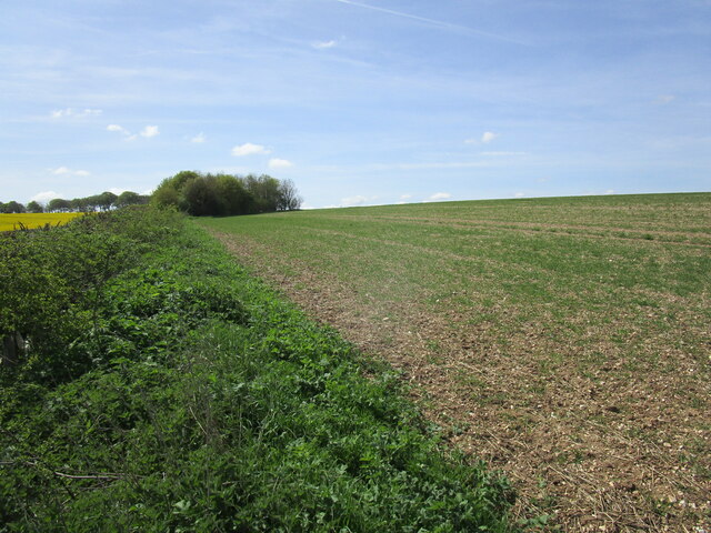
Belt Plantation, located in Lincolnshire, England, is a picturesque woodland area known for its lush greenery and diverse flora and fauna. Covering an extensive area, Belt Plantation is a significant part of the local ecosystem and provides a natural habitat for various species.

The plantation is primarily composed of different species of trees, including oak, beech, and birch. These trees create a dense canopy that offers shade and shelter to a wide range of wildlife. The forest floor is covered with a thick layer of leaf litter, providing an ideal environment for smaller plants, fungi, and insects to thrive.

Belt Plantation is also home to numerous mammals, such as deer, foxes, and badgers, which can often be spotted roaming through the woodland. Birdwatchers frequent the area to observe the diverse avian population, including woodpeckers, owls, and various songbirds.

The plantation is open to the public, offering visitors an opportunity to explore its natural beauty through well-maintained walking trails. These trails wind through the forest, allowing visitors to immerse themselves in the tranquil atmosphere and enjoy the sights and sounds of nature.

Belt Plantation is not just a recreational area; it also plays a vital role in environmental conservation. The woodland helps purify the air by absorbing carbon dioxide and releasing oxygen, contributing to the overall health of the surrounding area.

Overall, Belt Plantation, Lincolnshire, is a cherished natural gem, providing a haven for wildlife and an enchanting experience for nature enthusiasts.

If you have any feedback on the listing, please let us know in the comments section below.

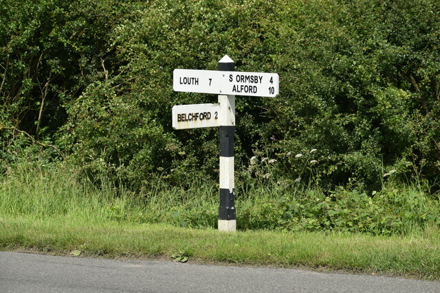
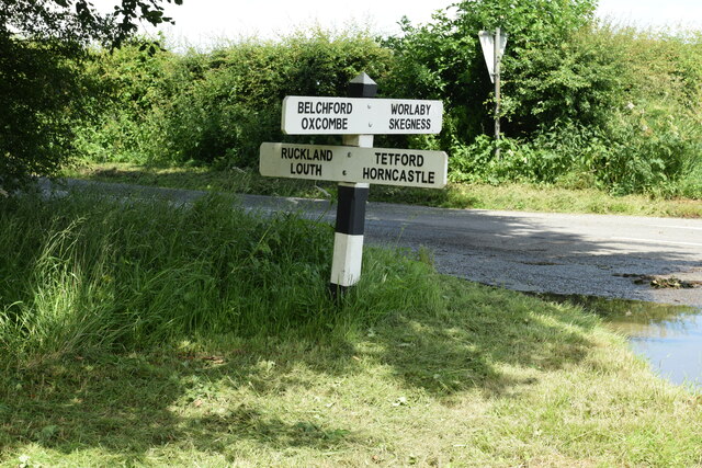
Belt Plantation Images

Images are sourced within 2km of 53.269606/-0.012188599 or Grid Reference TF3276. Thanks to Geograph Open Source API. All images are credited.

Direction Sign – Signpost on Bluestone Heath Road in Belchford parish Located on the northeast side of the T junction of Bluestone Heath Road and Lowfield Lane in Belchford parish. 3 arms and no finial. See also <a title="https://www.geograph.org.uk/photo/3261197" href="https://www.geograph.org.uk/photo/3261197">Link</a>.

Milestone Society National ID: LI_TF3076
Direction Sign – Signpost on Bluestone Heath Road in Belchford parish
Located on the northeast side of the T junction of Bluestone Heath Road and Lowfield Lane in Belchford parish. 3 arms and no finial. See also Link. Milestone Society National ID: LI_TF3076
Direction Sign – Signpost on Bluestone Heath Road in Tetford parish Located on the northwest side of the crossroads on Bluestone Heath Road at Tetford Hill, in Tetford parish. 4 arms and no finial. See also <a title="https://www.geograph.org.uk/photo/6676131" href="https://www.geograph.org.uk/photo/6676131">Link</a> and <a title="https://www.geograph.org.uk/photo/820855" href="https://www.geograph.org.uk/photo/820855">Link</a>.

Milestone Society National ID: LI_TF3276
Direction Sign – Signpost on Bluestone Heath Road in Tetford parish
Located on the northwest side of the crossroads on Bluestone Heath Road at Tetford Hill, in Tetford parish. 4 arms and no finial. See also Link and Link. Milestone Society National ID: LI_TF3276
Direction Sign – Signpost at the junction of West Road and North Road in Tetford Located on the southeast side of the junction of West Road and North Road, in Tetford parish. 3 arms and no finial.

Milestone Society National ID: LI_TF3374
Direction Sign – Signpost at the junction of West Road and North Road in Tetford
Located on the southeast side of the junction of West Road and North Road, in Tetford parish. 3 arms and no finial. Milestone Society National ID: LI_TF3374
Church of St. Olave, Ruckland
Memento Mori: gravestones, Church of St. Olave, Ruckland
Church of St. Olave, Ruckland
Fields of wheat by M Plantation, Farforth
Colourful garden, Keeper's Cottage, Worlaby
Track heading northwest passing Keeper's Cottage, Worlaby
Path running southwest from Worlaby to the Bluestone Heath Road
Oxcombe DMV: aerial 2022 See: <span class="nowrap"><a title="https://www.heritagegateway.org.uk/Gateway/Results_Single.aspx?uid=MLI41963&resourceID=1006" rel="nofollow ugc noopener" href="https://www.heritagegateway.org.uk/Gateway/Results_Single.aspx?uid=MLI41963&resourceID=1006">Link</a><img style="margin-left:2px;" alt="External link" title="External link - shift click to open in new window" src="https://s1.geograph.org.uk/img/external.png" width="10" height="10"/></span>

The earthworks are picked out by the early January morning frost.
Oxcombe DMV: aerial 2022
See: LinkExternal link The earthworks are picked out by the early January morning frost.
Cut Mark: Oxcombe, All Saints' Church Cut bench mark on the south-west face of the tower of the church.  Very difficult to spot so required chalk to highlight.  See <a title="https://www.geograph.org.uk/photo/7321441" href="https://www.geograph.org.uk/photo/7321441">Link</a> for a wider view and <span class="nowrap"><a title="https://www.bench-marks.org.uk/bm178080" rel="nofollow ugc noopener" href="https://www.bench-marks.org.uk/bm178080">Link</a><img style="margin-left:2px;" alt="External link" title="External link - shift click to open in new window" src="https://s1.geograph.org.uk/img/external.png" width="10" height="10"/></span> for details of the mark.
Cut Mark: Oxcombe, All Saints' Church
Cut bench mark on the south-west face of the tower of the church. Very difficult to spot so required chalk to highlight. See Link for a wider view and LinkExternal link for details of the mark.
Oxcombe, All Saints' Church There is a cut bench mark on the south-west face of the tower of the church.  See <a title="https://www.geograph.org.uk/photo/7321434" href="https://www.geograph.org.uk/photo/7321434">Link</a> for a closer view and <span class="nowrap"><a title="https://www.bench-marks.org.uk/bm178080" rel="nofollow ugc noopener" href="https://www.bench-marks.org.uk/bm178080">Link</a><img style="margin-left:2px;" alt="External link" title="External link - shift click to open in new window" src="https://s1.geograph.org.uk/img/external.png" width="10" height="10"/></span> for details of the mark.
Oxcombe, All Saints' Church
There is a cut bench mark on the south-west face of the tower of the church. See Link for a closer view and LinkExternal link for details of the mark.
Bean field and Rookery Plantation
Alongside the road from Ruckland to the Bluestone Heath Road
All Saints' church, Oxcombe A small church with interesting tower, tucked away in the Wolds.
All Saints' church, Oxcombe
A small church with interesting tower, tucked away in the Wolds.
East window, All Saints' church, Oxcombe Depicting the three Maries at the tomb, by Heaton, Butler and Bayne, C.1920.
A memorial to those killed in the First World War, erected by Francis Sowerby.
East window, All Saints' church, Oxcombe
Depicting the three Maries at the tomb, by Heaton, Butler and Bayne, C.1920. A memorial to those killed in the First World War, erected by Francis Sowerby.
Interior, All Saints' church, Oxcombe Unfortunately there was an exhibition on at the time!
Interior, All Saints' church, Oxcombe
Unfortunately there was an exhibition on at the time!
Show me another place!

Belt Plantation is located at Grid Ref: TF3276 (Lat: 53.269606, Lng: -0.012188599)

Administrative County: Lincolnshire

District: East Lindsey

Police Authority: Lincolnshire

What 3 Words

///skills.kilt.arranges. Near Burwell, Lincolnshire

Related Wikis

Ruckland

Ruckland is a village in the civil parish of Maidenwell, and about 6 miles (10 km) south from the town of Louth, in the East Lindsey district, in the county...

Oxcombe

Oxcombe is a small village in the civil parish of Maidenwell, in the East Lindsey district of Lincolnshire, England. It is situated 3 miles (5 km) west...

Bluestone Heath Road

The Bluestone Heath Road is an ancient route and ridgeway across the Lincolnshire Wolds in Lincolnshire, England. The surviving parts are somewhat fragmented...

Tetford

Tetford is a village and civil parish in the East Lindsey district of Lincolnshire, England. == History == Tetford is listed as "Tesforde" in the Domesday...

Farforth

Farforth or Farforth-cum-Maidenwell is a hamlet in the East Lindsey district of Lincolnshire, England. It is in the civil parish of Maidenwell, and approximately...

Maidenwell, Lincolnshire

Maidenwell is a village and civil parish in the East Lindsey district of Lincolnshire, England. The village is 6 miles (10 km) south from Louth. Maidenwell...

Salmonby

Salmonby is a village in the civil parish of Tetford, in the East Lindsey district of Lincolnshire, England. It is situated 5.5 miles (8.9 km) north-east...

East Lindsey

East Lindsey is a local government district in Lincolnshire, England. Its council is based in Horncastle and the largest town is Skegness. Other towns...

Nearby Amenities

Located within 500m of 53.269606,-0.012188599
Tetford Hill
Ele: 142
Natural: peak
Source: Bing
Lat/Long: 53.2661597/-0.0100064
The data included in this document is from www.openstreetmap.org. The data is made available under ODbL.

Have you been to Belt Plantation?

Leave your review of Belt Plantation below (or comments, questions and feedback).