The Wilderness
Wood, Forest in Lincolnshire East Lindsey
England
The Wilderness
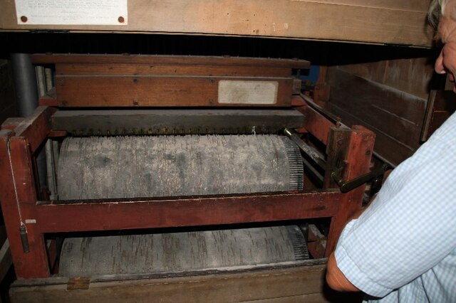
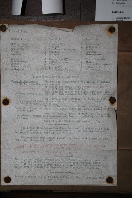
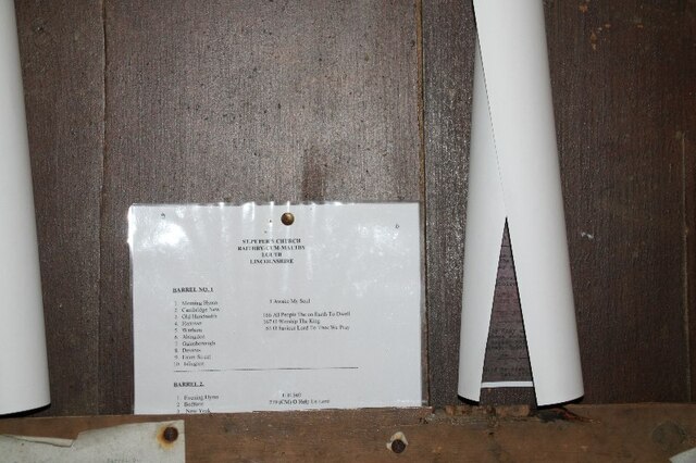
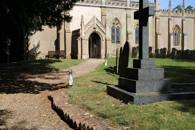
![Box Pews in Church of St. Peter, Raithby The one in the foreground contains multiple graffiti. For details see <a href="https://www.geograph.org.uk/photo/6975284">TF3184 : Graffiti in box pew in Raithby Church (3)</a>, <a href="https://www.geograph.org.uk/photo/6975278">TF3184 : Graffito in box pew, Raithby Church (1)</a>, <a href="https://www.geograph.org.uk/photo/6975279">TF3184 : Graffiti in box pew in Raithby Church (2)</a>] and <a href="https://www.geograph.org.uk/photo/6975282">TF3184 : Graffiti in box pew in Raithby Church (4)</a>.](https://s0.geograph.org.uk/geophotos/06/97/52/6975276_2e4327f9.jpg)
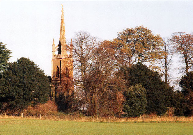
The Wilderness, located in Lincolnshire, is a mesmerizing woodland area that offers visitors a chance to immerse themselves in the serene beauty of nature. Spanning over a vast area, this forested landscape is a haven for wildlife and a popular destination for nature enthusiasts and outdoor adventurers alike.
The Wilderness boasts a diverse range of flora and fauna, with towering oak, birch, and beech trees dominating the landscape. The forest floor is adorned with a rich layer of moss, creating a lush carpet that adds to the enchanting atmosphere. In spring, the forest comes alive with a burst of vibrant colors as wildflowers bloom, while in autumn, the canopy transforms into a kaleidoscope of reds, oranges, and yellows.
As visitors explore The Wilderness, they may come across an array of wildlife, including deer, foxes, rabbits, and a variety of bird species. Nature lovers can indulge in birdwatching or embark on a leisurely stroll along the well-maintained trails, which offer breathtaking views of the surrounding woodland.
For those seeking a more immersive experience, The Wilderness also provides camping facilities, allowing visitors to spend a night under the stars. The peaceful ambiance, coupled with the gentle rustling of leaves and the occasional call of a distant bird, creates a tranquil retreat away from the hustle and bustle of daily life.
In conclusion, The Wilderness in Lincolnshire is a captivating woodland that captivates with its natural beauty and abundant wildlife. It offers a sanctuary for those seeking solace in nature and an opportunity to reconnect with the great outdoors.
If you have any feedback on the listing, please let us know in the comments section below.
The Wilderness Images
Images are sourced within 2km of 53.32884/-0.023927273 or Grid Reference TF3183. Thanks to Geograph Open Source API. All images are credited.


The Wilderness is located at Grid Ref: TF3183 (Lat: 53.32884, Lng: -0.023927273)
Administrative County: Lincolnshire
District: East Lindsey
Police Authority: Lincolnshire
What 3 Words
///office.ranch.reverted. Near Louth, Lincolnshire
Nearby Locations
Related Wikis
Tathwell
Tathwell is a village in the East Lindsey district of Lincolnshire, England. Tathwell is situated approximately 3 miles (5 km) south from the market town...

Maltby, Lincolnshire
Maltby is a hamlet in the East Lindsey district of Lincolnshire, England. It forms part of Raithby cum Maltby civil parish, and is situated on the A153...
Maltby Preceptory
Maltby Preceptory was a house of the Knights Hospitaller in the village of Maltby, Lincolnshire, England. There are two differing accounts regarding its...

Raithby cum Maltby
Raithby cum Maltby is a civil parish in the East Lindsey district of Lincolnshire, England. It is situated about 1 mile (1.6 km) south-west from the market...
Haugham Priory
Haugham Priory was a Benedictine priory in Lincolnshire, England. The priory of Haugham was built upon land granted by Hugh, Earl of Chester, at the end...

Hallington railway station
Hallington railway station was a station in Hallington, Lincolnshire. == History == The Great Northern Railway planned and built a branch line from Bardney...
All Saints Church, Haugham
All Saints Church is a former Anglican church in the village of Haugham, Lincolnshire, England. It is recorded in the National Heritage List for England...

Haugham
Haugham is a village and civil parish in the East Lindsey district of Lincolnshire, England. It is situated 3 miles (5 km) south from Louth. The prime...
Nearby Amenities
Located within 500m of 53.32884,-0.023927273Have you been to The Wilderness?
Leave your review of The Wilderness below (or comments, questions and feedback).