Broomfield Spring

Wood, Forest in Hertfordshire East Hertfordshire

England

Broomfield Spring

Stapleford : St Mary the Virgin View from the village playing field. Stapleford Church is Grade II* listed building, described at this <span class="nowrap"><a title="https://historicengland.org.uk/listing/the-list/list-entry/1089119?section=official-listing" rel="nofollow ugc noopener" href="https://historicengland.org.uk/listing/the-list/list-entry/1089119?section=official-listing">Link</a><img style="margin-left:2px;" alt="External link" title="External link - shift click to open in new window" src="https://s1.geograph.org.uk/img/external.png" width="10" height="10"/></span>.
Stapleford : St Mary the Virgin Credit: Jim Osley

Broomfield Spring is a picturesque woodland located in Hertfordshire, England. Nestled within the county's stunning countryside, this tranquil haven covers an area of approximately 50 acres. The woodland is part of the larger Broomfield Estate and provides a haven for nature enthusiasts, walkers, and those seeking a peaceful escape from the bustling city life.

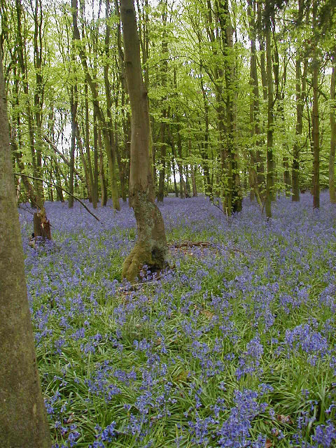
The forest is primarily made up of native broadleaf trees, such as oak, beech, and birch, which create a rich and diverse ecosystem. The dense canopy provides shade, allowing for the growth of a variety of flora on the forest floor, including bluebells, wood anemones, and wild garlic. These wildflowers create a vibrant display during the spring months, attracting a plethora of insects and birds.

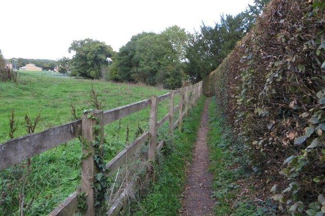
The woodland is crisscrossed by a network of well-maintained footpaths, making it easily accessible to visitors. The paths wind their way through the forest, leading to hidden clearings, babbling streams, and small ponds. These bodies of water provide a habitat for amphibians and water-loving creatures, adding to the biodiversity of the area.

Broomfield Spring is renowned for its rich wildlife, offering sightings of deer, foxes, and a variety of bird species, including woodpeckers and owls. The forest is also home to a diverse range of smaller mammals, such as bats, shrews, and voles.

The management of Broomfield Spring is carried out by local conservation groups, ensuring that the woodland remains a haven for wildlife and a place for visitors to enjoy its natural beauty. Whether it's a leisurely stroll, birdwatching, or simply a moment of tranquility, Broomfield Spring offers a serene escape into nature's embrace.

If you have any feedback on the listing, please let us know in the comments section below.

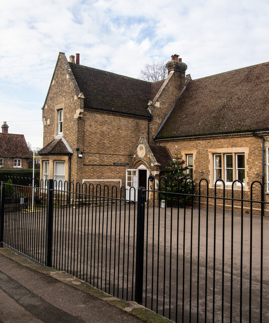
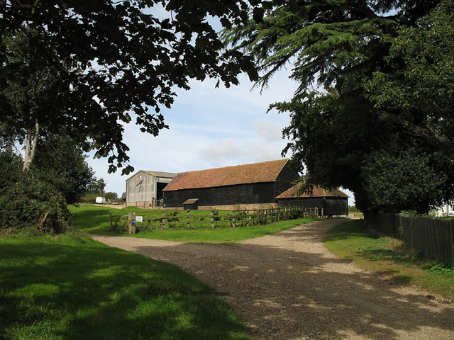
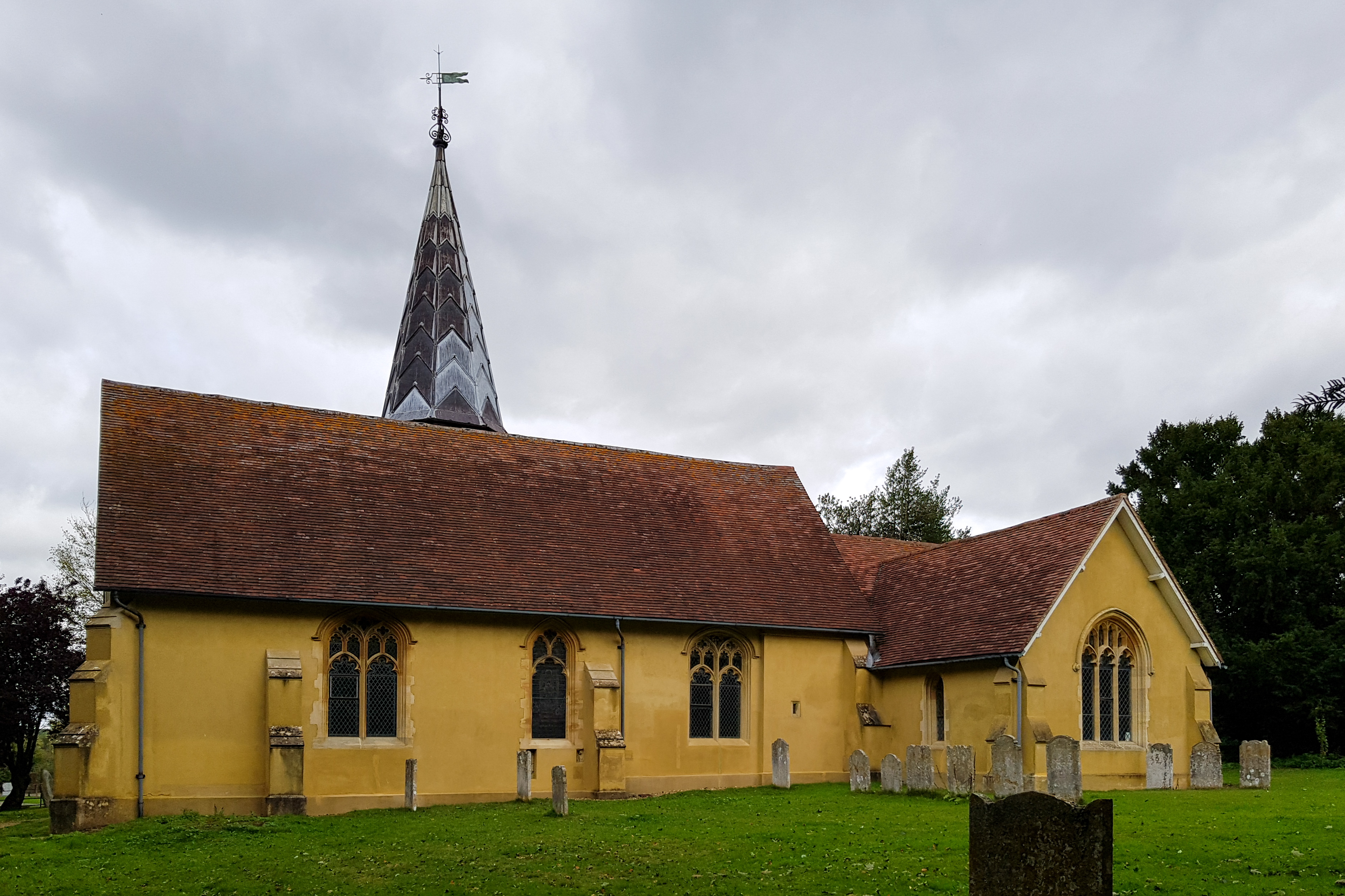
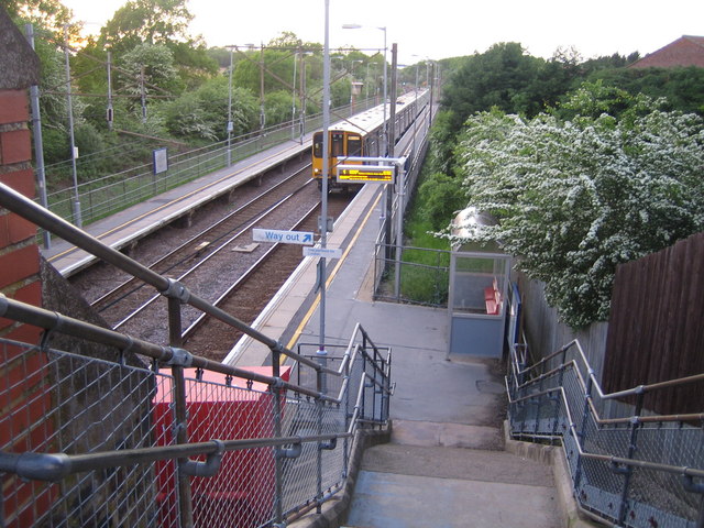
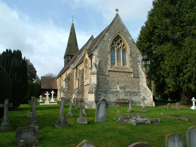
Broomfield Spring Images

Images are sourced within 2km of 51.83859/-0.10450864 or Grid Reference TL3017. Thanks to Geograph Open Source API. All images are credited.

Stapleford : St Mary the Virgin View from the village playing field. Stapleford Church is Grade II* listed building, described at this <span class="nowrap"><a title="https://historicengland.org.uk/listing/the-list/list-entry/1089119?section=official-listing" rel="nofollow ugc noopener" href="https://historicengland.org.uk/listing/the-list/list-entry/1089119?section=official-listing">Link</a><img style="margin-left:2px;" alt="External link" title="External link - shift click to open in new window" src="https://s1.geograph.org.uk/img/external.png" width="10" height="10"/></span>.
Stapleford : St Mary the Virgin
View from the village playing field. Stapleford Church is Grade II* listed building, described at this LinkExternal link.
Stapleford Primary School Former National school built in 1872.
Stapleford Primary School
Former National school built in 1872.
Stapleford : tower, St Mary the Virgin Stapleford Church is Grade II* listed building, described at this <span class="nowrap"><a title="https://historicengland.org.uk/listing/the-list/list-entry/1089119?section=official-listing" rel="nofollow ugc noopener" href="https://historicengland.org.uk/listing/the-list/list-entry/1089119?section=official-listing">Link</a><img style="margin-left:2px;" alt="External link" title="External link - shift click to open in new window" src="https://s1.geograph.org.uk/img/external.png" width="10" height="10"/></span>.
Stapleford : tower, St Mary the Virgin
Stapleford Church is Grade II* listed building, described at this LinkExternal link.
St Andrew & St Mary's church
Footpath from the churchyard to Watton House
Playing field and tennis courts at Watton at Stone
Chain Walk going into town
Footpath to Stonyhills
Angry skies, Widow Bushes near Stapleford
Bluebells in Row Wood
Great Gobions Farm Entrance to the farm.  The track to the right is a public bridleway.
Great Gobions Farm
Entrance to the farm. The track to the right is a public bridleway.
Conservation Walks Marker Post marking the route and showing a map of a local conservation walk.  The section it is indicating does not appear as a footpath on the OS map.
Conservation Walks Marker
Post marking the route and showing a map of a local conservation walk. The section it is indicating does not appear as a footpath on the OS map.
Hertford Loop near Watton at Stone Looking along the cutting of the railway line from Hertford as it approaches Watton at Stone.
Hertford Loop near Watton at Stone
Looking along the cutting of the railway line from Hertford as it approaches Watton at Stone.
Road to Watkin's Hall Farm No through road but a part of the Hertfordshire Chain Walk network.  The crops have long since been harvested, but the trees stand proud against the late summer sky.
Road to Watkin's Hall Farm
No through road but a part of the Hertfordshire Chain Walk network. The crops have long since been harvested, but the trees stand proud against the late summer sky.
Perry Wood farm
Perry Wood farm
Great Gobions Farmhouse Originally C17 or earlier but rebuilt around 1800. See <span class="nowrap"><a title="http://www.britishlistedbuildings.co.uk/en-356223-great-gobions-farm-house-stapleford-hert" rel="nofollow ugc noopener" href="http://www.britishlistedbuildings.co.uk/en-356223-great-gobions-farm-house-stapleford-hert">Link</a><img style="margin-left:2px;" alt="External link" title="External link - shift click to open in new window" src="https://s1.geograph.org.uk/img/external.png" width="10" height="10"/></span> for entry in British Listed Buildings.
Great Gobions Farmhouse
Originally C17 or earlier but rebuilt around 1800. See LinkExternal link for entry in British Listed Buildings.
Track from Gobions Farm towards Watton at Stone
Sharp turn near Row Wood
Show me another place!

Broomfield Spring is located at Grid Ref: TL3017 (Lat: 51.83859, Lng: -0.10450864)

Administrative County: Hertfordshire

District: East Hertfordshire

Police Authority: Hertfordshire

What 3 Words

///rested.dusty.skins. Near Watton at Stone, Hertfordshire

Related Wikis

Stapleford railway station

Stapleford railway station was a station on the Hertford Loop Line, and was situated in the village of Stapleford, Hertfordshire, England. == History... ==

Stapleford, Hertfordshire

Not to be confused with Stapleford, Nottinghamshire. Stapleford is a village and civil parish of 134 acres (54 ha) on the A119 road, in the East Hertfordshire...

Woodhall Park

Woodhall Park is a Grade I listed country house near Watton-at-Stone, Hertfordshire, England. The 18th century neo-classical building is set in a walled...

Heath Mount School

Heath Mount School is a Church of England co-educational independent prep school near Watton-at-Stone, Hertfordshire, England. It admits pupils aged 3...

Bramfield, Hertfordshire

Bramfield is a village and civil parish in the East Hertfordshire district, in the county of Hertfordshire, England. Nearby settlements include Hertford...

Watton-at-Stone

Watton-at-Stone is a village and civil parish in Hertfordshire, England, and is midway between the towns of Stevenage and Hertford in the valley of the...

Watton-at-Stone railway station

Watton-at-Stone railway station serves the village of Watton-at-Stone in Hertfordshire, England. It is 23 miles 72 chains (23.90 miles, 38.46 km) down...

Waterford, Hertfordshire

Waterford is a village in the East Hertfordshire district of Hertfordshire, England. It is located on the A119 road, around 2.5 km (1.6 miles) north of...

Nearby Amenities

Located within 500m of 51.83859,-0.10450864
Village Hall
Stapleford Village Hall
Lat/Long: 51.8360068/-0.1007523
Pub
The Woodhall Arms (Papillon)
Lat/Long: 51.8383413/-0.0993703
Barrier: stile
Lat/Long: 51.8412073/-0.1007988
Bus Stop
Papillon
Bench: no
Bin: no
Bus: yes
Lit: yes
Naptan AtcoCode: 210021300120
Naptan Bearing: S
Naptan CommonName: Papillon
Naptan Crossing: Papillon
Naptan Indicator: adj
Naptan Landmark: Papillon
Naptan NaptanCode: hrtdwdwp
Naptan ShortCommonName: NA
Naptan Street: High Road
Naptan Verified: no
Public Transport: platform
Shelter: no
Source: naptan_import
Tactile Paving: no
Lat/Long: 51.8383018/-0.0996078
Bus Stop
Church Lane
Bench: yes
Bin: yes
Bus: yes
Lit: yes
Local Ref: NR
Naptan AtcoCode: 210021300140
Naptan Bearing: S
Naptan CommonName: Church Lane
Naptan Crossing: Church Lane
Naptan Indicator: nr
Naptan Landmark: Church Lane
Naptan NaptanCode: hrtdwdwt
Naptan ShortCommonName: NA
Naptan Street: High Road
Naptan Verified: no
Public Transport: platform
Shelter: yes
Source: naptan_import
Tactile Paving: no
Lat/Long: 51.834938/-0.1006785
Bus Stop
Church Lane
Bench: no
Bin: no
Bus: yes
Lit: yes
Naptan AtcoCode: 210021312920
Naptan Bearing: N
Naptan CommonName: Church Lane
Naptan Crossing: Church Lane
Naptan Indicator: opp
Naptan Landmark: Church Lane
Naptan NaptanCode: hrtdmtmp
Naptan ShortCommonName: NA
Naptan Street: High Road
Naptan Verified: no
Public Transport: platform
Shelter: no
Source: naptan_import
Tactile Paving: no
Lat/Long: 51.8359638/-0.1007224
Bus Stop
Papillon
Bench: no
Bin: no
Bus: yes
Lit: yes
Naptan AtcoCode: 210021312940
Naptan Bearing: N
Naptan CommonName: Papillon
Naptan Crossing: Papillon
Naptan Indicator: opp
Naptan Landmark: Papillon
Naptan NaptanCode: hrtdmtmt
Naptan ShortCommonName: NA
Naptan Street: High Road
Naptan Verified: no
Public Transport: platform
Shelter: no
Source: naptan_import
Tactile Paving: no
Lat/Long: 51.8391184/-0.0995009
Barrier: entrance
Foot: yes
Lat/Long: 51.837297/-0.1037586
Post Box
Stapleford Post Office
Brand: Royal Mail
Brand Wikidata: Q638098
Brand Wikipedia: en:Royal Mail
Collection Times: Mo-Fr 17:00; Sa 11:30
Operator: Royal Mail
Operator Wikidata: Q638098
Post Box Design: type_m
Post Box Type: lamp
Ref: SG14 39
Royal Cypher: EIIR
Royal Cypher Wikidata: Q33102113
Lat/Long: 51.8354793/-0.1004475
Parking
Parking: street_side
Lat/Long: 51.8389381/-0.0996016
Communication Gsm-r: yes
Man Made: mast
Tower Type: communication
Lat/Long: 51.8391394/-0.103051
Power: pole
Lat/Long: 51.8377663/-0.0988367
Material: wood
Power: pole
Lat/Long: 51.8371117/-0.0987214
Material: wood
Power: pole
Lat/Long: 51.8366874/-0.0986356
Material: wood
Power: pole
Lat/Long: 51.8360742/-0.0986865
Power: pole
Lat/Long: 51.8361629/-0.1025288
Power: pole
Lat/Long: 51.8363261/-0.1036084
Power: pole
Lat/Long: 51.8365929/-0.1055422
Power: pole
Lat/Long: 51.836815/-0.1071864
Power: pole
Lat/Long: 51.8370272/-0.1086965
Power: pole
Lat/Long: 51.8372923/-0.1105231
Barrier: swing_gate
Lat/Long: 51.8361664/-0.1012108
Crossing
Crossing: unmarked
Crossing Island: yes
Tactile Paving: yes
Lat/Long: 51.8361661/-0.1005494
The data included in this document is from www.openstreetmap.org. The data is made available under ODbL.

Have you been to Broomfield Spring?

Leave your review of Broomfield Spring below (or comments, questions and feedback).