Monks Forest

Wood, Forest in Sussex Mid Sussex

England

Monks Forest

Victorian Post Box, Handcross Lane, near Balcombe, West Sussex Situated at the junction of an unclassified private lane to several private houses. The post box is mounted into a brick built pillar.
Victorian Post Box, Handcross Lane, near Balcombe, West Sussex Credit: Pete Chapman

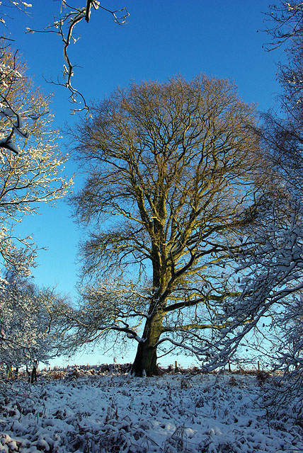
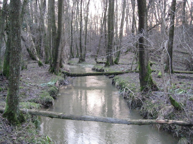
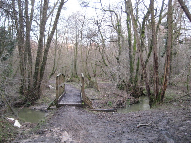
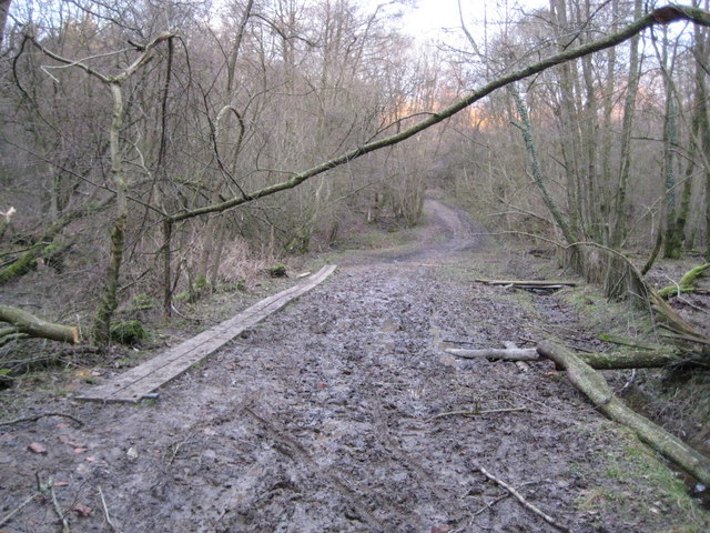
Monks Forest is a picturesque woodland located in Sussex, England. Covering an expansive area of approximately 500 acres, this enchanting forest is a beloved natural attraction for locals and tourists alike.

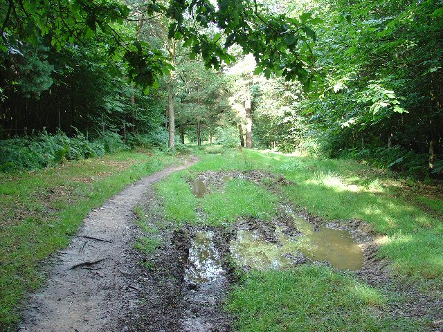
The forest is characterized by its diverse range of tree species, including oak, beech, and birch, which create a stunning and vibrant canopy overhead. The dense foliage provides a perfect habitat for a variety of wildlife, making Monks Forest a haven for nature enthusiasts and birdwatchers.

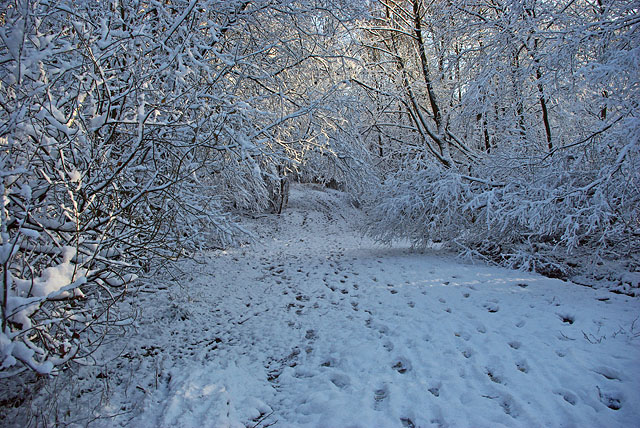
Tranquil walking trails wind their way through the forest, offering visitors the opportunity to immerse themselves in its serene atmosphere. These paths lead to hidden glades and secluded clearings, where visitors can rest and take in the beauty of their surroundings.

Monks Forest is also home to an array of rare plant species, adding to its ecological significance. The forest is meticulously maintained by conservationists, ensuring the preservation of its natural beauty for future generations to enjoy.

In addition to its natural wonders, Monks Forest boasts a rich historical background. It is believed that the forest was once inhabited by monks, who sought solace and spiritual retreat in its peaceful surroundings. Ancient ruins and remnants of their presence can still be found within the forest, adding an air of mystery and intrigue to the area.

Overall, Monks Forest is a captivating woodland destination that offers a harmonious blend of natural beauty and historical significance. It provides a sanctuary for both wildlife and visitors, allowing them to escape the hustle and bustle of everyday life and reconnect with nature.

If you have any feedback on the listing, please let us know in the comments section below.
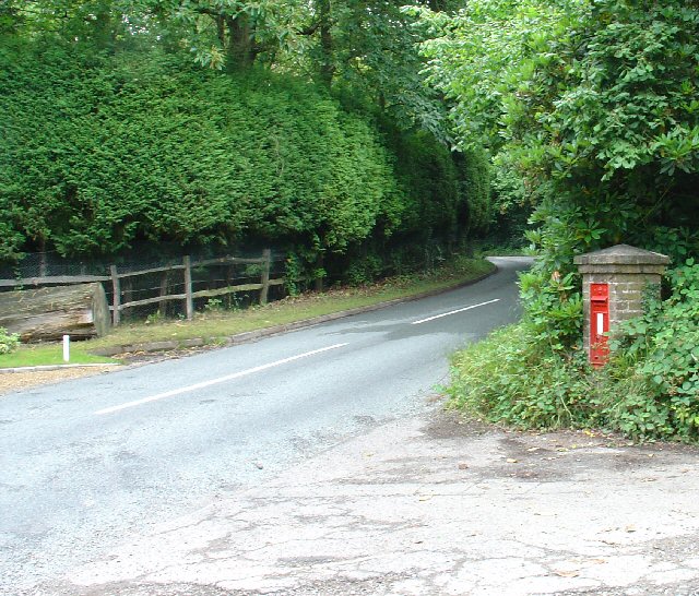
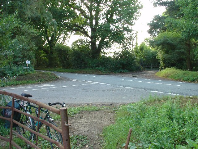
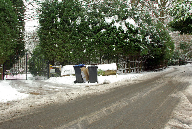
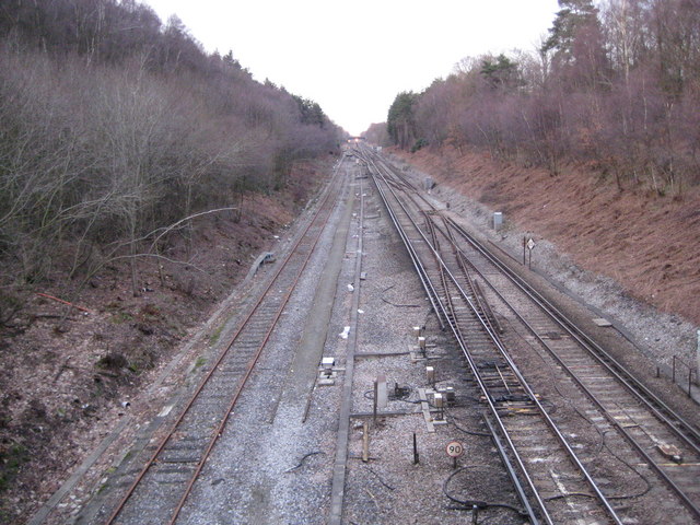
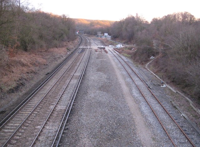
Monks Forest Images

Images are sourced within 2km of 51.076634/-0.13739918 or Grid Reference TQ3032. Thanks to Geograph Open Source API. All images are credited.

Victorian Post Box, Handcross Lane, near Balcombe, West Sussex Situated at the junction of an unclassified private lane to several private houses. The post box is mounted into a brick built pillar.
Victorian Post Box, Handcross Lane, near Balcombe, West Sussex
Situated at the junction of an unclassified private lane to several private houses. The post box is mounted into a brick built pillar.
Junction of Crawley Lane and High Street, Near Balcombe, West Sussex The only road junction in the grid square. High Street is a rural road that runs along the top of a wide ridge (not the more common urban type of High Street). View taken from the East side. Crawley Lane is on the left, with the entrance drive to Green Trees farm opposite it.
Junction of Crawley Lane and High Street, Near Balcombe, West Sussex
The only road junction in the grid square. High Street is a rural road that runs along the top of a wide ridge (not the more common urban type of High Street). View taken from the East side. Crawley Lane is on the left, with the entrance drive to Green Trees farm opposite it.
Bridleway through Oldhouse Warren, Near Crawley, West Sussex. A wide (and muddy, in places) bridle route through this otherwise private area of woodland. Links Pease Pottage (via Parish Lane) to Whitely Hill.
Bridleway through Oldhouse Warren, Near Crawley, West Sussex.
A wide (and muddy, in places) bridle route through this otherwise private area of woodland. Links Pease Pottage (via Parish Lane) to Whitely Hill.
Bridleway in the snow Probably a very ancient way, it extends Parish Lane, itself an extension of the ridge road from Horsham, in a direct line through Oldhouse Warren to align with the ridge road to Turners Hill and beyond.
Bridleway in the snow
Probably a very ancient way, it extends Parish Lane, itself an extension of the ridge road from Horsham, in a direct line through Oldhouse Warren to align with the ridge road to Turners Hill and beyond.
Woodland edge tree On the boundary of a field that protrudes into the woodland.
Woodland edge tree
On the boundary of a field that protrudes into the woodland.
Railway radio mast By the main Brighton line, the mast is hinged down to rest on four cable drums.
Railway radio mast
By the main Brighton line, the mast is hinged down to rest on four cable drums.
Waiting for the rubbish collection The road here, particularly to the left, was in a bad state, so no rubbish lorry will come this way until the thaw really sets in.
Waiting for the rubbish collection
The road here, particularly to the left, was in a bad state, so no rubbish lorry will come this way until the thaw really sets in.
Private road This connects Handcross Road with High Street, and serves several well-spaced desirable properties. Not often used as a through route, as the northern end is unsurfaced, and the junction with High Street does not have good sighting.
Private road
This connects Handcross Road with High Street, and serves several well-spaced desirable properties. Not often used as a through route, as the northern end is unsurfaced, and the junction with High Street does not have good sighting.
Tilgate Forest: London to Brighton railway (1) Looking northwards towards Three Bridges station this is the swathe cut through Tilgate Forest by the London & Brighton Railway prior to its opening in 1841. The London & Brighton Railway was quickly subsumed into the London, Brighton & South Coast Railway, and eventually into the Southern Railway in 1923.

This stretch once had four working tracks with the slow lines on the left and the fast on the right (had to check "London to Brighton in 4 minutes" on YouTube to be sure of my facts there!) but the break out junction from two to four has been rebuilt further north in the distance, and the track bed of the former slow lines on the left is now occupied by an unelectrified siding. There is a 90 mph speed restriction sign in the foreground.

This view was taken from the bridge at the end of Parish Lane. For a view in the opposite direction please see <a href="https://www.geograph.org.uk/photo/1752119">TQ2833 : Tilgate Forest: London to Brighton railway (2)</a>.
Tilgate Forest: London to Brighton railway (1)
Looking northwards towards Three Bridges station this is the swathe cut through Tilgate Forest by the London & Brighton Railway prior to its opening in 1841. The London & Brighton Railway was quickly subsumed into the London, Brighton & South Coast Railway, and eventually into the Southern Railway in 1923. This stretch once had four working tracks with the slow lines on the left and the fast on the right (had to check "London to Brighton in 4 minutes" on YouTube to be sure of my facts there!) but the break out junction from two to four has been rebuilt further north in the distance, and the track bed of the former slow lines on the left is now occupied by an unelectrified siding. There is a 90 mph speed restriction sign in the foreground. This view was taken from the bridge at the end of Parish Lane. For a view in the opposite direction please see TQ2833 : Tilgate Forest: London to Brighton railway (2).
Tilgate Forest: London to Brighton railway (2) For a brief history of the railway and a view in the opposite direction please see <a href="https://www.geograph.org.uk/photo/1752096">TQ2833 : Tilgate Forest: London to Brighton railway (1)</a>.

As the track curves to the left to enter Balcombe Tunnel this was the location of the junction where the four tracks from London merged into two to negate the construction of a costly second tunnel.

A red signal light for southbound trains to Brighton is visible in the distance, while the last rays of winter sunshine catch the trees on the hill on the horizon.
Tilgate Forest: London to Brighton railway (2)
For a brief history of the railway and a view in the opposite direction please see TQ2833 : Tilgate Forest: London to Brighton railway (1). As the track curves to the left to enter Balcombe Tunnel this was the location of the junction where the four tracks from London merged into two to negate the construction of a costly second tunnel. A red signal light for southbound trains to Brighton is visible in the distance, while the last rays of winter sunshine catch the trees on the hill on the horizon.
Stanford Brook in Tilgate Forest Stanford Brook is a tributary of the River Mole rising to the south of Crawley.
Stanford Brook in Tilgate Forest
Stanford Brook is a tributary of the River Mole rising to the south of Crawley.
Tilgate Forest: Footbridge over Stanford Brook This footbridge is the main point of access across Stanford Brook to Oldhouse Warren in Tilgate Forest.
Tilgate Forest: Footbridge over Stanford Brook
This footbridge is the main point of access across Stanford Brook to Oldhouse Warren in Tilgate Forest.
Tilgate Forest: Oldhouse Warren bridleway This is the third photograph to be submitted to the site for this grid square,  each so far showing the bridleway in different seasonal conditions, although mud seems to be a perennial problem! Here, just to the east of the Stanford Brook crossing, duckboards have had to be introduced. 

The area to the left of the bridleway is shown as an ancient "Pond Bay" on the Ordnance Survey mapping. These pond bays are a reminder of the old Wealden iron industry when water was needed to be stored in large quantities for the production process. There is a very informative description of the Wealden iron industry here <span class="nowrap"><a title="http://www.rh7.org/factsheets/Iron%20Industry.html" rel="nofollow ugc noopener" href="http://www.rh7.org/factsheets/Iron%20Industry.html">Link</a><img style="margin-left:2px;" alt="External link" title="External link - shift click to open in new window" src="https://s1.geograph.org.uk/img/external.png" width="10" height="10"/></span>
Tilgate Forest: Oldhouse Warren bridleway
This is the third photograph to be submitted to the site for this grid square, each so far showing the bridleway in different seasonal conditions, although mud seems to be a perennial problem! Here, just to the east of the Stanford Brook crossing, duckboards have had to be introduced. The area to the left of the bridleway is shown as an ancient "Pond Bay" on the Ordnance Survey mapping. These pond bays are a reminder of the old Wealden iron industry when water was needed to be stored in large quantities for the production process. There is a very informative description of the Wealden iron industry here LinkExternal link
Cowdray Arms This popular pub serves food and is close to the extensive Worth Forest
Cowdray Arms
This popular pub serves food and is close to the extensive Worth Forest
Balcombe centre with the pub Balcombe is a country village with the bonus of a railway station that links it to the coast and London. Thameslink makes several stops during the day. There is a nice 'Tea Rooms' just close to this spot (closes at 5 !)
Balcombe centre with the pub
Balcombe is a country village with the bonus of a railway station that links it to the coast and London. Thameslink makes several stops during the day. There is a nice 'Tea Rooms' just close to this spot (closes at 5 !)
Monks Forest, Near Crawley, West Sussex View taken from the B2110, looking S. This is an area of mixed woodland, with broadleaved trees (including sweet chestnut) and coniferous plantations.
Monks Forest, Near Crawley, West Sussex
View taken from the B2110, looking S. This is an area of mixed woodland, with broadleaved trees (including sweet chestnut) and coniferous plantations.
Oldhouse Warren, Near Crawley, west Sussex An area of generally mature broadleaved trees, with some coniferous planting. Privately owned and used for timber production and game. A favourite orienteering venue due to the runnability of the terrain, variation of vegetation, and size of area. View taken from B2036, looking W.
Oldhouse Warren, Near Crawley, west Sussex
An area of generally mature broadleaved trees, with some coniferous planting. Privately owned and used for timber production and game. A favourite orienteering venue due to the runnability of the terrain, variation of vegetation, and size of area. View taken from B2036, looking W.
Busy rural commuter road (B2110), near Crawley, West Sussex This rural B road gets lots of morning and evening commuter traffic, due to its proximity to Crawley and the alternative that it offers to travelling through built up areas. View taken looking SW towards a double bend from adjacent to Monks Forest (on the left) The woodland to the right is Cowdray Forest.
Busy rural commuter road (B2110), near Crawley, West Sussex
This rural B road gets lots of morning and evening commuter traffic, due to its proximity to Crawley and the alternative that it offers to travelling through built up areas. View taken looking SW towards a double bend from adjacent to Monks Forest (on the left) The woodland to the right is Cowdray Forest.
Show me another place!

Monks Forest is located at Grid Ref: TQ3032 (Lat: 51.076634, Lng: -0.13739918)

Administrative County: West Sussex

District: Mid Sussex

Police Authority: Sussex

What 3 Words

///caps.prep.simulations. Near Balcombe, West Sussex

Nearby Locations

Monks Forest

Related Wikis

Worth Forest (electoral division)

Worth Forest is an electoral division of West Sussex in the United Kingdom, and returns one member to sit on West Sussex County Council. == Extent == The...

Balcombe tunnel

Balcombe tunnel is a railway tunnel on the Brighton Main Line through the Sussex Weald between Three Bridges and Balcombe. It is 1,034 metres (1,131 yards...

Worth Forest

Worth Forest is a 43.8-hectare (108-acre) biological Site of Special Scientific Interest south of Crawley in West Sussex. It is in the High Weald Area...

Worth School

Worth School is a private co-educational Roman Catholic boarding and day school for pupils from 11 to 18 years of age near Worth, West Sussex, England...
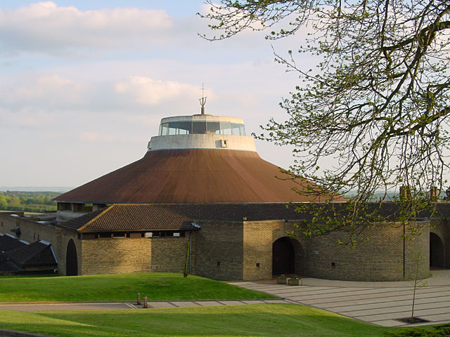
Worth Abbey

The Abbey of Our Lady, Help of Christians, commonly known as Worth Abbey, is a community of Roman Catholic monks who follow the Rule of St Benedict near...
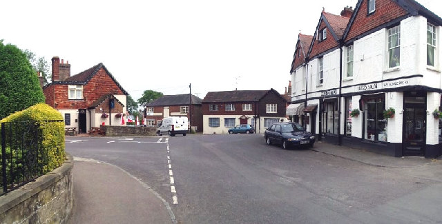
Balcombe

Balcombe is a village and civil parish in the Mid Sussex District of West Sussex, England. It lies 31 miles (50 km) south of London, 16 miles (26 km) north...

Balcombe railway station

Balcombe railway station is on the Brighton Main Line in England, serving the village of Balcombe, West Sussex. It is 33 miles 64 chains (54.4 km) down...

Burgess Hill East (electoral division)

Burgess Hill East is an electoral division of West Sussex in the United Kingdom, and returns one member to sit on West Sussex County Council. == Extent... ==

Nearby Amenities

Located within 500m of 51.076634,-0.13739918
Bus Stop
Stoney Lane
Bus: yes
Naptan AtcoCode: 4400HR0523
Naptan Bearing: S
Naptan BusStopType: CUS
Naptan CommonName: Stoney Lane
Naptan Indicator: adj
Naptan Landmark: Stoney Lane
Naptan NaptanCode: wsxawpdg
Naptan Street: London Road B2036
Naptan Verified: no
Public Transport: platform
Source: naptan_import
Lat/Long: 51.0754286/-0.1309789
Bus Stop
Stoney Lane
Bus: yes
Naptan AtcoCode: 4400HR1153
Naptan Bearing: N
Naptan BusStopType: CUS
Naptan CommonName: Stoney Lane
Naptan Indicator: opp
Naptan Landmark: Stoney Lane
Naptan NaptanCode: wsxgdwja
Naptan ShortCommonName: Stoney Lane
Naptan Street: London Road B2036
Naptan Verified: no
Public Transport: platform
Source: naptan_import
Lat/Long: 51.0754403/-0.1311498
Noexit: yes
Lat/Long: 51.0784623/-0.1316632
The data included in this document is from www.openstreetmap.org. The data is made available under ODbL.

Have you been to Monks Forest?

Leave your review of Monks Forest below (or comments, questions and feedback).