Long Plantation

Wood, Forest in Huntingdonshire Huntingdonshire

England

Long Plantation

Norris Museum gardens at St Ives
Norris Museum gardens at St Ives Credit: Peter S

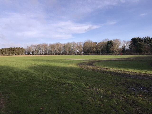
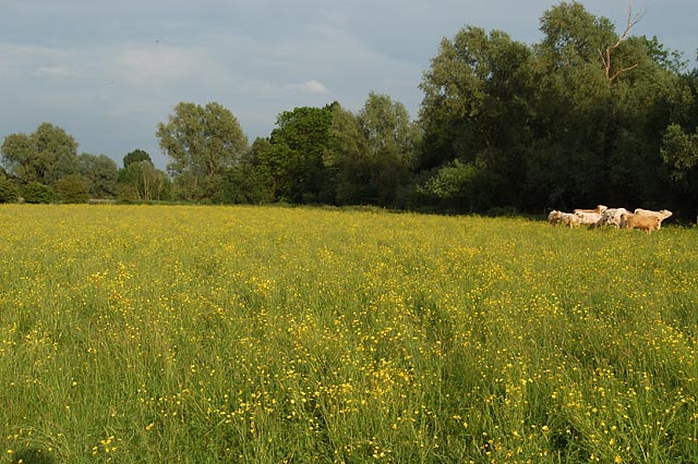
Long Plantation is a woodland situated in Huntingdonshire, a historic county in the east of England. Covering an area of approximately 100 acres, the plantation is known for its diverse range of trees and its picturesque natural beauty. It is a significant site for nature lovers, wildlife enthusiasts, and walkers alike.

The woodland consists mainly of native species, including oak, ash, and beech trees, which form a dense canopy overhead, creating a serene and tranquil atmosphere. The forest floor is covered with a rich carpet of moss and wildflowers, providing a habitat for a variety of flora and fauna.

Long Plantation is home to a wide range of wildlife, including deer, foxes, badgers, and numerous bird species such as woodpeckers, owls, and songbirds. The plantation also supports a diverse population of insects, including butterflies, beetles, and dragonflies.

Visitors to Long Plantation can enjoy a network of well-maintained footpaths and trails that meander through the woodland, offering stunning views of the surrounding countryside. The paths are suitable for all ages and abilities, making it an ideal destination for families and nature enthusiasts.

The plantation is managed by local authorities, who ensure the preservation of its natural habitat and protect it from any potential damage or disruption. Access to the woodland is free of charge, and there are ample parking facilities available nearby.

In conclusion, Long Plantation in Huntingdonshire is a beautiful woodland that offers visitors a chance to immerse themselves in nature. With its diverse range of trees, abundant wildlife, and well-maintained paths, it provides a peaceful retreat for those seeking a connection with the natural world.

If you have any feedback on the listing, please let us know in the comments section below.

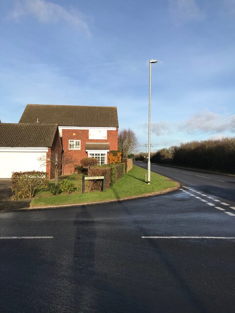
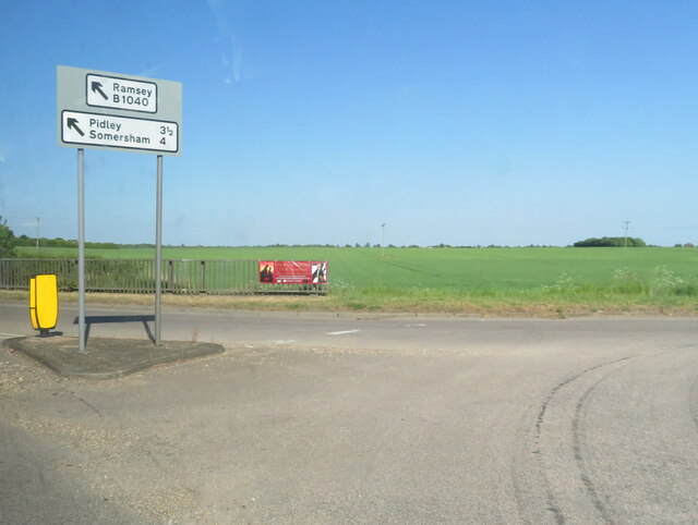
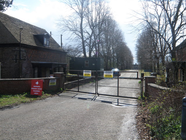
Long Plantation Images

Images are sourced within 2km of 52.341122/-0.087772488 or Grid Reference TL3073. Thanks to Geograph Open Source API. All images are credited.

Norris Museum gardens at St Ives
White bridge over the river The bridge leads to the Holt Island Nature Reserve which is currently open at weekends and bank holidays from 10-4.
White bridge over the river
The bridge leads to the Holt Island Nature Reserve which is currently open at weekends and bank holidays from 10-4.
The Holt Information point at Holt Island Nature Reserve.
The Holt
Information point at Holt Island Nature Reserve.
River Great Ouse from the Holt Island Nature Reserve A familiar landmark in the town of St Ives, the bridge over the river, but seen from an unusual angle.
River Great Ouse from the Holt Island Nature Reserve
A familiar landmark in the town of St Ives, the bridge over the river, but seen from an unusual angle.
Marley Road junction - St  Ives
Marley Road junction - St Ives
Burleigh Hill Farm Caravan site
Junction with Houghton Road
Houghton Meadows Species rich alkaline grassland managed as a Wildlife Trust reserve.
Houghton Meadows
Species rich alkaline grassland managed as a Wildlife Trust reserve.
Path by The Thicket A footpath, with considerate cycling permitted.
Path by The Thicket
A footpath, with considerate cycling permitted.
Road Junction at Marley Gap On the edge of St Ives.
Road Junction at Marley Gap
On the edge of St Ives.
The Back Water of the River Great Ouse A narrow strip of water separating The Holt from the main stream of the river.
The Back Water of the River Great Ouse
A narrow strip of water separating The Holt from the main stream of the river.
Ouse Valley Way sign A sign for the public footpath along the Thicket to Houghton and Wyton. Also an information board about the island, that the bridge on the left leads to, Ingle Holt.
Ouse Valley Way sign
A sign for the public footpath along the Thicket to Houghton and Wyton. Also an information board about the island, that the bridge on the left leads to, Ingle Holt.
St Ives' Methodist Church On the Waits. With decorative wrought iron rails - for details see <a href="https://www.geograph.org.uk/photo/7178249">TL3171 : Wrought iron wildlife</a>, <a href="https://www.geograph.org.uk/photo/7178251">TL3171 : Wrought iron wildlife</a> and <a href="https://www.geograph.org.uk/photo/7178252">TL3171 : Wrought iron wildlife</a>.
St Ives' Methodist Church
On the Waits. With decorative wrought iron rails - for details see TL3171 : Wrought iron wildlife, TL3171 : Wrought iron wildlife and TL3171 : Wrought iron wildlife.
Wrought iron wildlife Part of the decorative railing in front of St Ives' Methodist Church <a href="https://www.geograph.org.uk/photo/7178244">TL3171 : St Ives' Methodist Church</a>.
Wrought iron wildlife
Part of the decorative railing in front of St Ives' Methodist Church TL3171 : St Ives' Methodist Church.
Wrought iron wildlife Decorative railing in front of St Ives' Methodist Church <a href="https://www.geograph.org.uk/photo/7178244">TL3171 : St Ives' Methodist Church</a>.
Wrought iron wildlife
Decorative railing in front of St Ives' Methodist Church TL3171 : St Ives' Methodist Church.
Wrought iron wildlife Decorative railing in front of St Ives' Methodist Church <a href="https://www.geograph.org.uk/photo/7178244">TL3171 : St Ives' Methodist Church</a>.
Wrought iron wildlife
Decorative railing in front of St Ives' Methodist Church TL3171 : St Ives' Methodist Church.
The River Great Ouse near Houghton
Cemetery at St Ives On Westwood Road, near All Saints' Church; looking rather unkempt, and it may no longer be open for burials.
Cemetery at St Ives
On Westwood Road, near All Saints' Church; looking rather unkempt, and it may no longer be open for burials.
Show me another place!

Long Plantation is located at Grid Ref: TL3073 (Lat: 52.341122, Lng: -0.087772488)

Administrative County: Cambridgeshire

District: Huntingdonshire

Police Authority: Cambridgeshire

What 3 Words

///march.movies.vegetable. Near Houghton, Cambridgeshire

Nearby Locations

Long Plantation

Related Wikis

St Ives, Cambridgeshire

St Ives is a medieval market town and civil parish in the Huntingdonshire district in Cambridgeshire, England, 5 miles (8 km) east of Huntingdon and 12...

Houghton Poultry Research Station

The Houghton Poultry Research Station was a poultry disease research station in northern Cambridgeshire. By the 1970s, the site was the largest centre...

St Ivo Academy

St Ivo Academy is an academy secondary school and part of Astrea Academy Trust, with sixth form in St. Ives, Cambridgeshire, originally St Ivo School before...

St Ives Town F.C.

St. Ives Town Football Club is a football club based in St Ives, Cambridgeshire, England. They are currently members of the Southern League Premier Division...

Wyton on the Hill

Wyton on the Hill is a village and civil parish in Cambridgeshire, England. Wyton on the Hill lies approximately 3 miles (5 km) north-east of Huntingdon...

Houghton Meadows

Houghton Meadows is a 4.7-hectare (12-acre) biological Site of Special Scientific Interest (SSSI) between Houghton and St Ives in Cambridgeshire. The SSSI...
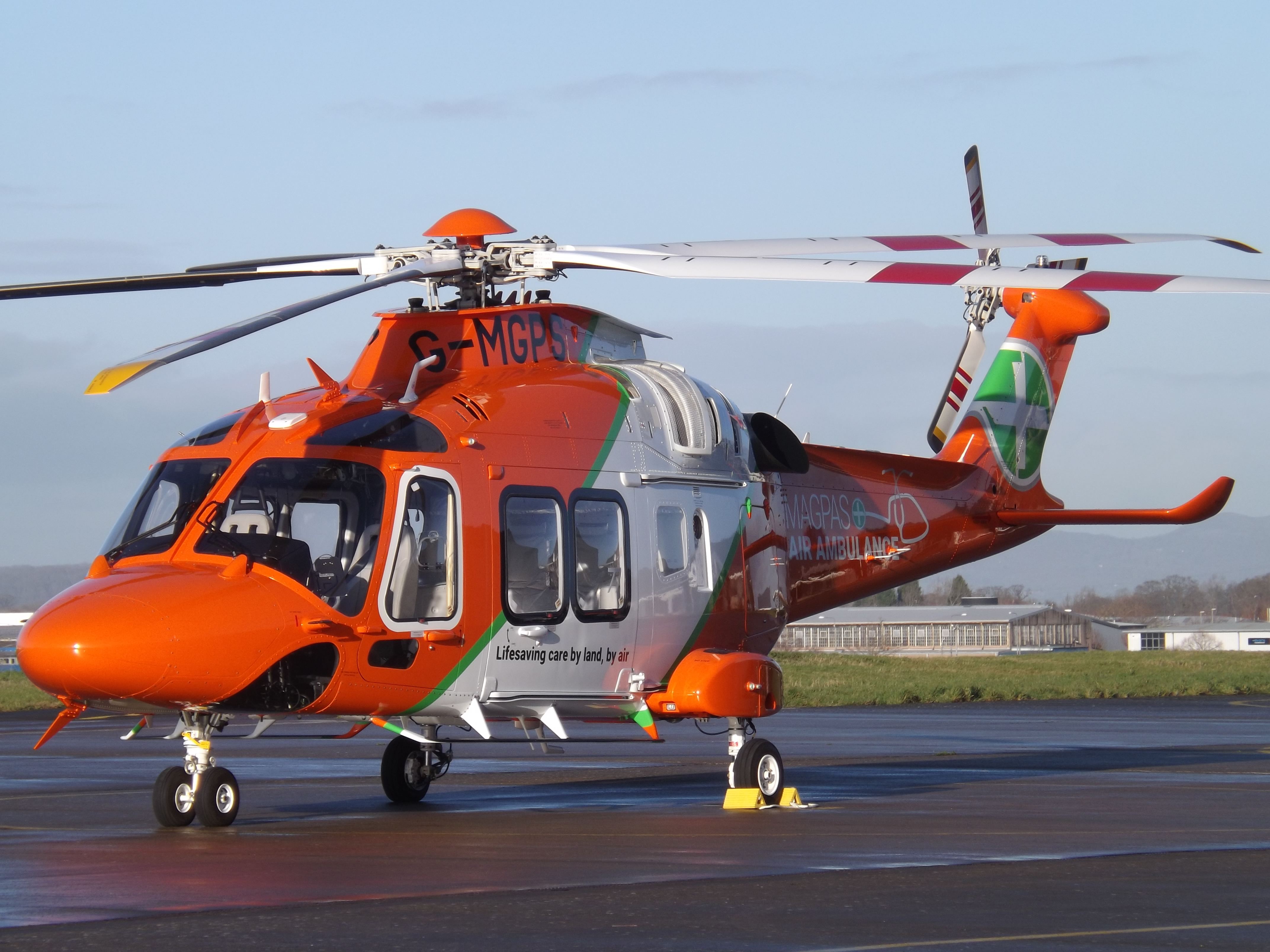
Magpas

Magpas Air Ambulance is a registered charity that operates a helicopter emergency medical service (HEMS) dedicated to the seriously ill and injured in...

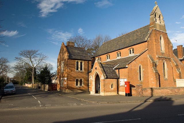
Sacred Heart Church, St Ives

Sacred Heart Church is a Roman Catholic church that serves as the parish church of St Ives, Cambridgeshire. It was originally designed and built by Augustus...

Nearby Amenities

Located within 500m of 52.341122,-0.087772488
Crossing
Crossing: traffic_signals
Lat/Long: 52.3406454/-0.0818313
Turning Circle
Lat/Long: 52.3432592/-0.0829482
Turning Circle
Lat/Long: 52.3409369/-0.0809801
Post Box
Lat/Long: 52.3420381/-0.0826486
Turning Circle
Lat/Long: 52.3418033/-0.0810008
Kerb: raised
Lat/Long: 52.3388999/-0.0820701
Post Box
Check Date Collection Times: 2023-10-03
Collection Times: Mo-Fr 09:00; Sa 07:00
Ref: PE27 64
Royal Cypher: EIIR
Lat/Long: 52.3374951/-0.0840699
Crossing
Crossing: traffic_signals
Lat/Long: 52.3403713/-0.0880868
Turning Circle
Lat/Long: 52.3403276/-0.0822467
Turning Circle
Lat/Long: 52.3399194/-0.0832753
Turning Circle
Lat/Long: 52.3403954/-0.0839727
Turning Circle
Lat/Long: 52.3395754/-0.0836817
Turning Circle
Lat/Long: 52.3386004/-0.0867131
Turning Circle
Lat/Long: 52.3400572/-0.0838912
Turning Circle
Lat/Long: 52.339229/-0.0837805
Turning Circle
Lat/Long: 52.3390117/-0.0843866
Post Box
Ref: PE27 269
Lat/Long: 52.3385522/-0.0847342
VG
Shop: convenience
Lat/Long: 52.3384999/-0.0847363
Fast Food
George's
Lat/Long: 52.3384577/-0.0847845
Turning Circle
Lat/Long: 52.3386969/-0.085987
Place Of Worship
Kingdom Hall
Denomination: jehovahs_witness
Religion: christian
Lat/Long: 52.3387294/-0.085064
Post Box
Post Box Type: lamp
Ref: PE27 246
Royal Cypher: EIIR
Royal Cypher Wikidata: Q33102113
Lat/Long: 52.3369898/-0.0891558
Bus Stop
Albemarle Road
Bench: no
Bin: no
Bus: yes
Lit: yes
Naptan AtcoCode: 0500HSTIV001
Naptan Bearing: SE
Naptan CommonName: Albemarle Road
Naptan Indicator: near
Naptan Landmark: Albemarle Road
Naptan NaptanCode: cmbdpwmj
Naptan ShortCommonName: Albemarle Road
Naptan Street: Ramsey Road
Naptan Verified: no
Public Transport: platform
Shelter: no
Source: naptan_import
Tactile Paving: no
Lat/Long: 52.3402764/-0.0815017
Bus Stop
Car Park
Bus: yes
Naptan AtcoCode: 0500HSTIV008
Naptan Bearing: SW
Naptan CommonName: Car Park
Naptan Indicator: opp
Naptan Landmark: Hill Rise
Naptan NaptanCode: cmbdpwpj
Naptan ShortCommonName: Car Park
Naptan Street: Hill Rise
Naptan Verified: no
Public Transport: platform
Source: naptan_import
Lat/Long: 52.3404252/-0.0879104
Bus Stop
California Road
Bench: no
Bus: yes
Naptan AtcoCode: 0500HSTIV022
Naptan Bearing: N
Naptan CommonName: California Road
Naptan Indicator: near
Naptan Landmark: California Road
Naptan NaptanCode: cmbdtadm
Naptan ShortCommonName: California Road
Naptan Street: Hill Rise
Naptan Verified: no
Public Transport: platform
Shelter: no
Source: naptan_import
Lat/Long: 52.3372187/-0.0892378
Bus Stop
Pettis Road
Bus: yes
Naptan AtcoCode: 0500HSTIV023
Naptan Bearing: N
Naptan CommonName: Pettis Road
Naptan Indicator: opp
Naptan Landmark: Pettis Road
Naptan NaptanCode: cmbdtadp
Naptan ShortCommonName: Pettis Road
Naptan Street: Hill Rise
Naptan Verified: no
Public Transport: platform
Source: naptan_import
Lat/Long: 52.338795/-0.0894047
Bus Stop
Pettis Road
Bus: yes
Naptan AtcoCode: 0500HSTIV034
Naptan Bearing: S
Naptan CommonName: Pettis Road
Naptan Indicator: near
Naptan Landmark: Pettis Road
Naptan NaptanCode: cmbdtajd
Naptan ShortCommonName: Pettis Road
Naptan Street: Hill Rise
Naptan Verified: no
Public Transport: platform
Shelter: yes
Source: naptan_import
Lat/Long: 52.3379196/-0.0893018
Bus Stop
Ramsey Road
Bus: yes
Naptan AtcoCode: 0500HSTIV036
Naptan Bearing: NW
Naptan CommonName: Ramsey Road
Naptan Indicator: o/s No 193
Naptan Landmark: Ramsey Road
Naptan NaptanCode: cmbdtajm
Naptan ShortCommonName: Ramsey Road
Naptan Street: Ramsey Road
Naptan Verified: no
Public Transport: platform
Shelter: yes
Source: naptan_import
Lat/Long: 52.342924/-0.083413
Bus Stop
Ramsey Road
Bench: yes
Bin: yes
Naptan AtcoCode: 0500HSTIV037
Naptan Bearing: SE
Naptan CommonName: Ramsey Road
Naptan Indicator: opp No 193
Naptan Landmark: Ramsey Road
Naptan NaptanCode: cmbdtajp
Naptan ShortCommonName: Ramsey Road
Naptan Street: Ramsey Road
Naptan Verified: no
Public Transport: platform
Shelter: yes
Source: naptan_import
Lat/Long: 52.3430299/-0.083291
Bus Stop
Car Park
Bus: yes
Naptan AtcoCode: 0500HSTIV044
Naptan Bearing: NE
Naptan CommonName: Car Park
Naptan Indicator: near
Naptan Landmark: Hill Rise
Naptan NaptanCode: cmbdtamp
Naptan ShortCommonName: Car Park
Naptan Street: Hill Rise
Naptan Verified: no
Public Transport: platform
Shelter: no
Source: naptan_import
Lat/Long: 52.3407116/-0.0878247
Bus Stop
Albemarle Road
Bench: no
Bin: no
Bus: yes
Lit: yes
Naptan AtcoCode: 0500HSTIV046
Naptan Bearing: NW
Naptan CommonName: Albemarle Road
Naptan Indicator: opp
Naptan Landmark: Albemarle Road
Naptan NaptanCode: cmbdtamw
Naptan ShortCommonName: Albemarle Road
Naptan Street: Ramsey Road
Naptan Verified: no
Public Transport: platform
Shelter: no
Source: naptan_import
Tactile Paving: no
Lat/Long: 52.3398883/-0.0814157
Bus Stop
The Mallards
Naptan AtcoCode: 0500HSTIV049
Naptan Bearing: NE
Naptan CommonName: The Mallards
Naptan Indicator: opp
Naptan Landmark: The Mallards
Naptan NaptanCode: cmbdtapg
Naptan ShortCommonName: The Mallards
Naptan Street: Hill Rise
Naptan Verified: no
Public Transport: platform
Shelter: no
Source: naptan_import
Lat/Long: 52.3428183/-0.0857665
Bus Stop
The Mallards
Bus: yes
Naptan AtcoCode: 0500HSTIV050
Naptan Bearing: SW
Naptan CommonName: The Mallards
Naptan Indicator: near
Naptan Landmark: The Mallards
Naptan NaptanCode: cmbdtapj
Naptan ShortCommonName: The Mallards
Naptan Street: Hill Rise
Naptan Verified: no
Public Transport: platform
Source: naptan_import
Lat/Long: 52.3425766/-0.0858357
Bus Stop
Hill Rise
Naptan AtcoCode: 0500HSTIV051
Naptan Bearing: NE
Naptan CommonName: Hill Rise
Naptan Indicator: opp No 122
Naptan Landmark: Hill Rise
Naptan NaptanCode: cmbdtapm
Naptan ShortCommonName: Hill Rise
Naptan Street: Hill Rise
Naptan Verified: no
Source: naptan_import
Lat/Long: 52.3430382/-0.0854634
Power: pole
Lat/Long: 52.3445947/-0.0911845
Power: pole
Lat/Long: 52.3442111/-0.0893337
Power: pole
Lat/Long: 52.3442112/-0.0842779
Power: pole
Lat/Long: 52.343477/-0.0856215
Power: pole
Lat/Long: 52.3438474/-0.0874937
Power: pole
Source: Bing
Lat/Long: 52.3453584/-0.0859075
Power: pole
Source: Bing
Lat/Long: 52.3451438/-0.0856527
Turning Circle
Lat/Long: 52.3425675/-0.0910633
Turning Circle
Lat/Long: 52.3409336/-0.0844623
Power: pole
Lat/Long: 52.3435759/-0.0861214
Turning Circle
Lat/Long: 52.3411786/-0.0867218
Turning Circle
Lat/Long: 52.3418178/-0.0832206
Turning Circle
Lat/Long: 52.3414703/-0.081313
Turning Circle
Lat/Long: 52.3419063/-0.0807753
Turning Circle
Lat/Long: 52.3424438/-0.0808515
Turning Circle
Lat/Long: 52.342959/-0.0819367
Generator Method: photovoltaic
Generator Output Electricity: yes
Generator Source: solar
Generator Type: solar_photovoltaic_panel
Location: roof
Power: generator
Lat/Long: 52.3412421/-0.0805011
Generator Method: photovoltaic
Generator Output Electricity: yes
Generator Source: solar
Generator Type: solar_photovoltaic_panel
Location: roof
Power: generator
Lat/Long: 52.3406358/-0.0838083
Generator Method: photovoltaic
Generator Output Electricity: yes
Generator Source: solar
Generator Type: solar_photovoltaic_panel
Location: roof
Power: generator
Lat/Long: 52.3393887/-0.085026
Generator Method: photovoltaic
Generator Output Electricity: yes
Generator Source: solar
Generator Type: solar_photovoltaic_panel
Location: roof
Power: generator
Lat/Long: 52.3394313/-0.0850958
Generator Method: photovoltaic
Generator Output Electricity: yes
Generator Source: solar
Generator Type: solar_photovoltaic_panel
Location: roof
Power: generator
Lat/Long: 52.3400311/-0.0861847
Generator Method: photovoltaic
Generator Output Electricity: yes
Generator Source: solar
Generator Type: solar_photovoltaic_panel
Location: roof
Power: generator
Lat/Long: 52.339664/-0.0870752
Generator Method: photovoltaic
Generator Output Electricity: yes
Generator Source: solar
Generator Type: solar_photovoltaic_panel
Location: roof
Power: generator
Lat/Long: 52.3412077/-0.0870404
Generator Method: photovoltaic
Generator Output Electricity: yes
Generator Source: solar
Generator Type: solar_photovoltaic_panel
Location: roof
Power: generator
Lat/Long: 52.3411241/-0.0843555
Generator Method: photovoltaic
Generator Output Electricity: yes
Generator Source: solar
Generator Type: solar_photovoltaic_panel
Location: roof
Power: generator
Lat/Long: 52.3410987/-0.0844266
Generator Method: photovoltaic
Generator Output Electricity: yes
Generator Source: solar
Generator Type: solar_photovoltaic_panel
Location: roof
Power: generator
Lat/Long: 52.3418894/-0.0859407
Generator Method: photovoltaic
Generator Output Electricity: yes
Generator Source: solar
Generator Type: solar_photovoltaic_panel
Location: roof
Power: generator
Lat/Long: 52.3426366/-0.0839961
Generator Method: photovoltaic
Generator Output Electricity: yes
Generator Source: solar
Generator Type: solar_photovoltaic_panel
Location: roof
Power: generator
Lat/Long: 52.3425006/-0.0855356
Generator Method: photovoltaic
Generator Output Electricity: yes
Generator Source: solar
Generator Type: solar_photovoltaic_panel
Location: roof
Power: generator
Lat/Long: 52.3434347/-0.0841731
Generator Method: photovoltaic
Generator Output Electricity: yes
Generator Source: solar
Generator Type: solar_photovoltaic_panel
Location: roof
Power: generator
Lat/Long: 52.3434773/-0.0839773
Generator Method: photovoltaic
Generator Output Electricity: yes
Generator Source: solar
Generator Type: solar_photovoltaic_panel
Location: roof
Power: generator
Lat/Long: 52.3431741/-0.0826898
Generator Method: photovoltaic
Generator Output Electricity: yes
Generator Source: solar
Generator Type: solar_photovoltaic_panel
Location: roof
Power: generator
Lat/Long: 52.3437689/-0.0831056
Generator Method: photovoltaic
Generator Output Electricity: yes
Generator Source: solar
Generator Type: solar_photovoltaic_panel
Location: roof
Power: generator
Lat/Long: 52.3440016/-0.0833684
Addr Housenumber: 14
Addr Street: Kent Close
Source: i lived here 1976 to 1979
Lat/Long: 52.3429053/-0.0817467
Advertising: board
Lat/Long: 52.3403688/-0.081781
Addr Housenumber: 3
Lat/Long: 52.3433153/-0.0817931
Addr Housenumber: 18
Lat/Long: 52.3431769/-0.0822682
Addr Housenumber: 8
Addr Street: Kent Close
Lat/Long: 52.3431812/-0.0815507
Addr Housenumber: 22
Lat/Long: 52.3434087/-0.0821195
Waste Basket
Colour: black
Lat/Long: 52.3410053/-0.0812139
Bench
Backrest: yes
Colour: black
Material: metal
Lat/Long: 52.3404958/-0.0900408
Waste Basket
Colour: black
Lat/Long: 52.3376286/-0.08547
Waste Basket
Colour: black
Lat/Long: 52.3383606/-0.0855034
Bench: yes
Covered: no
Leisure: picnic_table
Lit: no
Material: wood
Lat/Long: 52.3411099/-0.0932926
Bench: yes
Covered: no
Leisure: picnic_table
Lit: no
Material: wood
Lat/Long: 52.3410652/-0.0933316
Bench: yes
Covered: no
Leisure: picnic_table
Lit: no
Material: wood
Lat/Long: 52.3402804/-0.0931278
Bench: yes
Covered: no
Leisure: picnic_table
Lit: no
Material: wood
Lat/Long: 52.3402375/-0.0930702
Bench: yes
Covered: no
Leisure: picnic_table
Lit: no
Material: wood
Lat/Long: 52.3414258/-0.0925143
Bench: yes
Covered: no
Leisure: picnic_table
Lit: no
Material: wood
Lat/Long: 52.3414597/-0.0924021
Waste Basket
Colour: green
Lat/Long: 52.341384/-0.0924157
Waste Basket
Colour: black
Lat/Long: 52.3410587/-0.093197
Waste Basket
Colour: black
Lat/Long: 52.340309/-0.0930078
Waste Basket
Colour: black
Lat/Long: 52.3379806/-0.0859869
Waste Basket
Colour: black
Lat/Long: 52.3408788/-0.0907481
Waste Basket
Colour: green
Lat/Long: 52.3408669/-0.0908524
Bench: yes
Covered: no
Leisure: picnic_table
Lit: no
Material: wood
Lat/Long: 52.340881/-0.0909985
Bench: yes
Covered: no
Leisure: picnic_table
Lit: no
Material: wood
Lat/Long: 52.3408231/-0.0909713
Bench
Backrest: yes
Material: wood
Lat/Long: 52.3408477/-0.0909821
Waste Basket
Colour: black
Lat/Long: 52.3407307/-0.0878046
Waste Basket
Lat/Long: 52.340479/-0.0890926
Waste Basket
Waste: dog_excrement
Lat/Long: 52.3404954/-0.0890825
Bench
Backrest: yes
Lat/Long: 52.3405824/-0.0895694
Playground: structure
Lat/Long: 52.3407582/-0.0905267
Hill Rise Park Dog Walking Area
Leisure: dog_park
Lat/Long: 52.3412798/-0.0896701
Waste Basket
Lat/Long: 52.3402127/-0.0889647
Information: board
Tourism: information
Lat/Long: 52.3401288/-0.0888202
Bicycle Repair Station
Lat/Long: 52.3400956/-0.0890111
Waste Basket
Lat/Long: 52.3401072/-0.089994
The data included in this document is from www.openstreetmap.org. The data is made available under ODbL.

Have you been to Long Plantation?

Leave your review of Long Plantation below (or comments, questions and feedback).