Belchford Wood

Wood, Forest in Lincolnshire East Lindsey

England

Belchford Wood

Direction Sign – Signpost on Main Road in Belchford Located on the north side of the T junction of Main Road and Fulletby Road in Belchford parish. 3 arms and no finial.

Milestone Society National ID: LI_TF2975
Direction Sign – Signpost on Main Road in Belchford Credit: A Riley

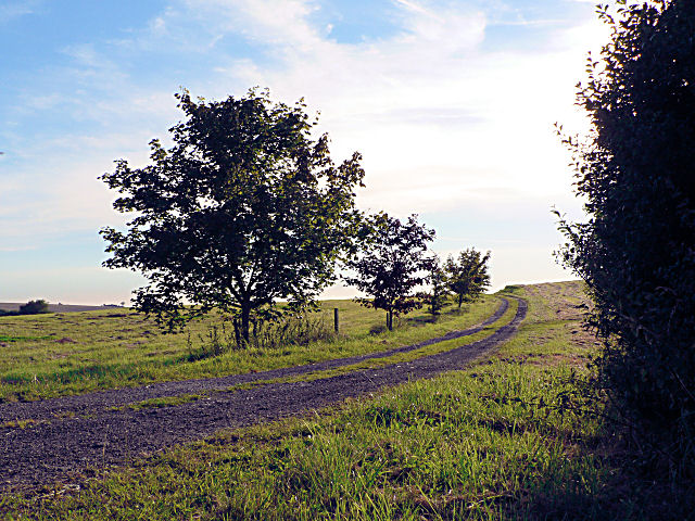
Belchford Wood is a picturesque forest located in the county of Lincolnshire, England. Situated near the village of Belchford, the wood covers an area of approximately 40 hectares. It is known for its diverse range of flora and fauna, making it a popular destination for nature enthusiasts and wildlife observers.

The wood is predominantly composed of broadleaf trees, including oak, ash, beech, and birch. These trees create a dense canopy that provides shade and shelter for a variety of woodland plants and animals. Bluebells, wood anemones, and wild garlic are just a few of the many wildflowers that carpet the forest floor during springtime, creating a breathtaking display of color and fragrance.

Belchford Wood is also home to a rich assortment of wildlife. Birdwatchers can spot various species, including woodpeckers, nuthatches, and tawny owls, among others. Mammals such as foxes, badgers, and deer can occasionally be seen roaming through the forest. The wood's tranquil atmosphere and secluded pathways make it an ideal habitat for these creatures.

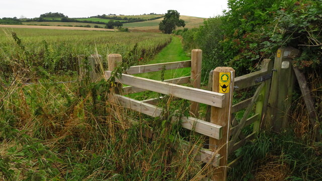
The wood offers several walking trails, allowing visitors to explore its beauty at their own pace. Information boards along the trails provide interesting facts about the wood's history, ecology, and management. For those seeking a longer hike, the wood is connected to the Viking Way, a long-distance footpath that stretches across Lincolnshire.

Belchford Wood is a cherished natural treasure in Lincolnshire. Its enchanting beauty, diverse wildlife, and serene atmosphere make it a must-visit destination for anyone seeking solace in nature.

If you have any feedback on the listing, please let us know in the comments section below.

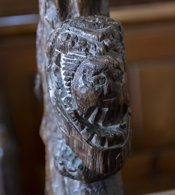
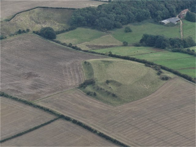
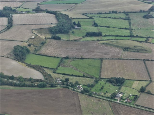
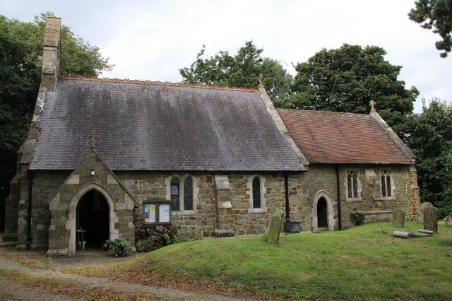
Belchford Wood Images

Images are sourced within 2km of 53.271661/-0.075486253 or Grid Reference TF2876. Thanks to Geograph Open Source API. All images are credited.

Direction Sign – Signpost on Main Road in Belchford Located on the north side of the T junction of Main Road and Fulletby Road in Belchford parish. 3 arms and no finial.

Milestone Society National ID: LI_TF2975
Direction Sign – Signpost on Main Road in Belchford
Located on the north side of the T junction of Main Road and Fulletby Road in Belchford parish. 3 arms and no finial. Milestone Society National ID: LI_TF2975
St Martin's church, Scamblesby There was probably a church here in Anglo-Saxon times, and  there are remnants of 12th C. fabric.
The chancel was rebuilt in 1890, and the nave in 1893 at a cost of £800. The architect was R. H. Fowler.

The church is built in green sandstone with limestone ashlar dressings and  a slate roof.
There is a nave with a west bellcote, north and south aisles, a south porch and chancel. The north aisle has a reused 12th C. Lancet window.
One of the nave pillars is early Norman, taken from the demolished church of Cawkwell (now a deserted mediaeval village). <a href="https://www.geograph.org.uk/gridref/TF2879">TF2879</a>
The font is a large thirteenth century bowl with an octagonal pedestal.
Most of the internal fabric is 19th-century, however there are older poppy heads on the pews which were taken from Cawkwell church, they depict different characters including a possible Green Man.

There are several wall monuments, and the east window with a depiction of St Martin. There is no organ.
St Martin's church, Scamblesby
There was probably a church here in Anglo-Saxon times, and there are remnants of 12th C. fabric. The chancel was rebuilt in 1890, and the nave in 1893 at a cost of £800. The architect was R. H. Fowler. The church is built in green sandstone with limestone ashlar dressings and a slate roof. There is a nave with a west bellcote, north and south aisles, a south porch and chancel. The north aisle has a reused 12th C. Lancet window. One of the nave pillars is early Norman, taken from the demolished church of Cawkwell (now a deserted mediaeval village). TF2879 The font is a large thirteenth century bowl with an octagonal pedestal. Most of the internal fabric is 19th-century, however there are older poppy heads on the pews which were taken from Cawkwell church, they depict different characters including a possible Green Man. There are several wall monuments, and the east window with a depiction of St Martin. There is no organ.
Interior, St Martin's church, Scamblesby Looking up the nave towards the chancel.
Interior, St Martin's church, Scamblesby
Looking up the nave towards the chancel.
East window, St Martin's church, Scamblesby Showing St Martin dividing his cloak for the beggar, and Jesus walking on water.
In memory of Christopher Bell Robson, Churchwarden, d. 1907 aged 61.
Artist unknown.
East window, St Martin's church, Scamblesby
Showing St Martin dividing his cloak for the beggar, and Jesus walking on water. In memory of Christopher Bell Robson, Churchwarden, d. 1907 aged 61. Artist unknown.
Font, St Martin's church, Scamblesby There was probably a church here in Anglo-Saxon times, and  there are remnants of 12th C. fabric.
The chancel was rebuilt in 1890, and the nave in 1893 at a cost of £800. The architect was R. H. Fowler.

The church is built in green sandstone with limestone ashlar dressings and  a slate roof.
There is a nave with a west bellcote, north and south aisles, a south porch and chancel. The north aisle has a reused 12th C. Lancet window.
One of the nave pillars is early Norman, taken from the demolished church of Cawkwell (now a deserted mediaeval village). <a href="https://www.geograph.org.uk/gridref/TF2879">TF2879</a>
The font is a large thirteenth century bowl with an octagonal pedestal.
Most of the internal fabric is 19th-century, however there are older poppy heads on the pews which were taken from Cawkwell church, they depict different characters including a possible Green Man.

There are several wall monuments, and the east window with a depiction of St Martin. There is no organ.
Font, St Martin's church, Scamblesby
There was probably a church here in Anglo-Saxon times, and there are remnants of 12th C. fabric. The chancel was rebuilt in 1890, and the nave in 1893 at a cost of £800. The architect was R. H. Fowler. The church is built in green sandstone with limestone ashlar dressings and a slate roof. There is a nave with a west bellcote, north and south aisles, a south porch and chancel. The north aisle has a reused 12th C. Lancet window. One of the nave pillars is early Norman, taken from the demolished church of Cawkwell (now a deserted mediaeval village). TF2879 The font is a large thirteenth century bowl with an octagonal pedestal. Most of the internal fabric is 19th-century, however there are older poppy heads on the pews which were taken from Cawkwell church, they depict different characters including a possible Green Man. There are several wall monuments, and the east window with a depiction of St Martin. There is no organ.
Pew end, St Martin's church, Scamblesby There was probably a church here in Anglo-Saxon times, and  there are remnants of 12th C. fabric.
The chancel was rebuilt in 1890, and the nave in 1893 at a cost of £800. The architect was R. H. Fowler.

The church is built in green sandstone with limestone ashlar dressings and  a slate roof.
There is a nave with a west bellcote, north and south aisles, a south porch and chancel. The north aisle has a reused 12th C. Lancet window.
One of the nave pillars is early Norman, taken from the demolished church of Cawkwell (now a deserted mediaeval village). <a href="https://www.geograph.org.uk/gridref/TF2879">TF2879</a>
The font is a large thirteenth century bowl with an octagonal pedestal.
Most of the internal fabric is 19th-century, however there are older poppy heads on the pews which were taken from Cawkwell church, they depict different characters including a possible Green Man.

There are several wall monuments, and the east window with a depiction of St Martin. There is no organ.
Pew end, St Martin's church, Scamblesby
There was probably a church here in Anglo-Saxon times, and there are remnants of 12th C. fabric. The chancel was rebuilt in 1890, and the nave in 1893 at a cost of £800. The architect was R. H. Fowler. The church is built in green sandstone with limestone ashlar dressings and a slate roof. There is a nave with a west bellcote, north and south aisles, a south porch and chancel. The north aisle has a reused 12th C. Lancet window. One of the nave pillars is early Norman, taken from the demolished church of Cawkwell (now a deserted mediaeval village). TF2879 The font is a large thirteenth century bowl with an octagonal pedestal. Most of the internal fabric is 19th-century, however there are older poppy heads on the pews which were taken from Cawkwell church, they depict different characters including a possible Green Man. There are several wall monuments, and the east window with a depiction of St Martin. There is no organ.
Memorial, St Martin's church, Scamblesby Memorial to Margaret Thorndike, nee Coppinger. She was daughter of Henry Coppinger of Suffolk, and married Fancis Thorndike of Scamblesby. She died in 1629.
"The heart on earth no other tomb desires,
And envies not those pompous names whose lives
Money and skill, not love and sorrow, gives."

Info:
Some Lincolnshire Epitaphs
Foster, James.  The Antiquary; London Vol. 5, Iss. 2, (Feb 1909): p66-68.
Memorial, St Martin's church, Scamblesby
Memorial to Margaret Thorndike, nee Coppinger. She was daughter of Henry Coppinger of Suffolk, and married Fancis Thorndike of Scamblesby. She died in 1629. "The heart on earth no other tomb desires, And envies not those pompous names whose lives Money and skill, not love and sorrow, gives." Info: Some Lincolnshire Epitaphs Foster, James. The Antiquary; London Vol. 5, Iss. 2, (Feb 1909): p66-68.
Gaumer Hill, Scamblesby: aerial 2021 (1) See <span class="nowrap"><a title="https://www.heritagegateway.org.uk/Gateway/Results_Single.aspx?uid=MLI42287&resourceID=1006" rel="nofollow ugc noopener" href="https://www.heritagegateway.org.uk/Gateway/Results_Single.aspx?uid=MLI42287&resourceID=1006">Link</a><img style="margin-left:2px;" alt="External link" title="External link - shift click to open in new window" src="https://s1.geograph.org.uk/img/external.png" width="10" height="10"/></span> and <a href="https://www.geograph.org.uk/photo/7002944">TF2877 : Gaumer Hill, Scamblesby: aerial 2021 (1)</a>. 

A pronounced series of cultivation terraces with working platforms up to 9m wide and with 6.5m vertical intervals. Cultivation terraces were ploughed up by the farmer the week beginning 5th June 1995. The terraces were at Gaumer Hill, east of High Field Farm.
Gaumer Hill, Scamblesby: aerial 2021 (1)
See LinkExternal link and TF2877 : Gaumer Hill, Scamblesby: aerial 2021 (1). A pronounced series of cultivation terraces with working platforms up to 9m wide and with 6.5m vertical intervals. Cultivation terraces were ploughed up by the farmer the week beginning 5th June 1995. The terraces were at Gaumer Hill, east of High Field Farm.
Gaumer Hill, Scamblesby: aerial 2021 (2) See <span class="nowrap"><a title="https://www.heritagegateway.org.uk/Gateway/Results_Single.aspx?uid=MLI42287&resourceID=1006" rel="nofollow ugc noopener" href="https://www.heritagegateway.org.uk/Gateway/Results_Single.aspx?uid=MLI42287&resourceID=1006">Link</a><img style="margin-left:2px;" alt="External link" title="External link - shift click to open in new window" src="https://s1.geograph.org.uk/img/external.png" width="10" height="10"/></span> and <a href="https://www.geograph.org.uk/photo/7002944">TF2877 : Gaumer Hill, Scamblesby: aerial 2021 (1)</a>. 

A pronounced series of cultivation terraces with working platforms up to 9m wide and with 6.5m vertical intervals. Cultivation terraces were ploughed up by the farmer the week beginning 5th June 1995. The terraces were at Gaumer Hill, east of High Field Farm. 

Gaumer Hill right. View is southwards along western Wolds escarpment, with Bluestone Heath Road running parallel (top left).
Gaumer Hill, Scamblesby: aerial 2021 (2)
See LinkExternal link and TF2877 : Gaumer Hill, Scamblesby: aerial 2021 (1). A pronounced series of cultivation terraces with working platforms up to 9m wide and with 6.5m vertical intervals. Cultivation terraces were ploughed up by the farmer the week beginning 5th June 1995. The terraces were at Gaumer Hill, east of High Field Farm. Gaumer Hill right. View is southwards along western Wolds escarpment, with Bluestone Heath Road running parallel (top left).
Church of St. Martin, Scamblesby 2021
The Viking Way north of Belchford
Gaumer Hill, Scamblesby, cultivation terraces: aerial 2022 See: <span class="nowrap"><a title="https://www.heritagegateway.org.uk/Gateway/Results_Single.aspx?uid=MLI42287&resourceID=1006" rel="nofollow ugc noopener" href="https://www.heritagegateway.org.uk/Gateway/Results_Single.aspx?uid=MLI42287&resourceID=1006">Link</a><img style="margin-left:2px;" alt="External link" title="External link - shift click to open in new window" src="https://s1.geograph.org.uk/img/external.png" width="10" height="10"/></span>
Gaumer Hill, Scamblesby, cultivation terraces: aerial 2022
See: LinkExternal link
Field edge near Belchford
Mill Lane, Scamblesby
Farm buildings at Manor Farm
Path across the stubble A few weeks ago it would have been necessary to go round the field
Path across the stubble
A few weeks ago it would have been necessary to go round the field
The Wolds Methodist Centre at Scamblesby This building replaces an earlier Methodist chapel on the site.
The Wolds Methodist Centre at Scamblesby
This building replaces an earlier Methodist chapel on the site.
View towards Scotland Barn
Show me another place!

Belchford Wood is located at Grid Ref: TF2876 (Lat: 53.271661, Lng: -0.075486253)

Administrative County: Lincolnshire

District: East Lindsey

Police Authority: Lincolnshire

What 3 Words

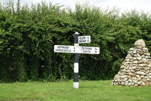
///stun.stem.migrants. Near Horncastle, Lincolnshire

Related Wikis

Juicetrump Hill

Juicetrump Hill is a hill around half a mile north of Belchford and 4.5 miles north-east of Horncastle in Lincolnshire, UK within the Lincolnshire Wolds...

Belchford

Belchford is a village and civil parish in the East Lindsey district of Lincolnshire, England. The village is situated approximately 4 miles (6 km) north...

Scamblesby

Scamblesby is a village and civil parish in the East Lindsey district from Lincolnshire, England. It is situated 6 miles (10 km) south-west from Louth...

Oxcombe

Oxcombe is a small village in the civil parish of Maidenwell, in the East Lindsey district of Lincolnshire, England. It is situated 3 miles (5 km) west...

East Lindsey

East Lindsey is a local government district in Lincolnshire, England. Its council is based in Horncastle and the largest town is Skegness. Other towns...

Cawkwell

Cawkwell is a hamlet and former civil parish, now in the parish of Scamblesby, in the East Lindsey district of Lincolnshire, England. It is situated approximately...

Asterby

Asterby is a hamlet between Goulceby and Scamblesby, west of Louth, in the East Lindsey district of Lincolnshire, England. The civil parish of Asterby...

Fulletby

Fulletby is a village and a civil parish in the East Lindsey district of Lincolnshire, England. It is in the Lincolnshire Wolds, and 3 miles (5 km) north...

Nearby Amenities

Located within 500m of 53.271661,-0.075486253
Power: pole
Source: Bing
Lat/Long: 53.2693579/-0.072019
Power: pole
Source: Bing
Lat/Long: 53.2684566/-0.0716002
Power: pole
Source: Bing
Lat/Long: 53.2702404/-0.072429
Juicetrummp Hill
Ele: 124
Natural: peak
Source: Bing
Lat/Long: 53.2694752/-0.0689194
Power: pole
Source: Bing
Lat/Long: 53.2736895/-0.0738487
Power: pole
Source: Bing
Lat/Long: 53.2719645/-0.0732372
Power: pole
Source: Bing
Lat/Long: 53.2727985/-0.0735443
Power: pole
Source: Bing
Lat/Long: 53.2710285/-0.0728161
Power: pole
Source: Bing
Lat/Long: 53.2745727/-0.0741738
Power: pole
Source: Bing
Lat/Long: 53.2754763/-0.0744965
Power: pole
Lat/Long: 53.2694556/-0.0818825
Wood Farm
Place: farm
Source: Bing
Lat/Long: 53.2701004/-0.0808839
The data included in this document is from www.openstreetmap.org. The data is made available under ODbL.

Have you been to Belchford Wood?

Leave your review of Belchford Wood below (or comments, questions and feedback).