Pond Wood

Wood, Forest in Middlesex Welwyn Hatfield

England

Pond Wood

Church of St Thomas A Becket, Northaw It's there if you look closely
Church of St Thomas A Becket, Northaw Credit: David Howard

Pond Wood, located in Middlesex, England, is a picturesque woodland area that encompasses approximately 40 acres of land. Situated near the town of Wood, this forested area is a popular destination for nature enthusiasts and locals looking to enjoy the tranquility of the outdoors.

The wood is primarily composed of deciduous trees, including oak, birch, and beech, which create a dense canopy overhead. This canopy provides shade and shelter for an array of wildlife species, making Pond Wood a haven for birds, mammals, and insects. Visitors can often spot squirrels scurrying through the treetops or hear the melodious songs of various bird species.

The highlight of Pond Wood is undoubtedly its namesake feature, a serene pond located towards the center of the woodland. The pond serves as a watering hole for local wildlife and provides a peaceful spot for visitors to relax and enjoy the surrounding nature. It is also home to a variety of aquatic plants, adding to the beauty and biodiversity of the area.

The wood is crisscrossed with well-maintained footpaths, making it easily accessible for walkers and hikers. These paths lead visitors through the heart of the woodland, allowing them to explore its hidden corners and discover the many wonders it has to offer.

Overall, Pond Wood in Middlesex is a cherished natural gem, offering a peaceful retreat from the hustle and bustle of everyday life. Its diverse ecosystem, tranquil pond, and well-marked trails make it an ideal destination for nature lovers and those seeking a serene escape in the heart of the English countryside.

If you have any feedback on the listing, please let us know in the comments section below.

Pond Wood Images

Images are sourced within 2km of 51.689689/-0.15140518 or Grid Reference TL2700. Thanks to Geograph Open Source API. All images are credited.

Church of St Thomas A Becket, Northaw It's there if you look closely
Church of St Thomas A Becket, Northaw
It's there if you look closely
Northaw Green and memorial
Judge's pub, Northaw Finally fully open after the lockdowns
Judge's pub, Northaw
Finally fully open after the lockdowns
Closed shop on High Street, Potters Bar
About to join the M25 from the A111
Potters Bar bus garage
Potty's car park on Barnet Road, Potters Bar Potty's is on the corner of the road and is a pancake house.
Potty's car park on Barnet Road, Potters Bar
Potty's is on the corner of the road and is a pancake house.
Shops on Hatfield Road, Potters Bar
Allure hairdressers on Hatfield Road, Potters Bar
Potters Bar - Eunice & Franklin topple scaffolding On Friday (18/2/22) as Storm Eunice swept across the UK, this upper section of Potters Bar High Street was closed as a large construction of scaffolding was teetering, and some had already fallen along (I believe) with part of the building's roof.
I don't know if the road was later re-opened, but in the small hours of Monday (21/2/22) Storm Franklin went one better - bringing down a whole section of the scaffolding and spraying it across the High Street into Oakmere Park on the opposite side of the road. Needless to say, the road is definitely closed again and I would think it will remain that way for quite some time.
Potters Bar - Eunice & Franklin topple scaffolding
On Friday (18/2/22) as Storm Eunice swept across the UK, this upper section of Potters Bar High Street was closed as a large construction of scaffolding was teetering, and some had already fallen along (I believe) with part of the building's roof. I don't know if the road was later re-opened, but in the small hours of Monday (21/2/22) Storm Franklin went one better - bringing down a whole section of the scaffolding and spraying it across the High Street into Oakmere Park on the opposite side of the road. Needless to say, the road is definitely closed again and I would think it will remain that way for quite some time.
Northaw Road West
Northaw Road West
M25 at Junction 24 (Potters Bar) Officially named the London Orbital and frequently derided as nothing more than a very big car park, the M25 is a 117-mile orbital motorway that encircles London; one of the world's biggest ring roads (Europe's second longest orbital road after the Berliner Ring, which is 122 miles). It is not, however, a continuous loop of motorway as the Dartford Crossing section (comprising the Dartford Tunnels and the Queen Elizabeth II Bridge) over the Thames and its approach roads are designated as the A282. 

Constructed between 1975 and 1986, the M25 is reputedly the most expensive motorway Britain ever built, costing a total of £909m or roughly £7.5m per mile, but at the time of its planning, the demand for the road was considerably underestimated so that when it was finally completed in 1986, it was already out of date. Demand outstripped capacity within a few years and ever since then it's been very heavily congested. 

The M25 is one of the UK’s busiest motorways, carrying up to 200,000 vehicles and 10,000 HGVs per day (AADT - Annual Average Daily Traffic flow) on the section near to Heathrow Airport. Since its opening in the 1980s, the southern, western and eastern sections have been widened to largely dual four lane (D4M) standard, but much of the motorway retains its dual three lane road (D3M) cross-section as originally built. 

The M25 was home to England's first Variable Speed Limits on motorways between the A3 and M4 in the early 1990s.

<span class="nowrap"><a title="http://www.cbrd.co.uk/motorway/m25/" rel="nofollow ugc noopener" href="http://www.cbrd.co.uk/motorway/m25/">Link</a><img style="margin-left:2px;" alt="External link" title="External link - shift click to open in new window" src="https://s1.geograph.org.uk/img/external.png" width="10" height="10"/></span>  cbrd
<span class="nowrap"><a title="http://www.sabre-roads.org.uk/wiki/index.php?title=M25" rel="nofollow ugc noopener" href="http://www.sabre-roads.org.uk/wiki/index.php?title=M25">Link</a><img style="margin-left:2px;" alt="External link" title="External link - shift click to open in new window" src="https://s1.geograph.org.uk/img/external.png" width="10" height="10"/></span>  SABRE
M25 at Junction 24 (Potters Bar)
Officially named the London Orbital and frequently derided as nothing more than a very big car park, the M25 is a 117-mile orbital motorway that encircles London; one of the world's biggest ring roads (Europe's second longest orbital road after the Berliner Ring, which is 122 miles). It is not, however, a continuous loop of motorway as the Dartford Crossing section (comprising the Dartford Tunnels and the Queen Elizabeth II Bridge) over the Thames and its approach roads are designated as the A282. Constructed between 1975 and 1986, the M25 is reputedly the most expensive motorway Britain ever built, costing a total of £909m or roughly £7.5m per mile, but at the time of its planning, the demand for the road was considerably underestimated so that when it was finally completed in 1986, it was already out of date. Demand outstripped capacity within a few years and ever since then it's been very heavily congested. The M25 is one of the UK’s busiest motorways, carrying up to 200,000 vehicles and 10,000 HGVs per day (AADT - Annual Average Daily Traffic flow) on the section near to Heathrow Airport. Since its opening in the 1980s, the southern, western and eastern sections have been widened to largely dual four lane (D4M) standard, but much of the motorway retains its dual three lane road (D3M) cross-section as originally built. The M25 was home to England's first Variable Speed Limits on motorways between the A3 and M4 in the early 1990s. LinkExternal link cbrd LinkExternal link SABRE
Clockwise M25, Enfield Officially named the London Orbital and frequently derided as nothing more than a very big car park, the M25 is a 117-mile orbital motorway that encircles London; one of the world's biggest ring roads (Europe's second longest orbital road after the Berliner Ring, which is 122 miles). It is not, however, a continuous loop of motorway as the Dartford Crossing section (comprising the Dartford Tunnels and the Queen Elizabeth II Bridge) over the Thames and its approach roads are designated as the A282. 

Constructed between 1975 and 1986, the M25 is reputedly the most expensive motorway Britain ever built, costing a total of £909m or roughly £7.5m per mile, but at the time of its planning, the demand for the road was considerably underestimated so that when it was finally completed in 1986, it was already out of date. Demand outstripped capacity within a few years and ever since then it's been very heavily congested. 

The M25 is one of the UK’s busiest motorways, carrying up to 200,000 vehicles and 10,000 HGVs per day (AADT - Annual Average Daily Traffic flow) on the section near to Heathrow Airport. Since its opening in the 1980s, the southern, western and eastern sections have been widened to largely dual four lane (D4M) standard, but much of the motorway retains its dual three lane road (D3M) cross-section as originally built. 

The M25 was home to England's first Variable Speed Limits on motorways between the A3 and M4 in the early 1990s.

<span class="nowrap"><a title="http://www.cbrd.co.uk/motorway/m25/" rel="nofollow ugc noopener" href="http://www.cbrd.co.uk/motorway/m25/">Link</a><img style="margin-left:2px;" alt="External link" title="External link - shift click to open in new window" src="https://s1.geograph.org.uk/img/external.png" width="10" height="10"/></span>  cbrd
<span class="nowrap"><a title="http://www.sabre-roads.org.uk/wiki/index.php?title=M25" rel="nofollow ugc noopener" href="http://www.sabre-roads.org.uk/wiki/index.php?title=M25">Link</a><img style="margin-left:2px;" alt="External link" title="External link - shift click to open in new window" src="https://s1.geograph.org.uk/img/external.png" width="10" height="10"/></span>  SABRE
Clockwise M25, Enfield
Officially named the London Orbital and frequently derided as nothing more than a very big car park, the M25 is a 117-mile orbital motorway that encircles London; one of the world's biggest ring roads (Europe's second longest orbital road after the Berliner Ring, which is 122 miles). It is not, however, a continuous loop of motorway as the Dartford Crossing section (comprising the Dartford Tunnels and the Queen Elizabeth II Bridge) over the Thames and its approach roads are designated as the A282. Constructed between 1975 and 1986, the M25 is reputedly the most expensive motorway Britain ever built, costing a total of £909m or roughly £7.5m per mile, but at the time of its planning, the demand for the road was considerably underestimated so that when it was finally completed in 1986, it was already out of date. Demand outstripped capacity within a few years and ever since then it's been very heavily congested. The M25 is one of the UK’s busiest motorways, carrying up to 200,000 vehicles and 10,000 HGVs per day (AADT - Annual Average Daily Traffic flow) on the section near to Heathrow Airport. Since its opening in the 1980s, the southern, western and eastern sections have been widened to largely dual four lane (D4M) standard, but much of the motorway retains its dual three lane road (D3M) cross-section as originally built. The M25 was home to England's first Variable Speed Limits on motorways between the A3 and M4 in the early 1990s. LinkExternal link cbrd LinkExternal link SABRE
Potters Bar Garage This was previously Dynastart
Potters Bar Garage
This was previously Dynastart
Petrol station on Barnet Road, Potters Bar It appears the price numbers flash faster than the camera exposure, so at any point in time only some are illuminated.
Petrol station on Barnet Road, Potters Bar
It appears the price numbers flash faster than the camera exposure, so at any point in time only some are illuminated.
Converted shop on Barnet Road, Potters Bar
Office block on Mutton Lane, Potters Bar This is currently occupied by Canada Life
Office block on Mutton Lane, Potters Bar
This is currently occupied by Canada Life
The Sun Public House, Northaw
Show me another place!

Pond Wood is located at Grid Ref: TL2700 (Lat: 51.689689, Lng: -0.15140518)

Administrative County: Hertfordshire

District: Welwyn Hatfield

Police Authority: Hertfordshire

What 3 Words

///actors.mice.losses. Near Potters Bar, Hertfordshire

Nearby Locations

Foxhole Hill Pond Wood

Related Wikis

St John's Senior School

St. John's Prep and Senior School is an English all-through school, co-educational day school near the M25 motorway in The Ridgeway, Botany Bay, Enfield...
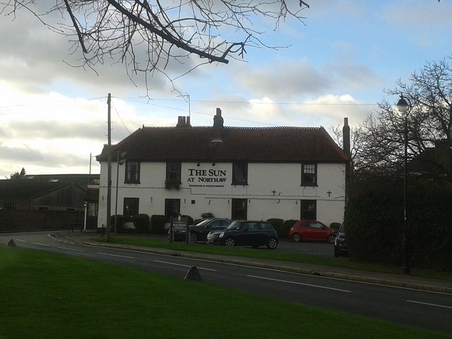
Northaw

Northaw is a village in the Welwyn Hatfield district of Hertfordshire, England. It is part of the civil parish of Northaw and Cuffley (where at the 2011...

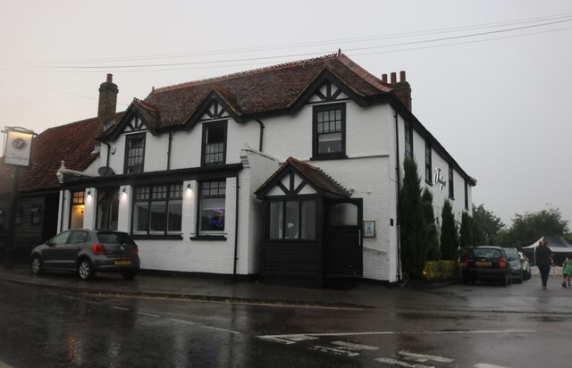
The Chequers, Potters Bar

The Chequers was a public house which occupied a Grade II listed building in Potters Bar, England. Originally opening in the 1700s, the pub moved site...
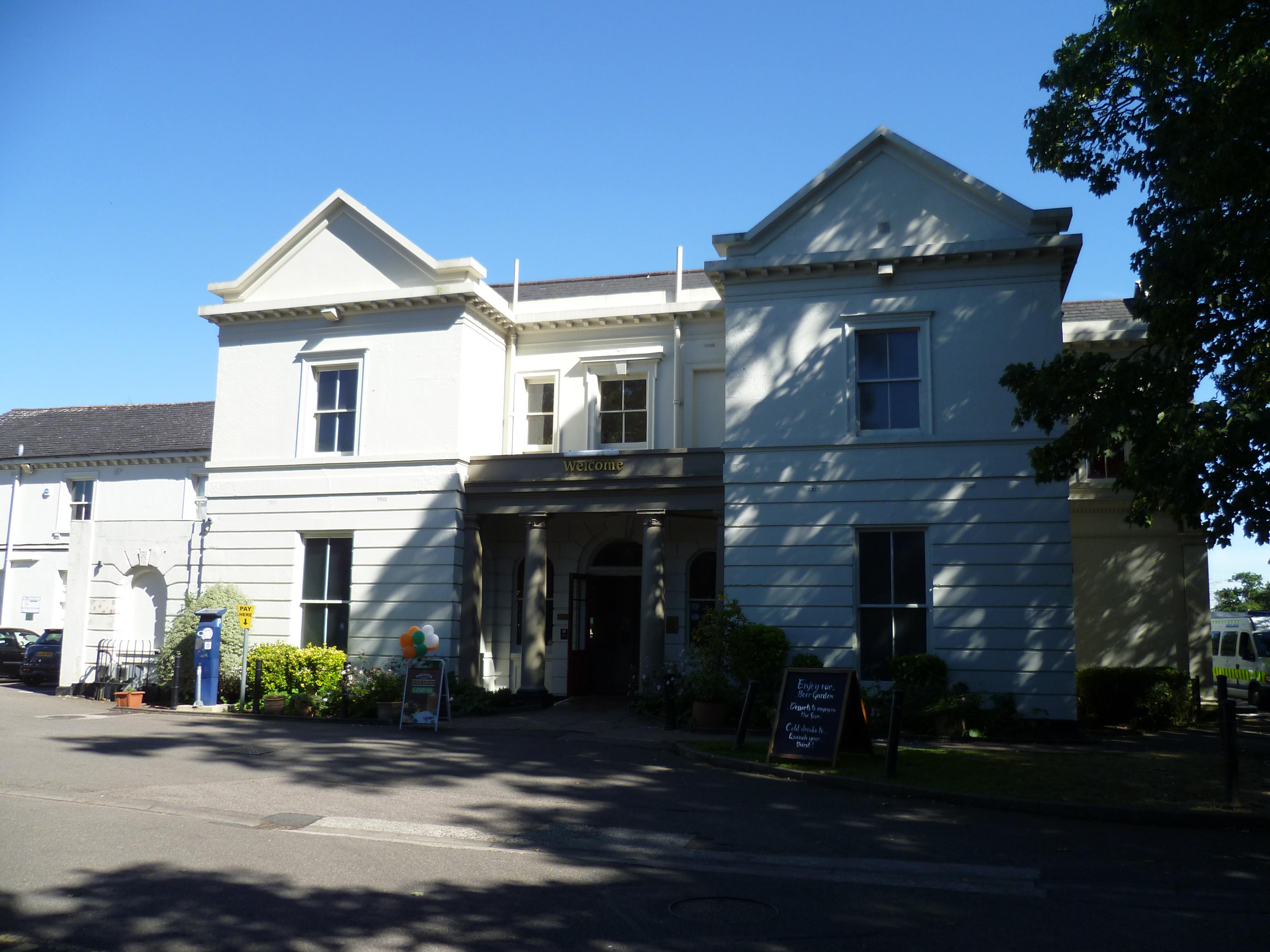
Oakmere House

Oakmere House is a public house and restaurant in Potters Bar, England, and a grade II listed building with Historic England. The pub is under the management...

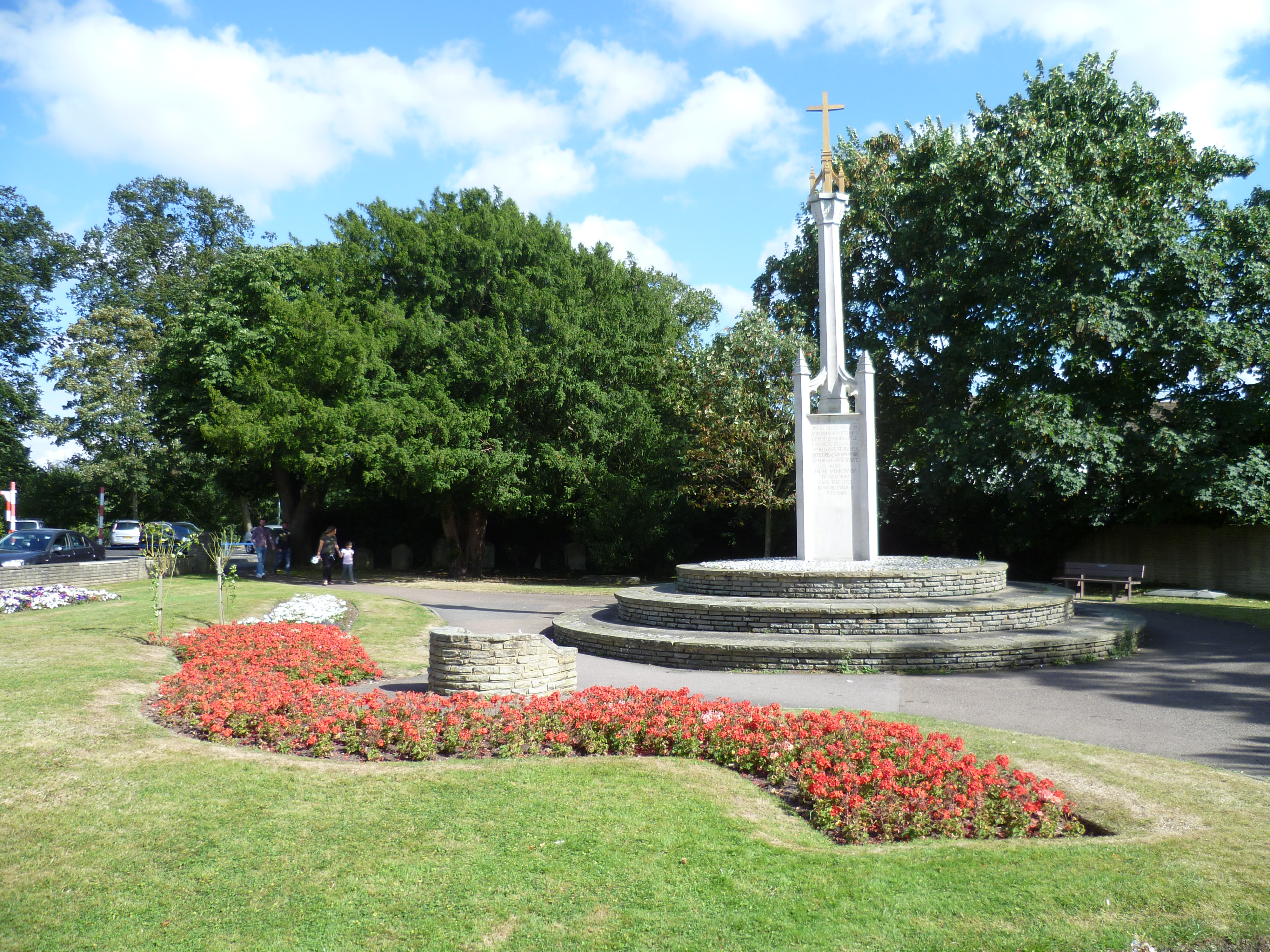
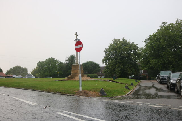
Potters Bar War Memorial

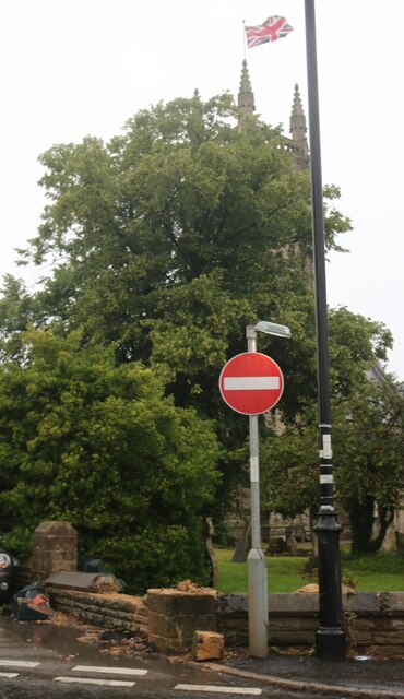
Potters Bar war memorial is located in St John's Churchyard in High Street, Potters Bar, England. The memorial was designed by the Arts and Crafts architect...

The Dower House, Northaw

The Dower House is a Grade II* listed house in Cooper's Lane between Potters Bar and Northaw in Hertfordshire, England. It was built in 1749 and was formerly...

Potters Bar Old Baptist Church

The Potters Bar Old Baptist Church, as it is now known, is a former church in Hertfordshire, England. It was designed by W. Allen Dixon in 1868. Dixon...

Ladbrooke School

Ladbrooke School is a former school in High Street, Potters Bar, England, and a grade II listed building with Historic England. == References == ��2�...

Nearby Amenities

Located within 500m of 51.689689,-0.15140518
Created By: YahooApplet 1.0
Lat/Long: 51.6864498/-0.1564067
Created By: YahooApplet 1.0
Lat/Long: 51.6854162/-0.1515765
Created By: YahooApplet 1.0
Lat/Long: 51.6852675/-0.1516137
Created By: YahooApplet 1.0
Lat/Long: 51.6853389/-0.1503337
Created By: YahooApplet 1.0
Lat/Long: 51.6854453/-0.152973
Created By: YahooApplet 1.0
Lat/Long: 51.685585/-0.1529193
Power: tower
Lat/Long: 51.6855914/-0.1494874
Man Made: gantry
Lat/Long: 51.6852271/-0.1519994
Camera Mount: pole
Camera Type: panning
Man Made: surveillance
Operator: National Highways
Operator Wikidata: Q5760006
Surveillance: outdoor
Surveillance Type: camera
Surveillance Zone: traffic
Lat/Long: 51.6859908/-0.1542686
Barrier: kissing_gate
Lat/Long: 51.6876072/-0.1545465
The data included in this document is from www.openstreetmap.org. The data is made available under ODbL.

Have you been to Pond Wood?

Leave your review of Pond Wood below (or comments, questions and feedback).