Englefield Green

Settlement in Surrey Runnymede

England

Englefield Green

The Beehive Pub sign: Fuller's pub on Middle Hill
The Beehive Credit: John Myers

Englefield Green is a charming village located in the Runnymede borough of Surrey, England. Situated on the outskirts of Windsor Great Park, it offers a serene and picturesque setting with a rich historical background. With a population of around 5,000 residents, Englefield Green maintains a close-knit community atmosphere.

One of the village's notable features is its proximity to the prestigious Royal Holloway, University of London. The stunning Victorian Gothic-style Royal Holloway College dominates the landscape and provides a unique architectural backdrop. The campus also includes the renowned Picture Gallery, housing an impressive collection of Victorian artworks.

Surrounded by lush greenery, Englefield Green offers ample opportunities for outdoor recreation. Windsor Great Park, which spans over 5,000 acres, is a stone's throw away and provides beautiful landscapes for walking, cycling, and picnicking. In addition, the village is close to the River Thames, offering scenic riverside walks and boating activities.

Englefield Green's quaint high street is home to a variety of local shops, cafes, and restaurants, providing residents and visitors with an array of amenities. The village also boasts several traditional pubs, offering a warm and friendly atmosphere for socializing.

Transport links are excellent in Englefield Green, with regular bus services connecting to nearby towns and cities, including Egham and Staines-upon-Thames. Heathrow Airport is just a short drive away, making it a convenient location for travelers.

Overall, Englefield Green combines historical charm, natural beauty, and a strong sense of community, making it an attractive place to live and visit in Surrey.

If you have any feedback on the listing, please let us know in the comments section below.

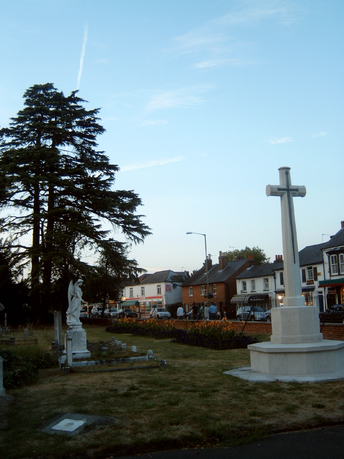
Englefield Green Images

Images are sourced within 2km of 51.43441/-0.575021 or Grid Reference SU9971. Thanks to Geograph Open Source API. All images are credited.

The Beehive Pub sign: Fuller's pub on Middle Hill
The Beehive
Pub sign: Fuller's pub on Middle Hill
Ongoing construction work, Egham This was taken where Church Road (running left-right) is met by Station Road (foreground).
Ongoing construction work, Egham
This was taken where Church Road (running left-right) is met by Station Road (foreground).
Remains of Ankerwycke Priory - looking south-east
Remains of Ankerwycke Priory - looking south-west
Remains of Ankerwycke Priory - looking north-west
Runnymede
Runnymede
Wedderburn Accommodation Block at Royal Holloway University
Tower Garage Art Deco listed building, built in 1935 as a Vauxhall/Bedford garage.  It is now the home of Maranello, who sell Ferrari and Maserati.
Tower Garage
Art Deco listed building, built in 1935 as a Vauxhall/Bedford garage. It is now the home of Maranello, who sell Ferrari and Maserati.
Ankerwyke Farm This farm estate is owned by the National Trust and extends to the River Thames. Magna Carta Lane can be glimpsed on the right edge of this photograph and leads to the eponymous island.
Ankerwyke Farm
This farm estate is owned by the National Trust and extends to the River Thames. Magna Carta Lane can be glimpsed on the right edge of this photograph and leads to the eponymous island.
Ankerwyke Farm The hill in the distance is on the west bank of the Thames where the Runnymede Kennedy Memorial is located. The track in the foreground leads to the site of Ankerwyke Priory, originally a Benedictine foundation.
Ankerwyke Farm
The hill in the distance is on the west bank of the Thames where the Runnymede Kennedy Memorial is located. The track in the foreground leads to the site of Ankerwyke Priory, originally a Benedictine foundation.
The River Thames, Runnymede Looking upstream.
The River Thames, Runnymede
Looking upstream.
The River Thames, Runnymede
Langham Pond, Runnymede This pond is owned by the National Trust and is excellent for wildlife. In the 1970s and early 1980s it was largely covered by floating Water Soldier plants (Stratioites aloides) a rare plant in the wild. This picture from July 1990 shows some still remaining in the mid distance.
Langham Pond, Runnymede
This pond is owned by the National Trust and is excellent for wildlife. In the 1970s and early 1980s it was largely covered by floating Water Soldier plants (Stratioites aloides) a rare plant in the wild. This picture from July 1990 shows some still remaining in the mid distance.
Ankerwyke Pond Ancient pond on Magna Carta Island, Wraysbury.
Ankerwyke Pond
Ancient pond on Magna Carta Island, Wraysbury.
Ankerwyke Priory Ruins of Ankerwyke Priory.
Ankerwyke Priory
Ruins of Ankerwyke Priory.
Park at Runnymede Between the road and the river is this park, which is always popular with visitors.  To get a picture with no people is most unusual.  There are plenty off to the right; I suppose I subconsciously left them out.
Park at Runnymede
Between the road and the river is this park, which is always popular with visitors. To get a picture with no people is most unusual. There are plenty off to the right; I suppose I subconsciously left them out.
Dragon boat practice This boat was practising for a forthcoming Dragon Boat event.
Dragon boat practice
This boat was practising for a forthcoming Dragon Boat event.
The Red Lion Large brick tile-hung pub on the north side of Egham's pedestrianized High Street.
<span class="nowrap"><a title="http://www.egham.co.uk/" rel="nofollow ugc noopener" href="http://www.egham.co.uk/">Link</a><img style="margin-left:2px;" alt="External link" title="External link - shift click to open in new window" src="https://s1.geograph.org.uk/img/external.png" width="10" height="10"/></span>
The Red Lion
Large brick tile-hung pub on the north side of Egham's pedestrianized High Street. LinkExternal link
Show me another place!

Englefield Green is located at Grid Ref: SU9971 (Lat: 51.43441, Lng: -0.575021)

Administrative County: Surrey

District: Runnymede

Police Authority: Surrey

What 3 Words

///tell.glue.boom. Near Egham, Surrey

Nearby Locations

Englefield Green

Related Wikis

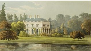
Castle Hill, Englefield Green

Castle Hill (originally known as Elvill's) is a large late-18th-century or early-19th-century Grade II listed mansion in Englefield Green, Surrey. The...

Englefield Green Rovers F.C.

Englefield Green Rovers F.C. was a football club based in Englefield Green, near Egham, England. They were members of the Surrey FA. == History == Englefield...

Englefield Green

Englefield Green is a large village in the Borough of Runnymede, Surrey, England, approximately 20 miles (32 km) west of central London. It is home to...

Royal Indian Engineering College

The Royal Indian Engineering College (or RIEC) was a British college of Civil Engineering run by the India Office to train civil engineers for service...

Air Forces Memorial

The Air Forces Memorial, or Runnymede Memorial, in Englefield Green, near Egham, Surrey, England is a memorial dedicated to some 20,456 men and women from...

Church of Our Lady of the Assumption, Englefield Green

The Church of Our Lady of the Assumption is a Roman Catholic church in Englefield Green, Surrey. It is situated on St Cuthbert's Close and faces Harvest...

Scaitcliffe

Scaitcliffe was a prep school for boys aged 6–13 in Egham, Surrey. Founded in 1896, it was both a boarding and day school. After merging with Virginia...

Langham Pond

Langham Pond is a 26.7-hectare (66-acre) biological Site of Special Scientific Interest north of Egham in Surrey.The pond and its surrounding alluvial...

Nearby Amenities

Located within 500m of 51.43441,-0.575021
Mini Roundabout
Direction: clockwise
Lat/Long: 51.4349677/-0.5736445
Turning Circle
Lat/Long: 51.4364016/-0.5722576
Turning Circle
Lat/Long: 51.4352347/-0.5697484
Crossing
Crossing: traffic_signals
Crossing Island: no
Tactile Paving: yes
Lat/Long: 51.431596/-0.5735655
Post Box
Collection Times: Mo-Fr 09:00; Sa 07:00
Post Box Type: pillar
Ref: TW20 322
Royal Cypher: VR
Royal Cypher Wikidata: Q33102356
Lat/Long: 51.4303315/-0.5732218
Bus Stop
Middle Hill
Bench: no
Naptan AtcoCode: 40004401005A
Naptan Bearing: N
Naptan CommonName: Middle Hill
Naptan Indicator: Just after
Naptan Landmark: Middle Hill
Naptan NaptanCode: suradpmt
Naptan Street: St. Judes Road
Naptan Verified: no
Public Transport: platform
Shelter: no
Source: naptan_import
Tactile Paving: no
Lat/Long: 51.4357157/-0.5740458
Bus Stop
Middle Hill
Bench: yes
Naptan AtcoCode: 40004401005B
Naptan Bearing: S
Naptan CommonName: Middle Hill
Naptan Indicator: adj
Naptan Landmark: Middle Hill
Naptan NaptanCode: suradpwt
Naptan Street: St. Judes Road
Naptan Verified: no
Public Transport: platform
Shelter: yes
Source: naptan_import
Tactile Paving: no
Lat/Long: 51.4345715/-0.5736733
Bus Stop
Barley Mow Road
Bench: no
Naptan AtcoCode: 40004401006A
Naptan Bearing: NW
Naptan CommonName: Barley Mow Road
Naptan Indicator: Opp
Naptan Landmark: Barley Mow Road
Naptan NaptanCode: suradtja
Naptan Street: St. Judes Road
Naptan Verified: no
Public Transport: platform
Shelter: no
Source: naptan_import
Tactile Paving: no
Lat/Long: 51.4329248/-0.5740897
Bus Stop
Barley Mow Road
Naptan AtcoCode: 40004401006B
Naptan Bearing: SE
Naptan CommonName: Barley Mow Road
Naptan Indicator: adj
Naptan Landmark: Barley Mow Road
Naptan NaptanCode: suradtjd
Naptan Street: St. Judes Road
Naptan Verified: no
Public Transport: platform
Source: naptan_import
Lat/Long: 51.4322502/-0.5736925
Bus Stop
St Judes Close
Bench: yes
Naptan AtcoCode: 40004401155A
Naptan Bearing: N
Naptan CommonName: St Judes Close
Naptan Indicator: Just Before
Naptan Landmark: St Judes Close
Naptan NaptanCode: suratpmw
Naptan Street: St Judes Road
Naptan Verified: no
Public Transport: platform
Shelter: yes
Source: naptan_import
Tactile Paving: no
Lat/Long: 51.4306559/-0.5733404
Bus Stop
St Judes Close
Naptan AtcoCode: 40004401155B
Naptan Bearing: S
Naptan BusStopType: CUS
Naptan CommonName: St Judes Close
Naptan Indicator: Just after
Naptan Landmark: St Judes Close
Naptan NaptanCode: surgpdwg
Naptan Street: St Judes Road
Naptan Verified: no
Public Transport: platform
Source: naptan_import
Lat/Long: 51.4304919/-0.5731241
Bench
Lat/Long: 51.4338856/-0.5758597
Bench
Lat/Long: 51.4339765/-0.5758536
Bench
Lat/Long: 51.4340485/-0.5758483
Waste Basket
Lat/Long: 51.4340947/-0.5758379
Waste Basket
Lat/Long: 51.4337922/-0.5758484
Was Barrier: cycle_barrier
Lat/Long: 51.4316957/-0.5765819
Crossing
Crossing: unmarked
Kerb: lowered
Sloped Curb: yes
Lat/Long: 51.433893/-0.5713128
Barrier: bollard
Lat/Long: 51.4368468/-0.5726778
Barrier: bollard
Lat/Long: 51.4365727/-0.572356
Crossing
Crossing: unmarked
Kerb: lowered
Sloped Curb: yes
Lat/Long: 51.4375513/-0.5723613
Crossing
Crossing: unmarked
Kerb: lowered
Sloped Curb: yes
Lat/Long: 51.4378581/-0.5719514
Give Way
Source: Bing
Lat/Long: 51.433879/-0.5714934
Give Way
Source: Bing
Lat/Long: 51.4355862/-0.5738448
Give Way
Source: Bing
Lat/Long: 51.4354616/-0.5738923
Direction: both
Traffic Calming: bump
Lat/Long: 51.4337303/-0.5705607
Direction: both
Traffic Calming: bump
Lat/Long: 51.4334482/-0.5709817
Waste Basket
Waste: dog_excrement
Lat/Long: 51.4339621/-0.5714883
Addr Housename: Hartford House
Building: house
Lat/Long: 51.43225/-0.5708283
Waste Basket
Waste: dog_excrement
Lat/Long: 51.4319546/-0.5709423
Waste Basket
Colour: black
Material: plastic
Waste: trash
Lat/Long: 51.4320432/-0.5713411
Bench
Backrest: yes
Material: wood
Seats: 3
Lat/Long: 51.432317/-0.5726629
Waste Basket
Waste: dog_excrement
Lat/Long: 51.4302664/-0.5732067
Waste Basket
Waste: dog_excrement
Lat/Long: 51.4327305/-0.5740497
Waste Basket
Material: wood
Waste: trash
Lat/Long: 51.4327467/-0.5741441
Addr Housename: Crown Farm
Building: yes
Lat/Long: 51.4334621/-0.5767068
Addr Housename: Crown House
Building: house
Lat/Long: 51.4333387/-0.5762134
Waste Basket
Waste: dog_excrement
Lat/Long: 51.4320504/-0.5770439
The data included in this document is from www.openstreetmap.org. The data is made available under ODbL.

Have you been to Englefield Green?

Leave your review of Englefield Green below (or comments, questions and feedback).