Broadfield Forest

Wood, Forest in Sussex Crawley

England

Broadfield Forest

Bewbush Leisure Centre Crawley's second leisure Centre, opened in 1984, demolished in 2009.
Bewbush Leisure Centre Credit: Michael of Crawley

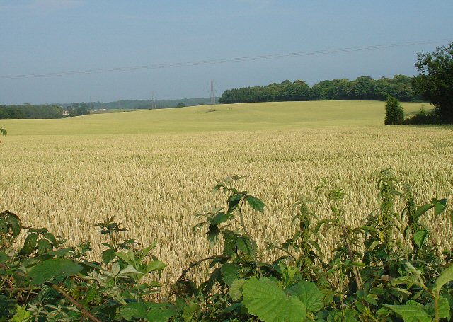
Broadfield Forest is a captivating woodland located in the heart of Sussex, England. Stretching over an area of approximately 500 acres, it provides a serene and tranquil escape from the bustling city life. The forest is nestled between the towns of Crawley, Horsham, and East Grinstead, making it easily accessible to nature enthusiasts and adventure seekers alike.

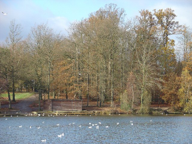
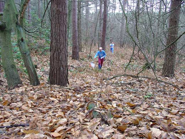
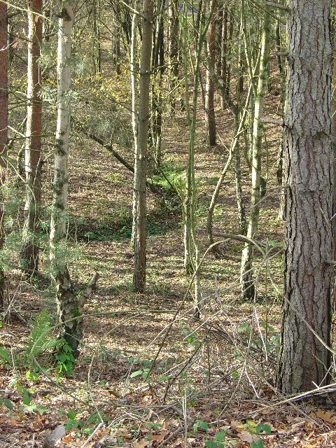
The forest is predominantly composed of broadleaf trees such as oak, beech, and birch, which lend an enchanting ambiance to the surroundings. Walking through the forest, visitors are greeted by a lush carpet of ferns and wildflowers that thrive beneath the dense canopy. The forest floor is adorned with a myriad of flora and fauna, including bluebells, primroses, and foxgloves, creating a picturesque landscape during springtime.

Broadfield Forest is not only a haven for nature lovers but also a sanctuary for wildlife. It is home to a diverse range of animal species, including deer, foxes, badgers, and a variety of bird species. Birdwatchers can spot woodpeckers, owls, and various migratory birds that frequent the area.

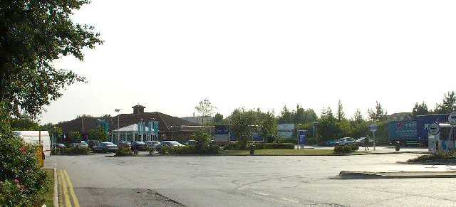
The forest offers numerous walking trails and cycling paths, allowing visitors to explore its captivating beauty at their own pace. There are picnic areas scattered throughout the forest, providing the perfect opportunity to relax and enjoy a meal amidst nature's embrace. Additionally, the forest is equipped with well-maintained facilities, including parking spaces and public toilets, ensuring a comfortable experience for visitors.

Broadfield Forest is a true gem in Sussex, offering a delightful escape to immerse oneself in the natural wonders of the region. With its diverse flora and fauna, scenic trails, and peaceful ambiance, it is a must-visit destination for those seeking solace in the heart of nature.

If you have any feedback on the listing, please let us know in the comments section below.

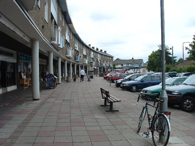
Broadfield Forest Images

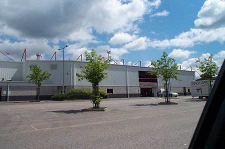
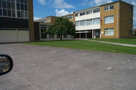
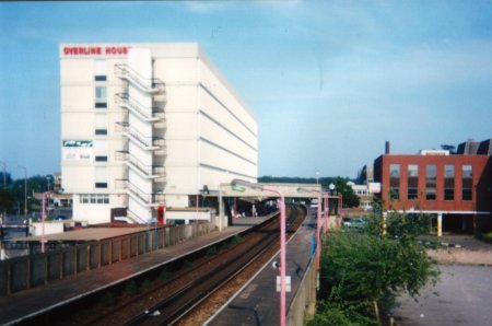
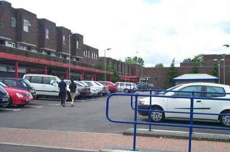
Images are sourced within 2km of 51.095501/-0.19700965 or Grid Reference TQ2634. Thanks to Geograph Open Source API. All images are credited.

Bewbush Leisure Centre Crawley's second leisure Centre, opened in 1984, demolished in 2009.
Bewbush Leisure Centre
Crawley's second leisure Centre, opened in 1984, demolished in 2009.
Broadfield Stadium Built by Crawley Council in the early 1990s to re-home Crawley Town Football Club. One of the best non-league stadia in the UK
Broadfield Stadium
Built by Crawley Council in the early 1990s to re-home Crawley Town Football Club. One of the best non-league stadia in the UK
Holy Trinity School Opened in the late 1960s, the main Church of England Secondary School in North Sussex
Holy Trinity School
Opened in the late 1960s, the main Church of England Secondary School in North Sussex
Crawley Signal Box 19th Century Signal Box on Horsham branch line. The box is now out of use following automation, although  it is subject to a preservation order, and is cared for by a local society.
Crawley Signal Box
19th Century Signal Box on Horsham branch line. The box is now out of use following automation, although it is subject to a preservation order, and is cared for by a local society.
St Wilfrid's RC School Catholic Comprehensive School, Crawley
St Wilfrid's RC School
Catholic Comprehensive School, Crawley
Thomas Bennett Community College Former buildings of the secondary school named for Sir Thomas Bennett, Chairman of Crawley New Town Development Corporation. The school was opened in 1959 and rebuilt on the same campus in 2004-5. The buildings shown were demolished in the summer of 2005.
Thomas Bennett Community College
Former buildings of the secondary school named for Sir Thomas Bennett, Chairman of Crawley New Town Development Corporation. The school was opened in 1959 and rebuilt on the same campus in 2004-5. The buildings shown were demolished in the summer of 2005.
Crawley Station Crawley Station, with Overline House above. The station was relocated here in the late 1960s from a former site 500yds further west.
Crawley Station
Crawley Station, with Overline House above. The station was relocated here in the late 1960s from a former site 500yds further west.
Broadfield Barton Local shopping parade for the neighbourhood of Broadfield in South-west Crawley
Broadfield Barton
Local shopping parade for the neighbourhood of Broadfield in South-west Crawley
Tilgate Lake, Tilgate Park, Crawley Tilgate Park is the largest public park in Crawley. Before the development of the Crawley New Town, it was the home of the Campbell family. Malcolm Campbell developed and tested his designs of the "Bluebird" world water speed record holding boats on this lake in the 1930s and 40s.
Tilgate Lake, Tilgate Park, Crawley
Tilgate Park is the largest public park in Crawley. Before the development of the Crawley New Town, it was the home of the Campbell family. Malcolm Campbell developed and tested his designs of the "Bluebird" world water speed record holding boats on this lake in the 1930s and 40s.
Tilgate Parade, Tilgate, Crawley Tilgate was one of Crawley New Town's original 12 neighbourhoods. Each neighbourhood had its own shops, pub, church etc. Tilgate Parade still commands a position at the centre of everyday life for many people in this neighbourhood (built mid-1950s).
Tilgate Parade, Tilgate, Crawley
Tilgate was one of Crawley New Town's original 12 neighbourhoods. Each neighbourhood had its own shops, pub, church etc. Tilgate Parade still commands a position at the centre of everyday life for many people in this neighbourhood (built mid-1950s).
Orienteering in Tilgate Forest, Nr Crawley, West Sussex This Square is dominated by Tilgate Forest, a public access forest managed by the Forestry Commission. The photo shows the mature mixed woodland that makes up most of the forest area. This part is predominantly broadleaved deciduous trees, with the odd coniferous example and a light scattering of rhododendron thickets. The high canopy is quite dense and doesn't let much heavy vegetation take hold. One of several popular woodland areas in the vicinity for orienteering. The event here was a Christmas Score event staged by Southdowns Orienteers.
Orienteering in Tilgate Forest, Nr Crawley, West Sussex
This Square is dominated by Tilgate Forest, a public access forest managed by the Forestry Commission. The photo shows the mature mixed woodland that makes up most of the forest area. This part is predominantly broadleaved deciduous trees, with the odd coniferous example and a light scattering of rhododendron thickets. The high canopy is quite dense and doesn't let much heavy vegetation take hold. One of several popular woodland areas in the vicinity for orienteering. The event here was a Christmas Score event staged by Southdowns Orienteers.
Ditch Bend in a Shallow Re-Entrant in a Coniferous Wooded Part of Tilgate Forest, Nr Crawley, West Sussex This view shows typical vegetation in much of this part of Tilgate Forest: pine trees (with the odd invading birch) with a fairly clean forest floor. The trees tend to form quite a dense canopy, preventing much from growing beneath them. The ditch is part of the drainage network.
Ditch Bend in a Shallow Re-Entrant in a Coniferous Wooded Part of Tilgate Forest, Nr Crawley, West Sussex
This view shows typical vegetation in much of this part of Tilgate Forest: pine trees (with the odd invading birch) with a fairly clean forest floor. The trees tend to form quite a dense canopy, preventing much from growing beneath them. The ditch is part of the drainage network.
Pease Pottage Services At the (current) end of the M23, Junction 11. Operated by Moto.
Pease Pottage Services
At the (current) end of the M23, Junction 11. Operated by Moto.
Pease Pottage Radar Station Taking advantage of this relatively high site (140m above sea level), 80m above Gatwick airport, this is an air traffic control radar. Painted white to blend into the sky.
Pease Pottage Radar Station
Taking advantage of this relatively high site (140m above sea level), 80m above Gatwick airport, this is an air traffic control radar. Painted white to blend into the sky.
Corn Fields, Pease Pottage A very summery rural site. Ripening corn in this large field, which covers the N side of this grid square. Much of the rural sussex terrain is patches of trees interspersed by fields of various crops. Tilgate Forest can be seen in the far distance and Bensonshill Wood is on the right. High voltage electricity transmission cross the field (the pylons are just visible). View taken from the old A23 road between Pease Pottage and Handcross, looking E.
Corn Fields, Pease Pottage
A very summery rural site. Ripening corn in this large field, which covers the N side of this grid square. Much of the rural sussex terrain is patches of trees interspersed by fields of various crops. Tilgate Forest can be seen in the far distance and Bensonshill Wood is on the right. High voltage electricity transmission cross the field (the pylons are just visible). View taken from the old A23 road between Pease Pottage and Handcross, looking E.
Cottesmore School, Buchan Hill, near Pease Pottage, West Sussex A full boarding co-educational prep school (the only one in the UK - according to their website <span class="nowrap"><a title="http://www.cottesmoreschool.com" rel="nofollow ugc noopener" href="http://www.cottesmoreschool.com">Link</a><img style="margin-left:2px;" alt="External link" title="External link - shift click to open in new window" src="https://s1.geograph.org.uk/img/external.png" width="10" height="10"/></span> ). A couple of sand traps of the Cottesmore Country Club golf course can also be seen.
Cottesmore School, Buchan Hill, near Pease Pottage, West Sussex
A full boarding co-educational prep school (the only one in the UK - according to their website LinkExternal link ). A couple of sand traps of the Cottesmore Country Club golf course can also be seen.
Bridleway through Cottesmore Country Club and School. The sign indicates a bend in the route of the bridleway that cuts through the country club and school grounds between Pease Pottage and the Broadfield neighbourhood of Crawley. At this point the public right of way is following the drive to the school. Behind the sign can be seen the flag of one of the golf greens.
Bridleway through Cottesmore Country Club and School.
The sign indicates a bend in the route of the bridleway that cuts through the country club and school grounds between Pease Pottage and the Broadfield neighbourhood of Crawley. At this point the public right of way is following the drive to the school. Behind the sign can be seen the flag of one of the golf greens.
Cottesmore Golf and Country Club - Golfer Taking a Swing The view is of a golfer on the fairway taking a swing at his ball.
Cottesmore Golf and Country Club - Golfer Taking a Swing
The view is of a golfer on the fairway taking a swing at his ball.
Show me another place!

Broadfield Forest is located at Grid Ref: TQ2634 (Lat: 51.095501, Lng: -0.19700965)

Administrative County: West Sussex

District: Crawley

Police Authority: Sussex

What 3 Words

///part.loudly.descended. Near Broadfield, West Sussex

Related Wikis

Discovery New School

Discovery New School was a co-educational Montessori free school for pupils aged 4 to 10 located in Crawley, West Sussex. The school opened in September...

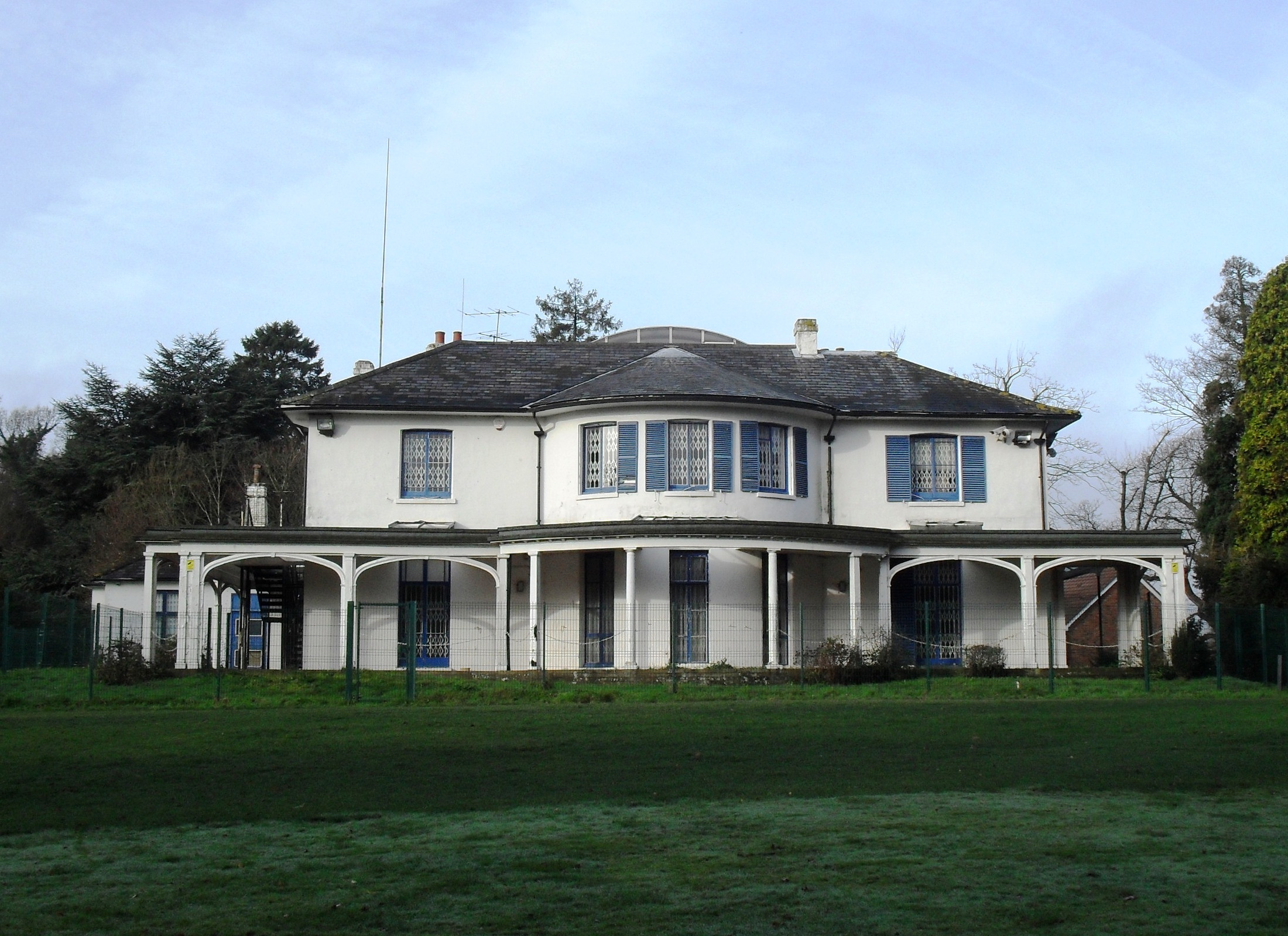
Broadfield House, Crawley

Broadfield House is a 19th-century villa-style house in the Broadfield neighbourhood of Crawley, a town and borough in West Sussex, England. Built in 1830...

K2 Leisure Centre

K2 is a sports and leisure facility covering 57,194 m2 in Pease Pottage Hill Crawley, UK. == Development == The building belongs to Crawley Borough Council...

Crawley Town F.C.

Crawley Town Football Club is a professional association football club based in the town of Crawley, West Sussex, England. The team competes in EFL League...

Nearby Amenities

Located within 500m of 51.095501,-0.19700965
Mini Roundabout
Direction: clockwise
Source: Yahoo WMS
Lat/Long: 51.0961658/-0.2027483
Mini Roundabout
Direction: clockwise
Lat/Long: 51.0977747/-0.202699
Mini Roundabout
Direction: clockwise
Lat/Long: 51.0962953/-0.1994108
Post Box
Collection Plate: CP8D
Collection Times: Mo-Fr 09:00; Sa 07:00
Operator: Royal Mail
Operator Wikidata: Q638098
Post Box Type: pillar
Ref: RH11 146D
Royal Cypher: EIIR
Royal Cypher Wikidata: Q33102113
Lat/Long: 51.0920659/-0.199934
Bus Stop
Bishopstone Walk
Bus: yes
Naptan AtcoCode: 4400CY0099
Naptan Bearing: S
Naptan CommonName: Bishopstone Walk
Naptan Indicator: Opp Bishopstone Walk
Naptan Landmark: Hollingbourne Crescent
Naptan NaptanCode: wsxajpmw
Naptan PlusbusZoneRef: CRAWLEY
Naptan Street: Tollgate Hill
Naptan Verified: no
Public Transport: platform
Source: naptan_import
Lat/Long: 51.0926683/-0.1998691
Bus Stop
Bishopstone Walk
Bus: yes
Naptan AtcoCode: 4400CY0100
Naptan Bearing: N
Naptan CommonName: Bishopstone Walk
Naptan Indicator: Adj Bishopstone Walk
Naptan Landmark: Hollingbourne Crescent
Naptan NaptanCode: wsxajpta
Naptan PlusbusZoneRef: CRAWLEY
Naptan Street: Tollgate Hill
Naptan Verified: no
Public Transport: platform
Source: naptan_import
Lat/Long: 51.0921775/-0.2002861
Coachmans Drive Central
Naptan AtcoCode: 4400CY0105
Naptan Bearing: N
Naptan CommonName: Coachmans Drive Central
Naptan Indicator: adj Broadfield Place
Naptan Landmark: Broadfield Place
Naptan NaptanCode: wsxajptp
Naptan PlusbusZoneRef: CRAWLEY
Naptan Street: Coachmans Drive
Naptan Verified: no
Source: naptan_import
Lat/Long: 51.0971436/-0.2029871
Bus Stop
Coachmans Drive Central
Naptan AtcoCode: 4400CY0106
Naptan Bearing: S
Naptan CommonName: Coachmans Drive Central
Naptan Indicator: opp. Broadfield Place
Naptan Landmark: Broadfield Place
Naptan NaptanCode: wsxajptw
Naptan PlusbusZoneRef: CRAWLEY
Naptan Street: Coachmans Drive
Naptan Verified: no
Public Transport: platform
Source: naptan_import
Lat/Long: 51.097374/-0.2027212
Bus Stop
Coachmans Drive North
Bus: yes
Naptan AtcoCode: 4400CY0107
Naptan Bearing: SW
Naptan CommonName: Coachmans Drive North
Naptan Indicator: opp
Naptan Landmark: Enfield Road
Naptan NaptanCode: wsxajpwa
Naptan PlusbusZoneRef: CRAWLEY
Naptan ShortCommonName: Coachmans Dr North
Naptan Street: Coachmans Drive
Naptan Verified: no
Public Transport: platform
Source: naptan_import
Lat/Long: 51.0987168/-0.2003743
Bus Stop
Coachmans Drive North
Bus: yes
Naptan AtcoCode: 4400CY0412
Naptan Bearing: NE
Naptan CommonName: Coachmans Drive North
Naptan Indicator: Opp
Naptan Landmark: Moyne Rd
Naptan NaptanCode: wsxdpwad
Naptan PlusbusZoneRef: CRAWLEY
Naptan ShortCommonName: Coachmans Dr North
Naptan Street: Coachman's Drive
Naptan Verified: no
Public Transport: platform
Source: naptan_import
Lat/Long: 51.0984242/-0.2016034
Bus Stop
Creasys Drive East
Bus: yes
Naptan AtcoCode: 4400CY0448
Naptan Bearing: NE
Naptan CommonName: Creasys Drive East
Naptan Indicator: Opp Woodwards
Naptan Landmark: Woodwards
Naptan NaptanCode: wsxdtdpa
Naptan PlusbusZoneRef: CRAWLEY
Naptan Street: Creaseys Drive
Naptan Verified: no
Public Transport: platform
Source: naptan_import
Lat/Long: 51.0931882/-0.203036
Bus Stop
K2 Leisure Centre
Bus: yes
Naptan AtcoCode: 4400CY0534
Naptan Bearing: N
Naptan CommonName: K2 Leisure Centre
Naptan Indicator: o/s Leisure Centre
Naptan Landmark: Leisure Centre
Naptan NaptanCode: wsxgdtaj
Naptan PlusbusZoneRef: CRAWLEY
Naptan Street: K2 Leisure Centre
Naptan Verified: no
Public Transport: platform
Source: naptan_import
Lat/Long: 51.0977246/-0.1921302
Bus Stop
Tilgate Park
Bus: yes
Naptan AtcoCode: 4400CY0559
Naptan Bearing: S
Naptan CommonName: Tilgate Park
Naptan Indicator: adj
Naptan Landmark: Brighton Road
Naptan NaptanCode: wsxgdwgw
Naptan ShortCommonName: Tilgate Park
Naptan Street: A23
Naptan Verified: no
Public Transport: platform
Source: naptan_import
Lat/Long: 51.0947085/-0.1945068
Crossing
Bicycle: yes
Crossing: traffic_signals
Crossing Ref: toucan
Lat/Long: 51.0968372/-0.1937055
Crossing
Bicycle: yes
Crossing: traffic_signals
Crossing Ref: toucan
Kerb: lowered
Lat/Long: 51.0968675/-0.1934506
Leisure: playground
Source: Bing
Lat/Long: 51.0955805/-0.1999828
Crossing
Crossing: traffic_signals
Kerb: lowered
Tactile Paving: yes
Lat/Long: 51.096537/-0.1932874
Old Stone Cottage Farm
Place: farm
Lat/Long: 51.0923773/-0.1944861
Barrier: bollard
Lat/Long: 51.093481/-0.1935444
Noexit: yes
Lat/Long: 51.0937275/-0.2003522
Bicycle Parking
Bicycle Parking: stands
Capacity: 40
Caution: theft hotspot
Cctv: no
Covered: yes
Lat/Long: 51.0971144/-0.1918895
Entrance: main
Lat/Long: 51.0972851/-0.1919207
Crossing
Crossing: unmarked
Crossing Markings: no
Lat/Long: 51.0972103/-0.1937534
Crossing
Crossing: unmarked
Crossing Markings: no
Lat/Long: 51.0971496/-0.1937676
Fire Hydrant
Description: Washout Hydrant
Emergency: fire_hydrant
Fire Hydrant Type: underground
Operator: Southern Water
Survey Date: 2018-11-09
Water Source: main
Lat/Long: 51.094951/-0.1992304
Fire Hydrant
Description: Washout Hydrant
Emergency: fire_hydrant
Fire Hydrant Type: underground
Operator: Southern Water
Survey Date: 2018-11-09
Water Source: main
Lat/Long: 51.09387/-0.1984144
Pond
Suction Point
Emergency: suction_point
Survey Date: 2018-11-09
Lat/Long: 51.096057/-0.1947069
Washout Hydrant
Fire Hydrant
Emergency: fire_hydrant
Fire Hydrant Type: underground
Survey Date: 2018-11-11
Water Source: main
Lat/Long: 51.093886/-0.1984292
Bus Stop
Broadfield Park
Bus: yes
Naptan AtcoCode: 4400CY0341
Naptan Bearing: N
Naptan CommonName: Broadfield Park
Naptan Indicator: In the shaldow of the football stadium
Naptan Landmark: next to Broadfield Park entrance
Naptan NaptanCode: wsxamgpd
Naptan PlusbusZoneRef: CRAWLEY
Naptan ShortCommonName: Broadfield Park
Naptan Street: A23
Naptan Verified: no
Public Transport: platform
Source: naptan_import
Lat/Long: 51.0976189/-0.1934752
Bus Stop
Coachmans Drive South
Bus: yes
Naptan AtcoCode: 4400CY0103
Naptan Bearing: SE
Naptan CommonName: Coachmans Drive South
Naptan Indicator: opp. Lansbury Road
Naptan Landmark: Lansbury Road
Naptan NaptanCode: wsxajptj
Naptan PlusbusZoneRef: CRAWLEY
Naptan Street: Coachmans Drive
Naptan Verified: no
Public Transport: platform
Source: naptan_import
Lat/Long: 51.0952448/-0.2000591
Bikes Revived
Addr Housenumber: Hut 3
Addr Postcode: RH11 9BQ
Addr Street: Tilgate Drive
Email: info@bikesrevived.org.uk
Opening Hours: Tu, Th, Sa 11:00-16:00
Phone: +44 7871 103357
Shop: bicycle
Website: https://www.bikesrevived.org.uk/
Lat/Long: 51.095487/-0.1902659
Traffic Signals
Traffic Signals: signal
Traffic Signals Direction: forward
Lat/Long: 51.0969214/-0.1934325
Give Way
Direction: forward
Lat/Long: 51.0999658/-0.1971488
Traffic Signals
Traffic Signals: signal
Traffic Signals Direction: forward
Lat/Long: 51.0965207/-0.1938649
Traffic Signals
Traffic Signals: signal
Traffic Signals Direction: forward
Lat/Long: 51.0964872/-0.1937349
Barrier: lift_gate
Lat/Long: 51.0965346/-0.1927736
Crossing
Crossing: unmarked
Crossing Markings: no
Lat/Long: 51.0955879/-0.2024951
Traffic Signals
Traffic Signals: signal
Traffic Signals Direction: backward
Lat/Long: 51.0965169/-0.1931908
The data included in this document is from www.openstreetmap.org. The data is made available under ODbL.

Have you been to Broadfield Forest?

Leave your review of Broadfield Forest below (or comments, questions and feedback).