Martin's Wood

Wood, Forest in Hertfordshire Stevenage

England

Martin's Wood

Fairlands Valley Park This large lake is used by sailors and fishermen.  This photo is taken facing south.  To the rear there are two smaller lakes.  The park is very popular in the summer.
Fairlands Valley Park Credit: Robin Hall

Martin's Wood is a captivating woodland located in Hertfordshire, England. Situated in the district of Dacorum, this forested area spans across acres of lush greenery, offering a serene and picturesque natural retreat for visitors of all ages.

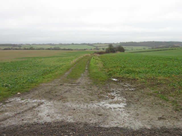
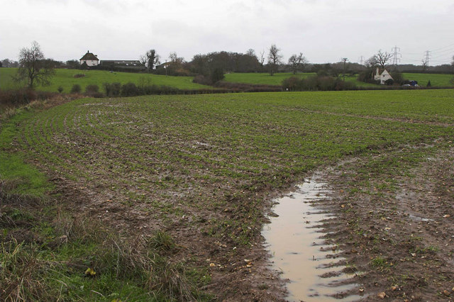
The wood is primarily composed of a mixture of deciduous and coniferous trees, creating a diverse and enchanting landscape. Towering oak, beech, and birch trees dominate the area, providing a dense canopy that filters sunlight and creates a cool and refreshing atmosphere. The forest floor is covered in a rich carpet of moss, ferns, and wildflowers, adding to the wood's natural beauty.

Martin's Wood features several well-maintained footpaths and trails, allowing visitors to explore the area at their own pace. These paths wind through the wood, leading to scenic viewpoints, bubbling streams, and hidden clearings. The tranquil ambiance is perfect for nature lovers, hikers, and photographers seeking to capture the essence of this idyllic woodland.

The wood is also home to a diverse range of wildlife, with various bird species, small mammals, and insects thriving in this natural habitat. Birdwatchers may spot woodpeckers, owls, and finches, among others, while lucky visitors might catch a glimpse of elusive deer or foxes.

Martin's Wood is easily accessible, with ample parking facilities and clear signposting. Whether one seeks solitude, a family outing, or a leisurely stroll through nature, this woodland sanctuary offers a peaceful and enchanting experience for all who venture into its serene embrace.

If you have any feedback on the listing, please let us know in the comments section below.

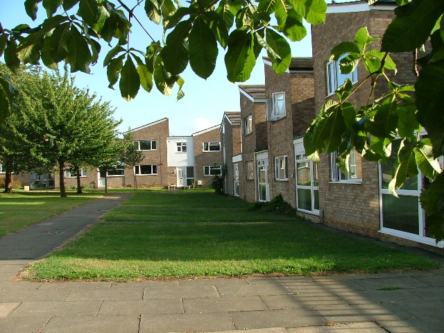
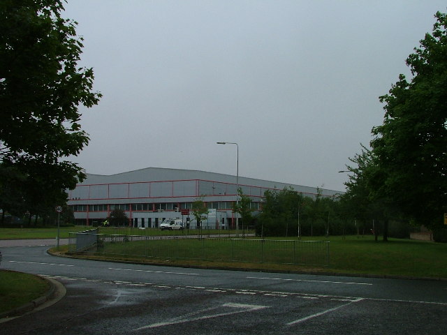
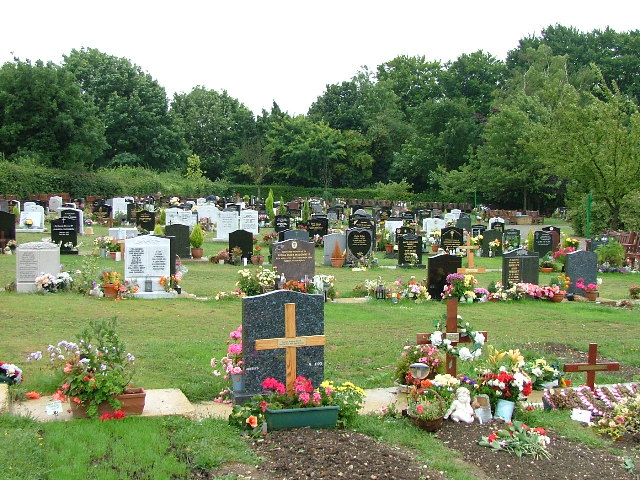
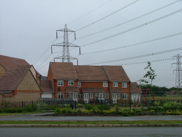
Martin's Wood Images

Images are sourced within 2km of 51.920406/-0.16506424 or Grid Reference TL2626. Thanks to Geograph Open Source API. All images are credited.

Fairlands Valley Park This large lake is used by sailors and fishermen.  This photo is taken facing south.  To the rear there are two smaller lakes.  The park is very popular in the summer.
Fairlands Valley Park
This large lake is used by sailors and fishermen. This photo is taken facing south. To the rear there are two smaller lakes. The park is very popular in the summer.
Mildmay Road. These houses were built in a variety of styles.  These are not untypical but some of the architectural styles bring their own maintenance problems.
Mildmay Road.
These houses were built in a variety of styles. These are not untypical but some of the architectural styles bring their own maintenance problems.
Fortuna Close One of the more modern parts of Stevenage and with some more imaginative building - three storeys!
Fortuna Close
One of the more modern parts of Stevenage and with some more imaginative building - three storeys!
Hampson Park / Pin Green Water Tower. Although this water tower is right on the edge of this square I have used it because it dominates the locality.  The large flat construction on the left, behind the fence, is a covered reservoir.  The tower is now bristling with aerials of all sorts.
Hampson Park / Pin Green Water Tower.
Although this water tower is right on the edge of this square I have used it because it dominates the locality. The large flat construction on the left, behind the fence, is a covered reservoir. The tower is now bristling with aerials of all sorts.
Mastercare warehousing Although this photograph is actually taken (just) from neighbouring TL2526, this warehouse is typical of this industrial estate.  Not all are grey and red.  Some are grey and another colour!
Mastercare warehousing
Although this photograph is actually taken (just) from neighbouring TL2526, this warehouse is typical of this industrial estate. Not all are grey and red. Some are grey and another colour!
Weston Rd Cemetery Although Weston Rd Cemetery takes up a relatively small portion of this square, Stevenage has lots and lots of houses but only two cemeteries.
Weston Rd Cemetery
Although Weston Rd Cemetery takes up a relatively small portion of this square, Stevenage has lots and lots of houses but only two cemeteries.
Great Ashby Estate. This development started about three years ago and is still being built.  The empty space to the right will be built on sooner or later.  The pylons are of course part of the National Grid.  Why on earth are we building houses under these lines?
Great Ashby Estate.
This development started about three years ago and is still being built. The empty space to the right will be built on sooner or later. The pylons are of course part of the National Grid. Why on earth are we building houses under these lines?
Ferrier Rd This could be any road in this area.  Plans seem to have been bought as a job lot.
Ferrier Rd
This could be any road in this area. Plans seem to have been bought as a job lot.
Telford Avenue. On the edge of TL2525..  I wasn't going any further into this estate.  I always get lost even though it's not that big by local standards.  This estate, in common with others in the area suffers from the increase in car ownership.  Parking is awkward, the roads not wide and the layout is twisting.
Telford Avenue.
On the edge of TL2525.. I wasn't going any further into this estate. I always get lost even though it's not that big by local standards. This estate, in common with others in the area suffers from the increase in car ownership. Parking is awkward, the roads not wide and the layout is twisting.
Just Outside Stevenage On the Stevenage boundary, looking across TL2725 from Stevenage Road and you are in open country.
Just Outside Stevenage
On the Stevenage boundary, looking across TL2725 from Stevenage Road and you are in open country.
Trig point at Lonsdale School I swear that tree was not there when I took the photo.

This Trig point is in the playing field of a special needs school caring for 75 children between the ages of 2 and 19 from London, Bedfordshire and Hertfordshire.
Trig point at Lonsdale School
I swear that tree was not there when I took the photo. This Trig point is in the playing field of a special needs school caring for 75 children between the ages of 2 and 19 from London, Bedfordshire and Hertfordshire.
St Joseph's Church and Presbytery A modern church set in its own grounds.
St Joseph's Church and Presbytery
A modern church set in its own grounds.
Moss Bury Primary School and Nursery Taken from a bridge over a part of Stevenage's excellent network of cycleways.  All of the tarmac between the school and the photographer is cycleway.  Road is over on the top left of this photo.
Moss Bury Primary School and Nursery
Taken from a bridge over a part of Stevenage's excellent network of cycleways. All of the tarmac between the school and the photographer is cycleway. Road is over on the top left of this photo.
Stevenage: Fairlands Valley Park The upstreammost of the artificial lakes in the park, viewed looking from the footbridge, with the top of the cascade to the next lower lake just visible in the bottom of the photograph.
Stevenage: Fairlands Valley Park
The upstreammost of the artificial lakes in the park, viewed looking from the footbridge, with the top of the cascade to the next lower lake just visible in the bottom of the photograph.
Stevenage: Fairlands Valley Park The second lake, going downstream, of the four in the park, this is the reverse view from <a href="https://www.geograph.org.uk/photo/175166">TL2524 : Stevenage: Fairlands Valley Park</a>
Stevenage: Fairlands Valley Park
The second lake, going downstream, of the four in the park, this is the reverse view from TL2524 : Stevenage: Fairlands Valley Park
Dane End Dane End Farm is on the left with Dane End Cottage on the right of frame. The very wet ground can be seen in the foreground after a night of heavy rain.
Dane End
Dane End Farm is on the left with Dane End Cottage on the right of frame. The very wet ground can be seen in the foreground after a night of heavy rain.
Boxbury Farm Looking across the fields to Boxbury Farm on bright New Years day.
Boxbury Farm
Looking across the fields to Boxbury Farm on bright New Years day.
Play area and recreation ground Play area and recreation ground created after the construction of the housing at Great Ashby below Clayhills Springs
Play area and recreation ground
Play area and recreation ground created after the construction of the housing at Great Ashby below Clayhills Springs
Show me another place!

Martin's Wood is located at Grid Ref: TL2626 (Lat: 51.920406, Lng: -0.16506424)

Administrative County: Hertfordshire

District: Stevenage

Police Authority: Hertfordshire

What 3 Words

///task.overdrive.output. Near Walkern, Hertfordshire

Related Wikis

Pryor's Wood

Pryor's Wood is an 8.7-hectare (21-acre) nature reserve in Great Ashby, near Stevenage in Hertfordshire. It was formerly managed by the Herts and Middlesex...

The Nobel School

The Nobel School is a co-educational secondary school and sixth form located in Stevenage in the English county of Hertfordshire. == History == The Nobel...

Great Ashby

Great Ashby is a civil parish in Stevenage in the North Hertfordshire district, in the county of Hertfordshire, England. The name Great Ashby was coined...

Rooks Nest House

Rooks Nest House is a house on Weston Road, Stevenage, Hertfordshire. It was the childhood home of the author E. M. Forster (1879–1970) who described it...

Marriotts School

Marriotts School is a secondary school in Stevenage, Hertfordshire, England. The school was rebuilt along with Lonsdale School (for special needs children...

St Nicholas' Church, Stevenage

St Nicholas' Church is an Anglican parish church in Stevenage, a town in Hertfordshire, England. It occupies a hilltop site above Old Stevenage. It is...

Walkern

Walkern is a village and civil parish in East Hertfordshire, England. It is about two miles (3 km) from Stevenage. The village has several shops, including...

Aston End

Aston End is a hamlet in Hertfordshire, England. It is in the civil parish of Aston. It features a pub and a butchers, as well as a few houses. == References... ==

Nearby Amenities

Located within 500m of 51.920406,-0.16506424
Crossing
Button Operated: yes
Check Date Crossing: 2021-01-17
Crossing: traffic_signals
Crossing Island: no
Crossing Ref: toucan
Tactile Paving: yes
Traffic Signals Sound: yes
Traffic Signals Vibration: yes
Lat/Long: 51.9228576/-0.1699088
Mini Roundabout
Direction: clockwise
Lat/Long: 51.9188872/-0.1697451
Kerb: raised
Lat/Long: 51.9183848/-0.1680301
Crossing
Button Operated: yes
Check Date Crossing: 2021-01-17
Crossing: traffic_signals
Crossing Island: no
Crossing Ref: toucan
Tactile Paving: yes
Traffic Signals Sound: yes
Traffic Signals Vibration: yes
Lat/Long: 51.9218717/-0.1696448
Crossing
Crossing: zebra
Crossing Island: no
Tactile Paving: yes
Traffic Calming: table
Lat/Long: 51.9188475/-0.1716105
Bus Stop
Mildmay Road
Bench: yes
Bin: yes
Lit: yes
Naptan AtcoCode: 210021202340
Naptan Bearing: W
Naptan CommonName: Mildmay Road
Naptan Crossing: Martins Wood JMI School
Naptan Indicator: W-bound
Naptan Landmark: Martins Wood JMI School
Naptan NaptanCode: hrtdwpjw
Naptan PlusbusZoneRef: STEVNGE
Naptan ShortCommonName: NA
Naptan Street: Mildmay Road
Shelter: no
Source: naptan_import
Tactile Paving: no
Lat/Long: 51.9188051/-0.1708396
Bus Stop
Ascot Crescent
Bench: yes
Bin: yes
Lit: yes
Naptan AtcoCode: 210021202470
Naptan Bearing: NW
Naptan CommonName: Ascot Crescent
Naptan Crossing: Sefton Road
Naptan Indicator: N-bound
Naptan Landmark: Sefton Road
Naptan NaptanCode: hrtdwptd
Naptan PlusbusZoneRef: STEVNGE
Naptan ShortCommonName: NA
Naptan Street: Ascot Crescent
Shelter: yes
Source: naptan_import
Tactile Paving: no
Lat/Long: 51.9204237/-0.1702419
Crossing
Crossing: unmarked
Crossing Island: no
Kerb: lowered
Tactile Paving: no
Lat/Long: 51.919474/-0.1695267
Crossing
Crossing: unmarked
Crossing Island: no
Kerb: lowered
Tactile Paving: no
Lat/Long: 51.9187998/-0.1710343
Crossing
Crossing: unmarked
Crossing Island: yes
Tactile Paving: no
Lat/Long: 51.9188163/-0.1696167
Crossing
Crossing: unmarked
Crossing Island: no
Kerb: lowered
Tactile Paving: no
Lat/Long: 51.9211752/-0.1711215
Traffic Calming: island
Lat/Long: 51.9188609/-0.1699251
Crossing
Crossing: unmarked
Crossing Island: no
Kerb: lowered
Tactile Paving: no
Lat/Long: 51.9196822/-0.1611608
Barrier: bollard
Bollard: removable
Lat/Long: 51.9172218/-0.1674029
Barrier: bollard
Bollard: removable
Lat/Long: 51.9174126/-0.1676288
Noexit: yes
Lat/Long: 51.9164649/-0.1633974
Noexit: yes
Lat/Long: 51.9164311/-0.1632921
Trajan Gate
Naptan AtcoCode: 210021202250
Naptan Bearing: SW
Naptan BusStopType: CUS
Naptan CommonName: Trajan Gate
Naptan Crossing: Gresley Way
Naptan Indicator: adj
Naptan Landmark: Gresley Way
Naptan NaptanCode: hrtdwtam
Naptan PlusbusZoneRef: STEVNGE
Naptan ShortCommonName: NA
Naptan Street: Valerian Way
Naptan Verified: no
Source: naptan_import
Lat/Long: 51.9192377/-0.1616312
Bus Stop
Valerian Way
Bench: no
Bin: no
Lit: yes
Naptan AtcoCode: 210021202255
Naptan Bearing: SE
Naptan CommonName: Valerian Way
Naptan Crossing: Box Wood
Naptan Indicator: opp
Naptan Landmark: Box Wood
Naptan NaptanCode: hrtdwtap
Naptan PlusbusZoneRef: STEVNGE
Naptan ShortCommonName: NA
Naptan Street: Gresley Way
Naptan Verified: no
Shelter: no
Source: naptan_import
Tactile Paving: no
Lat/Long: 51.9195132/-0.1602675
Bus Stop
Industrial Estate
Bench: no
Bin: yes
Lit: yes
Naptan AtcoCode: 210021202290
Naptan Bearing: E
Naptan CommonName: Industrial Estate
Naptan Crossing: Industrial Estate
Naptan Indicator: E-bound
Naptan Landmark: Industrial Estate
Naptan NaptanCode: hrtgtwdg
Naptan ShortCommonName: NA
Naptan Street: Cartwright Road
Naptan Verified: no
Shelter: no
Source: naptan_import
Tactile Paving: no
Lat/Long: 51.9233973/-0.168847
Bus Stop
Martins Way
Bench: no
Bin: yes
Lit: yes
Naptan AtcoCode: 210021202305
Naptan Bearing: S
Naptan CommonName: Martins Way
Naptan Crossing: Cartwright Road
Naptan Indicator: S-bound
Naptan Landmark: Cartwright Road
Naptan NaptanCode: hrtdwptw
Naptan PlusbusZoneRef: STEVNGE
Naptan ShortCommonName: NA
Naptan Street: Wedgwood Way
Naptan Verified: no
Shelter: no
Source: naptan_import
Tactile Paving: yes
Lat/Long: 51.9227287/-0.1698363
Bus Stop
Martins Way
Bench: no
Bin: no
Lit: yes
Naptan AtcoCode: 210021202318
Naptan Bearing: N
Naptan CommonName: Martins Way
Naptan Crossing: Martins Way
Naptan Indicator: N-bound
Naptan Landmark: Martins Way
Naptan NaptanCode: hrtdwpwg
Naptan PlusbusZoneRef: STEVNGE
Naptan ShortCommonName: NA
Naptan Street: Wedgwood Way
Naptan Verified: no
Shelter: no
Source: naptan_import
Tactile Paving: no
Lat/Long: 51.9224236/-0.1698778
Bus Stop
Ascot Crescent
Bench: yes
Bin: yes
Lit: yes
Naptan AtcoCode: 210021202320
Naptan Bearing: SE
Naptan CommonName: Ascot Crescent
Naptan Crossing: Martins Wood
Naptan Indicator: S-bound
Naptan Landmark: Martins Wood
Naptan NaptanCode: hrtdwpwj
Naptan PlusbusZoneRef: STEVNGE
Naptan ShortCommonName: NA
Naptan Street: Ascot Crescent
Shelter: yes
Source: naptan_import
Tactile Paving: no
Lat/Long: 51.9200843/-0.1697374
Bus Stop
Mildmay Road
Bench: yes
Bin: no
Lit: yes
Naptan AtcoCode: 210021202460
Naptan Bearing: E
Naptan CommonName: Mildmay Road
Naptan Crossing: Martins Wood JMI School
Naptan Indicator: E-bound
Naptan Landmark: Martins Wood JMI School
Naptan NaptanCode: hrtdwpta
Naptan PlusbusZoneRef: STEVNGE
Naptan ShortCommonName: NA
Naptan Street: Mildmay Road
Shelter: no
Source: naptan_import
Tactile Paving: no
Lat/Long: 51.9189001/-0.1712798
Bus Stop
Fortuna Close
Bench: no
Bin: no
Bus: yes
Lit: yes
Naptan AtcoCode: 210021202505
Naptan Bearing: NE
Naptan CommonName: Fortuna Close
Naptan Crossing: Aintree Way
Naptan Indicator: opp
Naptan Landmark: Aintree Way
Naptan NaptanCode: hrtdwpgm
Naptan PlusbusZoneRef: STEVNGE
Naptan ShortCommonName: NA
Naptan Street: Pacatian Way
Naptan Verified: no
Public Transport: platform
Shelter: no
Source: naptan_import
Tactile Paving: yes
Lat/Long: 51.916191/-0.165769
Bus Stop
Emperors Gate
Bench: no
Bin: no
Bus: yes
Lit: yes
Local Ref: NR
Naptan AtcoCode: 210021202510
Naptan Bearing: S
Naptan CommonName: Emperors Gate
Naptan Crossing: Fairlands Way
Naptan Indicator: nr
Naptan Landmark: Fairlands Way
Naptan NaptanCode: hrtdwpgp
Naptan PlusbusZoneRef: STEVNGE
Naptan ShortCommonName: NA
Naptan Street: Pacatian Way
Naptan Verified: no
Public Transport: platform
Shelter: no
Source: naptan_import
Tactile Paving: yes
Lat/Long: 51.9164096/-0.1624883
Bus Stop
Fortuna Close
Bench: yes
Bin: no
Bus: yes
Lit: yes
Local Ref: NR
Naptan AtcoCode: 210021202525
Naptan Bearing: SW
Naptan CommonName: Fortuna Close
Naptan Crossing: opp Ayr Close
Naptan Indicator: nr
Naptan Landmark: opp Ayr Close
Naptan NaptanCode: hrtdwpgw
Naptan PlusbusZoneRef: STEVNGE
Naptan ShortCommonName: NA
Naptan Street: Pacatian Way
Naptan Verified: no
Network: SB1
Operator: Arriva
Public Transport: platform
Shelter: yes
Source: naptan_import
Tactile Paving: yes
Lat/Long: 51.9163626/-0.1652385
Trajan Gate
Naptan AtcoCode: 210021204525
Naptan Bearing: NE
Naptan BusStopType: CUS
Naptan CommonName: Trajan Gate
Naptan Crossing: Gordian Way
Naptan Indicator: opp
Naptan Landmark: Gordian Way
Naptan NaptanCode: hrtdwgpw
Naptan PlusbusZoneRef: STEVNGE
Naptan ShortCommonName: NA
Naptan Street: Valerian Way
Naptan Verified: no
Source: naptan_import
Lat/Long: 51.919196/-0.1618365
Bus Stop
Valerian Way
Bench: yes
Bin: yes
Lit: yes
Local Ref: NR
Naptan AtcoCode: 210021204550
Naptan Bearing: NW
Naptan CommonName: Valerian Way
Naptan Crossing: Valerian Way
Naptan Indicator: nr
Naptan Landmark: Valerian Way
Naptan NaptanCode: hrtdwgtd
Naptan PlusbusZoneRef: STEVNGE
Naptan ShortCommonName: NA
Naptan Street: Gresley Way
Naptan Verified: no
Shelter: yes
Source: naptan_import
Tactile Paving: no
Lat/Long: 51.9191642/-0.1598019
Crossing
Crossing: unmarked
Crossing Island: no
Kerb: lowered
Tactile Paving: no
Lat/Long: 51.9182794/-0.171058
Kerb: raised
Lat/Long: 51.9189311/-0.1680315
Crossing
Crossing: unmarked
Crossing Island: no
Kerb: lowered
Tactile Paving: no
Lat/Long: 51.9209689/-0.1703267
Crossing
Crossing: unmarked
Crossing Island: no
Kerb: lowered
Tactile Paving: no
Lat/Long: 51.9210971/-0.1713616
Crossing
Crossing: unmarked
Crossing Island: no
Kerb: lowered
Tactile Paving: no
Lat/Long: 51.9204749/-0.1700273
Crossing
Crossing: unmarked
Crossing Island: no
Kerb: lowered
Tactile Paving: no
Lat/Long: 51.9199889/-0.1696287
Crossing
Crossing: unmarked
Crossing Island: no
Kerb: lowered
Tactile Paving: no
Lat/Long: 51.9199337/-0.169846
Crossing
Crossing: unmarked
Crossing Island: no
Kerb: lowered
Tactile Paving: no
Lat/Long: 51.9187707/-0.1700718
Crossing
Crossing: unmarked
Crossing Island: no
Kerb: lowered
Tactile Paving: no
Lat/Long: 51.9189012/-0.1701793
Kerb: raised
Lat/Long: 51.9194016/-0.1680136
Crossing
Crossing: uncontrolled
Tactile Paving: yes
Lat/Long: 51.9237726/-0.1642624
Crossing
Crossing: uncontrolled
Tactile Paving: yes
Lat/Long: 51.924082/-0.163722
Crossing
Crossing: uncontrolled
Tactile Paving: yes
Lat/Long: 51.9240863/-0.163532
Crossing
Crossing: unmarked
Tactile Paving: yes
Lat/Long: 51.9206512/-0.1635263
Crossing
Crossing: unmarked
Tactile Paving: yes
Lat/Long: 51.9207101/-0.1635645
Noexit: yes
Lat/Long: 51.9191874/-0.1693454
Noexit: yes
Lat/Long: 51.9187072/-0.1691206
Barrier: entrance
Lat/Long: 51.9215419/-0.1698637
Crossing
Button Operated: yes
Check Date Crossing: 2021-01-02
Crossing: traffic_signals
Crossing Ref: pelican
Tactile Paving: yes
Traffic Signals Sound: yes
Traffic Signals Vibration: yes
Lat/Long: 51.9215847/-0.1698809
Crossing
Button Operated: yes
Check Date Crossing: 2021-01-02
Crossing: traffic_signals
Crossing Ref: pelican
Tactile Paving: yes
Traffic Signals Sound: yes
Traffic Signals Vibration: yes
Lat/Long: 51.9216468/-0.169968
Noexit: yes
Lat/Long: 51.9212448/-0.1685465
Crossing
Crossing: unmarked
Crossing Island: no
Kerb: lowered
Tactile Paving: no
Lat/Long: 51.9185169/-0.1691795
Noexit: yes
Lat/Long: 51.9207477/-0.1709966
Post Box
Collection Times: Mo-Fr 17:45; Sa 12:00
Post Box Type: pillar
Ref: SG1 384
Royal Cypher: EIIR
Royal Cypher Wikidata: Q33102113
Lat/Long: 51.920547/-0.170505
Crossing
Bicycle: yes
Crossing: unmarked
Crossing Island: no
Kerb: lowered
Tactile Paving: no
Lat/Long: 51.9237495/-0.1649015
Crossing
Crossing: unmarked
Tactile Paving: yes
Lat/Long: 51.9220616/-0.1645302
Crossing
Crossing: uncontrolled
Tactile Paving: yes
Lat/Long: 51.9236369/-0.1642849
Crossing
Crossing: unmarked
Tactile Paving: yes
Lat/Long: 51.921868/-0.167291
Crossing
Crossing: unmarked
Tactile Paving: yes
Lat/Long: 51.9222755/-0.1638542
Crossing
Crossing: unmarked
Tactile Paving: yes
Lat/Long: 51.9218036/-0.1672788
Crossing
Crossing: unmarked
Tactile Paving: yes
Lat/Long: 51.9221544/-0.1645096
Crossing
Crossing: unmarked
Crossing Island: no
Tactile Paving: yes
Lat/Long: 51.9222075/-0.167081
Crossing
Crossing: unmarked
Tactile Paving: yes
Lat/Long: 51.9223296/-0.1639456
Bench
Backrest: yes
Check Date: 2021-01-10
Material: wood
Seats: 3
Lat/Long: 51.9203607/-0.1606553
Crossing
Crossing: unmarked
Crossing Island: no
Kerb: lowered
Tactile Paving: yes
Lat/Long: 51.9246979/-0.1637147
Noexit: yes
Lat/Long: 51.9243701/-0.1639093
Waste Basket
Check Date: 2021-04-25
Waste: dog_excrement
Lat/Long: 51.9229913/-0.1597743
Bench
Backrest: yes
Lat/Long: 51.9234214/-0.1604718
Traffic Calming: island
Lat/Long: 51.919039/-0.1696906
Waste Basket
Lat/Long: 51.9164694/-0.1625365
Waste Basket
Lat/Long: 51.9164537/-0.1627122
Waste Basket
Lat/Long: 51.9165215/-0.1650631
Waste Basket
Lat/Long: 51.9191487/-0.1597644
Waste Basket
Lat/Long: 51.9196168/-0.1611263
Waste Basket
Lat/Long: 51.9204183/-0.1624332
Waste Basket
Lat/Long: 51.9206102/-0.1644596
Barrier: cycle_barrier
Foot: yes
Lat/Long: 51.9183928/-0.1593056
Waste Basket
Lat/Long: 51.9189055/-0.1716399
Waste Basket
Lat/Long: 51.9204101/-0.1702331
Waste Basket
Lat/Long: 51.9227144/-0.1698294
Waste Basket
Lat/Long: 51.9233943/-0.1688732
Waste Basket
Lat/Long: 51.9237177/-0.1656358
Bus Stop
Allied Bakeries
Bench: no
Bin: yes
Lit: yes
Shelter: no
Tactile Paving: no
Lat/Long: 51.923721/-0.1656076
Noexit: yes
Lat/Long: 51.9207707/-0.1699917
Noexit: yes
Lat/Long: 51.9197436/-0.1694043
Waste Basket
Waste: dog_excrement
Lat/Long: 51.9227037/-0.1624802
Budgens
Addr Postcode: SG1 4QW
Addr Street: Wedgewood Way
Addr Unit: Unit 1
Brand: Budgens
Brand Wikidata: Q4985016
Opening Hours: Mo-Sa 07:00-22:00; Su 08:00-21:00
Shop: convenience
Website: https://www.budgens.co.uk/our-stores/pin-green
Lat/Long: 51.9221892/-0.1700158
The data included in this document is from www.openstreetmap.org. The data is made available under ODbL.

Have you been to Martin's Wood?

Leave your review of Martin's Wood below (or comments, questions and feedback).