Collens Leg Wood

Wood, Forest in Hertfordshire Stevenage

England

Collens Leg Wood

Hydean Way Shops Typical of local shops in Stevenage new town.  Above a parade of shops including a small supermarket, take away food outlet and Post Office there are maisonettes accessed from the rear.  To the right there are 2/3 bedroomed homes.
Hydean Way Shops Credit: Robin Hall

Collens Leg Wood is a picturesque forest located in Hertfordshire, England. Covering an area of approximately 500 acres, this ancient woodland is a haven for nature lovers and outdoor enthusiasts. With its rich biodiversity and tranquil surroundings, it offers a delightful escape from the hustle and bustle of urban life.

The woodland is predominantly made up of native broadleaf trees, including oak, beech, and birch, which create a dense canopy overhead. The forest floor is adorned with a myriad of wildflowers, ferns, and mosses, providing a vibrant and colorful landscape throughout the year.

Collens Leg Wood is home to a diverse range of wildlife, making it a popular spot for birdwatching and nature walks. Visitors may catch a glimpse of native species such as woodpeckers, nuthatches, and tawny owls, as well as various small mammals like squirrels and hedgehogs.

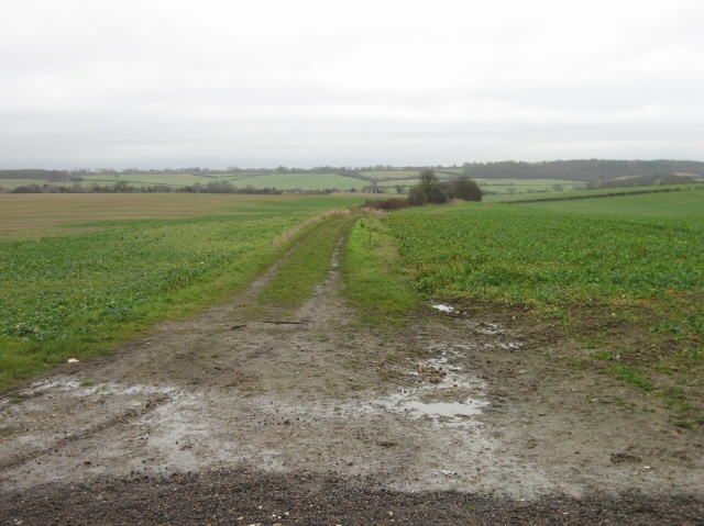
The woodland is crisscrossed with a network of well-maintained footpaths, allowing visitors to explore its beauty at their own pace. These paths lead to charming clearings and tranquil ponds, creating perfect spots for picnics or simply sitting and enjoying the peaceful ambiance.

Collens Leg Wood is managed by local conservation groups who work tirelessly to preserve its natural beauty and protect its flora and fauna. They organize educational events and guided walks, offering visitors the opportunity to learn more about the forest's ecosystem and its conservation efforts.

Overall, Collens Leg Wood is a hidden gem in Hertfordshire, offering a serene and enchanting environment for nature enthusiasts to immerse themselves in the beauty of the natural world.

If you have any feedback on the listing, please let us know in the comments section below.

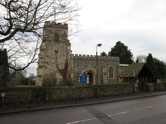
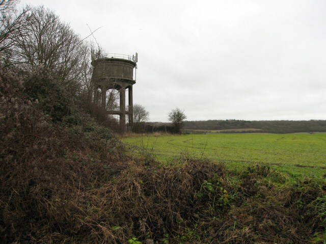
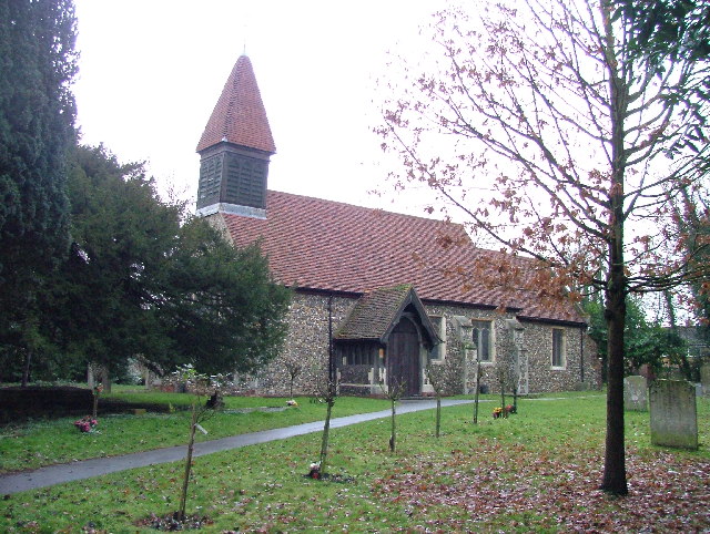
Collens Leg Wood Images

Images are sourced within 2km of 51.902537/-0.16605418 or Grid Reference TL2624. Thanks to Geograph Open Source API. All images are credited.

Hydean Way Shops Typical of local shops in Stevenage new town.  Above a parade of shops including a small supermarket, take away food outlet and Post Office there are maisonettes accessed from the rear.  To the right there are 2/3 bedroomed homes.
Hydean Way Shops
Typical of local shops in Stevenage new town. Above a parade of shops including a small supermarket, take away food outlet and Post Office there are maisonettes accessed from the rear. To the right there are 2/3 bedroomed homes.
South end of Fairlands Valley Park. This photograph was taken facing north into Fairlands Valley Park from the car park used for Stevenage Borough FC (see TL2422).  This park is also used for travelling fairs and circuses.
South end of Fairlands Valley Park.
This photograph was taken facing north into Fairlands Valley Park from the car park used for Stevenage Borough FC (see TL2422). This park is also used for travelling fairs and circuses.
Fairlands Valley Park This large lake is used by sailors and fishermen.  This photo is taken facing south.  To the rear there are two smaller lakes.  The park is very popular in the summer.
Fairlands Valley Park
This large lake is used by sailors and fishermen. This photo is taken facing south. To the rear there are two smaller lakes. The park is very popular in the summer.
Silam Rd. To the right are houses not untypical of Stevenage new town.  Looming over Silam Rd is one of a pair of high rise flats close to the town centre.
Silam Rd.
To the right are houses not untypical of Stevenage new town. Looming over Silam Rd is one of a pair of high rise flats close to the town centre.
Parishes Mead. Parishes mead is a newer development on the east side of Stevenage.  There is a mixture of private and social housing here.
Parishes Mead.
Parishes mead is a newer development on the east side of Stevenage. There is a mixture of private and social housing here.
Fortuna Close One of the more modern parts of Stevenage and with some more imaginative building - three storeys!
Fortuna Close
One of the more modern parts of Stevenage and with some more imaginative building - three storeys!
Ferrier Rd This could be any road in this area.  Plans seem to have been bought as a job lot.
Ferrier Rd
This could be any road in this area. Plans seem to have been bought as a job lot.
Telford Avenue. On the edge of TL2525..  I wasn't going any further into this estate.  I always get lost even though it's not that big by local standards.  This estate, in common with others in the area suffers from the increase in car ownership.  Parking is awkward, the roads not wide and the layout is twisting.
Telford Avenue.
On the edge of TL2525.. I wasn't going any further into this estate. I always get lost even though it's not that big by local standards. This estate, in common with others in the area suffers from the increase in car ownership. Parking is awkward, the roads not wide and the layout is twisting.
Ridlins Athletics Track This photo of the Ridlins Athletics track shows the west corner and the Bert Hill stand.  The back of the stand has space for community groups such as playgroups.
Ridlins Athletics Track
This photo of the Ridlins Athletics track shows the west corner and the Bert Hill stand. The back of the stand has space for community groups such as playgroups.
Football pitches These are to the north west of the running track.
Football pitches
These are to the north west of the running track.
St Mary's Church, Aston The church is built of flint with stone dressings on the nave and chancel and the roofs are covered with copper.
St Mary's Church, Aston
The church is built of flint with stone dressings on the nave and chancel and the roofs are covered with copper.
Aston Water Tower The Water Tower and surrounding countryside from the lane to Aston End
Aston Water Tower
The Water Tower and surrounding countryside from the lane to Aston End
The Crown, Aston End
Just Outside Stevenage On the Stevenage boundary, looking across TL2725 from Stevenage Road and you are in open country.
Just Outside Stevenage
On the Stevenage boundary, looking across TL2725 from Stevenage Road and you are in open country.
Trig point at Lonsdale School I swear that tree was not there when I took the photo.

This Trig point is in the playing field of a special needs school caring for 75 children between the ages of 2 and 19 from London, Bedfordshire and Hertfordshire.
Trig point at Lonsdale School
I swear that tree was not there when I took the photo. This Trig point is in the playing field of a special needs school caring for 75 children between the ages of 2 and 19 from London, Bedfordshire and Hertfordshire.
St Marys, Shephall St Mary's Shephall is a lovely little old church in the middle of a sprawl of 20th century buildings.
St Marys, Shephall
St Mary's Shephall is a lovely little old church in the middle of a sprawl of 20th century buildings.
Shephalbury Park Primary School. This small area of Stevenage is stuffed with schools of all sizes and ages.
Shephalbury Park Primary School.
This small area of Stevenage is stuffed with schools of all sizes and ages.
Grace Community Church. I'm not sure what one of these is and it is not quite where the OS say it is.  It's round the corner.
Grace Community Church.
I'm not sure what one of these is and it is not quite where the OS say it is. It's round the corner.
Show me another place!

Collens Leg Wood is located at Grid Ref: TL2624 (Lat: 51.902537, Lng: -0.16605418)

Administrative County: Hertfordshire

District: Stevenage

Police Authority: Hertfordshire

What 3 Words

///cure.newly.magically. Near Stevenage, Hertfordshire

Related Wikis

Marriotts School

Marriotts School is a secondary school in Stevenage, Hertfordshire, England. The school was rebuilt along with Lonsdale School (for special needs children...

The Nobel School

The Nobel School is a co-educational secondary school and sixth form located in Stevenage in the English county of Hertfordshire. == History == The Nobel...

Aston End

Aston End is a hamlet in Hertfordshire, England. It is in the civil parish of Aston. It features a pub and a butchers, as well as a few houses. == References... ==

Barnwell School

Barnwell School is a coeducational secondary school and sixth form that was established in 1959 and is situated in the south of Stevenage, Hertfordshire...

Shephall

Shephall (SHEP-all) is a neighbourhood of the new town of Stevenage in Hertfordshire. It was formerly a separate village and parish, being absorbed into...

The Heathcote School

The Heathcote School was an 11-18 comprehensive school in Stevenage, Hertfordshire. The school was founded in the 1950s. It was awarded Specialist Engineering...

Aston, Hertfordshire

Aston is a village and civil parish in the East Hertfordshire district of Hertfordshire, England. According to the 2001 census it had a population of...

Ridlins Mire

Ridlins Mire is a 1.6-hectare (4.0-acre) nature reserve managed by the Herts and Middlesex Wildlife Trust in Stevenage, Hertfordshire, England.This wetland...

Nearby Amenities

Located within 500m of 51.902537,-0.16605418
Traffic Calming: island
Lat/Long: 51.9015614/-0.1688201
Created By: osmeditor2
Lat/Long: 51.9011167/-0.1708767
Created By: osmeditor2
Lat/Long: 51.9009/-0.1716933
Created By: osmeditor2
Lat/Long: 51.9007133/-0.17224
Created By: osmeditor2
Lat/Long: 51.901255/-0.170235
Created By: osmeditor2
Lat/Long: 51.9034733/-0.1598169
Created By: osmeditor2
Lat/Long: 51.9041417/-0.1596388
Barrier: bollard
Bicycle: yes
Bollard: fixed
Foot: yes
Horse: yes
Lat/Long: 51.9016887/-0.1597949
Traffic Calming: island
Lat/Long: 51.9068308/-0.167265
Mini Roundabout
Direction: clockwise
Lat/Long: 51.9053334/-0.1662823
Crossing
Crossing: unmarked
Crossing Island: no
Kerb: lowered
Tactile Paving: no
Lat/Long: 51.902217/-0.1634882
Traffic Calming: island
Lat/Long: 51.9021331/-0.1644508
Crossing
Crossing: unmarked
Crossing Island: no
Lat/Long: 51.9020739/-0.1644165
Crossing
Crossing: unmarked
Crossing Island: no
Kerb: lowered
Tactile Paving: no
Lat/Long: 51.9016948/-0.167227
Bus Stop
Warwick Road
Bench: yes
Bin: yes
Bus: yes
Lit: yes
Naptan AtcoCode: 210021201620
Naptan Bearing: SE
Naptan CommonName: Warwick Road
Naptan Crossing: Siddons Road
Naptan Indicator: opp
Naptan Landmark: Siddons Road
Naptan NaptanCode: hrtgadgd
Naptan PlusbusZoneRef: STEVNGE
Naptan ShortCommonName: NA
Naptan Street: Chells Way
Naptan Verified: no
Public Transport: platform
Shelter: yes
Source: naptan_import
Tactile Paving: yes
Lat/Long: 51.9061312/-0.1664988
Bus Stop
The Squirrel PH
Bench: yes
Bin: yes
Bus: yes
Lit: yes
Local Ref: NR
Naptan AtcoCode: 210021201640
Naptan Bearing: SE
Naptan CommonName: The Squirrel PH
Naptan Crossing: Ferrier Road
Naptan Indicator: nr
Naptan Landmark: Ferrier Road
Naptan NaptanCode: hrtgadgj
Naptan PlusbusZoneRef: STEVNGE
Naptan ShortCommonName: NA
Naptan Street: Chells Way
Naptan Verified: no
Public Transport: platform
Shelter: yes
Source: naptan_import
Tactile Paving: yes
Lat/Long: 51.904227/-0.165486
Bus Stop
Marlboro Road
Bench: yes
Bin: yes
Bus: yes
Lit: yes
Local Ref: NR
Naptan AtcoCode: 210021201660
Naptan Bearing: SW
Naptan CommonName: Marlboro Road
Naptan Crossing: Great Collens Wood
Naptan Indicator: nr
Naptan Landmark: Great Collens Wood
Naptan NaptanCode: hrtgadgm
Naptan PlusbusZoneRef: STEVNGE
Naptan ShortCommonName: NA
Naptan Street: Six Hills Way
Naptan Verified: no
Public Transport: platform
Shelter: yes
Source: naptan_import
Tactile Paving: yes
Lat/Long: 51.9015662/-0.168429
Bus Stop
Marlboro Road
Bench: yes
Bin: no
Bus: yes
Lit: yes
Naptan AtcoCode: 210021203000
Naptan Bearing: NE
Naptan CommonName: Marlboro Road
Naptan Crossing: Collens Leg Wood
Naptan Indicator: opp
Naptan Landmark: Collens Leg Wood
Naptan NaptanCode: hrtdwmjp
Naptan PlusbusZoneRef: STEVNGE
Naptan ShortCommonName: NA
Naptan Street: Six Hills Way
Naptan Verified: no
Public Transport: platform
Shelter: yes
Source: naptan_import
Tactile Paving: yes
Lat/Long: 51.9018692/-0.1676753
Bus Stop
The Squirrel PH
Bench: yes
Bin: no
Bus: yes
Lit: yes
Naptan AtcoCode: 210021203020
Naptan Bearing: NW
Naptan CommonName: The Squirrel PH
Naptan Crossing: Pankhurst Crescent
Naptan Indicator: opp
Naptan Landmark: Pankhurst Crescent
Naptan NaptanCode: hrtdwmpa
Naptan PlusbusZoneRef: STEVNGE
Naptan ShortCommonName: NA
Naptan Street: Chells Way
Naptan Verified: no
Public Transport: platform
Shelter: yes
Source: naptan_import
Tactile Paving: yes
Lat/Long: 51.9042313/-0.165762
Mini Roundabout
Direction: clockwise
Lat/Long: 51.9056205/-0.1662825
Mini Roundabout
Direction: clockwise
Lat/Long: 51.9036922/-0.1650495
Crossing
Crossing: unmarked
Crossing Island: no
Kerb: lowered
Tactile Paving: no
Lat/Long: 51.9028891/-0.1644187
Mini Roundabout
Direction: clockwise
Lat/Long: 51.9039095/-0.1652858
Crossing
Button Operated: yes
Crossing: traffic_signals
Crossing Island: no
Tactile Paving: yes
Traffic Signals Sound: yes
Traffic Signals Vibration: yes
Lat/Long: 51.9045927/-0.165918
Pub
Squirrel Tavern
Lat/Long: 51.9045025/-0.1656058
Turning Circle
Lat/Long: 51.9006002/-0.1596279
Barrier: cycle_barrier
Cycle Barrier: triple
Cycle Barrier Installation: fixed
Lat/Long: 51.9011951/-0.1609493
Post Box
Check Date: 2021-01-23
Collection Times: Mo-Fr 18:30; Sa 12:30
Post Box Type: pillar
Ref: SG2 340
Lat/Long: 51.904644/-0.16583
Post Box
Collection Times: Mo-Fr 09:00; Sa 07:00
Post Box Type: lamp
Ref: SG2 339
Royal Cypher: EIIR
Royal Cypher Wikidata: Q33102113
Lat/Long: 51.902641/-0.168357
Post Box
Check Date: 2021-02-06
Collection Times: Mo-Fr 09:00; Sa 07:00
Post Box Type: pillar
Ref: SG2 374
Royal Cypher: EIIR
Royal Cypher Wikidata: Q33102113
Lat/Long: 51.901382/-0.16704
Barrier: bollard
Lat/Long: 51.8986719/-0.1666218
Barrier: bollard
Lat/Long: 51.8986732/-0.1666229
Barrier: cycle_barrier
Cycle Barrier: double
Cycle Barrier Installation: fixed
Lat/Long: 51.901484/-0.1612525
Crossing
Crossing: unmarked
Crossing Island: yes
Tactile Paving: yes
Lat/Long: 51.901722/-0.1680726
Parking
Lat/Long: 51.9024943/-0.1699335
Waste Basket
Lat/Long: 51.9010468/-0.171487
Waste Basket
Lat/Long: 51.9015806/-0.1683328
Waste Basket
Lat/Long: 51.9017163/-0.1673001
Waste Basket
Lat/Long: 51.8997456/-0.1606583
Waste Basket
Lat/Long: 51.9061033/-0.1664572
Waste Basket
Lat/Long: 51.9041829/-0.1653991
Bench
Backrest: yes
Lat/Long: 51.9063913/-0.1693319
Waste Basket
Lat/Long: 51.905587/-0.1700735
Grit Bin
Lat/Long: 51.9040522/-0.169301
Kerb: raised
Lat/Long: 51.9027347/-0.1685533
Traffic Calming: island
Lat/Long: 51.9023786/-0.1639941
Traffic Calming: island
Lat/Long: 51.9026533/-0.1639564
Waste Basket
Lat/Long: 51.9020307/-0.1671083
Traffic Calming: island
Lat/Long: 51.9019356/-0.1670493
Grit Bin
Lat/Long: 51.9028706/-0.1679117
Grit Bin
Lat/Long: 51.9039694/-0.1642317
Barrier: cycle_barrier
Bicycle: yes
Foot: yes
Horse: yes
Lat/Long: 51.8984364/-0.1631716
Waste Basket
Lat/Long: 51.8988281/-0.1626164
Grit Bin
Lat/Long: 51.9032896/-0.1636769
Waste Basket
Lat/Long: 51.9013056/-0.1609607
Waste Basket
Lat/Long: 51.8994974/-0.1618059
Waste Basket
Lat/Long: 51.9016934/-0.1605509
Waste Basket
Lat/Long: 51.902315/-0.1635198
Waste Basket
Lat/Long: 51.9034263/-0.1646542
Bench
Backrest: yes
Lat/Long: 51.905736/-0.1614559
Waste Basket
Lat/Long: 51.904898/-0.1610502
Waste Basket
Lat/Long: 51.9056963/-0.1614455
The data included in this document is from www.openstreetmap.org. The data is made available under ODbL.

Have you been to Collens Leg Wood?

Leave your review of Collens Leg Wood below (or comments, questions and feedback).