The Furze Field

Wood, Forest in Hertfordshire Welwyn Hatfield

England

The Furze Field

Hertford Road, Hatfield
Hertford Road, Hatfield Credit: David Howard

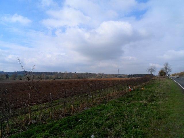
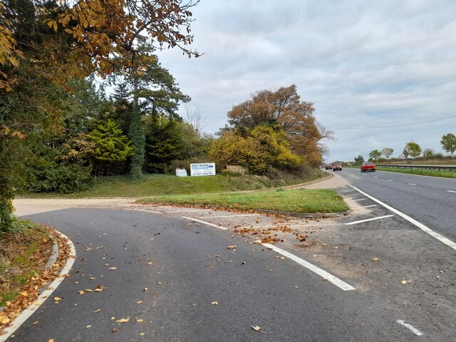
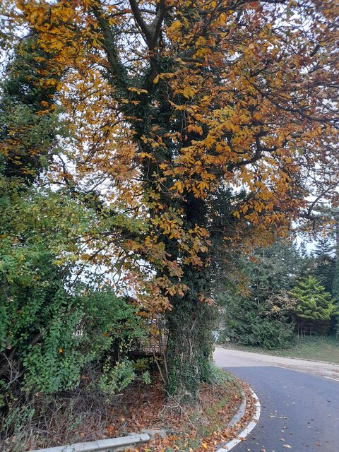
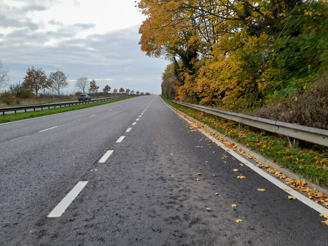
The Furze Field, located in Hertfordshire, is a picturesque wood or forest that offers a captivating natural environment. Spanning approximately 20 acres, it is characterized by its dense foliage, diverse flora, and tranquil atmosphere. The wood is predominantly composed of various species of trees, including oak, beech, birch, and pine, creating a lush and vibrant landscape.

The Furze Field is known for its rich biodiversity, providing a habitat for a wide array of wildlife. Visitors can often spot various bird species, such as woodpeckers and owls, as well as small mammals like rabbits and squirrels. The wood is also home to a diverse range of plant life, with bluebells, ferns, and mosses adding bursts of color and texture to the forest floor.

Several winding trails meander through The Furze Field, offering visitors the opportunity to explore the wood's hidden gems. These pathways guide hikers and nature enthusiasts through the wood, leading them past ancient trees, babbling brooks, and enchanting clearings.

The Furze Field is a popular destination for outdoor activities, attracting locals and tourists alike. It provides an idyllic setting for leisurely walks, picnics, and nature photography. Additionally, the wood serves as a haven for those seeking peace and tranquility, offering a serene escape from the hustle and bustle of everyday life.

Overall, The Furze Field is a stunning wood in Hertfordshire, providing a captivating natural environment for visitors to explore, relax, and connect with nature.

If you have any feedback on the listing, please let us know in the comments section below.

The Furze Field Images

Images are sourced within 2km of 51.762258/-0.18262718 or Grid Reference TL2508. Thanks to Geograph Open Source API. All images are credited.

Hertford Road, Hatfield
Path towards Mill Green Route of the (Welwyn Garden City) WGC Centenary 2020. A 20.20 km circular walk around the Outskirts of the city.
Path towards Mill Green
Route of the (Welwyn Garden City) WGC Centenary 2020. A 20.20 km circular walk around the Outskirts of the city.
Path towards Mill Green Route of the (Welwyn Garden City) WGC Centenary 2020. A 20.20 km circular walk around the Outskirts of the city.
Path towards Mill Green
Route of the (Welwyn Garden City) WGC Centenary 2020. A 20.20 km circular walk around the Outskirts of the city.
The former Green Man public house at Mill Green Route of the (Welwyn Garden City) WGC Centenary 2020. A 20.20 km circular walk around the Outskirts of the city.
The former Green Man public house at Mill Green
Route of the (Welwyn Garden City) WGC Centenary 2020. A 20.20 km circular walk around the Outskirts of the city.
Mill Green Lane, Mill Green Route of the (Welwyn Garden City) WGC Centenary 2020. A 20.20 km circular walk around the Outskirts of the city.
Mill Green Lane, Mill Green
Route of the (Welwyn Garden City) WGC Centenary 2020. A 20.20 km circular walk around the Outskirts of the city.
Postbox on Mill Green Lane, Mill Green Route of the (Welwyn Garden City) WGC Centenary 2020. A 20.20 km circular walk around the Outskirts of the city.
Postbox on Mill Green Lane, Mill Green
Route of the (Welwyn Garden City) WGC Centenary 2020. A 20.20 km circular walk around the Outskirts of the city.
Bush Hall Lane, Mill Green
Bedwell Park Ltd recycling at Burnside
Farmland alongside A414
Gypsy Lane, Hatfield Another path with a name, leading into the housing areas of Hatfield
Gypsy Lane, Hatfield
Another path with a name, leading into the housing areas of Hatfield
Hertford Road, Hatfield
Estate entrance on Hertford Road
Chestnut tree on Hertford Road
Hertford Road south of Welwyn Garden City
Path on The Commons Route of the (Welwyn Garden City) WGC Centenary 2020. A 20.20 km circular walk around the Outskirts of the city.
Path on The Commons
Route of the (Welwyn Garden City) WGC Centenary 2020. A 20.20 km circular walk around the Outskirts of the city.
Path towards Mill Green Route of the (Welwyn Garden City) WGC Centenary 2020. A 20.20 km circular walk around the Outskirts of the city.
Path towards Mill Green
Route of the (Welwyn Garden City) WGC Centenary 2020. A 20.20 km circular walk around the Outskirts of the city.
Preserved Green Bus in Essendon Taken on the B158 High Road, this photo shows a preserved London Transport country bus RF539 (NLE 539) on a short tour from Potters Bar Bus Garage, which was having an Open Day. The vehicle is an AEC Regal IV with Metro-Cammell 39-seater bodywork dating from the early 1950s. Essendon used to be served by routes 350/350A which were operated by London Transport green buses from Hertford bus garage in the 1960s, then by London Country Bus Services in the 1970s. The village is now served by route 341 operated by UNO on weekdays. The Rose & Crown pub can be seen behind the bus.
Preserved Green Bus in Essendon
Taken on the B158 High Road, this photo shows a preserved London Transport country bus RF539 (NLE 539) on a short tour from Potters Bar Bus Garage, which was having an Open Day. The vehicle is an AEC Regal IV with Metro-Cammell 39-seater bodywork dating from the early 1950s. Essendon used to be served by routes 350/350A which were operated by London Transport green buses from Hertford bus garage in the 1960s, then by London Country Bus Services in the 1970s. The village is now served by route 341 operated by UNO on weekdays. The Rose & Crown pub can be seen behind the bus.
Battle Proms, Hatfield House, Hertfordshire Part of the audience at the beginning of the Battle Proms.
Battle Proms, Hatfield House, Hertfordshire
Part of the audience at the beginning of the Battle Proms.
Show me another place!

The Furze Field is located at Grid Ref: TL2508 (Lat: 51.762258, Lng: -0.18262718)

Administrative County: Hertfordshire

District: Welwyn Hatfield

Police Authority: Hertfordshire

What 3 Words

///state.buck.resist. Near Hatfield, Hertfordshire

Related Wikis

Welwyn Hatfield

Welwyn Hatfield is a local government district with borough status in the county of Hertfordshire, England. Its council is based in Welwyn Garden City...

Welwyn Hatfield (UK Parliament constituency)

Welwyn Hatfield is a constituency in Hertfordshire represented in the House of Commons of the UK Parliament since 2005 by Grant Shapps, a Conservative...

The Troopie

The Trooper, also popularly referred as The Troopie, is a Rhodesian statue and war memorial. It is located in the grounds of Hatfield House, home of the...

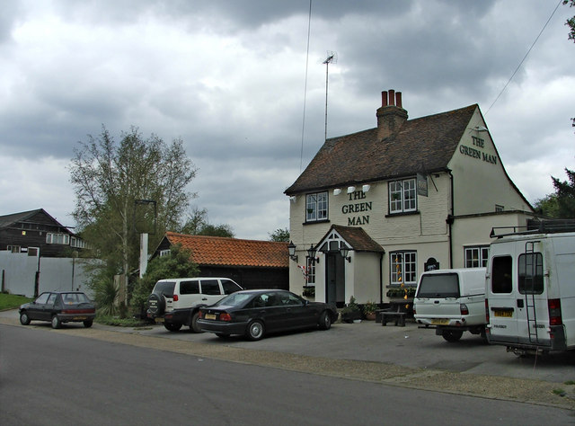
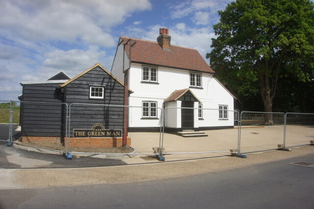
The Green Man, Hatfield

The Green Man is a grade II listed public house in Mill Green Lane, Hatfield, Hertfordshire, England. The building is based on a seventeenth-century timber...

Hatfield House

Hatfield House is a Grade I listed country house set in a large park, the Great Park, on the eastern side of the town of Hatfield, Hertfordshire, England...
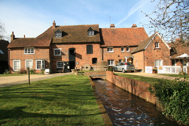
Mill Green Museum

Mill Green Museum is a working watermill in Hatfield, Hertfordshire, England. The building is listed grade II* ("The Old Mill House Museum and Mill Green...

Essendon, Hertfordshire

Essendon is a village and civil parish in Hertfordshire 6 miles (10 km), south-west of Hertford. The village is on the B158 road 330 feet (100 m) above...

St Etheldreda's Church, Hatfield

St Etheldreda's is the Anglican parish church of Old Hatfield, Hertfordshire in the United Kingdom. Parts of the building are 13th century and there...

Nearby Amenities

Located within 500m of 51.762258,-0.18262718
Power: tower
Lat/Long: 51.7630538/-0.1786674
Power: tower
Lat/Long: 51.765431/-0.1788605
Power: tower
Lat/Long: 51.7603313/-0.1784206
Barrier: entrance
Lat/Long: 51.7620465/-0.1795237
Power: pole
Lat/Long: 51.7648221/-0.1855606
Power: pole
Lat/Long: 51.7651616/-0.1853889
Power: pole
Lat/Long: 51.7657866/-0.1849276
Power: pole
Lat/Long: 51.7665086/-0.1844636
Power: pole
Lat/Long: 51.7661966/-0.1802579
Power: pole
Lat/Long: 51.7656554/-0.1790804
Power: pole
Lat/Long: 51.7650861/-0.1778251
Power: pole
Lat/Long: 51.7645316/-0.1765752
The data included in this document is from www.openstreetmap.org. The data is made available under ODbL.

Have you been to The Furze Field?

Leave your review of The Furze Field below (or comments, questions and feedback).