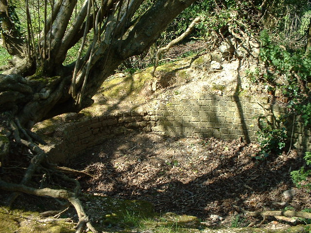
Magpie Wood

Wood, Forest in Surrey Reigate and Banstead

England

Magpie Wood

Emmanuel  Church, Sidlow Bridge Emmanuel Church designed by Henry Clutton and built in 1861. It was dedicated in 1892 and stands near the bridge over the Mole.
Emmanuel Church, Sidlow Bridge Credit: John Barrett

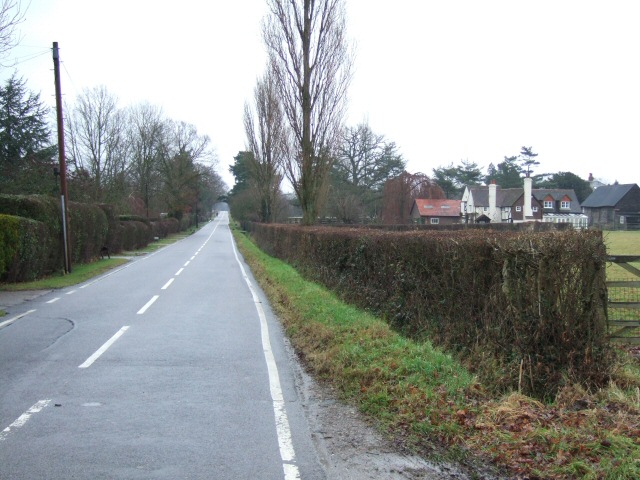
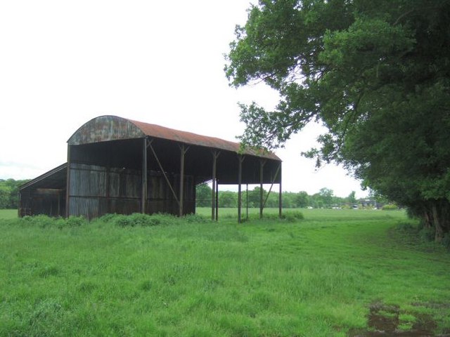
Magpie Wood is a picturesque forest located in Surrey, England. It is situated in the southeastern region of the county, near the town of Guildford. Covering an area of approximately 100 hectares, Magpie Wood is a haven for nature lovers and outdoor enthusiasts.

The wood is primarily composed of mixed deciduous trees, including oak, beech, and birch. These majestic trees provide a beautiful canopy that filters sunlight and creates a serene atmosphere within the forest. The woodland floor is adorned with an array of wildflowers and ferns, adding to the natural beauty of the area.

Magpie Wood is known for its diverse wildlife population. Birdwatchers flock to the area to catch glimpses of various avian species, including magpies (from which the wood gets its name), woodpeckers, and owls. The forest is also home to several mammals, such as foxes, deer, and squirrels, which can often be spotted exploring their natural habitat.

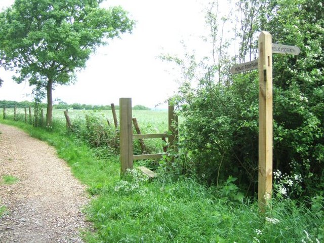
The wood offers a number of walking trails and paths, allowing visitors to explore its enchanting surroundings. These trails vary in difficulty, catering to both casual strollers and more avid hikers. Along the way, visitors can enjoy the peaceful ambiance, listen to the melodious sounds of birdsong, and perhaps even spot some of the woodland creatures.

Magpie Wood is a popular destination for both locals and tourists seeking a tranquil escape from the bustling city life. Its natural beauty and diverse wildlife make it an ideal location for those seeking solace in nature or wanting to engage in outdoor activities.

If you have any feedback on the listing, please let us know in the comments section below.
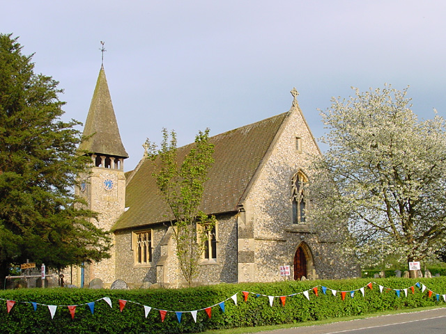
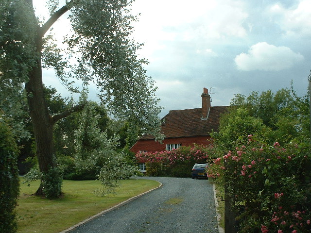
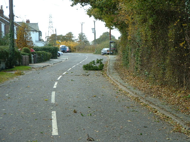
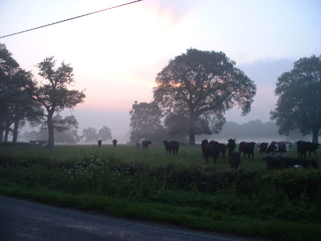
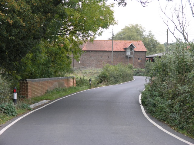
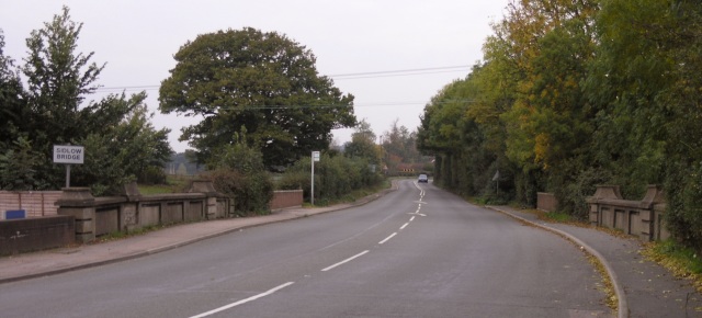
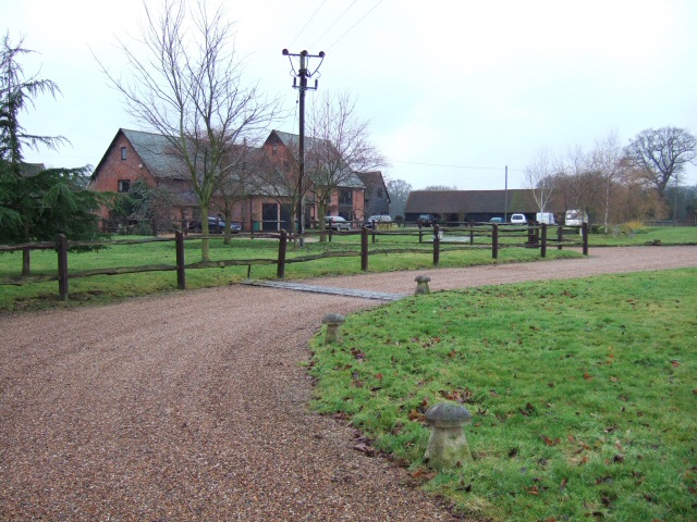
Magpie Wood Images

Images are sourced within 2km of 51.197878/-0.2093902 or Grid Reference TQ2545. Thanks to Geograph Open Source API. All images are credited.

Emmanuel  Church, Sidlow Bridge Emmanuel Church designed by Henry Clutton and built in 1861. It was dedicated in 1892 and stands near the bridge over the Mole.
Emmanuel Church, Sidlow Bridge
Emmanuel Church designed by Henry Clutton and built in 1861. It was dedicated in 1892 and stands near the bridge over the Mole.
Signpost at the junction of Collendean Lane and Horsehill
Plastic wrapped straw bales in a field adjacent to Collendean Lane
Collendean Farm
Collendean Farm
Sunset over woodland to the North-West of Collendean Lane * accepted as a supplemental image for use as an example in the guide.
Sunset over woodland to the North-West of Collendean Lane
* accepted as a supplemental image for use as an example in the guide.
Irons Bottom following a storm
Sunrise at Irons Bottom Just before dawn - during a partial solar eclipse
Sunrise at Irons Bottom
Just before dawn - during a partial solar eclipse
Cornfield taken from public footpath at Nutley Dean Farm
Remains of a Lime Kiln near Leigh
Bridge over Salfords Stream The road bridge over Salfords Stream.  Some buildings belonging to Lonesome Farm can be seen in the background and a small weir was observed through the trees to the right of the picture.
Bridge over Salfords Stream
The road bridge over Salfords Stream. Some buildings belonging to Lonesome Farm can be seen in the background and a small weir was observed through the trees to the right of the picture.
Sidlow Bridge Sidlow Bridge in Sidlow, where the A217 crosses the River Mole.
Sidlow Bridge
Sidlow Bridge in Sidlow, where the A217 crosses the River Mole.
Hartswood Manor Now a collection of private houses.
Hartswood Manor
Now a collection of private houses.
Deanoak Lane Property on the right is <a href="https://www.geograph.org.uk/photo/1854443">TQ2345 : Grove Farm House</a>.
Deanoak Lane
Property on the right is TQ2345 : Grove Farm House.
Fields just south of Reigate This picture was taken on Reigate Road which just clips the square to its west side.  The square is mostly fields intersected by the River Mole and a line of pylons.
Fields just south of Reigate
This picture was taken on Reigate Road which just clips the square to its west side. The square is mostly fields intersected by the River Mole and a line of pylons.
Footbridge over River Mole This is a small, well maintained footbridge over the river mole in rural countryside.  The supports suggest that a wider bridge once traversed the river here, something that is confirmed by older maps where a track once led along this route.
Footbridge over River Mole
This is a small, well maintained footbridge over the river mole in rural countryside. The supports suggest that a wider bridge once traversed the river here, something that is confirmed by older maps where a track once led along this route.
Derelict car on river bend A derelict car lies on the bend of the River Mole.
Derelict car on river bend
A derelict car lies on the bend of the River Mole.
Isolated Barn Magpie Wood is on the right; the building in the distance is Wolvers
Isolated Barn
Magpie Wood is on the right; the building in the distance is Wolvers
Footpath Crossing On the way from the A217 to Magpie Wood and Wolvers.
Footpath Crossing
On the way from the A217 to Magpie Wood and Wolvers.
Show me another place!

Magpie Wood is located at Grid Ref: TQ2545 (Lat: 51.197878, Lng: -0.2093902)

Administrative County: Surrey

District: Reigate and Banstead

Police Authority: Surrey

What 3 Words

///vibrate.looks.medium. Near Salfords, Surrey

Nearby Locations

Magpie Wood

Related Wikis

Sidlow

Sidlow is a mainly rural, lightly populated village in the parish of Salfords and Sidlow, in the south of the borough of Reigate and Banstead in Surrey...

Reigate Hundred

Reigate was a hundred in what is now Surrey, England. It was geographically consonant with the southern two thirds of Borough of Reigate and Banstead together...

Salfords and Sidlow

Salfords and Sidlow is a civil parish in the Reigate and Banstead borough of Surrey, England. It has a population of 3,069. The parish includes the villages...

Moon Hall School

Moon Hall School, since 1952 an independent co-educational preparatory school at Leigh, near Reigate in Surrey, is currently, as of 2021, a special school...

South Park F.C.

South Park Reigate Football Club are an English football club based in Reigate, Surrey. The club is affiliated to the Surrey County Football Association...

Salfords

Salfords SAL-fudz) is a village in the borough of Reigate and Banstead in Surrey, England. It lies approximately 3 miles (4.8 km) south of Redhill on...

Horley Town F.C.

Horley Town Football Club is a football club based in Horley, Surrey, England. They are currently members of the Combined Counties League Premier Division...

Reigate School

Reigate School is an 11–16 mixed secondary school with academy status in Reigate, Surrey, England. It has been a part of the Greensand Multi-Academy Trust...

Nearby Amenities

Located within 500m of 51.197878,-0.2093902
Power: tower
Lat/Long: 51.1994525/-0.2153931
Power: tower
Lat/Long: 51.1978191/-0.2066942
Power: tower
Lat/Long: 51.1990723/-0.2103764
Power: tower
Lat/Long: 51.1968444/-0.2039623
Barrier: stile
Lat/Long: 51.1992923/-0.2035876
Bus Stop
Deanoak Lane
Bus: yes
Naptan AtcoCode: 40004409020A
Naptan Bearing: N
Naptan CommonName: Deanoak Lane
Naptan Indicator: Just Before
Naptan Landmark: Dean Oak Lane
Naptan NaptanCode: surdgmpa
Naptan Street: Irons Bottom Road
Naptan Verified: no
Public Transport: platform
Source: naptan_import
Lat/Long: 51.1974762/-0.2161021
Bus Stop
Deanoak Lane
Bus: yes
Naptan AtcoCode: 40004409020B
Naptan Bearing: S
Naptan BusStopType: CUS
Naptan CommonName: Deanoak Lane
Naptan Indicator: Just after
Naptan Landmark: Deanoak Lane
Naptan NaptanCode: surgpgjd
Naptan Street: Irons Bottom Road
Naptan Verified: no
Public Transport: platform
Shelter: no
Source: naptan_import
Lat/Long: 51.1973979/-0.2159922
Power: pole
Lat/Long: 51.2015632/-0.212872
Power: pole
Lat/Long: 51.2010657/-0.2117884
Power: pole
Source: gps;Bing
Lat/Long: 51.1998724/-0.2092886
Power: pole
Lat/Long: 51.1988405/-0.206837
Power: pole
Lat/Long: 51.1983766/-0.2055335
Power: pole
Lat/Long: 51.1978484/-0.2044093
Power: pole
Lat/Long: 51.1973379/-0.2032161
Barrier: kissing_gate
Bicycle: no
Foot: yes
Lat/Long: 51.1952175/-0.2118554
Barrier: stile
Lat/Long: 51.1973673/-0.2077491
Barrier: kissing_gate
Foot: yes
Lat/Long: 51.1941941/-0.2123356
Barrier: stile
Lat/Long: 51.1989458/-0.2042177
Power: pole
Lat/Long: 51.2006535/-0.2109211
Power: pole
Source: gps
Lat/Long: 51.1982948/-0.2053466
Power: pole
Source: gps;Bing
Lat/Long: 51.199473/-0.211664
Power: pole
Source: gps;Bing
Lat/Long: 51.1999124/-0.2091721
Power: pole
Source: gps;Bing
Lat/Long: 51.2011713/-0.2054934
Power: pole
Source: visual estimate
Lat/Long: 51.2007582/-0.2067006
Wolvers
Place: isolated_dwelling
Lat/Long: 51.1950575/-0.2134994
Wolvers Home Farm
Place: farm
Lat/Long: 51.1938921/-0.211604
The data included in this document is from www.openstreetmap.org. The data is made available under ODbL.

Have you been to Magpie Wood?

Leave your review of Magpie Wood below (or comments, questions and feedback).