Duckdell Plantation

Wood, Forest in Hertfordshire Stevenage

England

Duckdell Plantation

Edge of Stevenage Taken from TL 237 268 looking towards Lister Hospital in the distance
Edge of Stevenage Credit: Paul Dixon

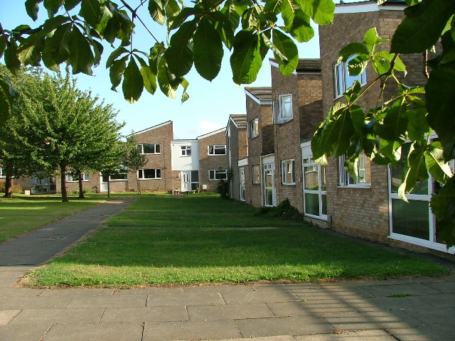
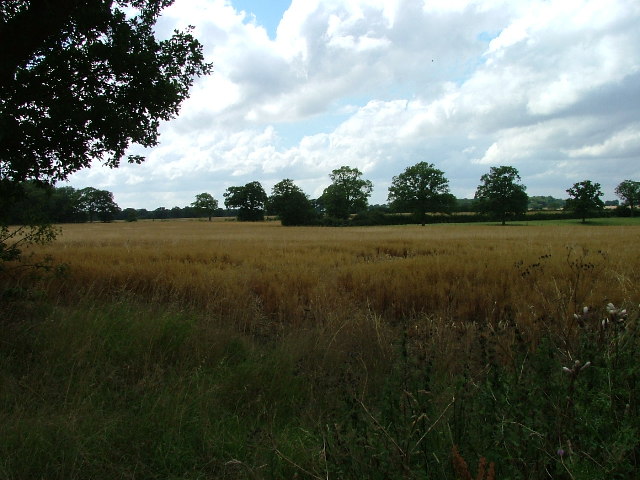
Duckdell Plantation is a picturesque woodland located in Hertfordshire, England. Situated in the county's rural landscape, it covers an area of approximately 200 acres and is known for its natural beauty and diverse ecosystem. The plantation is situated near the village of Wood, just a few miles from the town of Hertford.

The woodland is predominantly made up of deciduous trees, including oak, beech, and ash, which create a vibrant and colorful canopy during the autumn months. The forest floor is adorned with a variety of wildflowers, ferns, and mosses, adding to the enchanting atmosphere of the plantation.

Duckdell Plantation is home to a diverse range of wildlife, providing a habitat for numerous species. Visitors may have the opportunity to spot deer, foxes, badgers, and a variety of bird species, including woodpeckers and owls.

The plantation also offers several walking trails and picnic areas, making it a popular destination for nature enthusiasts and families seeking a peaceful retreat. The trails wind through the woodland, providing stunning views of the surrounding countryside and opportunities for quiet contemplation.

Duckdell Plantation is managed by the local forestry commission, ensuring the preservation and maintenance of its natural resources. The commission periodically conducts controlled burns and tree thinning to maintain the health and vitality of the woodland.

Overall, Duckdell Plantation is a hidden gem in Hertfordshire, offering visitors a chance to immerse themselves in the tranquility of nature and experience the beauty of a thriving woodland ecosystem.

If you have any feedback on the listing, please let us know in the comments section below.

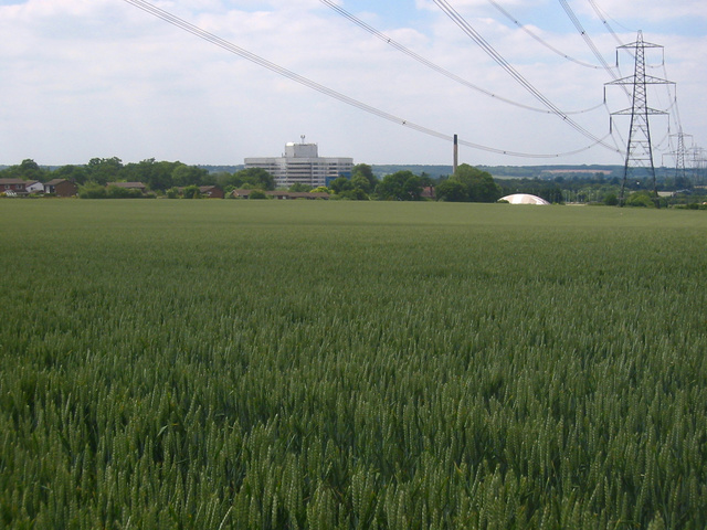
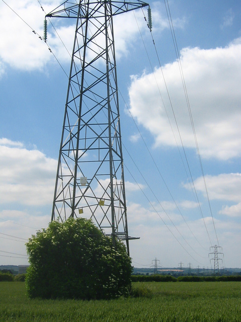
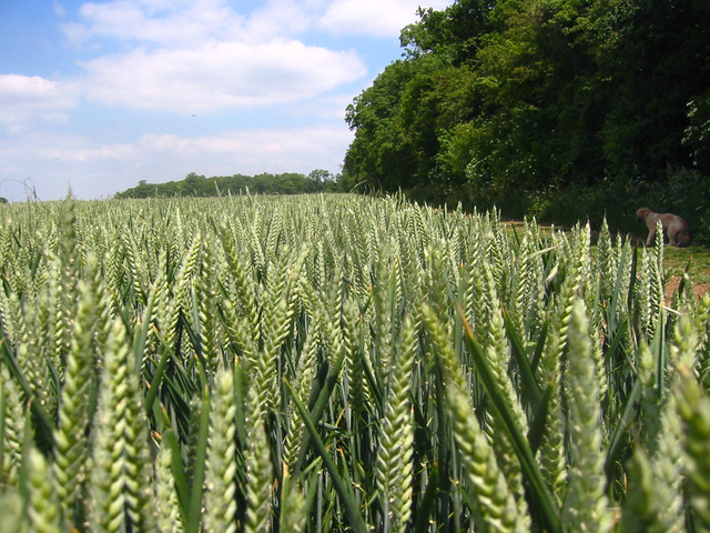
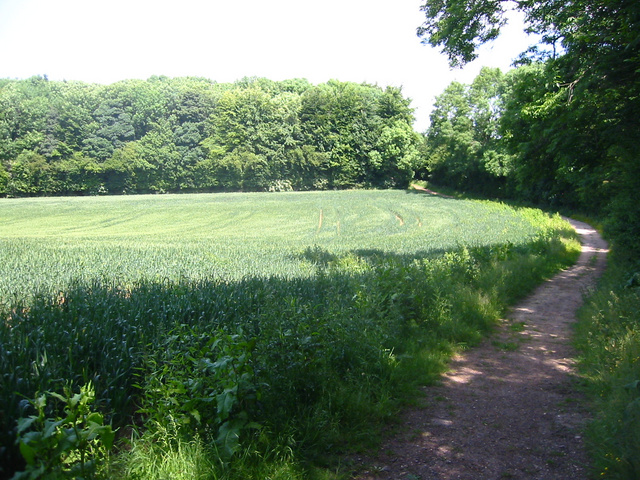
Duckdell Plantation Images

Images are sourced within 2km of 51.927923/-0.18184746 or Grid Reference TL2527. Thanks to Geograph Open Source API. All images are credited.

Edge of Stevenage Taken from TL 237 268 looking towards Lister Hospital in the distance
Edge of Stevenage
Taken from TL 237 268 looking towards Lister Hospital in the distance
Graveley Pylons Taken from TL 239 270 between Graveley and Stevenage, this line of pylons is running towards Hitchin, although the one in the foreground seems to morphing into a tree!
Graveley Pylons
Taken from TL 239 270 between Graveley and Stevenage, this line of pylons is running towards Hitchin, although the one in the foreground seems to morphing into a tree!
Ten Acre Plantation, Graveley Taken from  TL 241 275 looking NE, you can sometimes see deer hopping through the wheat!
Ten Acre Plantation, Graveley
Taken from TL 241 275 looking NE, you can sometimes see deer hopping through the wheat!
Stonesley and Harbourclose Woods, near Graveley Stonesley wood is in the distance, with Harbourclose Wood to the right
Stonesley and Harbourclose Woods, near Graveley
Stonesley wood is in the distance, with Harbourclose Wood to the right
Mildmay Road. These houses were built in a variety of styles.  These are not untypical but some of the architectural styles bring their own maintenance problems.
Mildmay Road.
These houses were built in a variety of styles. These are not untypical but some of the architectural styles bring their own maintenance problems.
Hampson Park / Pin Green Water Tower. Although this water tower is right on the edge of this square I have used it because it dominates the locality.  The large flat construction on the left, behind the fence, is a covered reservoir.  The tower is now bristling with aerials of all sorts.
Hampson Park / Pin Green Water Tower.
Although this water tower is right on the edge of this square I have used it because it dominates the locality. The large flat construction on the left, behind the fence, is a covered reservoir. The tower is now bristling with aerials of all sorts.
Mastercare warehousing Although this photograph is actually taken (just) from neighbouring TL2526, this warehouse is typical of this industrial estate.  Not all are grey and red.  Some are grey and another colour!
Mastercare warehousing
Although this photograph is actually taken (just) from neighbouring TL2526, this warehouse is typical of this industrial estate. Not all are grey and red. Some are grey and another colour!
Weston Rd Cemetery Although Weston Rd Cemetery takes up a relatively small portion of this square, Stevenage has lots and lots of houses but only two cemeteries.
Weston Rd Cemetery
Although Weston Rd Cemetery takes up a relatively small portion of this square, Stevenage has lots and lots of houses but only two cemeteries.
Great Ashby Estate. This development started about three years ago and is still being built.  The empty space to the right will be built on sooner or later.  The pylons are of course part of the National Grid.  Why on earth are we building houses under these lines?
Great Ashby Estate.
This development started about three years ago and is still being built. The empty space to the right will be built on sooner or later. The pylons are of course part of the National Grid. Why on earth are we building houses under these lines?
Telford Avenue. On the edge of TL2525..  I wasn't going any further into this estate.  I always get lost even though it's not that big by local standards.  This estate, in common with others in the area suffers from the increase in car ownership.  Parking is awkward, the roads not wide and the layout is twisting.
Telford Avenue.
On the edge of TL2525.. I wasn't going any further into this estate. I always get lost even though it's not that big by local standards. This estate, in common with others in the area suffers from the increase in car ownership. Parking is awkward, the roads not wide and the layout is twisting.
Fields opposite Tile Kiln Farm Typical farmland in this area.
Fields opposite Tile Kiln Farm
Typical farmland in this area.
Trig point at Lonsdale School I swear that tree was not there when I took the photo.

This Trig point is in the playing field of a special needs school caring for 75 children between the ages of 2 and 19 from London, Bedfordshire and Hertfordshire.
Trig point at Lonsdale School
I swear that tree was not there when I took the photo. This Trig point is in the playing field of a special needs school caring for 75 children between the ages of 2 and 19 from London, Bedfordshire and Hertfordshire.
The Bury. There are prominent "Private" signs.  The best photo seems to be "over the hedge".
The Bury.
There are prominent "Private" signs. The best photo seems to be "over the hedge".
St Nicholas' Church, Stevenage At the rear of the church yard there is a memorial to EM Forster.
St Nicholas' Church, Stevenage
At the rear of the church yard there is a memorial to EM Forster.
Lytch Gate, St Nicholas' Church Stevenage. This solid structure leads straight onto a muddy path.  (At least after it has been raining.).
Lytch Gate, St Nicholas' Church Stevenage.
This solid structure leads straight onto a muddy path. (At least after it has been raining.).
Moss Bury Primary School and Nursery Taken from a bridge over a part of Stevenage's excellent network of cycleways.  All of the tarmac between the school and the photographer is cycleway.  Road is over on the top left of this photo.
Moss Bury Primary School and Nursery
Taken from a bridge over a part of Stevenage's excellent network of cycleways. All of the tarmac between the school and the photographer is cycleway. Road is over on the top left of this photo.
Footpath across field. The photo "Edge of Stevenage" for this square would have been taken from just beyond the first pylon.
Footpath across field.
The photo "Edge of Stevenage" for this square would have been taken from just beyond the first pylon.
Footpath crossroads. Just here, helpfully labelled with local destinations.
Footpath crossroads.
Just here, helpfully labelled with local destinations.
Show me another place!

Duckdell Plantation is located at Grid Ref: TL2527 (Lat: 51.927923, Lng: -0.18184746)

Administrative County: Hertfordshire

District: Stevenage

Police Authority: Hertfordshire

What 3 Words

///buddy.twice.skins. Near Stevenage, Hertfordshire

Related Wikis

Rooks Nest House

Rooks Nest House is a house on Weston Road, Stevenage, Hertfordshire. It was the childhood home of the author E. M. Forster (1879–1970) who described it...

Great Ashby

Great Ashby is a civil parish in Stevenage in the North Hertfordshire district, in the county of Hertfordshire, England. The name Great Ashby was coined...

The Traveller Movement

The Traveller Movement (TM) is a charity based in the United Kingdom that supports the Gypsy, Roma and Traveller (GRT) community and challenge discrimination...

St Nicholas' Church, Stevenage

St Nicholas' Church is an Anglican parish church in Stevenage, a town in Hertfordshire, England. It occupies a hilltop site above Old Stevenage. It is...

Pryor's Wood

Pryor's Wood is an 8.7-hectare (21-acre) nature reserve in Great Ashby, near Stevenage in Hertfordshire. It was formerly managed by the Herts and Middlesex...

Barclay Academy

Barclay Academy is a secondary school and sixth form located in Stevenage, Hertfordshire, England. The current head teacher is Dr. Matthew Laban. Opening...

The Nobel School

The Nobel School is a co-educational secondary school and sixth form located in Stevenage in the English county of Hertfordshire. == History == The Nobel...

Graveley, Hertfordshire

Graveley is a village and civil parish about four miles east of Hitchin and two miles north of Stevenage in Hertfordshire, England. The population of the...

Nearby Amenities

Located within 500m of 51.927923,-0.18184746
Traffic Calming: island
Lat/Long: 51.9272229/-0.1858248
Traffic Calming: island
Lat/Long: 51.9293375/-0.1829762
Crossing
Crossing: unmarked
Crossing Island: no
Tactile Paving: yes
Traffic Calming: table
Lat/Long: 51.9260121/-0.179278
Barrier: bollard
Bollard: removable
Lat/Long: 51.931666/-0.1802877
Power: tower
Ref: 4TB 59
Source: GPS Survey
Source Ref: interpolation
Lat/Long: 51.9310353/-0.1778421
Bus Stop
Canterbury Way
Bench: yes
Bin: yes
Lit: yes
Naptan AtcoCode: 210021202720
Naptan Bearing: W
Naptan CommonName: Durham Road
Naptan Crossing: Durham Road
Naptan Indicator: W-bound
Naptan Landmark: Durham Road
Naptan NaptanCode: hrtdwpga
Naptan PlusbusZoneRef: STEVNGE
Naptan ShortCommonName: NA
Naptan Street: Canterbury Way
Shelter: yes
Source: naptan_import
Tactile Paving: yes
Lat/Long: 51.9240904/-0.1785183
Crossing
Crossing: unmarked
Crossing Island: no
Kerb: lowered
Tactile Paving: no
Lat/Long: 51.9273098/-0.1754934
Bus Stop
Canterbury Park
Bench: no
Bin: no
Bus: yes
Lit: yes
Local Ref: NR
Naptan AtcoCode: 210021201945
Naptan Bearing: N
Naptan CommonName: Canterbury Park
Naptan Crossing: Recreation Ground
Naptan Indicator: nr
Naptan Landmark: Recreation Ground
Naptan NaptanCode: hrtdwtmw
Naptan PlusbusZoneRef: STEVNGE
Naptan ShortCommonName: NA
Naptan Street: Ripon Road
Naptan Verified: no
Public Transport: platform
Shelter: no
Source: naptan_import
Tactile Paving: no
Lat/Long: 51.9254195/-0.1862344
Bus Stop
The Leys School
Bench: no
Bin: no
Lit: yes
Naptan AtcoCode: 210021201947
Naptan Bearing: E
Naptan CommonName: The Leys School
Naptan Crossing: The Leys Primary School
Naptan Indicator: o/s
Naptan Landmark: The Leys Primary School
Naptan NaptanCode: hrtgwpwg
Naptan ShortCommonName: NA
Naptan Street: Ripon Road
Naptan Verified: no
Shelter: no
Source: naptan_import
Tactile Paving: no
Lat/Long: 51.926271/-0.1831458
Bus Stop
Wellfield School
Bench: yes
Bin: yes
Lit: yes
Naptan AtcoCode: 210021201950
Naptan Bearing: E
Naptan CommonName: Wellfield School
Naptan Crossing: Pilgrims Way
Naptan Indicator: E-bound
Naptan Landmark: Pilgrims Way
Naptan NaptanCode: hrtdwtpa
Naptan PlusbusZoneRef: STEVNGE
Naptan ShortCommonName: NA
Naptan Street: Ripon Road
Naptan Verified: no
Shelter: yes
Source: naptan_import
Tactile Paving: no
Lat/Long: 51.9257875/-0.1763004
Bus Stop
St Nicholas Centre
Bench: yes
Bin: yes
Lit: yes
Naptan AtcoCode: 210021201960
Naptan Bearing: E
Naptan CommonName: St Nicholas Centre
Naptan Crossing: Truro Court
Naptan Indicator: adj
Naptan Landmark: Truro Court
Naptan NaptanCode: hrtdwtpg
Naptan PlusbusZoneRef: STEVNGE
Naptan ShortCommonName: NA
Naptan Street: Canterbury Way
Naptan Verified: no
Shelter: no
Source: naptan_import
Tactile Paving: no
Lat/Long: 51.9241334/-0.1838866
Bus Stop
Canterbury Way
Bench: no
Bin: yes
Lit: yes
Naptan AtcoCode: 210021201980
Naptan Bearing: E
Naptan CommonName: Durham Road
Naptan Crossing: Durham Road
Naptan Indicator: E-bound
Naptan Landmark: Durham Road
Naptan NaptanCode: hrtdwtpj
Naptan PlusbusZoneRef: STEVNGE
Naptan ShortCommonName: NA
Naptan Street: Canterbury Way
Shelter: no
Source: naptan_import
Tactile Paving: yes
Lat/Long: 51.9242037/-0.1785462
Bus Stop
St Davids Close
Bench: no
Bin: yes
Lit: yes
Naptan AtcoCode: 210021202205
Naptan Bearing: E
Naptan CommonName: St Davids Close
Naptan Crossing: Recreation Ground
Naptan Indicator: adj
Naptan Landmark: Recreation Ground
Naptan NaptanCode: hrtdwpwm
Naptan PlusbusZoneRef: STEVNGE
Naptan ShortCommonName: NA
Naptan Street: Islington Way
Naptan Verified: no
Shelter: no
Source: naptan_import
Tactile Paving: no
Lat/Long: 51.9270594/-0.1876191
Bus Stop
Bray Drive
Bench: no
Bin: yes
Lit: yes
Naptan AtcoCode: 210021202210
Naptan Bearing: NE
Naptan CommonName: Bray Drive
Naptan Crossing: Orwell Avenue
Naptan Indicator: adj
Naptan Landmark: Orwell Avenue
Naptan NaptanCode: hrtdwpwp
Naptan PlusbusZoneRef: STEVNGE
Naptan ShortCommonName: NA
Naptan Street: Great Ashby Way
Naptan Verified: no
Shelter: no
Source: naptan_import
Tactile Paving: no
Lat/Long: 51.9299261/-0.18063
Bus Stop
Bray Drive
Bench: yes
Bin: yes
Lit: yes
Naptan AtcoCode: 210021202735
Naptan Bearing: SW
Naptan CommonName: Bray Drive
Naptan Crossing: Wansbeck Close
Naptan Indicator: opp
Naptan Landmark: Wansbeck Close
Naptan NaptanCode: hrtdwpgd
Naptan PlusbusZoneRef: STEVNGE
Naptan ShortCommonName: NA
Naptan Street: Great Ashby Way
Naptan Verified: no
Shelter: yes
Source: naptan_import
Tactile Paving: no
Lat/Long: 51.9300416/-0.1792553
Bus Stop
St Nicholas Centre
Bench: yes
Bin: yes
Bus: yes
Check Date Shelter: 2021-01-09
Lit: yes
Naptan AtcoCode: 210021202740
Naptan Bearing: W
Naptan CommonName: St Nicholas Centre
Naptan Crossing: opp St Nicholas PH
Naptan Indicator: opp
Naptan Landmark: opp St Nicholas PH
Naptan NaptanCode: hrtdwmwm
Naptan PlusbusZoneRef: STEVNGE
Naptan ShortCommonName: NA
Naptan Street: Canterbury Way
Public Transport: platform
Shelter: yes
Source: naptan_import
Tactile Paving: yes
Lat/Long: 51.9240242/-0.183222
Bus Stop
St Davids Close
Bench: yes
Bin: yes
Lit: yes
Naptan AtcoCode: 210021202755
Naptan Bearing: W
Naptan CommonName: St Davids Close
Naptan Crossing: Weston Road
Naptan Indicator: opp
Naptan Landmark: Weston Road
Naptan NaptanCode: hrtdwpad
Naptan PlusbusZoneRef: STEVNGE
Naptan ShortCommonName: NA
Naptan Street: Islington Way
Naptan Verified: no
Shelter: yes
Source: naptan_import
Lat/Long: 51.927048/-0.1868815
Crossing
Crossing: unmarked
Crossing Island: yes
Kerb: lowered
Tactile Paving: yes
Lat/Long: 51.9270657/-0.1873992
Traffic Calming: island
Lat/Long: 51.9271118/-0.1862481
Crossing
Crossing: unmarked
Crossing Island: no
Tactile Paving: yes
Lat/Long: 51.9279655/-0.1843459
Traffic Calming: island
Lat/Long: 51.928419/-0.183902
Crossing
Bicycle: yes
Crossing: unmarked
Crossing Island: yes
Horse: yes
Tactile Paving: yes
Lat/Long: 51.9288182/-0.1836254
Traffic Calming: island
Lat/Long: 51.9295265/-0.1826844
Traffic Calming: table
Lat/Long: 51.9301183/-0.1827791
Telephone
Booth: KX300
Covered: booth
Lat/Long: 51.9244452/-0.1832268
Crossing
Crossing: unmarked
Crossing Island: no
Kerb: lowered
Tactile Paving: no
Lat/Long: 51.9271064/-0.1836284
Traffic Calming: island
Lat/Long: 51.9270672/-0.1858811
Barrier: bollard
Bollard: fixed
Lat/Long: 51.9275849/-0.1842089
Crossing
Crossing: unmarked
Crossing Island: no
Tactile Paving: yes
Lat/Long: 51.928508/-0.1836118
Power: tower
Source: GPS Survey
Lat/Long: 51.9285654/-0.1871149
Power: tower
Source: GPS Survey
Lat/Long: 51.9288197/-0.1881834
Power: tower
Source: GPS Survey
Lat/Long: 51.9294602/-0.18305
Power: tower
Ref: 4TB 60
Source: GPS Survey
Source Ref: survey
Lat/Long: 51.930004/-0.1826188
Power: tower
Source: GPS Survey
Lat/Long: 51.9304629/-0.178416
Post Box
Check Date: 2021-01-23
Collection Times: Mo-Fr 19:00; Sa 12:00
Post Box Type: pillar
Ref: SG1 16
Royal Cypher: EIIR
Royal Cypher Wikidata: Q33102113
Lat/Long: 51.927094/-0.187462
Post Box
Collection Times: Mo-Fr 19:00; Sa 12:15
Post Box Type: pillar
Ref: SG1 388
Lat/Long: 51.924335/-0.183243
Post Box
Check Date: 2021-04-25
Collection Times: Mo-Fr 09:00, Sa 07:00
Post Box Type: pillar
Ref: SG1 392
Royal Cypher: EIIR
Royal Cypher Wikidata: Q33102113
Lat/Long: 51.926533/-0.175438
Access: no
Barrier: bollard
Bicycle: yes
Bollard: fixed
Foot: yes
Motor Vehicle: no
Lat/Long: 51.9317313/-0.1806599
Crossing
Crossing: unmarked
Crossing Island: no
Kerb: lowered
Tactile Paving: no
Lat/Long: 51.9262495/-0.1826676
Noexit: yes
Lat/Long: 51.9252676/-0.1858998
Noexit: yes
Lat/Long: 51.9252238/-0.1863599
Noexit: yes
Lat/Long: 51.9265767/-0.1863866
Noexit: yes
Lat/Long: 51.9259668/-0.1867974
Crossing
Crossing: unmarked
Crossing Island: no
Tactile Paving: yes
Lat/Long: 51.9300454/-0.179619
Crossing
Crossing: unmarked
Crossing Island: no
Kerb: lowered
Tactile Paving: no
Lat/Long: 51.9305633/-0.1801144
Crossing
Crossing: unmarked
Crossing Island: no
Tactile Paving: yes
Lat/Long: 51.9299859/-0.1795631
Crossing
Crossing: unmarked
Crossing Island: no
Kerb: lowered
Tactile Paving: yes
Lat/Long: 51.9299819/-0.1766315
Crossing
Crossing: unmarked
Crossing Island: no
Tactile Paving: no
Lat/Long: 51.9241529/-0.1848323
Crossing
Crossing: unmarked
Crossing Island: no
Kerb: flush
Tactile Paving: no
Lat/Long: 51.9242506/-0.1779034
Crossing
Crossing: unmarked
Crossing Island: no
Kerb: lowered
Tactile Paving: no
Lat/Long: 51.9242625/-0.1792671
Crossing
Crossing: unmarked
Crossing Island: no
Kerb: lowered
Tactile Paving: no
Lat/Long: 51.92468/-0.1860181
Kerb: raised
Lat/Long: 51.9255153/-0.1862727
Crossing
Crossing: unmarked
Crossing Island: no
Kerb: lowered
Tactile Paving: no
Lat/Long: 51.9256497/-0.1764338
Crossing
Crossing: unmarked
Crossing Island: no
Kerb: lowered
Tactile Paving: no
Lat/Long: 51.9256593/-0.1777565
Crossing
Crossing: unmarked
Crossing Island: no
Kerb: lowered
Tactile Paving: no
Lat/Long: 51.9258479/-0.1790603
Crossing
Crossing: unmarked
Crossing Island: no
Kerb: lowered
Tactile Paving: no
Lat/Long: 51.9259469/-0.1804161
Crossing
Crossing: unmarked
Crossing Island: no
Kerb: lowered
Tactile Paving: no
Lat/Long: 51.9259863/-0.1859079
Crossing
Crossing: unmarked
Crossing Island: no
Kerb: lowered
Tactile Paving: no
Lat/Long: 51.9260772/-0.1821229
Crossing
Crossing: unmarked
Crossing Island: no
Kerb: lowered
Tactile Paving: no
Lat/Long: 51.926204/-0.1854213
Crossing
Crossing: unmarked
Crossing Island: no
Kerb: lowered
Tactile Paving: no
Lat/Long: 51.9262706/-0.1835675
Crossing
Crossing: unmarked
Crossing Island: no
Kerb: lowered
Tactile Paving: no
Lat/Long: 51.9262868/-0.1844495
Recycling
Recycling Cans: yes
Recycling Clothes: yes
Recycling Glass: yes
Recycling Paper: yes
Lat/Long: 51.9247632/-0.1828957
Pharmacy
St Nicholas Pharmacy
Addr City: Stevenage
Addr Housenumber: 61
Addr Postcode: SG1 4LJ
Addr Street: Canterbury Way
Fhrs Id: 349376
Opening Hours: Mo-Fr 08:30-18:00
Website: http://stnicholaspharmacy.co.uk/
Lat/Long: 51.9245069/-0.183089
Morrisons Daily
Addr Country: GB
Addr Housenumber: 63,65
Addr Postcode: SG1 4LJ
Addr Street: Canterbury Way
Brand: Morrisons Daily
Brand Wikidata: Q99752411
Fhrs Id: 706591
Operator: McColl's
Operator Wikidata: Q16997477
Shop: convenience
Website: https://my.morrisons.com/storefinder/66371/morrisons-daily-stevenage-canterbury-way
Lat/Long: 51.9244493/-0.1830943
Crossing: informal
Lat/Long: 51.9271214/-0.1777902
Note: There is a post here marking the start of the BOAT
Lat/Long: 51.9274531/-0.1800688
Crossing
Crossing: unmarked
Crossing Island: no
Kerb: lowered
Tactile Paving: no
Lat/Long: 51.9240676/-0.1782403
Crossing
Crossing: unmarked
Crossing Island: no
Kerb: lowered
Tactile Paving: no
Lat/Long: 51.9240179/-0.1844405
Crossing
Crossing: unmarked
Crossing Island: no
Tactile Paving: yes
Traffic Calming: table
Lat/Long: 51.9261556/-0.1816212
Generator Method: photovoltaic
Generator Output Electricity: yes
Generator Source: solar
Generator Type: solar_photovoltaic_panel
Location: roof
Power: generator
Lat/Long: 51.9272731/-0.177176
Generator Method: photovoltaic
Generator Output Electricity: yes
Generator Source: solar
Generator Type: solar_photovoltaic_panel
Location: roof
Power: generator
Lat/Long: 51.9272714/-0.1770419
Generator Method: photovoltaic
Generator Output Electricity: yes
Generator Source: solar
Generator Type: solar_photovoltaic_panel
Location: roof
Power: generator
Lat/Long: 51.9265205/-0.178442
Generator Method: photovoltaic
Generator Output Electricity: yes
Generator Source: solar
Generator Type: solar_photovoltaic_panel
Location: roof
Power: generator
Lat/Long: 51.9243653/-0.1788417
Generator Method: photovoltaic
Generator Output Electricity: yes
Generator Source: solar
Generator Type: solar_photovoltaic_panel
Location: roof
Power: generator
Lat/Long: 51.9243653/-0.1787666
Generator Method: photovoltaic
Generator Output Electricity: yes
Generator Source: solar
Generator Type: solar_photovoltaic_panel
Location: roof
Power: generator
Lat/Long: 51.9248995/-0.1807031
Generator Method: photovoltaic
Generator Output Electricity: yes
Generator Source: solar
Generator Type: solar_photovoltaic_panel
Location: roof
Power: generator
Lat/Long: 51.9248962/-0.180628
Generator Method: photovoltaic
Generator Output Electricity: yes
Generator Source: solar
Generator Type: solar_photovoltaic_panel
Location: roof
Power: generator
Lat/Long: 51.9257266/-0.1799789
Generator Method: photovoltaic
Generator Output Electricity: yes
Generator Source: solar
Generator Type: solar_photovoltaic_panel
Location: roof
Power: generator
Lat/Long: 51.9257249/-0.1799092
Generator Method: photovoltaic
Generator Output Electricity: yes
Generator Source: solar
Generator Type: solar_photovoltaic_panel
Location: roof
Power: generator
Lat/Long: 51.9272847/-0.1823071
Generator Method: photovoltaic
Generator Output Electricity: yes
Generator Source: solar
Generator Type: solar_photovoltaic_panel
Location: roof
Power: generator
Lat/Long: 51.9245406/-0.1863733
Generator Method: photovoltaic
Generator Output Electricity: yes
Generator Source: solar
Generator Type: solar_photovoltaic_panel
Location: roof
Power: generator
Lat/Long: 51.9258142/-0.1853541
Generator Method: photovoltaic
Generator Output Electricity: yes
Generator Source: solar
Generator Type: solar_photovoltaic_panel
Location: roof
Power: generator
Lat/Long: 51.9258142/-0.1853138
Generator Method: photovoltaic
Generator Output Electricity: yes
Generator Source: solar
Generator Type: solar_photovoltaic_panel
Location: roof
Power: generator
Lat/Long: 51.9267252/-0.1848726
Generator Method: photovoltaic
Generator Output Electricity: yes
Generator Source: solar
Generator Type: solar_photovoltaic_panel
Location: roof
Power: generator
Lat/Long: 51.9267256/-0.1847499
Generator Method: photovoltaic
Generator Output Electricity: yes
Generator Source: solar
Generator Type: solar_photovoltaic_panel
Location: roof
Power: generator
Lat/Long: 51.926193/-0.1857913
Generator Method: photovoltaic
Generator Output Electricity: yes
Generator Source: solar
Generator Type: solar_photovoltaic_panel
Location: roof
Power: generator
Lat/Long: 51.9262451/-0.1871082
Generator Method: photovoltaic
Generator Output Electricity: yes
Generator Source: solar
Generator Type: solar_photovoltaic_panel
Location: roof
Power: generator
Lat/Long: 51.9264411/-0.1867421
Generator Method: photovoltaic
Generator Output Electricity: yes
Generator Source: solar
Generator Type: solar_photovoltaic_panel
Location: roof
Power: generator
Lat/Long: 51.9264436/-0.186789
Generator Method: photovoltaic
Generator Output Electricity: yes
Generator Source: solar
Generator Type: solar_photovoltaic_panel
Location: roof
Power: generator
Lat/Long: 51.9265784/-0.1868869
Generator Method: photovoltaic
Generator Output Electricity: yes
Generator Source: solar
Generator Type: solar_photovoltaic_panel
Location: roof
Power: generator
Lat/Long: 51.9273525/-0.188503
Generator Method: photovoltaic
Generator Output Electricity: yes
Generator Source: solar
Generator Type: solar_photovoltaic_panel
Location: roof
Power: generator
Lat/Long: 51.9284615/-0.1867971
Generator Method: photovoltaic
Generator Output Electricity: yes
Generator Source: solar
Generator Type: solar_photovoltaic_panel
Location: roof
Power: generator
Lat/Long: 51.9280918/-0.1867193
Generator Method: photovoltaic
Generator Output Electricity: yes
Generator Source: solar
Generator Type: solar_photovoltaic_panel
Location: roof
Power: generator
Lat/Long: 51.9283102/-0.185692
Generator Method: photovoltaic
Generator Output Electricity: yes
Generator Source: solar
Generator Type: solar_photovoltaic_panel
Location: roof
Power: generator
Lat/Long: 51.9283432/-0.1855445
Generator Method: photovoltaic
Generator Output Electricity: yes
Generator Source: solar
Generator Type: solar_photovoltaic_panel
Location: roof
Power: generator
Lat/Long: 51.9283747/-0.1853701
Generator Method: photovoltaic
Generator Output Electricity: yes
Generator Source: solar
Generator Type: solar_photovoltaic_panel
Location: roof
Power: generator
Lat/Long: 51.928851/-0.1832324
Generator Method: photovoltaic
Generator Output Electricity: yes
Generator Source: solar
Generator Type: solar_photovoltaic_panel
Location: roof
Power: generator
Lat/Long: 51.9286641/-0.1841739
Generator Method: photovoltaic
Generator Output Electricity: yes
Generator Source: solar
Generator Type: solar_photovoltaic_panel
Location: roof
Power: generator
Lat/Long: 51.928932/-0.1845011
Generator Method: photovoltaic
Generator Output Electricity: yes
Generator Source: solar
Generator Type: solar_photovoltaic_panel
Location: roof
Power: generator
Lat/Long: 51.9306968/-0.1856947
Generator Method: photovoltaic
Generator Output Electricity: yes
Generator Source: solar
Generator Type: solar_photovoltaic_panel
Location: roof
Power: generator
Lat/Long: 51.9318297/-0.1830608
Generator Method: photovoltaic
Generator Output Electricity: yes
Generator Source: solar
Generator Type: solar_photovoltaic_panel
Location: roof
Power: generator
Lat/Long: 51.9303032/-0.1824224
Generator Method: photovoltaic
Generator Output Electricity: yes
Generator Source: solar
Generator Type: solar_photovoltaic_panel
Location: roof
Power: generator
Lat/Long: 51.9313649/-0.1819879
Generator Method: photovoltaic
Generator Output Electricity: yes
Generator Source: solar
Generator Type: solar_photovoltaic_panel
Location: roof
Power: generator
Lat/Long: 51.9311318/-0.1832002
Generator Method: photovoltaic
Generator Output Electricity: yes
Generator Source: solar
Generator Type: solar_photovoltaic_panel
Location: roof
Power: generator
Lat/Long: 51.9310672/-0.1828221
Generator Method: photovoltaic
Generator Output Electricity: yes
Generator Source: solar
Generator Type: solar_photovoltaic_panel
Location: roof
Power: generator
Lat/Long: 51.9310209/-0.1826289
Generator Method: photovoltaic
Generator Output Electricity: yes
Generator Source: solar
Generator Type: solar_photovoltaic_panel
Location: roof
Power: generator
Lat/Long: 51.9306124/-0.1815319
Generator Method: photovoltaic
Generator Output Electricity: yes
Generator Source: solar
Generator Type: solar_photovoltaic_panel
Location: roof
Power: generator
Lat/Long: 51.931527/-0.1793325
Generator Method: photovoltaic
Generator Output Electricity: yes
Generator Source: solar
Generator Type: solar_photovoltaic_panel
Location: roof
Power: generator
Lat/Long: 51.9315006/-0.1792172
Generator Method: photovoltaic
Generator Output Electricity: yes
Generator Source: solar
Generator Type: solar_photovoltaic_panel
Location: roof
Power: generator
Lat/Long: 51.9235034/-0.1826611
Generator Method: photovoltaic
Generator Output Electricity: yes
Generator Source: solar
Generator Type: solar_photovoltaic_panel
Location: roof
Power: generator
Lat/Long: 51.9235034/-0.1825753
Waste Basket
Lat/Long: 51.9241345/-0.1839419
Waste Basket
Lat/Long: 51.9239666/-0.1812074
Waste Basket
Lat/Long: 51.9242077/-0.1785902
Waste Basket
Lat/Long: 51.9240857/-0.1784856
Waste Basket
Lat/Long: 51.9300377/-0.1792721
Waste Basket
Lat/Long: 51.9299335/-0.1805797
Waste Basket
Lat/Long: 51.9298227/-0.1806414
Waste Basket
Lat/Long: 51.9278437/-0.1843911
Bus Stop
Manchester Close
Bench: yes
Bin: yes
Lit: yes
Shelter: yes
Tactile Paving: yes
Lat/Long: 51.9278264/-0.1843978
Waste Basket
Lat/Long: 51.9288613/-0.1837146
Waste Basket
Lat/Long: 51.927049/-0.1869151
Waste Basket
Lat/Long: 51.9269849/-0.1881026
Waste Basket
Lat/Long: 51.9256067/-0.1859683
Waste Basket
Lat/Long: 51.9261566/-0.1841095
Traffic Calming: table
Lat/Long: 51.9261732/-0.1824184
Waste Basket
Lat/Long: 51.9262021/-0.1816419
Traffic Calming: table
Lat/Long: 51.926148/-0.1808693
Waste Basket
Lat/Long: 51.9260607/-0.1805516
Waste Basket
Lat/Long: 51.9260243/-0.1789945
Waste Basket
Lat/Long: 51.9257869/-0.1762734
Barrier: bollard
Bollard: removable
Lat/Long: 51.9315994/-0.1799299
Traffic Calming: table
Lat/Long: 51.9316494/-0.1819034
Traffic Calming: table
Lat/Long: 51.9313162/-0.1820911
Traffic Calming: table
Lat/Long: 51.93104/-0.1822427
Traffic Calming: table
Lat/Long: 51.9306323/-0.1824734
Traffic Calming: table
Lat/Long: 51.9303453/-0.1826423
Noexit: yes
Lat/Long: 51.9261773/-0.178839
Noexit: yes
Lat/Long: 51.9261227/-0.1785466
Crossing
Crossing: unmarked
Crossing Island: no
Kerb: lowered
Tactile Paving: no
Lat/Long: 51.925848/-0.1773088
Noexit: yes
Lat/Long: 51.9261814/-0.1756619
Noexit: yes
Lat/Long: 51.9258316/-0.1756726
Noexit: yes
Lat/Long: 51.9263063/-0.1760736
Noexit: yes
Lat/Long: 51.9259664/-0.1865007
Noexit: yes
Lat/Long: 51.9264635/-0.1849423
Noexit: yes
Lat/Long: 51.9268373/-0.181776
Noexit: yes
Lat/Long: 51.9270101/-0.1816607
Noexit: yes
Lat/Long: 51.9266214/-0.1816848
Noexit: yes
Lat/Long: 51.9253924/-0.1824774
Barrier: entrance
Lat/Long: 51.9271045/-0.1842624
Barrier: entrance
Lat/Long: 51.9268765/-0.1844853
Noexit: yes
Lat/Long: 51.9237491/-0.1837783
Noexit: yes
Lat/Long: 51.927431/-0.1841785
Noexit: yes
Lat/Long: 51.9235903/-0.181772
The data included in this document is from www.openstreetmap.org. The data is made available under ODbL.

Have you been to Duckdell Plantation?

Leave your review of Duckdell Plantation below (or comments, questions and feedback).