Blackstone Gate Wood

Wood, Forest in Sussex Horsham

England

Blackstone Gate Wood

The Wheatsheaf A typical country pub just outside Henfield in West Sussex
The Wheatsheaf Credit: Richard Rogerson

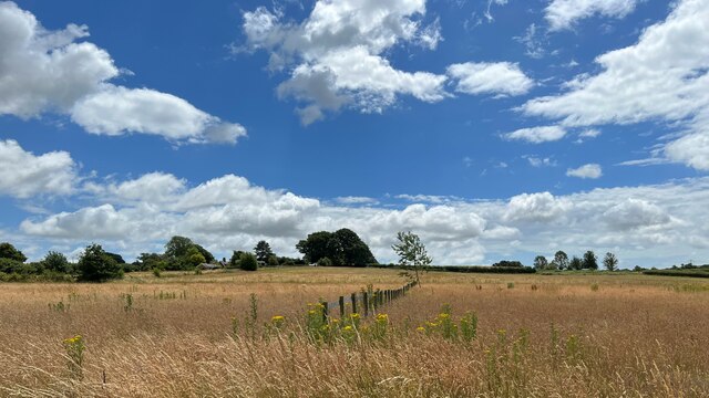
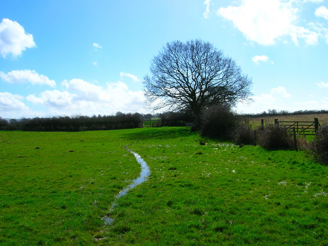
Blackstone Gate Wood is a captivating forest located in Sussex, England. Covering an area of approximately 50 hectares, this ancient woodland is a cherished natural gem in the region. With its rich biodiversity and stunning landscapes, it offers a serene and tranquil environment for visitors to explore.

The woodland is predominantly composed of native tree species such as oak, beech, and birch, which create a dense canopy overhead. These towering trees provide shelter for a diverse array of flora and fauna, contributing to the wood's ecological significance. Bluebells, wild garlic, and wood anemones carpet the forest floor in spring, adding a vibrant burst of color to the surroundings.

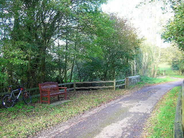
Numerous enchanting walking trails wind through Blackstone Gate Wood, allowing visitors to immerse themselves in its beauty. The paths meander along the gently rolling terrain, taking hikers past babbling brooks, moss-covered rocks, and ancient tree trunks. The sounds of birdsong fill the air, as woodpeckers drum away and song thrushes serenade visitors with their melodic tunes.

Nature enthusiasts will delight in the diversity of wildlife that calls Blackstone Gate Wood home. Red deer, foxes, and badgers can often be spotted foraging amongst the undergrowth, while a variety of bird species, including tawny owls and buzzards, soar overhead. The wood is also home to a multitude of insects, including butterflies and beetles, which play a vital role in the forest's ecosystem.

Blackstone Gate Wood is a cherished natural treasure, offering a magical escape for those seeking solace in nature. With its breathtaking scenery and abundant wildlife, it is a must-visit destination for anyone in search of a truly immersive woodland experience.

If you have any feedback on the listing, please let us know in the comments section below.

Blackstone Gate Wood Images

Images are sourced within 2km of 50.944615/-0.23354437 or Grid Reference TQ2417. Thanks to Geograph Open Source API. All images are credited.

The Wheatsheaf A typical country pub just outside Henfield in West Sussex
The Wheatsheaf
A typical country pub just outside Henfield in West Sussex
Outbuildings near Stonelands Farm
View north from the Henfield-Blackstone footpath
View west over farmland north of Furners Lane
Park Farm
Park Farm
View ESE towards Wolstonbury Hill
Field boundary west of Wick Farm
Resting place, Church Lane, Albourne A fine place to sit and have your lunch on a pleasant November afternoon. Looking north as the lane crosses Cutlers Brook before turning sharply right. My mode of transport is parked behind it.
Resting place, Church Lane, Albourne
A fine place to sit and have your lunch on a pleasant November afternoon. Looking north as the lane crosses Cutlers Brook before turning sharply right. My mode of transport is parked behind it.
Cart shed-Park Farm-Henfield The old rafters of this weathered cart shed might date back to Tudor times. Such precious witnesses of the past should be preserved at all costs.
Cart shed-Park Farm-Henfield
The old rafters of this weathered cart shed might date back to Tudor times. Such precious witnesses of the past should be preserved at all costs.
Weir, River Adur Taken from Wineham Bridge looking east.
Weir, River Adur
Taken from Wineham Bridge looking east.
Henfield and District Anglers Fishing Ponds Not marked on the map but there are a series of ponds next to the bridleway along this stretch. This view looks north west from the junction of the bridleway and a footpath.
Henfield and District Anglers Fishing Ponds
Not marked on the map but there are a series of ponds next to the bridleway along this stretch. This view looks north west from the junction of the bridleway and a footpath.
Sake Ride Lane Like to think that the original name had an expletive in front of it due to its boggy nature but that would just be indicative of the date I'm posting it on! The previous night's down pour left many paths in this area looking similar to this. This view looks south west down the bridleway between the two footpaths that branch from it.
Sake Ride Lane
Like to think that the original name had an expletive in front of it due to its boggy nature but that would just be indicative of the date I'm posting it on! The previous night's down pour left many paths in this area looking similar to this. This view looks south west down the bridleway between the two footpaths that branch from it.
Tomsetts Farm Looking north east from the point where the bridleway joins the drive to the farm.
Tomsetts Farm
Looking north east from the point where the bridleway joins the drive to the farm.
Lunchtime near Tomsetts Farm The farm building is at the junction of the Sake Ride Lane bridleway and the B2146 Wheatsheaf Road.
Lunchtime near Tomsetts Farm
The farm building is at the junction of the Sake Ride Lane bridleway and the B2146 Wheatsheaf Road.
Blackstone Gate Wood Looking south from the footpath that heads to the B2146.
Blackstone Gate Wood
Looking south from the footpath that heads to the B2146.
Woodhouse Wood Looking at the north western corner from the footpath that links the B2146 with Blackstone.
Woodhouse Wood
Looking at the north western corner from the footpath that links the B2146 with Blackstone.
Field near Morley Farm Looking east from the footpath that leads to the farm. The field's eastern boundary marks another footpath.
Field near Morley Farm
Looking east from the footpath that leads to the farm. The field's eastern boundary marks another footpath.
Waterlogged Field near Blackstone Looking south along the footpath that links the B2146 with Blackstone.
Waterlogged Field near Blackstone
Looking south along the footpath that links the B2146 with Blackstone.
Show me another place!

Blackstone Gate Wood is located at Grid Ref: TQ2417 (Lat: 50.944615, Lng: -0.23354437)

Administrative County: West Sussex

District: Horsham

Police Authority: Sussex

What 3 Words

///terms.gazed.trickster. Near Henfield, West Sussex

Related Wikis

Blackstone, West Sussex

Blackstone is a hamlet in the civil parish of Woodmancote and the Horsham district of West Sussex, England. Blackstone is significant for its listed...

Wineham

Wineham is a hamlet mainly in the Shermanbury civil parish (and the same ecclesiastical parish) of the Horsham district of West Sussex, England. It is...

Albourne

Albourne is a village and civil parish in the Mid Sussex district of West Sussex, England. It lies just off the A23 road three miles (4.8 km) east of Henfield...

Sayers Common

Sayers Common is a village in the Mid Sussex District of West Sussex, England. With Hurstpierpoint it forms one of the Mid Sussex parishes. It is located...

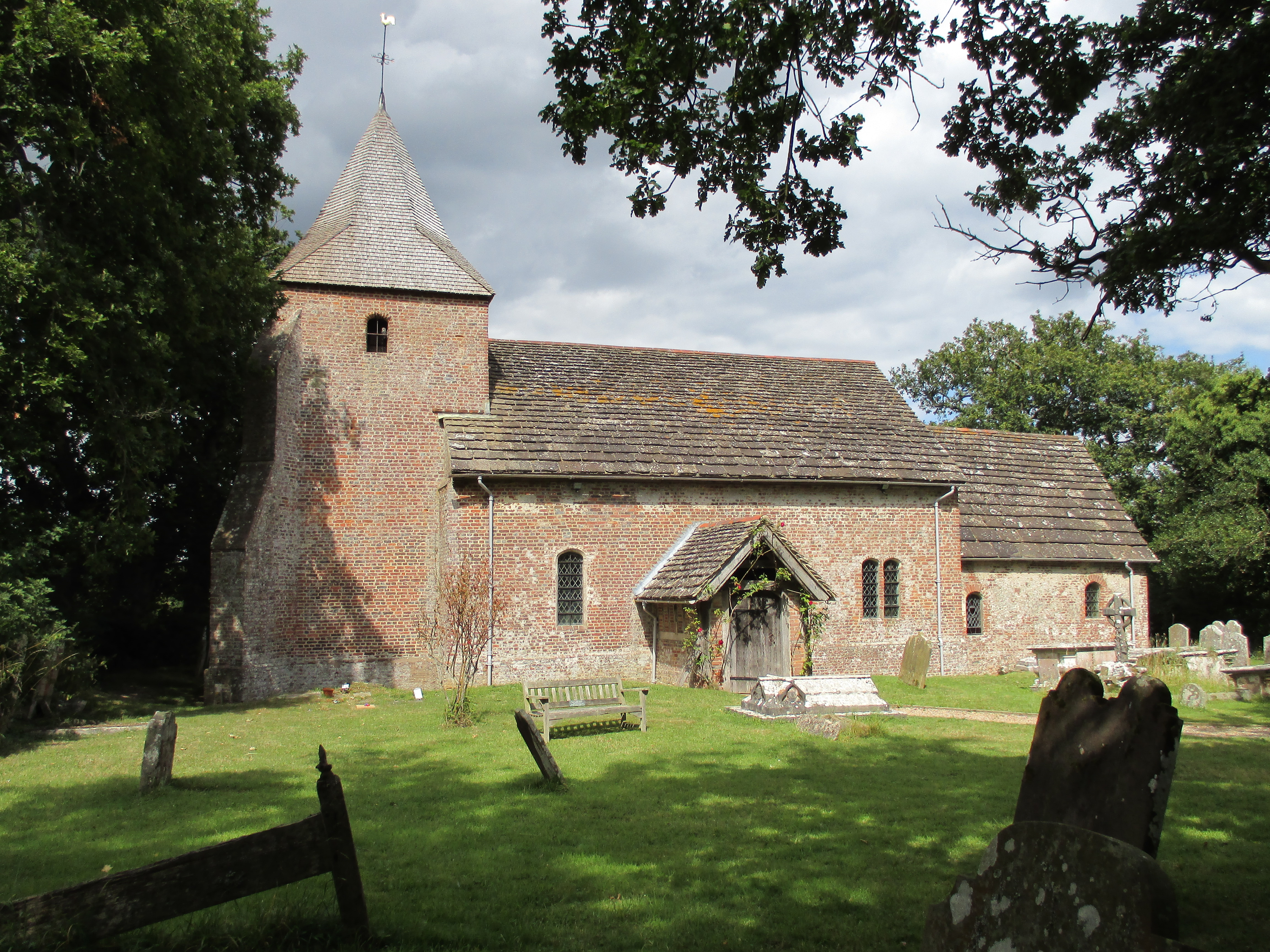
St Peter's Church, Twineham

St Peter's Church is the Church of England parish church of Twineham, a village in the Mid Sussex District of West Sussex, England. The church, with St...

Twineham

Twineham is a village and civil parish in the Mid Sussex District of West Sussex, England. It is located eight kilometres (5 miles) to the west of Burgess...

Hurstpierpoint and Sayers Common

Hurstpierpoint and Sayers Common is a civil parish in Mid Sussex District, West Sussex, England. == Settlements == === Major settlements === Hurstpierpoint...

Woodmancote, Horsham District

Woodmancote is a village and civil parish in the Horsham District of West Sussex, England. The village is 1 mile (1.5 km) southeast of Henfield on the...

Nearby Amenities

Located within 500m of 50.944615,-0.23354437
Barrier: stile
Lat/Long: 50.9437065/-0.236903
Landuse: forest
Lat/Long: 50.9438241/-0.2351637
Power: tower
Lat/Long: 50.9437203/-0.2269369
Post Box
Collection Times: Mo-Fr 09:00; Sa 07:00
Operator: Royal Mail
Post Box Type: wall
Ref: BN6 378D
Royal Cypher: GVIR
Royal Cypher Wikidata: Q33102169
Lat/Long: 50.9464822/-0.2332985
Barrier: stile
Lat/Long: 50.9463803/-0.2332736
Barrier: stile
Lat/Long: 50.9406005/-0.2367696
Barrier: stile
Lat/Long: 50.9422787/-0.2367616
Barrier: stile
Lat/Long: 50.9438587/-0.2368838
Barrier: stile
Lat/Long: 50.9457117/-0.2375823
Barrier: stile
Lat/Long: 50.9461673/-0.2356653
Barrier: stile
Lat/Long: 50.9462591/-0.2343611
Barrier: stile
Lat/Long: 50.9464403/-0.2332204
The data included in this document is from www.openstreetmap.org. The data is made available under ODbL.

Have you been to Blackstone Gate Wood?

Leave your review of Blackstone Gate Wood below (or comments, questions and feedback).