Beech Plantation

Wood, Forest in Lincolnshire East Lindsey

England

Beech Plantation

Cropmark on field near Parsonage Farm, Binbrook: aerial 2021 (1)
Cropmark on field near Parsonage Farm, Binbrook: aerial 2021 (1) Credit: Simon Tomson

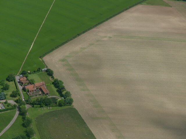
Beech Plantation, located in Lincolnshire, England, is a picturesque woodland area known for its abundant beech trees and serene atmosphere. Covering a vast area, the plantation is a popular destination for nature enthusiasts, hikers, and photographers.

The main feature of Beech Plantation is its dense population of beech trees, which dominate the landscape and provide a stunning display of vibrant green foliage during the spring and summer months. These majestic trees create a tranquil ambiance, making it an ideal retreat for those seeking solace in nature.

The woodland is home to a diverse range of flora and fauna, including various species of birds, butterflies, and small mammals. Walking through Beech Plantation, visitors can enjoy the melodic songs of birds and the rustling of leaves underfoot, immersing themselves in the natural symphony of the forest.

The plantation offers a network of well-maintained trails, allowing visitors to explore its beauty at their own pace. These paths wind through the woodland, passing by clearings, ancient trees, and occasional streams, providing scenic views and opportunities for wildlife spotting along the way.

Aside from its natural charm, Beech Plantation also plays a vital role in conservation efforts. The woodland serves as a protected habitat for various endangered species, contributing to the preservation of biodiversity in the region.

In conclusion, Beech Plantation in Lincolnshire is a captivating woodland area that showcases the beauty of nature. With its abundance of beech trees, diverse wildlife, and peaceful atmosphere, it offers a rejuvenating experience for anyone seeking a connection with the great outdoors.

If you have any feedback on the listing, please let us know in the comments section below.

Beech Plantation Images

Images are sourced within 2km of 53.432031/-0.13994735 or Grid Reference TF2394. Thanks to Geograph Open Source API. All images are credited.

Cropmark on field near Parsonage Farm, Binbrook: aerial 2021 (1)
Cropmark on field near Parsonage Farm, Binbrook: aerial 2021 (2)
Cropmark on field near Parsonage Farm, Binbrook: aerial 2021 (3)
Oblong cropmark on field SE of Swinhope: aerial 2022
Cold Harbour, Swinhope: aerial 2022
Soilmarks on field south of Wold Newton: aerial 2022
Scallows Hall, east of Binbrook: aerial 2022
Direction Sign – Signpost on Brats Lane, Swinhope Located on the northeast side of the crossroads of Brats Lane and Newton Lane in Swinhope parish. 4 arms but no finial. See also <a title="https://www.geograph.org.uk/photo/2227829" href="https://www.geograph.org.uk/photo/2227829">Link</a>.

Milestone Society National ID: LI_TF2394
Direction Sign – Signpost on Brats Lane, Swinhope
Located on the northeast side of the crossroads of Brats Lane and Newton Lane in Swinhope parish. 4 arms but no finial. See also Link. Milestone Society National ID: LI_TF2394
Direction Sign – Signpost on Blands Hill, Binbrook Located on the northeast side of the junction on Blands Hill northwest of Binbrook Hall. Binbrook parish. 3 arms but no finial.

Milestone Society National ID: LI_TF2394A
Direction Sign – Signpost on Blands Hill, Binbrook
Located on the northeast side of the junction on Blands Hill northwest of Binbrook Hall. Binbrook parish. 3 arms but no finial. Milestone Society National ID: LI_TF2394A
Direction Sign – Signpost at the end of Brats Lane, Wold Newton Located on the north side of the crossroads at the east end of Brats Lane, in Wold Newton parish. 4 arms but no finial.

Milestone Society National ID: LI_TF2495
Direction Sign – Signpost at the end of Brats Lane, Wold Newton
Located on the north side of the crossroads at the east end of Brats Lane, in Wold Newton parish. 4 arms but no finial. Milestone Society National ID: LI_TF2495
Binbrook Walk Farm: aerial 2023
Walk House, Binbrook: aerial 2023 (1) Scars from quarrying on the hillside.
Walk House, Binbrook: aerial 2023 (1)
Scars from quarrying on the hillside.
Walk House, Binbrook: aerial 2023 (2) Scars from quarrying on the hillside.
Walk House, Binbrook: aerial 2023 (2)
Scars from quarrying on the hillside.
Hoe Hill On the top above Binbrook
Hoe Hill
On the top above Binbrook
Long Farm Road This farm road runs almost the entire length of this square with Binbrook Hill Farm being at the opposite end.
Long Farm Road
This farm road runs almost the entire length of this square with Binbrook Hill Farm being at the opposite end.
Rolling Wolds Fields The fields of the Lincolnshire Wolds have no choice but to follow the rolling hills.
Rolling Wolds Fields
The fields of the Lincolnshire Wolds have no choice but to follow the rolling hills.
Bridleway Posts These elaborate posts mark the entrance to a bridleway which leads to Binbrook Hall.
Bridleway Posts
These elaborate posts mark the entrance to a bridleway which leads to Binbrook Hall.
Track To Top Farm The track heads up to the farm which is in the diagonally adjacent square NE. This view from the road to Wold Newton.
Track To Top Farm
The track heads up to the farm which is in the diagonally adjacent square NE. This view from the road to Wold Newton.
Show me another place!

Beech Plantation is located at Grid Ref: TF2394 (Lat: 53.432031, Lng: -0.13994735)

Administrative County: Lincolnshire

District: East Lindsey

Police Authority: Lincolnshire

What 3 Words

///sooner.avocado.practical. Near Wold Newton, Lincolnshire

Nearby Locations

Beech Plantation

Related Wikis

Swinhope

Swinhope is a village and civil parish about 6 miles west south west of North Thoresby railway station, in the West Lindsey district, in the county of...

Wold Newton, Lincolnshire

Wold Newton is a village and civil parish in North East Lincolnshire, England. It is situated just over 1 mile (1.6 km) west from the A18 road, 7 miles...

Binbrook

Binbrook is a village and civil parish in the East Lindsey district of Lincolnshire, England. It is situated on the B1203 road, and 8 miles (13 km) north...

RAF Kelstern

Royal Air Force Kelstern or RAF Kelstern is a former Royal Air Force station 3.6 miles (5.8 km) south east of Binbrook, Lincolnshire and 4.9 miles (7...
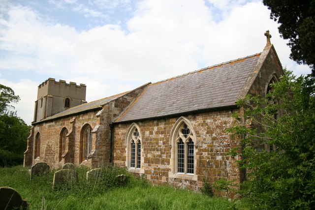
Brookenby Church

Brookenby Church is located in Brookenby, Lincolnshire, England. A member of the Church of England, it forms part of the Walesby group of churches, which...

Brookenby

Brookenby is a village and civil parish in the West Lindsey district of Lincolnshire, England. The village is situated 7 miles (11 km) north-east from...

Thorganby, Lincolnshire

Thorganby is a village and civil parish in the West Lindsey district of Lincolnshire. England. It is situated approximately 9 miles (14 km) north-east...

Kelstern

Kelstern is a village and former civil parish, now in the parish of Calcethorpe with Kelstern, in the East Lindsey district of Lincolnshire, England. In...

Nearby Amenities

Located within 500m of 53.432031,-0.13994735
Natural: peak
Source: Bing
Lat/Long: 53.432797/-0.1433379
The data included in this document is from www.openstreetmap.org. The data is made available under ODbL.

Have you been to Beech Plantation?

Leave your review of Beech Plantation below (or comments, questions and feedback).