Willow Holt

Wood, Forest in Lincolnshire East Lindsey

England

Willow Holt

Thorpe Camp, Tattershall Thorpe: aerial 2021 (1)
Thorpe Camp, Tattershall Thorpe: aerial 2021 (1) Credit: Chris

Willow Holt, located in Lincolnshire, England, is a charming wood or forest that offers a picturesque and tranquil retreat for nature enthusiasts. Spanning approximately 20 acres, it is nestled in the heart of the countryside, making it an ideal destination for those seeking a peaceful escape from the bustling city life.

The woodland is primarily composed of willow trees, which lend their name to the area. These tall and graceful trees provide a dense canopy, casting a dappled shade on the forest floor and creating a serene and enchanting atmosphere throughout the year. The vibrant green foliage of the willows adds to the beauty of the landscape, especially during the spring and summer months when the trees are in full bloom.

Willow Holt is home to a diverse range of flora and fauna, making it a haven for wildlife enthusiasts and birdwatchers. The wood provides habitat for various species of birds, including the melodious song thrush and the colorful kingfisher. Additionally, the forest floor is adorned with an array of wildflowers, such as bluebells and primroses, further enhancing the natural beauty of the area.

Visitors to Willow Holt can enjoy leisurely walks along well-maintained trails, immersing themselves in the tranquil surroundings and taking in the sights and sounds of nature. The wood also offers picnic areas and seating, providing the perfect spot for a relaxing lunch or a moment of quiet contemplation.

Overall, Willow Holt in Lincolnshire is a delightful woodland retreat, offering a serene and idyllic setting for nature lovers to escape the hustle and bustle of everyday life.

If you have any feedback on the listing, please let us know in the comments section below.
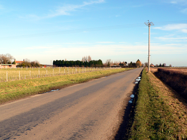
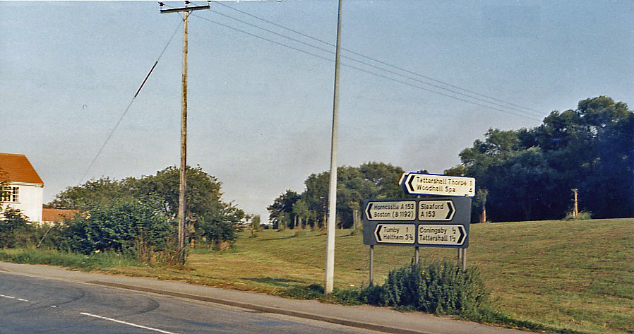
Willow Holt Images

Images are sourced within 2km of 53.118903/-0.15999411 or Grid Reference TF2359. Thanks to Geograph Open Source API. All images are credited.

Thorpe Camp, Tattershall Thorpe: aerial 2021 (1)
Thorpe Camp, Tattershall Thorpe: aerial 2021 (2)
Cropmarks on field north of Tattershall Thorpe: aerial 2022 Of geological origin.
Cropmarks on field north of Tattershall Thorpe: aerial 2022
Of geological origin.
Cropmarks on field by Walnut Farm, Tattershall Thorpe: aerial 2022 (1)
Cropmarks on field by Walnut Farm, Tattershall Thorpe: aerial 2022 (2)
Excavations on a field at Tumby: aerial 2022
Coningsby Church The most notable feature about St Michael's Church is its extraordinary one-handed clock dating from the 17th century. At 16½ feet in diameter it is the largest of its type in the world; the hand is nearly nine feet long. It is said that, on a clear day, it is possible to use it to tell the time from two miles away.
Coningsby Church
The most notable feature about St Michael's Church is its extraordinary one-handed clock dating from the 17th century. At 16½ feet in diameter it is the largest of its type in the world; the hand is nearly nine feet long. It is said that, on a clear day, it is possible to use it to tell the time from two miles away.
High Street, Coningsby Taken from outside St Michael's church (out of shot to the right), looking along the A153 with the White Bull on the left.
High Street, Coningsby
Taken from outside St Michael's church (out of shot to the right), looking along the A153 with the White Bull on the left.
Railway Bridge at Coningsby The arched brick built bridge and part of the embankment that carried the line over the River Bain, from Lincoln to Grimsby and Skegness, through New Bolingbroke and Stickney, still survives. The line closed in 1970 after 57 years of use.
Railway Bridge at Coningsby
The arched brick built bridge and part of the embankment that carried the line over the River Bain, from Lincoln to Grimsby and Skegness, through New Bolingbroke and Stickney, still survives. The line closed in 1970 after 57 years of use.
St.Michael's church, Coningsby, Lincs. Grand Decorated & Perpendicular church with and apsidal chancel by Nottingham architect T.C.Hine in 1874, the tower is open on the north and south sides for processions to pass. The great one handed clock is 16.5 feet in diameter - the largest single handed clock in the world.
St.Michael's church, Coningsby, Lincs.
Grand Decorated & Perpendicular church with and apsidal chancel by Nottingham architect T.C.Hine in 1874, the tower is open on the north and south sides for processions to pass. The great one handed clock is 16.5 feet in diameter - the largest single handed clock in the world.
Bus stop. Picture shows the wooden bus shelter at Tattershall Thorpe.
Bus stop.
Picture shows the wooden bus shelter at Tattershall Thorpe.
Agricultural land. A newly prepared field close to Tattershall Thorpe.
Agricultural land.
A newly prepared field close to Tattershall Thorpe.
Thorpe Camp Lightning BAC Lighting F1A at Thorpe camp Visitor Centre <span class="nowrap"><a title="http://www.thorpecamp.org.uk/" rel="nofollow ugc noopener" href="http://www.thorpecamp.org.uk/">Link</a><img style="margin-left:2px;" alt="External link" title="External link - shift click to open in new window" src="https://s1.geograph.org.uk/img/external.png" width="10" height="10"/></span>
Thorpe Camp Lightning
BAC Lighting F1A at Thorpe camp Visitor Centre LinkExternal link
Lancaster Propeller This Avro Lancaster propeller recovered from the Wash, is dedicated to the Royal and allied air forces who have served at RAF Woodhall since 1942 and greets visitors to Thorpe Camp visitor centre <span class="nowrap"><a title="http://www.thorpecamp.org.uk/" rel="nofollow ugc noopener" href="http://www.thorpecamp.org.uk/">Link</a><img style="margin-left:2px;" alt="External link" title="External link - shift click to open in new window" src="https://s1.geograph.org.uk/img/external.png" width="10" height="10"/></span>
Lancaster Propeller
This Avro Lancaster propeller recovered from the Wash, is dedicated to the Royal and allied air forces who have served at RAF Woodhall since 1942 and greets visitors to Thorpe Camp visitor centre LinkExternal link
The Blue Bell A wonderful grade II listed country inn with a history dating back to c1250, though the current structure is early 17th century mud & stud. Reputedly haunted, visited by King Henry VIII and popular with 617 and 627 squadrons during the war.
The Blue Bell
A wonderful grade II listed country inn with a history dating back to c1250, though the current structure is early 17th century mud & stud. Reputedly haunted, visited by King Henry VIII and popular with 617 and 627 squadrons during the war.
Grazing land. Grazing land for rent close to the village of Tattershall Thorpe.
Grazing land.
Grazing land for rent close to the village of Tattershall Thorpe.
Farmland off Pauls Lane
Nursery Farm To the rear of the farm is St Helen's Wood.
Nursery Farm
To the rear of the farm is St Helen's Wood.
Show me another place!

Willow Holt is located at Grid Ref: TF2359 (Lat: 53.118903, Lng: -0.15999411)

Administrative County: Lincolnshire

District: East Lindsey

Police Authority: Lincolnshire

What 3 Words

///albums.coasters.clashing. Near Coningsby, Lincolnshire

Related Wikis

Tumby, Lincolnshire

Tumby is a village in the East Lindsey district of Lincolnshire, England. It is situated approximately 2 miles (3.2 km) north from Coningsby and 6.5 miles...

Coningsby railway station

Coningsby railway station was a station in Coningsby, Lincolnshire, England on the Kirkstead and Little Steeping Railway which ran between Lincoln and...

Tattershall Thorpe

Tattershall Thorpe is a hamlet and civil parish in the East Lindsey district of Lincolnshire, England. It is situated approximately 3 miles (5 km) south...

Thorpe Camp

Thorpe Camp, officially known as the Thorpe Camp Visitor Centre, is the former Royal Air Force barracks for RAF Woodhall Spa. It is 2.5 miles (4.0 km)...

Coningsby

Coningsby is a town and civil parish in the East Lindsey district in Lincolnshire, England, it is situated on the A153 road, adjoining Tattershall on...

Barnes Wallis Academy

Barnes Wallis Academy (formerly Gartree Community School) is a coeducational secondary school located in the village of Tattershall in Lincolnshire, England...

RAF Woodhall Spa

Royal Air Force Woodhall Spa, or more simply RAF Woodhall Spa, is a former Royal Air Force satellite station located 2 miles (3.2 km) north of Coningsby...

Tattershall College

Tattershall College was a grammar school in Tattershall, Lincolnshire. The college was established in 1439 and the building that still stands today was...

Nearby Amenities

Located within 500m of 53.118903,-0.15999411
Source: OS_OpenData _StreetView
Lat/Long: 53.1210616/-0.1641195
Source: OS_OpenData _StreetView
Lat/Long: 53.1222182/-0.1633152
Source: OS_OpenData _StreetView
Lat/Long: 53.1161585/-0.1540782
Power: pole
Source: Bing
Lat/Long: 53.1210323/-0.1534867
Power: pole
Source: Bing
Lat/Long: 53.118718/-0.1569272
Power: pole
Source: Bing
Lat/Long: 53.1213325/-0.1560495
Power: pole
Source: Bing
Lat/Long: 53.1211949/-0.1549244
Power: pole
Source: Bing
Lat/Long: 53.1195288/-0.1562789
Power: pole
Source: Bing
Lat/Long: 53.1178732/-0.1576133
Power: pole
Source: Bing
Lat/Long: 53.1203635/-0.1555989
Power: pole
Source: Bing
Lat/Long: 53.1149014/-0.1622508
Power: pole
Source: Bing
Lat/Long: 53.1155695/-0.1609714
Power: pole
Source: Bing
Lat/Long: 53.1218162/-0.1600407
Power: pole
Source: Bing
Lat/Long: 53.1216472/-0.1586781
Power: pole
Source: Bing
Lat/Long: 53.1162932/-0.1595968
Power: pole
Source: Bing
Lat/Long: 53.1214661/-0.157156
Power: pole
Source: Bing
Lat/Long: 53.1169564/-0.1583616
Power: pole
Source: Bing
Lat/Long: 53.1216963/-0.1545193
Power: pole
Source: Bing
Lat/Long: 53.1219934/-0.161505
Power: pole
Source: Bing
Lat/Long: 53.1221922/-0.1631304
Power: pole
Source: Bing
Lat/Long: 53.1221751/-0.1631976
Power: pole
Source: Bing
Lat/Long: 53.1217743/-0.1635369
Power: pole
Source: Bing
Lat/Long: 53.1221792/-0.1634483
Power: pole
Source: Bing
Lat/Long: 53.1220158/-0.1635811
Power: pole
Lat/Long: 53.1209615/-0.1639983
Power: pole
Source: Bing
Lat/Long: 53.1214588/-0.1637528
Historic Highway: track
Lat/Long: 53.1219353/-0.1635086
Power: pole
Source: Bing
Lat/Long: 53.1147188/-0.1619399
Scholey ParK
Place: locality
Source: Bing
Lat/Long: 53.1198522/-0.1623509
Tumby Lock
Place: locality
Source: Bing
Lat/Long: 53.1189374/-0.1587856
The data included in this document is from www.openstreetmap.org. The data is made available under ODbL.

Have you been to Willow Holt?

Leave your review of Willow Holt below (or comments, questions and feedback).