Birch Copse
Wood, Forest in Sussex Horsham
England
Birch Copse

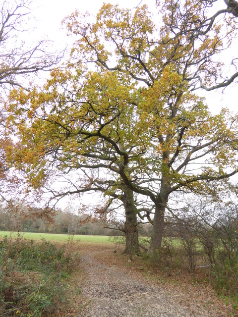
Birch Copse is a picturesque woodland located in Sussex, England. Covering an area of approximately 100 acres, this enchanting forest is known for its dense population of birch trees, which lend the copse its name. The woodland is situated in a rural area, providing a tranquil and serene atmosphere for visitors.
The copse is characterized by its diverse range of flora and fauna. Aside from the dominant birch trees, the woodland is home to a variety of other tree species including oak, beech, and ash. The forest floor is covered with a thick carpet of moss, ferns, and wildflowers, creating a vibrant and colorful display throughout the year.
Birch Copse is a haven for wildlife, attracting numerous species of birds, mammals, and insects. Birdwatchers can spot a multitude of species including woodpeckers, jays, and various songbirds. The woodland also provides a habitat for mammals such as foxes, deer, and badgers, which can occasionally be glimpsed by lucky visitors.
The copse offers a network of well-maintained trails, making it a popular destination for hikers and nature enthusiasts. Visitors can explore the forest while enjoying the calming sounds of birdsong and the scent of wildflowers. The woodland is particularly stunning during spring and autumn when the trees are adorned with vibrant foliage or delicate blossoms.
Birch Copse is not only a place of natural beauty, but it also holds historical significance. The woodland has been present for centuries and has witnessed the passage of time, making it a fascinating location for history buffs and researchers alike.
Overall, Birch Copse is a captivating woodland that offers a peaceful retreat for those seeking to connect with nature and enjoy the tranquility of Sussex's countryside.
If you have any feedback on the listing, please let us know in the comments section below.
Birch Copse Images
Images are sourced within 2km of 51.011417/-0.26845718 or Grid Reference TQ2124. Thanks to Geograph Open Source API. All images are credited.


Birch Copse is located at Grid Ref: TQ2124 (Lat: 51.011417, Lng: -0.26845718)
Administrative County: West Sussex
District: Horsham
Police Authority: Sussex
What 3 Words
///rationed.person.punters. Near Cowfold, West Sussex
Nearby Locations
Related Wikis

Crabtree, West Sussex
Crabtree is a hamlet in the parish of Lower Beeding and in Horsham District of West Sussex, England. It lies on the A281 road 4.4 miles (7.1 km) southeast...

Leonardslee
Leonardslee is an English country house and English landscape garden and woodland garden in Lower Beeding, near Horsham, West Sussex, England. The Grade...

Newells Preparatory School
Newells Preparatory School came to Lower Beeding, Sussex, in 1946. It has been at Handcross and known as Handcross Park School since 1968. It merged with...

Cowfold
Cowfold is a village and civil parish between Billingshurst and Haywards Heath in the Horsham District of West Sussex, England. The village is at the intersection...
Nearby Amenities
Located within 500m of 51.011417,-0.26845718Have you been to Birch Copse?
Leave your review of Birch Copse below (or comments, questions and feedback).