Vale Plantation

Wood, Forest in Lincolnshire East Lindsey

England

Vale Plantation

West Wykeham DMV: aerial 2021 One of Lincolnshire's finest. See: <span class="nowrap"><a title="https://www.heritagegateway.org.uk/Gateway/Results_Single.aspx?uid=MLI43549&resourceID=1006" rel="nofollow ugc noopener" href="https://www.heritagegateway.org.uk/Gateway/Results_Single.aspx?uid=MLI43549&resourceID=1006">Link</a><img style="margin-left:2px;" alt="External link" title="External link - shift click to open in new window" src="https://s1.geograph.org.uk/img/external.png" width="10" height="10"/></span>

West Wykeham first appears in the historical record in Domesday book, where a manor is recorded in the hands of Rainer de Brimou. This manor had sokeland in Ludford. At the time of Domesday there was minimum population of 11 people. Ralf de Criol succeeded the Domesday tenant Rainer de Brimou and is recorded as holding the manor in the Lindsey Survey of 1115. 

These lands in West Wykeham were held by Ralf de Criol in 1115, passed to his heir, Hugh de Scoteni in about 1155, and then to Hugh's son, Lambert de Scoteni before 1202. In 1212 the lands were in the hands of Thomas (probably the grandson of Lambert's younger brother, Walter). It was Thomas de Scoteni who granted lands in West Wykeham to Sixhills Priory in 1228-32.
West Wykeham DMV: aerial 2021 Credit: Chris

Vale Plantation is a sprawling woodland located in the county of Lincolnshire, England. Covering an area of approximately 500 acres, the plantation is a haven of natural beauty and biodiversity. It is situated in the Vale of Ancholme, near the village of Waddingham.

The woodland is predominantly made up of broadleaf trees, including oak, birch, and beech. These majestic trees provide a picturesque backdrop throughout the seasons, with vibrant green leaves in summer and a stunning array of colors in autumn. The dense canopy created by the trees offers shelter and a suitable habitat for a variety of woodland wildlife.

Vale Plantation is home to a diverse range of flora and fauna. The forest floor is covered in a thick carpet of wildflowers, including bluebells, foxgloves, and primroses, creating a vibrant and enchanting display in spring. The woodland is also teeming with wildlife, including deer, foxes, and a wide variety of bird species such as woodpeckers and owls.

The plantation is a popular destination for nature lovers, walkers, and photographers who are drawn to its natural beauty and tranquility. There are several walking trails that wind through the woodland, allowing visitors to explore its many hidden corners and discover its natural wonders.

Vale Plantation is not only a haven for wildlife but also serves as an important carbon sink, helping to mitigate climate change by absorbing carbon dioxide from the atmosphere. It is a precious natural resource that should be cherished and protected for future generations to enjoy.

If you have any feedback on the listing, please let us know in the comments section below.

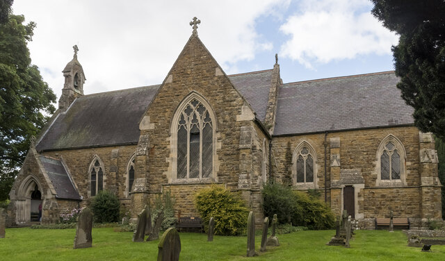
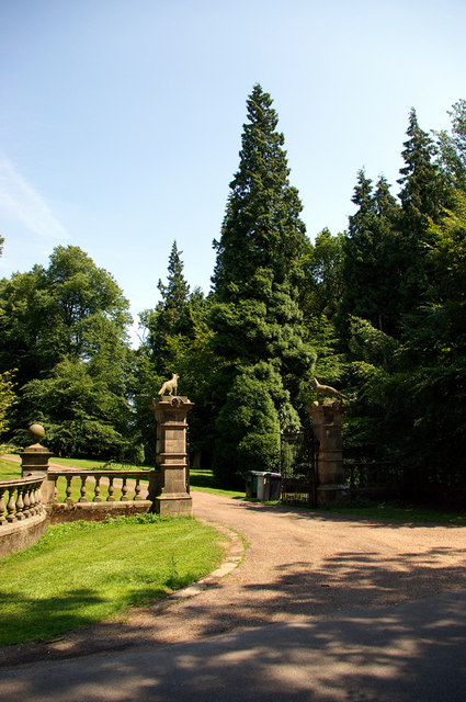
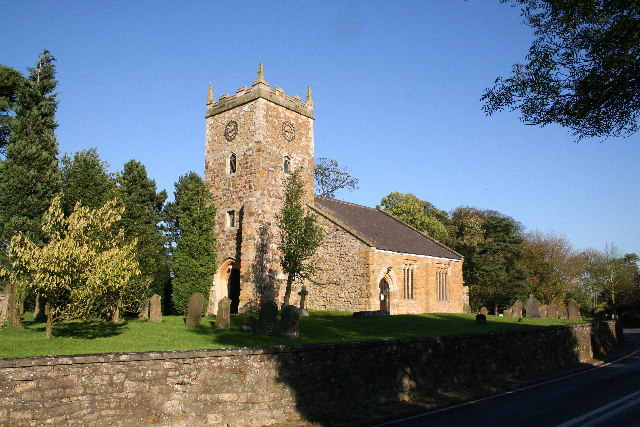
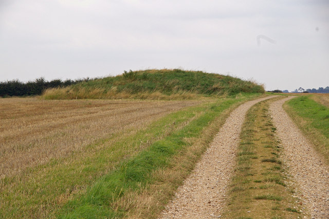
Vale Plantation Images

Images are sourced within 2km of 53.376254/-0.17459605 or Grid Reference TF2188. Thanks to Geograph Open Source API. All images are credited.

West Wykeham DMV: aerial 2021 One of Lincolnshire's finest. See: <span class="nowrap"><a title="https://www.heritagegateway.org.uk/Gateway/Results_Single.aspx?uid=MLI43549&resourceID=1006" rel="nofollow ugc noopener" href="https://www.heritagegateway.org.uk/Gateway/Results_Single.aspx?uid=MLI43549&resourceID=1006">Link</a><img style="margin-left:2px;" alt="External link" title="External link - shift click to open in new window" src="https://s1.geograph.org.uk/img/external.png" width="10" height="10"/></span>

West Wykeham first appears in the historical record in Domesday book, where a manor is recorded in the hands of Rainer de Brimou. This manor had sokeland in Ludford. At the time of Domesday there was minimum population of 11 people. Ralf de Criol succeeded the Domesday tenant Rainer de Brimou and is recorded as holding the manor in the Lindsey Survey of 1115. 

These lands in West Wykeham were held by Ralf de Criol in 1115, passed to his heir, Hugh de Scoteni in about 1155, and then to Hugh's son, Lambert de Scoteni before 1202. In 1212 the lands were in the hands of Thomas (probably the grandson of Lambert's younger brother, Walter). It was Thomas de Scoteni who granted lands in West Wykeham to Sixhills Priory in 1228-32.
West Wykeham DMV: aerial 2021
One of Lincolnshire's finest. See: LinkExternal link West Wykeham first appears in the historical record in Domesday book, where a manor is recorded in the hands of Rainer de Brimou. This manor had sokeland in Ludford. At the time of Domesday there was minimum population of 11 people. Ralf de Criol succeeded the Domesday tenant Rainer de Brimou and is recorded as holding the manor in the Lindsey Survey of 1115. These lands in West Wykeham were held by Ralf de Criol in 1115, passed to his heir, Hugh de Scoteni in about 1155, and then to Hugh's son, Lambert de Scoteni before 1202. In 1212 the lands were in the hands of Thomas (probably the grandson of Lambert's younger brother, Walter). It was Thomas de Scoteni who granted lands in West Wykeham to Sixhills Priory in 1228-32.
Girsby Vale and West Wykeham: aerial 2021 For West Wykeham see <a href="https://www.geograph.org.uk/photo/7002215">TF2188 : West Wykeham DMV: aerial 2021</a>.
Girsby Vale and West Wykeham: aerial 2021
Field path heading northwest towards Ludford
Burgh on Bain - St Helen's Church
St Mary & St Peter's church, Ludford Built by James Fowler, 1863-5.
St Mary & St Peter's church, Ludford
Built by James Fowler, 1863-5.
Interior, St Mary & St Peter's church, Ludford Looking west.
Interior, St Mary & St Peter's church, Ludford
Looking west.
East Window, St Mary & St Peter's church, Ludford Glass by Hardman.
East Window, St Mary & St Peter's church, Ludford
Glass by Hardman.
Pulpit, St Mary & St Peter's church, Ludford
Organ, St Mary & St Peter's church, Ludford The organ is by Forster & Andrews, and  came from  Trinity Church, Horncastle in 1919.
It does not appear to be in use, as an electronic organ is also present.
Organ, St Mary & St Peter's church, Ludford
The organ is by Forster & Andrews, and came from Trinity Church, Horncastle in 1919. It does not appear to be in use, as an electronic organ is also present.
Former RAF Ludford Magna: aerial 2023 See: <span class="nowrap"><a title="https://www.bcar.org.uk/ludford-history" rel="nofollow ugc noopener" href="https://www.bcar.org.uk/ludford-history">Link</a><img style="margin-left:2px;" alt="External link" title="External link - shift click to open in new window" src="https://s1.geograph.org.uk/img/external.png" width="10" height="10"/></span>
Former RAF Ludford Magna: aerial 2023
See: LinkExternal link
West Wykeham DMV: aerial 2023 West Wykeham first appears in the historical record in Domesday book, where a manor is recorded in the hands of Rainer de Brimou. This manor had sokeland in Ludford. At the time of Domesday there was a minimum population of 11 people. Ralf de Criol succeeded the Domesday tenant Rainer de Brimou and is recorded as holding the manor in the Lindsey Survey of 1115.

These lands in West Wykeham were held by Ralf de Criol in 1115, passed to his heir, Hugh de Scoteni in about 1155, and then to Hugh's son, Lambert de Scoteni before 1202. In 1212 the lands were in the hands of Thomas (probably the grandson of Lambert's younger brother, Walter). It was Thomas de Scoteni who granted lands in West Wykeham to Sixhills Priory in 1228-32.

See: <span class="nowrap"><a title="https://www.heritagegateway.org.uk/Gateway/Results_Single.aspx?uid=MLI43549&resourceID=1006" rel="nofollow ugc noopener" href="https://www.heritagegateway.org.uk/Gateway/Results_Single.aspx?uid=MLI43549&resourceID=1006">Link</a><img style="margin-left:2px;" alt="External link" title="External link - shift click to open in new window" src="https://s1.geograph.org.uk/img/external.png" width="10" height="10"/></span>
West Wykeham DMV: aerial 2023
West Wykeham first appears in the historical record in Domesday book, where a manor is recorded in the hands of Rainer de Brimou. This manor had sokeland in Ludford. At the time of Domesday there was a minimum population of 11 people. Ralf de Criol succeeded the Domesday tenant Rainer de Brimou and is recorded as holding the manor in the Lindsey Survey of 1115. These lands in West Wykeham were held by Ralf de Criol in 1115, passed to his heir, Hugh de Scoteni in about 1155, and then to Hugh's son, Lambert de Scoteni before 1202. In 1212 the lands were in the hands of Thomas (probably the grandson of Lambert's younger brother, Walter). It was Thomas de Scoteni who granted lands in West Wykeham to Sixhills Priory in 1228-32. See: LinkExternal link
East Wykeham DMV and Park: aerial 2023 East Wykeham occurs in the Domesday Book, where a holding of only half a bovate was part of a manor at South Cadeby, and a further 5 bovates and 10 acres of meadow were sokeland of South Cadeby. There was another half a bovate that is recorded as waste. There was a minimum population of five people at that time. There is no manor in East Wykeham recorded in Domesday. In the Lindsey survey of 1115 the holdings of 5 and a half bovates in East Wykeham are in the hands of Alan of Lincoln and a further two bovates held by the Bishop of Lincoln.

The church at East Wykeham was granted to Sixhills Priory in the mid twelfth century; half from Supir de Bayeux and half from Ralf of Grimblethorpe. Included within these gifts were tofts and land in East Wykeham

See: <span class="nowrap"><a title="https://www.heritagegateway.org.uk/Gateway/Results_Single.aspx?uid=MLI40581&resourceID=1006" rel="nofollow ugc noopener" href="https://www.heritagegateway.org.uk/Gateway/Results_Single.aspx?uid=MLI40581&resourceID=1006">Link</a><img style="margin-left:2px;" alt="External link" title="External link - shift click to open in new window" src="https://s1.geograph.org.uk/img/external.png" width="10" height="10"/></span>

A historic park recorded on the 1907 Ordnance Survey map at Wykeham Hall: <span class="nowrap"><a title="https://www.heritagegateway.org.uk/Gateway/Results_Single.aspx?uid=MLI92238&resourceID=1006" rel="nofollow ugc noopener" href="https://www.heritagegateway.org.uk/Gateway/Results_Single.aspx?uid=MLI92238&resourceID=1006">Link</a><img style="margin-left:2px;" alt="External link" title="External link - shift click to open in new window" src="https://s1.geograph.org.uk/img/external.png" width="10" height="10"/></span>
East Wykeham DMV and Park: aerial 2023
East Wykeham occurs in the Domesday Book, where a holding of only half a bovate was part of a manor at South Cadeby, and a further 5 bovates and 10 acres of meadow were sokeland of South Cadeby. There was another half a bovate that is recorded as waste. There was a minimum population of five people at that time. There is no manor in East Wykeham recorded in Domesday. In the Lindsey survey of 1115 the holdings of 5 and a half bovates in East Wykeham are in the hands of Alan of Lincoln and a further two bovates held by the Bishop of Lincoln. The church at East Wykeham was granted to Sixhills Priory in the mid twelfth century; half from Supir de Bayeux and half from Ralf of Grimblethorpe. Included within these gifts were tofts and land in East Wykeham See: LinkExternal link A historic park recorded on the 1907 Ordnance Survey map at Wykeham Hall: LinkExternal link
Part of former RAF Ludford: aerial 2023 (1) See: <span class="nowrap"><a title="https://www.bcar.org.uk/ludford-history" rel="nofollow ugc noopener" href="https://www.bcar.org.uk/ludford-history">Link</a><img style="margin-left:2px;" alt="External link" title="External link - shift click to open in new window" src="https://s1.geograph.org.uk/img/external.png" width="10" height="10"/></span>
Part of former RAF Ludford: aerial 2023 (1)
See: LinkExternal link
Part of former RAF Ludford: aerial 2023 (2) See: <span class="nowrap"><a title="https://www.bcar.org.uk/ludford-history" rel="nofollow ugc noopener" href="https://www.bcar.org.uk/ludford-history">Link</a><img style="margin-left:2px;" alt="External link" title="External link - shift click to open in new window" src="https://s1.geograph.org.uk/img/external.png" width="10" height="10"/></span>
Part of former RAF Ludford: aerial 2023 (2)
See: LinkExternal link
St Mary and St Peter's Church in Ludford
Road to Great Tows
Road to Great Tows
Saint Helen's Church, Burgh on Bain The charming little church occupies an ancient  site where its  structure  evolved over a thousand years.
Saint Helen's Church, Burgh on Bain
The charming little church occupies an ancient site where its structure evolved over a thousand years.
The gates of Girsby Manor
Show me another place!

Vale Plantation is located at Grid Ref: TF2188 (Lat: 53.376254, Lng: -0.17459605)

Administrative County: Lincolnshire

District: East Lindsey

Police Authority: Lincolnshire

What 3 Words

///masterpiece.blocking.powerful. Near Wold Newton, Lincolnshire

Related Wikis

West Wykeham

West Wykeham is a deserted medieval village in East Lindsey, Lincolnshire, England. It is situated just over 1 mile (1.6 km) east from Ludford. West Wykeham...

Girsby, Lincolnshire

Girsby is a hamlet in the East Lindsey district of Lincolnshire, England. It is situated less than 1 mile (2 km) north from the A157 road, 7 miles (11...

East Wykeham

East Wykeham is a deserted medieval village or DMV, seen as earthworks, in the East Lindsey district of Lincolnshire, England. The earthworks are situated...

Burgh on Bain

Burgh on Bain is a village and civil parish in the East Lindsey district of Lincolnshire, England. It is situated on the A157 road, 7 miles (11 km) west...

Ludford, Lincolnshire

Ludford is a village and civil parish in the East Lindsey district of Lincolnshire, England. The parish is composed of the villages of Ludford Magna and...

Grimblethorpe

Grimblethorpe is a hamlet in the East Lindsey district of Lincolnshire, England. It is situated 6 miles (10 km) west from Louth and just north of the village...

Gayton le Wold

Gayton le Wold is a village and civil parish in the East Lindsey district of Lincolnshire, England. It lies 6 miles (10 km) west from Louth, 3 miles (5...

Calcethorpe

Calcethorpe is a hamlet and deserted medieval village (DMV), in the East Lindsey district of Lincolnshire, England. It is situated approximately 5 miles...

Nearby Amenities

Located within 500m of 53.376254,-0.17459605
Girsby Top
Place: locality
Source: Bing
Lat/Long: 53.3731105/-0.1730315
Girsby Vale
Place: locality
Source: Bing
Lat/Long: 53.3759777/-0.1773477
The data included in this document is from www.openstreetmap.org. The data is made available under ODbL.

Have you been to Vale Plantation?

Leave your review of Vale Plantation below (or comments, questions and feedback).