Elsfield

Settlement in Oxfordshire South Oxfordshire

England

Elsfield

The Manor, home of John Buchan The Manor at Elsfield was the home of John Buchan from 1919 - 1935
The Manor, home of John Buchan Credit: Jon S

Elsfield is a small village located in the county of Oxfordshire, England. Situated approximately 4 miles northeast of the city of Oxford, it is nestled in the picturesque countryside of the Cherwell Valley. With a population of around 200 residents, Elsfield exudes a tranquil and idyllic atmosphere.

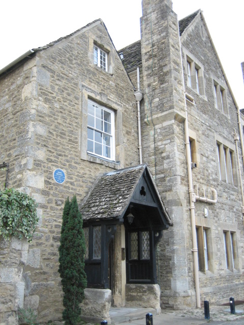
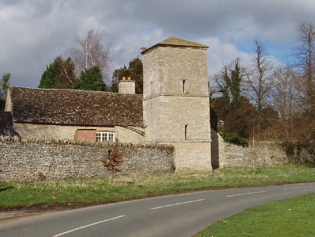
The village boasts a rich history, dating back to the Domesday Book of 1086, where it was mentioned as "Elesfeld." Its name is believed to derive from Old English, meaning "open land near an ash tree." Elsfield is characterized by a collection of charming cottages and historic buildings, many of which date back to the 17th and 18th centuries.

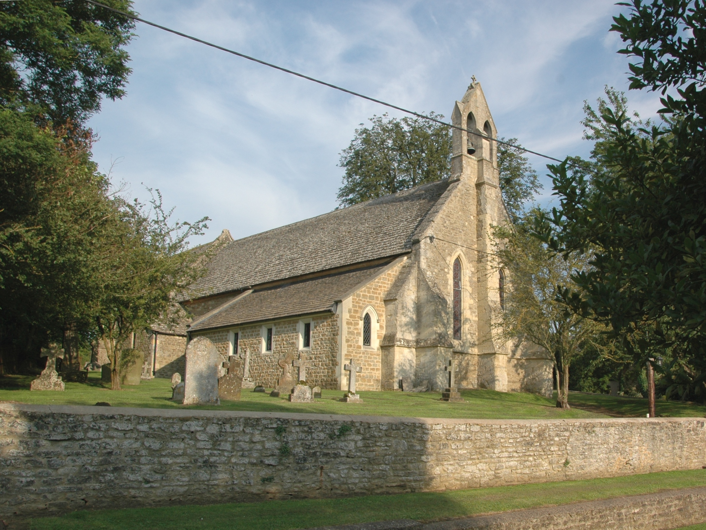
The centerpiece of the village is the St. Thomas à Becket Church, a beautiful Norman-style church dating back to the 12th century. The church features stunning stained glass windows and a serene churchyard, providing a peaceful spot for reflection.

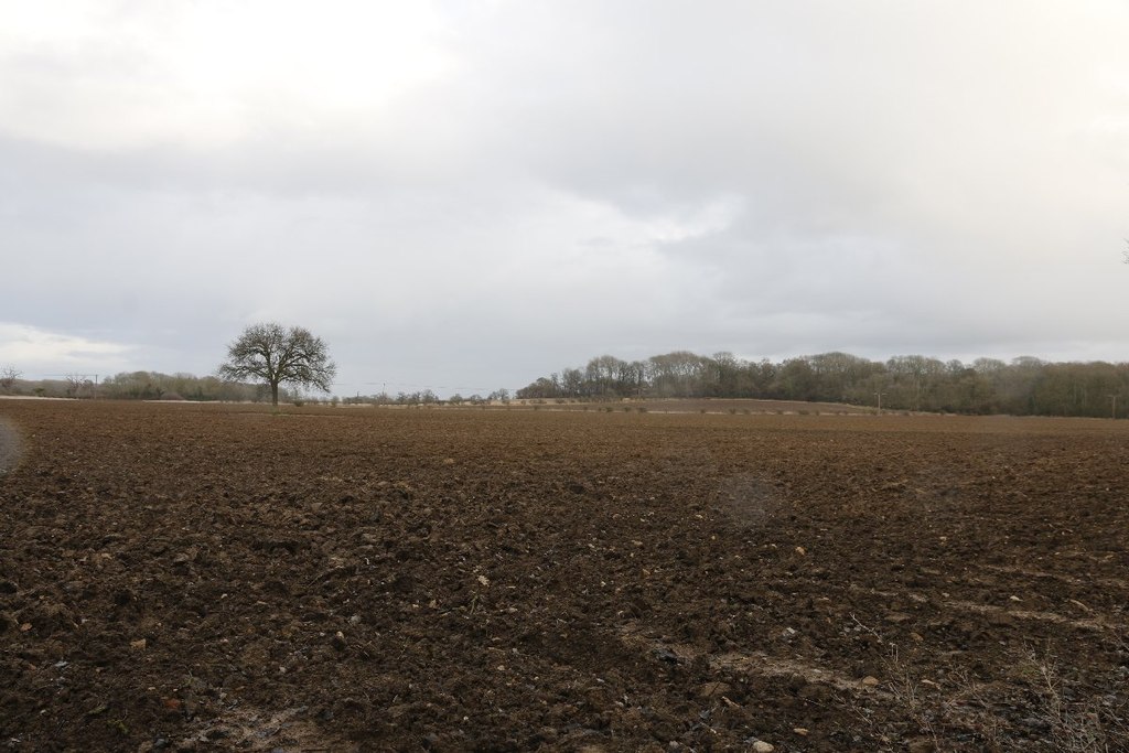
Surrounded by rolling hills and lush green fields, Elsfield offers a range of outdoor activities for nature enthusiasts. The village is crisscrossed by numerous footpaths and bridleways, providing opportunities for walking, cycling, and horse riding. Nearby Shotover Country Park is a popular destination for hikers and nature lovers, offering panoramic views of the Oxfordshire countryside.

While Elsfield may be a small village, its proximity to Oxford ensures that residents have easy access to a wide range of amenities, including shops, restaurants, and cultural attractions. The village's peaceful ambiance and rich history make it a charming and desirable place to live or visit.

If you have any feedback on the listing, please let us know in the comments section below.

Elsfield Images

Images are sourced within 2km of 51.788794/-1.218491 or Grid Reference SP5410. Thanks to Geograph Open Source API. All images are credited.

The Manor, home of John Buchan The Manor at Elsfield was the home of John Buchan from 1919 - 1935
The Manor, home of John Buchan
The Manor at Elsfield was the home of John Buchan from 1919 - 1935
Holy Rood, Woodeaton
East of Elsfield The road does a loop around this field, to North and East of Elsfield. It runs the other side of the hedge on the right and then across, below the brow of the hill, the tops of some of the trees in the hedge can just be seen.
East of Elsfield
The road does a loop around this field, to North and East of Elsfield. It runs the other side of the hedge on the right and then across, below the brow of the hill, the tops of some of the trees in the hedge can just be seen.
Discreet silo Nicely positioned between two trees on the brow of the hill.
Discreet silo
Nicely positioned between two trees on the brow of the hill.
Drun's Hill With Woodeaton Wood coming in from the left.
Drun's Hill
With Woodeaton Wood coming in from the left.
The Manor House, Elsfield
Blue plaque for John Buchan On the wall of the Manor House, Elsfield <a href="https://www.geograph.org.uk/photo/334513">SP5310 : The Manor House, Elsfield</a>
Blue plaque for John Buchan
On the wall of the Manor House, Elsfield SP5310 : The Manor House, Elsfield
House by road junction At the point where the Elsfield to Beckley road crosses the B4027.
House by road junction
At the point where the Elsfield to Beckley road crosses the B4027.
The drive to Upper Wood's Farm From the B4027.
The drive to Upper Wood's Farm
From the B4027.
Pasture and Noke Wood View from Folly Farm, Beckley, looking towards Otmoor. It seems to be newly sown grass.
Pasture and Noke Wood
View from Folly Farm, Beckley, looking towards Otmoor. It seems to be newly sown grass.
Tree reflected in wet wheatfield After heavy rain there was standing water in the field. Photo from road just by Bayswater Brook.
Tree reflected in wet wheatfield
After heavy rain there was standing water in the field. Photo from road just by Bayswater Brook.
Woodeaton Manor School This has been run by Oxfordshire County Council as a special needs school.
Woodeaton Manor School
This has been run by Oxfordshire County Council as a special needs school.
Tree-lined track This farm track between fields is the public footpath from Woodeaton to Cutteslowe
Tree-lined track
This farm track between fields is the public footpath from Woodeaton to Cutteslowe
Wet field near Marston Common Just by the bridge over Bayswater Brook. Field wet after heavy rain.
Wet field near Marston Common
Just by the bridge over Bayswater Brook. Field wet after heavy rain.
Bayswater Brook View by road to Woodeaton. Looking at the map, the brook has a rather circuitous route, from Shotover, past Sandhills and Barton, by Old Marston , back north to this site and a kilometre on joins the Cherwell.
Bayswater Brook
View by road to Woodeaton. Looking at the map, the brook has a rather circuitous route, from Shotover, past Sandhills and Barton, by Old Marston , back north to this site and a kilometre on joins the Cherwell.
Woodeaton Church from the south 13th century church with 14th century tower. See also <a href="https://www.geograph.org.uk/photo/92037">SP5311 : Holy Rood, Woodeaton</a> which is a view from the north.
Woodeaton Church from the south
13th century church with 14th century tower. See also SP5311 : Holy Rood, Woodeaton which is a view from the north.
Tower at Woodeaton Manor View from road by church.
Tower at Woodeaton Manor
View from road by church.
Woodeaton Manor Built in 1775. This south face is the back of the house. The extension on the right was built by Sir John Soane in 1791. View from public footpath.
Woodeaton Manor
Built in 1775. This south face is the back of the house. The extension on the right was built by Sir John Soane in 1791. View from public footpath.
Show me another place!

Elsfield is located at Grid Ref: SP5410 (Lat: 51.788794, Lng: -1.218491)

Administrative County: Oxfordshire

District: South Oxfordshire

Police Authority: Thames Valley

What 3 Words

///bells.bridge.amber. Near Oxford, Oxfordshire

Nearby Locations

Ridings Wood Elsfield

Related Wikis

Elsfield

Elsfield is an English village and civil parish about 3 miles (5 km) northeast of the centre of Oxford. The village is 310 feet (94 m) above sea level...

Oxford Montessori Schools

Oxford Montessori Schools is a group of progressive, co-educational private schools based in and around Oxford, England. Founded in 1990, the Oxford Montessori...

Woodeaton Wood

Woodeaton Wood is a 14-hectare (35-acre) biological Site of Special Scientific Interest north of Oxford in Oxfordshire.This coppice with standards on calcareous...

Oxford City Nomads F.C.

Oxford City Nomads Football Club was a football club based in Oxford, England. == History == The club was established in 1936 as Quarry Nomads, a youth...

Long Crendon F.C.

Long Crendon Football Club is a football club based in Long Crendon, Buckinghamshire, England. They are currently members of the Hellenic League Division...

Oxford United W.F.C.

Oxford United Women's Football Club is an English women's football club affiliated with Oxford United, and founded in 2005. They had major success in their...

Oxford City F.C.

Oxford City Football Club is a semi-professional association football club based in Marston, Oxford, England. In 2023–24 they will compete in the National...

Marston, Oxford

Marston is a village in the civil parish of Old Marston about 2 miles (3 km) northeast of the centre of Oxford, England. It was absorbed within the city...

Nearby Amenities

Located within 500m of 51.788794,-1.218491
Elsfield
Place: village
Source: NPE
Wikipedia: en:Elsfield
Lat/Long: 51.7863053/-1.2174286
Barrier: chicane
Lat/Long: 51.791624/-1.2158356
Barrier: stile
Lat/Long: 51.7855064/-1.2165665
Barrier: stile
Lat/Long: 51.7871495/-1.2160847
Barrier: stile
Lat/Long: 51.7859177/-1.2170288
Post Box
Check Date: 2021-05-25
Collection Times: Mo-Fr 16:30; Sa 10:00
Ref: OX3 41
Royal Cypher: EIIR
Royal Cypher Wikidata: Q33102113
Lat/Long: 51.7880884/-1.2186165
Church
Frequency: 0
Naptan AtcoCode: 340000035OV
Naptan Bearing: N
Naptan BusStopType: CUS
Naptan CommonName: Church
Naptan Indicator: Opposite
Naptan Landmark: Vicarage
Naptan NaptanCode: oxfawtja
Naptan Street: Elsfield Road
Naptan Verified: no
Source: naptan_import
Lat/Long: 51.7859461/-1.2182129
Power: pole
Lat/Long: 51.7909869/-1.219873
Power: pole
Lat/Long: 51.7887189/-1.2177165
Power: pole
Lat/Long: 51.7929975/-1.2198998
Power: pole
Lat/Long: 51.7906616/-1.2245451
Power: pole
Lat/Long: 51.7912738/-1.2190012
Power: pole
Lat/Long: 51.7918512/-1.2197442
Power: pole
Lat/Long: 51.7906717/-1.2207393
Power: pole
Lat/Long: 51.7907197/-1.2182958
Direction: 135
Generator Method: photovoltaic
Generator Output Electricity: yes
Generator Solar Modules: 6
Generator Source: solar
Generator Type: solar_photovoltaic_panel
Location: roof
Power: generator
Lat/Long: 51.7914474/-1.2152776
Parking
Access: customers
Capacity: 4
Parking: surface
Lat/Long: 51.7856819/-1.2177641
Historic: memorial
Inscription: John Buchan, First Baron Tweedsmuir of Elsfield, Author, Governor-General of Canada, lived here, 1919-1935
Memorial: blue_plaque
Lat/Long: 51.7875888/-1.2188691
Barrier: stile
Lat/Long: 51.7882048/-1.2181515
Barrier: stile
Lat/Long: 51.7881167/-1.2176724
Barrier: stile
Foot: yes
Lat/Long: 51.7879652/-1.2168985
Barrier: stile
Lat/Long: 51.7880951/-1.2175553
CHD Equestrian
Addr Housename: Home Farm
Addr Place: Elsfield
Addr Postcode: OX3 9UH
Contact Mobile: +447711888569
Contact Website: http://www.chdequestrian.co.uk/
Leisure: horse_riding
Lat/Long: 51.787268/-1.2172642
The data included in this document is from www.openstreetmap.org. The data is made available under ODbL.

Have you been to Elsfield?

Leave your review of Elsfield below (or comments, questions and feedback).