Sunoak Plantation

Wood, Forest in Sussex Horsham

England

Sunoak Plantation

Rural Bridleway near Horsham, West Sussex This bridleway runs up a straight avenue of trees that cuts across the old St. Leonards estate from a gate lodge on the public road to the "Big House". Offered a very pleasant cycle ride on the day of the photo! Photo taken looking N along the avenue. Corn fields can be seen on the other side of the trees on the right.
Rural Bridleway near Horsham, West Sussex Credit: Pete Chapman

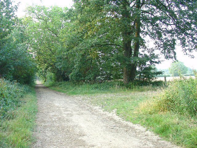
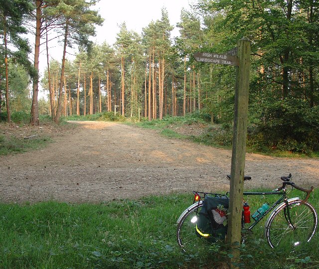
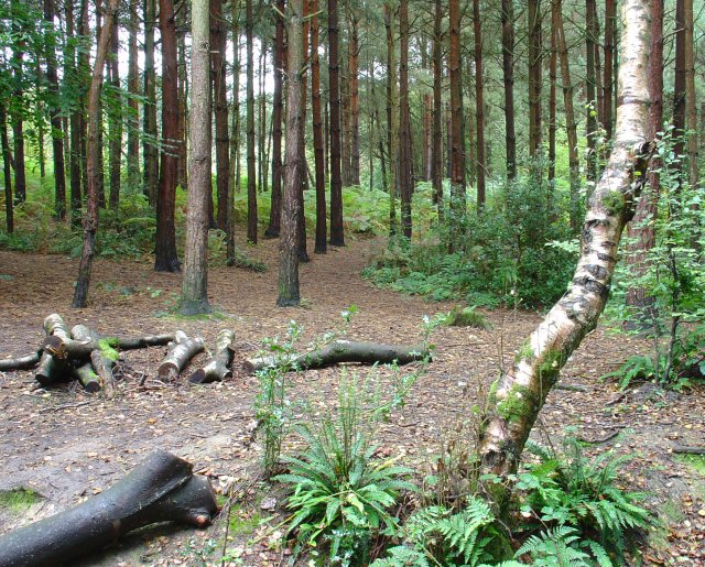
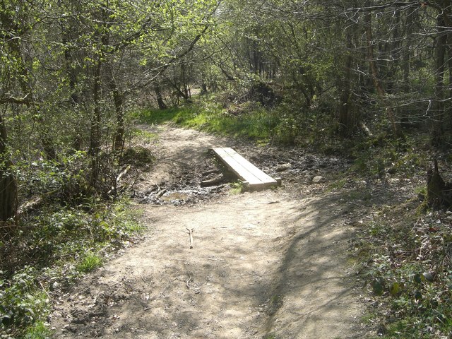
Sunoak Plantation is a picturesque woodland located in Sussex, England. Situated amidst the serene surroundings of dense forests and lush greenery, it offers a tranquil escape from the hustle and bustle of city life. The plantation spans over a vast area and is known for its spectacular sun-soaked oak trees, which give the estate its name.

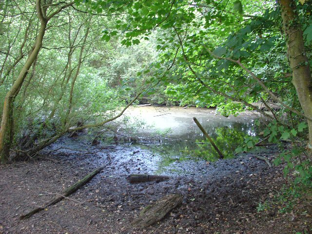
The woodland is home to a diverse range of flora and fauna, making it a haven for nature enthusiasts and wildlife lovers. The majestic oak trees dominate the landscape and provide a habitat for various bird species, including owls and woodpeckers. The forest floor is adorned with a vibrant carpet of bluebells and other wildflowers during the spring season, creating a mesmerizing sight.

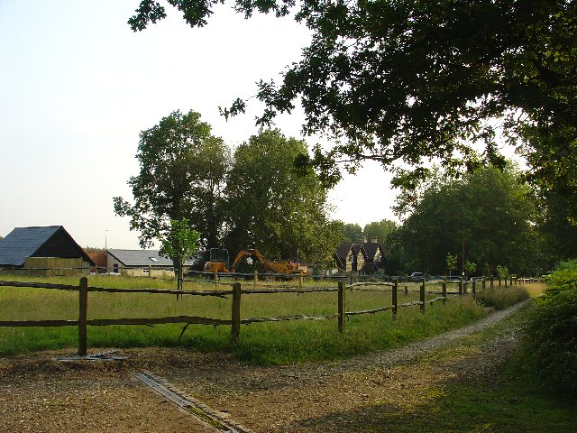
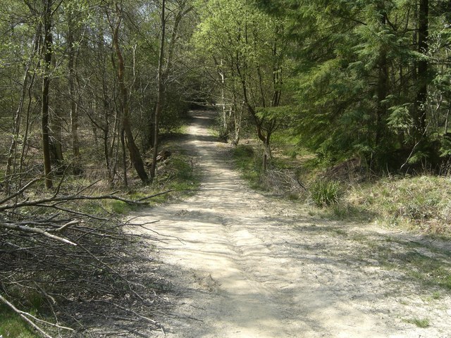
Sunoak Plantation offers several walking trails and nature paths, allowing visitors to explore the beauty of the woodland at their own pace. The well-maintained paths wind through the forest, offering glimpses of the enchanting wildlife and panoramic views of the surrounding countryside.

The plantation also hosts educational programs and nature walks, providing an opportunity for visitors to learn about the ecosystem and the importance of preserving the natural environment. Additionally, there are picnic areas and designated spots for outdoor activities, making it an ideal destination for families and groups.

Overall, Sunoak Plantation is a remarkable woodland retreat that showcases the natural beauty of Sussex. With its tranquil ambiance, diverse wildlife, and scenic trails, it offers a rejuvenating experience for nature lovers and a peaceful escape for those seeking solace in the lap of nature.

If you have any feedback on the listing, please let us know in the comments section below.

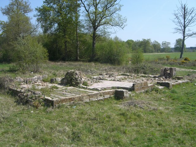
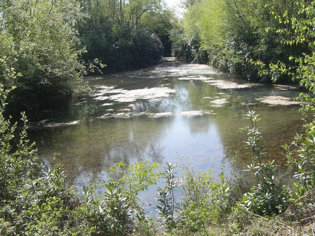
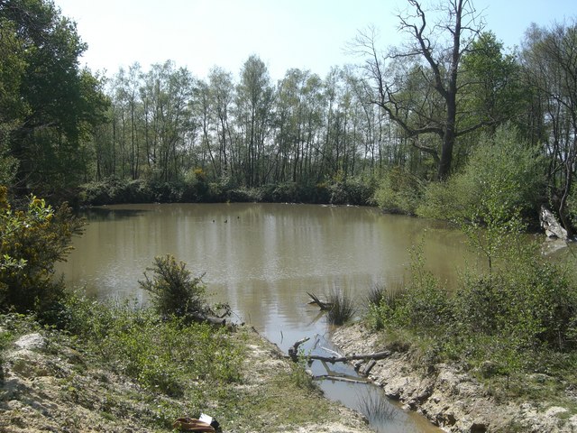
Sunoak Plantation Images

Images are sourced within 2km of 51.057466/-0.2858044 or Grid Reference TQ2030. Thanks to Geograph Open Source API. All images are credited.

Rural Bridleway near Horsham, West Sussex This bridleway runs up a straight avenue of trees that cuts across the old St. Leonards estate from a gate lodge on the public road to the "Big House". Offered a very pleasant cycle ride on the day of the photo! Photo taken looking N along the avenue. Corn fields can be seen on the other side of the trees on the right.
Rural Bridleway near Horsham, West Sussex
This bridleway runs up a straight avenue of trees that cuts across the old St. Leonards estate from a gate lodge on the public road to the "Big House". Offered a very pleasant cycle ride on the day of the photo! Photo taken looking N along the avenue. Corn fields can be seen on the other side of the trees on the right.
Stew Pond, adjacent to bridleway, St Leonards Park Estate, Near Horsham, West Sussex. The original purpose of this pond (and an adjacent pond) is not obvious, but its proximity to the main estate buildings may mean that it was used as water storage or a fish pond to supply the estate. Relatively overgrown and unused these days!
Stew Pond, adjacent to bridleway, St Leonards Park Estate, Near Horsham, West Sussex.
The original purpose of this pond (and an adjacent pond) is not obvious, but its proximity to the main estate buildings may mean that it was used as water storage or a fish pond to supply the estate. Relatively overgrown and unused these days!
Forest Grange, in the heart of St Leonards Forest, Near Horsham, West Sussex Earlier maps (e.g. 1993) show this as the site of Forest Grange School. Later maps have dropped school from the name. It didn't looked like it was being used as a school at the time the picture was taken.
Forest Grange, in the heart of St Leonards Forest, Near Horsham, West Sussex
Earlier maps (e.g. 1993) show this as the site of Forest Grange School. Later maps have dropped school from the name. It didn't looked like it was being used as a school at the time the picture was taken.
Forestry Operations, St Leonards Forest, Near Horsham, West Sussex The forest is run by the Forestry Commission for commercial timber extraction. Here we see a lorry on the main access track (also a public bridleway) being loaded up with logs.
Forestry Operations, St Leonards Forest, Near Horsham, West Sussex
The forest is run by the Forestry Commission for commercial timber extraction. Here we see a lorry on the main access track (also a public bridleway) being loaded up with logs.
Track Junction in St Leonard Forest. Part of the High Weald Landscape Trail The main bridleway through the middle of the forest intersects with several public footpaths. Here we see where one of the paths (part of the route of the High Weald Landscape Trail) leads off along an intersceting track. The View also shows the characteristic trees in this forest, which are mainly pine.
Track Junction in St Leonard Forest. Part of the High Weald Landscape Trail
The main bridleway through the middle of the forest intersects with several public footpaths. Here we see where one of the paths (part of the route of the High Weald Landscape Trail) leads off along an intersceting track. The View also shows the characteristic trees in this forest, which are mainly pine.
Owlbeech Woods, Horsham, West Sussex Mixed woodland. The part shown is a coniferous plantation. The woods join on to Leechpool woods <a href="https://www.geograph.org.uk/gridref/TQ1931">TQ1931</a>. Owned an run by Horsham District Council, who permit general public access.
Owlbeech Woods, Horsham, West Sussex
Mixed woodland. The part shown is a coniferous plantation. The woods join on to Leechpool woods TQ1931. Owned an run by Horsham District Council, who permit general public access.
Motocross track near to Horsham, West Sussex A view facing roughly north of the start line, with St. Leonard's forest in the background.
Motocross track near to Horsham, West Sussex
A view facing roughly north of the start line, with St. Leonard's forest in the background.
Mick Mills Race, St Leonards Forest Mick Mills (or is it Miles?) race.  Mick, a local braggart, boasted he could outrace anyone.  
The Devil took up the challenge.  
The resulting contest, which Mick won, left a course through the forest on which no tree would grow.
Being gravelled and a forestry access route probably helps.
Mick Mills Race, St Leonards Forest
Mick Mills (or is it Miles?) race. Mick, a local braggart, boasted he could outrace anyone. The Devil took up the challenge. The resulting contest, which Mick won, left a course through the forest on which no tree would grow. Being gravelled and a forestry access route probably helps.
Turf  Plain Turf Plain looking to the south east.  The ground dips just beyond the trees to Sheepwash Ghyll and then rises to Scragged Oak Hill in St Leonard's Forest.
Bottom left of the picture passes the High Weald Landscape Trail.
Turf Plain
Turf Plain looking to the south east. The ground dips just beyond the trees to Sheepwash Ghyll and then rises to Scragged Oak Hill in St Leonard's Forest. Bottom left of the picture passes the High Weald Landscape Trail.
Turf Plain Lodge The ground floor pattern of Turf Plain Lodge can be clearly seen.  The High Weald Landscape Trail passes just beyond the remains.
Turf Plain Lodge
The ground floor pattern of Turf Plain Lodge can be clearly seen. The High Weald Landscape Trail passes just beyond the remains.
Turf Plain pond One of several ponds on Turf Plain.  This one feeds to a commercial fishery.
Turf Plain pond
One of several ponds on Turf Plain. This one feeds to a commercial fishery.
Earthbank on Greenbroom Hill The earthbank goes west down Greenbroom Hill for approximately 200m.  Silver birch is here on the top of the bank which heads into a pine plantation.  The earthbank continues east for approximately 25m on the other side of the forestry track.
Earthbank on Greenbroom Hill
The earthbank goes west down Greenbroom Hill for approximately 200m. Silver birch is here on the top of the bank which heads into a pine plantation. The earthbank continues east for approximately 25m on the other side of the forestry track.
Whitevane Pond The notice says it all,  this is a very private fishery.
Try <span class="nowrap"><a title="http://www.fisheries.co.uk/whitevane/index.htm" rel="nofollow ugc noopener" href="http://www.fisheries.co.uk/whitevane/index.htm">Link</a><img style="margin-left:2px;" alt="External link" title="External link - shift click to open in new window" src="https://s1.geograph.org.uk/img/external.png" width="10" height="10"/></span>  for more pictures.
In 1879 Whitevane pond had Boat House on the west shore.
Whitevane Pond
The notice says it all, this is a very private fishery. Try LinkExternal link for more pictures. In 1879 Whitevane pond had Boat House on the west shore.
Pond on Turf  Plain Another pond on Turf Plain, this one drains a nearby motocross circuit.
Pond on Turf Plain
Another pond on Turf Plain, this one drains a nearby motocross circuit.
Lily Beds Dam 'St Leonard fought the local dragon and where the saint bled and drops of his blood touched the ground, lilies grew.'
The area of St Leonard's forest to the south of Greenbroom Hill and running down to Sheepwah Ghyll is known as the Liy beds; This track passes through the area on its way to Turf Plain.
Lily Beds Dam
'St Leonard fought the local dragon and where the saint bled and drops of his blood touched the ground, lilies grew.' The area of St Leonard's forest to the south of Greenbroom Hill and running down to Sheepwah Ghyll is known as the Liy beds; This track passes through the area on its way to Turf Plain.
Plank bridge by Sheepwash Ghyll A small stream runs down to Sheepwash ghyll and is crossed by this two plank bridge.
Plank bridge by Sheepwash Ghyll
A small stream runs down to Sheepwash ghyll and is crossed by this two plank bridge.
Ford across Sheepwash Ghyll, Lower Beeding A slab of 'Horsham stone' in the bed of Sheepwash Ghyll provides a shallow ford and a small waterfall for the footpath as it heads east up Scragged Oak Hill.
Sheepwash Ghyll?
In 1332 Sheepwash farm was the home of Philip atte Shepewash of West Grinstead which adjoins Nuthurst.  However Sheepwash farm is some 6km to the south at TQ184244 and the Ghyll itself after passing through Roosthole flows west under Birchen bridge as the river Arun.
Ford across Sheepwash Ghyll, Lower Beeding
A slab of 'Horsham stone' in the bed of Sheepwash Ghyll provides a shallow ford and a small waterfall for the footpath as it heads east up Scragged Oak Hill. Sheepwash Ghyll? In 1332 Sheepwash farm was the home of Philip atte Shepewash of West Grinstead which adjoins Nuthurst. However Sheepwash farm is some 6km to the south at TQ184244 and the Ghyll itself after passing through Roosthole flows west under Birchen bridge as the river Arun.
Mick's Cross This enclosure in Mick's Cross plantation is approximately 10 metres square and just off the track leading from Roosthole carpark to the south end of Mick Mill's Race.
In line with the gate it contains a low corrugated iron platform with two venting? pipes and a shaft driven gear wheel.  To the right, by the timber, is a water tank.  
Further photos on request!
Mick's Cross
This enclosure in Mick's Cross plantation is approximately 10 metres square and just off the track leading from Roosthole carpark to the south end of Mick Mill's Race. In line with the gate it contains a low corrugated iron platform with two venting? pipes and a shaft driven gear wheel. To the right, by the timber, is a water tank. Further photos on request!
Show me another place!

Sunoak Plantation is located at Grid Ref: TQ2030 (Lat: 51.057466, Lng: -0.2858044)

Administrative County: West Sussex

District: Horsham

Police Authority: Sussex

What 3 Words

///rise.costly.calculate. Near Horsham, West Sussex

Related Wikis

St Leonard's Park Ponds

St Leonard's Park Ponds is a 3.9-hectare (9.6-acre) biological Site of Special Scientific Interest east of Horsham in West Sussex. These ponds and adjacent...

St Leonard's Forest SSSI

St Leonard's Forest SSSI is an 85.4-hectare (211-acre) biological Site of Special Scientific Interest east of Horsham in West Sussex. The SSSI is in two...

Mannings Heath Golf & Wine Estate

Mannings Heath Golf & Wine Estate is located in Mannings Heath, Horsham in the south of England. The 500 acre parkland site includes two golf courses and...

Horsham Riverside (electoral division)

Horsham Riverside is an electoral division of West Sussex in the United Kingdom and returns one member to sit on West Sussex County Council. == Extent... ==

Nearby Amenities

Located within 500m of 51.057466,-0.2858044
Sunoak Farm
Place: farm
Lat/Long: 51.0568073/-0.2860364
The data included in this document is from www.openstreetmap.org. The data is made available under ODbL.

Have you been to Sunoak Plantation?

Leave your review of Sunoak Plantation below (or comments, questions and feedback).