Elmley Castle

Settlement in Worcestershire Wychavon

England

Elmley Castle

The Salt Way A bridleway section north from the winding lane between Elmley Castle and Ashton.
These ancient routes centred upon Droitwich and radiate out to ports and centres of population, in this case to Lechlade where it could be transported to London on the Thames.
The Salt Way Credit: Jonathan Billinger

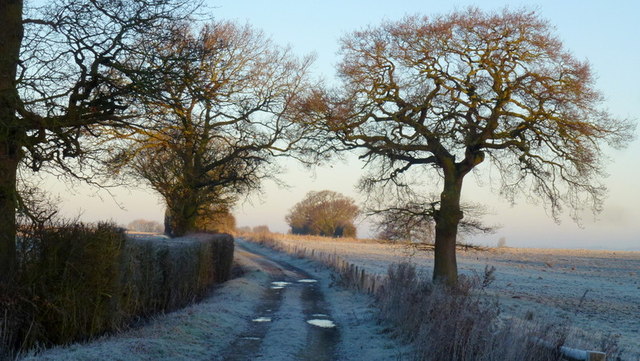
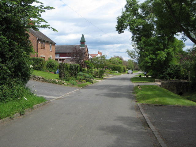
Elmley Castle is a picturesque village located in the county of Worcestershire, England. Situated on the eastern slopes of Bredon Hill, the village offers breathtaking views of the surrounding countryside and is renowned for its charm and tranquility.

The origins of Elmley Castle can be traced back to the medieval period, with historical records mentioning the village as early as the 11th century. The village takes its name from a former Norman castle that once stood nearby, although only remnants of its earthworks can be seen today.

The heart of Elmley Castle is its village green, a well-maintained open space surrounded by a mix of charming cottages, some dating back several centuries. The village also boasts a beautiful parish church, St. Mary's, which dates back to the 13th century and features stunning stained glass windows and a picturesque churchyard.

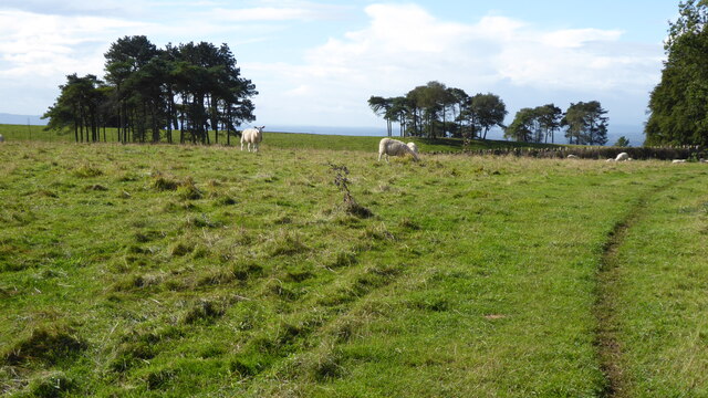
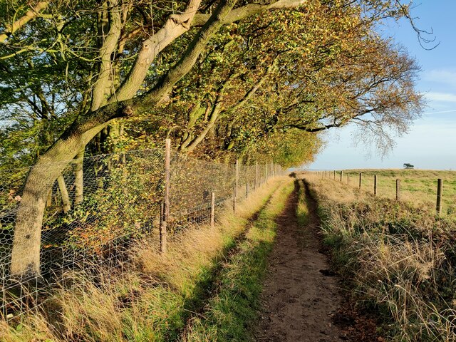
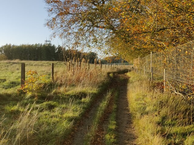
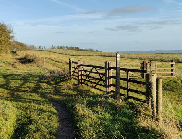
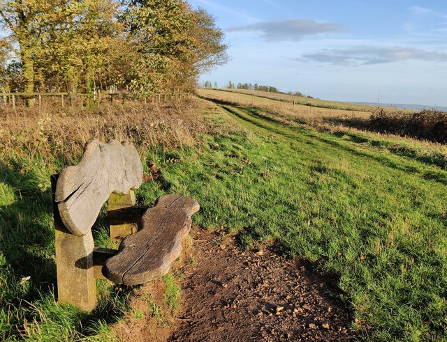
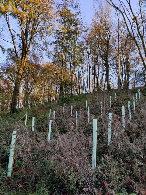
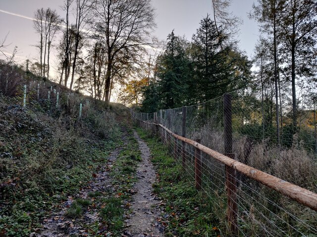
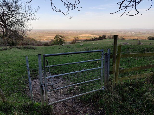
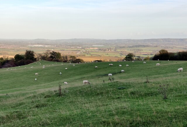
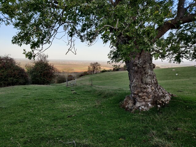
Nature enthusiasts will find Elmley Castle a perfect destination, as the village is located in an Area of Outstanding Natural Beauty. Bredon Hill, just a short distance from the village, offers numerous walking trails and is home to a rich variety of flora and fauna.

Despite its small size, Elmley Castle has a strong sense of community and hosts various annual events and activities, including a summer fete and a Christmas market. The village also has a traditional pub, The Queen Elizabeth, where locals and visitors can enjoy a pint and a hearty meal.

Overall, Elmley Castle is a hidden gem in Worcestershire, offering a peaceful retreat and a glimpse into the area's rich history and natural beauty.

If you have any feedback on the listing, please let us know in the comments section below.

Elmley Castle Images

Images are sourced within 2km of 52.068634/-2.027293 or Grid Reference SO9841. Thanks to Geograph Open Source API. All images are credited.

The Salt Way A bridleway section north from the winding lane between Elmley Castle and Ashton.
These ancient routes centred upon Droitwich and radiate out to ports and centres of population, in this case to Lechlade where it could be transported to London on the Thames.
The Salt Way
A bridleway section north from the winding lane between Elmley Castle and Ashton. These ancient routes centred upon Droitwich and radiate out to ports and centres of population, in this case to Lechlade where it could be transported to London on the Thames.
Sheep and trees on Bredon Hill The trees in the background are in clump giving the impression it has been planted as an estate parkland.
Sheep and trees on Bredon Hill
The trees in the background are in clump giving the impression it has been planted as an estate parkland.
Telecommunications mast on Bredon Hill Bredon Hill, 299 m (981 ft), is in South Worcestershire, it is geologically part of the Cotswolds but stands isolated in the Vale of Evesham.
There is a small stone tower on the summit called Parsons Folly, along with the remains of an Iron Age hill fort known as Kemerton Camp, abandoned in the 1st century AD.
Telecommunications mast on Bredon Hill
Bredon Hill, 299 m (981 ft), is in South Worcestershire, it is geologically part of the Cotswolds but stands isolated in the Vale of Evesham. There is a small stone tower on the summit called Parsons Folly, along with the remains of an Iron Age hill fort known as Kemerton Camp, abandoned in the 1st century AD.
Wychavon Way at Long Plantation on Bredon Hill The Wychavon Way begins in the Worcestershire town of Droitwich Spa and ends in the Cotswold village of Broadway. The trail is about 40 miles (64 km) in length and was created in 1977 to celebrate the Queen's Silver Jubilee.
Wychavon Way at Long Plantation on Bredon Hill
The Wychavon Way begins in the Worcestershire town of Droitwich Spa and ends in the Cotswold village of Broadway. The trail is about 40 miles (64 km) in length and was created in 1977 to celebrate the Queen's Silver Jubilee.
Wychavon Way on Bredon Hill The Wychavon Way begins in the Worcestershire town of Droitwich Spa and ends in the Cotswold village of Broadway. The trail is about 40 miles (64 km) in length and was created in 1977 to celebrate the Queen's Silver Jubilee.
Wychavon Way on Bredon Hill
The Wychavon Way begins in the Worcestershire town of Droitwich Spa and ends in the Cotswold village of Broadway. The trail is about 40 miles (64 km) in length and was created in 1977 to celebrate the Queen's Silver Jubilee.
Seat along the Wychavon Way on Bredon Hill Bredon Hill, 299 m (981 ft), is in South Worcestershire, it is geologically part of the Cotswolds but stands isolated in the Vale of Evesham.
There is a small stone tower on the summit called Parsons Folly, along with the remains of an Iron Age hill fort known as Kemerton Camp, abandoned in the 1st century AD.
Seat along the Wychavon Way on Bredon Hill
Bredon Hill, 299 m (981 ft), is in South Worcestershire, it is geologically part of the Cotswolds but stands isolated in the Vale of Evesham. There is a small stone tower on the summit called Parsons Folly, along with the remains of an Iron Age hill fort known as Kemerton Camp, abandoned in the 1st century AD.
Long Plantation on Bredon Hill Bredon Hill, 299 m (981 ft), is in South Worcestershire, it is geologically part of the Cotswolds but stands isolated in the Vale of Evesham.
There is a small stone tower on the summit called Parsons Folly, along with the remains of an Iron Age hill fort known as Kemerton Camp, abandoned in the 1st century AD.
Long Plantation on Bredon Hill
Bredon Hill, 299 m (981 ft), is in South Worcestershire, it is geologically part of the Cotswolds but stands isolated in the Vale of Evesham. There is a small stone tower on the summit called Parsons Folly, along with the remains of an Iron Age hill fort known as Kemerton Camp, abandoned in the 1st century AD.
Bridleway in Long Plantation on Bredon Hill Bredon Hill, 299 m (981 ft), is in South Worcestershire, it is geologically part of the Cotswolds but stands isolated in the Vale of Evesham.
There is a small stone tower on the summit called Parsons Folly, along with the remains of an Iron Age hill fort known as Kemerton Camp, abandoned in the 1st century AD.
Bridleway in Long Plantation on Bredon Hill
Bredon Hill, 299 m (981 ft), is in South Worcestershire, it is geologically part of the Cotswolds but stands isolated in the Vale of Evesham. There is a small stone tower on the summit called Parsons Folly, along with the remains of an Iron Age hill fort known as Kemerton Camp, abandoned in the 1st century AD.
Gate along a bridleway on Bredon Hill Bredon Hill, 299 m (981 ft), is in South Worcestershire, it is geologically part of the Cotswolds but stands isolated in the Vale of Evesham.
There is a small stone tower on the summit called Parsons Folly, along with the remains of an Iron Age hill fort known as Kemerton Camp, abandoned in the 1st century AD.
Gate along a bridleway on Bredon Hill
Bredon Hill, 299 m (981 ft), is in South Worcestershire, it is geologically part of the Cotswolds but stands isolated in the Vale of Evesham. There is a small stone tower on the summit called Parsons Folly, along with the remains of an Iron Age hill fort known as Kemerton Camp, abandoned in the 1st century AD.
Sheep at Fiddler's Knap on Bredon Hill Bredon Hill, 299 m (981 ft), is in South Worcestershire, it is geologically part of the Cotswolds but stands isolated in the Vale of Evesham.
There is a small stone tower on the summit called Parsons Folly, along with the remains of an Iron Age hill fort known as Kemerton Camp, abandoned in the 1st century AD.
Sheep at Fiddler's Knap on Bredon Hill
Bredon Hill, 299 m (981 ft), is in South Worcestershire, it is geologically part of the Cotswolds but stands isolated in the Vale of Evesham. There is a small stone tower on the summit called Parsons Folly, along with the remains of an Iron Age hill fort known as Kemerton Camp, abandoned in the 1st century AD.
Tree on Bredon Hill Bredon Hill, 299 m (981 ft), is in South Worcestershire, it is geologically part of the Cotswolds but stands isolated in the Vale of Evesham.
There is a small stone tower on the summit called Parsons Folly, along with the remains of an Iron Age hill fort known as Kemerton Camp, abandoned in the 1st century AD.
Tree on Bredon Hill
Bredon Hill, 299 m (981 ft), is in South Worcestershire, it is geologically part of the Cotswolds but stands isolated in the Vale of Evesham. There is a small stone tower on the summit called Parsons Folly, along with the remains of an Iron Age hill fort known as Kemerton Camp, abandoned in the 1st century AD.
Bridleway ascending Bredon Hill Bredon Hill, 299 m (981 ft), is in South Worcestershire, it is geologically part of the Cotswolds but stands isolated in the Vale of Evesham.
There is a small stone tower on the summit called Parsons Folly, along with the remains of an Iron Age hill fort known as Kemerton Camp, abandoned in the 1st century AD.
Bridleway ascending Bredon Hill
Bredon Hill, 299 m (981 ft), is in South Worcestershire, it is geologically part of the Cotswolds but stands isolated in the Vale of Evesham. There is a small stone tower on the summit called Parsons Folly, along with the remains of an Iron Age hill fort known as Kemerton Camp, abandoned in the 1st century AD.
Dry Stone Wall, Bredon Hill Looking down in a NE direction towards Kersoe from the Wychavon Way.
Dry Stone Wall, Bredon Hill
Looking down in a NE direction towards Kersoe from the Wychavon Way.
Long Coppice, Bredon Hill Looking in a NW direction along the Wychavon Way towards Long Coppice.
Long Coppice, Bredon Hill
Looking in a NW direction along the Wychavon Way towards Long Coppice.
Mast on Bredon Hill
Mast on Bredon Hill
Bridleway on Bredon Hill Here the bridleway passes along side Long Plantation.
Bridleway on Bredon Hill
Here the bridleway passes along side Long Plantation.
Bridleway This bridleway provides a shortcut compared to the road, which makes a detour through Elmley Castle.
Bridleway
This bridleway provides a shortcut compared to the road, which makes a detour through Elmley Castle.
Show me another place!

Elmley Castle is located at Grid Ref: SO9841 (Lat: 52.068634, Lng: -2.027293)

Administrative County: Worcestershire

District: Wychavon

Police Authority: West Mercia

What 3 Words

///cured.cowboys.sweetener. Near Pershore, Worcestershire

Nearby Locations

Elmley Castle

Related Wikis

Elmley Castle

Elmley Castle is a village and civil parish in Worcestershire, in England, United Kingdom. It is located on the north side of Bredon Hill 3 miles south...

Elmley Castle (castle)

Elmley Castle was a late 11th-century earthwork and timber castle which received stone additions in the 12th and possibly 13th centuries, located 0.5 miles...

Netherton, Worcestershire

Netherton is a hamlet with population of 50 living in 20 households. It is part of the civil parish of Elmley Castle, Bricklehampton & Netherton in...

Bricklehampton

Bricklehampton is a village and civil parish in Worcestershire, England. In the 2021 census the population of the parish was recorded as 236. Its area...

Kersoe

Kersoe is a hamlet in Worcestershire, England. It is at the foot of Bredon Hill an area of outstanding natural beauty.

Little Comberton

Little Comberton is a small village in Worcestershire, England. It is located 2.5 miles (4.0 km) to the southeast of Pershore. Little Comberton has a village...

Bredon Hill Hoard

The Bredon Hill Hoard (also known as the Bredon Hill Roman Coin Hoard) is a hoard of 3,784 debased silver Roman coins discovered in June 2011 by two metal...
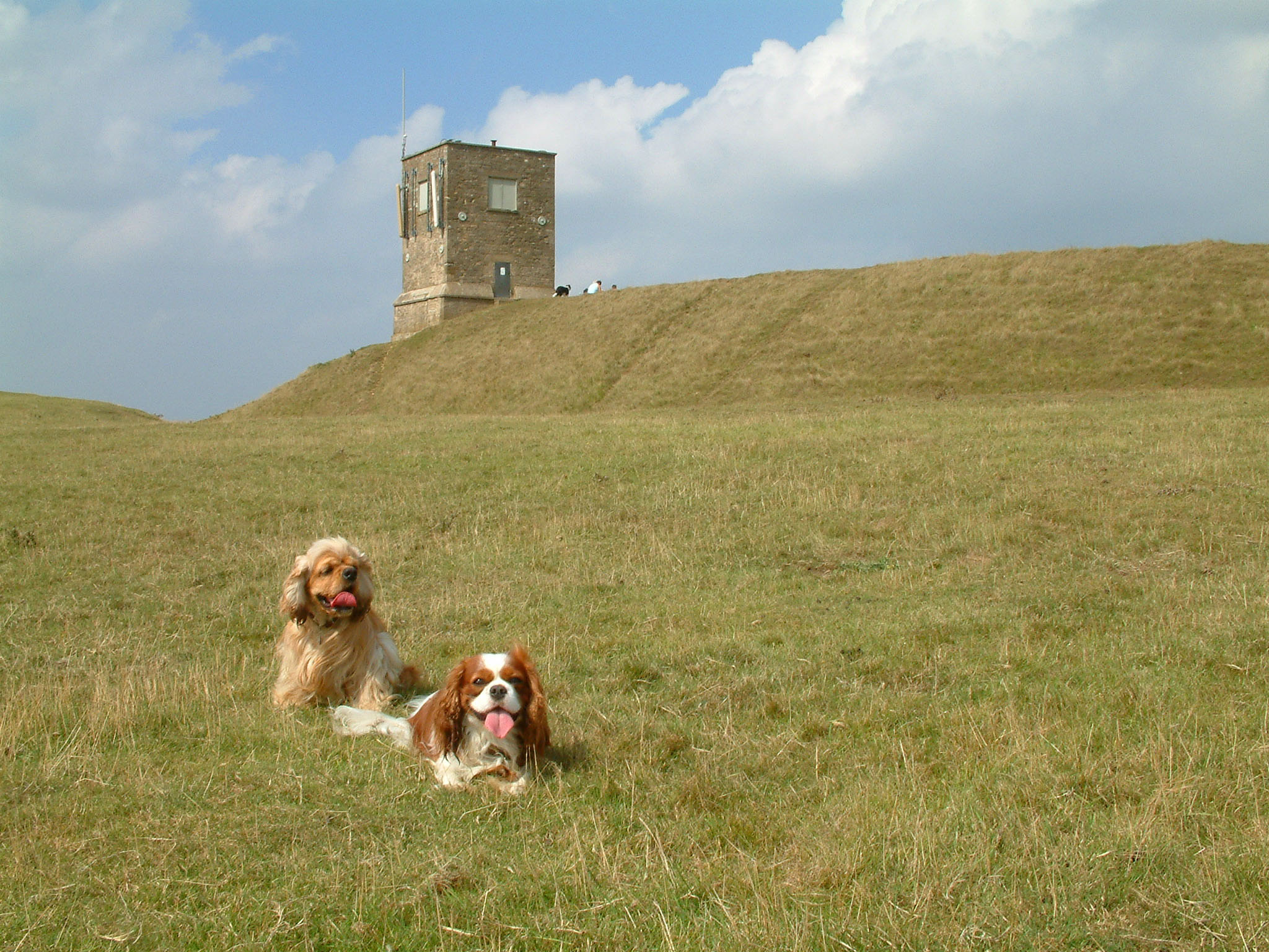
Bredon Hill

Bredon Hill is a hill in Worcestershire, England, south-west of Evesham in the Vale of Evesham. The summit of the hill is in the parish of Kemerton, and...

Nearby Amenities

Located within 500m of 52.068634,-2.027293
Elmley Castle
Place: village
Wikidata: Q1900066
Lat/Long: 52.0699085/-2.0282656
Bus Stop
Queen Elizabeth
Bus: yes
Naptan AtcoCode: 2000G073500
Naptan Bearing: N
Naptan CommonName: Queen Elizabeth
Naptan Indicator: Adj
Naptan Landmark: Queen Elizabeth Inn
Naptan NaptanCode: wocgmwam
Naptan Street: Main Street
Naptan Verified: no
Public Transport: platform
Source: naptan_import
Lat/Long: 52.0686082/-2.0274124
Bus Stop
Netherton Lane Village Hall
Bus: yes
Naptan AtcoCode: 2000G073501
Naptan Bearing: SE
Naptan CommonName: Netherton Lane Village Hall
Naptan Crossing: Netherton Lane
Naptan Indicator: Adj
Naptan Landmark: Village Hall
Naptan NaptanCode: wocgmwap
Naptan Street: New Road
Naptan Verified: no
Public Transport: platform
Source: naptan_import
Lat/Long: 52.0711349/-2.0261009
Netherton Lane Village Hall
Naptan AtcoCode: 2000G323229
Naptan Bearing: NW
Naptan BusStopType: CUS
Naptan CommonName: Netherton Lane Village Hall
Naptan Indicator: opp
Naptan Landmark: Village Hall
Naptan NaptanCode: wocdmaja
Naptan Street: New Road
Naptan Verified: no
Source: naptan_import
Lat/Long: 52.0710449/-2.0263051
Bus Stop
Elmley Castle First School
Bus: yes
Naptan AtcoCode: 2000G671015
Naptan Bearing: SW
Naptan CommonName: Elmley Castle First School
Naptan Indicator: Adj
Naptan Landmark: School
Naptan NaptanCode: wocdpjpd
Naptan Street: Main Street
Naptan Verified: no
Public Transport: platform
Source: naptan_import
Lat/Long: 52.0706062/-2.0261504
Barrier: stile
Lat/Long: 52.0719712/-2.0280874
Barrier: stile
Lat/Long: 52.0718325/-2.0298703
Entrance: yes
Lat/Long: 52.0675468/-2.0278206
Barrier: stile
Material: wood
Step Count: 1
Stile: stepover
Lat/Long: 52.0664996/-2.0259581
Post Box
Collection Plate: CP7
Collection Times: Mo-Fr 16:15; Sa 07:00
Historic Operator: Royal Mail
Post Box Type: lamp
Ref: WR10 499
Royal Cypher: EIIR
Royal Cypher Wikidata: Q33102113
Source: GPS Survey
Source Ref: survey
Lat/Long: 52.0708884/-2.0231116
Post Box
Collection Plate: CP5
Collection Times: Mo-Fr 16:15; Sa 08:30
Historic Operator: (none)
Post Box Mounting: brick_pillar
Post Box Type: wall
Ref: WR10 257
Royal Cypher: GR
Royal Cypher Wikidata: Q33102273
Source: survey;gps;bing
Source Collection Times: survey
Lat/Long: 52.0692881/-2.0269993
Barrier: stile
Lat/Long: 52.0700795/-2.0213964
Barrier: stile
Lat/Long: 52.0709927/-2.0306392
Barrier: stile
Lat/Long: 52.071424/-2.027127
Barrier: stile
Lat/Long: 52.0714976/-2.0273866
Barrier: stile
Lat/Long: 52.0715842/-2.0277687
Barrier: stile
Lat/Long: 52.0716851/-2.0283217
Barrier: stile
Lat/Long: 52.0718408/-2.0297293
Post Box
Collection Plate: CP7
Collection Times: Mo-Fr 16:15; Sa 09:15
Historic Operator: Post Office
Post Box Type: lamp
Ref: WR10 501
Royal Cypher: EIIR
Royal Cypher Wikidata: Q33102113
Source: survey;gps;bing
Lat/Long: 52.0722774/-2.0264745
Barrier: kissing_gate
Source: survey
Lat/Long: 52.0694444/-2.0302224
Barrier: stile
Lat/Long: 52.0664802/-2.0225417
Barrier: stile
Lat/Long: 52.0684015/-2.023261
HE Ref: 442998
Addr Locality: Elmley Castle
Historic: monument
Listed Status: Grade II
Man Made: cross
Source Listed Status: English Heritage
Lat/Long: 52.0710614/-2.0259633
Sundial
HE Ref: 442997
Addr Locality: Elmley Castle
Historic: monument
Listed Status: Grade II
Man Made: sundial
Source Listed Status: English Heritage
Lat/Long: 52.06773/-2.0276375
Defibrillator
Booth: K6
Covered: booth
Defibrillator Location: inside old red phone box, Elmley Castle
Disused Amenity: telephone
Emergency: defibrillator
Indoor: no
Man Made: telephone_box
Ref GB The Circuit: 5A8A070C-4DEF-4046-B36E-D380B9FC6793
Source: survey
Lat/Long: 52.0693076/-2.0269829
Bench
Lat/Long: 52.0711196/-2.0259594
Leisure: picnic_table
Lat/Long: 52.0676348/-2.0246781
Post Office
Elmley Castle Mobile Post Office Service
Addr Housename: Village Hall Car Park
Addr Place: Elmley Castle
Addr Postcode: WR10 3HS
Fixme: verify by survey
Opening Hours: Tu,Th 09:00-10:00
Ref Pol Id: 136487
Source: pol_branch_list_2018-01
Lat/Long: 52.0721422/-2.0267371
Fire Hydrant
Emergency: fire_hydrant
Fire Hydrant Position: lane
Fire Hydrant Type: underground
Source: survey
Lat/Long: 52.06888/-2.0335154
Fire Hydrant
Emergency: fire_hydrant
Fire Hydrant Type: underground
Source: survey
Lat/Long: 52.0695576/-2.0321059
Fire Hydrant
Emergency: fire_hydrant
Fire Hydrant Type: underground
Source: survey
Lat/Long: 52.0684821/-2.0274387
Grit Bin
Source: survey
Lat/Long: 52.0684933/-2.0273061
Netherton Lane Elmley
Power: transformer
Transformer: distribution
Voltage Primary: 11000
Lat/Long: 52.069989/-2.023425
Elmley Castle South
Power: pole
Transformer: distribution
Voltage Primary: 11000
Lat/Long: 52.0686059/-2.0286217
Power: pole
Lat/Long: 52.0698388/-2.0203847
Power: pole
Lat/Long: 52.0700902/-2.0214294
Power: pole
Lat/Long: 52.0705823/-2.0214696
Elms Cottage
Power: pole
Transformer: distribution
Voltage Primary: 11000
Lat/Long: 52.0709286/-2.0220222
Location Transition: yes
Power: pole
Lat/Long: 52.0712229/-2.0224969
Power: pole
Lat/Long: 52.0715266/-2.0229958
Power: pole
Lat/Long: 52.0720381/-2.0238326
Elmley Castle
Power: pole
Transformer: distribution
Voltage Primary: 11000
Lat/Long: 52.0725031/-2.024585
Elmley Castle Central
Power: pole
Transformer: distribution
Voltage Primary: 11000
Lat/Long: 52.0700164/-2.0274181
Power: pole
Lat/Long: 52.0704034/-2.0279002
Power: pole
Lat/Long: 52.0708667/-2.0284688
Stewards House
Power: pole
Transformer: distribution
Voltage Primary: 11000
Lat/Long: 52.0690968/-2.0339647
Power: pole
Lat/Long: 52.0697415/-2.0327523
Power: pole
Lat/Long: 52.0699525/-2.0323627
Hill Lane
Power: pole
Transformer: distribution
Voltage Primary: 11000
Lat/Long: 52.0702489/-2.0318149
Power: pole
Lat/Long: 52.0709566/-2.0315158
Power: pole
Lat/Long: 52.0712159/-2.0303652
Power: pole
Lat/Long: 52.0714401/-2.0293204
Power: pole
Lat/Long: 52.0716589/-2.028377
Power: pole
Lat/Long: 52.0724429/-2.028273
Bench
Backrest: yes
Direction: 289
Inscription: In loving memory of Ann Sharpe 1940 - 2022
Material: wood
Seats: 3
Lat/Long: 52.0673776/-2.0273336
The data included in this document is from www.openstreetmap.org. The data is made available under ODbL.

Have you been to Elmley Castle?

Leave your review of Elmley Castle below (or comments, questions and feedback).