Carr Banks Plantation

Wood, Forest in Lincolnshire East Lindsey

England

Carr Banks Plantation

Former RAF Ludford Magna: aerial 2023 See: <span class="nowrap"><a title="https://www.bcar.org.uk/ludford-history" rel="nofollow ugc noopener" href="https://www.bcar.org.uk/ludford-history">Link</a><img style="margin-left:2px;" alt="External link" title="External link - shift click to open in new window" src="https://s1.geograph.org.uk/img/external.png" width="10" height="10"/></span>
Former RAF Ludford Magna: aerial 2023 Credit: Simon Tomson

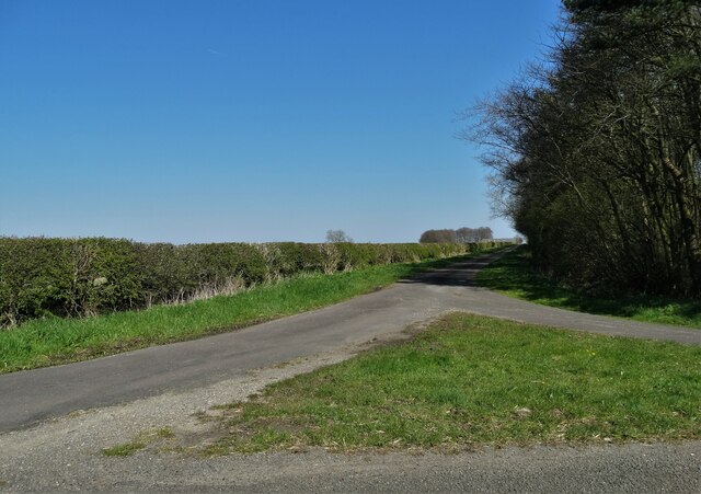
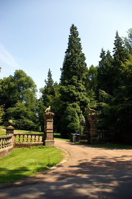
Carr Banks Plantation is a picturesque woodland area located in Lincolnshire, England. Spanning over a vast area, the plantation is known for its diverse flora and fauna, making it a popular destination for nature enthusiasts and hikers alike.

The plantation is particularly renowned for its lush woodlands, consisting of a variety of tree species such as oak, beech, and birch. These towering trees create a dense canopy, providing a haven for numerous bird species and small mammals. Visitors can often spot woodpeckers, owls, and squirrels scurrying through the branches, adding to the enchanting atmosphere of the plantation.

Traversing through Carr Banks Plantation, visitors will find a network of well-maintained walking trails that wind their way through the woodland. These trails offer incredible opportunities for exploration and provide breathtaking views of the surrounding landscape. Along the paths, one can discover vibrant wildflowers, tranquil streams, and hidden clearings where wildlife can often be observed in their natural habitat.

Carr Banks Plantation is also home to a variety of wildlife conservation efforts. The plantation management actively engages in habitat restoration and conservation projects to protect and enhance the natural ecosystem. This dedication to preserving the environment ensures that future generations can continue to enjoy the beauty and tranquility of the plantation.

Overall, Carr Banks Plantation is a haven for nature lovers, offering a serene escape from the hustle and bustle of everyday life. Whether it is to admire the diverse woodland, spot wildlife, or simply enjoy a peaceful walk, the plantation provides a truly enchanting experience for all who visit.

If you have any feedback on the listing, please let us know in the comments section below.

Carr Banks Plantation Images

Images are sourced within 2km of 53.365918/-0.2038202 or Grid Reference TF1986. Thanks to Geograph Open Source API. All images are credited.

Former RAF Ludford Magna: aerial 2023 See: <span class="nowrap"><a title="https://www.bcar.org.uk/ludford-history" rel="nofollow ugc noopener" href="https://www.bcar.org.uk/ludford-history">Link</a><img style="margin-left:2px;" alt="External link" title="External link - shift click to open in new window" src="https://s1.geograph.org.uk/img/external.png" width="10" height="10"/></span>
Former RAF Ludford Magna: aerial 2023
See: LinkExternal link
Red stained soil in shallow valley leading to Crepe Mieres Farm, Ludford: aerial 2023 (1)
Red stained soil in shallow valley leading to Crepe Mieres Farm, Ludford: aerial 2023 (2)
Ludford: aerial 2023 (1)
Ludford: aerial 2023 (2) The windmill tower at Sledge Hill is visible bottom right. See <a href="https://www.geograph.org.uk/photo/7426327">TF2089 : Windmill tower at Sledge Hill, Ludford: aerial 2023</a>.
Ludford: aerial 2023 (2)
The windmill tower at Sledge Hill is visible bottom right. See TF2089 : Windmill tower at Sledge Hill, Ludford: aerial 2023.
Looking southwards from Ludford down High Street: aerial 2023
Part of former RAF Ludford: aerial 2023 (1) See: <span class="nowrap"><a title="https://www.bcar.org.uk/ludford-history" rel="nofollow ugc noopener" href="https://www.bcar.org.uk/ludford-history">Link</a><img style="margin-left:2px;" alt="External link" title="External link - shift click to open in new window" src="https://s1.geograph.org.uk/img/external.png" width="10" height="10"/></span>
Part of former RAF Ludford: aerial 2023 (1)
See: LinkExternal link
Part of former RAF Ludford: aerial 2023 (2) See: <span class="nowrap"><a title="https://www.bcar.org.uk/ludford-history" rel="nofollow ugc noopener" href="https://www.bcar.org.uk/ludford-history">Link</a><img style="margin-left:2px;" alt="External link" title="External link - shift click to open in new window" src="https://s1.geograph.org.uk/img/external.png" width="10" height="10"/></span>
Part of former RAF Ludford: aerial 2023 (2)
See: LinkExternal link
Citroën 2CV in Ludford
The gates of Girsby Manor
Junction of Girsby Lane with Wykeham Lane
On Girsby Lane Near the junction with the track to Girsby Vale
On Girsby Lane
Near the junction with the track to Girsby Vale
On Girsby Lane near Ludford
B1225 and the road to Ludford
Hard-standing, former RAF Ludford Magna: aerial 2023
A631 westbound in Ludford
Six Hills Lane, Ludford Six Hills is about two miles from here.
Six Hills Lane, Ludford
Six Hills is about two miles from here.
The drive to Sixhills Walk Farm
Show me another place!

Carr Banks Plantation is located at Grid Ref: TF1986 (Lat: 53.365918, Lng: -0.2038202)

Administrative County: Lincolnshire

District: East Lindsey

Police Authority: Lincolnshire

What 3 Words

///dreamers.total.crunching. Near Market Rasen, Lincolnshire

Nearby Locations

Carr Banks Plantation

Related Wikis

Girsby, Lincolnshire

Girsby is a hamlet in the East Lindsey district of Lincolnshire, England. It is situated less than 1 mile (2 km) north from the A157 road, 7 miles (11...

Sixhills

Sixhills is a village in the West Lindsey district of Lincolnshire, England, about 3 miles (4.8 km) south-east from Market Rasen. It lies just south of...

West Wykeham

West Wykeham is a deserted medieval village in East Lindsey, Lincolnshire, England. It is situated just over 1 mile (1.6 km) east from Ludford. West Wykeham...

Burgh on Bain

Burgh on Bain is a village and civil parish in the East Lindsey district of Lincolnshire, England. It is situated on the A157 road, 7 miles (11 km) west...

Nearby Amenities

Located within 500m of 53.365918,-0.2038202
Power: pole
Lat/Long: 53.3696975/-0.2003436
Power: pole
Lat/Long: 53.3692478/-0.1995899
Power: pole
Lat/Long: 53.3688029/-0.1987316
Power: pole
Lat/Long: 53.3686885/-0.1983547
The data included in this document is from www.openstreetmap.org. The data is made available under ODbL.

Have you been to Carr Banks Plantation?

Leave your review of Carr Banks Plantation below (or comments, questions and feedback).