Hermitage Wood

Wood, Forest in Huntingdonshire Huntingdonshire

England

Hermitage Wood

Bridge at Alconbury, A14
Bridge at Alconbury, A14 Credit: N Chadwick

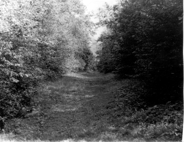
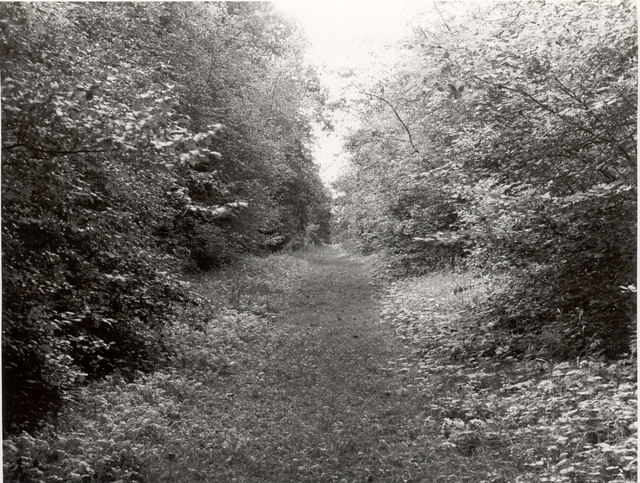
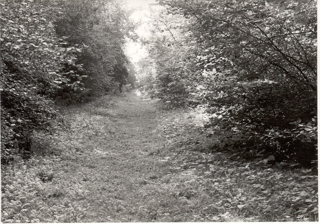
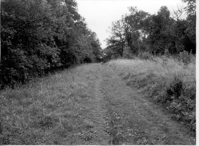
Hermitage Wood is a picturesque forest located in Huntingdonshire, England. Spanning an area of approximately 100 acres, it is a popular destination for nature enthusiasts and outdoor lovers. The wood is situated in close proximity to the village of Sawtry, offering a tranquil escape from the bustling urban life.

The wood boasts a diverse range of flora and fauna, making it an ideal habitat for various species. Tall, majestic oak trees dominate the landscape, while beech, hazel, and ash trees can also be found throughout the woodland. The forest floor is covered in a carpet of bluebells during spring, creating a stunning display of colors.

Hermitage Wood is home to a vibrant array of wildlife. Birdwatchers can spot species such as woodpeckers, owls, and various songbirds. Deer, foxes, and rabbits are also commonly seen in the wood, adding to its natural charm.

Visitors to Hermitage Wood can enjoy a variety of activities. Numerous walking trails wind through the forest, providing opportunities for leisurely strolls and peaceful picnics. The wood is also a popular spot for photography and nature study.

Managed by a local conservation group, Hermitage Wood is well-maintained and carefully preserved. Conservation efforts have been made to protect the natural ecosystem and maintain the delicate balance of the woodland.

Overall, Hermitage Wood offers a serene and enchanting experience for those seeking solace in nature. With its diverse flora and fauna, it is a treasure trove of natural beauty in Huntingdonshire.

If you have any feedback on the listing, please let us know in the comments section below.

Hermitage Wood Images

Images are sourced within 2km of 52.385306/-0.24550449 or Grid Reference TL1977. Thanks to Geograph Open Source API. All images are credited.

Bridge at Alconbury, A14
Joining the A1(M) The junction of the A1(M) and A14.
Joining the A1(M)
The junction of the A1(M) and A14.
A1(M), Alconbury Hill The A1 is the longest numbered road in the UK at 410 miles long. It connects London with Edinburgh, via the east of England. 
For much of its path it follows the Great North Road the old coaching route between London and Edinburgh. Several sections of the route are classified as motorway A1(M). The modern A1 bypasses the towns the Great North Road passed through and is dual carriageway for most of its route through England.
A1(M), Alconbury Hill
The A1 is the longest numbered road in the UK at 410 miles long. It connects London with Edinburgh, via the east of England. For much of its path it follows the Great North Road the old coaching route between London and Edinburgh. Several sections of the route are classified as motorway A1(M). The modern A1 bypasses the towns the Great North Road passed through and is dual carriageway for most of its route through England.
Fixed point 12 (1972), Monk's Wood NNR Main Ride (36) looking SE from junction with Badger Ride (61).
Fixed point 12 (1972), Monk's Wood NNR
Main Ride (36) looking SE from junction with Badger Ride (61).
Fixed point 12 (1973), Monk's Wood NNR Main Ride (36) looking SE from junction with Badger Ride (61).
Fixed point 12 (1973), Monk's Wood NNR
Main Ride (36) looking SE from junction with Badger Ride (61).
Fixed point 12 (1974), Monk's Wood NNR Main Ride (36) looking SE from junction with Badger Ride (61).
Fixed point 12 (1974), Monk's Wood NNR
Main Ride (36) looking SE from junction with Badger Ride (61).
Fixed point 12 (1992), Monk's Wood NNR Main Ride (36) looking SE from junction with Badger Ride (61).
Fixed point 12 (1992), Monk's Wood NNR
Main Ride (36) looking SE from junction with Badger Ride (61).
A14 exit  to B1043 Contrary to usual practice for motorways and trunk roads, this junction is apparently not numbered.
A14 exit to B1043
Contrary to usual practice for motorways and trunk roads, this junction is apparently not numbered.
B1043 bridge over A14(M) There is only about a mile of A14(M) before it joins the A1(M).
B1043 bridge over A14(M)
There is only about a mile of A14(M) before it joins the A1(M).
The A14(M) joins the A1(M) North of the junction the A1(M) has eight lanes for some distance.
The A14(M) joins the A1(M)
North of the junction the A1(M) has eight lanes for some distance.
A1(M) - gantries on Alconbury Hill No messages today, traffic is flowing well.
A1(M) - gantries on Alconbury Hill
No messages today, traffic is flowing well.
A1(M) - gantries on Stangate Hill No messages today - traffic is flowing smoothly. In the opposite direction signs are displayed for the A1 - A14 junction.
A1(M) - gantries on Stangate Hill
No messages today - traffic is flowing smoothly. In the opposite direction signs are displayed for the A1 - A14 junction.
Alconbury Brook The ford on Alconbury Brook at Alconbury Weston
Alconbury Brook
The ford on Alconbury Brook at Alconbury Weston
Ford at Alconbury Weston This gated ford is found in Alconbury Weston. The ford on the Alconbury Brook provides access between High Street and Hamerton Road.
Ford at Alconbury Weston
This gated ford is found in Alconbury Weston. The ford on the Alconbury Brook provides access between High Street and Hamerton Road.
The White Hart, Alconbury Weston
Grazing land, Alconbury Weston
Vinegar Hill towards Monk's Wood
Crop field, Vinegar Hill
Show me another place!

Hermitage Wood is located at Grid Ref: TL1977 (Lat: 52.385306, Lng: -0.24550449)

Administrative County: Cambridgeshire

District: Huntingdonshire

Police Authority: Cambridgeshire

What 3 Words

///grafted.blacked.transmits. Near Alconbury, Cambridgeshire

Nearby Locations

Hermitage Wood

Related Wikis

New Shire Hall, Alconbury Weald

New Shire Hall is a municipal building on Emery Crescent, Alconbury Weald, Cambridgeshire, England, built in 2019–2020. It is the headquarters of Cambridgeshire...

Alconbury Weald

Alconbury Weald is a new settlement in Cambridgeshire, England, lying to the north-west of the town of Huntingdon. The site was previously part of RAF...

Alconbury Weston

Alconbury Weston – in Huntingdonshire (now part of Cambridgeshire), England – is a village and civil parish, lying just outside of the Fens, having just...

Little Stukeley

Little Stukeley is a village and former civil parish, now in the parish of The Stukeleys, in Cambridgeshire, England. Little Stukeley lies approximately...

Upton, Huntingdonshire

Upton is a village and former civil parish, now in the parish of Upton and Coppingford, in the Huntingdonshire district, in the county of Cambridgeshire...

Monks Wood

Monks Wood is a 157-hectare (390-acre) National Nature Reserve north-west of Huntingdon in Cambridgeshire, and a Nature Conservation Review site, Grade...

Abbots Ripton railway station

Abbots Ripton railway station was a railway station on the East Coast Main Line in the English county of Cambridgeshire. Although trains still pass on...

Coppingford

Coppingford is a village and former civil parish, now in the parish of Upton and Coppingford, in Cambridgeshire, England. Coppingford lies approximately...

Nearby Amenities

Located within 500m of 52.385306,-0.24550449
Power: pole
Lat/Long: 52.3844203/-0.2524515
Power: pole
Lat/Long: 52.3833698/-0.2519687
The data included in this document is from www.openstreetmap.org. The data is made available under ODbL.

Have you been to Hermitage Wood?

Leave your review of Hermitage Wood below (or comments, questions and feedback).