Broadwood's Rough

Wood, Forest in Surrey Mole Valley

England

Broadwood's Rough

The Surrey Oaks pub at Parkgate
The Surrey Oaks pub at Parkgate Credit: James Insell

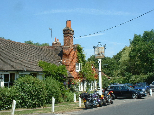
Broadwood's Rough is a picturesque woodland located in Surrey, England. Covering approximately 100 acres, this ancient forest is a haven for nature enthusiasts and offers a tranquil escape from the hustle and bustle of city life.

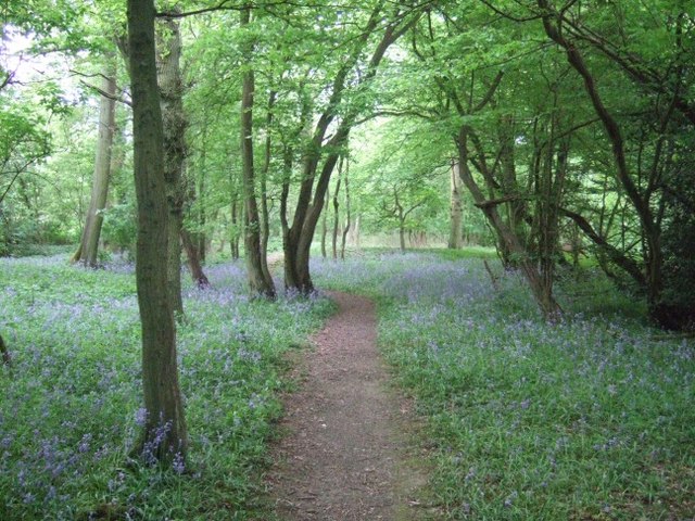
The woodland is predominantly composed of majestic oak and beech trees, which form a dense canopy overhead. The forest floor is carpeted with a diverse array of plant species, including bluebells, wild garlic, and ferns, creating a vibrant and enchanting atmosphere.

Broadwood's Rough is home to a rich variety of wildlife, making it a popular destination for bird watchers and animal lovers. Visitors may spot common woodland birds such as woodpeckers, owls, and thrushes, as well as larger mammals like deer and foxes. The forest's diverse ecosystem also supports a range of insects, butterflies, and small mammals, contributing to its ecological significance.

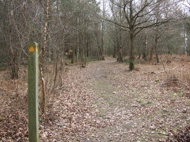
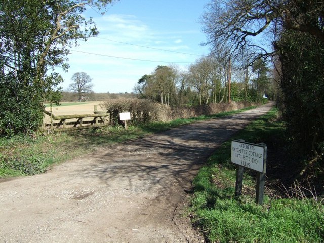
The forest offers several well-maintained trails and pathways, providing ample opportunities for walking, jogging, and cycling. These trails meander through the dense woodland, offering stunning views of the surrounding landscape. Visitors can also enjoy picnicking in designated areas or simply find a quiet spot to relax and soak in the peaceful ambiance.

Broadwood's Rough is easily accessible, with ample parking facilities available nearby. The forest is managed and maintained by local authorities, ensuring its preservation and protection for future generations to enjoy. Whether for a leisurely stroll, nature photography, or simply to reconnect with nature, Broadwood's Rough offers a serene and captivating experience for all who venture into its depths.

If you have any feedback on the listing, please let us know in the comments section below.

Broadwood's Rough Images

Images are sourced within 2km of 51.17514/-0.29456278 or Grid Reference TQ1943. Thanks to Geograph Open Source API. All images are credited.

The Surrey Oaks pub at Parkgate
Telephone box at Parkgate
The Ali Raj Indian restaurant at Parkgate
Bridge at Ewood Lane
Entrance to the Woodland Trust's Hammond's Copse
Pond bay at Ewood, near Newdigate, Surrey Ewood was one of the main centres for ironmaking in the 15th century. The works were water-powered, driven by a pond which is thought to have been 200 acres in size. The pond bay (or dam) can still be seen behind a cottage on Ewood Lane.
Pond bay at Ewood, near Newdigate, Surrey
Ewood was one of the main centres for ironmaking in the 15th century. The works were water-powered, driven by a pond which is thought to have been 200 acres in size. The pond bay (or dam) can still be seen behind a cottage on Ewood Lane.
Track Junction in Hammond's Copse Looking down the South Eastern track
Track Junction in Hammond's Copse
Looking down the South Eastern track
Hammond's Copse
Hammond's Copse
Lane to Hatchetts
Lane to Hatchetts
Junction of Church Lane (left), Hogspudding Lane (ahead) and Cudworth Lane (foreground) Looking north.
Junction of Church Lane (left), Hogspudding Lane (ahead) and Cudworth Lane (foreground)
Looking north.
Simons, Newdigate Formerly the farmhouse to Horsilands farm. The main structure dates from around the 15th-century with the gable-ended bay probably added later.
Simons, Newdigate
Formerly the farmhouse to Horsilands farm. The main structure dates from around the 15th-century with the gable-ended bay probably added later.
Junction of Cudworth Lane and Green Lane Cudworth Lane forks left with Green Lane to the right. To the left there are two gate posts, hidden by the undergrowth, which would have held the gate to the Cudworth Estate.
Junction of Cudworth Lane and Green Lane
Cudworth Lane forks left with Green Lane to the right. To the left there are two gate posts, hidden by the undergrowth, which would have held the gate to the Cudworth Estate.
The Surrey Oaks at Parkgate Seen from the lay-by next to <a href="https://www.geograph.org.uk/photo/25681">TQ2043 : Telephone box at Parkgate</a>.
The Surrey Oaks at Parkgate
Seen from the lay-by next to TQ2043 : Telephone box at Parkgate.
Newdigate Brickworks Nature Reserve Newdigate Brickworks opened in c.1928 and was a successful business for many years. The works closed during the Second World War and much of the site became derelict, but handmade bricks were made here on a smaller scale after the war, the trade lasting until 1974. The site then lay derelict until 2004, when a housing development was built on the old factory site and the four lakes left over from quarrying became a public nature reserve managed by the Surrey Wildlife Trust. The reserve covers 43 acres of lake, grassland and woodland near the centre of this grid-square.
Newdigate Brickworks Nature Reserve
Newdigate Brickworks opened in c.1928 and was a successful business for many years. The works closed during the Second World War and much of the site became derelict, but handmade bricks were made here on a smaller scale after the war, the trade lasting until 1974. The site then lay derelict until 2004, when a housing development was built on the old factory site and the four lakes left over from quarrying became a public nature reserve managed by the Surrey Wildlife Trust. The reserve covers 43 acres of lake, grassland and woodland near the centre of this grid-square.
Stream near Hatchetts Wealden stream flowing through a strip of deciduous woodland, east of Newdigate.
Stream near Hatchetts
Wealden stream flowing through a strip of deciduous woodland, east of Newdigate.
Hogspudding Lane Wonderfully named country lane east of Newdigate, in the Surrey Weald.
Hogspudding Lane
Wonderfully named country lane east of Newdigate, in the Surrey Weald.
Pond near Hatchetts East of Newdigate, looking across a field to a modern housing development which has some homes designed to look like old Wealden hall houses.
Pond near Hatchetts
East of Newdigate, looking across a field to a modern housing development which has some homes designed to look like old Wealden hall houses.
The End of the Road Change of road surface at Hatchetts, east of Newdigate.
The End of the Road
Change of road surface at Hatchetts, east of Newdigate.
Show me another place!

Broadwood's Rough is located at Grid Ref: TQ1943 (Lat: 51.17514, Lng: -0.29456278)

Administrative County: Surrey

District: Mole Valley

Police Authority: Surrey

What 3 Words

///inform.soon.career. Near Holmwood, Surrey

Related Wikis

Newdigate

Newdigate is a village and civil parish in the Mole Valley borough of Surrey lying in a relatively flat part of the Weald to the east of the A24 road between...

Newdigate Brickworks

Newdigate Brickworks is a 24-hectare (59-acre) nature reserve in Newdigate in Surrey. It is managed by the Surrey Wildlife Trust.The clay pits of this...

Holmwood railway station

Holmwood railway station serves the villages of Beare Green and South Holmwood in Surrey, England, on the Sutton and Mole Valley Lines between Dorking...

Wotton Hundred

The Hundred of Wotton, Wotton Hundred or Dorking Hundred was a hundred in Surrey, England. The hundred comprised a south-central portion of the county...

Capel, Surrey

Capel () is a village and civil parish in southern Surrey, England. It is equidistant between Dorking and Horsham – about 5 miles (8.0 km) away. Around...

South Holmwood

South Holmwood () is a semi-rural village in Surrey, England. It can be considered cognate with its wider civil parish, which stretches to the east to...

Ockley railway station

Ockley railway station serves the villages of Ockley and Capel in Surrey, England and is 1.4 miles (2.3 km) from Ockley village and 0.5 miles (0.80 km...

Edolph's Copse

Edolph's Copse is a 27.6-hectare (68-acre) Local Nature Reserve west of Horley in Surrey. It is owned and managed by the Woodland Trust.The copse is mainly...

Nearby Amenities

Located within 500m of 51.17514,-0.29456278
Henfold Farm
Place: farm
Lat/Long: 51.1752856/-0.3013641
The data included in this document is from www.openstreetmap.org. The data is made available under ODbL.

Have you been to Broadwood's Rough?

Leave your review of Broadwood's Rough below (or comments, questions and feedback).