Hamcross Plantation
Wood, Forest in Surrey
England
Hamcross Plantation
Hamcross Plantation is a picturesque woodland located in the county of Surrey, England. Nestled in the heart of the Surrey Hills Area of Outstanding Natural Beauty, this enchanting forest covers an area of approximately 500 acres.
The plantation is characterized by its diverse and thriving ecosystem, which is home to a wide variety of flora and fauna. Towering oak trees dominate the landscape, their branches reaching towards the sky, while beech, birch, and pine trees create a lush and verdant canopy. The forest floor is adorned with a rich carpet of ferns, bluebells, and wildflowers, providing a vibrant burst of color during the spring and summer months.
Visitors to Hamcross Plantation can expect to encounter an array of wildlife. Squirrels dart through the trees, while deer can often be spotted grazing peacefully in the glades. Numerous bird species, including woodpeckers and owls, make their home in the woodland, filling the air with their melodious songs.
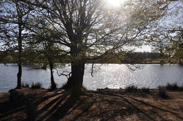
The plantation offers a network of well-maintained walking trails, allowing visitors to explore its beauty at their own pace. These paths meander through the woodland, offering glimpses of stunning vistas and hidden clearings. The forest also boasts a small lake, a serene and tranquil spot where visitors can relax and enjoy the peaceful surroundings.
Hamcross Plantation is not only a haven for nature lovers, but also a place of historical significance. The remains of an ancient Iron Age settlement can be found within the woodland, providing insight into the area's rich past.
Overall, Hamcross Plantation is a captivating destination that offers both natural beauty and historical intrigue, making it an ideal spot for those seeking tranquility and a connection with the natural world.
If you have any feedback on the listing, please let us know in the comments section below.
Hamcross Plantation Images
Images are sourced within 2km of 51.435217/-0.28603157 or Grid Reference TQ1972. Thanks to Geograph Open Source API. All images are credited.
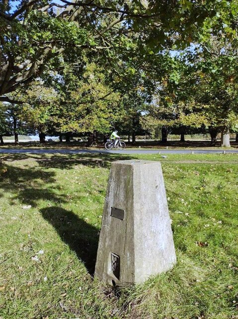
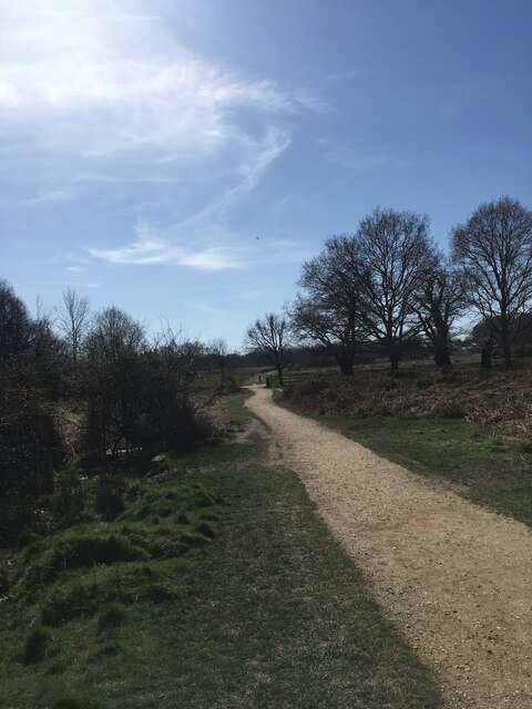
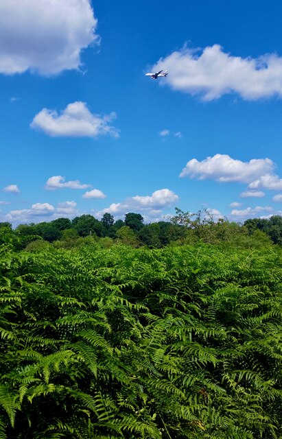


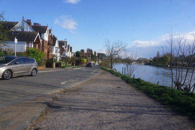

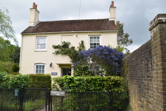
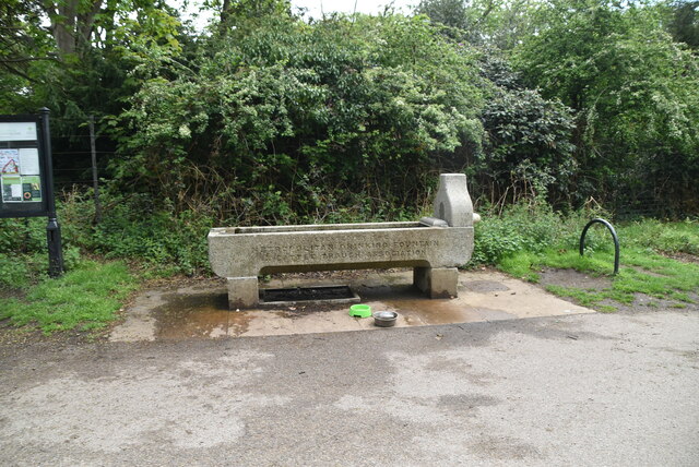
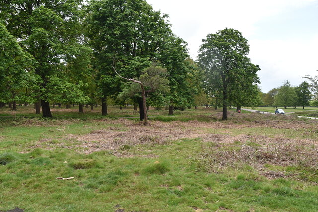
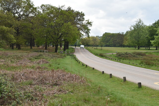
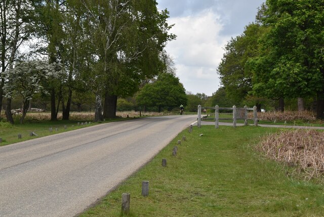
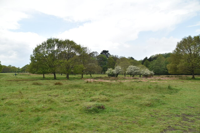
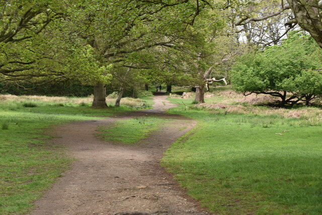
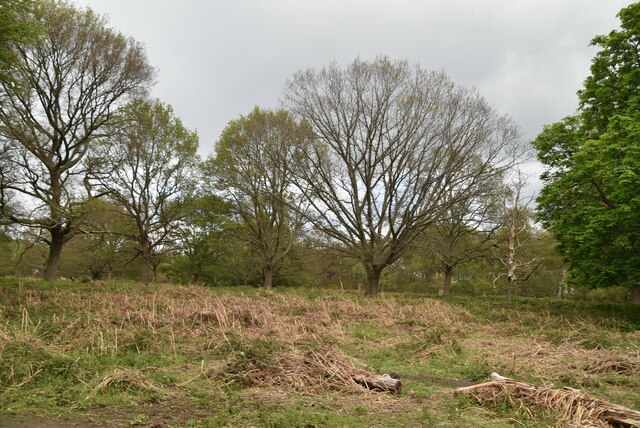
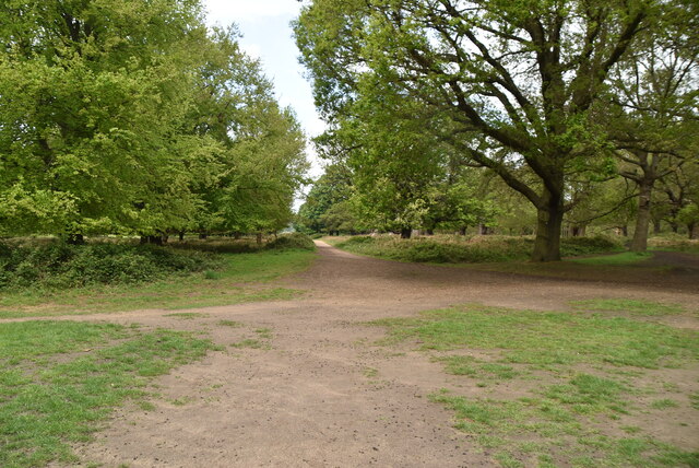
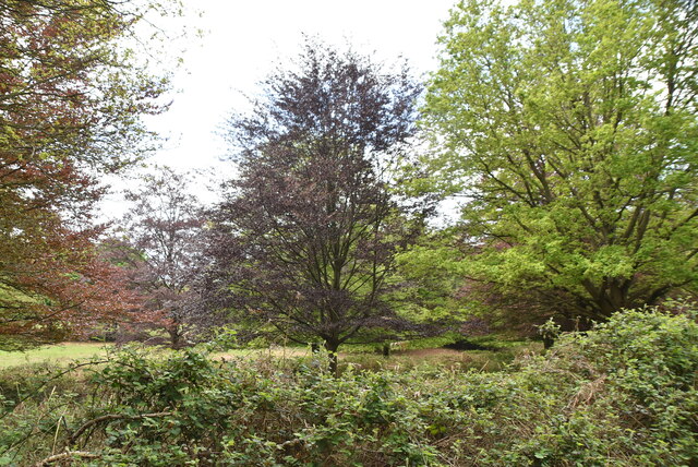
Notice (8): Undefined index: ownername [APP/View/Records/view.ctp, line 101]Code Context<figure class="figure mb-0 pt-2"><? echo $this->Html->image($images[0]['url'], array('alt' => $images[0]['title'], 'class' => 'img-fluid mx-auto d-block')) ?><figcaption class="figure-caption text-center"><? echo $images[0]['title'] ?> Credit: <? echo $images[0]['ownername'] ?>$viewFile = '/var/www/html/uk_places.millsbomb.com/app/View/Records/view.ctp' $dataForView = array( 'meta_keywords' => 'Hamcross Plantation', 'meta_description' => 'Hamcross Plantation is a picturesque woodland located in the county of Surrey, England. Nestled in the heart of the Surrey Hills Area of Outstanding Natural Beauty, this enchanting forest covers an area of approximately 500 acres.The plantation is characterized by its diverse and thriving...', 'title_for_layout' => 'Hamcross Plantation Surrey', 'videos' => null, 'wikis' => array( 'batchcomplete' => '', 'query' => array( 'geosearch' => array( [maximum depth reached] ) ) ), 'neighbours' => array( 'prev' => array( 'Record' => array( [maximum depth reached] ) ), 'next' => array( 'Record' => array( [maximum depth reached] ) ) ), 'para' => 'Hamcross Plantation is a Wood, Forest in Surrey', 'record' => array( 'Record' => array( 'id' => '143464', 'GBPNID' => '145710', 'PlaceName' => 'Hamcross Plantation', 'GridRef' => 'TQ1972', 'Lat' => '51.435217', 'Lng' => '-0.28603157', 'HistCounty' => 'Surrey', 'Division' => null, 'AdCounty' => null, 'District' => null, 'UniAuth' => 'Richmond upon Thames', 'Police' => 'Metropolitan', 'Region' => 'England', 'Alternative_Names' => null, 'Type' => 'Wood, Forest', 'description' => 'Hamcross Plantation is a picturesque woodland located in the county of Surrey, England. Nestled in the heart of the Surrey Hills Area of Outstanding Natural Beauty, this enchanting forest covers an area of approximately 500 acres. The plantation is characterized by its diverse and thriving ecosystem, which is home to a wide variety of flora and fauna. Towering oak trees dominate the landscape, their branches reaching towards the sky, while beech, birch, and pine trees create a lush and verdant canopy. The forest floor is adorned with a rich carpet of ferns, bluebells, and wildflowers, providing a vibrant burst of color during the spring and summer months. Visitors to Hamcross Plantation can expect to encounter an array of wildlife. Squirrels dart through the trees, while deer can often be spotted grazing peacefully in the glades. Numerous bird species, including woodpeckers and owls, make their home in the woodland, filling the air with their melodious songs. The plantation offers a network of well-maintained walking trails, allowing visitors to explore its beauty at their own pace. These paths meander through the woodland, offering glimpses of stunning vistas and hidden clearings. The forest also boasts a small lake, a serene and tranquil spot where visitors can relax and enjoy the peaceful surroundings. Hamcross Plantation is not only a haven for nature lovers, but also a place of historical significance. The remains of an ancient Iron Age settlement can be found within the woodland, providing insight into the area's rich past. Overall, Hamcross Plantation is a captivating destination that offers both natural beauty and historical intrigue, making it an ideal spot for those seeking tranquility and a connection with the natural world.', 'what3words' => 'career.wacky.mercy', 'what3words_place' => 'Kingston upon Thames, London', 'images' => '[{"id":"6966169","title":"Pen Ponds in Richmond Park","grid_reference":"TQ1973","realname":"Bob Walters","monthname":"April","hash":"d98e2ef2","takenyear":"2021","user_id":"42548","geodist":"1213.378174","description":"Sun through the trees around Pen Ponds.","url":"https:\/\/s1.geograph.org.uk\/geophotos\/06\/96\/61\/6966169_d98e2ef2.jpg"},{"id":"7039567","title":"Richmond Park trig","grid_reference":"TQ1873","realname":"Alex McGregor","monthname":"October","hash":"9bd029d8","takenyear":"2021","user_id":"45095","geodist":"1221.447144","description":"","url":"https:\/\/s3.geograph.org.uk\/geophotos\/07\/03\/95\/7039567_9bd029d8.jpg"},{"id":"7084450","title":"Path to Pen Ponds","grid_reference":"TQ1974","realname":"Rachel","monthname":"March","hash":"08f2fbb3","takenyear":"2020","user_id":"136653","geodist":"1949.500488","description":"","url":"https:\/\/s2.geograph.org.uk\/geophotos\/07\/08\/44\/7084450_08f2fbb3.jpg"},{"id":"7110747","title":"Richmond Park","grid_reference":"TQ1974","realname":"Lauren","monthname":"August","hash":"4da1f550","takenyear":"2016","user_id":"136297","geodist":"1979.090332","description":"Richmond Park is a 2,360 acre (3.69 sq mi) park within London. It is the largest of the Royal Parks in London and Britain's second largest urban walled park after Sutton Park, Birmingham. It is close to Richmond, Ham, Kingston upon Thames, Wimbledon, Roehampton and East Sheen. The park is famous for its red and fallow deer, which number over six hundred. The park is a National Nature Reserve. There is access to the park through several gates and many footpaths cross the park.\r\nWebsite & map: <span class=\"nowrap\"><a title=\"http:\/\/www.royalparks.gov.uk\/Richmond-Park.aspx\" rel=\"nofollow ugc noopener\" href=\"http:\/\/www.royalparks.gov.uk\/Richmond-Park.aspx\">Link<\/a><img style=\"margin-left:2px;\" alt=\"External link\" title=\"External link - shift click to open in new window\" src=\"https:\/\/s1.geograph.org.uk\/img\/external.png\" width=\"10\" height=\"10\"\/><\/span> \r\nWikipedia: <span class=\"nowrap\"><a title=\"http:\/\/en.wikipedia.org\/wiki\/Richmond_Park\" rel=\"nofollow ugc noopener\" href=\"http:\/\/en.wikipedia.org\/wiki\/Richmond_Park\">Link<\/a><img style=\"margin-left:2px;\" alt=\"External link\" title=\"External link - shift click to open in new window\" src=\"https:\/\/s1.geograph.org.uk\/img\/external.png\" width=\"10\" height=\"10\"\/><\/span> ","url":"https:\/\/s3.geograph.org.uk\/geophotos\/07\/11\/07\/7110747_4da1f550.jpg"},{"id":"7112120","title":"Richmond Park","grid_reference":"TQ1873","realname":"Lauren","monthname":"October","hash":"808e1410","takenyear":"2016","user_id":"136297","geodist":"1752.073486","description":"Richmond Park is a 2,360 acre (3.69 sq mi) park within London. It is the largest of the Royal Parks in London and Britain's second largest urban walled park after Sutton Park, Birmingham. It is close to Richmond, Ham, Kingston upon Thames, Wimbledon, Roehampton and East Sheen. The park is famous for its red and fallow deer, which number over six hundred. The park is a National Nature Reserve. There is access to the park through several gates and many footpaths cross the park.\r\nWebsite & map: <span class=\"nowrap\"><a title=\"http:\/\/www.royalparks.gov.uk\/Richmond-Park.aspx\" rel=\"nofollow ugc noopener\" href=\"http:\/\/www.royalparks.gov.uk\/Richmond-Park.aspx\">Link<\/a><img style=\"margin-left:2px;\" alt=\"External link\" title=\"External link - shift click to open in new window\" src=\"https:\/\/s1.geograph.org.uk\/img\/external.png\" width=\"10\" height=\"10\"\/><\/span> \r\nWikipedia: <span class=\"nowrap\"><a title=\"http:\/\/en.wikipedia.org\/wiki\/Richmond_Park\" rel=\"nofollow ugc noopener\" href=\"http:\/\/en.wikipedia.org\/wiki\/Richmond_Park\">Link<\/a><img style=\"margin-left:2px;\" alt=\"External link\" title=\"External link - shift click to open in new window\" src=\"https:\/\/s1.geograph.org.uk\/img\/external.png\" width=\"10\" height=\"10\"\/><\/span> ","url":"https:\/\/s0.geograph.org.uk\/geophotos\/07\/11\/21\/7112120_808e1410.jpg"},{"id":"7150185","title":"Thames Path towards Kingston upon Thames","grid_reference":"TQ1770","realname":"Ian S","monthname":"April","hash":"3fed09ee","takenyear":"2022","user_id":"48731","geodist":"1896.249268","description":"","url":"https:\/\/s1.geograph.org.uk\/geophotos\/07\/15\/01\/7150185_3fed09ee.jpg"},{"id":"7150186","title":"Lower Ham Road, Kingston upon Thames","grid_reference":"TQ1770","realname":"Ian S","monthname":"April","hash":"39a5ede5","takenyear":"2022","user_id":"48731","geodist":"1911.071411","description":"","url":"https:\/\/s2.geograph.org.uk\/geophotos\/07\/15\/01\/7150186_39a5ede5.jpg"},{"id":"7150191","title":"Lower Ham Road, Kingston upon Thames","grid_reference":"TQ1770","realname":"Ian S","monthname":"April","hash":"f06fb659","takenyear":"2022","user_id":"48731","geodist":"1998.211914","description":"","url":"https:\/\/s3.geograph.org.uk\/geophotos\/07\/15\/01\/7150191_f06fb659.jpg"},{"id":"7206371","title":"Ladderstile Gate Lodge","grid_reference":"TQ1971","realname":"N Chadwick","monthname":"May","hash":"44e56251","takenyear":"2021","user_id":"3101","geodist":"1296.586304","description":"","url":"https:\/\/s3.geograph.org.uk\/geophotos\/07\/20\/63\/7206371_44e56251.jpg"},{"id":"7206373","title":"Water trough, Ladderstile Gate","grid_reference":"TQ1971","realname":"N Chadwick","monthname":"May","hash":"16079351","takenyear":"2021","user_id":"3101","geodist":"1274.037109","description":"The Metropolitan Drinking Fountain and Cattle Trough Association was founded in 1859 initially to provide clean drinking water in public places for people in London, but soon extended to include animals and also outside London itself. It is still active (now known as The Drinking Fountain Association), with the objectives of:\r\n\r\n\u2022 The promotion of the provision of drinking water for people and animals in the United Kingdom and Overseas\r\n\u2022 The preservation of the Association's archive materials, artefacts, drinking fountains, cattle troughs and other installations.\r\n\r\nFor full details of its history, see <span class=\"nowrap\"><a title=\"http:\/\/drinkingfountains.org\/Attachments(PDF)\/DFA%20HIstory.pdf\" rel=\"nofollow ugc noopener\" href=\"http:\/\/drinkingfountains.org\/Attachments(PDF)\/DFA%20HIstory.pdf\">Link<\/a><img style=\"margin-left:2px;\" alt=\"External link\" title=\"External link - shift click to open in new window\" src=\"https:\/\/s1.geograph.org.uk\/img\/external.png\" width=\"10\" height=\"10\"\/><\/span>.","url":"https:\/\/s1.geograph.org.uk\/geophotos\/07\/20\/63\/7206373_16079351.jpg"},{"id":"7206375","title":"Richmond Park","grid_reference":"TQ1971","realname":"N Chadwick","monthname":"May","hash":"fa9b8947","takenyear":"2021","user_id":"3101","geodist":"1217.725098","description":"Richmond Park is a 2,360 acre (3.69 sq mi) park within London. It is the largest of the Royal Parks in London and Britain's second largest urban walled park after Sutton Park, Birmingham. It is close to Richmond, Ham, Kingston upon Thames, Wimbledon, Roehampton and East Sheen. The park is famous for its red and fallow deer, which number over six hundred. The park is a National Nature Reserve. There is access to the park through several gates and many footpaths cross the park.\r\nWebsite & map: <span class=\"nowrap\"><a title=\"http:\/\/www.royalparks.gov.uk\/Richmond-Park.aspx\" rel=\"nofollow ugc noopener\" href=\"http:\/\/www.royalparks.gov.uk\/Richmond-Park.aspx\">Link<\/a><img style=\"margin-left:2px;\" alt=\"External link\" title=\"External link - shift click to open in new window\" src=\"https:\/\/s1.geograph.org.uk\/img\/external.png\" width=\"10\" height=\"10\"\/><\/span> \r\nWikipedia: <span class=\"nowrap\"><a title=\"http:\/\/en.wikipedia.org\/wiki\/Richmond_Park\" rel=\"nofollow ugc noopener\" href=\"http:\/\/en.wikipedia.org\/wiki\/Richmond_Park\">Link<\/a><img style=\"margin-left:2px;\" alt=\"External link\" title=\"External link - shift click to open in new window\" src=\"https:\/\/s1.geograph.org.uk\/img\/external.png\" width=\"10\" height=\"10\"\/><\/span> ","url":"https:\/\/s3.geograph.org.uk\/geophotos\/07\/20\/63\/7206375_fa9b8947.jpg"},{"id":"7206380","title":"Broomfield Hill","grid_reference":"TQ1971","realname":"N Chadwick","monthname":"May","hash":"bb85994f","takenyear":"2021","user_id":"3101","geodist":"1148.917236","description":"Richmond Park is a 2,360 acre (3.69 sq mi) park within London. It is the largest of the Royal Parks in London and Britain's second largest urban walled park after Sutton Park, Birmingham. It is close to Richmond, Ham, Kingston upon Thames, Wimbledon, Roehampton and East Sheen. The park is famous for its red and fallow deer, which number over six hundred. The park is a National Nature Reserve. There is access to the park through several gates and many footpaths cross the park.\r\nWebsite & map: <span class=\"nowrap\"><a title=\"http:\/\/www.royalparks.gov.uk\/Richmond-Park.aspx\" rel=\"nofollow ugc noopener\" href=\"http:\/\/www.royalparks.gov.uk\/Richmond-Park.aspx\">Link<\/a><img style=\"margin-left:2px;\" alt=\"External link\" title=\"External link - shift click to open in new window\" src=\"https:\/\/s1.geograph.org.uk\/img\/external.png\" width=\"10\" height=\"10\"\/><\/span> \r\nWikipedia: <span class=\"nowrap\"><a title=\"http:\/\/en.wikipedia.org\/wiki\/Richmond_Park\" rel=\"nofollow ugc noopener\" href=\"http:\/\/en.wikipedia.org\/wiki\/Richmond_Park\">Link<\/a><img style=\"margin-left:2px;\" alt=\"External link\" title=\"External link - shift click to open in new window\" src=\"https:\/\/s1.geograph.org.uk\/img\/external.png\" width=\"10\" height=\"10\"\/><\/span> ","url":"https:\/\/s0.geograph.org.uk\/geophotos\/07\/20\/63\/7206380_bb85994f.jpg"},{"id":"7206386","title":"Broomfield Hill","grid_reference":"TQ1971","realname":"N Chadwick","monthname":"May","hash":"4d4eb8aa","takenyear":"2021","user_id":"3101","geodist":"1124.098267","description":"Richmond Park is a 2,360 acre (3.69 sq mi) park within London. It is the largest of the Royal Parks in London and Britain's second largest urban walled park after Sutton Park, Birmingham. It is close to Richmond, Ham, Kingston upon Thames, Wimbledon, Roehampton and East Sheen. The park is famous for its red and fallow deer, which number over six hundred. The park is a National Nature Reserve. There is access to the park through several gates and many footpaths cross the park.\r\nWebsite & map: <span class=\"nowrap\"><a title=\"http:\/\/www.royalparks.gov.uk\/Richmond-Park.aspx\" rel=\"nofollow ugc noopener\" href=\"http:\/\/www.royalparks.gov.uk\/Richmond-Park.aspx\">Link<\/a><img style=\"margin-left:2px;\" alt=\"External link\" title=\"External link - shift click to open in new window\" src=\"https:\/\/s1.geograph.org.uk\/img\/external.png\" width=\"10\" height=\"10\"\/><\/span> \r\nWikipedia: <span class=\"nowrap\"><a title=\"http:\/\/en.wikipedia.org\/wiki\/Richmond_Park\" rel=\"nofollow ugc noopener\" href=\"http:\/\/en.wikipedia.org\/wiki\/Richmond_Park\">Link<\/a><img style=\"margin-left:2px;\" alt=\"External link\" title=\"External link - shift click to open in new window\" src=\"https:\/\/s1.geograph.org.uk\/img\/external.png\" width=\"10\" height=\"10\"\/><\/span> ","url":"https:\/\/s2.geograph.org.uk\/geophotos\/07\/20\/63\/7206386_4d4eb8aa.jpg"},{"id":"7206389","title":"Richmond Park","grid_reference":"TQ1971","realname":"N Chadwick","monthname":"May","hash":"dcf511a7","takenyear":"2021","user_id":"3101","geodist":"1035.037964","description":"Richmond Park is a 2,360 acre (3.69 sq mi) park within London. It is the largest of the Royal Parks in London and Britain's second largest urban walled park after Sutton Park, Birmingham. It is close to Richmond, Ham, Kingston upon Thames, Wimbledon, Roehampton and East Sheen. The park is famous for its red and fallow deer, which number over six hundred. The park is a National Nature Reserve. There is access to the park through several gates and many footpaths cross the park.\r\nWebsite & map: <span class=\"nowrap\"><a title=\"http:\/\/www.royalparks.gov.uk\/Richmond-Park.aspx\" rel=\"nofollow ugc noopener\" href=\"http:\/\/www.royalparks.gov.uk\/Richmond-Park.aspx\">Link<\/a><img style=\"margin-left:2px;\" alt=\"External link\" title=\"External link - shift click to open in new window\" src=\"https:\/\/s1.geograph.org.uk\/img\/external.png\" width=\"10\" height=\"10\"\/><\/span> \r\nWikipedia: <span class=\"nowrap\"><a title=\"http:\/\/en.wikipedia.org\/wiki\/Richmond_Park\" rel=\"nofollow ugc noopener\" href=\"http:\/\/en.wikipedia.org\/wiki\/Richmond_Park\">Link<\/a><img style=\"margin-left:2px;\" alt=\"External link\" title=\"External link - shift click to open in new window\" src=\"https:\/\/s1.geograph.org.uk\/img\/external.png\" width=\"10\" height=\"10\"\/><\/span> ","url":"https:\/\/s1.geograph.org.uk\/geophotos\/07\/20\/63\/7206389_dcf511a7.jpg"},{"id":"7206394","title":"Richmond Park","grid_reference":"TQ1971","realname":"N Chadwick","monthname":"May","hash":"3ec131ad","takenyear":"2021","user_id":"3101","geodist":"960.296692","description":"","url":"https:\/\/s2.geograph.org.uk\/geophotos\/07\/20\/63\/7206394_3ec131ad.jpg"},{"id":"7206398","title":"Richmond Park","grid_reference":"TQ1971","realname":"N Chadwick","monthname":"May","hash":"e5d6d876","takenyear":"2021","user_id":"3101","geodist":"863.982910","description":"Richmond Park is a 2,360 acre (3.69 sq mi) park within London. It is the largest of the Royal Parks in London and Britain's second largest urban walled park after Sutton Park, Birmingham. It is close to Richmond, Ham, Kingston upon Thames, Wimbledon, Roehampton and East Sheen. The park is famous for its red and fallow deer, which number over six hundred. The park is a National Nature Reserve. There is access to the park through several gates and many footpaths cross the park.\r\nWebsite & map: <span class=\"nowrap\"><a title=\"http:\/\/www.royalparks.gov.uk\/Richmond-Park.aspx\" rel=\"nofollow ugc noopener\" href=\"http:\/\/www.royalparks.gov.uk\/Richmond-Park.aspx\">Link<\/a><img style=\"margin-left:2px;\" alt=\"External link\" title=\"External link - shift click to open in new window\" src=\"https:\/\/s1.geograph.org.uk\/img\/external.png\" width=\"10\" height=\"10\"\/><\/span> \r\nWikipedia: <span class=\"nowrap\"><a title=\"http:\/\/en.wikipedia.org\/wiki\/Richmond_Park\" rel=\"nofollow ugc noopener\" href=\"http:\/\/en.wikipedia.org\/wiki\/Richmond_Park\">Link<\/a><img style=\"margin-left:2px;\" alt=\"External link\" title=\"External link - shift click to open in new window\" src=\"https:\/\/s1.geograph.org.uk\/img\/external.png\" width=\"10\" height=\"10\"\/><\/span> ","url":"https:\/\/s2.geograph.org.uk\/geophotos\/07\/20\/63\/7206398_e5d6d876.jpg"},{"id":"7206401","title":"Richmond Park","grid_reference":"TQ1971","realname":"N Chadwick","monthname":"May","hash":"893f5af0","takenyear":"2021","user_id":"3101","geodist":"854.802979","description":"Richmond Park is a 2,360 acre (3.69 sq mi) park within London. It is the largest of the Royal Parks in London and Britain's second largest urban walled park after Sutton Park, Birmingham. It is close to Richmond, Ham, Kingston upon Thames, Wimbledon, Roehampton and East Sheen. The park is famous for its red and fallow deer, which number over six hundred. The park is a National Nature Reserve. There is access to the park through several gates and many footpaths cross the park.\r\nWebsite & map: <span class=\"nowrap\"><a title=\"http:\/\/www.royalparks.gov.uk\/Richmond-Park.aspx\" rel=\"nofollow ugc noopener\" href=\"http:\/\/www.royalparks.gov.uk\/Richmond-Park.aspx\">Link<\/a><img style=\"margin-left:2px;\" alt=\"External link\" title=\"External link - shift click to open in new window\" src=\"https:\/\/s1.geograph.org.uk\/img\/external.png\" width=\"10\" height=\"10\"\/><\/span> \r\nWikipedia: <span class=\"nowrap\"><a title=\"http:\/\/en.wikipedia.org\/wiki\/Richmond_Park\" rel=\"nofollow ugc noopener\" href=\"http:\/\/en.wikipedia.org\/wiki\/Richmond_Park\">Link<\/a><img style=\"margin-left:2px;\" alt=\"External link\" title=\"External link - shift click to open in new window\" src=\"https:\/\/s1.geograph.org.uk\/img\/external.png\" width=\"10\" height=\"10\"\/><\/span> ","url":"https:\/\/s1.geograph.org.uk\/geophotos\/07\/20\/64\/7206401_893f5af0.jpg"},{"id":"7206408","title":"Richmond Park","grid_reference":"TQ1971","realname":"N Chadwick","monthname":"May","hash":"5a080034","takenyear":"2021","user_id":"3101","geodist":"834.321106","description":"","url":"https:\/\/s0.geograph.org.uk\/geophotos\/07\/20\/64\/7206408_5a080034.jpg"}]', 'wikis' => '{"batchcomplete":"","query":{"geosearch":[{"pageid":45673391,"ns":0,"title":"Isabella Plantation","lat":51.433,"lon":-0.277,"dist":672.9,"primary":"","url":"https:\/\/en.wikipedia.org\/wiki\/Isabella_Plantation","image":"https:\/\/upload.wikimedia.org\/wikipedia\/commons\/2\/20\/Isabella_Plantation%2C_Richmond_Park%2C_London_-_April_2011.jpg","extract":"Isabella Plantation is a woodland garden in Richmond Park in south west London. It is managed by The Royal Parks.\nOriginally located in a boggy part of..."},{"pageid":2495893,"ns":0,"title":"Thatched House Lodge","lat":51.4275,"lon":-0.28527777777778,"dist":859.7,"primary":"","url":"https:\/\/en.wikipedia.org\/wiki\/Thatched_House_Lodge","image":"https:\/\/upload.wikimedia.org\/wikipedia\/commons\/9\/9b\/Thatched_House_Lodge.jpg","extract":"Thatched House Lodge is a Grade II-listed building, dating from the 17th century, in Richmond Park in the London Borough of Richmond upon Thames in London..."},{"pageid":37844632,"ns":0,"title":"Sudbrook Park, Petersham","lat":51.439777777778,"lon":-0.29711111111111,"dist":920.3,"primary":"","url":"https:\/\/en.wikipedia.org\/wiki\/Sudbrook_Park,_Petersham","image":"https:\/\/upload.wikimedia.org\/wikipedia\/commons\/a\/a7\/Sudbrook_House_-_Petersham.jpg","extract":"Sudbrook Park in Petersham (now in the London Borough of Richmond upon Thames) was developed by John Campbell, 2nd Duke of Argyll in the early 18th century..."},{"pageid":37843942,"ns":0,"title":"Richmond Golf Club","lat":51.439822222222,"lon":-0.29707777777778,"dist":921.1,"primary":"","url":"https:\/\/en.wikipedia.org\/wiki\/Richmond_Golf_Club","image":"https:\/\/upload.wikimedia.org\/wikipedia\/commons\/0\/0f\/RGC_Clubhouse_and_8th_Green.jpg","extract":"The Richmond Golf Club is a private golf club whose 18-hole course now occupies the historic Sudbrook Park adjacent to Richmond Park, in Petersham, south..."},{"pageid":2451418,"ns":0,"title":"Pembroke Lodge, Richmond Park","lat":51.4425,"lon":-0.29444444444444,"dist":997.9,"primary":"","url":"https:\/\/en.wikipedia.org\/wiki\/Pembroke_Lodge,_Richmond_Park","image":"https:\/\/upload.wikimedia.org\/wikipedia\/commons\/2\/21\/Pembroke_Lodge_10233-5.jpg","extract":"Pembroke Lodge is an initial, mainstream category listed (Grade II) Georgian two-storey large house in Richmond Park in the London Borough of Richmond..."},{"pageid":20508424,"ns":0,"title":"Latchmere House","lat":51.4287,"lon":-0.296,"dist":1001.3,"primary":"","url":"https:\/\/en.wikipedia.org\/wiki\/Latchmere_House","image":"https:\/\/upload.wikimedia.org\/wikipedia\/commons\/e\/e1\/Latchmere_House_2020.jpeg","extract":"Latchmere House is a building and grounds southeast of Ham Common in Ham, in the London Borough of Richmond upon Thames, in south west London, England..."},{"pageid":15351789,"ns":0,"title":"Ormeley Lodge","lat":51.435277777778,"lon":-0.30222222222222,"dist":1122.3,"primary":"","url":"https:\/\/en.wikipedia.org\/wiki\/Ormeley_Lodge","image":"https:\/\/upload.wikimedia.org\/wikipedia\/commons\/2\/2e\/Ormeley_Lodge.JPG","extract":"Ormeley Lodge is a Grade II* listed early 18th-century Georgian house, set in 6 acres (2 ha) on the edge of Ham Common, near to Richmond Park in Ham..."},{"pageid":7284174,"ns":0,"title":"Ham Urban District","lat":51.43,"lon":-0.3,"dist":1128.8,"primary":"","url":"https:\/\/en.wikipedia.org\/wiki\/Ham_Urban_District","image":"https:\/\/upload.wikimedia.org\/wikipedia\/commons\/f\/fd\/Ham_Pond.jpg","extract":"Ham was a local government district in north east Surrey, England around the village of Ham from 1894 to 1933.\nHam Common Local Government District was..."}]}}', 'videos' => null, 'places' => '{ "version": 0.6, "generator": "Overpass API 0.7.62.1 084b4234", "osm3s": { "timestamp_osm_base": "2024-04-16T04:31:00Z", "copyright": "The data included in this document is from www.openstreetmap.org. The data is made available under ODbL." }, "elements": [ { "type": "node", "id": 21090118, "lat": 51.4324545, "lon": -0.2803657, "tags": { "created_by": "JOSM" } }, { "type": "node", "id": 30608562, "lat": 51.4342900, "lon": -0.2815452, "tags": { "created_by": "JOSM" } }, { "type": "node", "id": 30614698, "lat": 51.4388150, "lon": -0.2822827, "tags": { "created_by": "JOSM" } }, { "type": "node", "id": 30614699, "lat": 51.4381587, "lon": -0.2834549, "tags": { "created_by": "JOSM" } }, { "type": "node", "id": 30614803, "lat": 51.4395457, "lon": -0.2854217, "tags": { "created_by": "JOSM" } }, { "type": "node", "id": 30614805, "lat": 51.4388646, "lon": -0.2845873, "tags": { "created_by": "JOSM" } }, { "type": "node", "id": 30614806, "lat": 51.4388150, "lon": -0.2844681, "tags": { "created_by": "JOSM" } }, { "type": "node", "id": 30614808, "lat": 51.4387036, "lon": -0.2842098, "tags": { "created_by": "JOSM" } }, { "type": "node", "id": 30614809, "lat": 51.4377500, "lon": -0.2828986, "tags": { "created_by": "JOSM" } }, { "type": "node", "id": 30614810, "lat": 51.4376138, "lon": -0.2826602, "tags": { "created_by": "JOSM" } }, { "type": "node", "id": 30614811, "lat": 51.4375394, "lon": -0.2823423, "tags": { "created_by": "JOSM" } }, { "type": "node", "id": 30614812, "lat": 51.4373661, "lon": -0.2819053, "tags": { "created_by": "JOSM" } }, { "type": "node", "id": 30614813, "lat": 51.4368955, "lon": -0.2811305, "tags": { "created_by": "JOSM" } }, { "type": "node", "id": 30614814, "lat": 51.4385178, "lon": -0.2811901, "tags": { "created_by": "JOSM" } }, { "type": "node", "id": 30614815, "lat": 51.4385921, "lon": -0.2814285, "tags": { "created_by": "JOSM" } }, { "type": "node", "id": 30614817, "lat": 51.4391246, "lon": -0.2836933, "tags": { "created_by": "JOSM" } }, { "type": "node", "id": 30614818, "lat": 51.4391989, "lon": -0.2839913, "tags": { "created_by": "JOSM" } }, { "type": "node", "id": 30614819, "lat": 51.4395580, "lon": -0.2852627, "tags": { "created_by": "JOSM" } }, { "type": "node", "id": 30614957, "lat": 51.4378491, "lon": -0.2807133, "tags": { "created_by": "JOSM" } }, { "type": "node", "id": 30614959, "lat": 51.4371060, "lon": -0.2809914, "tags": { "created_by": "JOSM" } }, { "type": "node", "id": 30614960, "lat": 51.4361648, "lon": -0.2811702, "tags": { "created_by": "JOSM" } }, { "type": "node", "id": 30614962, "lat": 51.4350625, "lon": -0.2814086, "tags": { "created_by": "JOSM" } }, { "type": "node", "id": 30614963, "lat": 51.4345919, "lon": -0.2814483, "tags": { "created_by": "JOSM" } }, { "type": "node", "id": 1425093352, "lat": 51.4338303, "lon": -0.2814432, "tags": { "barrier": "gate" } }, { "type": "node", "id": 1674641440, "lat": 51.4323575, "lon": -0.2870615, "tags": { "crossing": "unmarked", "highway": "crossing", "kerb": "lowered", "tactile_paving": "no" } }, { "type": "node", "id": 1692205826, "lat": 51.4332100, "lon": -0.2871790, "tags": { "crossing": "unmarked", "crossing:island": "no", "highway": "crossing", "tactile_paving": "no", "traffic_calming": "table" } }, { "type": "node", "id": 1692205837, "lat": 51.4330179, "lon": -0.2870610, "tags": { "junction": "yes", "name": "Ham Cross" } }, { "type": "node", "id": 1970804812, "lat": 51.4351518, "lon": -0.2831472, "tags": { "barrier": "gate", "bicycle": "yes", "foot": "yes", "motor_vehicle": "private", "wheelchair": "yes" } }, { "type": "node", "id": 3292348341, "lat": 51.4331296, "lon": -0.2868071, "tags": { "barrier": "gate", "bicycle": "yes", "disabled": "yes", "foot": "yes", "motor_vehicle": "permit", "wheelchair": "yes" } }, { "type": "node", "id": 3416271110, "lat": 51.4394596, "lon": -0.2883396, "tags": { "amenity": "bench" } }, { "type": "node", "id": 3416271138, "lat": 51.4338412, "lon": -0.2812894, "tags": { "information": "board", "tourism": "information" } }, { "type": "node", "id": 3472802758, "lat": 51.4341836, "lon": -0.2814582, "tags": { "disused:barrier": "gate", "entrance": "yes", "old_name": "Peg's Pond Gate" } }, { "type": "node", "id": 3688620054, "lat": 51.4342294, "lon": -0.2811589, "tags": { "amenity": "bench" } }, { "type": "node", "id": 4713544805, "lat": 51.4325607, "lon": -0.2804668, "tags": { "barrier": "gate", "name": "Deer Sanctuary Gate" } }, { "type": "node", "id": 5416215078, "lat": 51.4357712, "lon": -0.2810334, "tags": { "natural": "tree" } }, { "type": "node", "id": 5416215087, "lat": 51.4356137, "lon": -0.2800105, "tags": { "natural": "tree" } }, { "type": "node", "id": 5416215088, "lat": 51.4358250, "lon": -0.2796592, "tags": { "natural": "tree" } }, { "type": "node", "id": 5416215089, "lat": 51.4360055, "lon": -0.2793881, "tags": { "natural": "tree" } }, { "type": "node", "id": 5416215090, "lat": 51.4360862, "lon": -0.2795421, "tags": { "natural": "tree" } }, { "type": "node", "id": 5416215091, "lat": 51.4360478, "lon": -0.2801275, "tags": { "natural": "tree" } }, { "type": "node", "id": 5416215092, "lat": 51.4360516, "lon": -0.2804110, "tags": { "natural": "tree" } }, { "type": "node", "id": 5416215093, "lat": 51.4361515, "lon": -0.2802446, "tags": { "natural": "tree" } }, { "type": "node", "id": 5416215094, "lat": 51.4362321, "lon": -0.2804048, "tags": { "natural": "tree" } }, { "type": "node", "id": 5416215095, "lat": 51.4362398, "lon": -0.2800844, "tags": { "natural": "tree" } }, { "type": "node", "id": 5416215096, "lat": 51.4364511, "lon": -0.2794744, "tags": { "natural": "tree" } }, { "type": "node", "id": 5416215097, "lat": 51.4365087, "lon": -0.2797517, "tags": { "natural": "tree" } }, { "type": "node", "id": 5416215098, "lat": 51.4365971, "lon": -0.2795791, "tags": { "natural": "tree" } }, { "type": "node", "id": 5416215099, "lat": 51.4366585, "lon": -0.2793758, "tags": { "natural": "tree" } }, { "type": "node", "id": 5416215100, "lat": 51.4370158, "lon": -0.2806205, "tags": { "natural": "tree" } }, { "type": "node", "id": 5416215101, "lat": 51.4367392, "lon": -0.2809964, "tags": { "natural": "tree" } }, { "type": "node", "id": 5416215102, "lat": 51.4364088, "lon": -0.2815202, "tags": { "natural": "tree" } }, { "type": "node", "id": 5416215103, "lat": 51.4365817, "lon": -0.2815140, "tags": { "natural": "tree" } }, { "type": "node", "id": 5416215437, "lat": 51.4348954, "lon": -0.2798242, "tags": { "natural": "tree" } }, { "type": "node", "id": 5416215438, "lat": 51.4349131, "lon": -0.2801006, "tags": { "natural": "tree" } }, { "type": "node", "id": 5416215448, "lat": 51.4349832, "lon": -0.2813263, "tags": { "natural": "tree" } }, { "type": "node", "id": 5416215449, "lat": 51.4349237, "lon": -0.2814649, "tags": { "natural": "tree" } }, { "type": "node", "id": 5416215450, "lat": 51.4363135, "lon": -0.2822768, "tags": { "natural": "tree" } }, { "type": "node", "id": 5416215451, "lat": 51.4362324, "lon": -0.2824191, "tags": { "natural": "tree" } }, { "type": "node", "id": 5416215452, "lat": 51.4353251, "lon": -0.2836550, "tags": { "natural": "tree" } }, { "type": "node", "id": 5416215453, "lat": 51.4351071, "lon": -0.2834395, "tags": { "natural": "tree" } }, { "type": "node", "id": 5416215454, "lat": 51.4352972, "lon": -0.2834029, "tags": { "natural": "tree" } }, { "type": "node", "id": 5416215455, "lat": 51.4355684, "lon": -0.2833867, "tags": { "natural": "tree" } }, { "type": "node", "id": 5416215456, "lat": 51.4357889, "lon": -0.2833419, "tags": { "natural": "tree" } }, { "type": "node", "id": 5416215457, "lat": 51.4357281, "lon": -0.2830655, "tags": { "natural": "tree" } }, { "type": "node", "id": 5416424234, "lat": 51.4326398, "lon": -0.2850418, "tags": { "natural": "tree" } }, { "type": "node", "id": 5416424235, "lat": 51.4325559, "lon": -0.2848649, "tags": { "natural": "tree" } }, { "type": "node", "id": 5416424236, "lat": 51.4327457, "lon": -0.2848118, "tags": { "natural": "tree" } }, { "type": "node", "id": 5416424237, "lat": 51.4334319, "lon": -0.2853922, "tags": { "natural": "tree" } }, { "type": "node", "id": 5416424238, "lat": 51.4334804, "lon": -0.2852082, "tags": { "natural": "tree" } }, { "type": "node", "id": 5416424239, "lat": 51.4336172, "lon": -0.2849321, "tags": { "natural": "tree" } }, { "type": "node", "id": 5416424240, "lat": 51.4335268, "lon": -0.2848189, "tags": { "natural": "tree" } }, { "type": "node", "id": 5416424241, "lat": 51.4336967, "lon": -0.2846844, "tags": { "natural": "tree" } }, { "type": "node", "id": 5416424244, "lat": 51.4337695, "lon": -0.2859125, "tags": { "natural": "tree" } }, { "type": "node", "id": 5416424245, "lat": 51.4338246, "lon": -0.2845251, "tags": { "natural": "tree" } }, { "type": "node", "id": 5416424246, "lat": 51.4339725, "lon": -0.2846844, "tags": { "natural": "tree" } }, { "type": "node", "id": 5416424247, "lat": 51.4340629, "lon": -0.2844827, "tags": { "natural": "tree" } }, { "type": "node", "id": 5416424248, "lat": 51.4339328, "lon": -0.2843057, "tags": { "natural": "tree" } }, { "type": "node", "id": 5416424249, "lat": 51.4340497, "lon": -0.2843340, "tags": { "natural": "tree" } }, { "type": "node", "id": 5416424250, "lat": 51.4340254, "lon": -0.2838314, "tags": { "natural": "tree" } }, { "type": "node", "id": 5416424251, "lat": 51.4341181, "lon": -0.2839907, "tags": { "natural": "tree" } }, { "type": "node", "id": 5416424252, "lat": 51.4340365, "lon": -0.2840969, "tags": { "natural": "tree" } }, { "type": "node", "id": 5416424253, "lat": 51.4342218, "lon": -0.2841252, "tags": { "natural": "tree" } }, { "type": "node", "id": 5416424254, "lat": 51.4344866, "lon": -0.2836828, "tags": { "natural": "tree" } }, { "type": "node", "id": 5416424255, "lat": 51.4343564, "lon": -0.2835766, "tags": { "natural": "tree" } }, { "type": "node", "id": 5416424256, "lat": 51.4342505, "lon": -0.2837925, "tags": { "natural": "tree" } }, { "type": "node", "id": 5416424257, "lat": 51.4342372, "lon": -0.2833961, "tags": { "natural": "tree" } }, { "type": "node", "id": 5416424258, "lat": 51.4347359, "lon": -0.2832015, "tags": { "natural": "tree" } }, { "type": "node", "id": 5416424259, "lat": 51.4345505, "lon": -0.2831661, "tags": { "natural": "tree" } }, { "type": "node", "id": 5416424260, "lat": 51.4345836, "lon": -0.2830103, "tags": { "natural": "tree" } }, { "type": "node", "id": 5416424261, "lat": 51.4346719, "lon": -0.2828794, "tags": { "natural": "tree" } }, { "type": "node", "id": 5416424262, "lat": 51.4344821, "lon": -0.2828936, "tags": { "natural": "tree" } }, { "type": "node", "id": 5416424263, "lat": 51.4347910, "lon": -0.2826847, "tags": { "natural": "tree" } }, { "type": "node", "id": 5416424264, "lat": 51.4349675, "lon": -0.2826847, "tags": { "natural": "tree" } }, { "type": "node", "id": 5416424265, "lat": 51.4348638, "lon": -0.2825467, "tags": { "natural": "tree" } }, { "type": "node", "id": 5416424266, "lat": 51.4349631, "lon": -0.2823556, "tags": { "natural": "tree" } }, { "type": "node", "id": 5416424267, "lat": 51.4352676, "lon": -0.2818460, "tags": { "natural": "tree" } }, { "type": "node", "id": 5416424268, "lat": 51.4353890, "lon": -0.2820194, "tags": { "natural": "tree" } }, { "type": "node", "id": 5416424269, "lat": 51.4354287, "lon": -0.2817292, "tags": { "natural": "tree" } }, { "type": "node", "id": 5416424270, "lat": 51.4347712, "lon": -0.2820300, "tags": { "natural": "tree" } }, { "type": "node", "id": 5416424271, "lat": 51.4347888, "lon": -0.2823839, "tags": { "natural": "tree" } }, { "type": "node", "id": 5416424272, "lat": 51.4346807, "lon": -0.2825255, "tags": { "natural": "tree" } }, { "type": "node", "id": 5416424273, "lat": 51.4346498, "lon": -0.2822848, "tags": { "natural": "tree" } }, { "type": "node", "id": 5416424274, "lat": 51.4342549, "lon": -0.2827838, "tags": { "natural": "tree" } }, { "type": "node", "id": 5416424275, "lat": 51.4337761, "lon": -0.2823910, "tags": { "natural": "tree" } }, { "type": "node", "id": 5416424276, "lat": 51.4337540, "lon": -0.2821397, "tags": { "natural": "tree" } }, { "type": "node", "id": 5416424277, "lat": 51.4335643, "lon": -0.2820689, "tags": { "natural": "tree" } }, { "type": "node", "id": 5416424278, "lat": 51.4339306, "lon": -0.2823273, "tags": { "natural": "tree" } }, { "type": "node", "id": 5416424279, "lat": 51.4340585, "lon": -0.2823344, "tags": { "natural": "tree" } }, { "type": "node", "id": 5416424280, "lat": 51.4339967, "lon": -0.2825007, "tags": { "natural": "tree" } }, { "type": "node", "id": 5416424281, "lat": 51.4341225, "lon": -0.2825573, "tags": { "natural": "tree" } }, { "type": "node", "id": 5416424282, "lat": 51.4341710, "lon": -0.2823874, "tags": { "natural": "tree" } }, { "type": "node", "id": 5416424283, "lat": 51.4342703, "lon": -0.2825963, "tags": { "natural": "tree" } }, { "type": "node", "id": 5416424284, "lat": 51.4343762, "lon": -0.2823662, "tags": { "natural": "tree" } }, { "type": "node", "id": 5416424285, "lat": 51.4345108, "lon": -0.2822494, "tags": { "natural": "tree" } }, { "type": "node", "id": 5416424286, "lat": 51.4345285, "lon": -0.2824512, "tags": { "natural": "tree" } }, { "type": "node", "id": 5416424287, "lat": 51.4345064, "lon": -0.2820654, "tags": { "natural": "tree" } }, { "type": "node", "id": 5416424288, "lat": 51.4343299, "lon": -0.2821114, "tags": { "natural": "tree" } }, { "type": "node", "id": 5416424289, "lat": 51.4342483, "lon": -0.2821786, "tags": { "natural": "tree" } }, { "type": "node", "id": 5416424290, "lat": 51.4341733, "lon": -0.2820866, "tags": { "natural": "tree" } }, { "type": "node", "id": 5416424291, "lat": 51.4341402, "lon": -0.2819734, "tags": { "natural": "tree" } }, { "type": "node", "id": 5416424292, "lat": 51.4340012, "lon": -0.2820902, "tags": { "natural": "tree" } }, { "type": "node", "id": 5416424293, "lat": 51.4338688, "lon": -0.2819380, "tags": { "natural": "tree" } }, { "type": "node", "id": 5416424294, "lat": 51.4339438, "lon": -0.2818707, "tags": { "natural": "tree" } }, { "type": "node", "id": 5416424295, "lat": 51.4338909, "lon": -0.2817060, "tags": { "natural": "tree" } }, { "type": "node", "id": 5416424307, "lat": 51.4337105, "lon": -0.2818774, "tags": { "natural": "tree" } }, { "type": "node", "id": 5416424308, "lat": 51.4335001, "lon": -0.2817188, "tags": { "natural": "tree" } }, { "type": "node", "id": 5416424309, "lat": 51.4335635, "lon": -0.2815725, "tags": { "natural": "tree" } }, { "type": "node", "id": 5416424310, "lat": 51.4337270, "lon": -0.2815542, "tags": { "natural": "tree" } }, { "type": "node", "id": 5416424311, "lat": 51.4337903, "lon": -0.2816945, "tags": { "natural": "tree" } }, { "type": "node", "id": 5416424312, "lat": 51.4332441, "lon": -0.2812147, "tags": { "natural": "tree" } }, { "type": "node", "id": 5416424313, "lat": 51.4332809, "lon": -0.2814302, "tags": { "natural": "tree" } }, { "type": "node", "id": 5416424314, "lat": 51.4334292, "lon": -0.2815054, "tags": { "natural": "tree" } }, { "type": "node", "id": 5416424315, "lat": 51.4335242, "lon": -0.2813875, "tags": { "natural": "tree" } }, { "type": "node", "id": 5416424316, "lat": 51.4334254, "lon": -0.2813062, "tags": { "natural": "tree" } }, { "type": "node", "id": 5416424422, "lat": 51.4329641, "lon": -0.2812066, "tags": { "natural": "tree" } }, { "type": "node", "id": 5416424423, "lat": 51.4328994, "lon": -0.2810338, "tags": { "natural": "tree" } }, { "type": "node", "id": 5416424424, "lat": 51.4329653, "lon": -0.2810277, "tags": { "natural": "tree" } }, { "type": "node", "id": 5416424425, "lat": 51.4331352, "lon": -0.2810806, "tags": { "natural": "tree" } }, { "type": "node", "id": 5416424452, "lat": 51.4348953, "lon": -0.2818615, "tags": { "natural": "tree" } }, { "type": "node", "id": 5416424453, "lat": 51.4346782, "lon": -0.2811713, "tags": { "natural": "tree" } }, { "type": "node", "id": 5416424454, "lat": 51.4344996, "lon": -0.2810789, "tags": { "natural": "tree" } }, { "type": "node", "id": 5416424455, "lat": 51.4331295, "lon": -0.2858490, "tags": { "natural": "tree" } }, { "type": "node", "id": 5416424456, "lat": 51.4331877, "lon": -0.2861900, "tags": { "natural": "tree" } }, { "type": "node", "id": 5416424457, "lat": 51.4335691, "lon": -0.2866570, "tags": { "natural": "tree" } }, { "type": "node", "id": 5416424458, "lat": 51.4335284, "lon": -0.2864888, "tags": { "natural": "tree" } }, { "type": "node", "id": 5416424459, "lat": 51.4325734, "lon": -0.2866943, "tags": { "natural": "tree" } }, { "type": "node", "id": 5416424460, "lat": 51.4324308, "lon": -0.2865309, "tags": { "natural": "tree" } }, { "type": "node", "id": 5416424461, "lat": 51.4320377, "lon": -0.2864421, "tags": { "natural": "tree" } }, { "type": "node", "id": 5416424462, "lat": 51.4321687, "lon": -0.2864608, "tags": { "natural": "tree" } }, { "type": "node", "id": 5416424463, "lat": 51.4323260, "lon": -0.2862927, "tags": { "natural": "tree" } }, { "type": "node", "id": 5416424464, "lat": 51.4317407, "lon": -0.2857089, "tags": { "natural": "tree" } }, { "type": "node", "id": 5416424465, "lat": 51.4315690, "lon": -0.2855455, "tags": { "natural": "tree" } }, { "type": "node", "id": 5416424466, "lat": 51.4318601, "lon": -0.2854287, "tags": { "natural": "tree" } }, { "type": "node", "id": 5416424508, "lat": 51.4315952, "lon": -0.2853120, "tags": { "natural": "tree" } }, { "type": "node", "id": 5416424509, "lat": 51.4314059, "lon": -0.2852700, "tags": { "natural": "tree" } }, { "type": "node", "id": 5416424510, "lat": 51.4315107, "lon": -0.2849711, "tags": { "natural": "tree" } }, { "type": "node", "id": 5416424511, "lat": 51.4316650, "lon": -0.2850084, "tags": { "natural": "tree" } }, { "type": "node", "id": 5416424512, "lat": 51.4313011, "lon": -0.2850365, "tags": { "natural": "tree" } }, { "type": "node", "id": 5416424513, "lat": 51.4313244, "lon": -0.2847749, "tags": { "natural": "tree" } }, { "type": "node", "id": 5416424514, "lat": 51.4314758, "lon": -0.2847236, "tags": { "natural": "tree" } }, { "type": "node", "id": 5416424515, "lat": 51.4313419, "lon": -0.2844480, "tags": { "natural": "tree" } }, { "type": "node", "id": 5416424516, "lat": 51.4311876, "lon": -0.2844714, "tags": { "natural": "tree" } }, { "type": "node", "id": 5416424517, "lat": 51.4309925, "lon": -0.2845555, "tags": { "natural": "tree" } }, { "type": "node", "id": 5416424518, "lat": 51.4311410, "lon": -0.2847189, "tags": { "natural": "tree" } }, { "type": "node", "id": 5416424519, "lat": 51.4310332, "lon": -0.2842472, "tags": { "natural": "tree" } }, { "type": "node", "id": 5416424520, "lat": 51.4310391, "lon": -0.2839857, "tags": { "natural": "tree" } }, { "type": "node", "id": 5562347688, "lat": 51.4374172, "lon": -0.2860462, "tags": { "natural": "tree" } }, { "type": "node", "id": 5562347689, "lat": 51.4375017, "lon": -0.2858552, "tags": { "natural": "tree" } }, { "type": "node", "id": 5562347690, "lat": 51.4353467, "lon": -0.2885912, "tags": { "natural": "tree" } }, { "type": "node", "id": 5562347691, "lat": 51.4358807, "lon": -0.2883385, "tags": { "natural": "tree" } }, { "type": "node", "id": 5562347692, "lat": 51.4358922, "lon": -0.2885357, "tags": { "natural": "tree" } }, { "type": "node", "id": 5562347693, "lat": 51.4357501, "lon": -0.2884679, "tags": { "natural": "tree" } }, { "type": "node", "id": 5562347694, "lat": 51.4354351, "lon": -0.2882214, "tags": { "natural": "tree" } }, { "type": "node", "id": 5562347695, "lat": 51.4357424, "lon": -0.2881105, "tags": { "natural": "tree" } }, { "type": "node", "id": 5562347696, "lat": 51.4356348, "lon": -0.2879688, "tags": { "natural": "tree" } }, { "type": "node", "id": 8376065558, "lat": 51.4337683, "lon": -0.2814521, "tags": { "amenity": "bicycle_parking", "bicycle_parking": "stands", "capacity": "20", "covered": "no" } }, { "type": "node", "id": 8735087368, "lat": 51.4326727, "lon": -0.2877805, "tags": { "direction": "forward", "highway": "give_way" } }, { "type": "node", "id": 8735087370, "lat": 51.4330507, "lon": -0.2870077, "tags": { "direction": "forward", "highway": "give_way" } }, { "type": "node", "id": 8735087371, "lat": 51.4329802, "lon": -0.2871125, "tags": { "direction": "backward", "highway": "give_way" } }, { "type": "node", "id": 8752652184, "lat": 51.4332304, "lon": -0.2874682, "tags": { "natural": "tree" } }, { "type": "node", "id": 8752652185, "lat": 51.4333893, "lon": -0.2874762, "tags": { "natural": "tree" } }, { "type": "node", "id": 8752652186, "lat": 51.4336652, "lon": -0.2874413, "tags": { "natural": "tree" } }, { "type": "node", "id": 8752652187, "lat": 51.4329629, "lon": -0.2876693, "tags": { "natural": "tree" } }, { "type": "node", "id": 8752652188, "lat": 51.4327304, "lon": -0.2874816, "tags": { "natural": "tree" } }, { "type": "node", "id": 8752652189, "lat": 51.4326569, "lon": -0.2874065, "tags": { "natural": "tree" } }, { "type": "node", "id": 8752652190, "lat": 51.4327405, "lon": -0.2872589, "tags": { "natural": "tree" } }, { "type": "node", "id": 8752652191, "lat": 51.4324428, "lon": -0.2873260, "tags": { "natural": "tree" } }, { "type": "node", "id": 8752652235, "lat": 51.4320120, "lon": -0.2875398, "tags": { "natural": "tree" } }, { "type": "node", "id": 8752652236, "lat": 51.4316910, "lon": -0.2876659, "tags": { "natural": "tree" } }, { "type": "node", "id": 8752652237, "lat": 51.4315806, "lon": -0.2877812, "tags": { "natural": "tree" } }, { "type": "node", "id": 8752652238, "lat": 51.4313933, "lon": -0.2880334, "tags": { "natural": "tree" } }, { "type": "node", "id": 8752652239, "lat": 51.4311960, "lon": -0.2882050, "tags": { "natural": "tree" } }, { "type": "node", "id": 8752652240, "lat": 51.4312110, "lon": -0.2880280, "tags": { "natural": "tree" } }, { "type": "node", "id": 8752652241, "lat": 51.4309987, "lon": -0.2881836, "tags": { "natural": "tree" } }, { "type": "node", "id": 8752652242, "lat": 51.4313632, "lon": -0.2877947, "tags": { "natural": "tree" } }, { "type": "node", "id": 8752652243, "lat": 51.4314685, "lon": -0.2877276, "tags": { "natural": "tree" } }, { "type": "node", "id": 8752652244, "lat": 51.4313481, "lon": -0.2873601, "tags": { "natural": "tree" } }, { "type": "node", "id": 8752652290, "lat": 51.4356899, "lon": -0.2892865, "tags": { "natural": "tree" } }, { "type": "node", "id": 8752652291, "lat": 51.4357938, "lon": -0.2893394, "tags": { "natural": "tree" } }, { "type": "node", "id": 8752652329, "lat": 51.4332005, "lon": -0.2878709, "tags": { "natural": "tree" } }, { "type": "node", "id": 8752652388, "lat": 51.4326642, "lon": -0.2896556, "tags": { "natural": "tree" } }, { "type": "node", "id": 8752652389, "lat": 51.4324754, "lon": -0.2897329, "tags": { "natural": "tree" } }, { "type": "node", "id": 8752652390, "lat": 51.4326946, "lon": -0.2901028, "tags": { "natural": "tree" } }, { "type": "node", "id": 8752652391, "lat": 51.4326883, "lon": -0.2906476, "tags": { "natural": "tree" } }, { "type": "node", "id": 8752652392, "lat": 51.4327948, "lon": -0.2903102, "tags": { "natural": "tree" } }, { "type": "node", "id": 8752652393, "lat": 51.4328543, "lon": -0.2905785, "tags": { "natural": "tree" } }, { "type": "node", "id": 8752652394, "lat": 51.4331195, "lon": -0.2899528, "tags": { "natural": "tree" } }, { "type": "node", "id": 8752652395, "lat": 51.4329927, "lon": -0.2903810, "tags": { "natural": "tree" } }, { "type": "node", "id": 8752652396, "lat": 51.4334076, "lon": -0.2898911, "tags": { "natural": "tree" } }, { "type": "node", "id": 8752652397, "lat": 51.4333404, "lon": -0.2899836, "tags": { "natural": "tree" } }, { "type": "node", "id": 8752652398, "lat": 51.4335651, "lon": -0.2892934, "tags": { "natural": "tree" } }, { "type": "node", "id": 8752652399, "lat": 51.4338014, "lon": -0.2895954, "tags": { "natural": "tree" } }, { "type": "node", "id": 8752652400, "lat": 51.4333903, "lon": -0.2909295, "tags": { "natural": "tree" } }, { "type": "node", "id": 8752652446, "lat": 51.4341068, "lon": -0.2900175, "tags": { "natural": "tree" } }, { "type": "node", "id": 8752652447, "lat": 51.4345313, "lon": -0.2887542, "tags": { "natural": "tree" } }, { "type": "node", "id": 8752652448, "lat": 51.4342470, "lon": -0.2886033, "tags": { "natural": "tree" } }, { "type": "node", "id": 8752652449, "lat": 51.4337803, "lon": -0.2881596, "tags": { "natural": "tree" } }, { "type": "node", "id": 8752652521, "lat": 51.4339070, "lon": -0.2919539, "tags": { "natural": "tree" } }, { "type": "node", "id": 8752652522, "lat": 51.4338013, "lon": -0.2919077, "tags": { "natural": "tree" } }, { "type": "node", "id": 8752652523, "lat": 51.4336515, "lon": -0.2918369, "tags": { "natural": "tree" } }, { "type": "node", "id": 8752652524, "lat": 51.4335977, "lon": -0.2920156, "tags": { "natural": "tree" } }, { "type": "node", "id": 8752652525, "lat": 51.4336592, "lon": -0.2922158, "tags": { "natural": "tree" } }, { "type": "node", "id": 8752652526, "lat": 51.4338647, "lon": -0.2924746, "tags": { "natural": "tree" } }, { "type": "node", "id": 8752652527, "lat": 51.4342988, "lon": -0.2928906, "tags": { "natural": "tree" } }, { "type": "node", "id": 8752652528, "lat": 51.4345197, "lon": -0.2931217, "tags": { "natural": "tree" } }, { "type": "node", "id": 8752652529, "lat": 51.4341413, "lon": -0.2928166, "tags": { "natural": "tree" } }, { "type": "node", "id": 8752652530, "lat": 51.4340779, "lon": -0.2928043, "tags": { "natural": "tree" } }, { "type": "node", "id": 8752652531, "lat": 51.4339396, "lon": -0.2926626, "tags": { "natural": "tree" } }, { "type": "node", "id": 8752652533, "lat": 51.4331483, "lon": -0.2922651, "tags": { "natural": "tree" } }, { "type": "node", "id": 8752652534, "lat": 51.4333269, "lon": -0.2921511, "tags": { "natural": "tree" } }, { "type": "node", "id": 8752652535, "lat": 51.4335401, "lon": -0.2922220, "tags": { "natural": "tree" } }, { "type": "node", "id": 8752652537, "lat": 51.4327487, "lon": -0.2916366, "tags": { "natural": "tree" } }, { "type": "node", "id": 8752652546, "lat": 51.4324028, "lon": -0.2915270, "tags": { "natural": "tree" } }, { "type": "node", "id": 8752652687, "lat": 51.4322319, "lon": -0.2914156, "tags": { "advertising": "board" } }, { "type": "node", "id": 9108165496, "lat": 51.4336547, "lon": -0.2813277, "tags": { "access": "private", "barrier": "gate" } }, { "type": "node", "id": 9367353551, "lat": 51.4326412, "lon": -0.2804415, "tags": { "genus": "Stewardia", "leaf_cycle": "deciduous", "leaf_type": "broadleaved", "natural": "tree", "species": "Monadelpha", "species:wikidata": "Q119122934" } }, { "type": "node", "id": 9705482285, "lat": 51.4350162, "lon": -0.2886209, "tags": { "barrier": "gate" } }, { "type": "node", "id": 9926301438, "lat": 51.4337501, "lon": -0.2797168, "tags": { "amenity": "bench", "source": "gps+mapnoter" } }, { "type": "node", "id": 9926320867, "lat": 51.4340527, "lon": -0.2812511, "tags": { "amenity": "bench", "source": "gps+mapnoter" } }, { "type": "node", "id": 9926320868, "lat": 51.4339574, "lon": -0.2812779, "tags": { "amenity": "bench", "source": "gps+mapnoter" } }, { "type": "node", "id": 9926320869, "lat": 51.4339110, "lon": -0.2808581, "tags": { "amenity": "bench" } }, { "type": "node", "id": 9926320870, "lat": 51.4339248, "lon": -0.2810010, "tags": { "amenity": "bench" } }, { "type": "node", "id": 10788235829, "lat": 51.4341230, "lon": -0.2821469, "tags": { "bench": "no", "fixme": "Location approximate", "highway": "bus_stop", "name": "Isabella Plantation", "public_transport": "platform" } } ] } ' ) ), 'nearbyPlaces' => array( (int) 0 => array( 'Record' => array( [maximum depth reached] ) ), (int) 1 => array( 'Record' => array( [maximum depth reached] ) ), (int) 2 => array( 'Record' => array( [maximum depth reached] ) ), (int) 3 => array( 'Record' => array( [maximum depth reached] ) ), (int) 4 => array( 'Record' => array( [maximum depth reached] ) ) ), 'noIndex' => false, 'images' => array( (int) 0 => array( 'id' => '6966169', 'title' => 'Pen Ponds in Richmond Park', 'grid_reference' => 'TQ1973', 'realname' => 'Bob Walters', 'monthname' => 'April', 'hash' => 'd98e2ef2', 'takenyear' => '2021', 'user_id' => '42548', 'geodist' => '1213.378174', 'description' => 'Sun through the trees around Pen Ponds.', 'url' => 'https://s1.geograph.org.uk/geophotos/06/96/61/6966169_d98e2ef2.jpg' ), (int) 1 => array( 'id' => '7039567', 'title' => 'Richmond Park trig', 'grid_reference' => 'TQ1873', 'realname' => 'Alex McGregor', 'monthname' => 'October', 'hash' => '9bd029d8', 'takenyear' => '2021', 'user_id' => '45095', 'geodist' => '1221.447144', 'description' => '', 'url' => 'https://s3.geograph.org.uk/geophotos/07/03/95/7039567_9bd029d8.jpg' ), (int) 2 => array( 'id' => '7084450', 'title' => 'Path to Pen Ponds', 'grid_reference' => 'TQ1974', 'realname' => 'Rachel', 'monthname' => 'March', 'hash' => '08f2fbb3', 'takenyear' => '2020', 'user_id' => '136653', 'geodist' => '1949.500488', 'description' => '', 'url' => 'https://s2.geograph.org.uk/geophotos/07/08/44/7084450_08f2fbb3.jpg' ), (int) 3 => array( 'id' => '7110747', 'title' => 'Richmond Park', 'grid_reference' => 'TQ1974', 'realname' => 'Lauren', 'monthname' => 'August', 'hash' => '4da1f550', 'takenyear' => '2016', 'user_id' => '136297', 'geodist' => '1979.090332', 'description' => 'Richmond Park is a 2,360 acre (3.69 sq mi) park within London. It is the largest of the Royal Parks in London and Britain's second largest urban walled park after Sutton Park, Birmingham. It is close to Richmond, Ham, Kingston upon Thames, Wimbledon, Roehampton and East Sheen. The park is famous for its red and fallow deer, which number over six hundred. The park is a National Nature Reserve. There is access to the park through several gates and many footpaths cross the park. Website & map: <span class="nowrap"><a title="http://www.royalparks.gov.uk/Richmond-Park.aspx" rel="nofollow ugc noopener" href="http://www.royalparks.gov.uk/Richmond-Park.aspx">Link</a><img style="margin-left:2px;" alt="External link" title="External link - shift click to open in new window" src="https://s1.geograph.org.uk/img/external.png" width="10" height="10"/></span> Wikipedia: <span class="nowrap"><a title="http://en.wikipedia.org/wiki/Richmond_Park" rel="nofollow ugc noopener" href="http://en.wikipedia.org/wiki/Richmond_Park">Link</a><img style="margin-left:2px;" alt="External link" title="External link - shift click to open in new window" src="https://s1.geograph.org.uk/img/external.png" width="10" height="10"/></span> ', 'url' => 'https://s3.geograph.org.uk/geophotos/07/11/07/7110747_4da1f550.jpg' ), (int) 4 => array( 'id' => '7112120', 'title' => 'Richmond Park', 'grid_reference' => 'TQ1873', 'realname' => 'Lauren', 'monthname' => 'October', 'hash' => '808e1410', 'takenyear' => '2016', 'user_id' => '136297', 'geodist' => '1752.073486', 'description' => 'Richmond Park is a 2,360 acre (3.69 sq mi) park within London. It is the largest of the Royal Parks in London and Britain's second largest urban walled park after Sutton Park, Birmingham. It is close to Richmond, Ham, Kingston upon Thames, Wimbledon, Roehampton and East Sheen. The park is famous for its red and fallow deer, which number over six hundred. The park is a National Nature Reserve. There is access to the park through several gates and many footpaths cross the park. Website & map: <span class="nowrap"><a title="http://www.royalparks.gov.uk/Richmond-Park.aspx" rel="nofollow ugc noopener" href="http://www.royalparks.gov.uk/Richmond-Park.aspx">Link</a><img style="margin-left:2px;" alt="External link" title="External link - shift click to open in new window" src="https://s1.geograph.org.uk/img/external.png" width="10" height="10"/></span> Wikipedia: <span class="nowrap"><a title="http://en.wikipedia.org/wiki/Richmond_Park" rel="nofollow ugc noopener" href="http://en.wikipedia.org/wiki/Richmond_Park">Link</a><img style="margin-left:2px;" alt="External link" title="External link - shift click to open in new window" src="https://s1.geograph.org.uk/img/external.png" width="10" height="10"/></span> ', 'url' => 'https://s0.geograph.org.uk/geophotos/07/11/21/7112120_808e1410.jpg' ), (int) 5 => array( 'id' => '7150185', 'title' => 'Thames Path towards Kingston upon Thames', 'grid_reference' => 'TQ1770', 'realname' => 'Ian S', 'monthname' => 'April', 'hash' => '3fed09ee', 'takenyear' => '2022', 'user_id' => '48731', 'geodist' => '1896.249268', 'description' => '', 'url' => 'https://s1.geograph.org.uk/geophotos/07/15/01/7150185_3fed09ee.jpg' ), (int) 6 => array( 'id' => '7150186', 'title' => 'Lower Ham Road, Kingston upon Thames', 'grid_reference' => 'TQ1770', 'realname' => 'Ian S', 'monthname' => 'April', 'hash' => '39a5ede5', 'takenyear' => '2022', 'user_id' => '48731', 'geodist' => '1911.071411', 'description' => '', 'url' => 'https://s2.geograph.org.uk/geophotos/07/15/01/7150186_39a5ede5.jpg' ), (int) 7 => array( 'id' => '7150191', 'title' => 'Lower Ham Road, Kingston upon Thames', 'grid_reference' => 'TQ1770', 'realname' => 'Ian S', 'monthname' => 'April', 'hash' => 'f06fb659', 'takenyear' => '2022', 'user_id' => '48731', 'geodist' => '1998.211914', 'description' => '', 'url' => 'https://s3.geograph.org.uk/geophotos/07/15/01/7150191_f06fb659.jpg' ), (int) 8 => array( 'id' => '7206371', 'title' => 'Ladderstile Gate Lodge', 'grid_reference' => 'TQ1971', 'realname' => 'N Chadwick', 'monthname' => 'May', 'hash' => '44e56251', 'takenyear' => '2021', 'user_id' => '3101', 'geodist' => '1296.586304', 'description' => '', 'url' => 'https://s3.geograph.org.uk/geophotos/07/20/63/7206371_44e56251.jpg' ), (int) 9 => array( 'id' => '7206373', 'title' => 'Water trough, Ladderstile Gate', 'grid_reference' => 'TQ1971', 'realname' => 'N Chadwick', 'monthname' => 'May', 'hash' => '16079351', 'takenyear' => '2021', 'user_id' => '3101', 'geodist' => '1274.037109', 'description' => 'The Metropolitan Drinking Fountain and Cattle Trough Association was founded in 1859 initially to provide clean drinking water in public places for people in London, but soon extended to include animals and also outside London itself. It is still active (now known as The Drinking Fountain Association), with the objectives of: • The promotion of the provision of drinking water for people and animals in the United Kingdom and Overseas • The preservation of the Association's archive materials, artefacts, drinking fountains, cattle troughs and other installations. For full details of its history, see <span class="nowrap"><a title="http://drinkingfountains.org/Attachments(PDF)/DFA%20HIstory.pdf" rel="nofollow ugc noopener" href="http://drinkingfountains.org/Attachments(PDF)/DFA%20HIstory.pdf">Link</a><img style="margin-left:2px;" alt="External link" title="External link - shift click to open in new window" src="https://s1.geograph.org.uk/img/external.png" width="10" height="10"/></span>.', 'url' => 'https://s1.geograph.org.uk/geophotos/07/20/63/7206373_16079351.jpg' ), (int) 10 => array( 'id' => '7206375', 'title' => 'Richmond Park', 'grid_reference' => 'TQ1971', 'realname' => 'N Chadwick', 'monthname' => 'May', 'hash' => 'fa9b8947', 'takenyear' => '2021', 'user_id' => '3101', 'geodist' => '1217.725098', 'description' => 'Richmond Park is a 2,360 acre (3.69 sq mi) park within London. It is the largest of the Royal Parks in London and Britain's second largest urban walled park after Sutton Park, Birmingham. It is close to Richmond, Ham, Kingston upon Thames, Wimbledon, Roehampton and East Sheen. The park is famous for its red and fallow deer, which number over six hundred. The park is a National Nature Reserve. There is access to the park through several gates and many footpaths cross the park. Website & map: <span class="nowrap"><a title="http://www.royalparks.gov.uk/Richmond-Park.aspx" rel="nofollow ugc noopener" href="http://www.royalparks.gov.uk/Richmond-Park.aspx">Link</a><img style="margin-left:2px;" alt="External link" title="External link - shift click to open in new window" src="https://s1.geograph.org.uk/img/external.png" width="10" height="10"/></span> Wikipedia: <span class="nowrap"><a title="http://en.wikipedia.org/wiki/Richmond_Park" rel="nofollow ugc noopener" href="http://en.wikipedia.org/wiki/Richmond_Park">Link</a><img style="margin-left:2px;" alt="External link" title="External link - shift click to open in new window" src="https://s1.geograph.org.uk/img/external.png" width="10" height="10"/></span> ', 'url' => 'https://s3.geograph.org.uk/geophotos/07/20/63/7206375_fa9b8947.jpg' ), (int) 11 => array( 'id' => '7206380', 'title' => 'Broomfield Hill', 'grid_reference' => 'TQ1971', 'realname' => 'N Chadwick', 'monthname' => 'May', 'hash' => 'bb85994f', 'takenyear' => '2021', 'user_id' => '3101', 'geodist' => '1148.917236', 'description' => 'Richmond Park is a 2,360 acre (3.69 sq mi) park within London. It is the largest of the Royal Parks in London and Britain's second largest urban walled park after Sutton Park, Birmingham. It is close to Richmond, Ham, Kingston upon Thames, Wimbledon, Roehampton and East Sheen. The park is famous for its red and fallow deer, which number over six hundred. The park is a National Nature Reserve. There is access to the park through several gates and many footpaths cross the park. Website & map: <span class="nowrap"><a title="http://www.royalparks.gov.uk/Richmond-Park.aspx" rel="nofollow ugc noopener" href="http://www.royalparks.gov.uk/Richmond-Park.aspx">Link</a><img style="margin-left:2px;" alt="External link" title="External link - shift click to open in new window" src="https://s1.geograph.org.uk/img/external.png" width="10" height="10"/></span> Wikipedia: <span class="nowrap"><a title="http://en.wikipedia.org/wiki/Richmond_Park" rel="nofollow ugc noopener" href="http://en.wikipedia.org/wiki/Richmond_Park">Link</a><img style="margin-left:2px;" alt="External link" title="External link - shift click to open in new window" src="https://s1.geograph.org.uk/img/external.png" width="10" height="10"/></span> ', 'url' => 'https://s0.geograph.org.uk/geophotos/07/20/63/7206380_bb85994f.jpg' ), (int) 12 => array( 'id' => '7206386', 'title' => 'Broomfield Hill', 'grid_reference' => 'TQ1971', 'realname' => 'N Chadwick', 'monthname' => 'May', 'hash' => '4d4eb8aa', 'takenyear' => '2021', 'user_id' => '3101', 'geodist' => '1124.098267', 'description' => 'Richmond Park is a 2,360 acre (3.69 sq mi) park within London. It is the largest of the Royal Parks in London and Britain's second largest urban walled park after Sutton Park, Birmingham. It is close to Richmond, Ham, Kingston upon Thames, Wimbledon, Roehampton and East Sheen. The park is famous for its red and fallow deer, which number over six hundred. The park is a National Nature Reserve. There is access to the park through several gates and many footpaths cross the park. Website & map: <span class="nowrap"><a title="http://www.royalparks.gov.uk/Richmond-Park.aspx" rel="nofollow ugc noopener" href="http://www.royalparks.gov.uk/Richmond-Park.aspx">Link</a><img style="margin-left:2px;" alt="External link" title="External link - shift click to open in new window" src="https://s1.geograph.org.uk/img/external.png" width="10" height="10"/></span> Wikipedia: <span class="nowrap"><a title="http://en.wikipedia.org/wiki/Richmond_Park" rel="nofollow ugc noopener" href="http://en.wikipedia.org/wiki/Richmond_Park">Link</a><img style="margin-left:2px;" alt="External link" title="External link - shift click to open in new window" src="https://s1.geograph.org.uk/img/external.png" width="10" height="10"/></span> ', 'url' => 'https://s2.geograph.org.uk/geophotos/07/20/63/7206386_4d4eb8aa.jpg' ), (int) 13 => array( 'id' => '7206389', 'title' => 'Richmond Park', 'grid_reference' => 'TQ1971', 'realname' => 'N Chadwick', 'monthname' => 'May', 'hash' => 'dcf511a7', 'takenyear' => '2021', 'user_id' => '3101', 'geodist' => '1035.037964', 'description' => 'Richmond Park is a 2,360 acre (3.69 sq mi) park within London. It is the largest of the Royal Parks in London and Britain's second largest urban walled park after Sutton Park, Birmingham. It is close to Richmond, Ham, Kingston upon Thames, Wimbledon, Roehampton and East Sheen. The park is famous for its red and fallow deer, which number over six hundred. The park is a National Nature Reserve. There is access to the park through several gates and many footpaths cross the park. Website & map: <span class="nowrap"><a title="http://www.royalparks.gov.uk/Richmond-Park.aspx" rel="nofollow ugc noopener" href="http://www.royalparks.gov.uk/Richmond-Park.aspx">Link</a><img style="margin-left:2px;" alt="External link" title="External link - shift click to open in new window" src="https://s1.geograph.org.uk/img/external.png" width="10" height="10"/></span> Wikipedia: <span class="nowrap"><a title="http://en.wikipedia.org/wiki/Richmond_Park" rel="nofollow ugc noopener" href="http://en.wikipedia.org/wiki/Richmond_Park">Link</a><img style="margin-left:2px;" alt="External link" title="External link - shift click to open in new window" src="https://s1.geograph.org.uk/img/external.png" width="10" height="10"/></span> ', 'url' => 'https://s1.geograph.org.uk/geophotos/07/20/63/7206389_dcf511a7.jpg' ), (int) 14 => array( 'id' => '7206394', 'title' => 'Richmond Park', 'grid_reference' => 'TQ1971', 'realname' => 'N Chadwick', 'monthname' => 'May', 'hash' => '3ec131ad', 'takenyear' => '2021', 'user_id' => '3101', 'geodist' => '960.296692', 'description' => '', 'url' => 'https://s2.geograph.org.uk/geophotos/07/20/63/7206394_3ec131ad.jpg' ), (int) 15 => array( 'id' => '7206398', 'title' => 'Richmond Park', 'grid_reference' => 'TQ1971', 'realname' => 'N Chadwick', 'monthname' => 'May', 'hash' => 'e5d6d876', 'takenyear' => '2021', 'user_id' => '3101', 'geodist' => '863.982910', 'description' => 'Richmond Park is a 2,360 acre (3.69 sq mi) park within London. It is the largest of the Royal Parks in London and Britain's second largest urban walled park after Sutton Park, Birmingham. It is close to Richmond, Ham, Kingston upon Thames, Wimbledon, Roehampton and East Sheen. The park is famous for its red and fallow deer, which number over six hundred. The park is a National Nature Reserve. There is access to the park through several gates and many footpaths cross the park. Website & map: <span class="nowrap"><a title="http://www.royalparks.gov.uk/Richmond-Park.aspx" rel="nofollow ugc noopener" href="http://www.royalparks.gov.uk/Richmond-Park.aspx">Link</a><img style="margin-left:2px;" alt="External link" title="External link - shift click to open in new window" src="https://s1.geograph.org.uk/img/external.png" width="10" height="10"/></span> Wikipedia: <span class="nowrap"><a title="http://en.wikipedia.org/wiki/Richmond_Park" rel="nofollow ugc noopener" href="http://en.wikipedia.org/wiki/Richmond_Park">Link</a><img style="margin-left:2px;" alt="External link" title="External link - shift click to open in new window" src="https://s1.geograph.org.uk/img/external.png" width="10" height="10"/></span> ', 'url' => 'https://s2.geograph.org.uk/geophotos/07/20/63/7206398_e5d6d876.jpg' ), (int) 16 => array( 'id' => '7206401', 'title' => 'Richmond Park', 'grid_reference' => 'TQ1971', 'realname' => 'N Chadwick', 'monthname' => 'May', 'hash' => '893f5af0', 'takenyear' => '2021', 'user_id' => '3101', 'geodist' => '854.802979', 'description' => 'Richmond Park is a 2,360 acre (3.69 sq mi) park within London. It is the largest of the Royal Parks in London and Britain's second largest urban walled park after Sutton Park, Birmingham. It is close to Richmond, Ham, Kingston upon Thames, Wimbledon, Roehampton and East Sheen. The park is famous for its red and fallow deer, which number over six hundred. The park is a National Nature Reserve. There is access to the park through several gates and many footpaths cross the park. Website & map: <span class="nowrap"><a title="http://www.royalparks.gov.uk/Richmond-Park.aspx" rel="nofollow ugc noopener" href="http://www.royalparks.gov.uk/Richmond-Park.aspx">Link</a><img style="margin-left:2px;" alt="External link" title="External link - shift click to open in new window" src="https://s1.geograph.org.uk/img/external.png" width="10" height="10"/></span> Wikipedia: <span class="nowrap"><a title="http://en.wikipedia.org/wiki/Richmond_Park" rel="nofollow ugc noopener" href="http://en.wikipedia.org/wiki/Richmond_Park">Link</a><img style="margin-left:2px;" alt="External link" title="External link - shift click to open in new window" src="https://s1.geograph.org.uk/img/external.png" width="10" height="10"/></span> ', 'url' => 'https://s1.geograph.org.uk/geophotos/07/20/64/7206401_893f5af0.jpg' ), (int) 17 => array( 'id' => '7206408', 'title' => 'Richmond Park', 'grid_reference' => 'TQ1971', 'realname' => 'N Chadwick', 'monthname' => 'May', 'hash' => '5a080034', 'takenyear' => '2021', 'user_id' => '3101', 'geodist' => '834.321106', 'description' => '', 'url' => 'https://s0.geograph.org.uk/geophotos/07/20/64/7206408_5a080034.jpg' ) ), 'amp' => false ) $meta_keywords = 'Hamcross Plantation' $meta_description = 'Hamcross Plantation is a picturesque woodland located in the county of Surrey, England. Nestled in the heart of the Surrey Hills Area of Outstanding Natural Beauty, this enchanting forest covers an area of approximately 500 acres.The plantation is characterized by its diverse and thriving...' $title_for_layout = 'Hamcross Plantation Surrey' $videos = null $wikis = array( 'batchcomplete' => '', 'query' => array( 'geosearch' => array( (int) 0 => array( [maximum depth reached] ), (int) 1 => array( [maximum depth reached] ), (int) 2 => array( [maximum depth reached] ), (int) 3 => array( [maximum depth reached] ), (int) 4 => array( [maximum depth reached] ), (int) 5 => array( [maximum depth reached] ), (int) 6 => array( [maximum depth reached] ), (int) 7 => array( [maximum depth reached] ) ) ) ) $neighbours = array( 'prev' => array( 'Record' => array( 'id' => '143463', 'GBPNID' => '145709', 'PlaceName' => 'Wyckham Wood', 'GridRef' => 'TQ1914', 'Lat' => '50.913546', 'Lng' => '-0.30528026', 'HistCounty' => 'Sussex', 'Division' => null, 'AdCounty' => 'West Sussex', 'District' => 'Horsham', 'UniAuth' => null, 'Police' => 'Sussex', 'Region' => 'England', 'Alternative_Names' => null, 'Type' => 'Wood, Forest', 'description' => 'Wyckham Wood is a picturesque forest located in Sussex, England. Covering an area of approximately 500 acres, this woodland is a haven for nature lovers and outdoor enthusiasts alike. The wood is known for its diverse range of flora and fauna, making it a popular destination for wildlife enthusiasts. The woodland is primarily composed of native broadleaf trees such as oak, beech, and birch, which create a dense canopy that offers shade and shelter to numerous species. The forest floor is carpeted with a rich array of wildflowers, including bluebells and primroses, which bloom in abundance during the spring months. Wyckham Wood is home to a wide variety of wildlife, including deer, badgers, foxes, and a plethora of bird species. Birdwatchers flock to the wood to catch a glimpse of species such as woodpeckers, owls, and various songbirds. The forest also supports a diverse population of insects, including butterflies and dragonflies, adding to its ecological significance. Several walking trails wind through the wood, providing visitors with the opportunity to explore its beauty at their own pace. These paths offer stunning views of the surrounding countryside and are suitable for all ages and abilities. The wood is also a popular spot for picnicking, with several designated areas providing picnic tables and benches. Wyckham Wood is a true gem in the Sussex countryside, offering visitors a tranquil escape from the hustle and bustle of everyday life. Its natural beauty, diverse wildlife, and peaceful ambiance make it a must-visit destination for those seeking solace in nature.', 'what3words' => 'lamplight.readjust.deserved', 'what3words_place' => 'Ashurst, West Sussex', 'images' => null, 'wikis' => null, 'videos' => null, 'places' => null ) ), 'next' => array( 'Record' => array( 'id' => '143465', 'GBPNID' => '145711', 'PlaceName' => 'Cowless Field', 'GridRef' => 'TQ1943', 'Lat' => '51.181061', 'Lng' => '-0.29544599', 'HistCounty' => 'Surrey', 'Division' => null, 'AdCounty' => 'Surrey', 'District' => 'Mole Valley', 'UniAuth' => null, 'Police' => 'Surrey', 'Region' => 'England', 'Alternative_Names' => null, 'Type' => 'Wood, Forest', 'description' => 'Cowless Field, located in Surrey, England, is a picturesque woodland area known for its dense forest and natural beauty. Covering an area of approximately 200 acres, the field is situated amidst the rolling hills and valleys of the Surrey countryside. It is a popular destination for nature enthusiasts, hikers, and wildlife observers. The woodland itself is primarily composed of deciduous trees, including oak, beech, and birch, which create a vibrant canopy during the summer months. The forest floor is adorned with an array of wildflowers, ferns, and mosses, adding to the area's charm and biodiversity. The variety of flora in Cowless Field provides an ideal habitat for numerous animal species, including rabbits, squirrels, foxes, and an assortment of bird species. Several walking trails wind through the field, offering visitors the opportunity to explore the woodland at their leisure. These paths are well-maintained and accessible to individuals of all ages and abilities. Along the trails, informative signage provides interesting facts about the area's flora and fauna, enhancing visitors' understanding and appreciation of the natural environment. Cowless Field is also home to a small pond, which serves as a watering hole for local wildlife. The pond attracts a diverse range of bird species, including ducks, herons, and kingfishers, making it a haven for birdwatchers. Overall, Cowless Field is a tranquil and captivating woodland area that provides a peaceful escape from the hustle and bustle of everyday life. Its natural beauty and rich biodiversity make it a must-visit destination for anyone seeking to reconnect with nature in Surrey.', 'what3words' => 'photo.moving.gladiators', 'what3words_place' => 'Holmwood, Surrey', 'images' => '[{"id":"25680","title":"The Surrey Oaks pub at Parkgate","grid_reference":"TQ2043","realname":"James Insell","monthname":"July","hash":"aeb3d3a3","takenyear":"2005","user_id":"1128","geodist":"1298.706177","description":"","url":"https:\/\/s0.geograph.org.uk\/photos\/02\/56\/025680_aeb3d3a3.jpg"},{"id":"25681","title":"Telephone box at Parkgate","grid_reference":"TQ2043","realname":"James Insell","monthname":"July","hash":"6ea806e3","takenyear":"2005","user_id":"1128","geodist":"1290.499146","description":"","url":"https:\/\/s1.geograph.org.uk\/photos\/02\/56\/025681_6ea806e3.jpg"},{"id":"25683","title":"The Ali Raj Indian restaurant at Parkgate","grid_reference":"TQ2043","realname":"James Insell","monthname":"July","hash":"a0da3319","takenyear":"2005","user_id":"1128","geodist":"1280.682251","description":"","url":"https:\/\/s3.geograph.org.uk\/photos\/02\/56\/025683_a0da3319.jpg"},{"id":"25689","title":"Bridge at Ewood Lane","grid_reference":"TQ2044","realname":"James Insell","monthname":"July","hash":"c35890a3","takenyear":"2005","user_id":"1128","geodist":"1444.820801","description":"","url":"https:\/\/s1.geograph.org.uk\/photos\/02\/56\/025689_c35890a3.jpg"},{"id":"25693","title":"Entrance to the Woodland Trust's Hammond's Copse","grid_reference":"TQ2044","realname":"James Insell","monthname":"July","hash":"ac115eb3","takenyear":"2005","user_id":"1128","geodist":"1717.183960","description":"","url":"https:\/\/s1.geograph.org.uk\/photos\/02\/56\/025693_ac115eb3.jpg"},{"id":"25696","title":"Information point at the Woodland Trust's Hammond's Copse","grid_reference":"TQ2144","realname":"James Insell","monthname":"July","hash":"02b4506b","takenyear":"2005","user_id":"1128","geodist":"1882.702881","description":"","url":"https:\/\/s0.geograph.org.uk\/photos\/02\/56\/025696_02b4506b.jpg"},{"id":"40403","title":"Pond bay at Ewood, near Newdigate, Surrey","grid_reference":"TQ2044","realname":"Ron Strutt","monthname":"February","hash":"d2dca425","takenyear":"2005","user_id":"1811","geodist":"1440.571289","description":"Ewood was one of the main centres for ironmaking in the 15th century. The works were water-powered, driven by a pond which is thought to have been 200 acres in size. The pond bay (or dam) can still be seen behind a cottage on Ewood Lane.","url":"https:\/\/s3.geograph.org.uk\/photos\/04\/04\/040403_d2dca425.jpg"},{"id":"135860","title":"Track Junction in Hammond's Copse","grid_reference":"TQ2043","realname":"Martyn Davies","monthname":"March","hash":"e2080e5b","takenyear":"2006","user_id":"3637","geodist":"1665.031494","description":"Looking down the South Eastern track","url":"https:\/\/s0.geograph.org.uk\/photos\/13\/58\/135860_e2080e5b.jpg"},{"id":"135864","title":"Hammond's Copse","grid_reference":"TQ2044","realname":"Martyn Davies","monthname":"March","hash":"e85e67a0","takenyear":"2006","user_id":"3637","geodist":"1673.685547","description":"","url":"https:\/\/s0.geograph.org.uk\/photos\/13\/58\/135864_e85e67a0.jpg"},{"id":"147632","title":"Lane to Hatchetts","grid_reference":"TQ2042","realname":"Martyn Davies","monthname":"April","hash":"a4160310","takenyear":"2006","user_id":"3637","geodist":"1945.332031","description":"","url":"https:\/\/s0.geograph.org.uk\/photos\/14\/76\/147632_a4160310.jpg"},{"id":"147771","title":"Junction of Church Lane (left), Hogspudding Lane (ahead) and Cudworth Lane (foreground)","grid_reference":"TQ2042","realname":"Andrew Longton","monthname":"April","hash":"16dd0419","takenyear":"2006","user_id":"1142","geodist":"1958.830200","description":"Looking north.","url":"https:\/\/s3.geograph.org.uk\/photos\/14\/77\/147771_16dd0419.jpg"},{"id":"507709","title":"Simons, Newdigate","grid_reference":"TQ2042","realname":"Andy Potter","monthname":"July","hash":"a66c2105","takenyear":"2007","user_id":"6997","geodist":"1922.827026","description":"Formerly the farmhouse to Horsilands farm. The main structure dates from around the 15th-century with the gable-ended bay probably added later.","url":"https:\/\/s1.geograph.org.uk\/photos\/50\/77\/507709_a66c2105.jpg"},{"id":"650205","title":"The Surrey Oaks at Parkgate","grid_reference":"TQ2043","realname":"Andy Potter","monthname":"December","hash":"46916004","takenyear":"2007","user_id":"6997","geodist":"1295.718384","description":"Seen from the lay-by next to <a href=\"https:\/\/www.geograph.org.uk\/photo\/25681\">TQ2043 : Telephone box at Parkgate<\/a>.","url":"https:\/\/s1.geograph.org.uk\/photos\/65\/02\/650205_46916004.jpg"},{"id":"957683","title":"Newdigate Brickworks Nature Reserve","grid_reference":"TQ2042","realname":"Dan Gregory","monthname":"August","hash":"381cb9a9","takenyear":"2008","user_id":"16895","geodist":"1668.613525","description":"Newdigate Brickworks opened in c.1928 and was a successful business for many years. The works closed during the Second World War and much of the site became derelict, but handmade bricks were made here on a smaller scale after the war, the trade lasting until 1974. The site then lay derelict until 2004, when a housing development was built on the old factory site and the four lakes left over from quarrying became a public nature reserve managed by the Surrey Wildlife Trust. The reserve covers 43 acres of lake, grassland and woodland near the centre of this grid-square.","url":"https:\/\/s3.geograph.org.uk\/photos\/95\/76\/957683_381cb9a9.jpg"},{"id":"1205074","title":"Jubilee Hall","grid_reference":"TQ2144","realname":"Andy Potter","monthname":"March","hash":"0dfe8ef5","takenyear":"2009","user_id":"6997","geodist":"1849.008057","description":"Village hall built circa 1885 (according to the name plate) for Queen Victoria's golden jubilee and recently converted into a dwelling. The rusting corrugated iron roof has been replaced with tile but the essential character of the building has been retained.","url":"https:\/\/s2.geograph.org.uk\/geophotos\/01\/20\/50\/1205074_0dfe8ef5.jpg"},{"id":"1751595","title":"Hogspudding Lane","grid_reference":"TQ2042","realname":"Colin Smith","monthname":"March","hash":"a1ae541e","takenyear":"2010","user_id":"3972","geodist":"1982.561401","description":"Wonderfully named country lane east of Newdigate, in the Surrey Weald.","url":"https:\/\/s3.geograph.org.uk\/geophotos\/01\/75\/15\/1751595_a1ae541e.jpg"},{"id":"1751607","title":"Pond near Hatchetts","grid_reference":"TQ2042","realname":"Colin Smith","monthname":"March","hash":"a1d6dcc2","takenyear":"2010","user_id":"3972","geodist":"1925.706543","description":"East of Newdigate, looking across a field to a modern housing development which has some homes designed to look like old Wealden hall houses.","url":"https:\/\/s3.geograph.org.uk\/geophotos\/01\/75\/16\/1751607_a1d6dcc2.jpg"},{"id":"1932082","title":"Main path out of Hammond's Copse","grid_reference":"TQ2044","realname":"Robin Webster","monthname":"June","hash":"d8478955","takenyear":"2010","user_id":"9905","geodist":"1754.547485","description":"This Woodland Trust property has several ways in via public footpaths and bridleways, but there is no public right of way here, although Woodland Trust woods are freely open to the public anyway. Beyond the gate just visible is a parking area for several cars.","url":"https:\/\/s2.geograph.org.uk\/geophotos\/01\/93\/20\/1932082_d8478955.jpg"}]', 'wikis' => '{"batchcomplete":"","query":{"geosearch":[{"pageid":2842516,"ns":0,"title":"Newdigate","lat":51.1786,"lon":-0.2782,"dist":1232.9,"primary":"","url":"https:\/\/en.wikipedia.org\/wiki\/Newdigate","image":"https:\/\/upload.wikimedia.org\/wikipedia\/commons\/5\/5a\/Newdigate_Church_-_geograph.org.uk_-_34639.jpg","extract":"Newdigate is a village and civil parish in the Mole Valley borough of Surrey lying in a relatively flat part of the Weald to the east of the A24 road between..."},{"pageid":59255298,"ns":0,"title":"Newdigate Brickworks","lat":51.171,"lon":-0.278,"dist":1652.5,"primary":"","url":"https:\/\/en.wikipedia.org\/wiki\/Newdigate_Brickworks","image":"https:\/\/upload.wikimedia.org\/wikipedia\/commons\/c\/cf\/Newdigate_Brickworks_Nature_Reserve_-_geograph.org.uk_-_957683.jpg","extract":"Newdigate Brickworks is a 24-hectare (59-acre) nature reserve in Newdigate in Surrey. It is managed by the Surrey Wildlife Trust.The clay pits of this..."},{"pageid":5194640,"ns":0,"title":"Holmwood railway station","lat":51.181,"lon":-0.321,"dist":1781.2,"primary":"","url":"https:\/\/en.wikipedia.org\/wiki\/Holmwood_railway_station","image":"https:\/\/upload.wikimedia.org\/wikipedia\/commons\/9\/97\/Holmwood_station_-_on_the_up_platform_-_geograph.org.uk_-_2308645.jpg","extract":"Holmwood railway station serves the villages of Beare Green and South Holmwood in Surrey, England, on the Sutton and Mole Valley Lines between Dorking..."},{"pageid":12874408,"ns":0,"title":"Wotton Hundred","lat":51.2,"lon":-0.3,"dist":2129.7,"primary":"","url":"https:\/\/en.wikipedia.org\/wiki\/Wotton_Hundred","extract":"The Hundred of Wotton, Wotton Hundred or Dorking Hundred was a hundred in Surrey, England.\nThe hundred comprised a south-central portion of the county..."},{"pageid":15113525,"ns":0,"title":"South Holmwood","lat":51.202,"lon":-0.323,"dist":3018,"primary":"","url":"https:\/\/en.wikipedia.org\/wiki\/South_Holmwood","image":"https:\/\/upload.wikimedia.org\/wikipedia\/commons\/d\/d4\/South_Holmwood_View_Redlands.JPG","extract":"South Holmwood () is a semi-rural village in Surrey, England. It can be considered cognate with its wider civil parish, which stretches to the east to..."},{"pageid":8527663,"ns":0,"title":"Capel, Surrey","lat":51.154,"lon":-0.321,"dist":3497,"primary":"","url":"https:\/\/en.wikipedia.org\/wiki\/Capel,_Surrey","image":"https:\/\/upload.wikimedia.org\/wikipedia\/commons\/5\/52\/Shiremark_mill.jpg","extract":"Capel () is a village and civil parish in southern Surrey, England. It is equidistant between Dorking and Horsham \u2013 about 5 miles (8.0 km) away. Around..."},{"pageid":472346,"ns":0,"title":"A24 road (England)","lat":51.2065,"lon":-0.331,"dist":3760.3,"primary":"","url":"https:\/\/en.wikipedia.org\/wiki\/A24_road_(England)","image":"https:\/\/upload.wikimedia.org\/wikipedia\/commons\/a\/a2\/UK_road_A24.svg","extract":"The A24 is a major road in England that runs for 53.2 miles (85.6 km) from Clapham in south-west London to Worthing on the English Channel in West Sussex..."},{"pageid":59224185,"ns":0,"title":"Inholms Clay Pit","lat":51.211,"lon":-0.321,"dist":3775.4,"primary":"","url":"https:\/\/en.wikipedia.org\/wiki\/Inholms_Clay_Pit","image":"https:\/\/upload.wikimedia.org\/wikipedia\/commons\/e\/ea\/Inholms_Clay_Pit_%283%29.jpg","extract":"Inholms Clay Pit is a 8.4-hectare (21-acre) Local Nature Reserve south of Dorking in Surrey. It is owned by Mole Valley District Council and from 2009..."}]}}', 'videos' => null, 'places' => null ) ) ) $para = 'Hamcross Plantation is a Wood, Forest in Surrey' $record = array( 'Record' => array( 'id' => '143464', 'GBPNID' => '145710', 'PlaceName' => 'Hamcross Plantation', 'GridRef' => 'TQ1972', 'Lat' => '51.435217', 'Lng' => '-0.28603157', 'HistCounty' => 'Surrey', 'Division' => null, 'AdCounty' => null, 'District' => null, 'UniAuth' => 'Richmond upon Thames', 'Police' => 'Metropolitan', 'Region' => 'England', 'Alternative_Names' => null, 'Type' => 'Wood, Forest', 'description' => 'Hamcross Plantation is a picturesque woodland located in the county of Surrey, England. Nestled in the heart of the Surrey Hills Area of Outstanding Natural Beauty, this enchanting forest covers an area of approximately 500 acres. The plantation is characterized by its diverse and thriving ecosystem, which is home to a wide variety of flora and fauna. Towering oak trees dominate the landscape, their branches reaching towards the sky, while beech, birch, and pine trees create a lush and verdant canopy. The forest floor is adorned with a rich carpet of ferns, bluebells, and wildflowers, providing a vibrant burst of color during the spring and summer months. Visitors to Hamcross Plantation can expect to encounter an array of wildlife. Squirrels dart through the trees, while deer can often be spotted grazing peacefully in the glades. Numerous bird species, including woodpeckers and owls, make their home in the woodland, filling the air with their melodious songs. The plantation offers a network of well-maintained walking trails, allowing visitors to explore its beauty at their own pace. These paths meander through the woodland, offering glimpses of stunning vistas and hidden clearings. The forest also boasts a small lake, a serene and tranquil spot where visitors can relax and enjoy the peaceful surroundings. Hamcross Plantation is not only a haven for nature lovers, but also a place of historical significance. The remains of an ancient Iron Age settlement can be found within the woodland, providing insight into the area's rich past. Overall, Hamcross Plantation is a captivating destination that offers both natural beauty and historical intrigue, making it an ideal spot for those seeking tranquility and a connection with the natural world.', 'what3words' => 'career.wacky.mercy', 'what3words_place' => 'Kingston upon Thames, London', 'images' => '[{"id":"6966169","title":"Pen Ponds in Richmond Park","grid_reference":"TQ1973","realname":"Bob Walters","monthname":"April","hash":"d98e2ef2","takenyear":"2021","user_id":"42548","geodist":"1213.378174","description":"Sun through the trees around Pen Ponds.","url":"https:\/\/s1.geograph.org.uk\/geophotos\/06\/96\/61\/6966169_d98e2ef2.jpg"},{"id":"7039567","title":"Richmond Park trig","grid_reference":"TQ1873","realname":"Alex McGregor","monthname":"October","hash":"9bd029d8","takenyear":"2021","user_id":"45095","geodist":"1221.447144","description":"","url":"https:\/\/s3.geograph.org.uk\/geophotos\/07\/03\/95\/7039567_9bd029d8.jpg"},{"id":"7084450","title":"Path to Pen Ponds","grid_reference":"TQ1974","realname":"Rachel","monthname":"March","hash":"08f2fbb3","takenyear":"2020","user_id":"136653","geodist":"1949.500488","description":"","url":"https:\/\/s2.geograph.org.uk\/geophotos\/07\/08\/44\/7084450_08f2fbb3.jpg"},{"id":"7110747","title":"Richmond Park","grid_reference":"TQ1974","realname":"Lauren","monthname":"August","hash":"4da1f550","takenyear":"2016","user_id":"136297","geodist":"1979.090332","description":"Richmond Park is a 2,360 acre (3.69 sq mi) park within London. It is the largest of the Royal Parks in London and Britain's second largest urban walled park after Sutton Park, Birmingham. It is close to Richmond, Ham, Kingston upon Thames, Wimbledon, Roehampton and East Sheen. The park is famous for its red and fallow deer, which number over six hundred. The park is a National Nature Reserve. There is access to the park through several gates and many footpaths cross the park.\r\nWebsite & map: <span class=\"nowrap\"><a title=\"http:\/\/www.royalparks.gov.uk\/Richmond-Park.aspx\" rel=\"nofollow ugc noopener\" href=\"http:\/\/www.royalparks.gov.uk\/Richmond-Park.aspx\">Link<\/a><img style=\"margin-left:2px;\" alt=\"External link\" title=\"External link - shift click to open in new window\" src=\"https:\/\/s1.geograph.org.uk\/img\/external.png\" width=\"10\" height=\"10\"\/><\/span> \r\nWikipedia: <span class=\"nowrap\"><a title=\"http:\/\/en.wikipedia.org\/wiki\/Richmond_Park\" rel=\"nofollow ugc noopener\" href=\"http:\/\/en.wikipedia.org\/wiki\/Richmond_Park\">Link<\/a><img style=\"margin-left:2px;\" alt=\"External link\" title=\"External link - shift click to open in new window\" src=\"https:\/\/s1.geograph.org.uk\/img\/external.png\" width=\"10\" height=\"10\"\/><\/span> ","url":"https:\/\/s3.geograph.org.uk\/geophotos\/07\/11\/07\/7110747_4da1f550.jpg"},{"id":"7112120","title":"Richmond Park","grid_reference":"TQ1873","realname":"Lauren","monthname":"October","hash":"808e1410","takenyear":"2016","user_id":"136297","geodist":"1752.073486","description":"Richmond Park is a 2,360 acre (3.69 sq mi) park within London. It is the largest of the Royal Parks in London and Britain's second largest urban walled park after Sutton Park, Birmingham. It is close to Richmond, Ham, Kingston upon Thames, Wimbledon, Roehampton and East Sheen. The park is famous for its red and fallow deer, which number over six hundred. The park is a National Nature Reserve. There is access to the park through several gates and many footpaths cross the park.\r\nWebsite & map: <span class=\"nowrap\"><a title=\"http:\/\/www.royalparks.gov.uk\/Richmond-Park.aspx\" rel=\"nofollow ugc noopener\" href=\"http:\/\/www.royalparks.gov.uk\/Richmond-Park.aspx\">Link<\/a><img style=\"margin-left:2px;\" alt=\"External link\" title=\"External link - shift click to open in new window\" src=\"https:\/\/s1.geograph.org.uk\/img\/external.png\" width=\"10\" height=\"10\"\/><\/span> \r\nWikipedia: <span class=\"nowrap\"><a title=\"http:\/\/en.wikipedia.org\/wiki\/Richmond_Park\" rel=\"nofollow ugc noopener\" href=\"http:\/\/en.wikipedia.org\/wiki\/Richmond_Park\">Link<\/a><img style=\"margin-left:2px;\" alt=\"External link\" title=\"External link - shift click to open in new window\" src=\"https:\/\/s1.geograph.org.uk\/img\/external.png\" width=\"10\" height=\"10\"\/><\/span> ","url":"https:\/\/s0.geograph.org.uk\/geophotos\/07\/11\/21\/7112120_808e1410.jpg"},{"id":"7150185","title":"Thames Path towards Kingston upon Thames","grid_reference":"TQ1770","realname":"Ian S","monthname":"April","hash":"3fed09ee","takenyear":"2022","user_id":"48731","geodist":"1896.249268","description":"","url":"https:\/\/s1.geograph.org.uk\/geophotos\/07\/15\/01\/7150185_3fed09ee.jpg"},{"id":"7150186","title":"Lower Ham Road, Kingston upon Thames","grid_reference":"TQ1770","realname":"Ian S","monthname":"April","hash":"39a5ede5","takenyear":"2022","user_id":"48731","geodist":"1911.071411","description":"","url":"https:\/\/s2.geograph.org.uk\/geophotos\/07\/15\/01\/7150186_39a5ede5.jpg"},{"id":"7150191","title":"Lower Ham Road, Kingston upon Thames","grid_reference":"TQ1770","realname":"Ian S","monthname":"April","hash":"f06fb659","takenyear":"2022","user_id":"48731","geodist":"1998.211914","description":"","url":"https:\/\/s3.geograph.org.uk\/geophotos\/07\/15\/01\/7150191_f06fb659.jpg"},{"id":"7206371","title":"Ladderstile Gate Lodge","grid_reference":"TQ1971","realname":"N Chadwick","monthname":"May","hash":"44e56251","takenyear":"2021","user_id":"3101","geodist":"1296.586304","description":"","url":"https:\/\/s3.geograph.org.uk\/geophotos\/07\/20\/63\/7206371_44e56251.jpg"},{"id":"7206373","title":"Water trough, Ladderstile Gate","grid_reference":"TQ1971","realname":"N Chadwick","monthname":"May","hash":"16079351","takenyear":"2021","user_id":"3101","geodist":"1274.037109","description":"The Metropolitan Drinking Fountain and Cattle Trough Association was founded in 1859 initially to provide clean drinking water in public places for people in London, but soon extended to include animals and also outside London itself. It is still active (now known as The Drinking Fountain Association), with the objectives of:\r\n\r\n\u2022 The promotion of the provision of drinking water for people and animals in the United Kingdom and Overseas\r\n\u2022 The preservation of the Association's archive materials, artefacts, drinking fountains, cattle troughs and other installations.\r\n\r\nFor full details of its history, see <span class=\"nowrap\"><a title=\"http:\/\/drinkingfountains.org\/Attachments(PDF)\/DFA%20HIstory.pdf\" rel=\"nofollow ugc noopener\" href=\"http:\/\/drinkingfountains.org\/Attachments(PDF)\/DFA%20HIstory.pdf\">Link<\/a><img style=\"margin-left:2px;\" alt=\"External link\" title=\"External link - shift click to open in new window\" src=\"https:\/\/s1.geograph.org.uk\/img\/external.png\" width=\"10\" height=\"10\"\/><\/span>.","url":"https:\/\/s1.geograph.org.uk\/geophotos\/07\/20\/63\/7206373_16079351.jpg"},{"id":"7206375","title":"Richmond Park","grid_reference":"TQ1971","realname":"N Chadwick","monthname":"May","hash":"fa9b8947","takenyear":"2021","user_id":"3101","geodist":"1217.725098","description":"Richmond Park is a 2,360 acre (3.69 sq mi) park within London. It is the largest of the Royal Parks in London and Britain's second largest urban walled park after Sutton Park, Birmingham. It is close to Richmond, Ham, Kingston upon Thames, Wimbledon, Roehampton and East Sheen. The park is famous for its red and fallow deer, which number over six hundred. The park is a National Nature Reserve. There is access to the park through several gates and many footpaths cross the park.\r\nWebsite & map: <span class=\"nowrap\"><a title=\"http:\/\/www.royalparks.gov.uk\/Richmond-Park.aspx\" rel=\"nofollow ugc noopener\" href=\"http:\/\/www.royalparks.gov.uk\/Richmond-Park.aspx\">Link<\/a><img style=\"margin-left:2px;\" alt=\"External link\" title=\"External link - shift click to open in new window\" src=\"https:\/\/s1.geograph.org.uk\/img\/external.png\" width=\"10\" height=\"10\"\/><\/span> \r\nWikipedia: <span class=\"nowrap\"><a title=\"http:\/\/en.wikipedia.org\/wiki\/Richmond_Park\" rel=\"nofollow ugc noopener\" href=\"http:\/\/en.wikipedia.org\/wiki\/Richmond_Park\">Link<\/a><img style=\"margin-left:2px;\" alt=\"External link\" title=\"External link - shift click to open in new window\" src=\"https:\/\/s1.geograph.org.uk\/img\/external.png\" width=\"10\" height=\"10\"\/><\/span> ","url":"https:\/\/s3.geograph.org.uk\/geophotos\/07\/20\/63\/7206375_fa9b8947.jpg"},{"id":"7206380","title":"Broomfield Hill","grid_reference":"TQ1971","realname":"N Chadwick","monthname":"May","hash":"bb85994f","takenyear":"2021","user_id":"3101","geodist":"1148.917236","description":"Richmond Park is a 2,360 acre (3.69 sq mi) park within London. It is the largest of the Royal Parks in London and Britain's second largest urban walled park after Sutton Park, Birmingham. It is close to Richmond, Ham, Kingston upon Thames, Wimbledon, Roehampton and East Sheen. The park is famous for its red and fallow deer, which number over six hundred. The park is a National Nature Reserve. There is access to the park through several gates and many footpaths cross the park.\r\nWebsite & map: <span class=\"nowrap\"><a title=\"http:\/\/www.royalparks.gov.uk\/Richmond-Park.aspx\" rel=\"nofollow ugc noopener\" href=\"http:\/\/www.royalparks.gov.uk\/Richmond-Park.aspx\">Link<\/a><img style=\"margin-left:2px;\" alt=\"External link\" title=\"External link - shift click to open in new window\" src=\"https:\/\/s1.geograph.org.uk\/img\/external.png\" width=\"10\" height=\"10\"\/><\/span> \r\nWikipedia: <span class=\"nowrap\"><a title=\"http:\/\/en.wikipedia.org\/wiki\/Richmond_Park\" rel=\"nofollow ugc noopener\" href=\"http:\/\/en.wikipedia.org\/wiki\/Richmond_Park\">Link<\/a><img style=\"margin-left:2px;\" alt=\"External link\" title=\"External link - shift click to open in new window\" src=\"https:\/\/s1.geograph.org.uk\/img\/external.png\" width=\"10\" height=\"10\"\/><\/span> ","url":"https:\/\/s0.geograph.org.uk\/geophotos\/07\/20\/63\/7206380_bb85994f.jpg"},{"id":"7206386","title":"Broomfield Hill","grid_reference":"TQ1971","realname":"N Chadwick","monthname":"May","hash":"4d4eb8aa","takenyear":"2021","user_id":"3101","geodist":"1124.098267","description":"Richmond Park is a 2,360 acre (3.69 sq mi) park within London. It is the largest of the Royal Parks in London and Britain's second largest urban walled park after Sutton Park, Birmingham. It is close to Richmond, Ham, Kingston upon Thames, Wimbledon, Roehampton and East Sheen. The park is famous for its red and fallow deer, which number over six hundred. The park is a National Nature Reserve. There is access to the park through several gates and many footpaths cross the park.\r\nWebsite & map: <span class=\"nowrap\"><a title=\"http:\/\/www.royalparks.gov.uk\/Richmond-Park.aspx\" rel=\"nofollow ugc noopener\" href=\"http:\/\/www.royalparks.gov.uk\/Richmond-Park.aspx\">Link<\/a><img style=\"margin-left:2px;\" alt=\"External link\" title=\"External link - shift click to open in new window\" src=\"https:\/\/s1.geograph.org.uk\/img\/external.png\" width=\"10\" height=\"10\"\/><\/span> \r\nWikipedia: <span class=\"nowrap\"><a title=\"http:\/\/en.wikipedia.org\/wiki\/Richmond_Park\" rel=\"nofollow ugc noopener\" href=\"http:\/\/en.wikipedia.org\/wiki\/Richmond_Park\">Link<\/a><img style=\"margin-left:2px;\" alt=\"External link\" title=\"External link - shift click to open in new window\" src=\"https:\/\/s1.geograph.org.uk\/img\/external.png\" width=\"10\" height=\"10\"\/><\/span> ","url":"https:\/\/s2.geograph.org.uk\/geophotos\/07\/20\/63\/7206386_4d4eb8aa.jpg"},{"id":"7206389","title":"Richmond Park","grid_reference":"TQ1971","realname":"N Chadwick","monthname":"May","hash":"dcf511a7","takenyear":"2021","user_id":"3101","geodist":"1035.037964","description":"Richmond Park is a 2,360 acre (3.69 sq mi) park within London. It is the largest of the Royal Parks in London and Britain's second largest urban walled park after Sutton Park, Birmingham. It is close to Richmond, Ham, Kingston upon Thames, Wimbledon, Roehampton and East Sheen. The park is famous for its red and fallow deer, which number over six hundred. The park is a National Nature Reserve. There is access to the park through several gates and many footpaths cross the park.\r\nWebsite & map: <span class=\"nowrap\"><a title=\"http:\/\/www.royalparks.gov.uk\/Richmond-Park.aspx\" rel=\"nofollow ugc noopener\" href=\"http:\/\/www.royalparks.gov.uk\/Richmond-Park.aspx\">Link<\/a><img style=\"margin-left:2px;\" alt=\"External link\" title=\"External link - shift click to open in new window\" src=\"https:\/\/s1.geograph.org.uk\/img\/external.png\" width=\"10\" height=\"10\"\/><\/span> \r\nWikipedia: <span class=\"nowrap\"><a title=\"http:\/\/en.wikipedia.org\/wiki\/Richmond_Park\" rel=\"nofollow ugc noopener\" href=\"http:\/\/en.wikipedia.org\/wiki\/Richmond_Park\">Link<\/a><img style=\"margin-left:2px;\" alt=\"External link\" title=\"External link - shift click to open in new window\" src=\"https:\/\/s1.geograph.org.uk\/img\/external.png\" width=\"10\" height=\"10\"\/><\/span> ","url":"https:\/\/s1.geograph.org.uk\/geophotos\/07\/20\/63\/7206389_dcf511a7.jpg"},{"id":"7206394","title":"Richmond Park","grid_reference":"TQ1971","realname":"N Chadwick","monthname":"May","hash":"3ec131ad","takenyear":"2021","user_id":"3101","geodist":"960.296692","description":"","url":"https:\/\/s2.geograph.org.uk\/geophotos\/07\/20\/63\/7206394_3ec131ad.jpg"},{"id":"7206398","title":"Richmond Park","grid_reference":"TQ1971","realname":"N Chadwick","monthname":"May","hash":"e5d6d876","takenyear":"2021","user_id":"3101","geodist":"863.982910","description":"Richmond Park is a 2,360 acre (3.69 sq mi) park within London. It is the largest of the Royal Parks in London and Britain's second largest urban walled park after Sutton Park, Birmingham. It is close to Richmond, Ham, Kingston upon Thames, Wimbledon, Roehampton and East Sheen. The park is famous for its red and fallow deer, which number over six hundred. The park is a National Nature Reserve. There is access to the park through several gates and many footpaths cross the park.\r\nWebsite & map: <span class=\"nowrap\"><a title=\"http:\/\/www.royalparks.gov.uk\/Richmond-Park.aspx\" rel=\"nofollow ugc noopener\" href=\"http:\/\/www.royalparks.gov.uk\/Richmond-Park.aspx\">Link<\/a><img style=\"margin-left:2px;\" alt=\"External link\" title=\"External link - shift click to open in new window\" src=\"https:\/\/s1.geograph.org.uk\/img\/external.png\" width=\"10\" height=\"10\"\/><\/span> \r\nWikipedia: <span class=\"nowrap\"><a title=\"http:\/\/en.wikipedia.org\/wiki\/Richmond_Park\" rel=\"nofollow ugc noopener\" href=\"http:\/\/en.wikipedia.org\/wiki\/Richmond_Park\">Link<\/a><img style=\"margin-left:2px;\" alt=\"External link\" title=\"External link - shift click to open in new window\" src=\"https:\/\/s1.geograph.org.uk\/img\/external.png\" width=\"10\" height=\"10\"\/><\/span> ","url":"https:\/\/s2.geograph.org.uk\/geophotos\/07\/20\/63\/7206398_e5d6d876.jpg"},{"id":"7206401","title":"Richmond Park","grid_reference":"TQ1971","realname":"N Chadwick","monthname":"May","hash":"893f5af0","takenyear":"2021","user_id":"3101","geodist":"854.802979","description":"Richmond Park is a 2,360 acre (3.69 sq mi) park within London. It is the largest of the Royal Parks in London and Britain's second largest urban walled park after Sutton Park, Birmingham. It is close to Richmond, Ham, Kingston upon Thames, Wimbledon, Roehampton and East Sheen. The park is famous for its red and fallow deer, which number over six hundred. The park is a National Nature Reserve. There is access to the park through several gates and many footpaths cross the park.\r\nWebsite & map: <span class=\"nowrap\"><a title=\"http:\/\/www.royalparks.gov.uk\/Richmond-Park.aspx\" rel=\"nofollow ugc noopener\" href=\"http:\/\/www.royalparks.gov.uk\/Richmond-Park.aspx\">Link<\/a><img style=\"margin-left:2px;\" alt=\"External link\" title=\"External link - shift click to open in new window\" src=\"https:\/\/s1.geograph.org.uk\/img\/external.png\" width=\"10\" height=\"10\"\/><\/span> \r\nWikipedia: <span class=\"nowrap\"><a title=\"http:\/\/en.wikipedia.org\/wiki\/Richmond_Park\" rel=\"nofollow ugc noopener\" href=\"http:\/\/en.wikipedia.org\/wiki\/Richmond_Park\">Link<\/a><img style=\"margin-left:2px;\" alt=\"External link\" title=\"External link - shift click to open in new window\" src=\"https:\/\/s1.geograph.org.uk\/img\/external.png\" width=\"10\" height=\"10\"\/><\/span> ","url":"https:\/\/s1.geograph.org.uk\/geophotos\/07\/20\/64\/7206401_893f5af0.jpg"},{"id":"7206408","title":"Richmond Park","grid_reference":"TQ1971","realname":"N Chadwick","monthname":"May","hash":"5a080034","takenyear":"2021","user_id":"3101","geodist":"834.321106","description":"","url":"https:\/\/s0.geograph.org.uk\/geophotos\/07\/20\/64\/7206408_5a080034.jpg"}]', 'wikis' => '{"batchcomplete":"","query":{"geosearch":[{"pageid":45673391,"ns":0,"title":"Isabella Plantation","lat":51.433,"lon":-0.277,"dist":672.9,"primary":"","url":"https:\/\/en.wikipedia.org\/wiki\/Isabella_Plantation","image":"https:\/\/upload.wikimedia.org\/wikipedia\/commons\/2\/20\/Isabella_Plantation%2C_Richmond_Park%2C_London_-_April_2011.jpg","extract":"Isabella Plantation is a woodland garden in Richmond Park in south west London. It is managed by The Royal Parks.\nOriginally located in a boggy part of..."},{"pageid":2495893,"ns":0,"title":"Thatched House Lodge","lat":51.4275,"lon":-0.28527777777778,"dist":859.7,"primary":"","url":"https:\/\/en.wikipedia.org\/wiki\/Thatched_House_Lodge","image":"https:\/\/upload.wikimedia.org\/wikipedia\/commons\/9\/9b\/Thatched_House_Lodge.jpg","extract":"Thatched House Lodge is a Grade II-listed building, dating from the 17th century, in Richmond Park in the London Borough of Richmond upon Thames in London..."},{"pageid":37844632,"ns":0,"title":"Sudbrook Park, Petersham","lat":51.439777777778,"lon":-0.29711111111111,"dist":920.3,"primary":"","url":"https:\/\/en.wikipedia.org\/wiki\/Sudbrook_Park,_Petersham","image":"https:\/\/upload.wikimedia.org\/wikipedia\/commons\/a\/a7\/Sudbrook_House_-_Petersham.jpg","extract":"Sudbrook Park in Petersham (now in the London Borough of Richmond upon Thames) was developed by John Campbell, 2nd Duke of Argyll in the early 18th century..."},{"pageid":37843942,"ns":0,"title":"Richmond Golf Club","lat":51.439822222222,"lon":-0.29707777777778,"dist":921.1,"primary":"","url":"https:\/\/en.wikipedia.org\/wiki\/Richmond_Golf_Club","image":"https:\/\/upload.wikimedia.org\/wikipedia\/commons\/0\/0f\/RGC_Clubhouse_and_8th_Green.jpg","extract":"The Richmond Golf Club is a private golf club whose 18-hole course now occupies the historic Sudbrook Park adjacent to Richmond Park, in Petersham, south..."},{"pageid":2451418,"ns":0,"title":"Pembroke Lodge, Richmond Park","lat":51.4425,"lon":-0.29444444444444,"dist":997.9,"primary":"","url":"https:\/\/en.wikipedia.org\/wiki\/Pembroke_Lodge,_Richmond_Park","image":"https:\/\/upload.wikimedia.org\/wikipedia\/commons\/2\/21\/Pembroke_Lodge_10233-5.jpg","extract":"Pembroke Lodge is an initial, mainstream category listed (Grade II) Georgian two-storey large house in Richmond Park in the London Borough of Richmond..."},{"pageid":20508424,"ns":0,"title":"Latchmere House","lat":51.4287,"lon":-0.296,"dist":1001.3,"primary":"","url":"https:\/\/en.wikipedia.org\/wiki\/Latchmere_House","image":"https:\/\/upload.wikimedia.org\/wikipedia\/commons\/e\/e1\/Latchmere_House_2020.jpeg","extract":"Latchmere House is a building and grounds southeast of Ham Common in Ham, in the London Borough of Richmond upon Thames, in south west London, England..."},{"pageid":15351789,"ns":0,"title":"Ormeley Lodge","lat":51.435277777778,"lon":-0.30222222222222,"dist":1122.3,"primary":"","url":"https:\/\/en.wikipedia.org\/wiki\/Ormeley_Lodge","image":"https:\/\/upload.wikimedia.org\/wikipedia\/commons\/2\/2e\/Ormeley_Lodge.JPG","extract":"Ormeley Lodge is a Grade II* listed early 18th-century Georgian house, set in 6 acres (2 ha) on the edge of Ham Common, near to Richmond Park in Ham..."},{"pageid":7284174,"ns":0,"title":"Ham Urban District","lat":51.43,"lon":-0.3,"dist":1128.8,"primary":"","url":"https:\/\/en.wikipedia.org\/wiki\/Ham_Urban_District","image":"https:\/\/upload.wikimedia.org\/wikipedia\/commons\/f\/fd\/Ham_Pond.jpg","extract":"Ham was a local government district in north east Surrey, England around the village of Ham from 1894 to 1933.\nHam Common Local Government District was..."}]}}', 'videos' => null, 'places' => '{ "version": 0.6, "generator": "Overpass API 0.7.62.1 084b4234", "osm3s": { "timestamp_osm_base": "2024-04-16T04:31:00Z", "copyright": "The data included in this document is from www.openstreetmap.org. The data is made available under ODbL." }, "elements": [ { "type": "node", "id": 21090118, "lat": 51.4324545, "lon": -0.2803657, "tags": { "created_by": "JOSM" } }, { "type": "node", "id": 30608562, "lat": 51.4342900, "lon": -0.2815452, "tags": { "created_by": "JOSM" } }, { "type": "node", "id": 30614698, "lat": 51.4388150, "lon": -0.2822827, "tags": { "created_by": "JOSM" } }, { "type": "node", "id": 30614699, "lat": 51.4381587, "lon": -0.2834549, "tags": { "created_by": "JOSM" } }, { "type": "node", "id": 30614803, "lat": 51.4395457, "lon": -0.2854217, "tags": { "created_by": "JOSM" } }, { "type": "node", "id": 30614805, "lat": 51.4388646, "lon": -0.2845873, "tags": { "created_by": "JOSM" } }, { "type": "node", "id": 30614806, "lat": 51.4388150, "lon": -0.2844681, "tags": { "created_by": "JOSM" } }, { "type": "node", "id": 30614808, "lat": 51.4387036, "lon": -0.2842098, "tags": { "created_by": "JOSM" } }, { "type": "node", "id": 30614809, "lat": 51.4377500, "lon": -0.2828986, "tags": { "created_by": "JOSM" } }, { "type": "node", "id": 30614810, "lat": 51.4376138, "lon": -0.2826602, "tags": { "created_by": "JOSM" } }, { "type": "node", "id": 30614811, "lat": 51.4375394, "lon": -0.2823423, "tags": { "created_by": "JOSM" } }, { "type": "node", "id": 30614812, "lat": 51.4373661, "lon": -0.2819053, "tags": { "created_by": "JOSM" } }, { "type": "node", "id": 30614813, "lat": 51.4368955, "lon": -0.2811305, "tags": { "created_by": "JOSM" } }, { "type": "node", "id": 30614814, "lat": 51.4385178, "lon": -0.2811901, "tags": { "created_by": "JOSM" } }, { "type": "node", "id": 30614815, "lat": 51.4385921, "lon": -0.2814285, "tags": { "created_by": "JOSM" } }, { "type": "node", "id": 30614817, "lat": 51.4391246, "lon": -0.2836933, "tags": { "created_by": "JOSM" } }, { "type": "node", "id": 30614818, "lat": 51.4391989, "lon": -0.2839913, "tags": { "created_by": "JOSM" } }, { "type": "node", "id": 30614819, "lat": 51.4395580, "lon": -0.2852627, "tags": { "created_by": "JOSM" } }, { "type": "node", "id": 30614957, "lat": 51.4378491, "lon": -0.2807133, "tags": { "created_by": "JOSM" } }, { "type": "node", "id": 30614959, "lat": 51.4371060, "lon": -0.2809914, "tags": { "created_by": "JOSM" } }, { "type": "node", "id": 30614960, "lat": 51.4361648, "lon": -0.2811702, "tags": { "created_by": "JOSM" } }, { "type": "node", "id": 30614962, "lat": 51.4350625, "lon": -0.2814086, "tags": { "created_by": "JOSM" } }, { "type": "node", "id": 30614963, "lat": 51.4345919, "lon": -0.2814483, "tags": { "created_by": "JOSM" } }, { "type": "node", "id": 1425093352, "lat": 51.4338303, "lon": -0.2814432, "tags": { "barrier": "gate" } }, { "type": "node", "id": 1674641440, "lat": 51.4323575, "lon": -0.2870615, "tags": { "crossing": "unmarked", "highway": "crossing", "kerb": "lowered", "tactile_paving": "no" } }, { "type": "node", "id": 1692205826, "lat": 51.4332100, "lon": -0.2871790, "tags": { "crossing": "unmarked", "crossing:island": "no", "highway": "crossing", "tactile_paving": "no", "traffic_calming": "table" } }, { "type": "node", "id": 1692205837, "lat": 51.4330179, "lon": -0.2870610, "tags": { "junction": "yes", "name": "Ham Cross" } }, { "type": "node", "id": 1970804812, "lat": 51.4351518, "lon": -0.2831472, "tags": { "barrier": "gate", "bicycle": "yes", "foot": "yes", "motor_vehicle": "private", "wheelchair": "yes" } }, { "type": "node", "id": 3292348341, "lat": 51.4331296, "lon": -0.2868071, "tags": { "barrier": "gate", "bicycle": "yes", "disabled": "yes", "foot": "yes", "motor_vehicle": "permit", "wheelchair": "yes" } }, { "type": "node", "id": 3416271110, "lat": 51.4394596, "lon": -0.2883396, "tags": { "amenity": "bench" } }, { "type": "node", "id": 3416271138, "lat": 51.4338412, "lon": -0.2812894, "tags": { "information": "board", "tourism": "information" } }, { "type": "node", "id": 3472802758, "lat": 51.4341836, "lon": -0.2814582, "tags": { "disused:barrier": "gate", "entrance": "yes", "old_name": "Peg's Pond Gate" } }, { "type": "node", "id": 3688620054, "lat": 51.4342294, "lon": -0.2811589, "tags": { "amenity": "bench" } }, { "type": "node", "id": 4713544805, "lat": 51.4325607, "lon": -0.2804668, "tags": { "barrier": "gate", "name": "Deer Sanctuary Gate" } }, { "type": "node", "id": 5416215078, "lat": 51.4357712, "lon": -0.2810334, "tags": { "natural": "tree" } }, { "type": "node", "id": 5416215087, "lat": 51.4356137, "lon": -0.2800105, "tags": { "natural": "tree" } }, { "type": "node", "id": 5416215088, "lat": 51.4358250, "lon": -0.2796592, "tags": { "natural": "tree" } }, { "type": "node", "id": 5416215089, "lat": 51.4360055, "lon": -0.2793881, "tags": { "natural": "tree" } }, { "type": "node", "id": 5416215090, "lat": 51.4360862, "lon": -0.2795421, "tags": { "natural": "tree" } }, { "type": "node", "id": 5416215091, "lat": 51.4360478, "lon": -0.2801275, "tags": { "natural": "tree" } }, { "type": "node", "id": 5416215092, "lat": 51.4360516, "lon": -0.2804110, "tags": { "natural": "tree" } }, { "type": "node", "id": 5416215093, "lat": 51.4361515, "lon": -0.2802446, "tags": { "natural": "tree" } }, { "type": "node", "id": 5416215094, "lat": 51.4362321, "lon": -0.2804048, "tags": { "natural": "tree" } }, { "type": "node", "id": 5416215095, "lat": 51.4362398, "lon": -0.2800844, "tags": { "natural": "tree" } }, { "type": "node", "id": 5416215096, "lat": 51.4364511, "lon": -0.2794744, "tags": { "natural": "tree" } }, { "type": "node", "id": 5416215097, "lat": 51.4365087, "lon": -0.2797517, "tags": { "natural": "tree" } }, { "type": "node", "id": 5416215098, "lat": 51.4365971, "lon": -0.2795791, "tags": { "natural": "tree" } }, { "type": "node", "id": 5416215099, "lat": 51.4366585, "lon": -0.2793758, "tags": { "natural": "tree" } }, { "type": "node", "id": 5416215100, "lat": 51.4370158, "lon": -0.2806205, "tags": { "natural": "tree" } }, { "type": "node", "id": 5416215101, "lat": 51.4367392, "lon": -0.2809964, "tags": { "natural": "tree" } }, { "type": "node", "id": 5416215102, "lat": 51.4364088, "lon": -0.2815202, "tags": { "natural": "tree" } }, { "type": "node", "id": 5416215103, "lat": 51.4365817, "lon": -0.2815140, "tags": { "natural": "tree" } }, { "type": "node", "id": 5416215437, "lat": 51.4348954, "lon": -0.2798242, "tags": { "natural": "tree" } }, { "type": "node", "id": 5416215438, "lat": 51.4349131, "lon": -0.2801006, "tags": { "natural": "tree" } }, { "type": "node", "id": 5416215448, "lat": 51.4349832, "lon": -0.2813263, "tags": { "natural": "tree" } }, { "type": "node", "id": 5416215449, "lat": 51.4349237, "lon": -0.2814649, "tags": { "natural": "tree" } }, { "type": "node", "id": 5416215450, "lat": 51.4363135, "lon": -0.2822768, "tags": { "natural": "tree" } }, { "type": "node", "id": 5416215451, "lat": 51.4362324, "lon": -0.2824191, "tags": { "natural": "tree" } }, { "type": "node", "id": 5416215452, "lat": 51.4353251, "lon": -0.2836550, "tags": { "natural": "tree" } }, { "type": "node", "id": 5416215453, "lat": 51.4351071, "lon": -0.2834395, "tags": { "natural": "tree" } }, { "type": "node", "id": 5416215454, "lat": 51.4352972, "lon": -0.2834029, "tags": { "natural": "tree" } }, { "type": "node", "id": 5416215455, "lat": 51.4355684, "lon": -0.2833867, "tags": { "natural": "tree" } }, { "type": "node", "id": 5416215456, "lat": 51.4357889, "lon": -0.2833419, "tags": { "natural": "tree" } }, { "type": "node", "id": 5416215457, "lat": 51.4357281, "lon": -0.2830655, "tags": { "natural": "tree" } }, { "type": "node", "id": 5416424234, "lat": 51.4326398, "lon": -0.2850418, "tags": { "natural": "tree" } }, { "type": "node", "id": 5416424235, "lat": 51.4325559, "lon": -0.2848649, "tags": { "natural": "tree" } }, { "type": "node", "id": 5416424236, "lat": 51.4327457, "lon": -0.2848118, "tags": { "natural": "tree" } }, { "type": "node", "id": 5416424237, "lat": 51.4334319, "lon": -0.2853922, "tags": { "natural": "tree" } }, { "type": "node", "id": 5416424238, "lat": 51.4334804, "lon": -0.2852082, "tags": { "natural": "tree" } }, { "type": "node", "id": 5416424239, "lat": 51.4336172, "lon": -0.2849321, "tags": { "natural": "tree" } }, { "type": "node", "id": 5416424240, "lat": 51.4335268, "lon": -0.2848189, "tags": { "natural": "tree" } }, { "type": "node", "id": 5416424241, "lat": 51.4336967, "lon": -0.2846844, "tags": { "natural": "tree" } }, { "type": "node", "id": 5416424244, "lat": 51.4337695, "lon": -0.2859125, "tags": { "natural": "tree" } }, { "type": "node", "id": 5416424245, "lat": 51.4338246, "lon": -0.2845251, "tags": { "natural": "tree" } }, { "type": "node", "id": 5416424246, "lat": 51.4339725, "lon": -0.2846844, "tags": { "natural": "tree" } }, { "type": "node", "id": 5416424247, "lat": 51.4340629, "lon": -0.2844827, "tags": { "natural": "tree" } }, { "type": "node", "id": 5416424248, "lat": 51.4339328, "lon": -0.2843057, "tags": { "natural": "tree" } }, { "type": "node", "id": 5416424249, "lat": 51.4340497, "lon": -0.2843340, "tags": { "natural": "tree" } }, { "type": "node", "id": 5416424250, "lat": 51.4340254, "lon": -0.2838314, "tags": { "natural": "tree" } }, { "type": "node", "id": 5416424251, "lat": 51.4341181, "lon": -0.2839907, "tags": { "natural": "tree" } }, { "type": "node", "id": 5416424252, "lat": 51.4340365, "lon": -0.2840969, "tags": { "natural": "tree" } }, { "type": "node", "id": 5416424253, "lat": 51.4342218, "lon": -0.2841252, "tags": { "natural": "tree" } }, { "type": "node", "id": 5416424254, "lat": 51.4344866, "lon": -0.2836828, "tags": { "natural": "tree" } }, { "type": "node", "id": 5416424255, "lat": 51.4343564, "lon": -0.2835766, "tags": { "natural": "tree" } }, { "type": "node", "id": 5416424256, "lat": 51.4342505, "lon": -0.2837925, "tags": { "natural": "tree" } }, { "type": "node", "id": 5416424257, "lat": 51.4342372, "lon": -0.2833961, "tags": { "natural": "tree" } }, { "type": "node", "id": 5416424258, "lat": 51.4347359, "lon": -0.2832015, "tags": { "natural": "tree" } }, { "type": "node", "id": 5416424259, "lat": 51.4345505, "lon": -0.2831661, "tags": { "natural": "tree" } }, { "type": "node", "id": 5416424260, "lat": 51.4345836, "lon": -0.2830103, "tags": { "natural": "tree" } }, { "type": "node", "id": 5416424261, "lat": 51.4346719, "lon": -0.2828794, "tags": { "natural": "tree" } }, { "type": "node", "id": 5416424262, "lat": 51.4344821, "lon": -0.2828936, "tags": { "natural": "tree" } }, { "type": "node", "id": 5416424263, "lat": 51.4347910, "lon": -0.2826847, "tags": { "natural": "tree" } }, { "type": "node", "id": 5416424264, "lat": 51.4349675, "lon": -0.2826847, "tags": { "natural": "tree" } }, { "type": "node", "id": 5416424265, "lat": 51.4348638, "lon": -0.2825467, "tags": { "natural": "tree" } }, { "type": "node", "id": 5416424266, "lat": 51.4349631, "lon": -0.2823556, "tags": { "natural": "tree" } }, { "type": "node", "id": 5416424267, "lat": 51.4352676, "lon": -0.2818460, "tags": { "natural": "tree" } }, { "type": "node", "id": 5416424268, "lat": 51.4353890, "lon": -0.2820194, "tags": { "natural": "tree" } }, { "type": "node", "id": 5416424269, "lat": 51.4354287, "lon": -0.2817292, "tags": { "natural": "tree" } }, { "type": "node", "id": 5416424270, "lat": 51.4347712, "lon": -0.2820300, "tags": { "natural": "tree" } }, { "type": "node", "id": 5416424271, "lat": 51.4347888, "lon": -0.2823839, "tags": { "natural": "tree" } }, { "type": "node", "id": 5416424272, "lat": 51.4346807, "lon": -0.2825255, "tags": { "natural": "tree" } }, { "type": "node", "id": 5416424273, "lat": 51.4346498, "lon": -0.2822848, "tags": { "natural": "tree" } }, { "type": "node", "id": 5416424274, "lat": 51.4342549, "lon": -0.2827838, "tags": { "natural": "tree" } }, { "type": "node", "id": 5416424275, "lat": 51.4337761, "lon": -0.2823910, "tags": { "natural": "tree" } }, { "type": "node", "id": 5416424276, "lat": 51.4337540, "lon": -0.2821397, "tags": { "natural": "tree" } }, { "type": "node", "id": 5416424277, "lat": 51.4335643, "lon": -0.2820689, "tags": { "natural": "tree" } }, { "type": "node", "id": 5416424278, "lat": 51.4339306, "lon": -0.2823273, "tags": { "natural": "tree" } }, { "type": "node", "id": 5416424279, "lat": 51.4340585, "lon": -0.2823344, "tags": { "natural": "tree" } }, { "type": "node", "id": 5416424280, "lat": 51.4339967, "lon": -0.2825007, "tags": { "natural": "tree" } }, { "type": "node", "id": 5416424281, "lat": 51.4341225, "lon": -0.2825573, "tags": { "natural": "tree" } }, { "type": "node", "id": 5416424282, "lat": 51.4341710, "lon": -0.2823874, "tags": { "natural": "tree" } }, { "type": "node", "id": 5416424283, "lat": 51.4342703, "lon": -0.2825963, "tags": { "natural": "tree" } }, { "type": "node", "id": 5416424284, "lat": 51.4343762, "lon": -0.2823662, "tags": { "natural": "tree" } }, { "type": "node", "id": 5416424285, "lat": 51.4345108, "lon": -0.2822494, "tags": { "natural": "tree" } }, { "type": "node", "id": 5416424286, "lat": 51.4345285, "lon": -0.2824512, "tags": { "natural": "tree" } }, { "type": "node", "id": 5416424287, "lat": 51.4345064, "lon": -0.2820654, "tags": { "natural": "tree" } }, { "type": "node", "id": 5416424288, "lat": 51.4343299, "lon": -0.2821114, "tags": { "natural": "tree" } }, { "type": "node", "id": 5416424289, "lat": 51.4342483, "lon": -0.2821786, "tags": { "natural": "tree" } }, { "type": "node", "id": 5416424290, "lat": 51.4341733, "lon": -0.2820866, "tags": { "natural": "tree" } }, { "type": "node", "id": 5416424291, "lat": 51.4341402, "lon": -0.2819734, "tags": { "natural": "tree" } }, { "type": "node", "id": 5416424292, "lat": 51.4340012, "lon": -0.2820902, "tags": { "natural": "tree" } }, { "type": "node", "id": 5416424293, "lat": 51.4338688, "lon": -0.2819380, "tags": { "natural": "tree" } }, { "type": "node", "id": 5416424294, "lat": 51.4339438, "lon": -0.2818707, "tags": { "natural": "tree" } }, { "type": "node", "id": 5416424295, "lat": 51.4338909, "lon": -0.2817060, "tags": { "natural": "tree" } }, { "type": "node", "id": 5416424307, "lat": 51.4337105, "lon": -0.2818774, "tags": { "natural": "tree" } }, { "type": "node", "id": 5416424308, "lat": 51.4335001, "lon": -0.2817188, "tags": { "natural": "tree" } }, { "type": "node", "id": 5416424309, "lat": 51.4335635, "lon": -0.2815725, "tags": { "natural": "tree" } }, { "type": "node", "id": 5416424310, "lat": 51.4337270, "lon": -0.2815542, "tags": { "natural": "tree" } }, { "type": "node", "id": 5416424311, "lat": 51.4337903, "lon": -0.2816945, "tags": { "natural": "tree" } }, { "type": "node", "id": 5416424312, "lat": 51.4332441, "lon": -0.2812147, "tags": { "natural": "tree" } }, { "type": "node", "id": 5416424313, "lat": 51.4332809, "lon": -0.2814302, "tags": { "natural": "tree" } }, { "type": "node", "id": 5416424314, "lat": 51.4334292, "lon": -0.2815054, "tags": { "natural": "tree" } }, { "type": "node", "id": 5416424315, "lat": 51.4335242, "lon": -0.2813875, "tags": { "natural": "tree" } }, { "type": "node", "id": 5416424316, "lat": 51.4334254, "lon": -0.2813062, "tags": { "natural": "tree" } }, { "type": "node", "id": 5416424422, "lat": 51.4329641, "lon": -0.2812066, "tags": { "natural": "tree" } }, { "type": "node", "id": 5416424423, "lat": 51.4328994, "lon": -0.2810338, "tags": { "natural": "tree" } }, { "type": "node", "id": 5416424424, "lat": 51.4329653, "lon": -0.2810277, "tags": { "natural": "tree" } }, { "type": "node", "id": 5416424425, "lat": 51.4331352, "lon": -0.2810806, "tags": { "natural": "tree" } }, { "type": "node", "id": 5416424452, "lat": 51.4348953, "lon": -0.2818615, "tags": { "natural": "tree" } }, { "type": "node", "id": 5416424453, "lat": 51.4346782, "lon": -0.2811713, "tags": { "natural": "tree" } }, { "type": "node", "id": 5416424454, "lat": 51.4344996, "lon": -0.2810789, "tags": { "natural": "tree" } }, { "type": "node", "id": 5416424455, "lat": 51.4331295, "lon": -0.2858490, "tags": { "natural": "tree" } }, { "type": "node", "id": 5416424456, "lat": 51.4331877, "lon": -0.2861900, "tags": { "natural": "tree" } }, { "type": "node", "id": 5416424457, "lat": 51.4335691, "lon": -0.2866570, "tags": { "natural": "tree" } }, { "type": "node", "id": 5416424458, "lat": 51.4335284, "lon": -0.2864888, "tags": { "natural": "tree" } }, { "type": "node", "id": 5416424459, "lat": 51.4325734, "lon": -0.2866943, "tags": { "natural": "tree" } }, { "type": "node", "id": 5416424460, "lat": 51.4324308, "lon": -0.2865309, "tags": { "natural": "tree" } }, { "type": "node", "id": 5416424461, "lat": 51.4320377, "lon": -0.2864421, "tags": { "natural": "tree" } }, { "type": "node", "id": 5416424462, "lat": 51.4321687, "lon": -0.2864608, "tags": { "natural": "tree" } }, { "type": "node", "id": 5416424463, "lat": 51.4323260, "lon": -0.2862927, "tags": { "natural": "tree" } }, { "type": "node", "id": 5416424464, "lat": 51.4317407, "lon": -0.2857089, "tags": { "natural": "tree" } }, { "type": "node", "id": 5416424465, "lat": 51.4315690, "lon": -0.2855455, "tags": { "natural": "tree" } }, { "type": "node", "id": 5416424466, "lat": 51.4318601, "lon": -0.2854287, "tags": { "natural": "tree" } }, { "type": "node", "id": 5416424508, "lat": 51.4315952, "lon": -0.2853120, "tags": { "natural": "tree" } }, { "type": "node", "id": 5416424509, "lat": 51.4314059, "lon": -0.2852700, "tags": { "natural": "tree" } }, { "type": "node", "id": 5416424510, "lat": 51.4315107, "lon": -0.2849711, "tags": { "natural": "tree" } }, { "type": "node", "id": 5416424511, "lat": 51.4316650, "lon": -0.2850084, "tags": { "natural": "tree" } }, { "type": "node", "id": 5416424512, "lat": 51.4313011, "lon": -0.2850365, "tags": { "natural": "tree" } }, { "type": "node", "id": 5416424513, "lat": 51.4313244, "lon": -0.2847749, "tags": { "natural": "tree" } }, { "type": "node", "id": 5416424514, "lat": 51.4314758, "lon": -0.2847236, "tags": { "natural": "tree" } }, { "type": "node", "id": 5416424515, "lat": 51.4313419, "lon": -0.2844480, "tags": { "natural": "tree" } }, { "type": "node", "id": 5416424516, "lat": 51.4311876, "lon": -0.2844714, "tags": { "natural": "tree" } }, { "type": "node", "id": 5416424517, "lat": 51.4309925, "lon": -0.2845555, "tags": { "natural": "tree" } }, { "type": "node", "id": 5416424518, "lat": 51.4311410, "lon": -0.2847189, "tags": { "natural": "tree" } }, { "type": "node", "id": 5416424519, "lat": 51.4310332, "lon": -0.2842472, "tags": { "natural": "tree" } }, { "type": "node", "id": 5416424520, "lat": 51.4310391, "lon": -0.2839857, "tags": { "natural": "tree" } }, { "type": "node", "id": 5562347688, "lat": 51.4374172, "lon": -0.2860462, "tags": { "natural": "tree" } }, { "type": "node", "id": 5562347689, "lat": 51.4375017, "lon": -0.2858552, "tags": { "natural": "tree" } }, { "type": "node", "id": 5562347690, "lat": 51.4353467, "lon": -0.2885912, "tags": { "natural": "tree" } }, { "type": "node", "id": 5562347691, "lat": 51.4358807, "lon": -0.2883385, "tags": { "natural": "tree" } }, { "type": "node", "id": 5562347692, "lat": 51.4358922, "lon": -0.2885357, "tags": { "natural": "tree" } }, { "type": "node", "id": 5562347693, "lat": 51.4357501, "lon": -0.2884679, "tags": { "natural": "tree" } }, { "type": "node", "id": 5562347694, "lat": 51.4354351, "lon": -0.2882214, "tags": { "natural": "tree" } }, { "type": "node", "id": 5562347695, "lat": 51.4357424, "lon": -0.2881105, "tags": { "natural": "tree" } }, { "type": "node", "id": 5562347696, "lat": 51.4356348, "lon": -0.2879688, "tags": { "natural": "tree" } }, { "type": "node", "id": 8376065558, "lat": 51.4337683, "lon": -0.2814521, "tags": { "amenity": "bicycle_parking", "bicycle_parking": "stands", "capacity": "20", "covered": "no" } }, { "type": "node", "id": 8735087368, "lat": 51.4326727, "lon": -0.2877805, "tags": { "direction": "forward", "highway": "give_way" } }, { "type": "node", "id": 8735087370, "lat": 51.4330507, "lon": -0.2870077, "tags": { "direction": "forward", "highway": "give_way" } }, { "type": "node", "id": 8735087371, "lat": 51.4329802, "lon": -0.2871125, "tags": { "direction": "backward", "highway": "give_way" } }, { "type": "node", "id": 8752652184, "lat": 51.4332304, "lon": -0.2874682, "tags": { "natural": "tree" } }, { "type": "node", "id": 8752652185, "lat": 51.4333893, "lon": -0.2874762, "tags": { "natural": "tree" } }, { "type": "node", "id": 8752652186, "lat": 51.4336652, "lon": -0.2874413, "tags": { "natural": "tree" } }, { "type": "node", "id": 8752652187, "lat": 51.4329629, "lon": -0.2876693, "tags": { "natural": "tree" } }, { "type": "node", "id": 8752652188, "lat": 51.4327304, "lon": -0.2874816, "tags": { "natural": "tree" } }, { "type": "node", "id": 8752652189, "lat": 51.4326569, "lon": -0.2874065, "tags": { "natural": "tree" } }, { "type": "node", "id": 8752652190, "lat": 51.4327405, "lon": -0.2872589, "tags": { "natural": "tree" } }, { "type": "node", "id": 8752652191, "lat": 51.4324428, "lon": -0.2873260, "tags": { "natural": "tree" } }, { "type": "node", "id": 8752652235, "lat": 51.4320120, "lon": -0.2875398, "tags": { "natural": "tree" } }, { "type": "node", "id": 8752652236, "lat": 51.4316910, "lon": -0.2876659, "tags": { "natural": "tree" } }, { "type": "node", "id": 8752652237, "lat": 51.4315806, "lon": -0.2877812, "tags": { "natural": "tree" } }, { "type": "node", "id": 8752652238, "lat": 51.4313933, "lon": -0.2880334, "tags": { "natural": "tree" } }, { "type": "node", "id": 8752652239, "lat": 51.4311960, "lon": -0.2882050, "tags": { "natural": "tree" } }, { "type": "node", "id": 8752652240, "lat": 51.4312110, "lon": -0.2880280, "tags": { "natural": "tree" } }, { "type": "node", "id": 8752652241, "lat": 51.4309987, "lon": -0.2881836, "tags": { "natural": "tree" } }, { "type": "node", "id": 8752652242, "lat": 51.4313632, "lon": -0.2877947, "tags": { "natural": "tree" } }, { "type": "node", "id": 8752652243, "lat": 51.4314685, "lon": -0.2877276, "tags": { "natural": "tree" } }, { "type": "node", "id": 8752652244, "lat": 51.4313481, "lon": -0.2873601, "tags": { "natural": "tree" } }, { "type": "node", "id": 8752652290, "lat": 51.4356899, "lon": -0.2892865, "tags": { "natural": "tree" } }, { "type": "node", "id": 8752652291, "lat": 51.4357938, "lon": -0.2893394, "tags": { "natural": "tree" } }, { "type": "node", "id": 8752652329, "lat": 51.4332005, "lon": -0.2878709, "tags": { "natural": "tree" } }, { "type": "node", "id": 8752652388, "lat": 51.4326642, "lon": -0.2896556, "tags": { "natural": "tree" } }, { "type": "node", "id": 8752652389, "lat": 51.4324754, "lon": -0.2897329, "tags": { "natural": "tree" } }, { "type": "node", "id": 8752652390, "lat": 51.4326946, "lon": -0.2901028, "tags": { "natural": "tree" } }, { "type": "node", "id": 8752652391, "lat": 51.4326883, "lon": -0.2906476, "tags": { "natural": "tree" } }, { "type": "node", "id": 8752652392, "lat": 51.4327948, "lon": -0.2903102, "tags": { "natural": "tree" } }, { "type": "node", "id": 8752652393, "lat": 51.4328543, "lon": -0.2905785, "tags": { "natural": "tree" } }, { "type": "node", "id": 8752652394, "lat": 51.4331195, "lon": -0.2899528, "tags": { "natural": "tree" } }, { "type": "node", "id": 8752652395, "lat": 51.4329927, "lon": -0.2903810, "tags": { "natural": "tree" } }, { "type": "node", "id": 8752652396, "lat": 51.4334076, "lon": -0.2898911, "tags": { "natural": "tree" } }, { "type": "node", "id": 8752652397, "lat": 51.4333404, "lon": -0.2899836, "tags": { "natural": "tree" } }, { "type": "node", "id": 8752652398, "lat": 51.4335651, "lon": -0.2892934, "tags": { "natural": "tree" } }, { "type": "node", "id": 8752652399, "lat": 51.4338014, "lon": -0.2895954, "tags": { "natural": "tree" } }, { "type": "node", "id": 8752652400, "lat": 51.4333903, "lon": -0.2909295, "tags": { "natural": "tree" } }, { "type": "node", "id": 8752652446, "lat": 51.4341068, "lon": -0.2900175, "tags": { "natural": "tree" } }, { "type": "node", "id": 8752652447, "lat": 51.4345313, "lon": -0.2887542, "tags": { "natural": "tree" } }, { "type": "node", "id": 8752652448, "lat": 51.4342470, "lon": -0.2886033, "tags": { "natural": "tree" } }, { "type": "node", "id": 8752652449, "lat": 51.4337803, "lon": -0.2881596, "tags": { "natural": "tree" } }, { "type": "node", "id": 8752652521, "lat": 51.4339070, "lon": -0.2919539, "tags": { "natural": "tree" } }, { "type": "node", "id": 8752652522, "lat": 51.4338013, "lon": -0.2919077, "tags": { "natural": "tree" } }, { "type": "node", "id": 8752652523, "lat": 51.4336515, "lon": -0.2918369, "tags": { "natural": "tree" } }, { "type": "node", "id": 8752652524, "lat": 51.4335977, "lon": -0.2920156, "tags": { "natural": "tree" } }, { "type": "node", "id": 8752652525, "lat": 51.4336592, "lon": -0.2922158, "tags": { "natural": "tree" } }, { "type": "node", "id": 8752652526, "lat": 51.4338647, "lon": -0.2924746, "tags": { "natural": "tree" } }, { "type": "node", "id": 8752652527, "lat": 51.4342988, "lon": -0.2928906, "tags": { "natural": "tree" } }, { "type": "node", "id": 8752652528, "lat": 51.4345197, "lon": -0.2931217, "tags": { "natural": "tree" } }, { "type": "node", "id": 8752652529, "lat": 51.4341413, "lon": -0.2928166, "tags": { "natural": "tree" } }, { "type": "node", "id": 8752652530, "lat": 51.4340779, "lon": -0.2928043, "tags": { "natural": "tree" } }, { "type": "node", "id": 8752652531, "lat": 51.4339396, "lon": -0.2926626, "tags": { "natural": "tree" } }, { "type": "node", "id": 8752652533, "lat": 51.4331483, "lon": -0.2922651, "tags": { "natural": "tree" } }, { "type": "node", "id": 8752652534, "lat": 51.4333269, "lon": -0.2921511, "tags": { "natural": "tree" } }, { "type": "node", "id": 8752652535, "lat": 51.4335401, "lon": -0.2922220, "tags": { "natural": "tree" } }, { "type": "node", "id": 8752652537, "lat": 51.4327487, "lon": -0.2916366, "tags": { "natural": "tree" } }, { "type": "node", "id": 8752652546, "lat": 51.4324028, "lon": -0.2915270, "tags": { "natural": "tree" } }, { "type": "node", "id": 8752652687, "lat": 51.4322319, "lon": -0.2914156, "tags": { "advertising": "board" } }, { "type": "node", "id": 9108165496, "lat": 51.4336547, "lon": -0.2813277, "tags": { "access": "private", "barrier": "gate" } }, { "type": "node", "id": 9367353551, "lat": 51.4326412, "lon": -0.2804415, "tags": { "genus": "Stewardia", "leaf_cycle": "deciduous", "leaf_type": "broadleaved", "natural": "tree", "species": "Monadelpha", "species:wikidata": "Q119122934" } }, { "type": "node", "id": 9705482285, "lat": 51.4350162, "lon": -0.2886209, "tags": { "barrier": "gate" } }, { "type": "node", "id": 9926301438, "lat": 51.4337501, "lon": -0.2797168, "tags": { "amenity": "bench", "source": "gps+mapnoter" } }, { "type": "node", "id": 9926320867, "lat": 51.4340527, "lon": -0.2812511, "tags": { "amenity": "bench", "source": "gps+mapnoter" } }, { "type": "node", "id": 9926320868, "lat": 51.4339574, "lon": -0.2812779, "tags": { "amenity": "bench", "source": "gps+mapnoter" } }, { "type": "node", "id": 9926320869, "lat": 51.4339110, "lon": -0.2808581, "tags": { "amenity": "bench" } }, { "type": "node", "id": 9926320870, "lat": 51.4339248, "lon": -0.2810010, "tags": { "amenity": "bench" } }, { "type": "node", "id": 10788235829, "lat": 51.4341230, "lon": -0.2821469, "tags": { "bench": "no", "fixme": "Location approximate", "highway": "bus_stop", "name": "Isabella Plantation", "public_transport": "platform" } } ] } ' ) ) $nearbyPlaces = array( (int) 0 => array( 'Record' => array( 'id' => '179929', 'PlaceName' => 'Pen Ponds' ) ), (int) 1 => array( 'Record' => array( 'id' => '198259', 'PlaceName' => 'Pond Slade' ) ), (int) 2 => array( 'Record' => array( 'id' => '143574', 'PlaceName' => 'Pond Plantation' ) ), (int) 3 => array( 'Record' => array( 'id' => '143464', 'PlaceName' => 'Hamcross Plantation' ) ), (int) 4 => array( 'Record' => array( 'id' => '143503', 'PlaceName' => 'Queen Elizabeth's Plantation' ) ) ) $noIndex = false $images = array( (int) 0 => array( 'id' => '6966169', 'title' => 'Pen Ponds in Richmond Park', 'grid_reference' => 'TQ1973', 'realname' => 'Bob Walters', 'monthname' => 'April', 'hash' => 'd98e2ef2', 'takenyear' => '2021', 'user_id' => '42548', 'geodist' => '1213.378174', 'description' => 'Sun through the trees around Pen Ponds.', 'url' => 'https://s1.geograph.org.uk/geophotos/06/96/61/6966169_d98e2ef2.jpg' ), (int) 1 => array( 'id' => '7039567', 'title' => 'Richmond Park trig', 'grid_reference' => 'TQ1873', 'realname' => 'Alex McGregor', 'monthname' => 'October', 'hash' => '9bd029d8', 'takenyear' => '2021', 'user_id' => '45095', 'geodist' => '1221.447144', 'description' => '', 'url' => 'https://s3.geograph.org.uk/geophotos/07/03/95/7039567_9bd029d8.jpg' ), (int) 2 => array( 'id' => '7084450', 'title' => 'Path to Pen Ponds', 'grid_reference' => 'TQ1974', 'realname' => 'Rachel', 'monthname' => 'March', 'hash' => '08f2fbb3', 'takenyear' => '2020', 'user_id' => '136653', 'geodist' => '1949.500488', 'description' => '', 'url' => 'https://s2.geograph.org.uk/geophotos/07/08/44/7084450_08f2fbb3.jpg' ), (int) 3 => array( 'id' => '7110747', 'title' => 'Richmond Park', 'grid_reference' => 'TQ1974', 'realname' => 'Lauren', 'monthname' => 'August', 'hash' => '4da1f550', 'takenyear' => '2016', 'user_id' => '136297', 'geodist' => '1979.090332', 'description' => 'Richmond Park is a 2,360 acre (3.69 sq mi) park within London. It is the largest of the Royal Parks in London and Britain's second largest urban walled park after Sutton Park, Birmingham. It is close to Richmond, Ham, Kingston upon Thames, Wimbledon, Roehampton and East Sheen. The park is famous for its red and fallow deer, which number over six hundred. The park is a National Nature Reserve. There is access to the park through several gates and many footpaths cross the park. Website & map: <span class="nowrap"><a title="http://www.royalparks.gov.uk/Richmond-Park.aspx" rel="nofollow ugc noopener" href="http://www.royalparks.gov.uk/Richmond-Park.aspx">Link</a><img style="margin-left:2px;" alt="External link" title="External link - shift click to open in new window" src="https://s1.geograph.org.uk/img/external.png" width="10" height="10"/></span> Wikipedia: <span class="nowrap"><a title="http://en.wikipedia.org/wiki/Richmond_Park" rel="nofollow ugc noopener" href="http://en.wikipedia.org/wiki/Richmond_Park">Link</a><img style="margin-left:2px;" alt="External link" title="External link - shift click to open in new window" src="https://s1.geograph.org.uk/img/external.png" width="10" height="10"/></span> ', 'url' => 'https://s3.geograph.org.uk/geophotos/07/11/07/7110747_4da1f550.jpg' ), (int) 4 => array( 'id' => '7112120', 'title' => 'Richmond Park', 'grid_reference' => 'TQ1873', 'realname' => 'Lauren', 'monthname' => 'October', 'hash' => '808e1410', 'takenyear' => '2016', 'user_id' => '136297', 'geodist' => '1752.073486', 'description' => 'Richmond Park is a 2,360 acre (3.69 sq mi) park within London. It is the largest of the Royal Parks in London and Britain's second largest urban walled park after Sutton Park, Birmingham. It is close to Richmond, Ham, Kingston upon Thames, Wimbledon, Roehampton and East Sheen. The park is famous for its red and fallow deer, which number over six hundred. The park is a National Nature Reserve. There is access to the park through several gates and many footpaths cross the park. Website & map: <span class="nowrap"><a title="http://www.royalparks.gov.uk/Richmond-Park.aspx" rel="nofollow ugc noopener" href="http://www.royalparks.gov.uk/Richmond-Park.aspx">Link</a><img style="margin-left:2px;" alt="External link" title="External link - shift click to open in new window" src="https://s1.geograph.org.uk/img/external.png" width="10" height="10"/></span> Wikipedia: <span class="nowrap"><a title="http://en.wikipedia.org/wiki/Richmond_Park" rel="nofollow ugc noopener" href="http://en.wikipedia.org/wiki/Richmond_Park">Link</a><img style="margin-left:2px;" alt="External link" title="External link - shift click to open in new window" src="https://s1.geograph.org.uk/img/external.png" width="10" height="10"/></span> ', 'url' => 'https://s0.geograph.org.uk/geophotos/07/11/21/7112120_808e1410.jpg' ), (int) 5 => array( 'id' => '7150185', 'title' => 'Thames Path towards Kingston upon Thames', 'grid_reference' => 'TQ1770', 'realname' => 'Ian S', 'monthname' => 'April', 'hash' => '3fed09ee', 'takenyear' => '2022', 'user_id' => '48731', 'geodist' => '1896.249268', 'description' => '', 'url' => 'https://s1.geograph.org.uk/geophotos/07/15/01/7150185_3fed09ee.jpg' ), (int) 6 => array( 'id' => '7150186', 'title' => 'Lower Ham Road, Kingston upon Thames', 'grid_reference' => 'TQ1770', 'realname' => 'Ian S', 'monthname' => 'April', 'hash' => '39a5ede5', 'takenyear' => '2022', 'user_id' => '48731', 'geodist' => '1911.071411', 'description' => '', 'url' => 'https://s2.geograph.org.uk/geophotos/07/15/01/7150186_39a5ede5.jpg' ), (int) 7 => array( 'id' => '7150191', 'title' => 'Lower Ham Road, Kingston upon Thames', 'grid_reference' => 'TQ1770', 'realname' => 'Ian S', 'monthname' => 'April', 'hash' => 'f06fb659', 'takenyear' => '2022', 'user_id' => '48731', 'geodist' => '1998.211914', 'description' => '', 'url' => 'https://s3.geograph.org.uk/geophotos/07/15/01/7150191_f06fb659.jpg' ), (int) 8 => array( 'id' => '7206371', 'title' => 'Ladderstile Gate Lodge', 'grid_reference' => 'TQ1971', 'realname' => 'N Chadwick', 'monthname' => 'May', 'hash' => '44e56251', 'takenyear' => '2021', 'user_id' => '3101', 'geodist' => '1296.586304', 'description' => '', 'url' => 'https://s3.geograph.org.uk/geophotos/07/20/63/7206371_44e56251.jpg' ), (int) 9 => array( 'id' => '7206373', 'title' => 'Water trough, Ladderstile Gate', 'grid_reference' => 'TQ1971', 'realname' => 'N Chadwick', 'monthname' => 'May', 'hash' => '16079351', 'takenyear' => '2021', 'user_id' => '3101', 'geodist' => '1274.037109', 'description' => 'The Metropolitan Drinking Fountain and Cattle Trough Association was founded in 1859 initially to provide clean drinking water in public places for people in London, but soon extended to include animals and also outside London itself. It is still active (now known as The Drinking Fountain Association), with the objectives of: • The promotion of the provision of drinking water for people and animals in the United Kingdom and Overseas • The preservation of the Association's archive materials, artefacts, drinking fountains, cattle troughs and other installations. For full details of its history, see <span class="nowrap"><a title="http://drinkingfountains.org/Attachments(PDF)/DFA%20HIstory.pdf" rel="nofollow ugc noopener" href="http://drinkingfountains.org/Attachments(PDF)/DFA%20HIstory.pdf">Link</a><img style="margin-left:2px;" alt="External link" title="External link - shift click to open in new window" src="https://s1.geograph.org.uk/img/external.png" width="10" height="10"/></span>.', 'url' => 'https://s1.geograph.org.uk/geophotos/07/20/63/7206373_16079351.jpg' ), (int) 10 => array( 'id' => '7206375', 'title' => 'Richmond Park', 'grid_reference' => 'TQ1971', 'realname' => 'N Chadwick', 'monthname' => 'May', 'hash' => 'fa9b8947', 'takenyear' => '2021', 'user_id' => '3101', 'geodist' => '1217.725098', 'description' => 'Richmond Park is a 2,360 acre (3.69 sq mi) park within London. It is the largest of the Royal Parks in London and Britain's second largest urban walled park after Sutton Park, Birmingham. It is close to Richmond, Ham, Kingston upon Thames, Wimbledon, Roehampton and East Sheen. The park is famous for its red and fallow deer, which number over six hundred. The park is a National Nature Reserve. There is access to the park through several gates and many footpaths cross the park. Website & map: <span class="nowrap"><a title="http://www.royalparks.gov.uk/Richmond-Park.aspx" rel="nofollow ugc noopener" href="http://www.royalparks.gov.uk/Richmond-Park.aspx">Link</a><img style="margin-left:2px;" alt="External link" title="External link - shift click to open in new window" src="https://s1.geograph.org.uk/img/external.png" width="10" height="10"/></span> Wikipedia: <span class="nowrap"><a title="http://en.wikipedia.org/wiki/Richmond_Park" rel="nofollow ugc noopener" href="http://en.wikipedia.org/wiki/Richmond_Park">Link</a><img style="margin-left:2px;" alt="External link" title="External link - shift click to open in new window" src="https://s1.geograph.org.uk/img/external.png" width="10" height="10"/></span> ', 'url' => 'https://s3.geograph.org.uk/geophotos/07/20/63/7206375_fa9b8947.jpg' ), (int) 11 => array( 'id' => '7206380', 'title' => 'Broomfield Hill', 'grid_reference' => 'TQ1971', 'realname' => 'N Chadwick', 'monthname' => 'May', 'hash' => 'bb85994f', 'takenyear' => '2021', 'user_id' => '3101', 'geodist' => '1148.917236', 'description' => 'Richmond Park is a 2,360 acre (3.69 sq mi) park within London. It is the largest of the Royal Parks in London and Britain's second largest urban walled park after Sutton Park, Birmingham. It is close to Richmond, Ham, Kingston upon Thames, Wimbledon, Roehampton and East Sheen. The park is famous for its red and fallow deer, which number over six hundred. The park is a National Nature Reserve. There is access to the park through several gates and many footpaths cross the park. Website & map: <span class="nowrap"><a title="http://www.royalparks.gov.uk/Richmond-Park.aspx" rel="nofollow ugc noopener" href="http://www.royalparks.gov.uk/Richmond-Park.aspx">Link</a><img style="margin-left:2px;" alt="External link" title="External link - shift click to open in new window" src="https://s1.geograph.org.uk/img/external.png" width="10" height="10"/></span> Wikipedia: <span class="nowrap"><a title="http://en.wikipedia.org/wiki/Richmond_Park" rel="nofollow ugc noopener" href="http://en.wikipedia.org/wiki/Richmond_Park">Link</a><img style="margin-left:2px;" alt="External link" title="External link - shift click to open in new window" src="https://s1.geograph.org.uk/img/external.png" width="10" height="10"/></span> ', 'url' => 'https://s0.geograph.org.uk/geophotos/07/20/63/7206380_bb85994f.jpg' ), (int) 12 => array( 'id' => '7206386', 'title' => 'Broomfield Hill', 'grid_reference' => 'TQ1971', 'realname' => 'N Chadwick', 'monthname' => 'May', 'hash' => '4d4eb8aa', 'takenyear' => '2021', 'user_id' => '3101', 'geodist' => '1124.098267', 'description' => 'Richmond Park is a 2,360 acre (3.69 sq mi) park within London. It is the largest of the Royal Parks in London and Britain's second largest urban walled park after Sutton Park, Birmingham. It is close to Richmond, Ham, Kingston upon Thames, Wimbledon, Roehampton and East Sheen. The park is famous for its red and fallow deer, which number over six hundred. The park is a National Nature Reserve. There is access to the park through several gates and many footpaths cross the park. Website & map: <span class="nowrap"><a title="http://www.royalparks.gov.uk/Richmond-Park.aspx" rel="nofollow ugc noopener" href="http://www.royalparks.gov.uk/Richmond-Park.aspx">Link</a><img style="margin-left:2px;" alt="External link" title="External link - shift click to open in new window" src="https://s1.geograph.org.uk/img/external.png" width="10" height="10"/></span> Wikipedia: <span class="nowrap"><a title="http://en.wikipedia.org/wiki/Richmond_Park" rel="nofollow ugc noopener" href="http://en.wikipedia.org/wiki/Richmond_Park">Link</a><img style="margin-left:2px;" alt="External link" title="External link - shift click to open in new window" src="https://s1.geograph.org.uk/img/external.png" width="10" height="10"/></span> ', 'url' => 'https://s2.geograph.org.uk/geophotos/07/20/63/7206386_4d4eb8aa.jpg' ), (int) 13 => array( 'id' => '7206389', 'title' => 'Richmond Park', 'grid_reference' => 'TQ1971', 'realname' => 'N Chadwick', 'monthname' => 'May', 'hash' => 'dcf511a7', 'takenyear' => '2021', 'user_id' => '3101', 'geodist' => '1035.037964', 'description' => 'Richmond Park is a 2,360 acre (3.69 sq mi) park within London. It is the largest of the Royal Parks in London and Britain's second largest urban walled park after Sutton Park, Birmingham. It is close to Richmond, Ham, Kingston upon Thames, Wimbledon, Roehampton and East Sheen. The park is famous for its red and fallow deer, which number over six hundred. The park is a National Nature Reserve. There is access to the park through several gates and many footpaths cross the park. Website & map: <span class="nowrap"><a title="http://www.royalparks.gov.uk/Richmond-Park.aspx" rel="nofollow ugc noopener" href="http://www.royalparks.gov.uk/Richmond-Park.aspx">Link</a><img style="margin-left:2px;" alt="External link" title="External link - shift click to open in new window" src="https://s1.geograph.org.uk/img/external.png" width="10" height="10"/></span> Wikipedia: <span class="nowrap"><a title="http://en.wikipedia.org/wiki/Richmond_Park" rel="nofollow ugc noopener" href="http://en.wikipedia.org/wiki/Richmond_Park">Link</a><img style="margin-left:2px;" alt="External link" title="External link - shift click to open in new window" src="https://s1.geograph.org.uk/img/external.png" width="10" height="10"/></span> ', 'url' => 'https://s1.geograph.org.uk/geophotos/07/20/63/7206389_dcf511a7.jpg' ), (int) 14 => array( 'id' => '7206394', 'title' => 'Richmond Park', 'grid_reference' => 'TQ1971', 'realname' => 'N Chadwick', 'monthname' => 'May', 'hash' => '3ec131ad', 'takenyear' => '2021', 'user_id' => '3101', 'geodist' => '960.296692', 'description' => '', 'url' => 'https://s2.geograph.org.uk/geophotos/07/20/63/7206394_3ec131ad.jpg' ), (int) 15 => array( 'id' => '7206398', 'title' => 'Richmond Park', 'grid_reference' => 'TQ1971', 'realname' => 'N Chadwick', 'monthname' => 'May', 'hash' => 'e5d6d876', 'takenyear' => '2021', 'user_id' => '3101', 'geodist' => '863.982910', 'description' => 'Richmond Park is a 2,360 acre (3.69 sq mi) park within London. It is the largest of the Royal Parks in London and Britain's second largest urban walled park after Sutton Park, Birmingham. It is close to Richmond, Ham, Kingston upon Thames, Wimbledon, Roehampton and East Sheen. The park is famous for its red and fallow deer, which number over six hundred. The park is a National Nature Reserve. There is access to the park through several gates and many footpaths cross the park. Website & map: <span class="nowrap"><a title="http://www.royalparks.gov.uk/Richmond-Park.aspx" rel="nofollow ugc noopener" href="http://www.royalparks.gov.uk/Richmond-Park.aspx">Link</a><img style="margin-left:2px;" alt="External link" title="External link - shift click to open in new window" src="https://s1.geograph.org.uk/img/external.png" width="10" height="10"/></span> Wikipedia: <span class="nowrap"><a title="http://en.wikipedia.org/wiki/Richmond_Park" rel="nofollow ugc noopener" href="http://en.wikipedia.org/wiki/Richmond_Park">Link</a><img style="margin-left:2px;" alt="External link" title="External link - shift click to open in new window" src="https://s1.geograph.org.uk/img/external.png" width="10" height="10"/></span> ', 'url' => 'https://s2.geograph.org.uk/geophotos/07/20/63/7206398_e5d6d876.jpg' ), (int) 16 => array( 'id' => '7206401', 'title' => 'Richmond Park', 'grid_reference' => 'TQ1971', 'realname' => 'N Chadwick', 'monthname' => 'May', 'hash' => '893f5af0', 'takenyear' => '2021', 'user_id' => '3101', 'geodist' => '854.802979', 'description' => 'Richmond Park is a 2,360 acre (3.69 sq mi) park within London. It is the largest of the Royal Parks in London and Britain's second largest urban walled park after Sutton Park, Birmingham. It is close to Richmond, Ham, Kingston upon Thames, Wimbledon, Roehampton and East Sheen. The park is famous for its red and fallow deer, which number over six hundred. The park is a National Nature Reserve. There is access to the park through several gates and many footpaths cross the park. Website & map: <span class="nowrap"><a title="http://www.royalparks.gov.uk/Richmond-Park.aspx" rel="nofollow ugc noopener" href="http://www.royalparks.gov.uk/Richmond-Park.aspx">Link</a><img style="margin-left:2px;" alt="External link" title="External link - shift click to open in new window" src="https://s1.geograph.org.uk/img/external.png" width="10" height="10"/></span> Wikipedia: <span class="nowrap"><a title="http://en.wikipedia.org/wiki/Richmond_Park" rel="nofollow ugc noopener" href="http://en.wikipedia.org/wiki/Richmond_Park">Link</a><img style="margin-left:2px;" alt="External link" title="External link - shift click to open in new window" src="https://s1.geograph.org.uk/img/external.png" width="10" height="10"/></span> ', 'url' => 'https://s1.geograph.org.uk/geophotos/07/20/64/7206401_893f5af0.jpg' ), (int) 17 => array( 'id' => '7206408', 'title' => 'Richmond Park', 'grid_reference' => 'TQ1971', 'realname' => 'N Chadwick', 'monthname' => 'May', 'hash' => '5a080034', 'takenyear' => '2021', 'user_id' => '3101', 'geodist' => '834.321106', 'description' => '', 'url' => 'https://s0.geograph.org.uk/geophotos/07/20/64/7206408_5a080034.jpg' ) ) $amp = false $image = array( 'id' => '7206408', 'title' => 'Richmond Park', 'grid_reference' => 'TQ1971', 'realname' => 'N Chadwick', 'monthname' => 'May', 'hash' => '5a080034', 'takenyear' => '2021', 'user_id' => '3101', 'geodist' => '834.321106', 'description' => '', 'url' => 'https://s0.geograph.org.uk/geophotos/07/20/64/7206408_5a080034.jpg' ) $key = (int) 17 $img = 'https://s0.geograph.org.uk/geophotos/07/20/64/7206408_5a080034.jpg'include - APP/View/Records/view.ctp, line 101 View::_evaluate() - CORE/Cake/View/View.php, line 971 View::_render() - CORE/Cake/View/View.php, line 933 View::render() - CORE/Cake/View/View.php, line 473 Controller::render() - CORE/Cake/Controller/Controller.php, line 963 Dispatcher::_invoke() - CORE/Cake/Routing/Dispatcher.php, line 200 Dispatcher::dispatch() - CORE/Cake/Routing/Dispatcher.php, line 167 [main] - APP/webroot/index.php, line 118
Hamcross Plantation is located at Grid Ref: TQ1972 (Lat: 51.435217, Lng: -0.28603157)
Unitary Authority: Richmond upon Thames
Police Authority: Metropolitan
What 3 Words
///career.wacky.mercy. Near Kingston upon Thames, London
Nearby Locations
Related Wikis

Isabella Plantation
Isabella Plantation is a woodland garden in Richmond Park in south west London. It is managed by The Royal Parks. Originally located in a boggy part of...

Thatched House Lodge
Thatched House Lodge is a Grade II-listed building, dating from the 17th century, in Richmond Park in the London Borough of Richmond upon Thames in London...
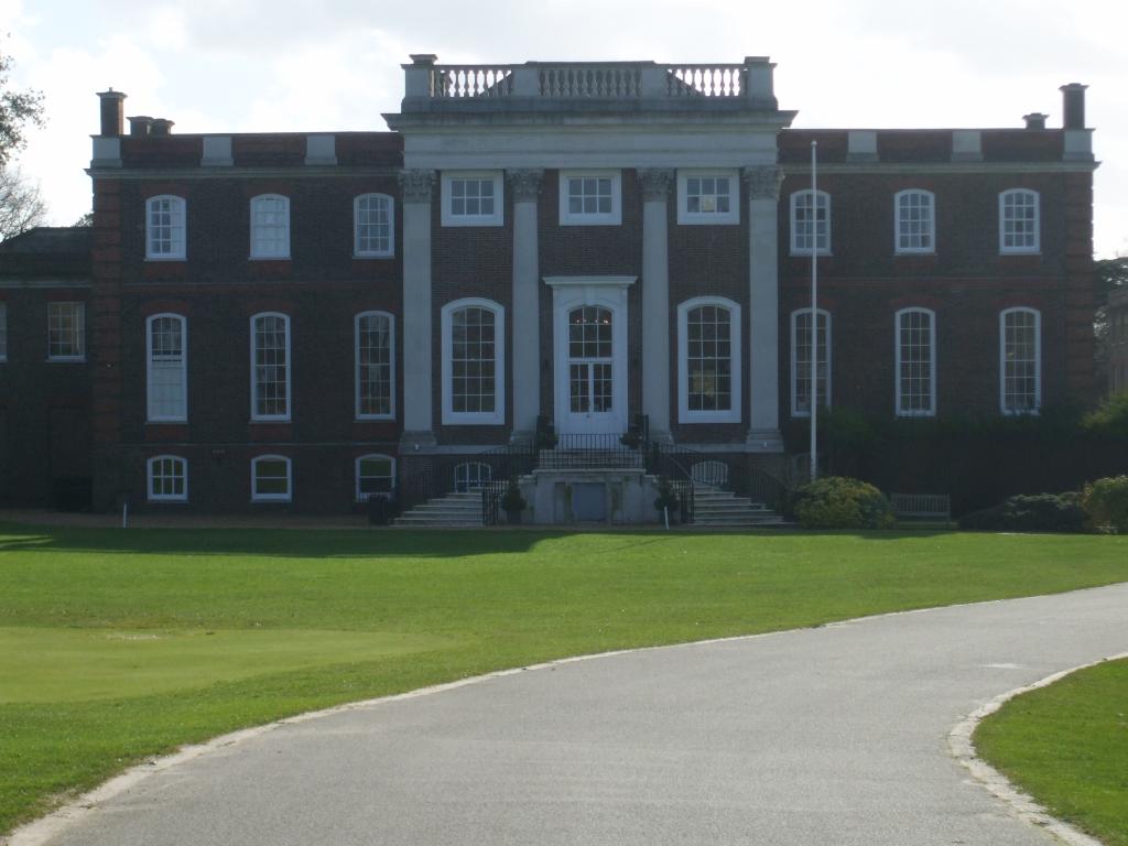
Sudbrook Park, Petersham
Sudbrook Park in Petersham (now in the London Borough of Richmond upon Thames) was developed by John Campbell, 2nd Duke of Argyll in the early 18th century...

Richmond Golf Club
The Richmond Golf Club is a private golf club whose 18-hole course now occupies the historic Sudbrook Park adjacent to Richmond Park, in Petersham, south...

Pembroke Lodge, Richmond Park
Pembroke Lodge is an initial, mainstream category listed (Grade II) Georgian two-storey large house in Richmond Park in the London Borough of Richmond...

Latchmere House
Latchmere House is a building and grounds southeast of Ham Common in Ham, in the London Borough of Richmond upon Thames, in south west London, England...
Ormeley Lodge
Ormeley Lodge is a Grade II* listed early 18th-century Georgian house, set in 6 acres (2 ha) on the edge of Ham Common, near to Richmond Park in Ham...
Ham Urban District
Ham was a local government district in north east Surrey, England around the village of Ham from 1894 to 1933. Ham Common Local Government District was...
Nearby Amenities
Located within 500m of 51.435217,-0.28603157Have you been to Hamcross Plantation?
Leave your review of Hamcross Plantation below (or comments, questions and feedback).