Fox Covert

Wood, Forest in Huntingdonshire Huntingdonshire

England

Fox Covert

Holme Brook Rather overgrown.  The brook is passing beneath a Network Rail access track adjacent to the East Coast Main Line.
Holme Brook Credit: Jonathan Thacker

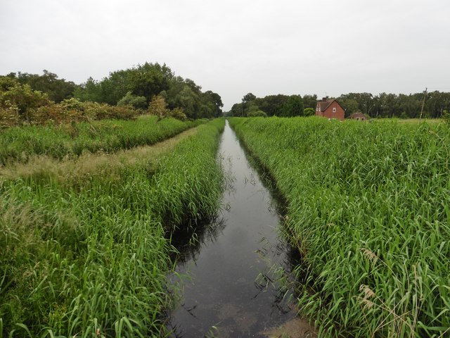
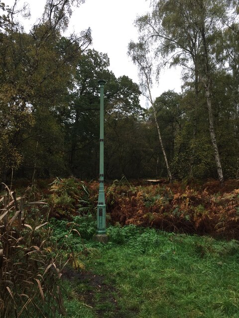
Fox Covert is a wood and forest located in Huntingdonshire, a county in the eastern part of England. The woodland covers an area of approximately 100 acres and can be found within close proximity to the village of Woodhurst.

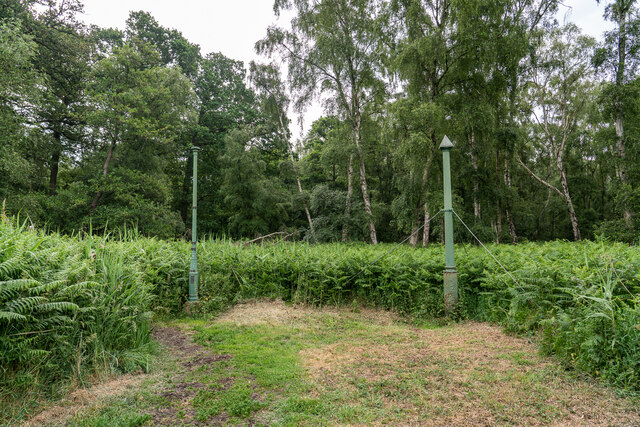
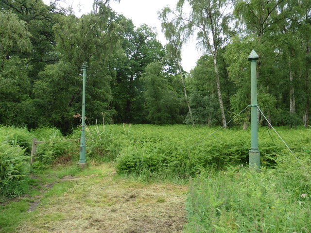
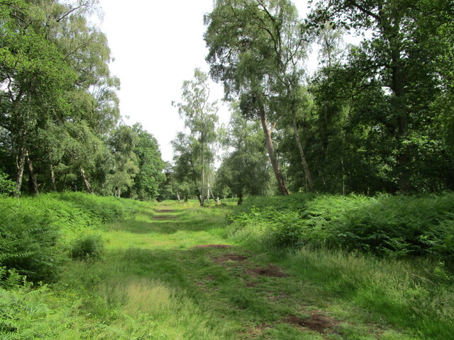
The forest is characterized by its dense canopy of mature trees, predominantly consisting of oak, beech, and birch. These trees provide a rich habitat for a variety of wildlife, including numerous bird species, small mammals, and insects. The forest floor is covered with a thick layer of leaf litter, creating a natural ecosystem that supports a diverse range of flora and fauna.

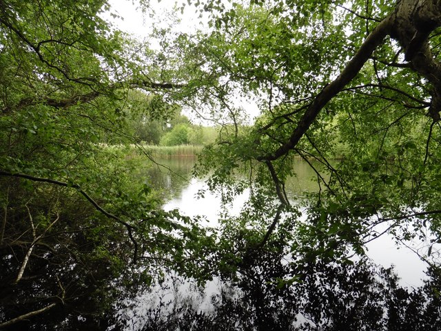
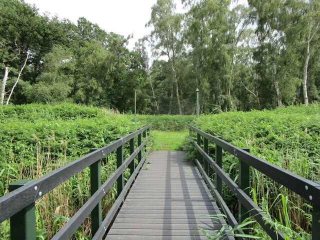
Walking trails wind through the woodland, allowing visitors to explore and enjoy the peaceful surroundings. These paths lead to a picturesque lake nestled within the forest, providing a tranquil spot for picnics or simply enjoying nature. The lake attracts waterfowl and is also popular among anglers.

Fox Covert is managed by the local authorities, who ensure the preservation of the woodland and its inhabitants. The forest is open to the public throughout the year, offering a serene escape from the bustle of everyday life. It is a popular destination for nature enthusiasts, photographers, and families looking to reconnect with the outdoors.

Overall, Fox Covert is a beautiful woodland and forest in Huntingdonshire, offering a haven of tranquility and natural beauty for visitors to enjoy.

If you have any feedback on the listing, please let us know in the comments section below.
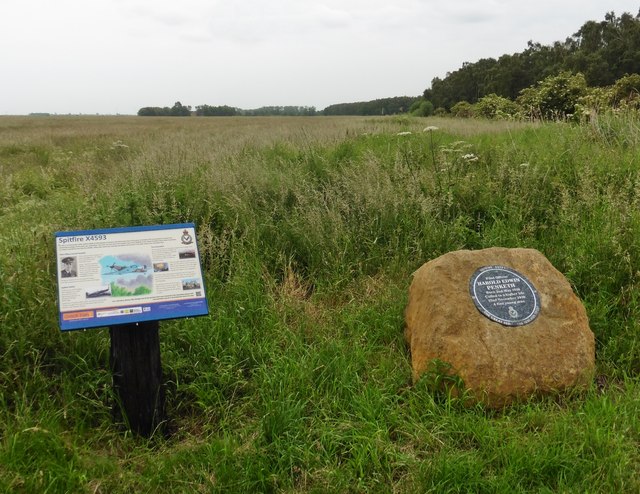
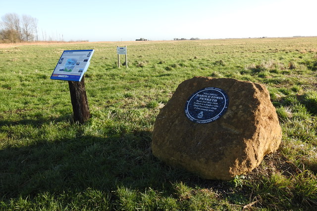
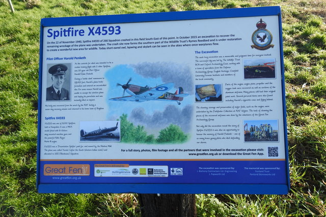
Fox Covert Images

Images are sourced within 2km of 52.484725/-0.24761881 or Grid Reference TL1988. Thanks to Geograph Open Source API. All images are credited.

Holme Brook Rather overgrown.  The brook is passing beneath a Network Rail access track adjacent to the East Coast Main Line.
Holme Brook
Rather overgrown. The brook is passing beneath a Network Rail access track adjacent to the East Coast Main Line.
Church Street, Holme
Sewage works at Holme The East Coast Main Line railway in the background.
Sewage works at Holme
The East Coast Main Line railway in the background.
Stubble field at Holme The buildings of Peterborough Business Airport in the distance.
Stubble field at Holme
The buildings of Peterborough Business Airport in the distance.
Holme Church of England Primary School
St Giles' church, Holme Designed in 1862 by Edward Browning <span class="nowrap"><a title="https://en.wikipedia.org/wiki/Edward_Browning" rel="nofollow ugc noopener" href="https://en.wikipedia.org/wiki/Edward_Browning">Link</a><img style="margin-left:2px;" alt="External link" title="External link - shift click to open in new window" src="https://s1.geograph.org.uk/img/external.png" width="10" height="10"/></span> partly using old materials <span class="nowrap"><a title="https://historicengland.org.uk/listing/the-list/list-entry/1215533?section=official-list-entry" rel="nofollow ugc noopener" href="https://historicengland.org.uk/listing/the-list/list-entry/1215533?section=official-list-entry">Link</a><img style="margin-left:2px;" alt="External link" title="External link - shift click to open in new window" src="https://s1.geograph.org.uk/img/external.png" width="10" height="10"/></span>
St Giles' church, Holme
Designed in 1862 by Edward Browning LinkExternal link partly using old materials LinkExternal link
Holme Fen Posts Believed to be the lowest land point at nearly -3m below sea level . The posts were used to measure the shrinkage as the water was drained. The tops mark the height the land used to be in 1848. 

<span class="nowrap"><a title="https://www.greatfen.org.uk/about-great-fen/heritage/holme-fen-posts" rel="nofollow ugc noopener" href="https://www.greatfen.org.uk/about-great-fen/heritage/holme-fen-posts">Link</a><img style="margin-left:2px;" alt="External link" title="External link - shift click to open in new window" src="https://s1.geograph.org.uk/img/external.png" width="10" height="10"/></span>
Holme Fen Posts
Believed to be the lowest land point at nearly -3m below sea level . The posts were used to measure the shrinkage as the water was drained. The tops mark the height the land used to be in 1848. LinkExternal link
Peterborough Business Airport
Holme Fen Posts Mark the lowest point in the UK.
Holme Fen Posts
Mark the lowest point in the UK.
A glimpse of the water at Caldecote Fen
Holme Fen Edge Drain
WW2 memorial on Holme Fen
Memorial to Pilot Officer Harold Edwin Penketh, age 20 Pilot Officer Penketh of 266 Rhodesian Squadron Royal Air Force was flying his Mk 1A, Spitfire, X4593 from RAF Wittering on the 22nd November 1940, on a routine training flight with two other Spitfires, Pilot Officer Penketh was seen to break formation entering a dive from which he failed to fully recover. Witnesses stated that his aircraft partially recovered at around 2,000ft but then re-entered a dive and struck the ground vertically.  
He was the son of James and Ann Penketh. of Hove and his ashes are buried at Brighton (Woodvale) Crematorium.
Memorial to Pilot Officer Harold Edwin Penketh, age 20
Pilot Officer Penketh of 266 Rhodesian Squadron Royal Air Force was flying his Mk 1A, Spitfire, X4593 from RAF Wittering on the 22nd November 1940, on a routine training flight with two other Spitfires, Pilot Officer Penketh was seen to break formation entering a dive from which he failed to fully recover. Witnesses stated that his aircraft partially recovered at around 2,000ft but then re-entered a dive and struck the ground vertically. He was the son of James and Ann Penketh. of Hove and his ashes are buried at Brighton (Woodvale) Crematorium.
Information board at Holme Fen (Spitfire X4593) See also <a title="https://www.geograph.org.uk/photo/6371387" href="https://www.geograph.org.uk/photo/6371387">Link</a>
Information board at Holme Fen (Spitfire X4593)
See also Link
Holme Fen Post Holme Fen is a 269.4 hectare biological Site of Special Scientific Interest near Holme in Cambridgeshire. It is also a National Nature Reserve and a Nature Conservation Review site, Grade I.  It is part of the Great Fen project, which aims to create a 3,700 wetland wildlife area including Holme Fen, Woodwalton Fen and other areas. It is home to a variety of birds, including the Eurasian siskin, Nightingale and Lesser redpoll, and around 450 species of fungi.

Home Fen is described by Natural England as the finest example of birch woodland in lowland Britain. Part of it was a mere which was drained in the nineteenth century, and some relict wetland plants survive such as saw sedge and fen wood-rush. Two new lakes have been excavated.

Holme Fen, specifically Holme Posts, is believed to be the lowest land point in Great Britain at 2.75 metres (9.0 ft) below sea level.

<span class="nowrap"><a title="https://en.wikipedia.org/wiki/Holme_Fen" rel="nofollow ugc noopener" href="https://en.wikipedia.org/wiki/Holme_Fen">Link</a><img style="margin-left:2px;" alt="External link" title="External link - shift click to open in new window" src="https://s1.geograph.org.uk/img/external.png" width="10" height="10"/></span>
Holme Fen Post
Holme Fen is a 269.4 hectare biological Site of Special Scientific Interest near Holme in Cambridgeshire. It is also a National Nature Reserve and a Nature Conservation Review site, Grade I. It is part of the Great Fen project, which aims to create a 3,700 wetland wildlife area including Holme Fen, Woodwalton Fen and other areas. It is home to a variety of birds, including the Eurasian siskin, Nightingale and Lesser redpoll, and around 450 species of fungi. Home Fen is described by Natural England as the finest example of birch woodland in lowland Britain. Part of it was a mere which was drained in the nineteenth century, and some relict wetland plants survive such as saw sedge and fen wood-rush. Two new lakes have been excavated. Holme Fen, specifically Holme Posts, is believed to be the lowest land point in Great Britain at 2.75 metres (9.0 ft) below sea level. LinkExternal link
Footbridge and Holme Fen Posts The Fen Posts mark the lowest point in England -9ft. The post on the left was erected in 1851 with just its head showing above ground. Plaques mark the extent of the shrinkage of the peat since then, The post on the right is more recent dating from 1957. <span class="nowrap"><a title="https://www.greatfen.org.uk/about-great-fen/heritage/holme-fen-posts" rel="nofollow ugc noopener" href="https://www.greatfen.org.uk/about-great-fen/heritage/holme-fen-posts">Link</a><img style="margin-left:2px;" alt="External link" title="External link - shift click to open in new window" src="https://s1.geograph.org.uk/img/external.png" width="10" height="10"/></span>
Footbridge and Holme Fen Posts
The Fen Posts mark the lowest point in England -9ft. The post on the left was erected in 1851 with just its head showing above ground. Plaques mark the extent of the shrinkage of the peat since then, The post on the right is more recent dating from 1957. LinkExternal link
Holme Fen One of many paths through this area of birch woodland <span class="nowrap"><a title="https://en.wikipedia.org/wiki/Holme_Fen" rel="nofollow ugc noopener" href="https://en.wikipedia.org/wiki/Holme_Fen">Link</a><img style="margin-left:2px;" alt="External link" title="External link - shift click to open in new window" src="https://s1.geograph.org.uk/img/external.png" width="10" height="10"/></span>
Holme Fen
One of many paths through this area of birch woodland LinkExternal link
Holme Lode In Holme Fen National Nature Reserve.
Holme Lode
In Holme Fen National Nature Reserve.
Show me another place!

Fox Covert is located at Grid Ref: TL1988 (Lat: 52.484725, Lng: -0.24761881)

Administrative County: Cambridgeshire

District: Huntingdonshire

Police Authority: Cambridgeshire

What 3 Words

///festivity.toolbar.procured. Near Stilton, Cambridgeshire

Nearby Locations

Denton Fen Fox Covert

Related Wikis

Holme, Cambridgeshire

Holme is a village and civil parish in Cambridgeshire, England. Holme lies approximately 7 miles (11 km) south of Peterborough, near Conington and Yaxley...

Battle of the Holme

The Battle of the Holme took place in East Anglia on 13 December 902 where the Anglo-Saxon men of Wessex and Kent fought against the Danelaw and East Anglian...

The Fens

The Fens or Fenlands in eastern England are a naturally marshy region supporting a rich ecology and numerous species. Most of the fens were drained centuries...
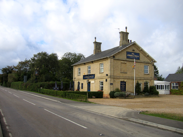
Admiral Wells

The Admiral Wells is a public house in Holme, Huntingdonshire, now in Cambridgeshire. Nearby Holme Fen is 2.75 metres (9.0 feet) below sea level, and the...

Holme railway station (Cambridgeshire)

Holme railway station is a former station in Holme, Cambridgeshire. == History == The first section of the Great Northern Railway (GNR) - that from Louth...

Holme Fen

Holme Fen is a 269.4-hectare (666-acre) biological Site of Special Scientific Interest near Holme in Cambridgeshire. It is also a National Nature Reserve...

Peterborough Business Airport

Peterborough Business Airport (ICAO: EGSF) is a privately owned airfield in the English county of Cambridgeshire near the villages of Holme and Conington...

RAF Glatton

Royal Air Force Glatton or more simply RAF Glatton is a former Royal Air Force station located 10 miles (16 km) north of Huntingdon, Cambridgeshire, England...

Nearby Amenities

Located within 500m of 52.484725,-0.24761881
The data included in this document is from www.openstreetmap.org. The data is made available under ODbL.

Have you been to Fox Covert?

Leave your review of Fox Covert below (or comments, questions and feedback).