Furzefield Wood

Wood, Forest in Sussex Horsham

England

Furzefield Wood

Mares Field/Little Snares Hill The name of the fields according to the 1840 tithe map with Mares Field being closest to the camera. Both have been extended to include a number of other fields that are on or line the northern slope of this small ridge.
Mares Field/Little Snares Hill Credit: Simon Carey

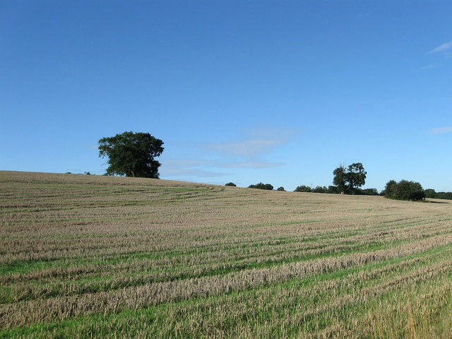
Furzefield Wood is a captivating woodland located in the county of Sussex, England. Nestled amidst the rolling countryside, this enchanting forest covers a vast area of approximately 100 acres. It is renowned for its diverse range of trees, flora, and fauna, making it a haven for nature enthusiasts and wildlife lovers.

The wood is predominantly composed of deciduous trees such as oak, beech, and ash, with their towering canopies providing a lush green canopy during the summer months. In autumn, the forest transforms into a kaleidoscope of vibrant colors as the leaves turn various shades of red, orange, and gold.

Walking through Furzefield Wood is a sensory delight, with the air filled with the sweet scent of wildflowers and the melodic chirping of birds. The forest floor is adorned with a rich carpet of bluebells in the spring, creating a breathtaking display. Numerous walking trails wind their way through the wood, offering visitors the opportunity to explore its many hidden treasures.

The wood is also home to a diverse array of wildlife. Deer can often be spotted grazing amongst the trees, while small mammals such as foxes, badgers, and squirrels scurry about their daily routines. Birdwatchers will be delighted by the presence of various species, including woodpeckers, owls, and warblers.

Furzefield Wood is a cherished natural gem, providing a tranquil retreat for those seeking solace in nature's embrace. Its beauty and biodiversity make it a must-visit destination for anyone looking to immerse themselves in the wonders of Sussex's countryside.

If you have any feedback on the listing, please let us know in the comments section below.

Furzefield Wood Images

Images are sourced within 2km of 50.963634/-0.31688755 or Grid Reference TQ1819. Thanks to Geograph Open Source API. All images are credited.

Mares Field/Little Snares Hill The name of the fields according to the 1840 tithe map with Mares Field being closest to the camera. Both have been extended to include a number of other fields that are on or line the northern slope of this small ridge.
Mares Field/Little Snares Hill
The name of the fields according to the 1840 tithe map with Mares Field being closest to the camera. Both have been extended to include a number of other fields that are on or line the northern slope of this small ridge.
Barn Field The name of the field according to the 1840 tithe map. The original Green Tree Farm once stood on the edge of this field out of shot to the left. The farm and its land was purchased in 1890 by the owners of Shermanbury Grange to extend their park and while the farm continued up to the Second World War it had gone by the early 1950s replaced by another of the same name to the east. Felix Plantation is the wood at the end of the field that was planted in the 1890s on what was once three fields.
Barn Field
The name of the field according to the 1840 tithe map. The original Green Tree Farm once stood on the edge of this field out of shot to the left. The farm and its land was purchased in 1890 by the owners of Shermanbury Grange to extend their park and while the farm continued up to the Second World War it had gone by the early 1950s replaced by another of the same name to the east. Felix Plantation is the wood at the end of the field that was planted in the 1890s on what was once three fields.
The Weir at Hatterell Bridge
Prettys Garage, Partridge Green Small cottage garage still operating in the centre of the village on the B2135 opposite the village inn.
Prettys Garage, Partridge Green
Small cottage garage still operating in the centre of the village on the B2135 opposite the village inn.
High Street, Partridge Green The B2116 looking east. The Post Office is to the left of the parked red car.
High Street, Partridge Green
The B2116 looking east. The Post Office is to the left of the parked red car.
Pond, near Lloyts Farm If you follow the bridleway from east to west this is the first of four ponds that are to the north of the bridleway.
Pond, near Lloyts Farm
If you follow the bridleway from east to west this is the first of four ponds that are to the north of the bridleway.
Water Meadows and Farmland, near Partridge Green Looking north east from the Downs Link cycle path.
Water Meadows and Farmland, near Partridge Green
Looking north east from the Downs Link cycle path.
Jasmine Cottage, Rookcross Lane Situated at the junction of the lane with the entrance to Rooklands Farm.
Jasmine Cottage, Rookcross Lane
Situated at the junction of the lane with the entrance to Rooklands Farm.
Partridge Green - St.Michaels Way - Fire!
Joles Farm, Partridge Green
Towards Lock Farm The Lock estate is the largest in the parish of Ashurst. Lock Farm is to the right and Old Lock House is to the left.
Towards Lock Farm
The Lock estate is the largest in the parish of Ashurst. Lock Farm is to the right and Old Lock House is to the left.
Farmland, Lock Farm To the north west of the farm buildings with Stony Copse just over the brow.
Farmland, Lock Farm
To the north west of the farm buildings with Stony Copse just over the brow.
River Adur North of Locks Bridge This is the western branch of the river as it heads towards West Grinstead.
River Adur North of Locks Bridge
This is the western branch of the river as it heads towards West Grinstead.
River Adur South of Locks Bridge This is the western branch of the Adur as it heads towards Bines Bridge.
River Adur South of Locks Bridge
This is the western branch of the Adur as it heads towards Bines Bridge.
Lloyts Farm 17th century farmhouse near Partridge Green.
Lloyts Farm
17th century farmhouse near Partridge Green.
Field near Moat Farm The Lock estate is just visible through the gap in the trees.
Field near Moat Farm
The Lock estate is just visible through the gap in the trees.
River Adur Looking north west along the western branch towards Pinlands Farm.
River Adur
Looking north west along the western branch towards Pinlands Farm.
Bridleway off the Downs Link This bridleway leaves the Downs Link near Partridge Green heading west to the River Adur and Hatterell bridge.
Bridleway off the Downs Link
This bridleway leaves the Downs Link near Partridge Green heading west to the River Adur and Hatterell bridge.
Show me another place!

Furzefield Wood is located at Grid Ref: TQ1819 (Lat: 50.963634, Lng: -0.31688755)

Administrative County: West Sussex

District: Horsham

Police Authority: Sussex

What 3 Words

///garages.sweeter.birthing. Near Partridge Green, West Sussex

Related Wikis

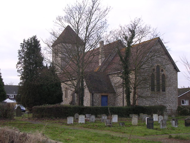
St Michael and All Angels Church, Partridge Green

St Michael and All Angels Church is a late nineteenth-century church in the settlement of Partridge Green in the parish of West Grinstead in West Sussex...
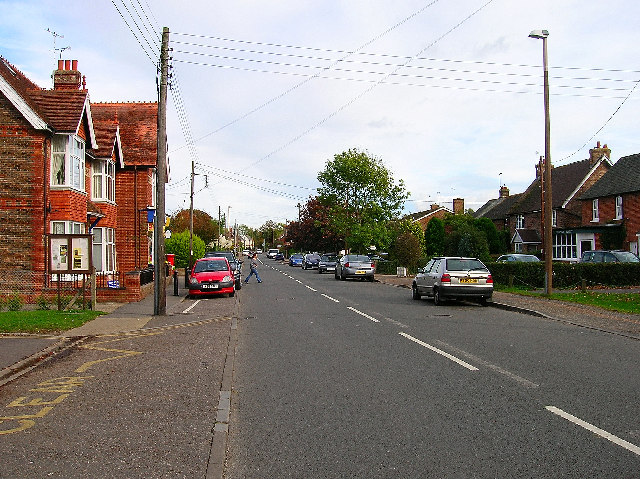
Partridge Green

Partridge Green is a village in the Horsham District of West Sussex, England. It lies on the B2135 road 2.5 miles (4 km) north-west of Henfield. It is...

Partridge Green railway station

Partridge Green was a railway station on the Steyning Line which served the village of Partridge Green. The station closed as a result of the Beeching...

Dark Star Brewing Company

Dark Star is a brewery in Partridge Green, Sussex, England. == History == Dark Star Brewery was established in 1994, brewing in the cellar of the Evening...

Littleworth, West Sussex

Littleworth is a hamlet in the Horsham District of West Sussex, England. It lies on the Partridge Green to Maplehurst road 2.9 miles (4.7 km) north of...

Henfield (electoral division)

Henfield is an electoral division of West Sussex in the United Kingdom and returns one member to sit on West Sussex County Council. The current County...

St George's Church, West Grinstead

St George's Church is an Anglican church in West Grinstead, West Sussex, England. It is in the Diocese of Chichester, occupying a rural position in the...

West Grinstead

West Grinstead is a village and civil parish in the Horsham District of West Sussex, England. It lies just off the B2135 road four miles (6.3 km) northwest...

Nearby Amenities

Located within 500m of 50.963634,-0.31688755
Waterway: weir
Lat/Long: 50.9650154/-0.3231969
Jolesfield House
Place: isolated_dwelling
Lat/Long: 50.9640849/-0.3109095
Hatterell Bridge
Place: locality
Lat/Long: 50.9650568/-0.3232878
The data included in this document is from www.openstreetmap.org. The data is made available under ODbL.

Have you been to Furzefield Wood?

Leave your review of Furzefield Wood below (or comments, questions and feedback).