Arch Wood

Wood, Forest in Middlesex Hertsmere

England

Arch Wood

Derelict restaurant on Watling Street, Elstree
Derelict restaurant on Watling Street, Elstree Credit: David Howard

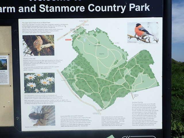
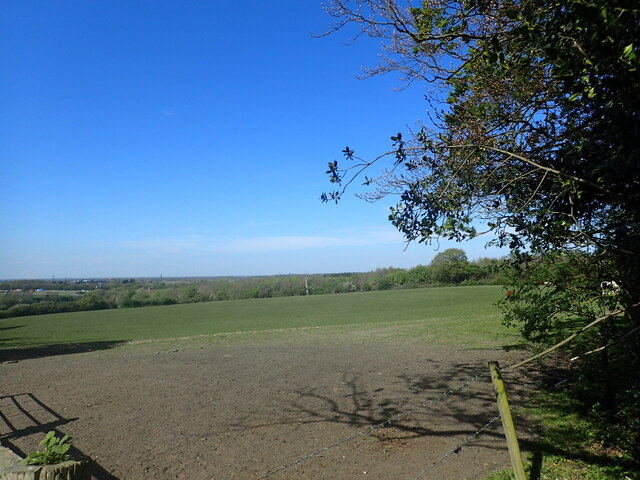
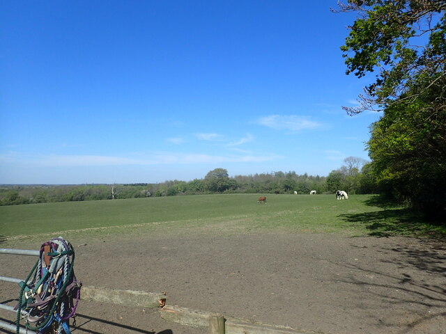
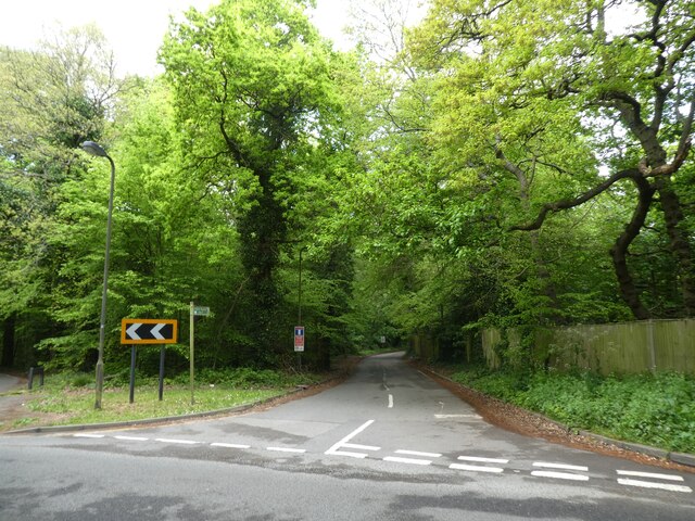
Arch Wood is a picturesque forest located in the county of Middlesex, England. Spread over a vast area, it is known for its dense woodland and rich biodiversity. The wood is situated near the town of Arch, providing easy access to nature enthusiasts and locals alike.

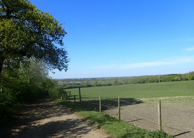
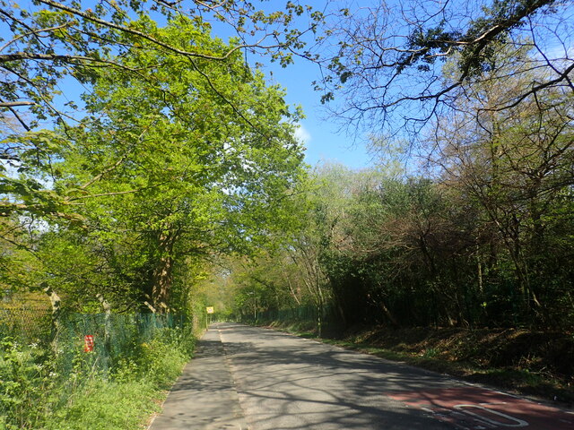
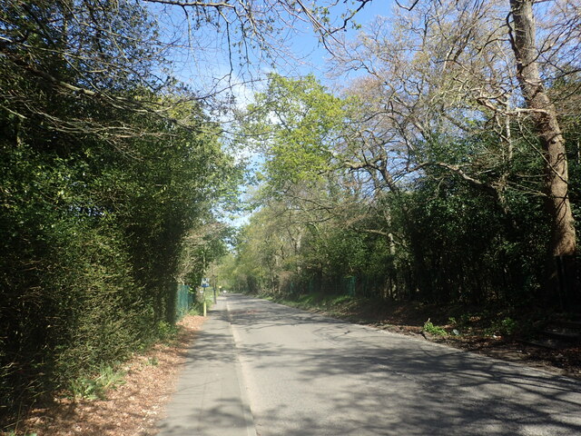
The woodland is characterized by towering ancient trees, predominantly oak and beech, creating a breathtaking canopy that offers shade and shelter. These majestic trees, some of which are estimated to be several centuries old, lend an aura of timelessness to the surroundings. The forest floor is adorned with a lush carpet of moss, wildflowers, and ferns, adding to the enchanting ambiance of the wood.

Arch Wood is a haven for wildlife, with a diverse range of species calling it home. Birdsong fills the air as numerous avian species, including woodpeckers, owls, and warblers, flit from branch to branch. Squirrels can be spotted scurrying through the treetops, while badgers and foxes leave their traces on the forest floor. The wood is also home to a variety of insects, from beetles to butterflies, providing an important ecosystem for pollination.

The forest is a popular destination for outdoor activities such as hiking, nature walks, and birdwatching. Several well-marked trails crisscross the wood, allowing visitors to explore its beauty at their own pace. Additionally, designated picnic areas provide a serene setting for enjoying a meal amidst the tranquility of nature.

Arch Wood, Middlesex, is a natural treasure that offers a peaceful retreat from the bustle of urban life. Its ancient trees, diverse wildlife, and serene atmosphere make it a destination worth exploring for nature enthusiasts and those seeking solace in the embrace of the natural world.

If you have any feedback on the listing, please let us know in the comments section below.

Arch Wood Images

Images are sourced within 2km of 51.640113/-0.29570295 or Grid Reference TQ1894. Thanks to Geograph Open Source API. All images are credited.

Derelict restaurant on Watling Street, Elstree
The London Loop This is just after leaving a narrow footpath which runs alongside the Royal National Orthopaedic Hospital. The Loop drops down to pass under the M1 which can just be made out in the distance. It then heads on to Aldenham Reservoir.
The London Loop
This is just after leaving a narrow footpath which runs alongside the Royal National Orthopaedic Hospital. The Loop drops down to pass under the M1 which can just be made out in the distance. It then heads on to Aldenham Reservoir.
Wood Lane This is just after passing the entrance to the Royal National Orthopaedic Hospital.
Wood Lane
This is just after passing the entrance to the Royal National Orthopaedic Hospital.
Wood Lane This is approaching the entrance to the Royal National Orthopaedic Hospital.
Wood Lane
This is approaching the entrance to the Royal National Orthopaedic Hospital.
Wood Farm Close This gated group of new housing is off Wood Lane to the east of Wood Farm.
Wood Farm Close
This gated group of new housing is off Wood Lane to the east of Wood Farm.
The viewpoint at Wood Farm Wood Farm has in the past been a dairy farm, and a pig farm owned by Joe Bygraves, a former British heavyweight boxing champion. From the mid 1970s to the late 1980s, the lower parts were used as a landfill site. Wood Farm has now been restored for nature and for recreation.

As can be seen, there are fabulous views as far as the North Downs and including the Wembley Arch.
The viewpoint at Wood Farm
Wood Farm has in the past been a dairy farm, and a pig farm owned by Joe Bygraves, a former British heavyweight boxing champion. From the mid 1970s to the late 1980s, the lower parts were used as a landfill site. Wood Farm has now been restored for nature and for recreation. As can be seen, there are fabulous views as far as the North Downs and including the Wembley Arch.
View from Wood Farm Wood Farm has in the past been a dairy farm, and a pig farm owned by Joe Bygraves, a former British heavyweight boxing champion. From the mid 1970s to the late 1980s, the lower parts were used as a landfill site. Wood Farm has now been restored for nature and for recreation.

As can be seen, there are fabulous views as far as the North Downs, which are in the distance here, and including the Wembley Arch which can be seen towards the right of the pictures.
View from Wood Farm
Wood Farm has in the past been a dairy farm, and a pig farm owned by Joe Bygraves, a former British heavyweight boxing champion. From the mid 1970s to the late 1980s, the lower parts were used as a landfill site. Wood Farm has now been restored for nature and for recreation. As can be seen, there are fabulous views as far as the North Downs, which are in the distance here, and including the Wembley Arch which can be seen towards the right of the pictures.
Pond at Wood farm Wood Farm has in the past been a dairy farm, and a pig farm owned by Joe Bygraves, a former British heavyweight boxing champion. From the mid 1970s to the late 1980s, the lower parts were used as a landfill site. Wood Farm has now been restored for nature and for recreation.

As can be seen at <a title="https://www.geograph.org.uk/photo/7153529" href="https://www.geograph.org.uk/photo/7153529">Link</a> there are fabulous views as far as the North Downs and including the Wembley Arch.
Pond at Wood farm
Wood Farm has in the past been a dairy farm, and a pig farm owned by Joe Bygraves, a former British heavyweight boxing champion. From the mid 1970s to the late 1980s, the lower parts were used as a landfill site. Wood Farm has now been restored for nature and for recreation. As can be seen at Link there are fabulous views as far as the North Downs and including the Wembley Arch.
Pond at Wood Farm Wood Farm has in the past been a dairy farm, and a pig farm owned by Joe Bygraves, a former British heavyweight boxing champion. From the mid 1970s to the late 1980s, the lower parts were used as a landfill site. Wood Farm has now been restored for nature and for recreation.

As can be seen at <a title="https://www.geograph.org.uk/photo/7153529" href="https://www.geograph.org.uk/photo/7153529">Link</a> there are fabulous views as far as the North Downs and including the Wembley Arch.
Pond at Wood Farm
Wood Farm has in the past been a dairy farm, and a pig farm owned by Joe Bygraves, a former British heavyweight boxing champion. From the mid 1970s to the late 1980s, the lower parts were used as a landfill site. Wood Farm has now been restored for nature and for recreation. As can be seen at Link there are fabulous views as far as the North Downs and including the Wembley Arch.
Information board at Wood Farm As explained on the information board, Wood Farm has in the past been a dairy farm, and a pig farm owned by Joe Bygraves, a former British heavyweight boxing champion. From the mid 1970s to the late 1980s, the lower parts were used as a landfill site. Wood Farm has now been restored for nature and for recreation.

As can be seen at <a title="https://www.geograph.org.uk/photo/7153529" href="https://www.geograph.org.uk/photo/7153529">Link</a> there are fabulous views as far as the North Downs and including the Wembley Arch.
Information board at Wood Farm
As explained on the information board, Wood Farm has in the past been a dairy farm, and a pig farm owned by Joe Bygraves, a former British heavyweight boxing champion. From the mid 1970s to the late 1980s, the lower parts were used as a landfill site. Wood Farm has now been restored for nature and for recreation. As can be seen at Link there are fabulous views as far as the North Downs and including the Wembley Arch.
View from the London Loop This is just after leaving a narrow footpath which runs alongside the Royal National Orthopaedic Hospital. The Loop drops down to pass under the M1 which can just be made out in the far distance on the left. It then heads on to Aldenham Reservoir. An enclosed footpath leads off to the right at this point to pass under the M1 and reach the A41 Watford By-pass.
View from the London Loop
This is just after leaving a narrow footpath which runs alongside the Royal National Orthopaedic Hospital. The Loop drops down to pass under the M1 which can just be made out in the far distance on the left. It then heads on to Aldenham Reservoir. An enclosed footpath leads off to the right at this point to pass under the M1 and reach the A41 Watford By-pass.
View from the London loop This is just after leaving a narrow footpath which runs alongside the Royal National Orthopaedic Hospital. The Loop drops down to pass under the M1 and then heads on to Aldenham Reservoir. An enclosed footpath leads off here, beyond the edge of this field on the right, to pass under the M1 and reach the A41 Watford By-pass.
View from the London loop
This is just after leaving a narrow footpath which runs alongside the Royal National Orthopaedic Hospital. The Loop drops down to pass under the M1 and then heads on to Aldenham Reservoir. An enclosed footpath leads off here, beyond the edge of this field on the right, to pass under the M1 and reach the A41 Watford By-pass.
Bridleway and 'London Loop'
Elstree & Borehamwood railway station Elstree & Borehamwood is a railway station on the "Thameslink" route between London, St. Albans and Bedford.  It is served by suburban trains.  The railway is electrified using overhead cables.

This image was taken on a bright and sunny early November day.  At this time of year, the sun is low in the sky therefore shadows were long.
Elstree & Borehamwood railway station
Elstree & Borehamwood is a railway station on the "Thameslink" route between London, St. Albans and Bedford. It is served by suburban trains. The railway is electrified using overhead cables. This image was taken on a bright and sunny early November day. At this time of year, the sun is low in the sky therefore shadows were long.
Penta Court, Borehamwood Penta Court is a mixed-use block in Borehamwood.  Part of the building is offices, but it also contains residential apartments.

This image was taken on a bright and sunny early November day.  At this time of year, the sun is low in the sky therefore shadows were long.
Penta Court, Borehamwood
Penta Court is a mixed-use block in Borehamwood. Part of the building is offices, but it also contains residential apartments. This image was taken on a bright and sunny early November day. At this time of year, the sun is low in the sky therefore shadows were long.
Sainsbury's Local, Borehamwood A Sainsbury's Local shop in Borehamwood.  The building was previously a pub.
Sainsbury's Local, Borehamwood
A Sainsbury's Local shop in Borehamwood. The building was previously a pub.
Allum Manor, Borehamwood Allum Manor is a manor house, parts of which date from the 17th Century, in Borehamwood.  More information about the house can be found on the Allum Manor website: <span class="nowrap"><a title="https://www.allummanor.co.uk/key-information/our-history" rel="nofollow ugc noopener" href="https://www.allummanor.co.uk/key-information/our-history">Link</a><img style="margin-left:2px;" alt="External link" title="External link - shift click to open in new window" src="https://s1.geograph.org.uk/img/external.png" width="10" height="10"/></span>
Allum Manor, Borehamwood
Allum Manor is a manor house, parts of which date from the 17th Century, in Borehamwood. More information about the house can be found on the Allum Manor website: LinkExternal link
Show me another place!

Arch Wood is located at Grid Ref: TQ1894 (Lat: 51.640113, Lng: -0.29570295)

Administrative County: Hertfordshire

District: Hertsmere

Police Authority: Hertfordshire

What 3 Words

///normal.along.family. Near Elstree, Hertfordshire

Nearby Locations

Edgewarebury Arch Wood

Related Wikis

The Leys, Elstree

The Leys in Barnet Lane, Elstree, Hertfordshire, is an architecturally notable house that is grade II* listed with Historic England. == References ==

Elstree

Elstree is a large village in the Hertsmere borough of Hertfordshire, England. It is about 15 miles (24 kilometres) northwest of central London on the...

Elstree South tube station

Elstree South (usually just Elstree on Underground maps) was a proposed London Underground station in Elstree, Hertfordshire. It was designed by Charles...

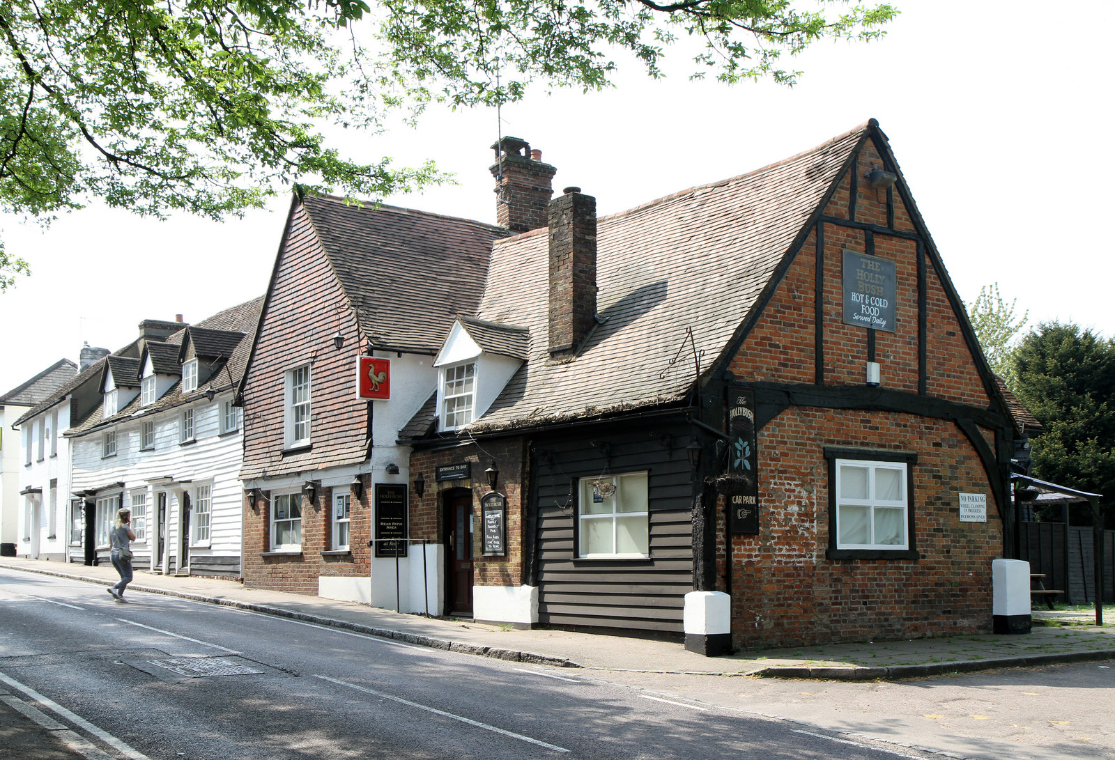
The Holly Bush, Elstree

The Holly Bush is a listed building, formerly a public house, on the High Street, Elstree, Hertfordshire, England. Elstree's High Street was formerly an...

Aldenham Works

The Aldenham Works, or Aldenham Bus Overhaul Works, was the main London Transport bus overhaul works. It was located on the edge of the Hertfordshire village...

Royal National Orthopaedic Hospital

The Royal National Orthopaedic Hospital (RNOH) is a specialist orthopaedic hospital located in the London Borough of Harrow, United Kingdom, and a part...

Deacon's Hill

Deacon's Hill is an area of Elstree, Hertfordshire, England. It is the part of the town which lies to the immediate west of the railway line and is informally...

Brockley Hill

Brockley Hill, Stanmore, is an area of high ground on the outskirts of North London, England. The hill, which rises to 136 metres (446 ft) above sea level...

Nearby Amenities

Located within 500m of 51.640113,-0.29570295
Give Way
Direction: forward
Lat/Long: 51.6417795/-0.3009938
Created By: YahooApplet 1.0
Lat/Long: 51.6398941/-0.2893289
Created By: YahooApplet 1.0
Lat/Long: 51.6404268/-0.2900799
Created By: YahooApplet 1.0
Lat/Long: 51.6412524/-0.289758
Created By: YahooApplet 1.0
Lat/Long: 51.6399474/-0.2908738
Elstree
Place: village
Population: 5110
Wikidata: Q19931
Wikipedia: en:Elstree
Lat/Long: 51.6437729/-0.2989349
Power: tower
Lat/Long: 51.6387326/-0.3014333
Power: tower
Lat/Long: 51.637056/-0.2974202
Bus Stop
Rodgers Close
Bench: yes
Bin: yes
Naptan AtcoCode: 210021002780
Naptan Bearing: N
Naptan CommonName: Rodgers Close
Naptan Indicator: adj
Naptan Landmark: Unknown
Naptan NaptanCode: hrtgpgwj
Naptan ShortCommonName: NA
Naptan Street: High Street South
Naptan Verified: yes
Public Transport: platform
Shelter: yes
Source: naptan_import
Lat/Long: 51.6423648/-0.3002145
Bus Stop
Sullivan Way
Bench: yes
Naptan AtcoCode: 210021004980
Naptan Bearing: N
Naptan CommonName: Sullivan Way
Naptan Indicator: adj
Naptan Landmark: Unknown
Naptan NaptanCode: hrtgmwmg
Naptan ShortCommonName: NA
Naptan Street: Elstree Hill South
Naptan Verified: yes
Public Transport: platform
Shelter: yes
Source: naptan_import
Lat/Long: 51.6403264/-0.3017016
Edgewarebury Lane
Naptan AtcoCode: 210021007795
Naptan Bearing: E
Naptan BusStopType: CUS
Naptan CommonName: Edgewarebury Lane
Naptan Crossing: Penniwells
Naptan Indicator: opp
Naptan Landmark: Penniwells
Naptan NaptanCode: hrtgmjpg
Naptan ShortCommonName: NA
Naptan Street: Barnet Lane
Naptan Verified: no
Source: naptan_import
Lat/Long: 51.6418122/-0.2900314
Bus Stop
Watling Court
Bench: no
Bin: yes
Naptan AtcoCode: 210021007800
Naptan Bearing: S
Naptan CommonName: The East PH
Naptan Crossing: Free Church
Naptan Indicator: opp
Naptan Landmark: Free Church
Naptan NaptanCode: hrtgmjpj
Naptan PlusbusZoneRef: ELTR
Naptan ShortCommonName: NA
Naptan Street: High Street
Naptan Verified: no
Public Transport: platform
Shelter: no
Source: naptan_import
Lat/Long: 51.6441696/-0.2985296
Bus Stop
Rodgers Close
Bench: yes
Bin: yes
Naptan AtcoCode: 210021008160
Naptan Bearing: S
Naptan CommonName: Rodgers Close
Naptan Indicator: opp
Naptan Landmark: Unknown
Naptan NaptanCode: hrtgmjad
Naptan ShortCommonName: NA
Naptan Street: Elstree Hill South
Naptan Verified: yes
Public Transport: platform
Shelter: no
Source: naptan_import
Lat/Long: 51.6425316/-0.2999337
Bus Stop
Edgewarebury Lane
Local Ref: NR
Naptan AtcoCode: 210021008170
Naptan Bearing: W
Naptan CommonName: Edgewarebury Lane
Naptan Crossing: Penniwells
Naptan Indicator: nr
Naptan Landmark: Penniwells
Naptan NaptanCode: hrtgmjag
Naptan ShortCommonName: NA
Naptan Street: Barnet Lane
Naptan Verified: yes
Note: School services only.
Public Transport: platform
Source: naptan_import
Lat/Long: 51.6417172/-0.2902952
Bus Stop
Sullivan Way
Bench: yes
Bin: yes
Naptan AtcoCode: 210021011800
Naptan Bearing: S
Naptan CommonName: Sullivan Way
Naptan Indicator: opp
Naptan Landmark: Unknown
Naptan NaptanCode: hrtgmgdj
Naptan ShortCommonName: NA
Naptan Street: Elstree
Naptan Verified: yes
Public Transport: platform
Shelter: yes
Source: naptan_import
Lat/Long: 51.6395525/-0.3020852
Post Box
Ref: WD6 162
Lat/Long: 51.6417103/-0.2902661
Old Name: Kiss Kiss
Shop: vacant
Lat/Long: 51.6441224/-0.2988539
Post Box
Check Date: 2022-08-25
Ref: WD6 100
Lat/Long: 51.6432374/-0.2992884
Village Food and Wine
Old Name: Londis
Shop: convenience
Lat/Long: 51.6433727/-0.2991092
Restaurant
The Eastern Brasserie
Cuisine: indian
Lat/Long: 51.6433054/-0.2991282
Addr Housename: Old Barn House
Lat/Long: 51.6439118/-0.2986912
Addr Housename: Old St Mary's House
Lat/Long: 51.643968/-0.2986502
Traffic Signals
Traffic Signals: signal
Traffic Signals Direction: forward
Lat/Long: 51.643625/-0.2991791
Give Way
Direction: forward
Lat/Long: 51.6436972/-0.2992741
Traffic Signals
Traffic Signals: signal
Traffic Signals Direction: forward
Lat/Long: 51.6438204/-0.2991212
Crossing
Button Operated: yes
Crossing: traffic_signals
Crossing Island: no
Tactile Paving: yes
Lat/Long: 51.6439185/-0.2988265
Ash's Newsagents
Addr City: Borehamwood
Addr Housename: St Marys Terrace
Addr Postcode: WD6 3HA
Addr Street: High Street
Addr Suburb: Elstree
Phone: +44 (0) 2089533132
Shop: convenience
Lat/Long: 51.6440723/-0.2985123
Addr Housenumber: 1
Lat/Long: 51.6396545/-0.3025777
Addr Housenumber: 2
Lat/Long: 51.6401313/-0.3024958
Crossing
Button Operated: yes
Crossing: traffic_signals
Crossing Island: no
Lat/Long: 51.643783/-0.2987195
Direction: 210
Fixme: survey for panel count
Generator Method: photovoltaic
Generator Output Electricity: yes
Generator Solar Modules: 14
Generator Source: solar
Generator Type: solar_photovoltaic_panel
Location: roof
Power: generator
Lat/Long: 51.6427511/-0.2993126
Direction: 30
Fixme: survey for panel count
Generator Method: photovoltaic
Generator Output Electricity: yes
Generator Solar Modules: 6
Generator Source: solar
Generator Type: solar_photovoltaic_panel
Location: roof
Power: generator
Lat/Long: 51.6427649/-0.2992741
Direction: 200
Generator Method: photovoltaic
Generator Output Electricity: yes
Generator Solar Modules: 16
Generator Source: solar
Generator Type: solar_photovoltaic_panel
Location: roof
Power: generator
Lat/Long: 51.642455/-0.2945287
Direction: 200
Generator Method: photovoltaic
Generator Output Electricity: yes
Generator Solar Modules: 8
Generator Source: solar
Generator Type: solar_photovoltaic_panel
Location: roof
Power: generator
Lat/Long: 51.6431755/-0.2953804
Barrier: bollard
Lat/Long: 51.6419439/-0.3008566
Traffic Signals
Traffic Signals: signal
Traffic Signals Direction: forward
Lat/Long: 51.643611/-0.2990704
Traffic Signals
Traffic Signals: signal
Traffic Signals Direction: backward
Lat/Long: 51.6439843/-0.2987738
Traffic Signals
Traffic Signals: signal
Traffic Signals Direction: forward
Lat/Long: 51.6438767/-0.2991196
Traffic Signals
Traffic Signals: signal
Traffic Signals Direction: forward
Lat/Long: 51.6437087/-0.2987077
Crossing
Crossing: traffic_signals
Crossing Island: no
Lat/Long: 51.6437251/-0.2987646
Crossing
Button Operated: yes
Crossing: traffic_signals
Crossing Island: no
Lat/Long: 51.6438834/-0.2990596
Crossing
Button Operated: yes
Crossing: traffic_signals
Crossing Island: no
Lat/Long: 51.6438208/-0.2990646
Crossing
Crossing: traffic_signals
Crossing Island: no
Lat/Long: 51.6437304/-0.2991119
Crossing
Crossing: traffic_signals
Crossing Island: no
Lat/Long: 51.643659/-0.2992055
Crossing
Button Operated: yes
Crossing: traffic_signals
Crossing Island: no
Lat/Long: 51.6436462/-0.2990415
Tactile Paving: yes
Lat/Long: 51.6436381/-0.2992452
Tactile Paving: yes
Lat/Long: 51.6437557/-0.299086
Barrier: kerb
Kerb: lowered
Tactile Paving: yes
Lat/Long: 51.6436209/-0.2989701
Barrier: kerb
Kerb: lowered
Tactile Paving: yes
Lat/Long: 51.6439455/-0.298933
Barrier: kerb
Kerb: lowered
Tactile Paving: yes
Lat/Long: 51.6438994/-0.2987542
Barrier: kerb
Kerb: lowered
Tactile Paving: yes
Lat/Long: 51.643693/-0.2987897
Barrier: kerb
Kerb: lowered
Tactile Paving: yes
Lat/Long: 51.6438083/-0.2986997
Give Way
Direction: backward
Lat/Long: 51.6418742/-0.3005154
Crossing
Crossing: unmarked
Crossing Island: yes
Tactile Paving: yes
Lat/Long: 51.6424187/-0.3000683
Tactile Paving: yes
Lat/Long: 51.6437888/-0.2990696
Tactile Paving: yes
Lat/Long: 51.6437502/-0.2987451
Tactile Paving: yes
Lat/Long: 51.6437643/-0.2987341
Tactile Paving: yes
Lat/Long: 51.643707/-0.2991336
Tactile Paving: yes
Lat/Long: 51.6436712/-0.2991816
Tactile Paving: yes
Lat/Long: 51.6436714/-0.2991141
Tactile Paving: yes
Lat/Long: 51.6438535/-0.2990608
Tactile Paving: yes
Lat/Long: 51.6438645/-0.2990612
Tactile Paving: yes
Lat/Long: 51.6439037/-0.299058
Bench
Lat/Long: 51.6416362/-0.3011765
The data included in this document is from www.openstreetmap.org. The data is made available under ODbL.

Have you been to Arch Wood?

Leave your review of Arch Wood below (or comments, questions and feedback).