Hatterell Wood

Wood, Forest in Sussex Horsham

England

Hatterell Wood

The Weir at Hatterell Bridge
The Weir at Hatterell Bridge Credit: Andy Walkden

Hatterell Wood is a charming woodland located in Sussex, England. Spanning over a vast area, this forest is known for its natural beauty, diverse wildlife, and tranquil atmosphere. It is a popular destination for nature enthusiasts, hikers, and photographers.

The woodland is characterized by its dense canopy of trees, predominantly consisting of oak, beech, and birch. The vibrant green foliage creates a picturesque setting, particularly during the spring and summer seasons when the forest is adorned with colorful wildflowers. The forest floor is covered with a thick layer of moss and ferns, adding to the enchanting ambiance.

Hatterell Wood is home to a rich variety of wildlife. Visitors may spot deer, rabbits, squirrels, and a multitude of bird species, including woodpeckers and owls. The forest also hosts a diverse range of insect life, such as butterflies and beetles, making it a haven for nature lovers and photographers seeking to capture the beauty of the natural world.

Tranquility and serenity abound in Hatterell Wood, making it an ideal location for peaceful walks and contemplation. Several well-marked trails crisscross through the forest, allowing visitors to explore its hidden gems and discover its secluded corners. The sound of rustling leaves and birdsong create a soothing soundtrack to accompany one's journey through this enchanting woodland.

Overall, Hatterell Wood in Sussex offers a serene and captivating experience for those seeking a connection with nature. Whether it be a leisurely stroll, a picnic among the trees, or an opportunity to observe wildlife, this woodland provides a perfect escape from the hustle and bustle of everyday life.

If you have any feedback on the listing, please let us know in the comments section below.

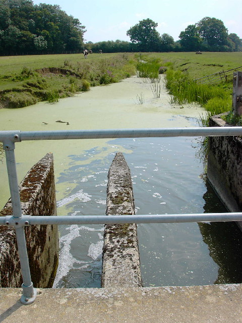
Hatterell Wood Images

Images are sourced within 2km of 50.966531/-0.32128329 or Grid Reference TQ1719. Thanks to Geograph Open Source API. All images are credited.

The Weir at Hatterell Bridge
Prettys Garage, Partridge Green Small cottage garage still operating in the centre of the village on the B2135 opposite the village inn.
Prettys Garage, Partridge Green
Small cottage garage still operating in the centre of the village on the B2135 opposite the village inn.
High Street, Partridge Green The B2116 looking east. The Post Office is to the left of the parked red car.
High Street, Partridge Green
The B2116 looking east. The Post Office is to the left of the parked red car.
Pond, near Lloyts Farm If you follow the bridleway from east to west this is the first of four ponds that are to the north of the bridleway.
Pond, near Lloyts Farm
If you follow the bridleway from east to west this is the first of four ponds that are to the north of the bridleway.
Jasmine Cottage, Rookcross Lane Situated at the junction of the lane with the entrance to Rooklands Farm.
Jasmine Cottage, Rookcross Lane
Situated at the junction of the lane with the entrance to Rooklands Farm.
Partridge Green - St.Michaels Way - Fire!
Joles Farm, Partridge Green
Towards Lock Farm The Lock estate is the largest in the parish of Ashurst. Lock Farm is to the right and Old Lock House is to the left.
Towards Lock Farm
The Lock estate is the largest in the parish of Ashurst. Lock Farm is to the right and Old Lock House is to the left.
Farmland, Lock Farm To the north west of the farm buildings with Stony Copse just over the brow.
Farmland, Lock Farm
To the north west of the farm buildings with Stony Copse just over the brow.
River Adur North of Locks Bridge This is the western branch of the river as it heads towards West Grinstead.
River Adur North of Locks Bridge
This is the western branch of the river as it heads towards West Grinstead.
River Adur South of Locks Bridge This is the western branch of the Adur as it heads towards Bines Bridge.
River Adur South of Locks Bridge
This is the western branch of the Adur as it heads towards Bines Bridge.
Lloyts Farm 17th century farmhouse near Partridge Green.
Lloyts Farm
17th century farmhouse near Partridge Green.
Field near Moat Farm The Lock estate is just visible through the gap in the trees.
Field near Moat Farm
The Lock estate is just visible through the gap in the trees.
Bridleway off the Downs Link This bridleway leaves the Downs Link near Partridge Green heading west to the River Adur and Hatterell bridge.
Bridleway off the Downs Link
This bridleway leaves the Downs Link near Partridge Green heading west to the River Adur and Hatterell bridge.
Bridleway to Hatterell bridge After dropping through Whitewick Rough (woodland) the bridleway crosses the flood plain to the river Adur and Hatterell bridge.
Bridleway to Hatterell bridge
After dropping through Whitewick Rough (woodland) the bridleway crosses the flood plain to the river Adur and Hatterell bridge.
Hatterell bridge Hatterell bridge crosses the river Adur and is now a gauging station.  Once, when the river was part of the Adur navigation, there was a drawbridge here.
For more on the Adur navigation and the Baybridge canal <span class="nowrap"><a title="http://www.sussex.co.uk/waterways/baybridge.htm" rel="nofollow ugc noopener" href="http://www.sussex.co.uk/waterways/baybridge.htm">Link</a><img style="margin-left:2px;" alt="External link" title="External link - shift click to open in new window" src="https://s1.geograph.org.uk/img/external.png" width="10" height="10"/></span> and on the river Adur <span class="nowrap"><a title="http://www.adur.org.uk/index.htm" rel="nofollow ugc noopener" href="http://www.adur.org.uk/index.htm">Link</a><img style="margin-left:2px;" alt="External link" title="External link - shift click to open in new window" src="https://s1.geograph.org.uk/img/external.png" width="10" height="10"/></span>
Hatterell bridge
Hatterell bridge crosses the river Adur and is now a gauging station. Once, when the river was part of the Adur navigation, there was a drawbridge here. For more on the Adur navigation and the Baybridge canal LinkExternal link and on the river Adur LinkExternal link
Pond at Hatterell's farm Hatterell farm has now gone and has been ploughed under (see Old Maps <span class="nowrap"><a title="http://www.old-maps.co.uk/" rel="nofollow ugc noopener" href="http://www.old-maps.co.uk/">Link</a><img style="margin-left:2px;" alt="External link" title="External link - shift click to open in new window" src="https://s1.geograph.org.uk/img/external.png" width="10" height="10"/></span> for an 1879 OS map) but its pond survives (but for how long?).
Pond at Hatterell's farm
Hatterell farm has now gone and has been ploughed under (see Old Maps LinkExternal link for an 1879 OS map) but its pond survives (but for how long?).
Clothall's Farmhouse Clothalls is on a moated site with the southern (right) representing the earliest portion.  A three-bay hall and northern cross-wing being added in the  C15.
Clothall is a small parish in Hertfordshire and a family from there seems to have made its way to Sussex.  Adam de Clothale married into the 'de Grensted' family about 1270.  The last, Richard de Clothale, died in 1454.
'Wealden Buildings' Editor John Warren.  Coach Publishing, Horsham 1990.  ISBN 0 902608 06 1
'The Victoria County History' A History of the County of Sussex: Volume 6 Part 2
Bramber Rape (North-Western Part) including Horsham
Clothall's Farmhouse
Clothalls is on a moated site with the southern (right) representing the earliest portion. A three-bay hall and northern cross-wing being added in the C15. Clothall is a small parish in Hertfordshire and a family from there seems to have made its way to Sussex. Adam de Clothale married into the 'de Grensted' family about 1270. The last, Richard de Clothale, died in 1454. 'Wealden Buildings' Editor John Warren. Coach Publishing, Horsham 1990. ISBN 0 902608 06 1 'The Victoria County History' A History of the County of Sussex: Volume 6 Part 2 Bramber Rape (North-Western Part) including Horsham
Show me another place!

Hatterell Wood is located at Grid Ref: TQ1719 (Lat: 50.966531, Lng: -0.32128329)

Administrative County: West Sussex

District: Horsham

Police Authority: Sussex

What 3 Words

///tech.poetic.relieves. Near Partridge Green, West Sussex

Related Wikis

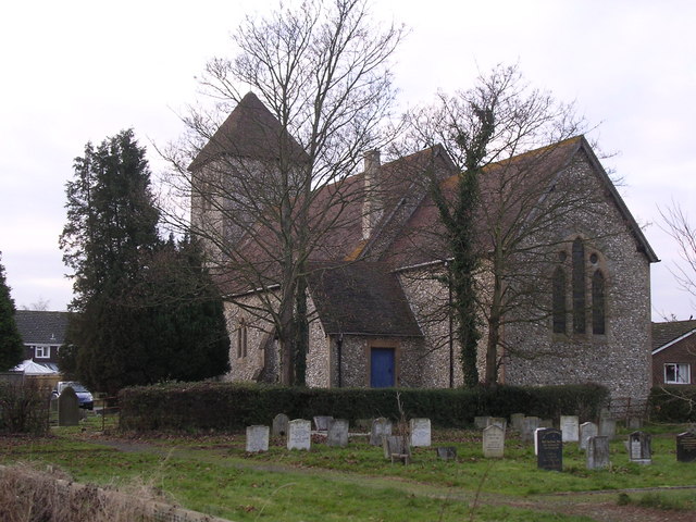
St Michael and All Angels Church, Partridge Green

St Michael and All Angels Church is a late nineteenth-century church in the settlement of Partridge Green in the parish of West Grinstead in West Sussex...

St George's Church, West Grinstead

St George's Church is an Anglican church in West Grinstead, West Sussex, England. It is in the Diocese of Chichester, occupying a rural position in the...

West Grinstead

West Grinstead is a village and civil parish in the Horsham District of West Sussex, England. It lies just off the B2135 road four miles (6.3 km) northwest...
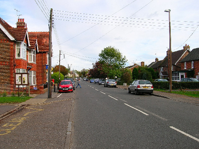
Partridge Green

Partridge Green is a village in the Horsham District of West Sussex, England. It lies on the B2135 road 2.5 miles (4 km) north-west of Henfield. It is...

Shrine of Our Lady of Consolation

The Shrine of Our Lady of Consolation or Church of Our Lady of Consolation and Saint Francis is a Roman Catholic parish church in West Grinstead, in West...

Littleworth, West Sussex

Littleworth is a hamlet in the Horsham District of West Sussex, England. It lies on the Partridge Green to Maplehurst road 2.9 miles (4.7 km) north of...

Partridge Green railway station

Partridge Green was a railway station on the Steyning Line which served the village of Partridge Green. The station closed as a result of the Beeching...

Dark Star Brewing Company

Dark Star is a brewery in Partridge Green, Sussex, England. == History == Dark Star Brewery was established in 1994, brewing in the cellar of the Evening...

Nearby Amenities

Located within 500m of 50.966531,-0.32128329
Waterway: weir
Lat/Long: 50.9650154/-0.3231969
Hatterell Bridge
Place: locality
Lat/Long: 50.9650568/-0.3232878
The data included in this document is from www.openstreetmap.org. The data is made available under ODbL.

Have you been to Hatterell Wood?

Leave your review of Hatterell Wood below (or comments, questions and feedback).