Hobhearn Wood

Wood, Forest in Sussex Horsham

England

Hobhearn Wood

The Weir at Hatterell Bridge
The Weir at Hatterell Bridge Credit: Andy Walkden

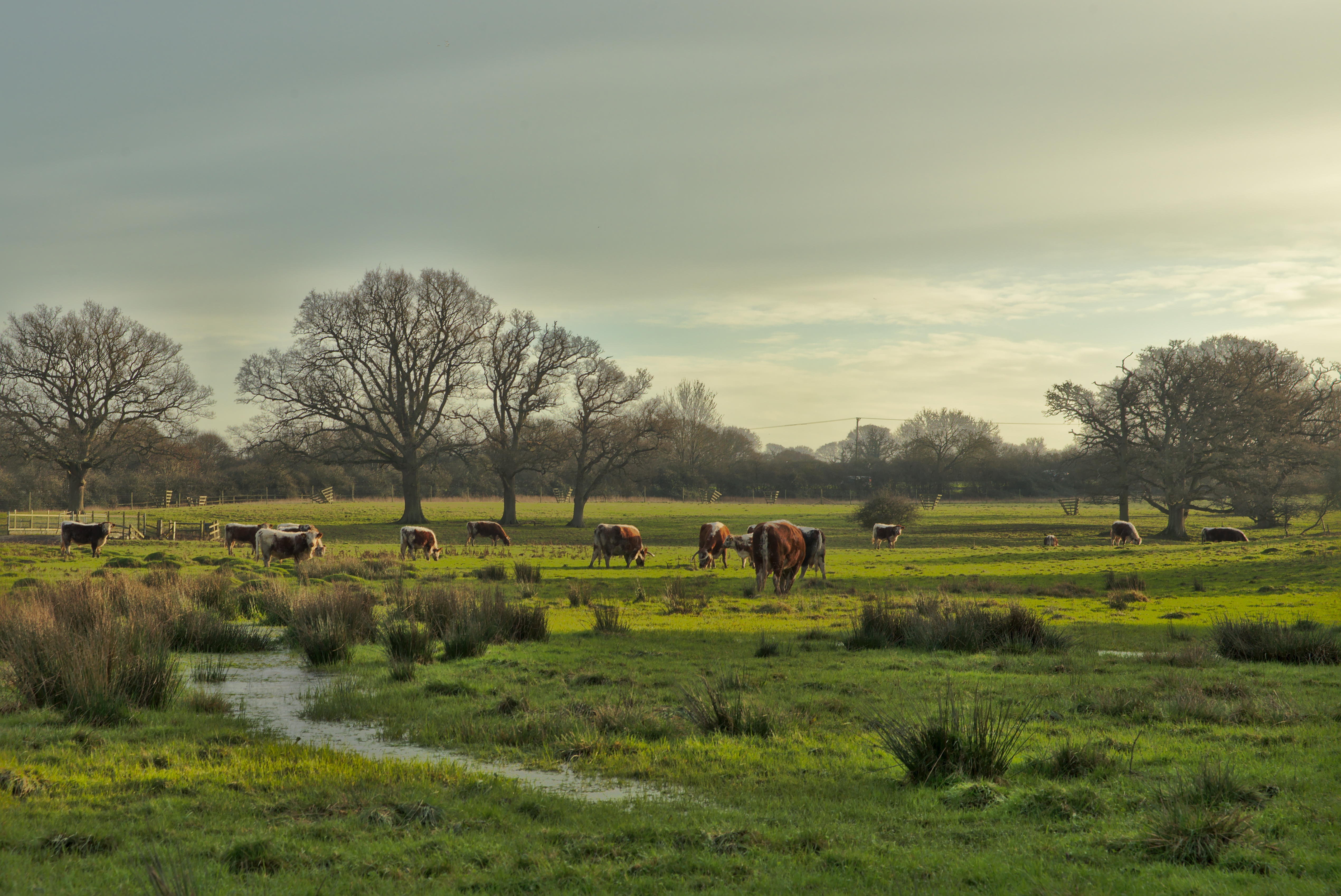
Hobhearn Wood, located in Sussex, England, is a picturesque woodland area that covers a vast expanse of approximately 100 acres. Nestled amidst the rolling hills of the South Downs, this ancient woodland is a haven for nature enthusiasts and provides a tranquil retreat for visitors.

The wood is primarily composed of a mixture of broadleaf trees, including oak, beech, and ash, which create a dense canopy that shades the forest floor. This thriving ecosystem supports a diverse array of flora and fauna, making it a popular destination for birdwatchers and botanists alike.

Walking through Hobhearn Wood, visitors can expect to encounter a variety of wildlife, such as deer, squirrels, and a wide range of bird species. The woodland is particularly renowned for its bird population, including the elusive nightingale, whose melodious song can be heard during the spring months.

Aside from its natural beauty, Hobhearn Wood also boasts a rich history. Archaeological evidence suggests that the area has been inhabited since the Neolithic period, with remnants of ancient settlements and burial mounds still visible today. The wood has also played a role in local folklore, with tales of mythical creatures and hidden treasures adding to its mystique.

Whether it's a leisurely stroll, birdwatching, or immersing oneself in the history and folklore, Hobhearn Wood offers a captivating experience for visitors of all ages. With its breathtaking scenery and abundant wildlife, it is no wonder that this woodland is regarded as one of the hidden gems of Sussex.

If you have any feedback on the listing, please let us know in the comments section below.

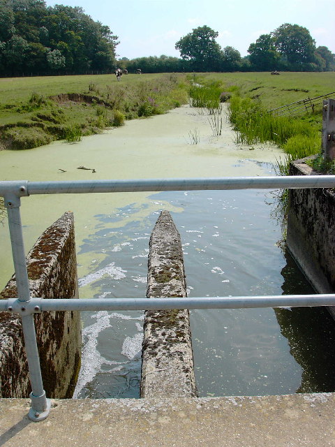
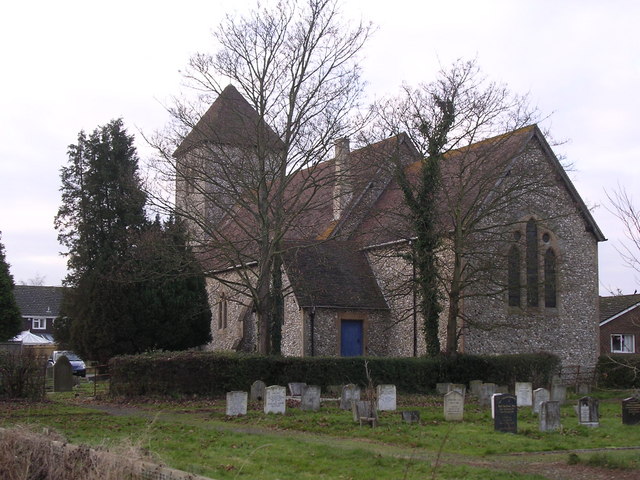
Hobhearn Wood Images

Images are sourced within 2km of 50.974467/-0.32413086 or Grid Reference TQ1720. Thanks to Geograph Open Source API. All images are credited.

The Weir at Hatterell Bridge
Jasmine Cottage, Rookcross Lane Situated at the junction of the lane with the entrance to Rooklands Farm.
Jasmine Cottage, Rookcross Lane
Situated at the junction of the lane with the entrance to Rooklands Farm.
Partridge Green - St.Michaels Way - Fire!
Joles Farm, Partridge Green
Bridleway off the Downs Link This bridleway leaves the Downs Link near Partridge Green heading west to the River Adur and Hatterell bridge.
Bridleway off the Downs Link
This bridleway leaves the Downs Link near Partridge Green heading west to the River Adur and Hatterell bridge.
Bridleway to Hatterell bridge After dropping through Whitewick Rough (woodland) the bridleway crosses the flood plain to the river Adur and Hatterell bridge.
Bridleway to Hatterell bridge
After dropping through Whitewick Rough (woodland) the bridleway crosses the flood plain to the river Adur and Hatterell bridge.
Hatterell bridge Hatterell bridge crosses the river Adur and is now a gauging station.  Once, when the river was part of the Adur navigation, there was a drawbridge here.
For more on the Adur navigation and the Baybridge canal <span class="nowrap"><a title="http://www.sussex.co.uk/waterways/baybridge.htm" rel="nofollow ugc noopener" href="http://www.sussex.co.uk/waterways/baybridge.htm">Link</a><img style="margin-left:2px;" alt="External link" title="External link - shift click to open in new window" src="https://s1.geograph.org.uk/img/external.png" width="10" height="10"/></span> and on the river Adur <span class="nowrap"><a title="http://www.adur.org.uk/index.htm" rel="nofollow ugc noopener" href="http://www.adur.org.uk/index.htm">Link</a><img style="margin-left:2px;" alt="External link" title="External link - shift click to open in new window" src="https://s1.geograph.org.uk/img/external.png" width="10" height="10"/></span>
Hatterell bridge
Hatterell bridge crosses the river Adur and is now a gauging station. Once, when the river was part of the Adur navigation, there was a drawbridge here. For more on the Adur navigation and the Baybridge canal LinkExternal link and on the river Adur LinkExternal link
Pond at Hatterell's farm Hatterell farm has now gone and has been ploughed under (see Old Maps <span class="nowrap"><a title="http://www.old-maps.co.uk/" rel="nofollow ugc noopener" href="http://www.old-maps.co.uk/">Link</a><img style="margin-left:2px;" alt="External link" title="External link - shift click to open in new window" src="https://s1.geograph.org.uk/img/external.png" width="10" height="10"/></span> for an 1879 OS map) but its pond survives (but for how long?).
Pond at Hatterell's farm
Hatterell farm has now gone and has been ploughed under (see Old Maps LinkExternal link for an 1879 OS map) but its pond survives (but for how long?).
Clothall's Farmhouse Clothalls is on a moated site with the southern (right) representing the earliest portion.  A three-bay hall and northern cross-wing being added in the  C15.
Clothall is a small parish in Hertfordshire and a family from there seems to have made its way to Sussex.  Adam de Clothale married into the 'de Grensted' family about 1270.  The last, Richard de Clothale, died in 1454.
'Wealden Buildings' Editor John Warren.  Coach Publishing, Horsham 1990.  ISBN 0 902608 06 1
'The Victoria County History' A History of the County of Sussex: Volume 6 Part 2
Bramber Rape (North-Western Part) including Horsham
Clothall's Farmhouse
Clothalls is on a moated site with the southern (right) representing the earliest portion. A three-bay hall and northern cross-wing being added in the C15. Clothall is a small parish in Hertfordshire and a family from there seems to have made its way to Sussex. Adam de Clothale married into the 'de Grensted' family about 1270. The last, Richard de Clothale, died in 1454. 'Wealden Buildings' Editor John Warren. Coach Publishing, Horsham 1990. ISBN 0 902608 06 1 'The Victoria County History' A History of the County of Sussex: Volume 6 Part 2 Bramber Rape (North-Western Part) including Horsham
River Adur looking north from Hatterell bridge This section of the river Adur was part of the Baybridge canal which ran for 3.5 miles from Pike's brook, near Knepp castle, to Locks farm.  From Locks farm, as the Adur Navigation, the river ran to the sea at Shoreham.
See <span class="nowrap"><a title="http://www.sussex.co.uk/waterways/baybridge.htm" rel="nofollow ugc noopener" href="http://www.sussex.co.uk/waterways/baybridge.htm">Link</a><img style="margin-left:2px;" alt="External link" title="External link - shift click to open in new window" src="https://s1.geograph.org.uk/img/external.png" width="10" height="10"/></span>
for just a little more.
The canal had closed by 1875 due to competition from the Horsham to Shoreham railway.
River Adur looking north from Hatterell bridge
This section of the river Adur was part of the Baybridge canal which ran for 3.5 miles from Pike's brook, near Knepp castle, to Locks farm. From Locks farm, as the Adur Navigation, the river ran to the sea at Shoreham. See LinkExternal link for just a little more. The canal had closed by 1875 due to competition from the Horsham to Shoreham railway.
St Michaels and All Angels, Partridge Green Church of England church in the Deanery of Horsham
St Michaels and All Angels, Partridge Green
Church of England church in the Deanery of Horsham
Porch of St. Michaels and All Angels, Partridge Green <span class="nowrap"><a title="http://www.westgrinstead.org.uk/stmichaels.html" rel="nofollow ugc noopener" href="http://www.westgrinstead.org.uk/stmichaels.html">Link</a><img style="margin-left:2px;" alt="External link" title="External link - shift click to open in new window" src="https://s1.geograph.org.uk/img/external.png" width="10" height="10"/></span>
Porch of St. Michaels and All Angels, Partridge Green
Muddy Field near Sussex Farm Taken at sunrise with the footpath to the River Adur to the left.
Muddy Field near Sussex Farm
Taken at sunrise with the footpath to the River Adur to the left.
Furze Wood Viewed from the junction of footpaths near Sussex Farm at sunrise.
Furze Wood
Viewed from the junction of footpaths near Sussex Farm at sunrise.
Sunlight and Mud The first rays of a sun of the day shine on the gate opening that takes the footpath from Partridge Green northwards beside the eastern bank of the River Adur. The previous evenings rainfall made the mud thick and capable of sucking your boots off.
Sunlight and Mud
The first rays of a sun of the day shine on the gate opening that takes the footpath from Partridge Green northwards beside the eastern bank of the River Adur. The previous evenings rainfall made the mud thick and capable of sucking your boots off.
River Adur This is the western branch of the river which splits north-west of Henfield and rises near Itchingfield. Hookshile Wood provides the back drop.
River Adur
This is the western branch of the river which splits north-west of Henfield and rises near Itchingfield. Hookshile Wood provides the back drop.
Footpath to West Grinstead Following the eastern bank of the Adur though here it moves away from the river following the eastern edge of the flood plain.
Footpath to West Grinstead
Following the eastern bank of the Adur though here it moves away from the river following the eastern edge of the flood plain.
Farmland near the River Adur The line of reeds in the foreground mark the course of the river.
Farmland near the River Adur
The line of reeds in the foreground mark the course of the river.
Show me another place!

Hobhearn Wood is located at Grid Ref: TQ1720 (Lat: 50.974467, Lng: -0.32413086)

Administrative County: West Sussex

District: Horsham

Police Authority: Sussex

What 3 Words

///fattening.glare.will. Near Partridge Green, West Sussex

Related Wikis

Shrine of Our Lady of Consolation

The Shrine of Our Lady of Consolation or Church of Our Lady of Consolation and Saint Francis is a Roman Catholic parish church in West Grinstead, in West...

West Grinstead

West Grinstead is a village and civil parish in the Horsham District of West Sussex, England. It lies just off the B2135 road four miles (6.3 km) northwest...

St George's Church, West Grinstead

St George's Church is an Anglican church in West Grinstead, West Sussex, England. It is in the Diocese of Chichester, occupying a rural position in the...

Knepp Castle

The medieval Knepp Castle (sometimes referred to as 'Old Knepp Castle', to distinguish it from the nearby 19th-century mansion) is to the west of the village...

Knepp Wildland

Knepp Wildland is the first major lowland rewilding project in England. It comprises 1,400 hectares (3,500 acres; 5.4 square miles) of former arable and...

Littleworth, West Sussex

Littleworth is a hamlet in the Horsham District of West Sussex, England. It lies on the Partridge Green to Maplehurst road 2.9 miles (4.7 km) north of...

St Michael and All Angels Church, Partridge Green

St Michael and All Angels Church is a late nineteenth-century church in the settlement of Partridge Green in the parish of West Grinstead in West Sussex...

West Grinstead railway station

West Grinstead was a railway station on the Steyning Line which served the village of West Grinstead. It had a goods yard with a cattle loading bay and...

Nearby Amenities

Located within 500m of 50.974467,-0.32413086
West Grinstead
Is In: West Sussex, England, UK
Place: village
Source: npe
Wikidata: Q847396
Lat/Long: 50.97801/-0.3255026
College
Naptan AtcoCode: 4400HR0471
Naptan Bearing: E
Naptan BusStopType: CUS
Naptan CommonName: College
Naptan Indicator: adj track to Black Barn
Naptan Landmark: Black Barn
Naptan NaptanCode: wsxawmat
Naptan Street: Steyning Road
Naptan Verified: no
Source: naptan_import
Lat/Long: 50.9766911/-0.3211346
The Priory
Naptan AtcoCode: 4400HR0472
Naptan Bearing: N
Naptan BusStopType: CUS
Naptan CommonName: The Priory
Naptan Indicator: opp West Grinstead Church
Naptan Landmark: Steyning Road
Naptan NaptanCode: wsxawmaw
Naptan ShortCommonName: W Grinstead Priory
Naptan Street: Park Lane
Naptan Verified: no
Source: naptan_import
Lat/Long: 50.977838/-0.325185
Power: pole
Lat/Long: 50.9734765/-0.3173627
Barrier: stile
Lat/Long: 50.9722078/-0.3257414
Power: pole
Lat/Long: 50.9743704/-0.326602
Power: pole
Lat/Long: 50.9745367/-0.3284024
Power: pole
Lat/Long: 50.9740345/-0.3231922
Power: pole
Lat/Long: 50.9739141/-0.322006
Power: pole
Lat/Long: 50.9737777/-0.3204847
Power: pole
Lat/Long: 50.9741809/-0.3246777
Power: pole
Lat/Long: 50.9762798/-0.3258166
Power: pole
Lat/Long: 50.9774971/-0.3252988
Power: pole
Lat/Long: 50.9752776/-0.3262289
Power: pole
Lat/Long: 50.9769992/-0.3255106
Post Box
Collection Times: Mo-Fr 16:00; Sa 08:45
Operator: Royal Mail
Operator Wikidata: Q638098
Post Box Mounting: brick_wall
Post Box Type: wall
Ref: RH13 187
Royal Cypher: GR
Royal Cypher Wikidata: Q33102273
Lat/Long: 50.9778625/-0.3250676
Black Barn
Place: isolated_dwelling
Lat/Long: 50.9772905/-0.3210891
Glebe Farm
Place: isolated_dwelling
Lat/Long: 50.9742223/-0.331072
The data included in this document is from www.openstreetmap.org. The data is made available under ODbL.

Have you been to Hobhearn Wood?

Leave your review of Hobhearn Wood below (or comments, questions and feedback).