Furzefield Wood

Wood, Forest in Sussex Horsham

England

Furzefield Wood
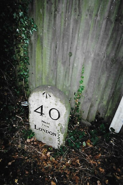
Old Milestone by the former A24, Mill Straight, Southwater parish Carved stone post by the UC road (was A24), in parish of Southwater (Horsham District), Mill Straight, West of Fieldings, against fence, on South side of road at end of bus lay-by. Steyning stone, erected by the Horsham & Steyning turnpike trust in the 19th century. Painted and re-engraved by Lionel Joseph in about 2011.

Inscription reads:-
40
MILES
FROM
LONDON
Carved benchmark upper centre, rivet on top.

West Sussex HER.
HER Ref: MWS8538 <span class="nowrap"><a title="https://www.heritagegateway.org.uk/Gateway/Results_Single.aspx?uid=MWS8538&resourceID=1032" rel="nofollow ugc noopener" href="https://www.heritagegateway.org.uk/Gateway/Results_Single.aspx?uid=MWS8538&resourceID=1032">Link</a><img style="margin-left:2px;" alt="External link" title="External link - shift click to open in new window" src="https://s1.geograph.org.uk/img/external.png" width="10" height="10"/></span>

Milestone Society National ID: SX_LA40
Old Milestone by the former A24, Mill Straight, Southwater parish Credit: Lionel Joseph

Furzefield Wood is a picturesque woodland located in Sussex, England. Covering an area of approximately 100 acres, this enchanting forest is an idyllic destination for nature lovers and outdoor enthusiasts alike.

The wood is predominantly composed of native tree species, including oak, beech, and birch, which create a dense and diverse canopy. The forest floor is adorned with a rich carpet of wildflowers, ferns, and mosses, adding to its natural beauty and providing a habitat for numerous woodland creatures.

Traversing through Furzefield Wood, visitors can enjoy a network of well-maintained footpaths that meander amidst the trees, allowing for leisurely strolls and exploration. The wood also offers several picnic areas and benches, providing opportunities for visitors to rest and take in the peaceful surroundings.

Wildlife thrives within Furzefield Wood, with sightings of various bird species, including woodpeckers, owls, and thrushes. The forest is also home to mammals such as deer, badgers, and foxes, making it an ideal location for wildlife enthusiasts and photographers.

Furzefield Wood is managed by local authorities and conservation groups, ensuring the preservation of its natural habitat. The wood is open to the public year-round, with no entry fee, making it an accessible and affordable destination for families and individuals seeking a tranquil escape from the hustle and bustle of daily life.

In conclusion, Furzefield Wood, Sussex, offers a serene and captivating woodland experience, with its diverse flora and fauna, well-maintained trails, and peaceful atmosphere. It is a haven for nature enthusiasts and a place of respite for those seeking solace in the beauty of the natural world.

If you have any feedback on the listing, please let us know in the comments section below.

Furzefield Wood Images

Images are sourced within 2km of 51.01499/-0.3259781 or Grid Reference TQ1725. Thanks to Geograph Open Source API. All images are credited.

Old Milestone by the former A24, Mill Straight, Southwater parish Carved stone post by the UC road (was A24), in parish of Southwater (Horsham District), Mill Straight, West of Fieldings, against fence, on South side of road at end of bus lay-by. Steyning stone, erected by the Horsham & Steyning turnpike trust in the 19th century. Painted and re-engraved by Lionel Joseph in about 2011.

Inscription reads:-
40
MILES
FROM
LONDON
Carved benchmark upper centre, rivet on top.

West Sussex HER.
HER Ref: MWS8538 <span class="nowrap"><a title="https://www.heritagegateway.org.uk/Gateway/Results_Single.aspx?uid=MWS8538&resourceID=1032" rel="nofollow ugc noopener" href="https://www.heritagegateway.org.uk/Gateway/Results_Single.aspx?uid=MWS8538&resourceID=1032">Link</a><img style="margin-left:2px;" alt="External link" title="External link - shift click to open in new window" src="https://s1.geograph.org.uk/img/external.png" width="10" height="10"/></span>

Milestone Society National ID: SX_LA40
Old Milestone by the former A24, Mill Straight, Southwater parish
Carved stone post by the UC road (was A24), in parish of Southwater (Horsham District), Mill Straight, West of Fieldings, against fence, on South side of road at end of bus lay-by. Steyning stone, erected by the Horsham & Steyning turnpike trust in the 19th century. Painted and re-engraved by Lionel Joseph in about 2011. Inscription reads:- 40 MILES FROM LONDON Carved benchmark upper centre, rivet on top. West Sussex HER. HER Ref: MWS8538 LinkExternal link Milestone Society National ID: SX_LA40
Exotic trees near Cooks Farm The ones in the background were very tall, and looked like some kind of eucalyptus. There's a kind of garden centre nearby that sells "architectural plants".
Exotic trees near Cooks Farm
The ones in the background were very tall, and looked like some kind of eucalyptus. There's a kind of garden centre nearby that sells "architectural plants".
Autumn leaves
Autumn leaves
Autumn leaves
Autumn leaves
Nuthurst Farmhouse
Nuthurst Farmhouse
Exotic trees and shrubs in Nuthurst There's some kind of upmarket garden centre hereabouts I think.
Exotic trees and shrubs in Nuthurst
There's some kind of upmarket garden centre hereabouts I think.
Tiles in the porch of St Andrew's Church
Bracket fungi
Bracket fungi
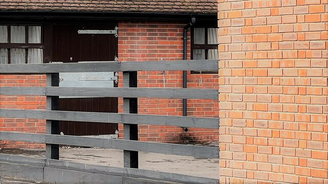
Stables at Elliotts Farm
New houses south of "The Wilderness"
View SE from the bridleway SE of Sedgwick Park This photo shows the wooded landscape at the western end of the Weald. The South Downs can be made out faintly on the horizon.
View SE from the bridleway SE of Sedgwick Park
This photo shows the wooded landscape at the western end of the Weald. The South Downs can be made out faintly on the horizon.
St Andrew's Church, Nuthurst Village church originating in the 11th Century, with the chancel extended in the 14th Century and nave extended in 1856-7 by James Smithers, replacing the previous wooden tower with the current spirelet and open belfry.  Grade II listed - see <span class="nowrap"><a title="https://historicengland.org.uk/listing/the-list/list-entry/1027018?section=official-list-entry" rel="nofollow ugc noopener" href="https://historicengland.org.uk/listing/the-list/list-entry/1027018?section=official-list-entry">Link</a><img style="margin-left:2px;" alt="External link" title="External link - shift click to open in new window" src="https://s1.geograph.org.uk/img/external.png" width="10" height="10"/></span>.
St Andrew's Church, Nuthurst
Village church originating in the 11th Century, with the chancel extended in the 14th Century and nave extended in 1856-7 by James Smithers, replacing the previous wooden tower with the current spirelet and open belfry. Grade II listed - see LinkExternal link.
Exotic plants at "Architectural Plants" This nursery is now closed. The business has moved to Pulborough.
Exotic plants at "Architectural Plants"
This nursery is now closed. The business has moved to Pulborough.
Horse's head painted on gatepost They keep horses in the field on the west side of the bridleway.
Horse's head painted on gatepost
They keep horses in the field on the west side of the bridleway.
Heathtolt Farm Accessed from Park Lane by the track coming down the hill. The track is also a public footpath, which comes through the farmyard and up a wooded ridge, passing the viewpoint.
Heathtolt Farm
Accessed from Park Lane by the track coming down the hill. The track is also a public footpath, which comes through the farmyard and up a wooded ridge, passing the viewpoint.
Farmland by the Downs Link
Downs Link The Downs Link is a 37-mile (59 km) footpath and bridleway linking the North Downs Way <a title="https://www.geograph.org.uk/snippet/174" href="https://www.geograph.org.uk/snippet/174">Link</a>  at St. Martha's Hill in Surrey with the South Downs Way <a title="https://www.geograph.org.uk/snippet/1186" href="https://www.geograph.org.uk/snippet/1186">Link</a>  near Steyning in West Sussex and on via the Coastal Link to Shoreham-by-Sea. Most of the route follows two dismantled railway lines, both closed by the Beeching cuts in the 1960s. The Shoreham-On-Sea to Christ’s Hospital line and the Christ’s Hospital to Shalford Junction line. The link opened in 1984. 
Cycle Route 223 follows the Downs link from Guildford to Shoreham.
The logo for the walk is the viaduct across the River Arun <a href="https://www.geograph.org.uk/photo/1870646">TQ0932 : Double Viaduct over the River Arun</a>.
A full history of the Cranleigh line (Christ’s Hospital to Shalford Junction) can be read at <span class="nowrap"><a title="http://en.wikipedia.org/wiki/Cranleigh_Line" rel="nofollow ugc noopener" href="http://en.wikipedia.org/wiki/Cranleigh_Line">Link</a><img style="margin-left:2px;" alt="External link" title="External link - shift click to open in new window" src="https://s1.geograph.org.uk/img/external.png" width="10" height="10"/></span>
Downs Link
The Downs Link is a 37-mile (59 km) footpath and bridleway linking the North Downs Way Link at St. Martha's Hill in Surrey with the South Downs Way Link near Steyning in West Sussex and on via the Coastal Link to Shoreham-by-Sea. Most of the route follows two dismantled railway lines, both closed by the Beeching cuts in the 1960s. The Shoreham-On-Sea to Christ’s Hospital line and the Christ’s Hospital to Shalford Junction line. The link opened in 1984. Cycle Route 223 follows the Downs link from Guildford to Shoreham. The logo for the walk is the viaduct across the River Arun TQ0932 : Double Viaduct over the River Arun. A full history of the Cranleigh line (Christ’s Hospital to Shalford Junction) can be read at LinkExternal link
Tree lined Downs Link The Downs Link is a 37-mile (59 km) footpath and bridleway linking the North Downs Way <a title="https://www.geograph.org.uk/snippet/174" href="https://www.geograph.org.uk/snippet/174">Link</a>  at St. Martha's Hill in Surrey with the South Downs Way <a title="https://www.geograph.org.uk/snippet/1186" href="https://www.geograph.org.uk/snippet/1186">Link</a>  near Steyning in West Sussex and on via the Coastal Link to Shoreham-by-Sea. Most of the route follows two dismantled railway lines, both closed by the Beeching cuts in the 1960s. The Shoreham-On-Sea to Christ’s Hospital line and the Christ’s Hospital to Shalford Junction line. The link opened in 1984. 
Cycle Route 223 follows the Downs link from Guildford to Shoreham.
The logo for the walk is the viaduct across the River Arun <a href="https://www.geograph.org.uk/photo/1870646">TQ0932 : Double Viaduct over the River Arun</a>.
A full history of the Cranleigh line (Christ’s Hospital to Shalford Junction) can be read at <span class="nowrap"><a title="http://en.wikipedia.org/wiki/Cranleigh_Line" rel="nofollow ugc noopener" href="http://en.wikipedia.org/wiki/Cranleigh_Line">Link</a><img style="margin-left:2px;" alt="External link" title="External link - shift click to open in new window" src="https://s1.geograph.org.uk/img/external.png" width="10" height="10"/></span>
Tree lined Downs Link
The Downs Link is a 37-mile (59 km) footpath and bridleway linking the North Downs Way Link at St. Martha's Hill in Surrey with the South Downs Way Link near Steyning in West Sussex and on via the Coastal Link to Shoreham-by-Sea. Most of the route follows two dismantled railway lines, both closed by the Beeching cuts in the 1960s. The Shoreham-On-Sea to Christ’s Hospital line and the Christ’s Hospital to Shalford Junction line. The link opened in 1984. Cycle Route 223 follows the Downs link from Guildford to Shoreham. The logo for the walk is the viaduct across the River Arun TQ0932 : Double Viaduct over the River Arun. A full history of the Cranleigh line (Christ’s Hospital to Shalford Junction) can be read at LinkExternal link
Show me another place!

Furzefield Wood is located at Grid Ref: TQ1725 (Lat: 51.01499, Lng: -0.3259781)

Administrative County: West Sussex

District: Horsham

Police Authority: Sussex

What 3 Words

///allies.rezoning.dazzling. Near Southwater, West Sussex

Related Wikis

Copsale

Copsale is a hamlet in the civil parish of Nuthurst, and the Horsham District of West Sussex, England. It lies on the Southwater to Maplehurst road 3.5...

Maplehurst, West Sussex

Maplehurst is a hamlet in the civil parish of Nuthurst, and the Horsham District of West Sussex, England. The hamlet is on the Copsale to Nuthurst road...

Nuthurst

Nuthurst is a village and civil parish in the Horsham district of West Sussex, England. The north of the parish borders Horsham town, with Nuthurst village...

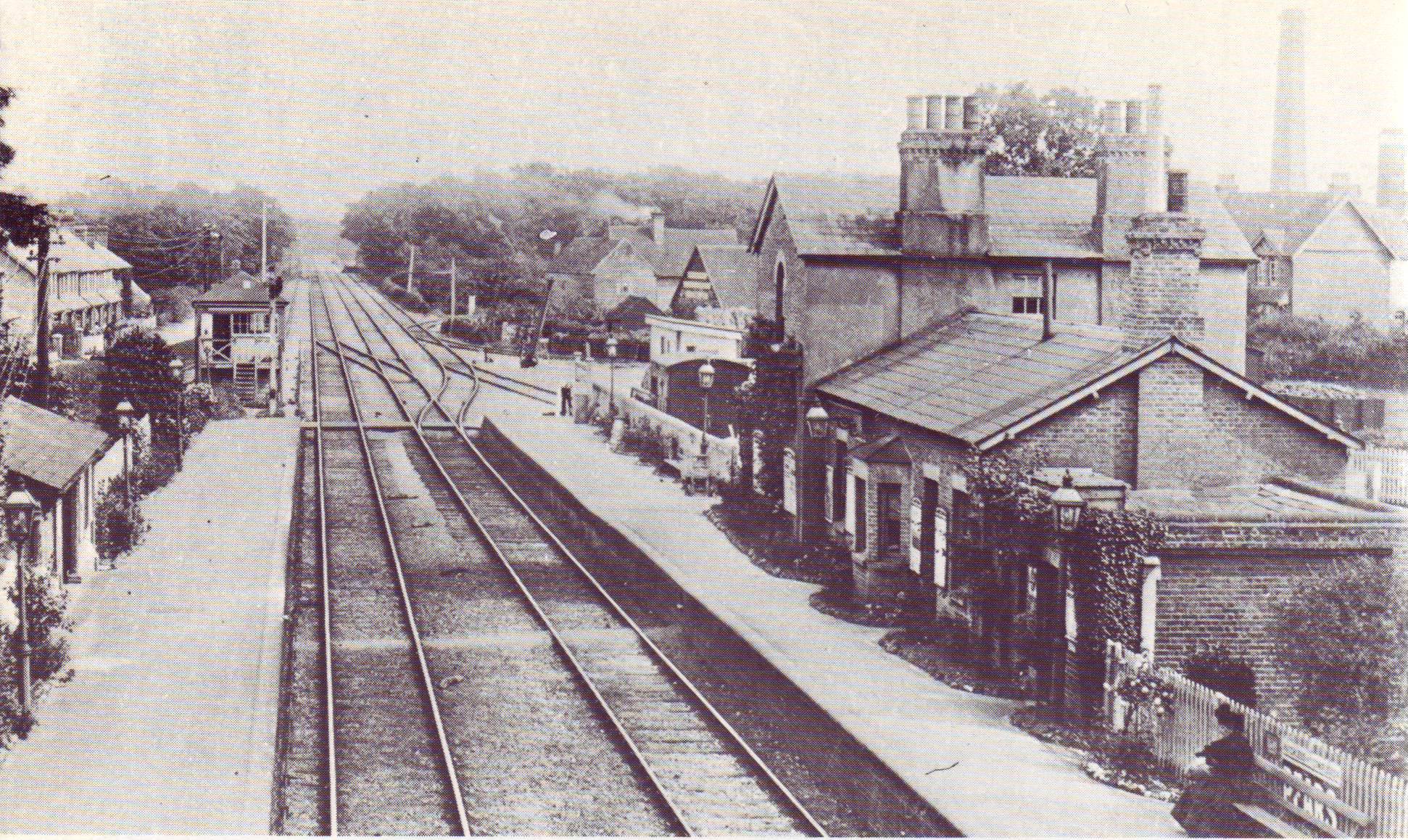
Southwater railway station

Southwater was a railway station on the Steyning Line which served the village of Southwater. A goods siding allowed for the transportation of coal and...

Southwater

Southwater is a large village and civil parish in the Horsham District of West Sussex, England, with a population of roughly 10,000. It is administered...

Holy Innocents Church, Southwater

Holy Innocents Church is the Anglican parish church of Southwater, a village in the Horsham District of West Sussex, England. Built in 1849, the church...

Southwater & Nuthurst (electoral division)

Southwater & Nuthurst is an electoral division of West Sussex in the United Kingdom and returns one member to sit on West Sussex County Council. The current...

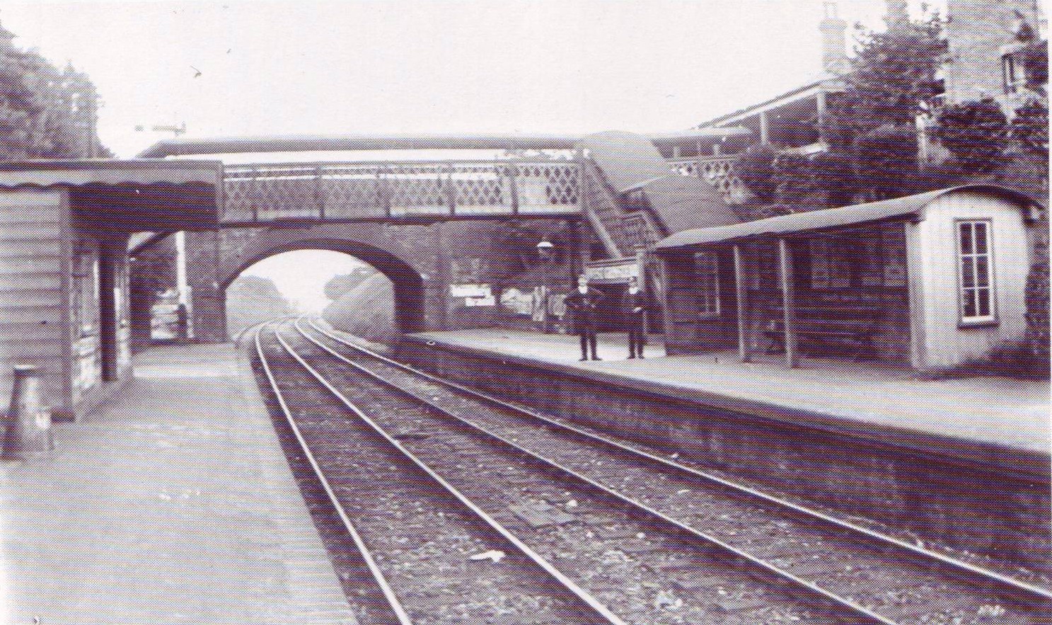
West Grinstead railway station

West Grinstead was a railway station on the Steyning Line which served the village of West Grinstead. It had a goods yard with a cattle loading bay and...

Nearby Amenities

Located within 500m of 51.01499,-0.3259781
Jamesland Farm
Place: farm
Lat/Long: 51.0119905/-0.3259799
Barnfield Farm
Place: farm
Lat/Long: 51.0131421/-0.3307188
Copsale Court
Place: isolated_dwelling
Lat/Long: 51.014184/-0.3321462
Power: pole
Lat/Long: 51.0107734/-0.3234929
The data included in this document is from www.openstreetmap.org. The data is made available under ODbL.

Have you been to Furzefield Wood?

Leave your review of Furzefield Wood below (or comments, questions and feedback).