Butlers Copse

Wood, Forest in Surrey Mole Valley

England

Butlers Copse

Wolvens Lane Byway between Coldharbour and Wotton.
Wolvens Lane Credit: Ian Capper

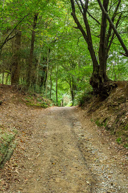
Butler's Copse is a picturesque wood located in the county of Surrey, England. Situated near the village of Holmbury St Mary, this forested area covers an approximate area of 20 acres. The copse is characterized by its dense canopy of trees, creating a serene and tranquil atmosphere for visitors to enjoy.

The wood is predominantly composed of various species of broadleaf trees, including oak, beech, and chestnut, which provide a rich tapestry of colors throughout the year. These trees create a dense canopy that allows only dappled sunlight to filter through, creating an enchanting ambiance for those exploring the copse.

Butler's Copse is home to a diverse range of flora and fauna, making it a haven for nature enthusiasts. Bluebells carpet the forest floor in spring, creating a vibrant and fragrant display. The copse is also home to an array of bird species, such as woodpeckers, nuthatches, and thrushes, which can be heard singing their melodic songs throughout the year.

Visitors to Butler's Copse can enjoy a network of well-maintained footpaths that wind their way through the forest, offering scenic views and opportunities for exploration. It is a popular destination for walkers, joggers, and dog owners looking for a peaceful retreat in nature.

Overall, Butler's Copse is a stunning woodland in Surrey, offering a serene escape from the hustle and bustle of everyday life. Its diverse flora and fauna, coupled with its tranquil atmosphere, make it a must-visit destination for nature lovers and outdoor enthusiasts.

If you have any feedback on the listing, please let us know in the comments section below.

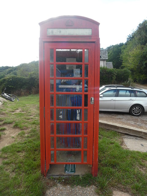
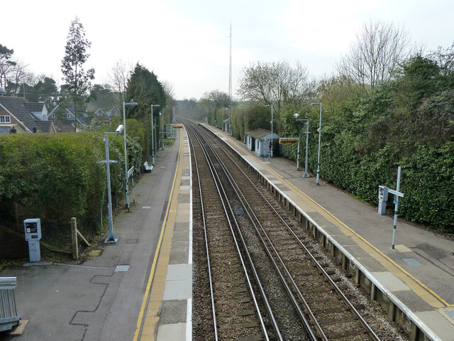
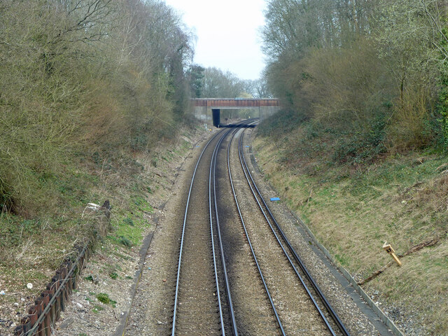
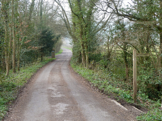
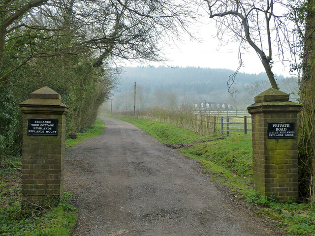
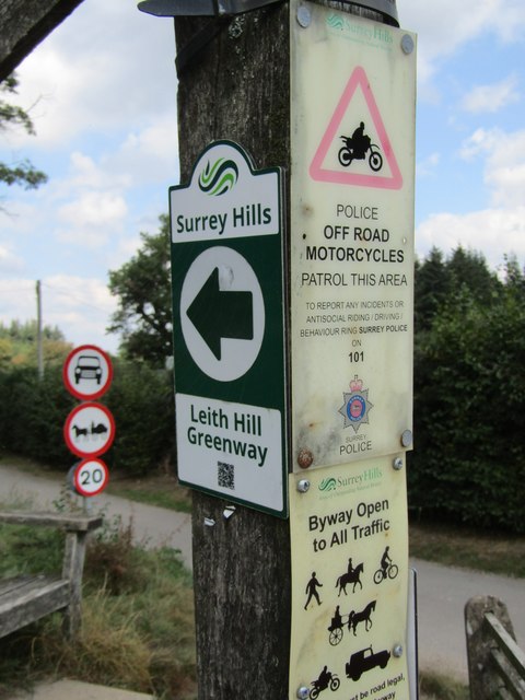
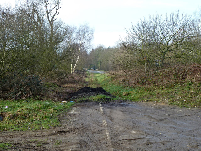
Butlers Copse Images

Images are sourced within 2km of 51.178822/-0.33288454 or Grid Reference TQ1643. Thanks to Geograph Open Source API. All images are credited.

Wolvens Lane Byway between Coldharbour and Wotton.
Wolvens Lane
Byway between Coldharbour and Wotton.
Information Board at The Landslip Car Park This information board is at The Landslip car park in Abinger Road RH5 6HG, east of Leith Hill. It has the following wording:

 Mosses Wood
 Arboretum and Frank's Wood
 Covering 69 acres

 Left column
 Welcome to Mosses Wood. As you stand here you are surrounded by some 
 spectacular specimen trees which form part of an arboretum. The arboretum is
 full of an array of interesting pines towering high above. The older of these
 trees were planted in the mid 1800s, some of which form an avenue created by
 Alexander Hargreaves Brown leading to his family home at Broome Hall. More
 recently, in 1995, the National Trust planted 100 trees to celebrate the
 centenary of the National Trust.
 Mosses Wood was donated to the National Trust by Lady Edith Ivy Pigott Brown in
 memory of her son Capt Sir John Pigott Brown who was killed in action in 
 Tunisia on Christmas Day 1942.
 Lady Pigott Brown also lost her husband Capt Hargreaves Brown during the First
 World War at the first battle of Ypres on 29 October 1914. Both her husband and 
 her son were in the Coldstream Guards. At the southern edge of Mosses Wood you
 will find a gate built in memory of Capt Pigott Brown, TQ1442 refers.
 
 Capt Hargreaves Brown
 After attending Sandhurst, Capt Brown was commissioned into the Coldstream 
 Guards in 1900 and served in South Africa between 1901-1902. He married Lady
 Pigott Brown on 18 October 1910 at the Guards Chapel in Wellington Barracks,
 London.
 At the outbreak of The First World War, Capt Brown was part of the British
 Expeditionary Force (BEF) and deployed to France with the 1st Battalion
 Coldstream Guards. The BEF was a small professional army (not much larger than
 today's modern British Army) and by the end of November 1914 they had all but
 destroyed while halting the continuous mass attacks by the much larger 
 conscripted German army.
 Capt Brown was killed in action during the 1st Battle of Ypres on 29 October
 1914. The exact account of what happened will never been known due to the 
 losses sustained by the 1st Battalion and therefore no accounts exist. What is
 known is the Coldstream Guards were attacked at 05:30am under the cover of fog
 by the Bavarian Reserve Division. At this stage the BEF frontline was not much
 more than isolated outposts and the disaster was owned, in part, to the 
 supporting machine guns failing to work due to the wrong calibre of rounds 
 being supplied. Capt Brown's body was never recovered and is remembered on the
 Ypres (Menin Gate) Memorial.

 Middle and right column
 Image of Capt Sir John Pigott Brown
 Capt Sir John Pigott Brown
 Capt Pigott Brown followed his father's footsteps and was commissioned into the
 2nd Battalion Coldstream Guards. Like his father in 1914, he was also deployed
 to France under the BEF to halt the German Blitzkrieg in the summer of 1940. He
 received a gunshot wound to his head in Belgium and was sent back to the UK
 shortly before the evacuation of Dunkirk.
 After recovering from his wounds in November 1942, as part of Operation Torch, 
 he deployed to North Africa. He was killed in action on Christmas Day 1942 
 during the first battle of Longstop Hill, a strategic high point overlooking
 Tunis. On Christmas Day morning he was Officer Commanding of the reserve 
 company but was tasked with taking over command of Number 3 Company. Shortly
 after his arrival at Longstop Hill, the Coldstream Guards were attacked by 1 
 Company of the 69 Panzer Grenadier regiment. The attack was started by a heavy
 artillery barrage and Captain Pigott Brown's position took a direct hit. It 
 also killed Sgt Noble and WO2 (CSM) Callaghan. Like his father in 1914, his 
 final resting place is unknown and he is remembered at The Medjez-El-Bab 
 memorial in Tunisia.
 The pink walk follows a footpath through Frank's Wood, named after National
 Trust woodsman Frank Longhurst who planted the oak trees in 1949. This walk is
 particularly beautiful in spring when the bluebells are in flower. The woodland
 floor is transformed into a sea of purple, a really spectacular display.
 This area is particularly prone to landslips due to its geology: the first of
 which is believed to have occurred when Elizabeth I was on the throne. More
 recently in 2000, the land slipped again causing damage to the road. There is
 still evidence today of the landslip. There is more information about the 
 geology of Leith Hill on the noticeboard at the Tower.
 
 Map of the Leith Hill area with photos of the memorial gate and inscription
 beside it.
 Images of the following trees from left to right:
  a) Sweet Gum or Liquidambar styraciflua
  b) Monkey Puzzle or Araucaria
  c) Pond Cypress or Taxodium ascendens
  d) Bosnian Pine or Pinus Heldreichii

  c)
Information Board at The Landslip Car Park
This information board is at The Landslip car park in Abinger Road RH5 6HG, east of Leith Hill. It has the following wording: Mosses Wood Arboretum and Frank's Wood Covering 69 acres Left column Welcome to Mosses Wood. As you stand here you are surrounded by some spectacular specimen trees which form part of an arboretum. The arboretum is full of an array of interesting pines towering high above. The older of these trees were planted in the mid 1800s, some of which form an avenue created by Alexander Hargreaves Brown leading to his family home at Broome Hall. More recently, in 1995, the National Trust planted 100 trees to celebrate the centenary of the National Trust. Mosses Wood was donated to the National Trust by Lady Edith Ivy Pigott Brown in memory of her son Capt Sir John Pigott Brown who was killed in action in Tunisia on Christmas Day 1942. Lady Pigott Brown also lost her husband Capt Hargreaves Brown during the First World War at the first battle of Ypres on 29 October 1914. Both her husband and her son were in the Coldstream Guards. At the southern edge of Mosses Wood you will find a gate built in memory of Capt Pigott Brown, TQ1442 refers. Capt Hargreaves Brown After attending Sandhurst, Capt Brown was commissioned into the Coldstream Guards in 1900 and served in South Africa between 1901-1902. He married Lady Pigott Brown on 18 October 1910 at the Guards Chapel in Wellington Barracks, London. At the outbreak of The First World War, Capt Brown was part of the British Expeditionary Force (BEF) and deployed to France with the 1st Battalion Coldstream Guards. The BEF was a small professional army (not much larger than today's modern British Army) and by the end of November 1914 they had all but destroyed while halting the continuous mass attacks by the much larger conscripted German army. Capt Brown was killed in action during the 1st Battle of Ypres on 29 October 1914. The exact account of what happened will never been known due to the losses sustained by the 1st Battalion and therefore no accounts exist. What is known is the Coldstream Guards were attacked at 05:30am under the cover of fog by the Bavarian Reserve Division. At this stage the BEF frontline was not much more than isolated outposts and the disaster was owned, in part, to the supporting machine guns failing to work due to the wrong calibre of rounds being supplied. Capt Brown's body was never recovered and is remembered on the Ypres (Menin Gate) Memorial. Middle and right column Image of Capt Sir John Pigott Brown Capt Sir John Pigott Brown Capt Pigott Brown followed his father's footsteps and was commissioned into the 2nd Battalion Coldstream Guards. Like his father in 1914, he was also deployed to France under the BEF to halt the German Blitzkrieg in the summer of 1940. He received a gunshot wound to his head in Belgium and was sent back to the UK shortly before the evacuation of Dunkirk. After recovering from his wounds in November 1942, as part of Operation Torch, he deployed to North Africa. He was killed in action on Christmas Day 1942 during the first battle of Longstop Hill, a strategic high point overlooking Tunis. On Christmas Day morning he was Officer Commanding of the reserve company but was tasked with taking over command of Number 3 Company. Shortly after his arrival at Longstop Hill, the Coldstream Guards were attacked by 1 Company of the 69 Panzer Grenadier regiment. The attack was started by a heavy artillery barrage and Captain Pigott Brown's position took a direct hit. It also killed Sgt Noble and WO2 (CSM) Callaghan. Like his father in 1914, his final resting place is unknown and he is remembered at The Medjez-El-Bab memorial in Tunisia. The pink walk follows a footpath through Frank's Wood, named after National Trust woodsman Frank Longhurst who planted the oak trees in 1949. This walk is particularly beautiful in spring when the bluebells are in flower. The woodland floor is transformed into a sea of purple, a really spectacular display. This area is particularly prone to landslips due to its geology: the first of which is believed to have occurred when Elizabeth I was on the throne. More recently in 2000, the land slipped again causing damage to the road. There is still evidence today of the landslip. There is more information about the geology of Leith Hill on the noticeboard at the Tower. Map of the Leith Hill area with photos of the memorial gate and inscription beside it. Images of the following trees from left to right: a) Sweet Gum or Liquidambar styraciflua b) Monkey Puzzle or Araucaria c) Pond Cypress or Taxodium ascendens d) Bosnian Pine or Pinus Heldreichii c)
National Trust Sign at Coldharbour Common This NT sign is in Abinger Road RH5 6HG and is by a footpath leading to Leith Hill. Coldharbour Common, which comprises of 104 acres (42.1 hectares) of woodland and open space, was acquired by the National Trust in 1986 through the National Heritage Memorial Fund.
National Trust Sign at Coldharbour Common
This NT sign is in Abinger Road RH5 6HG and is by a footpath leading to Leith Hill. Coldharbour Common, which comprises of 104 acres (42.1 hectares) of woodland and open space, was acquired by the National Trust in 1986 through the National Heritage Memorial Fund.
Inside the red telephone box at Coldharbour This photo shows the inside of the telephone box with an advertisement for Park Tools which is an American firm that manufactures bicycle tools. Above the advertisement is a notice that says:
                            FLAT TYRE?
                           BROKEN CHAIN?
                           WE SELL BIKE
                             SPARES
                               AT
                             THE SHOP
  
 The shop in question is based at the Plough Inn nearby in Coldharbour.
Inside the red telephone box at Coldharbour
This photo shows the inside of the telephone box with an advertisement for Park Tools which is an American firm that manufactures bicycle tools. Above the advertisement is a notice that says: FLAT TYRE? BROKEN CHAIN? WE SELL BIKE SPARES AT THE SHOP The shop in question is based at the Plough Inn nearby in Coldharbour.
Red K6 Telephone Box at Coldharbour This telephone box is located in Coldharbour village, its postcode being RH5 6HE. It no longer has a payphone, but an advertisement instead for an American firm which manufactures bicycle tools, <a title="https://www.geograph.org.uk/photo/7331988" href="https://www.geograph.org.uk/photo/7331988">Link</a> refers.
Red K6 Telephone Box at Coldharbour
This telephone box is located in Coldharbour village, its postcode being RH5 6HE. It no longer has a payphone, but an advertisement instead for an American firm which manufactures bicycle tools, Link refers.
Holmwood station Looking towards Horsham.
Holmwood station
Looking towards Horsham.
Railway north from Holmwood station Looking from the Old Horsham Road bridge to the A24 Horsham Road bridge. Milepost 27 on the right - the datum seems to be Waterloo, although no trains are routed from there now.
Railway north from Holmwood station
Looking from the Old Horsham Road bridge to the A24 Horsham Road bridge. Milepost 27 on the right - the datum seems to be Waterloo, although no trains are routed from there now.
Former recycling bay, Old Horsham Road Presumably this once had assorted skips lined up. The sign asks people not to leave bottles etc. here, remarkably it has been complied with.
Former recycling bay, Old Horsham Road
Presumably this once had assorted skips lined up. The sign asks people not to leave bottles etc. here, remarkably it has been complied with.
Footpath junction, Betchets Green Holmwood footpath 525 goes straight on along the drive to Redlands, footpath 266 goes right.
Footpath junction, Betchets Green
Holmwood footpath 525 goes straight on along the drive to Redlands, footpath 266 goes right.
Drive to Redlands and other places A private road but public footpath 525, Holmwood.
Drive to Redlands and other places
A private road but public footpath 525, Holmwood.
Public footpath 266, Holmwood From Betchets Green to Warwick Road, South Holmwood.
Public footpath 266, Holmwood
From Betchets Green to Warwick Road, South Holmwood.
Public footpath 266, Holmwood From Betchets Green to Warwick Road, South Holmwood.
Public footpath 266, Holmwood
From Betchets Green to Warwick Road, South Holmwood.
North end of public footpath 266, Holmwood At Warwick Close.
North end of public footpath 266, Holmwood
At Warwick Close.
Coldharbour - Summer Lightning A fairly new waymarker beside Coldharbour Cricket Club's pitch on Leith Hill shows the way for off road cyclists.
Coldharbour - Summer Lightning
A fairly new waymarker beside Coldharbour Cricket Club's pitch on Leith Hill shows the way for off road cyclists.
Surrey Hills - Leith Hill Greenway A newish waymarker in Coldharbour points towards Wolvens Lane, a Byway Open to All Traffic (BOAT). Note the accompanying signs showing restrictions and a warning to would be off road motorcyclists from the Surrey Police.
Surrey Hills - Leith Hill Greenway
A newish waymarker in Coldharbour points towards Wolvens Lane, a Byway Open to All Traffic (BOAT). Note the accompanying signs showing restrictions and a warning to would be off road motorcyclists from the Surrey Police.
Coldharbour - The Plough This country inn offers accommodation, food, drink, microbrewery and shop in the hilltop village of Coldharbour. It is a welcome sight after a walk up neighbouring Leith Hill.
<span class="nowrap"><a title="www.ploughinn.com" rel="nofollow ugc noopener" href="http://www.ploughinn.com">Link</a><img style="margin-left:2px;" alt="External link" title="External link - shift click to open in new window" src="https://s1.geograph.org.uk/img/external.png" width="10" height="10"/></span>
Coldharbour - The Plough
This country inn offers accommodation, food, drink, microbrewery and shop in the hilltop village of Coldharbour. It is a welcome sight after a walk up neighbouring Leith Hill. LinkExternal link
Coldharbour - The Shop at the Plough This country inn offers accommodation, food, drink, microbrewery and shop in the hilltop village of Coldharbour. It is a welcome sight after a walk up neighbouring Leith Hill.
<span class="nowrap"><a title="www.ploughinn.com" rel="nofollow ugc noopener" href="http://www.ploughinn.com">Link</a><img style="margin-left:2px;" alt="External link" title="External link - shift click to open in new window" src="https://s1.geograph.org.uk/img/external.png" width="10" height="10"/></span>
Coldharbour - The Shop at the Plough
This country inn offers accommodation, food, drink, microbrewery and shop in the hilltop village of Coldharbour. It is a welcome sight after a walk up neighbouring Leith Hill. LinkExternal link
Original alignment of A29 Ockley Road This dates from before the A24 roundabout and Capel bypass were built. It seems to have been retained as a path, as the pavement is missing on the deviation route.
Original alignment of A29 Ockley Road
This dates from before the A24 roundabout and Capel bypass were built. It seems to have been retained as a path, as the pavement is missing on the deviation route.
Show me another place!

Butlers Copse is located at Grid Ref: TQ1643 (Lat: 51.178822, Lng: -0.33288454)

Administrative County: Surrey

District: Mole Valley

Police Authority: Surrey

What 3 Words

///scarcely.tolls.lowest. Near Holmwood, Surrey

Nearby Locations

Butlers Copse Nobs Copse

Related Wikis

Holmwood railway station

Holmwood railway station serves the villages of Beare Green and South Holmwood in Surrey, England, on the Sutton and Mole Valley Lines between Dorking...

Coldharbour, Surrey

Coldharbour is a hamlet in the Mole Valley district, in the English county of Surrey. It is on a minor road from Dorking to Leith Hill Place. == Description... ==

Broome Hall

Broome Hall is a Grade II-listed country house with grounds including cottages and outhouses on the wooded, upper southern slopes of the Greensand Ridge...

Leith Hill

Leith Hill in southern England is the highest summit of the Greensand Ridge, approximately 6.7 km (4 mi) southwest of Dorking, Surrey and 40.5 km (30 mi...

Nearby Amenities

Located within 500m of 51.178822,-0.33288454
Power: pole
Lat/Long: 51.1744968/-0.3320533
Power: pole
Lat/Long: 51.1786969/-0.3362986
Power: pole
Lat/Long: 51.1780776/-0.335115
Power: pole
Lat/Long: 51.1780238/-0.3338302
Power: pole
Lat/Long: 51.17798/-0.3327492
Power: pole
Lat/Long: 51.1778825/-0.3305686
Power: pole
Lat/Long: 51.1777917/-0.3283853
Power: pole
Source: survey
Lat/Long: 51.1783197/-0.3261188
Power: pole
Lat/Long: 51.1804618/-0.3265909
Power: pole
Lat/Long: 51.1811865/-0.3276263
Power: pole
Lat/Long: 51.1818271/-0.3277577
Power: pole
Lat/Long: 51.1753619/-0.3287957
Power: pole
Lat/Long: 51.1760984/-0.3294501
Power: pole
Lat/Long: 51.1768484/-0.330126
Barrier: stile
Lat/Long: 51.1790149/-0.327264
Barrier: stile
Lat/Long: 51.1810665/-0.3370417
Power: pole
Lat/Long: 51.1793386/-0.3376292
Power: pole
Lat/Long: 51.1815521/-0.327764
Power: pole
Lat/Long: 51.1779865/-0.3311329
Power: pole
Lat/Long: 51.1802699/-0.3314468
Power: pole
Lat/Long: 51.1791466/-0.3321722
Power: pole
Lat/Long: 51.1750438/-0.333158
Power: pole
Lat/Long: 51.1758543/-0.3330561
Power: pole
Lat/Long: 51.1770532/-0.3328764
Power: pole
Lat/Long: 51.1813354/-0.3307466
Power: pole
Lat/Long: 51.1823157/-0.3300914
Barrier: stile
Lat/Long: 51.1804153/-0.3274687
Power: pole
Source: survey
Lat/Long: 51.1780802/-0.3265509
Power: pole
Source: survey
Lat/Long: 51.1777237/-0.3271973
Barrier: bollard
Lat/Long: 51.1810174/-0.3370208
Copse Farm
Place: farm
Lat/Long: 51.1800467/-0.3297139
The data included in this document is from www.openstreetmap.org. The data is made available under ODbL.

Have you been to Butlers Copse?

Leave your review of Butlers Copse below (or comments, questions and feedback).