Betchetsgreen Copse

Wood, Forest in Surrey Mole Valley

England

Betchetsgreen Copse

Wolvens Lane Byway between Coldharbour and Wotton.
Wolvens Lane Credit: Ian Capper

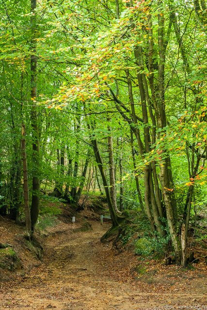
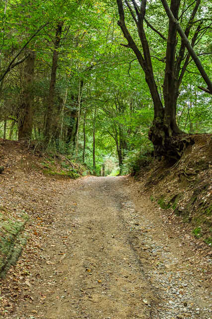
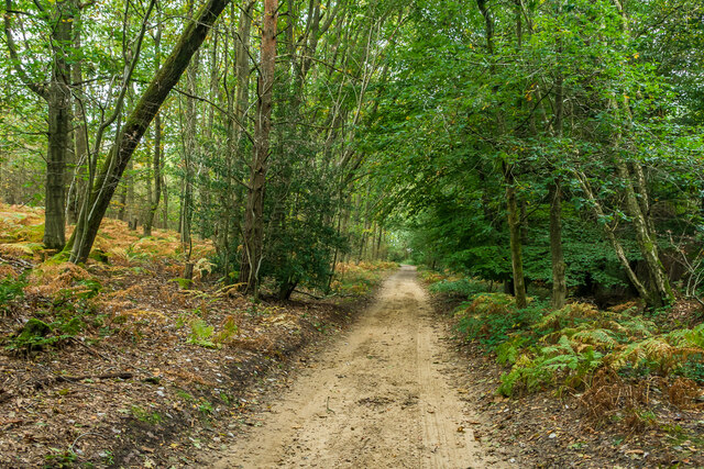
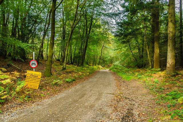
Betchetsgreen Copse is a charming woodland located in the county of Surrey, England. Situated near the village of Betchworth, this copse covers an area of approximately 20 acres and is renowned for its natural beauty and tranquil atmosphere.

The copse primarily consists of broadleaf trees, including oak, beech, and birch, which create a dense canopy that provides shade and shelter for a diverse range of wildlife. The forest floor is adorned with a carpet of ferns, bluebells, and other wildflowers, adding to the copse's picturesque appeal.

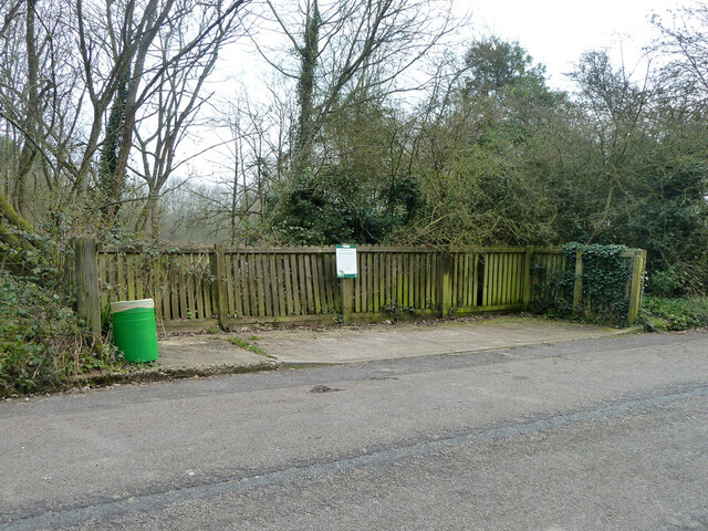
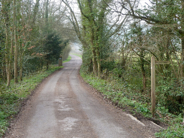
Visitors to Betchetsgreen Copse can enjoy a peaceful stroll along its well-maintained footpaths, which wind through the woodland and offer glimpses of its stunning flora and fauna. The copse is also a popular spot for birdwatching enthusiasts, as it is home to a variety of avian species, such as woodpeckers, finches, and thrushes.

In addition to its natural charm, Betchetsgreen Copse holds historical significance, with traces of ancient settlements and historical landmarks scattered throughout the area. Archaeological evidence suggests that the copse has been inhabited since the Iron Age, with remnants of ancient earthworks and burial mounds still visible today.

Betchetsgreen Copse is a cherished local treasure, offering residents and visitors alike a peaceful retreat from the hustle and bustle of everyday life. Whether one seeks solace in its serene surroundings, explores its rich history, or simply enjoys a leisurely walk amidst nature, this copse is a true haven for those seeking respite in the beauty of Surrey's woodlands.

If you have any feedback on the listing, please let us know in the comments section below.

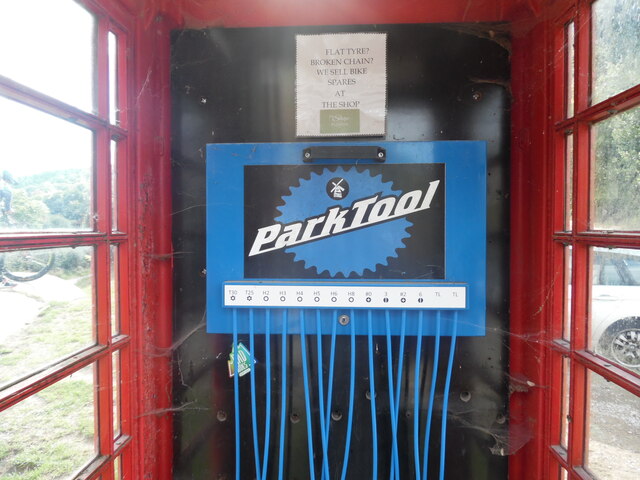
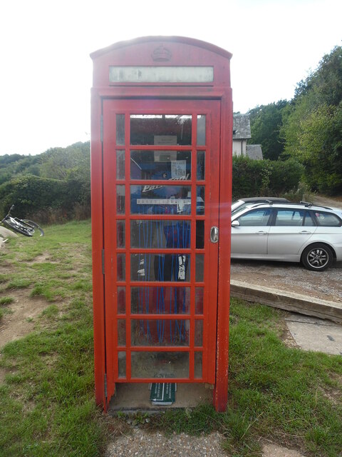
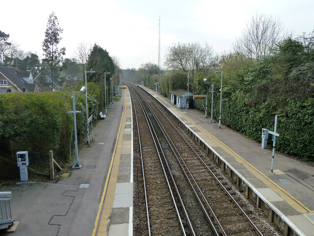
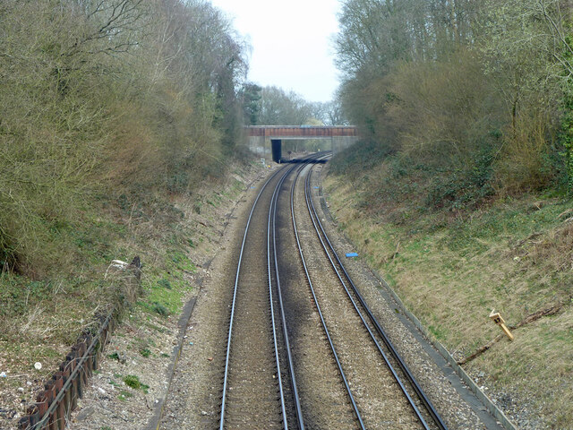
Betchetsgreen Copse Images

Images are sourced within 2km of 51.187476/-0.33313038 or Grid Reference TQ1644. Thanks to Geograph Open Source API. All images are credited.

Wolvens Lane Byway between Coldharbour and Wotton.
Wolvens Lane
Byway between Coldharbour and Wotton.
Wolvens Lane Byway between Coldharbour and Wotton.
Wolvens Lane
Byway between Coldharbour and Wotton.
Wolvens Lane Byway between Coldharbour and Wotton.
Wolvens Lane
Byway between Coldharbour and Wotton.
Wolvens Lane Byway between Coldharbour and Wotton.  Although it is a "BOAT" (Byway open to all traffic), the sign refers to a temporary closure to four wheel drive vehicles, to avoid damage to recent repairs, and a consultation is currently under way to make the closure permanent.
Wolvens Lane
Byway between Coldharbour and Wotton. Although it is a "BOAT" (Byway open to all traffic), the sign refers to a temporary closure to four wheel drive vehicles, to avoid damage to recent repairs, and a consultation is currently under way to make the closure permanent.
Inside the red telephone box at Coldharbour This photo shows the inside of the telephone box with an advertisement for Park Tools which is an American firm that manufactures bicycle tools. Above the advertisement is a notice that says:
                            FLAT TYRE?
                           BROKEN CHAIN?
                           WE SELL BIKE
                             SPARES
                               AT
                             THE SHOP
  
 The shop in question is based at the Plough Inn nearby in Coldharbour.
Inside the red telephone box at Coldharbour
This photo shows the inside of the telephone box with an advertisement for Park Tools which is an American firm that manufactures bicycle tools. Above the advertisement is a notice that says: FLAT TYRE? BROKEN CHAIN? WE SELL BIKE SPARES AT THE SHOP The shop in question is based at the Plough Inn nearby in Coldharbour.
Red K6 Telephone Box at Coldharbour This telephone box is located in Coldharbour village, its postcode being RH5 6HE. It no longer has a payphone, but an advertisement instead for an American firm which manufactures bicycle tools, <a title="https://www.geograph.org.uk/photo/7331988" href="https://www.geograph.org.uk/photo/7331988">Link</a> refers.
Red K6 Telephone Box at Coldharbour
This telephone box is located in Coldharbour village, its postcode being RH5 6HE. It no longer has a payphone, but an advertisement instead for an American firm which manufactures bicycle tools, Link refers.
Holmwood station Looking towards Horsham.
Holmwood station
Looking towards Horsham.
Railway north from Holmwood station Looking from the Old Horsham Road bridge to the A24 Horsham Road bridge. Milepost 27 on the right - the datum seems to be Waterloo, although no trains are routed from there now.
Railway north from Holmwood station
Looking from the Old Horsham Road bridge to the A24 Horsham Road bridge. Milepost 27 on the right - the datum seems to be Waterloo, although no trains are routed from there now.
Former recycling bay, Old Horsham Road Presumably this once had assorted skips lined up. The sign asks people not to leave bottles etc. here, remarkably it has been complied with.
Former recycling bay, Old Horsham Road
Presumably this once had assorted skips lined up. The sign asks people not to leave bottles etc. here, remarkably it has been complied with.
Footpath junction, Betchets Green Holmwood footpath 525 goes straight on along the drive to Redlands, footpath 266 goes right.
Footpath junction, Betchets Green
Holmwood footpath 525 goes straight on along the drive to Redlands, footpath 266 goes right.
Drive to Redlands and other places A private road but public footpath 525, Holmwood.
Drive to Redlands and other places
A private road but public footpath 525, Holmwood.
Public footpath 266, Holmwood From Betchets Green to Warwick Road, South Holmwood.
Public footpath 266, Holmwood
From Betchets Green to Warwick Road, South Holmwood.
Public footpath 266, Holmwood From Betchets Green to Warwick Road, South Holmwood.
Public footpath 266, Holmwood
From Betchets Green to Warwick Road, South Holmwood.
North end of public footpath 266, Holmwood At Warwick Close.
North end of public footpath 266, Holmwood
At Warwick Close.
Coldharbour - Summer Lightning A fairly new waymarker beside Coldharbour Cricket Club's pitch on Leith Hill shows the way for off road cyclists.
Coldharbour - Summer Lightning
A fairly new waymarker beside Coldharbour Cricket Club's pitch on Leith Hill shows the way for off road cyclists.
Surrey Hills - Leith Hill Greenway A newish waymarker in Coldharbour points towards Wolvens Lane, a Byway Open to All Traffic (BOAT). Note the accompanying signs showing restrictions and a warning to would be off road motorcyclists from the Surrey Police.
Surrey Hills - Leith Hill Greenway
A newish waymarker in Coldharbour points towards Wolvens Lane, a Byway Open to All Traffic (BOAT). Note the accompanying signs showing restrictions and a warning to would be off road motorcyclists from the Surrey Police.
Coldharbour - The Plough This country inn offers accommodation, food, drink, microbrewery and shop in the hilltop village of Coldharbour. It is a welcome sight after a walk up neighbouring Leith Hill.
<span class="nowrap"><a title="www.ploughinn.com" rel="nofollow ugc noopener" href="http://www.ploughinn.com">Link</a><img style="margin-left:2px;" alt="External link" title="External link - shift click to open in new window" src="https://s1.geograph.org.uk/img/external.png" width="10" height="10"/></span>
Coldharbour - The Plough
This country inn offers accommodation, food, drink, microbrewery and shop in the hilltop village of Coldharbour. It is a welcome sight after a walk up neighbouring Leith Hill. LinkExternal link
Coldharbour - The Shop at the Plough This country inn offers accommodation, food, drink, microbrewery and shop in the hilltop village of Coldharbour. It is a welcome sight after a walk up neighbouring Leith Hill.
<span class="nowrap"><a title="www.ploughinn.com" rel="nofollow ugc noopener" href="http://www.ploughinn.com">Link</a><img style="margin-left:2px;" alt="External link" title="External link - shift click to open in new window" src="https://s1.geograph.org.uk/img/external.png" width="10" height="10"/></span>
Coldharbour - The Shop at the Plough
This country inn offers accommodation, food, drink, microbrewery and shop in the hilltop village of Coldharbour. It is a welcome sight after a walk up neighbouring Leith Hill. LinkExternal link
Show me another place!

Betchetsgreen Copse is located at Grid Ref: TQ1644 (Lat: 51.187476, Lng: -0.33313038)

Administrative County: Surrey

District: Mole Valley

Police Authority: Surrey

What 3 Words

///starts.encounter.chart. Near Holmwood, Surrey

Related Wikis

Holmwood railway station

Holmwood railway station serves the villages of Beare Green and South Holmwood in Surrey, England, on the Sutton and Mole Valley Lines between Dorking...

Coldharbour, Surrey

Coldharbour is a hamlet in the Mole Valley district, in the English county of Surrey. It is on a minor road from Dorking to Leith Hill Place. == Description... ==

South Holmwood

South Holmwood () is a semi-rural village in Surrey, England. It can be considered cognate with its wider civil parish, which stretches to the east to...

A24 road (England)

The A24 is a major road in England that runs for 53.2 miles (85.6 km) from Clapham in south-west London to Worthing on the English Channel in West Sussex...

Broome Hall

Broome Hall is a Grade II-listed country house with grounds including cottages and outhouses on the wooded, upper southern slopes of the Greensand Ridge...

Wotton Hundred

The Hundred of Wotton, Wotton Hundred or Dorking Hundred was a hundred in Surrey, England. The hundred comprised a south-central portion of the county...

Inholms Clay Pit

Inholms Clay Pit is a 8.4-hectare (21-acre) Local Nature Reserve south of Dorking in Surrey. It is owned by Mole Valley District Council and from 2009...

North Holmwood

North Holmwood is a residential area on the outskirts of Dorking, in Surrey, England. The village is accessible from the A24, the village's historic heart...

Nearby Amenities

Located within 500m of 51.187476,-0.33313038
Barrier: stile
Lat/Long: 51.1839584/-0.3308351
Barrier: stile
Lat/Long: 51.1850128/-0.3307964
Barrier: stile
Lat/Long: 51.1852974/-0.3307695
Barrier: kissing_gate
Lat/Long: 51.1882169/-0.3298546
Betchets Green
Place: hamlet
Lat/Long: 51.1901772/-0.3277888
Barrier: stile
Lat/Long: 51.1901817/-0.3353745
Barrier: kissing_gate
Lat/Long: 51.1906012/-0.3332004
Barrier: stile
Lat/Long: 51.1906408/-0.3333311
Barrier: stile
Source: gps
Lat/Long: 51.1883793/-0.3299051
Power: pole
Lat/Long: 51.1866973/-0.3335402
Power: pole
Lat/Long: 51.1879279/-0.3321776
Power: pole
Lat/Long: 51.1890878/-0.3308526
Power: pole
Lat/Long: 51.1882431/-0.3379269
Power: pole
Lat/Long: 51.1869082/-0.3372215
Power: pole
Lat/Long: 51.1865048/-0.3370365
Power: pole
Lat/Long: 51.1861013/-0.3368326
Power: pole
Lat/Long: 51.1856961/-0.33661
Power: pole
Lat/Long: 51.1852825/-0.3363927
Power: pole
Lat/Long: 51.1848622/-0.3361674
Power: pole
Lat/Long: 51.1907809/-0.3286076
Power: pole
Lat/Long: 51.1868042/-0.3384313
Power: pole
Lat/Long: 51.1873136/-0.3373973
Power: pole
Lat/Long: 51.188218/-0.3332841
Barrier: stile
Lat/Long: 51.1879209/-0.3325949
Power: pole
Source: gps
Lat/Long: 51.1900051/-0.3298611
Power: pole
Lat/Long: 51.1907552/-0.328989
Power: pole
Lat/Long: 51.1890186/-0.3317973
Power: pole
Lat/Long: 51.1852915/-0.3336695
Power: pole
Lat/Long: 51.1843904/-0.3325751
Anstie Grange
Place: isolated_dwelling
Lat/Long: 51.1852409/-0.3388858
Anstie Grange Farm
Place: farm
Lat/Long: 51.1847534/-0.3355017
Redlands
Place: isolated_dwelling
Lat/Long: 51.1895892/-0.3376384
The data included in this document is from www.openstreetmap.org. The data is made available under ODbL.

Have you been to Betchetsgreen Copse?

Leave your review of Betchetsgreen Copse below (or comments, questions and feedback).