Piggottshill Wood
Wood, Forest in Hertfordshire St. Albans
England
Piggottshill Wood

Piggottshill Wood is a picturesque woodland located in Hertfordshire, England. Covering an area of approximately 50 acres, this woodland offers visitors a serene escape from the hustle and bustle of everyday life.
Situated on the outskirts of a small village, Piggottshill Wood is easily accessible and attracts nature enthusiasts, hikers, and families alike. The woodland is characterized by its diverse range of flora and fauna, with ancient oak and beech trees dominating the landscape. The forest floor is covered in a thick carpet of bluebells during the spring, creating a stunning visual display.
The wood offers a network of well-maintained trails, allowing visitors to explore its various sections. Walking through Piggottshill Wood, one can encounter an abundance of wildlife, including deer, rabbits, and various bird species. The peaceful ambiance and lush surroundings make it an ideal spot for birdwatching and nature photography.
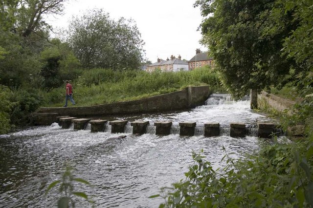
The woodland is also home to a small pond, providing a tranquil setting for visitors to relax and enjoy the natural beauty around them. This area attracts a variety of water-loving wildlife, such as ducks and dragonflies.
Piggottshill Wood is managed by a local conservation group, ensuring its preservation and protection for future generations. The group organizes regular events and educational activities to promote awareness and understanding of the woodland's importance in the local ecosystem.
In conclusion, Piggottshill Wood is a stunning woodland in Hertfordshire, offering visitors a peaceful retreat amidst nature's beauty. With its diverse wildlife, well-maintained trails, and tranquil pond, it is a haven for nature lovers and a valuable asset to the local community.
If you have any feedback on the listing, please let us know in the comments section below.
Piggottshill Wood Images
Images are sourced within 2km of 51.814338/-0.32665467 or Grid Reference TL1514. Thanks to Geograph Open Source API. All images are credited.


Piggottshill Wood is located at Grid Ref: TL1514 (Lat: 51.814338, Lng: -0.32665467)
Administrative County: Hertfordshire
District: St. Albans
Police Authority: Hertfordshire
What 3 Words
///form.drank.affair. Near Harpenden, Hertfordshire
Nearby Locations
Related Wikis

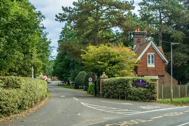
Aldwickbury School
Aldwickbury School is a 4–13 boys private preparatory school located on the outskirts of Harpenden, Hertfordshire in the United Kingdom. Aldwickbury School...

Marshalls Heath
Marshalls Heath is a hamlet and a 4-hectare (10-acre) Local Nature Reserve in Wheathampstead parish, Hertfordshire, England. The nature reserve is owned...

Batford
Batford is a village in Hertfordshire, England, located on the River Lea on the outskirts of Harpenden. Batford Springs is a local nature reserve alongside...
Batford Springs
Batford Springs is a 3.5-hectare (8.6-acre) Local Nature Reserve in Harpenden in Hertfordshire. It is owned and managed by Harpenden Town Council, and...
Harpenden East railway station
Harpenden East was one of two stations serving the town of Harpenden, the other station which remains open being Harpenden Central. Originally named Harpenden...
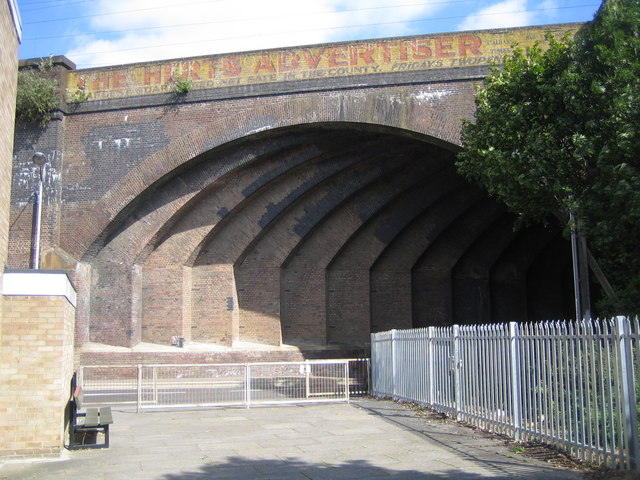
Southdown Road Skew Bridge
Southdown Road Skew Bridge is a ribbed skew arch railway bridge, which carries the Midland Main Line across Southdown Road in Harpenden, Hertfordshire...
Sir John Lawes School
Sir John Lawes School (also known as SJL) is a mixed state secondary school with academy status in Harpenden, United Kingdom. The school has close links...

Harpenden railway station
Harpenden railway station is on the Midland Main Line in England, serving the town of Harpenden, Hertfordshire. It is 24 miles 51 chains (39.7 km) down...
Nearby Amenities
Located within 500m of 51.814338,-0.32665467Have you been to Piggottshill Wood?
Leave your review of Piggottshill Wood below (or comments, questions and feedback).