Courtland Wood

Wood, Forest in Sussex Horsham

England

Courtland Wood

Rear of house on Marlpost Road The house is called "Woodlands" according to the large-scale map. This is also a cross-grid shot. The camera was just in the square to the west.
Rear of house on Marlpost Road Credit: Ian Cunliffe

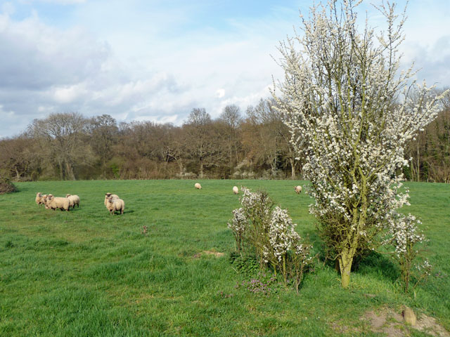
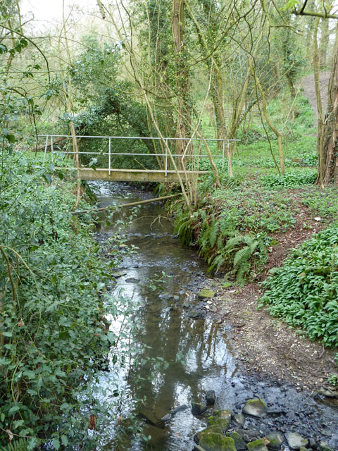
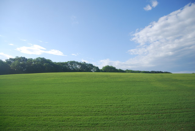
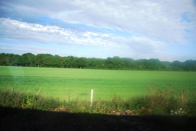
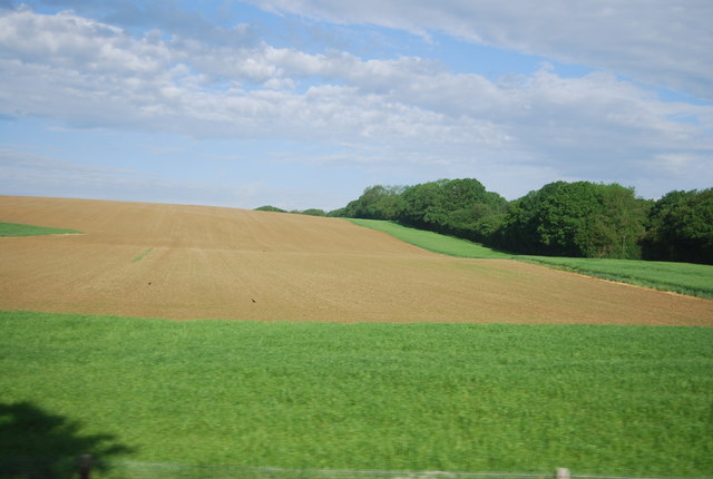
Courtland Wood is a picturesque woodland located in the county of Sussex, England. It is nestled within the wider Sussex Weald, renowned for its natural beauty and rich biodiversity. Covering an area of approximately 50 hectares, Courtland Wood boasts a diverse range of habitats, including ancient woodland, mixed broadleaf trees, and conifer plantations.

This woodland is a haven for wildlife, serving as a home to a plethora of species. The ancient woodland section of Courtland Wood is particularly noteworthy, as it contains trees that have stood for centuries, creating a truly enchanting atmosphere. This area is characterized by a dense canopy of oak, beech, and ash trees, providing a habitat for an array of woodland birds, such as woodpeckers, owls, and warblers.

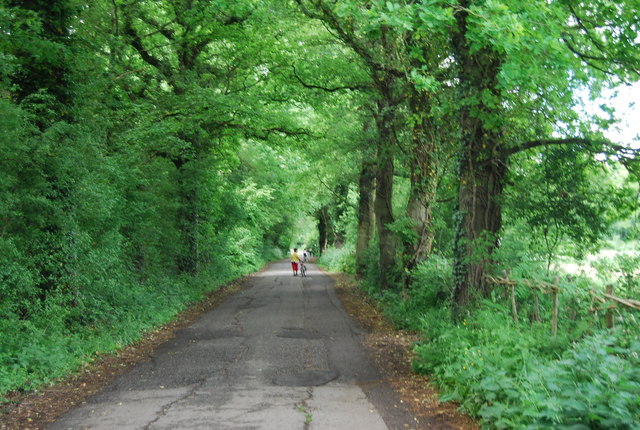
Visitors to Courtland Wood can explore its numerous walking trails, allowing them to immerse themselves in the serene surroundings and embrace the tranquility of nature. Along these paths, one can discover a variety of flora, including bluebells, primroses, and wild garlic, which adorn the forest floor during the springtime.

Managed by the local Forestry Commission, Courtland Wood is not only a natural treasure but also serves as a valuable resource for the local community. It offers educational programs and guided tours, providing visitors with the opportunity to learn about the importance of woodland conservation and sustainable forestry practices.

In conclusion, Courtland Wood in Sussex is a cherished woodland that captivates visitors with its ancient trees, diverse habitats, and abundant wildlife. It offers an idyllic escape from the hustle and bustle of everyday life, inviting individuals to connect with nature and appreciate the beauty of the natural world.

If you have any feedback on the listing, please let us know in the comments section below.

Courtland Wood Images

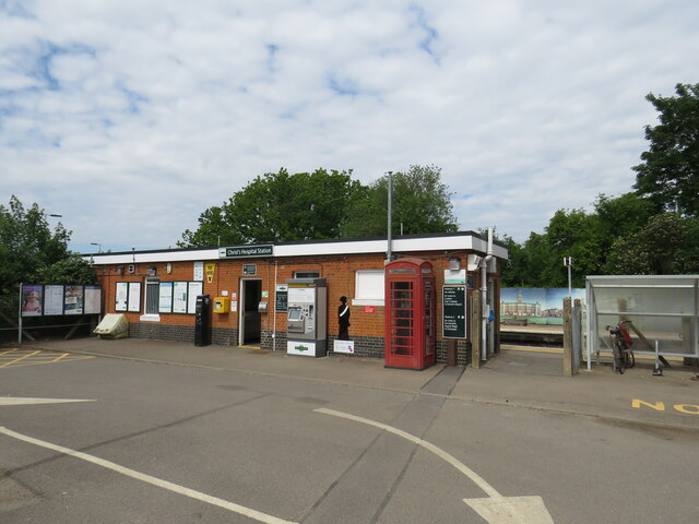
Images are sourced within 2km of 51.033162/-0.35943853 or Grid Reference TQ1527. Thanks to Geograph Open Source API. All images are credited.

Rear of house on Marlpost Road The house is called "Woodlands" according to the large-scale map. This is also a cross-grid shot. The camera was just in the square to the west.
Rear of house on Marlpost Road
The house is called "Woodlands" according to the large-scale map. This is also a cross-grid shot. The camera was just in the square to the west.
Train at Christ's Hospital station, near Horsham A train passing through Christ's Hospital station, near Horsham in West Sussex.  The train is a Class 377 "Electrostar" electric multiple unit.  The railway here is electrified using the third rail system.
Train at Christ's Hospital station, near Horsham
A train passing through Christ's Hospital station, near Horsham in West Sussex. The train is a Class 377 "Electrostar" electric multiple unit. The railway here is electrified using the third rail system.
Christ's Hospital station, near Horsham The entrance to Christ's Hospital railway station, near Horsham in West Sussex.  The single-storey station building dates from the 1970s.  It replaced the original station which was much larger and more grand.
Christ's Hospital station, near Horsham
The entrance to Christ's Hospital railway station, near Horsham in West Sussex. The single-storey station building dates from the 1970s. It replaced the original station which was much larger and more grand.
Converted goods shed, Christ's Hospital station, near Horsham The Old Goods Shed at Christ's Hospital station, near Horsham in West Sussex.  As its name suggests, this building was originally a goods shed built for railway use.  Having been derelict for a number of years, it has recently been redeveloped as affordable housing.
Converted goods shed, Christ's Hospital station, near Horsham
The Old Goods Shed at Christ's Hospital station, near Horsham in West Sussex. As its name suggests, this building was originally a goods shed built for railway use. Having been derelict for a number of years, it has recently been redeveloped as affordable housing.
Sheep and Blackthorn In the field crossed by footpath 1628/3 north of Christ's Hospital.
Sheep and Blackthorn
In the field crossed by footpath 1628/3 north of Christ's Hospital.
Footbridge on path 1628/3 The junction with footpath 1637 is just to the right of the view - this path can just be seen climbing out of the gill.
Footbridge on path 1628/3
The junction with footpath 1637 is just to the right of the view - this path can just be seen climbing out of the gill.
Godfreys of Horsham
Godfreys of Horsham
Shelley's Wood across an arable field
Shelley's Wood
Shelley's Wood
The lower slopes of Sharpenhurst Hill
Farmland, Sharpenhurst Farm
Woodland by Downs Link
Downs Link (Stakers Lane) The Downs Link is a 37-mile (59 km) footpath and bridleway linking the North Downs Way <a title="https://www.geograph.org.uk/snippet/174" href="https://www.geograph.org.uk/snippet/174">Link</a>  at St. Martha's Hill in Surrey with the South Downs Way <a title="https://www.geograph.org.uk/snippet/1186" href="https://www.geograph.org.uk/snippet/1186">Link</a>  near Steyning in West Sussex and on via the Coastal Link to Shoreham-by-Sea. Most of the route follows two dismantled railway lines, both closed by the Beeching cuts in the 1960s. The Shoreham-On-Sea to Christ’s Hospital line and the Christ’s Hospital to Shalford Junction line. The link opened in 1984. 
Cycle Route 223 follows the Downs link from Guildford to Shoreham.
The logo for the walk is the viaduct across the River Arun <a href="https://www.geograph.org.uk/photo/1870646">TQ0932 : Double Viaduct over the River Arun</a>.
A full history of the Cranleigh line (Christ’s Hospital to Shalford Junction) can be read at <span class="nowrap"><a title="http://en.wikipedia.org/wiki/Cranleigh_Line" rel="nofollow ugc noopener" href="http://en.wikipedia.org/wiki/Cranleigh_Line">Link</a><img style="margin-left:2px;" alt="External link" title="External link - shift click to open in new window" src="https://s1.geograph.org.uk/img/external.png" width="10" height="10"/></span>
Downs Link (Stakers Lane)
The Downs Link is a 37-mile (59 km) footpath and bridleway linking the North Downs Way Link at St. Martha's Hill in Surrey with the South Downs Way Link near Steyning in West Sussex and on via the Coastal Link to Shoreham-by-Sea. Most of the route follows two dismantled railway lines, both closed by the Beeching cuts in the 1960s. The Shoreham-On-Sea to Christ’s Hospital line and the Christ’s Hospital to Shalford Junction line. The link opened in 1984. Cycle Route 223 follows the Downs link from Guildford to Shoreham. The logo for the walk is the viaduct across the River Arun TQ0932 : Double Viaduct over the River Arun. A full history of the Cranleigh line (Christ’s Hospital to Shalford Junction) can be read at LinkExternal link
Stakers Lane (Downs Link) The Downs Link is a 37-mile (59 km) footpath and bridleway linking the North Downs Way <a title="https://www.geograph.org.uk/snippet/174" href="https://www.geograph.org.uk/snippet/174">Link</a>  at St. Martha's Hill in Surrey with the South Downs Way <a title="https://www.geograph.org.uk/snippet/1186" href="https://www.geograph.org.uk/snippet/1186">Link</a>  near Steyning in West Sussex and on via the Coastal Link to Shoreham-by-Sea. Most of the route follows two dismantled railway lines, both closed by the Beeching cuts in the 1960s. The Shoreham-On-Sea to Christ’s Hospital line and the Christ’s Hospital to Shalford Junction line. The link opened in 1984. 
Cycle Route 223 follows the Downs link from Guildford to Shoreham.
The logo for the walk is the viaduct across the River Arun <a href="https://www.geograph.org.uk/photo/1870646">TQ0932 : Double Viaduct over the River Arun</a>.
A full history of the Cranleigh line (Christ’s Hospital to Shalford Junction) can be read at <span class="nowrap"><a title="http://en.wikipedia.org/wiki/Cranleigh_Line" rel="nofollow ugc noopener" href="http://en.wikipedia.org/wiki/Cranleigh_Line">Link</a><img style="margin-left:2px;" alt="External link" title="External link - shift click to open in new window" src="https://s1.geograph.org.uk/img/external.png" width="10" height="10"/></span>
Stakers Lane (Downs Link)
The Downs Link is a 37-mile (59 km) footpath and bridleway linking the North Downs Way Link at St. Martha's Hill in Surrey with the South Downs Way Link near Steyning in West Sussex and on via the Coastal Link to Shoreham-by-Sea. Most of the route follows two dismantled railway lines, both closed by the Beeching cuts in the 1960s. The Shoreham-On-Sea to Christ’s Hospital line and the Christ’s Hospital to Shalford Junction line. The link opened in 1984. Cycle Route 223 follows the Downs link from Guildford to Shoreham. The logo for the walk is the viaduct across the River Arun TQ0932 : Double Viaduct over the River Arun. A full history of the Cranleigh line (Christ’s Hospital to Shalford Junction) can be read at LinkExternal link
Field by Downs Link
Field by Downs Link
Gate by the Downs Link
Cripplegate Lane
Cripplegate Lane
Cripplegate Lane
Cripplegate Lane
Show me another place!

Courtland Wood is located at Grid Ref: TQ1527 (Lat: 51.033162, Lng: -0.35943853)

Administrative County: West Sussex

District: Horsham

Police Authority: Sussex

What 3 Words

///thudding.underway.tins. Near Southwater, West Sussex

Related Wikis

Holy Innocents Church, Southwater

Holy Innocents Church is the Anglican parish church of Southwater, a village in the Horsham District of West Sussex, England. Built in 1849, the church...

Downs Link

The Downs Link is a 36.7 miles (59.1 km) path and bridleway linking the North Downs Way at St. Martha's Hill in Surrey with the South Downs Way near Steyning...

Southwater railway station

Southwater was a railway station on the Steyning Line which served the village of Southwater. A goods siding allowed for the transportation of coal and...

Southwater

Southwater is a large village and civil parish in the Horsham District of West Sussex, England, with a population of roughly 10,000. It is administered...

Nearby Amenities

Located within 500m of 51.033162,-0.35943853
Two Mile Ash
Place: hamlet
Lat/Long: 51.0330145/-0.3642299
Barrier: stile
Lat/Long: 51.0332337/-0.3560872
Barrier: stile
Lat/Long: 51.0321169/-0.3583686
Barrier: stile
Lat/Long: 51.0331567/-0.3526287
Barrier: stile
Lat/Long: 51.0325376/-0.3620226
Barrier: stile
Lat/Long: 51.0328796/-0.3641976
Great House Farm
Place: farm
Lat/Long: 51.0295198/-0.3565441
Barrier: stile
Lat/Long: 51.0325206/-0.3536645
Post Box
Operator: Royal Mail
Operator Wikidata: Q638098
Post Box Type: lamp
Ref: RH13 49D
Royal Cypher: EIIR
Royal Cypher Wikidata: Q33102113
Lat/Long: 51.0328714/-0.3646892
Sayers Farm
Place: farm
Lat/Long: 51.035546/-0.3600207
Give Way
Direction: backward
Lat/Long: 51.0325604/-0.3660751
The Moat House
Place: isolated_dwelling
Lat/Long: 51.0340454/-0.3645815
Fountain
Lat/Long: 51.0340848/-0.3649581
Fountain
Lat/Long: 51.0340814/-0.3641165
The data included in this document is from www.openstreetmap.org. The data is made available under ODbL.

Have you been to Courtland Wood?

Leave your review of Courtland Wood below (or comments, questions and feedback).