Elephant and Castle

Settlement in Surrey

England

Elephant and Castle

Lambeth : National COVID Memorial wall Some 150,000 hand-painted (by volunteers) red and pink hearts line a wall beside the River Thames in London, opposite the Houses of Parliament. Each heart represents a person lost to COVID-19 in the UK.
Lambeth : National COVID Memorial wall Credit: Jim Osley

Elephant and Castle is a vibrant and diverse neighborhood located in the borough of Surrey, England. Situated in the heart of South London, it is known for its rich history, cultural diversity, and bustling atmosphere. The area gets its peculiar name from a long-standing pub that once stood at the intersection of Elephant and Castle, which took its name from the nearby coaching inn.

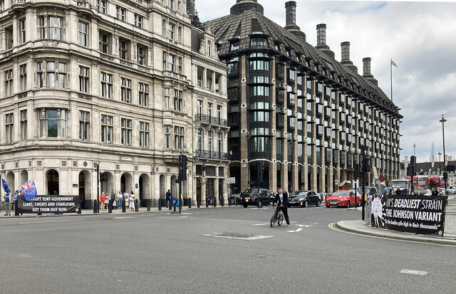
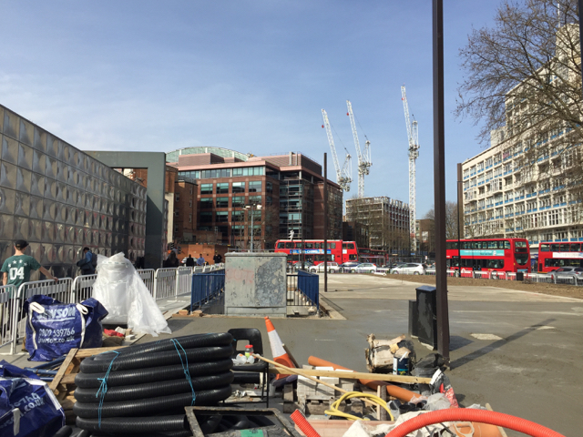
One of the defining features of Elephant and Castle is the iconic Elephant and Castle Roundabout, a busy traffic intersection that serves as a major transport hub connecting various parts of London. The area is well-served by public transportation, with its underground station providing access to the Bakerloo and Northern lines, and numerous bus routes passing through the neighborhood.

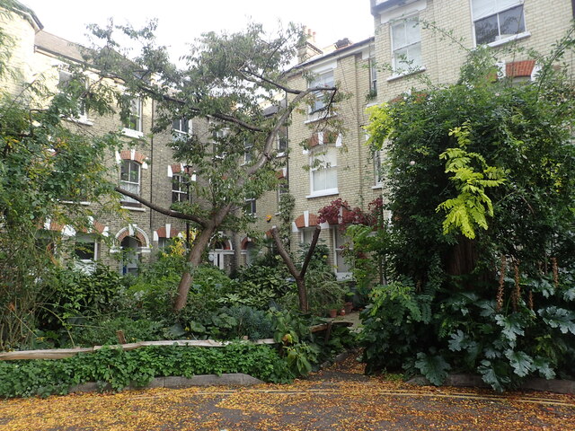
In recent years, Elephant and Castle has undergone extensive regeneration, transforming into a vibrant and modern area. The neighborhood is home to a diverse community, with residents from different cultural backgrounds, which is reflected in the wide range of shops, restaurants, and markets that can be found in the area.

The neighborhood also boasts a number of landmark buildings, including the Strata SE1 Tower, a striking residential skyscraper, and the Metropolitan Tabernacle, a historic Baptist church. Additionally, Elephant and Castle offers several green spaces, such as the nearby Burgess Park, providing residents and visitors with recreational opportunities.

Overall, Elephant and Castle is a dynamic and evolving neighborhood that combines its rich history with a contemporary urban atmosphere, making it a popular destination for both residents and visitors alike.

If you have any feedback on the listing, please let us know in the comments section below.

Elephant and Castle Images

Images are sourced within 2km of 51.494948/-0.10061 or Grid Reference TQ3179. Thanks to Geograph Open Source API. All images are credited.

Lambeth : National COVID Memorial wall Some 150,000 hand-painted (by volunteers) red and pink hearts line a wall beside the River Thames in London, opposite the Houses of Parliament. Each heart represents a person lost to COVID-19 in the UK.
Lambeth : National COVID Memorial wall
Some 150,000 hand-painted (by volunteers) red and pink hearts line a wall beside the River Thames in London, opposite the Houses of Parliament. Each heart represents a person lost to COVID-19 in the UK.
Lambeth : St Thomas' Hospital
Westminster Bridge Grade II* listed road bridge built in 1862, by civil engineer Thomas Page. Description at this <span class="nowrap"><a title="https://historicengland.org.uk/listing/the-list/list-entry/1066172" rel="nofollow ugc noopener" href="https://historicengland.org.uk/listing/the-list/list-entry/1066172">Link</a><img style="margin-left:2px;" alt="External link" title="External link - shift click to open in new window" src="https://s1.geograph.org.uk/img/external.png" width="10" height="10"/></span>. More on Thomas Page at this <span class="nowrap"><a title="https://www.gracesguide.co.uk/Thomas_Page_(1803-1877)" rel="nofollow ugc noopener" href="https://www.gracesguide.co.uk/Thomas_Page_(1803-1877)">Link</a><img style="margin-left:2px;" alt="External link" title="External link - shift click to open in new window" src="https://s1.geograph.org.uk/img/external.png" width="10" height="10"/></span>.
Westminster Bridge
Grade II* listed road bridge built in 1862, by civil engineer Thomas Page. Description at this LinkExternal link. More on Thomas Page at this LinkExternal link.
Lambeth - detail, Mary Seacole statue, St Thomas' Hospital "On 30 June 2016, a memorial statue of Mary Seacole was unveiled by Baroness Floella Benjamin OBE in the gardens of St Thomas’s Hospital; the UK’s first in honour of a named black woman." - <span class="nowrap"><a title="https://www.maryseacoletrust.org.uk/mary-seacole-statue/" rel="nofollow ugc noopener" href="https://www.maryseacoletrust.org.uk/mary-seacole-statue/">Link</a><img style="margin-left:2px;" alt="External link" title="External link - shift click to open in new window" src="https://s1.geograph.org.uk/img/external.png" width="10" height="10"/></span>. Sculptor : Martin Jennings. Find out more about Mary Seacole at this <span class="nowrap"><a title="https://www.blackhistorymonth.org.uk/article/section/bhm-heroes/970/" rel="nofollow ugc noopener" href="https://www.blackhistorymonth.org.uk/article/section/bhm-heroes/970/">Link</a><img style="margin-left:2px;" alt="External link" title="External link - shift click to open in new window" src="https://s1.geograph.org.uk/img/external.png" width="10" height="10"/></span>.
Lambeth - detail, Mary Seacole statue, St Thomas' Hospital
"On 30 June 2016, a memorial statue of Mary Seacole was unveiled by Baroness Floella Benjamin OBE in the gardens of St Thomas’s Hospital; the UK’s first in honour of a named black woman." - LinkExternal link. Sculptor : Martin Jennings. Find out more about Mary Seacole at this LinkExternal link.
Lambeth Bridge and beyond View from Westminster Bridge.
Lambeth Bridge and beyond
View from Westminster Bridge.
Banners, Parliament Square As the Prime Minister, Boris Johnson, makes the brief journey from Downing Street to the House, weighed down by the burdens of office, he must no doubt be buoyed by the cheery messages of support which greet him.
One reads: "Corrupt Tory government/ Liars cheats and charlatans / Get them out now."
The other reads: "UK's deadliest strain / The Johnson variant / "Let the bodies pile high in their thousands"". The latter is an alleged quote of his.
Banners, Parliament Square
As the Prime Minister, Boris Johnson, makes the brief journey from Downing Street to the House, weighed down by the burdens of office, he must no doubt be buoyed by the cheery messages of support which greet him. One reads: "Corrupt Tory government/ Liars cheats and charlatans / Get them out now." The other reads: "UK's deadliest strain / The Johnson variant / "Let the bodies pile high in their thousands"". The latter is an alleged quote of his.
Regarding Turner, Tate Britain One of the galleries used for the 'Turner's Modern World' exhibition. Delayed from its original schedule, it ran from 28 October 2020 to 12 September 2021. The large painting here is one of J.M.W. Turner's maritime scenes, originally entitled: 'Spithead: Two Captured Danish Ships Entering Portsmouth Harbour'.
Regarding Turner, Tate Britain
One of the galleries used for the 'Turner's Modern World' exhibition. Delayed from its original schedule, it ran from 28 October 2020 to 12 September 2021. The large painting here is one of J.M.W. Turner's maritime scenes, originally entitled: 'Spithead: Two Captured Danish Ships Entering Portsmouth Harbour'.
The Oval
The Oval
England play India at the Oval On this sunny September afternoon England had just begun a futile chase in their second innings against India.  They duly lost the following day: <span class="nowrap"><a title="https://www.espncricinfo.com/series/india-tour-of-england-2021-1239527/england-vs-india-4th-test-1239546/full-scorecard" rel="nofollow ugc noopener" href="https://www.espncricinfo.com/series/india-tour-of-england-2021-1239527/england-vs-india-4th-test-1239546/full-scorecard">Link</a><img style="margin-left:2px;" alt="External link" title="External link - shift click to open in new window" src="https://s1.geograph.org.uk/img/external.png" width="10" height="10"/></span> . Archbishop Tenison's School <span class="nowrap"><a title="https://www.tenisons.com/" rel="nofollow ugc noopener" href="https://www.tenisons.com/">Link</a><img style="margin-left:2px;" alt="External link" title="External link - shift click to open in new window" src="https://s1.geograph.org.uk/img/external.png" width="10" height="10"/></span> is visible to the right of the lights.
England play India at the Oval
On this sunny September afternoon England had just begun a futile chase in their second innings against India. They duly lost the following day: LinkExternal link . Archbishop Tenison's School LinkExternal link is visible to the right of the lights.
Towards Westminster Bridge Looking along the River Thames from close to the London Eye.
Towards Westminster Bridge
Looking along the River Thames from close to the London Eye.
Westminster Bridge Looking across the Thames from Southbank. Note the Houses of Parliament with the clocktower clad in scaffolding.
Westminster Bridge
Looking across the Thames from Southbank. Note the Houses of Parliament with the clocktower clad in scaffolding.
Road over Westminster Bridge Looking across the bridge over the Thames towards the Houses of Parliament. Scaffolding is covering much of the clock tower.
Road over Westminster Bridge
Looking across the bridge over the Thames towards the Houses of Parliament. Scaffolding is covering much of the clock tower.
Aerial view of Westminster Including Westminster Abbey, the Houses of Parliament and Westminster Bridge.
Aerial view of Westminster
Including Westminster Abbey, the Houses of Parliament and Westminster Bridge.
View of the London Eye and Houses of Parliament from Waterloo Bridge Looking south-southwest.
View of the London Eye and Houses of Parliament from Waterloo Bridge
Looking south-southwest.
Returning to Nine Elms – 1966 Bulleid 'Battle of Britain' class light pacific 34059 'Sir Archibald Sinclair' makes its way back to shed at Nine Elms after working a train into Waterloo Station. This locomotive has survived into preservation, currently (2021) on the Bluebell Railway <a title="https://www.geograph.org.uk/photo/2431565" href="https://www.geograph.org.uk/photo/2431565">Link</a>
Returning to Nine Elms – 1966
Bulleid 'Battle of Britain' class light pacific 34059 'Sir Archibald Sinclair' makes its way back to shed at Nine Elms after working a train into Waterloo Station. This locomotive has survived into preservation, currently (2021) on the Bluebell Railway Link
The derelict Cricketers pub The Cricketers pub next to Kennington Oval has been closed and derelict since 2002. In March 2019, planning permission was granted for demolition and construction of a new residential development with a replacement ground floor public house. Behind are the famous Grade II gasholders, familiar from test matches at the Oval. The shape of the Oval Cricket Ground was determined by the pre-existing street pattern – not the other way around.
The derelict Cricketers pub
The Cricketers pub next to Kennington Oval has been closed and derelict since 2002. In March 2019, planning permission was granted for demolition and construction of a new residential development with a replacement ground floor public house. Behind are the famous Grade II gasholders, familiar from test matches at the Oval. The shape of the Oval Cricket Ground was determined by the pre-existing street pattern – not the other way around.
A corner of Bonnington Square Bonnington Square in Vauxhall is an amazing oasis to stumble across near to the high-rise towers of Vauxhall and area. It can be reached via a passageway through a house from Harleyford Road Community Garden and on the other side you reach a square of houses built in the 1870s in order to house railway workers. By the late 1970s, Bonnington Square was compulsorily purchased for the Inner London Education Authority, which intended to demolish it in order to build a new school. A Turkish shopkeeper in one of the buildings managed to prevent the demolition through legal means during the period in which all the houses' occupants were departing, and shortly afterward squatters began moving into the vacated buildings. 

It has a secret garden at the centre, leafy overgrown corners, vines climbing up the house fronts and both tropical and native trees planted in every available space. More about the place can be seen at <span class="nowrap"><a title="https://livinglondonhistory.com/the-fascinating-story-of-vauxhalls-secret-jungle-neighbourhood/" rel="nofollow ugc noopener" href="https://livinglondonhistory.com/the-fascinating-story-of-vauxhalls-secret-jungle-neighbourhood/">Link</a><img style="margin-left:2px;" alt="External link" title="External link - shift click to open in new window" src="https://s1.geograph.org.uk/img/external.png" width="10" height="10"/></span>  The writer of this post says that he has found one of his new secret spots in London and I agree.
A corner of Bonnington Square
Bonnington Square in Vauxhall is an amazing oasis to stumble across near to the high-rise towers of Vauxhall and area. It can be reached via a passageway through a house from Harleyford Road Community Garden and on the other side you reach a square of houses built in the 1870s in order to house railway workers. By the late 1970s, Bonnington Square was compulsorily purchased for the Inner London Education Authority, which intended to demolish it in order to build a new school. A Turkish shopkeeper in one of the buildings managed to prevent the demolition through legal means during the period in which all the houses' occupants were departing, and shortly afterward squatters began moving into the vacated buildings. It has a secret garden at the centre, leafy overgrown corners, vines climbing up the house fronts and both tropical and native trees planted in every available space. More about the place can be seen at LinkExternal link The writer of this post says that he has found one of his new secret spots in London and I agree.
Show me another place!

Elephant and Castle is located at Grid Ref: TQ3179 (Lat: 51.494948, Lng: -0.10061)

Unitary Authority: Southwark

Police Authority: Metropolitan

What 3 Words

///shots.loss.thus. Near Kennington, London

Nearby Locations

Elephant and Castle

Related Wikis

Michael Faraday Memorial

The Michael Faraday Memorial is a monument to the Victorian scientist Michael Faraday. It is located at Elephant Square in Elephant and Castle, London...

Newington Butts Theatre

The Newington Butts Theatre was one of the earliest Elizabethan theatres, possibly predating even The Theatre of 1576 and the Curtain Theatre, which are...

Elephant Square

Elephant Square is a public space in Elephant and Castle, London. The square was created by Transport for London (TfL) as part of work to reconfigure the...

Elephant and Castle

Elephant and Castle is an area of South London, England, in the London Borough of Southwark. The name also informally refers to much of Walworth and Newington...

Nearby Amenities

Located within 500m of 51.494948,-0.10061
Crossing
Button Operated: yes
Crossing: traffic_signals
Crossing Ref: pelican
Traffic Signals Countdown: yes
Lat/Long: 51.4956723/-0.1007179
Crossing
Bicycle: yes
Crossing: traffic_signals
Crossing Island: separate
Crossing Markings: dots;surface
Crossing Signals: yes
Crossing Ref: toucan
Lat/Long: 51.4935743/-0.1007024
Traffic Signals
Traffic Signals Direction: forward
Lat/Long: 51.4920415/-0.098137
Elephant and Castle
Place: suburb
Wikidata: Q2716414
Wikipedia: en:Elephant and Castle
Lat/Long: 51.495007/-0.1003315
Crossing
Crossing: unmarked
Crossing Markings: no
Lat/Long: 51.4930669/-0.0988104
Crossing
Crossing: traffic_signals
Crossing Island: no
Crossing Ref: pelican
Tactile Paving: yes
Lat/Long: 51.4969147/-0.1067334
Traffic Signals
Crossing: no
Traffic Signals: traffic_lights
Traffic Signals Direction: forward
Lat/Long: 51.4913059/-0.1029726
Traffic Calming: bump
Lat/Long: 51.4961404/-0.0939697
Crossing
Crossing: unmarked
Crossing Markings: no
Lat/Long: 51.4948215/-0.0982731
Crossing
Crossing: marked
Crossing Island: no
Crossing Markings: yes
Lat/Long: 51.4940564/-0.0947143
Crossing
Bicycle: yes
Crossing: unmarked
Crossing Markings: no
Lat/Long: 51.4940271/-0.0941798
Crossing
Button Operated: yes
Crossing: traffic_signals
Crossing Ref: pelican
Lat/Long: 51.4945696/-0.0967833
Crossing
Button Operated: yes
Crossing: traffic_signals
Crossing Signals: yes
Crossing Ref: pelican
Lat/Long: 51.4946284/-0.0967519
Ref GB Tflcid: RWG079582
Traffic Calming: hump
Lat/Long: 51.4959814/-0.0979412
Bicycle Parking
Bicycle Parking: stands
Capacity: 6
Covered: no
Lat/Long: 51.4987226/-0.0976003
Pub
Prince of Wales
Check Date Opening Hours: 2023-02-12
Created By: Potlatch 0.9a
Opening Hours Signed: no
Lat/Long: 51.495739/-0.1038184
Post Box
Brand: Royal Mail
Brand Wikidata: Q638098
Collection Times: Mo-Fr 17:30; Sa 12:00
Drive Through: no
Operator: Royal Mail
Operator Wikidata: Q638098
Post Box Design: type_a
Post Box Type: pillar
Postal Code: SE11
Ref: SE11 20
Royal Cypher: EIIR
Royal Cypher Wikidata: Q33102113
Source: survey
Lat/Long: 51.4920051/-0.1024258
Post Box
Brand: Royal Mail
Brand Wikidata: Q638098
Brand Wikipedia: en:Royal Mail
Collection Times: Mo-Fr 18:30, Sa 13:00
Drive Through: no
Operator: Royal Mail
Operator Wikidata: Q638098
Post Box Apertures: 2
Post Box Design: type_c
Post Box Type: pillar
Ref: SE1 80;SE1 180
Royal Cypher: EIIR
Royal Cypher Wikidata: Q33102113
Source: survey
Lat/Long: 51.4957918/-0.1038984
Telephone
Atm: yes
Booth: KXPlus
Lat/Long: 51.4960381/-0.1012388
Telephone
Booth: InLink
Operator: BT
Operator Wikidata: Q593786
Lat/Long: 51.4928898/-0.1007737
Post Box
Brand: Royal Mail
Brand Wikidata: Q638098
Brand Wikipedia: en:Royal Mail
Collection Times: Mo-Fr 18:30, Sa 13:00
Drive Through: no
Operator: Royal Mail
Operator Wikidata: Q638098
Post Box Design: type_a
Post Box Type: pillar
Ref: SE1 69
Royal Cypher: EIIR
Royal Cypher Wikidata: Q33102113
Source: survey
Lat/Long: 51.4942226/-0.0953969
Traffic Calming: bump
Lat/Long: 51.4951359/-0.0951694
Pub
The Rockingham Arms
Addr City: London
Addr Housenumber: 119
Addr Postcode: SE1 6DQ
Addr Street: Newington Causeway
Brand: Wetherspoon
Brand Wikidata: Q6109362
Brand Wikipedia: en:Wetherspoons
Fhrs Id: 364748
Opening Hours: Su-Th 08:00-23:00; Fr,Sa 08:00-24:00
Source Addr: FHRS Open Data
Website: https://www.jdwetherspoon.com/pubs/all-pubs/england/london/the-rockingham-arms-elephant--castle
Wheelchair: limited
Wikidata: Q88916689
Lat/Long: 51.4958703/-0.0995924
Traffic Signals
Traffic Signals Direction: forward
Lat/Long: 51.4936771/-0.1004723
Bus Stop
Elephant & Castle / New Kent Road
Bench: yes
Bus: yes
Local Ref: M
Naptan AtcoCode: 490000073M
Naptan Bearing: W
Naptan CommonName: Elephant & Castle New Kent Rd
Naptan Indicator: Stop M
Naptan Street: NEW KENT ROAD
Public Transport: platform
Ref: 53709
Shelter: yes
Tactile Paving: no
Wheelchair: yes
Lat/Long: 51.4947634/-0.0980184
Elephant Road
Railway: entrance
Lat/Long: 51.4940025/-0.0984263
Railway Aws: yes
Railway Tpws: yes
Lat/Long: 51.4951441/-0.0983383
Railway Aws: yes
Railway Tpws: yes
Lat/Long: 51.4955485/-0.0983136
Railway Aws: yes
Railway Tpws: yes
Lat/Long: 51.4963045/-0.0983344
Railway Aws: yes
Railway Tpws: yes
Lat/Long: 51.4966903/-0.0984129
Railway Aws: yes
Railway Tpws: yes
Lat/Long: 51.4970693/-0.0985327
Railway Aws: yes
Railway Tpws: yes
Lat/Long: 51.4974554/-0.0987038
Railway Aws: yes
Railway Tpws: yes
Lat/Long: 51.498786/-0.0995999
Post Box
Brand: Royal Mail
Brand Wikidata: Q638098
Brand Wikipedia: en:Royal Mail
Collection Times: Mo-Fr 18:30; Sa 13:00
Drive Through: no
Operator: Royal Mail
Operator Wikidata: Q638098
Post Box Apertures: 2
Post Box Design: type_c
Post Box Type: pillar
Ref: SE1 41;SE1 141
Royal Cypher: EIIR
Royal Cypher Wikidata: Q33102113
Source: survey
Lat/Long: 51.4989195/-0.100891
Post Box
Brand: Royal Mail
Brand Wikidata: Q638098
Brand Wikipedia: en:Royal Mail
Collection Times: Mo-Fr 18:30; Sa 13:00
Drive Through: no
Operator: Royal Mail
Operator Wikidata: Q638098
Post Box Apertures: 2
Post Box Design: type_c
Post Box Type: pillar
Ref: SE1 68;SE1 168
Royal Cypher: EIIR
Royal Cypher Wikidata: Q33102113
Source: survey
Lat/Long: 51.4978944/-0.0983065
Theatre
Southwark Playhouse Borough
Addr City: London
Addr Housenumber: 77-85
Addr Postcode: SE1 6BD
Addr Street: Newington Causeway
Fhrs Id: 635609
Source Addr: FHRS Open Data
Website: https://southwarkplayhouse.co.uk/
Wheelchair: limited
Wikidata: Q7571159
Wikipedia: en:Southwark Playhouse
Lat/Long: 51.497606/-0.0984055
Curve Geometry: yes
Lat/Long: 51.4947125/-0.1005893
Restaurant
Dragon Castle
Addr City: London
Addr Housenumber: 114
Addr Postcode: SE17 1JL
Addr Street: Walworth Road
Cuisine: chinese
Fhrs Id: 813202
Website: http://www.dragoncastle.co.uk
Wheelchair: yes
Lat/Long: 51.4920367/-0.0983889
Bus Stop
Elephant & Castle / Newington Causeway
Bench: yes
Bin: yes
Bus: yes
Lit: yes
Local Ref: F
Naptan AtcoCode: 490000073F
Naptan Bearing: N
Naptan CommonName: Elephant & Castle
Naptan Indicator: Stop F
Naptan Street: NEWINGTON CAUSEWAY
Public Transport: platform
Ref: 72096
Shelter: yes
Tactile Paving: no
Lat/Long: 51.4964972/-0.0999161
Bus Stop
Elephant & Castle / Newington Causeway
Bench: yes
Bin: no
Bus: yes
Lit: yes
Local Ref: G
Naptan AtcoCode: 490000073G
Naptan Bearing: S
Naptan CommonName: Elephant & Castle
Naptan Indicator: Stop G
Naptan Street: NEWINGTON CAUSEWAY
Public Transport: platform
Ref: 51281
Shelter: yes
Tactile Paving: no
Lat/Long: 51.496985/-0.0992236
Bus Stop
Elephant & Castle / Newington Causeway
Bench: yes
Bin: no
Bus: yes
Lit: yes
Local Ref: H
Naptan AtcoCode: 490000073H
Naptan Bearing: S
Naptan CommonName: Elephant & Castle
Naptan Indicator: Stop H
Naptan Street: NEWINGTON CAUSEWAY
Public Transport: platform
Ref: 58283
Shelter: yes
Tactile Paving: yes
Lat/Long: 51.4963725/-0.099672
Bus Stop
Elephant & Castle / New Kent Road
Bench: yes
Bin: no
Bus: yes
Flag: yes
Lit: yes
Local Ref: J
Naptan AtcoCode: 490000073J
Naptan Bearing: E
Naptan CommonName: Elephant & Castle New Kent Rd
Naptan Indicator: Stop J
Naptan Street: NEW KENT ROAD
Public Transport: platform
Ref: 47096
Shelter: yes
Tactile Paving: no
Wheelchair: yes
Lat/Long: 51.4948846/-0.0977497
Bus Stop
Elephant & Castle / New Kent Road
Bench: yes
Bin: yes
Bus: yes
Lit: yes
Local Ref: K
Naptan AtcoCode: 490000073K
Naptan Bearing: S
Naptan CommonName: Elephant & Castle New Kent Rd
Naptan Indicator: Stop K
Naptan Street: NEW KENT ROAD
Public Transport: platform
Ref: 77998
Shelter: yes
Tactile Paving: no
Wheelchair: yes
Lat/Long: 51.4950625/-0.0986856
Bus Stop
Elephant & Castle / New Kent Road
Bus: yes
Local Ref: N
Naptan AtcoCode: 490000073N
Naptan Bearing: W
Naptan CommonName: Elephant & Castle New Kent Rd
Naptan Indicator: Stop N
Naptan Street: NEW KENT ROAD
Public Transport: platform
Ref: 72877
Wheelchair: yes
Lat/Long: 51.4949131/-0.0987654
Bus Stop
Elephant & Castle Station
Bus: yes
Local Ref: P
Naptan AtcoCode: 490000073P
Naptan Bearing: S
Naptan CommonName: Elephant & Castle
Naptan Indicator: Stop P
Naptan Street: ELEPHANT & CASTLE
Public Transport: platform
Ref: 77124
Shelter: yes
Lat/Long: 51.4942664/-0.100425
Bus Stop
Elephant & Castle Station
Bus: yes
Local Ref: R
Naptan AtcoCode: 490000073R
Naptan Bearing: S
Naptan CommonName: Elephant & Castle
Naptan Indicator: Stop R
Naptan Street: ELEPHANT & CASTLE
Public Transport: platform
Ref: 53201
Shelter: yes
Lat/Long: 51.4923538/-0.0982691
Bus Stop
Hampton Street
Bus: yes
Naptan AtcoCode: 490007739N
Naptan Bearing: N
Naptan CommonName: Hampton Street
Naptan Street: WALWORTH ROAD
Naptan Verified: no
Public Transport: platform
Ref: 75057
Lat/Long: 51.4922114/-0.0983351
Naptan AtcoCode: 490007739S
Naptan Bearing: N
Naptan CommonName: Hampton Street
Naptan Street: WALWORTH ROAD
Naptan Verified: no
Lat/Long: 51.4923589/-0.0982393
Bus Stop
Heygate Street
Bus: yes
Local Ref: Z
Naptan AtcoCode: 490008122N
Naptan Bearing: N
Naptan CommonName: Heygate Street
Naptan Street: WALWORTH ROAD
Naptan Verified: yes
Public Transport: platform
Ref: 48927
Lat/Long: 51.4916508/-0.0979698
Bus Stop
St George's Road / Imperial War Museum
Bench: yes
Bin: yes
Bus: yes
Lit: no
Local Ref: M
Naptan AtcoCode: 490008473M
Naptan Bearing: W
Naptan CommonName: Imperial War Museum
Naptan Indicator: Stop M
Naptan Street: ST GEORGES ROAD
Public Transport: platform
Ref: 54606
Shelter: yes
Tactile Paving: yes
Lat/Long: 51.4967952/-0.1066339
Bus Stop
St George's Road / Imperial War Museum
Bench: yes
Bin: yes
Bus: yes
Lit: yes
Local Ref: N
Naptan AtcoCode: 490008473N
Naptan Bearing: W
Naptan CommonName: Imperial War Museum
Naptan Indicator: Stop N
Naptan Street: ST GEORGE'S ROAD
Public Transport: platform
Ref: 48161
Shelter: yes
Tactile Paving: no
Lat/Long: 51.4966249/-0.1062906
Bus Stop
London College Of Communication
Bench: yes
Bin: yes
Bus: yes
Lit: yes
Local Ref: Z
Naptan AtcoCode: 490009270Z
Naptan Bearing: N
Naptan CommonName: London College Of Printing
Naptan Indicator: Stop Z
Naptan Street: ST GEORGE'S ROAD
Public Transport: platform
Ref: 71105
Shelter: yes
Tactile Paving: no
Lat/Long: 51.4952884/-0.1022321
Bus Stop
Elephant & Castle / London Road
Bench: yes
Bin: yes
Bus: yes
Local Ref: A
Naptan AtcoCode: 490009281A
Naptan Bearing: N
Naptan CommonName: Elephant & Castle London Rd
Naptan Indicator: A
Naptan Street: LONDON ROAD
Naptan Verified: no
Public Transport: platform
Ref: 74792
Shelter: yes
Lat/Long: 51.4960825/-0.1016028
Bus Stop
Elephant & Castle / London Road
Bus: yes
Local Ref: B
Naptan AtcoCode: 490009281B
Naptan Bearing: N
Naptan CommonName: Elephant & Castle London Rd
Naptan Indicator: B
Naptan Street: LONDON ROAD
Note: Alighting point only.
Public Transport: platform
Ref: 49429
Lat/Long: 51.4958979/-0.1013974
Bus Stop
Elephant & Castle / London Road
Bench: yes
Bin: no
Bus: yes
Local Ref: C
Naptan AtcoCode: 490009281C
Naptan Bearing: S
Naptan CommonName: Elephant & Castle London Rd
Naptan Indicator: C
Naptan Street: LONDON ROAD
Naptan Verified: no
Public Transport: platform
Ref: 49684
Shelter: yes
Lat/Long: 51.4965007/-0.1018546
Bus Stop
Elephant & Castle / London Road
Bench: yes
Bin: yes
Bus: yes
Lit: yes
Local Ref: D
Naptan AtcoCode: 490009281D
Naptan Bearing: S
Naptan CommonName: Elephant & Castle London Rd
Naptan Indicator: Stop D
Naptan Street: LONDON ROAD
Naptan Verified: no
Public Transport: platform
Ref: 71828
Shelter: yes
Tactile Paving: no
Lat/Long: 51.4962887/-0.1015937
Bus Stop
Elephant & Castle / London Road
Bench: yes
Bin: yes
Bus: yes
Lit: yes
Local Ref: E
Naptan AtcoCode: 490009281E
Naptan Bearing: N
Naptan CommonName: Elephant & Castle London Rd
Naptan Indicator: Stop E
Naptan Street: LONDON ROAD
Public Transport: platform
Ref: 56108
Shelter: yes
Tactile Paving: no
Lat/Long: 51.4960218/-0.1012887
Bus Stop
Newington Butts
Bench: yes
Bin: no
Bus: yes
Lit: yes
Local Ref: BL
Naptan AtcoCode: 490010223N
Naptan Bearing: N
Naptan CommonName: Newington Butts
Naptan Indicator: Stop BL
Naptan Street: NEWINGTON BUTTS
Public Transport: platform
Ref: 57404
Shelter: yes
Source: https://www.mapillary.com/map/im/lgX9BAw9ic-mGa7T6bPCJA
Tactile Paving: no
Lat/Long: 51.4917777/-0.1027609
Bus Stop
Newington Butts
Bench: yes
Bus: yes
Local Ref: BD
Naptan AtcoCode: 490010223S1
Naptan Bearing: S
Naptan CommonName: Newington Butts
Naptan Indicator: Stop BD
Naptan Street: NEWINGTON BUTTS
Public Transport: platform
Ref: 56597
Shelter: yes
Tactile Paving: no
Lat/Long: 51.4918577/-0.1022412
Bus Stop
Newington Butts
Bench: yes
Bus: yes
Local Ref: BC
Naptan AtcoCode: 490010223S2
Naptan Bearing: S
Naptan CommonName: Newington Butts
Naptan Indicator: Stop BC
Naptan Street: NEWINGTON BUTTS
Public Transport: platform
Ref: 76553
Shelter: yes
Tactile Paving: no
Lat/Long: 51.4920732/-0.1019659
Rodney Place
Bus: yes
Local Ref: BA
Public Transport: stop_position
Lat/Long: 51.4941829/-0.0947592
Rodney Place
Bus: yes
Local Ref: BT
Public Transport: stop_position
Lat/Long: 51.4941976/-0.0948552
Bus Stop
Inner London Crown Court
Bench: yes
Bin: no
Bus: yes
Local Ref: P
Naptan AtcoCode: 490012354N
Naptan Bearing: N
Naptan CommonName: Southwark Police Station
Naptan Indicator: Stop
Naptan Street: NEWINGTON CAUSEWAY
Public Transport: platform
Ref: 48695
Shelter: yes
Tactile Paving: no
Wheelchair: yes
Lat/Long: 51.4985444/-0.0978135
56a Infoshop
Addr City: London
Addr Housenumber: 56a
Addr Postcode: SE17 3AE
Addr Street: Crampton Street
Opening Hours: Sa 14:00-18:00
Shop: books
Website: https://56a.org.uk/
Lat/Long: 51.4906794/-0.1003589
T. Clarke
Addr Housenumber: 116-118
Addr Street: Walworth Road
Business: electrical
Postal Code: SE17 1JY
Website: https://www.tclarke.co.uk/
Lat/Long: 51.4918067/-0.0981441
Bicycle Parking
Created By: iLOE 0.9
Lat/Long: 51.494703/-0.098369
Restaurant
Nando's
Brand: Nando's
Brand Wikidata: Q3472954
Brand Wikipedia: en:Nando's
Check Date: 2024-05-03
Cuisine: chicken;portuguese
Opening Hours: Mo-Su 11:30-22:00
Operator: Nando's
Postal Code: SE1 6BA
Website: https://www.nandos.co.uk/restaurants/elephant-castle
Wheelchair: yes
Lat/Long: 51.4955682/-0.0996143
Atm
Check Date: 2024-05-03
Operator: NatWest
Lat/Long: 51.4956078/-0.0997229
Bar
The Colab Tavern
Addr Housenumber: 16
Addr Street: Harper Road
Indoor Seating: yes
Outdoor Seating: yes
Lat/Long: 51.4969245/-0.0943454
Pharmacy
Lloyds Pharmacy
Addr Housenumber: 18
Addr Street: Harper Road
Brand: Lloyds Pharmacy
Brand Wikidata: Q6662870
Brand Wikipedia: en:LloydsPharmacy
Healthcare: pharmacy
Lat/Long: 51.4967687/-0.0942319
Telephone
Booth: KXPlus
Covered: booth
Lat/Long: 51.4949207/-0.0979547
Taxi
Elephant Car Service
Lat/Long: 51.494609/-0.098312
Cafe
Art Cafe
Name Fa: ارت کافی
Lat/Long: 51.4973961/-0.1035181
Restaurant
La Fogata
Check Date: 2024-05-03
Lat/Long: 51.4948267/-0.0984783
Positive Assets
Office: accountant
Lat/Long: 51.4966378/-0.09405
Barrier: bollard
Bollard: removable
Lat/Long: 51.4976832/-0.0949854
Restaurant
Chillies
Addr City: London
Addr Housenumber: 7B-7C
Addr Postcode: SE1 6HS
Addr Street: St Georges Circus
Check Date: 2024-04-26
Fhrs Id: 365122
Name Fa: چیلیز
Source Addr: FHRS Open Data
Wheelchair: no
Lat/Long: 51.4983308/-0.1048293
Superway
Addr City: London
Addr Housenumber: 16
Addr Postcode: SE1 6JZ
Addr Street: London Road
Fhrs Id: 362874
Name Fa: سوپروی
Shop: convenience
Wheelchair: yes
Lat/Long: 51.497668/-0.103797
The Southbank Art Company
Addr City: London
Addr Housenumber: 21
Addr Postcode: SE1 6JX
Addr Street: London Road
Postal Code: SE1 6JX
Shop: gift
Website: https://southbankart.co.uk/
Lat/Long: 51.4972489/-0.1033207
Silverprint
Addr City: London
Addr Housenumber: 120
Addr Street: London Road
Name Fa: سیلورپرینت
Postal Code: SE1 6LF
Shop: photo
Wheelchair: yes
Lat/Long: 51.49796/-0.103544
Bicycle Parking
Bicycle Parking: stands
Capacity: 20
Covered: no
Lat/Long: 51.496792/-0.100188
Post Box
Brand: Royal Mail
Brand Wikidata: Q638098
Brand Wikipedia: en:Royal Mail
Collection Times: Mo-Fr 17:30, Sa 12:00
Drive Through: no
Operator: Royal Mail
Operator Wikidata: Q638098
Post Box Design: type_a
Post Box Type: pillar
Ref: SE11 7
Royal Cypher: EVIIR
Royal Cypher Wikidata: Q33102324
Source: survey
Lat/Long: 51.4934816/-0.1045749
Addr City: London
Addr Housenumber: 151
Addr Postcode: SE11 4TG
Addr Street: Brook Drive
Disused Shop: convenience
Old Name: Brook Drive Mini Market
Lat/Long: 51.4935955/-0.1045982
Bicycle Parking
Description: Cap 10
Lat/Long: 51.495674/-0.101186
Bicycle Parking
Bicycle Parking: stands
Capacity: 22
Covered: no
Description: Cap 6
Lat/Long: 51.497507/-0.103509
Bicycle Parking
Bicycle Parking: stands
Capacity: 4
Covered: no
Lat/Long: 51.498178/-0.10433
Restaurant
La Dolce Vita
Lat/Long: 51.4980823/-0.1043329
Fast Food
Golden Sun
Addr City: London
Addr Housenumber: 7
Addr Postcode: SE1 6JZ
Addr Street: London Road
Cuisine: chinese
Fhrs Id: 810716
Name Fa: گلدن سان
Lat/Long: 51.4980006/-0.1042184
Telephone
Booth: KXPlus
Covered: booth
Lat/Long: 51.4946757/-0.1004425
Cafe
Builders Cafe
Lat/Long: 51.4928238/-0.1000252
Restaurant
Theo's
Lat/Long: 51.4928104/-0.1003874
Fast Food
Addr Housenumber: 4
Addr Street: Hampton Street
Cuisine: vietnamese
Opening Hours: Tu-Su 15:00-24:00
Phone: +44 20 7703 7634
Lat/Long: 51.4924392/-0.0988489
Elephant & Castle Station
Bus: yes
Local Ref: R
Public Transport: stop_position
Lat/Long: 51.4923368/-0.0983244
Bicycle Parking
Capacity: 20
Lat/Long: 51.4929516/-0.1001224
Bicycle Parking
Bicycle Parking: stands
Capacity: 4
Covered: no
Lat/Long: 51.4984417/-0.1048767
Doctors
Princess Street Group Practice
Healthcare: doctor
Lat/Long: 51.4956686/-0.1023189
Traffic Signals
Traffic Signals Direction: backward
Lat/Long: 51.4917464/-0.0979299
Bicycle Rental
Borough Road
Bicycle Rental: docking_station
Brand: Santander Cycles
Brand Wikidata: Q807961
Capacity: 41
Local: Elephant & Castle
Network: tfl_cycle_hire
Official Name: Borough Road, Elephant & Castle
Official Ref: 92
Operator: Serco
Lat/Long: 51.4989557/-0.1001908
Wansey Street
Capacity: 17
Historic Amenity: bicycle_rental
Historic Network: tfl_cycle_hire
Historic Ref: CH16114
Local: Walworth
Lat/Long: 51.4911759/-0.0971575
Bicycle Rental
Hampton Street
Bicycle Rental: docking_station
Brand: Santander Cycles
Brand Wikidata: Q807961
Capacity: 39
Historic Ref: CH16106
Local: Walworth
Network: tfl_cycle_hire
Official Name: Hampton Street, Walworth
Official Ref: 152
Operator: Serco
Operator Wikidata: Q499104
Lat/Long: 51.4922003/-0.1015734
Bicycle Parking
Bicycle Parking: stands
Capacity: 10
Covered: no
Lat/Long: 51.495727/-0.0999471
Bicycle Parking
Capacity: 6
Lat/Long: 51.4957521/-0.1009225
Bicycle Rental
Ontario Street
Bicycle Rental: docking_station
Brand: Santander Cycles
Brand Wikidata: Q807961
Capacity: 16
Historic Ref: CH16094
Local: Elephant & Castle
Network: tfl_cycle_hire
Official Name: Ontario Street, Elephant & Castle
Official Ref: 324
Operator: Serco
Operator Wikidata: Q499104
Lat/Long: 51.4964323/-0.1016196
Bicycle Rental
LSBU (Borough Road)
Bicycle Rental: docking_station
Brand: Santander Cycles
Brand Wikidata: Q807961
Local: Elephant & Castle
Network: tfl_cycle_hire
Official Name: LSBU (Borough Road), Elephant & Castle
Official Ref: 262
Operator: Serco
Operator Wikidata: Q499104
Lat/Long: 51.498733/-0.1030913
Bicycle Rental
Geraldine Street
Bicycle Rental: docking_station
Brand: Santander Cycles
Brand Wikidata: Q807961
Capacity: 17
Historic Ref: CH16111
Local: Elephant & Castle
Network: tfl_cycle_hire
Official Name: Geraldine Street, Elephant & Castle
Official Ref: 297
Operator: Serco
Operator Wikidata: Q499104
Lat/Long: 51.4962987/-0.1058786
Bicycle Parking
Bicycle Parking: stands
Capacity: 4
Covered: no
Lat/Long: 51.4979235/-0.0985062
Recycle
Name Fa: ریسایکل
Shop: bicycle
Lat/Long: 51.4945573/-0.0983296
Description: On top of the Strata Tower
Flickr: https://www.flickr.com/photos/43367059@N08/4473026700
Generator Method: wind_turbine
Generator Output Electricity: 19 kW
Generator Source: wind
Location: rooftop
Min Height: 100
Power: generator
Lat/Long: 51.4929026/-0.0994926
Description: On top of the Strata Tower
Flickr: https://www.flickr.com/photos/43367059@N08/4473026700
Generator Method: wind_turbine
Generator Output Electricity: 19 kW
Generator Source: wind
Location: rooftop
Min Height: 100
Power: generator
Lat/Long: 51.4928786/-0.099353
Description: On top of the Strata Tower
Flickr: https://www.flickr.com/photos/43367059@N08/4473026700
Generator Method: wind_turbine
Generator Output Electricity: 19 kW
Generator Source: wind
Location: rooftop
Min Height: 100
Power: generator
Lat/Long: 51.4929216/-0.0996333
Recycling
Recycling Cans: yes
Recycling Cardboard: yes
Recycling Paper: yes
Lat/Long: 51.496077/-0.1006691
Bicycle Parking
Bicycle Parking: stands
Capacity: 30
Covered: no
Lat/Long: 51.494673/-0.1012302
Traffic Signals
Traffic Signals Direction: forward
Lat/Long: 51.4933895/-0.1003889
Crossing
Bicycle: yes
Crossing: traffic_signals
Crossing Island: no
Crossing Signals: yes
Crossing Ref: toucan
Lat/Long: 51.4932515/-0.1002463
Crossing
Bicycle: yes
Button Operated: yes
Crossing: traffic_signals
Crossing Island: no
Crossing Ref: toucan
Lat/Long: 51.4931453/-0.1005605
Crossing
Bicycle: yes
Button Operated: yes
Crossing: traffic_signals
Crossing Island: no
Crossing Ref: toucan
Lat/Long: 51.4932295/-0.1008107
Crossing
Crossing: uncontrolled
Crossing Island: yes
Crossing Ref: zebra
Tactile Paving: yes
Lat/Long: 51.4983057/-0.0979786
Bicycle Parking
Bicycle Parking: stands
Capacity: 4
Covered: no
Lat/Long: 51.498785/-0.102137
Bicycle Parking
Bicycle Parking: stands
Capacity: 4
Covered: no
Lat/Long: 51.4989732/-0.101949
Bicycle Parking
Bicycle Parking: stands
Capacity: 2
Covered: no
Lat/Long: 51.4988245/-0.1034431
Crossing
Crossing: uncontrolled
Crossing Island: no
Crossing Ref: zebra
Kerb: flush
Tactile Paving: yes
Lat/Long: 51.4989122/-0.1018171
Bicycle Parking
Bicycle Parking: stands
Capacity: 4
Covered: no
Lat/Long: 51.4988846/-0.103067
Bicycle Parking
Bicycle Parking: stands
Capacity: 4
Covered: no
Lat/Long: 51.4978444/-0.098376
Addr Housenumber: 5
Addr Street: Dante Road
Lat/Long: 51.4931623/-0.1043828
Addr Housenumber: 3
Addr Street: Dante Road
Lat/Long: 51.4932105/-0.1043209
Turning Circle
Lat/Long: 51.4923875/-0.1008426
Restaurant
Donde Lucho
Lat/Long: 51.4926074/-0.1007555
Restaurant
Cuisine: brazilian
Lat/Long: 51.4928692/-0.1003007
Parking
Lat/Long: 51.4983503/-0.1003449
Bicycle Parking
Bicycle Parking: stands
Capacity: 4
Covered: no
Lat/Long: 51.4989829/-0.1014589
Bicycle Parking
Bicycle Parking: stands
Capacity: 16
Covered: no
Lat/Long: 51.4990499/-0.1004344
Bicycle Parking
Bicycle Parking: stands
Capacity: 4
Check Date: 2023-04-01
Covered: no
Lat/Long: 51.494038/-0.093969
Bicycle Parking
Bicycle Parking: stands
Capacity: 6
Check Date: 2023-04-22
Covered: no
Lat/Long: 51.4956309/-0.0969092
Motorcycle Parking
Lat/Long: 51.4978099/-0.1008556
Crossing
Bicycle: yes
Button Operated: yes
Crossing: traffic_signals
Crossing Island: no
Crossing Signals: yes
Crossing Ref: toucan
Lat/Long: 51.4943054/-0.0951994
Crossing
Bicycle: yes
Button Operated: yes
Crossing: traffic_signals
Crossing Island: no
Crossing Ref: toucan
Lat/Long: 51.4942441/-0.0952304
Curve Geometry: yes
Lat/Long: 51.4956091/-0.1001888
Nightclub
Corsica Studios
Addr City: London
Addr Housenumber: 4/5
Addr Postcode: SE17 1LB
Addr Street: Elephant Road
Phone: +44 20 7703 4760
Website: https://www.corsicastudios.com/
Wikidata: Q115651239
Lat/Long: 51.4934892/-0.0987681
Railway Aws: yes
Railway Tpws: yes
Lat/Long: 51.4993029/-0.0999677
Walworth Road
Brand: Santander Cycles
Brand Wikidata: Q807961
Capacity: 16
Local: Elephant & Castle
Note: Santander Cycles docking station removed for construction works (expected completion in 2022)
Official Name: Walworth Road, Elephant & Castle
Operator: Serco
Source Note: https://tfl.gov.uk/modes/cycling/santander-cycles/find-a-docking-station
Was Amenity: bicycle_rental
Was Network: tfl_cycle_hire
Was Official Ref: 411
Lat/Long: 51.493403/-0.0998282
Bicycle Rental
Strata
Bicycle Rental: docking_station
Brand: Santander Cycles
Brand Wikidata: Q807961
Capacity: 12
Local: Elephant & Castle
Network: tfl_cycle_hire
Official Name: Strata, Elephant & Castle
Official Ref: 409
Operator: Serco
Operator Wikidata: Q499104
Lat/Long: 51.4931071/-0.0998432
Elephant & Castle
Level: -4
Operator: London Underground
Public Transport: stop_position
Railway: stop
Ref: 3
Subway: yes
Lat/Long: 51.4958111/-0.1013036
Elephant & Castle
Level: -2
Operator: London Underground
Public Transport: stop_position
Railway: stop
Ref: 2
Subway: yes
Lat/Long: 51.4949204/-0.1005484
Railway Aws: yes
Railway Tpws: yes
Lat/Long: 51.497355/-0.0987084
Railway Aws: yes
Railway Tpws: yes
Lat/Long: 51.4975543/-0.0988137
Railway: switch
Lat/Long: 51.4978681/-0.0990676
Railway: switch
Lat/Long: 51.4982568/-0.0992715
Railway: switch
Railway Aws: yes
Railway Tpws: yes
Lat/Long: 51.4983389/-0.0993835
Railway: switch
Lat/Long: 51.4985932/-0.0994587
Railway: switch
Lat/Long: 51.4987277/-0.0996115
Railway Aws: yes
Railway Tpws: yes
Lat/Long: 51.4988274/-0.0996853
Railway Aws: yes
Railway Tpws: yes
Lat/Long: 51.4988619/-0.0998568
Railway Aws: yes
Railway Tpws: yes
Lat/Long: 51.4989781/-0.0999045
Railway Aws: yes
Railway Tpws: yes
Lat/Long: 51.4990849/-0.0998752
Railway Aws: yes
Railway Tpws: yes
Lat/Long: 51.4992376/-0.1000988
Railway Aws: yes
Railway Tpws: yes
Lat/Long: 51.499345/-0.1000532
Railway Aws: yes
Railway Tpws: yes
Lat/Long: 51.4993457/-0.1002182
Railway Aws: yes
Railway Tpws: yes
Lat/Long: 51.4994173/-0.1002182
Elephant & Castle
Public Transport: stop_position
Railway: stop
Ref: 3
Train: yes
Lat/Long: 51.4943257/-0.0985145
Railway Aws: yes
Railway Tpws: yes
Lat/Long: 51.4953474/-0.0983207
Railway Aws: yes
Railway Tpws: yes
Lat/Long: 51.4953666/-0.0983694
Railway Aws: yes
Railway Tpws: yes
Lat/Long: 51.4956804/-0.0983545
Railway Aws: yes
Railway Tpws: yes
Lat/Long: 51.4959185/-0.0983043
Railway Aws: yes
Railway Tpws: yes
Lat/Long: 51.4959861/-0.0983638
Railway Aws: yes
Railway Tpws: yes
Lat/Long: 51.4963184/-0.0983843
Railway Aws: yes
Railway Tpws: yes
Lat/Long: 51.4964982/-0.0983647
Railway Aws: yes
Railway Tpws: yes
Lat/Long: 51.4966762/-0.0984587
Railway Aws: yes
Railway Tpws: yes
Lat/Long: 51.4968805/-0.0984647
Railway Aws: yes
Railway Tpws: yes
Lat/Long: 51.4969541/-0.0985442
Railway Aws: yes
Railway Tpws: yes
Lat/Long: 51.4951428/-0.0983892
FareShares
Addr City: London
Addr Housenumber: 56
Addr Postcode: SE17 3AE
Addr Street: Crampton Street
Fhrs Id: 363963
Note: Vegan whole food co-op. open Thursday 2-8, fri 4-7, sat 3-5
Shop: convenience
Website: https://fareshares.org.uk/
Lat/Long: 51.4906874/-0.100263
Tactile Paving: yes
Lat/Long: 51.4935752/-0.1005208
Cycleway Left: asl
Direction: forward
Lat/Long: 51.4957922/-0.101039
Railway: switch
Lat/Long: 51.4980146/-0.099215
Tactile Paving: yes
Lat/Long: 51.4936012/-0.1003513
Crossing
Crossing: unmarked
Crossing Markings: no
Traffic Calming: table
Lat/Long: 51.492428/-0.0984959
Direction: both
Surface: asphalt
Traffic Calming: hump
Lat/Long: 51.4938115/-0.1060714
Crossing
Crossing: traffic_signals
Crossing Ref: pelican
Tactile Paving: yes
Lat/Long: 51.4952037/-0.1017161
Traffic Signals
Traffic Signals Direction: forward
Lat/Long: 51.4934568/-0.1002598
Crossing
Bicycle: yes
Crossing: traffic_signals
Crossing Island: no
Crossing Signals: yes
Crossing Ref: toucan
Lat/Long: 51.4934317/-0.1001878
Traffic Signals
Traffic Signals: signal
Lat/Long: 51.493485/-0.1005459
Crossing
Bicycle: yes
Crossing: traffic_signals
Crossing Island: separate
Crossing Markings: dots;surface
Crossing Signals: yes
Crossing Ref: toucan
Lat/Long: 51.4935873/-0.1004421
Traffic Signals
Traffic Signals Direction: forward
Lat/Long: 51.49325/-0.1000854
Traffic Signals
Traffic Signals: traffic_lights
Traffic Signals Direction: forward
Lat/Long: 51.4932847/-0.100594
Tactile Paving: yes
Lat/Long: 51.4934645/-0.1001701
Traffic Signals
Traffic Signals Direction: forward
Lat/Long: 51.4931762/-0.1005115
Telephone
Booth: K2
Covered: booth
Operator: BT
Operator Wikidata: Q593786
Phone: +44 20 7703 4772
Source: survey
Lat/Long: 51.4944827/-0.0970265
Traffic Calming: cushion
Lat/Long: 51.4952216/-0.0968709
Crossing
Button Operated: yes
Crossing: traffic_signals
Crossing Ref: pelican
Lat/Long: 51.4951459/-0.0995651
Tactile Paving: yes
Lat/Long: 51.4933127/-0.1002439
Tactile Paving: yes
Lat/Long: 51.4934039/-0.1002049
Longdan
Addr City: London
Addr Housename: Dashwood Studios
Addr Housenumber: 128-132
Addr Postcode: SE17 1JL
Addr Street: Walworth Road
Brand: Longdan
Brand Wikidata: Q111462402
Fhrs Id: 550636
Note: Chinese/Vietnamese
Origin: asian
Shop: supermarket
Source Addr: FHRS Open Data
Wheelchair: yes
Lat/Long: 51.491484/-0.098029
Cafe
Aobaba
Addr City: London
Addr Country: GB
Addr Housenumber: 128-132
Addr Postcode: SE17 1JL
Addr Street: Walworth Road
Cuisine: vietnamese
Fhrs Id: 1180863
Internet Access: wlan
Internet Access Fee: no
Note: Vietnamese Street Food, ground floor of Dashwood Studios
Outdoor Seating: yes
Phone: +44 20 7701 2566
Source Addr: FHRS Open Data
Takeaway: yes
Website: https://aobaba.com/
Lat/Long: 51.491324/-0.09789
56a Bikespace
Addr City: London
Addr Housenumber: 56
Addr Postcode: SE17 3AE
Addr Street: Crampton Street
Opening Hours: Fr 16:00-19:00
Shop: bicycle
Website: www.56a.org.uk/bikeworkshop.html
Lat/Long: 51.4906632/-0.100434
Elephant & Castle
Level: -4
Operator: London Underground
Public Transport: stop_position
Railway: stop
Ref: 4
Subway: yes
Lat/Long: 51.495876/-0.1011026
Crossing
Crossing Markings: no
Crossing Signals: no
Fixme: The pedestrian crossing of the side road here may be either via a speed table (traffic_calming=table) or a "Copenhagen Crossing" (crossing:continuous=yes) #tflcid #surveyme
Kerb: flush
Tactile Paving: yes
Lat/Long: 51.498925/-0.1028422
Crossing
Button Operated: yes
Crossing: traffic_signals
Crossing Island: no
Crossing Ref: pelican
Tactile Paving: yes
Traffic Signals Sound: no
Traffic Signals Vibration: yes
Lat/Long: 51.4984225/-0.1043533
Traffic Signals
Bicycle: yes
Traffic Signals Direction: forward
Lat/Long: 51.4962227/-0.1018361
Barrier: bollard
Lat/Long: 51.4961483/-0.1019989
Traffic Signals
Traffic Signals Direction: forward
Lat/Long: 51.4983902/-0.1044745
Bicycle Rental
Gaywood Street
Bicycle Rental: docking_station
Brand: Santander Cycles
Brand Wikidata: Q807961
Capacity: 44
Local: Elephant & Castle
Network: tfl_cycle_hire
Official Name: Gaywood Street, Elephant & Castle
Official Ref: 549
Operator: Serco
Operator Wikidata: Q499104
Lat/Long: 51.4960545/-0.104211
Traffic Calming: table
Lat/Long: 51.4961554/-0.1049613
Give Way
Direction: forward
Lat/Long: 51.4971764/-0.1009497
Traffic Signals
Bicycle: yes
Traffic Signals Direction: forward
Lat/Long: 51.4965254/-0.0995018
Traffic Calming: cushion
Lat/Long: 51.495789/-0.097197
Crossing
Button Operated: yes
Crossing: traffic_signals
Crossing Markings: dots
Crossing Signals: yes
Tactile Paving: yes
Lat/Long: 51.4967072/-0.0998203
Traffic Calming: cushion
Lat/Long: 51.4960281/-0.0980485
Traffic Calming: table
Lat/Long: 51.4982909/-0.1031631
Traffic Calming: table
Lat/Long: 51.4979729/-0.1024648
Crossing
Button Operated: yes
Crossing: traffic_signals
Crossing Island: no
Crossing Ref: pelican
Traffic Signals Countdown: yes
Lat/Long: 51.4958654/-0.1003335
Curve Geometry: yes
Lat/Long: 51.4955436/-0.1000233
Cycleway: asl
Direction: forward
Lat/Long: 51.4989256/-0.0998904
Cycleway: asl
Direction: backward
Lat/Long: 51.4990443/-0.1000735
Traffic Signals
Traffic Signals Direction: forward
Lat/Long: 51.4990676/-0.0995656
Traffic Signals
Traffic Signals Direction: forward
Lat/Long: 51.4988712/-0.0998992
Railway Aws: yes
Railway Tpws: yes
Lat/Long: 51.4990987/-0.099838
Borough Road
Bus: yes
Public Transport: stop_position
Lat/Long: 51.4982576/-0.1000548
Crossing
Crossing: unmarked
Kerb: lowered
Tactile Paving: yes
Lat/Long: 51.4977803/-0.1000377
Crossing
Crossing: traffic_signals
Crossing Island: no
Crossing Markings: dots
Crossing Signals: yes
Crossing Ref: pelican
Tactile Paving: yes
Lat/Long: 51.491349/-0.1032674
Cycleway: asl
Direction: forward
Lat/Long: 51.4913323/-0.1033419
Crossing
Crossing: traffic_signals
Crossing Island: no
Crossing Markings: dots
Crossing Signals: yes
Crossing Ref: pelican
Tactile Paving: yes
Lat/Long: 51.4912245/-0.1030347
Traffic Signals
Crossing: no
Traffic Signals: traffic_lights
Traffic Signals Direction: backward
Lat/Long: 51.4911036/-0.1031829
Cycleway: asl
Direction: forward
Lat/Long: 51.493252/-0.1001629
Crossing
Crossing: traffic_signals
Crossing Ref: pelican
Surface: paving_stones
Traffic Calming: table
Lat/Long: 51.4919073/-0.098214
Barrier: bollard
Lat/Long: 51.4921529/-0.1015463
Traffic Calming: hump
Lat/Long: 51.493516/-0.1039254
Check Date: 2023-01-30
Traffic Calming: hump
Lat/Long: 51.4935132/-0.1044327
Traffic Calming: hump
Lat/Long: 51.4935672/-0.1032337
Traffic Calming: hump
Lat/Long: 51.4936659/-0.1055813
Check Date: 2023-02-23
Traffic Calming: hump
Lat/Long: 51.4940647/-0.1068635
Give Way
Direction: forward
Lat/Long: 51.4969844/-0.100417
Give Way
Direction: backward
Lat/Long: 51.497229/-0.10091
Traffic Signals
Bicycle: yes
Traffic Signals Direction: forward
Lat/Long: 51.4967774/-0.0998359
Crossing
Button Operated: yes
Crossing: traffic_signals
Crossing Island: no
Crossing Ref: pelican
Lat/Long: 51.4967525/-0.0997794
Crossing
Button Operated: yes
Crossing: traffic_signals
Crossing Island: no
Crossing Ref: pelican
Tactile Paving: yes
Lat/Long: 51.4967741/-0.099649
Traffic Signals
Traffic Signals Direction: forward
Lat/Long: 51.4965543/-0.0997898
Traffic Signals
Traffic Signals Direction: forward
Lat/Long: 51.4967735/-0.0994898
Crossing
Button Operated: yes
Crossing: traffic_signals
Crossing Island: no
Crossing Ref: pelican
Tactile Paving: yes
Lat/Long: 51.4967346/-0.0995219
Give Way
Direction: forward
Lat/Long: 51.4969852/-0.1002708
Man Made: water_tap
Lat/Long: 51.4991498/-0.0998108
Crossing
Fixme: The pedestrian crossing of the side road here may be either via a speed table (traffic_calming=table) or a "Copenhagen Crossing" (crossing:continuous=yes) #tflcid #surveyme
Lat/Long: 51.4987194/-0.102908
Elephant & Castle Station
Bus: yes
Local Ref: V
Public Transport: stop_position
Lat/Long: 51.4944696/-0.1007469
Betfred
Brand: Betfred
Brand Wikidata: Q4897425
Brand Wikipedia: en:Betfred
Check Date: 2024-05-03
Name Fa: بتفرد
Shop: bookmaker
Lat/Long: 51.4957298/-0.0996095
Cafe
Sapore Coffee Bar
Addr City: London
Addr Housenumber: 87
Addr Postcode: SE1 1DN
Addr Street: Borough Road
Fhrs Id: 635606
Lat/Long: 51.4989456/-0.0994588
Fast Food
Tops Pizza
Addr City: London
Addr Housenumber: 86
Addr Postcode: SE1 1DN
Addr Street: Borough Road
Cuisine: pizza
Fhrs Id: 775227
Name En: Tops Pizza
Lat/Long: 51.4989364/-0.0992992
Bicycle Parking
Bicycle Parking: stands
Capacity: 16
Covered: no
Lat/Long: 51.4960187/-0.1011516
Bicycle Parking
Access: private
Bicycle Parking: stands
Capacity: 100
Covered: yes
Lat/Long: 51.4964228/-0.1011592
Restaurant
Brasserie Toulouse Lautrec
Addr City: London
Addr Housename: Brasserie Toulouse Lautrec
Addr Housenumber: 140
Addr Postcode: SE11 4RN
Addr Street: Newington Butts
Capacity: 150
Cuisine: french
Fhrs Id: 483418
Opening Hours: Mo-Th 11:00-14:00,18:00-00:00; Fr 11:00-02:30; Sa 10:00-02:30; Su 10:00-23:30
Phone: +44 20 7582 6800
Smoking: isolated
Source Addr: FHRS Open Data
Website: https://brasserietoulouselautrec.co.uk/
Wheelchair: limited
Lat/Long: 51.4911287/-0.1033552
Arts Centre
Nursery Gallery
Lat/Long: 51.4950031/-0.1022482
London Tattoo
Shop: tattoo
Lat/Long: 51.4963149/-0.1047137
Elephant & Castle Food & Wine
Check Date: 2024-05-03
Opening Hours: 24/7
Shop: convenience
Lat/Long: 51.4952836/-0.0993011
Crossing
Button Operated: yes
Crossing: traffic_signals
Crossing Island: no
Crossing Markings: dots
Crossing Signals: yes
Crossing Ref: pelican
Tactile Paving: yes
Traffic Signals Sound: no
Traffic Signals Vibration: yes
Lat/Long: 51.4912831/-0.1032671
Crossing
Crossing: unmarked
Crossing Markings: no
Lat/Long: 51.4932118/-0.1029284
Fast Food
Falafel Lover
Building: kiosk
Lat/Long: 51.4953868/-0.1026193
Global House Estates
Check Date Opening Hours: 2023-02-12
Office: estate_agent
Opening Hours Signed: no
Lat/Long: 51.4956587/-0.1035922
Fast Food
Nandine Coffee
Building: kiosk
Lat/Long: 51.4953743/-0.1025764
Hotel Elephant
Demolished Amenity: arts_centre
Lat/Long: 51.4986984/-0.0979834
Traffic Signals
Traffic Signals: traffic_lights
Traffic Signals Direction: forward
Lat/Long: 51.4954601/-0.1030157
Parking
Layer: -1
Parking: underground
Lat/Long: 51.4926077/-0.0997157
Tactile Paving: yes
Lat/Long: 51.4931896/-0.1002489
Elephant & Castle
Fare Zone: 1;2
Name Ru: Элефант-энд-Касл
Naptan AtcoCode: 9100ELPHNAC
Network: National Rail
Network Website: https://www.nationalrail.co.uk/stations/eph/
Network Wikidata: Q26334
Operator: Thameslink
Public Transport: station
Railway: station
Ref Crs: EPH
Source Ref: http://en.wikipedia.org/wiki/List_of_London_railway_stations
Train: yes
Wheelchair: no
Wikidata: Q13583357
Wikipedia: en:Elephant & Castle railway station
Lat/Long: 51.4940431/-0.0987169
Elephant & Castle
Fare Zone: 1;2
Line: Bakerloo;Northern
Name Ru: Элефант-энд-Касл
Naptan AtcoCode: 940GZZLUEAC
Network: London Underground
Network Wikidata: Q20075
Operator: London Underground
Public Transport: station
Railway: station
Ref: ZEL
Ref Crs: ZEL
Station: subway
Subway: yes
Wheelchair: no
Wikidata: Q1481451
Wikipedia: en:Elephant & Castle tube station
Lat/Long: 51.4948884/-0.1005731
Bus Stop
Elephant & Castle Station
Bus: yes
Local Ref: S
Naptan AtcoCode: 490000073S
Naptan Bearing: N
Naptan CommonName: Elephant & Castle
Naptan Indicator: Stop S
Naptan Street: ELEPHANT & CASTLE
Public Transport: platform
Ref: 57749
Shelter: yes
Lat/Long: 51.4939245/-0.100777
Bus Stop
Elephant & Castle Station
Bus: yes
Local Ref: T
Naptan AtcoCode: 490000073T
Naptan Bearing: N
Naptan CommonName: Elephant & Castle
Naptan Indicator: Stop T
Naptan Street: ELEPHANT & CASTLE
Public Transport: platform
Ref: 56989
Shelter: yes
Lat/Long: 51.4941425/-0.1008202
ETC Venues
Addr City: London
Addr Housename: Avonmouth House
Addr Housenumber: 6
Addr Postcode: SE1 6NX
Addr Street: Avonmouth Street
Office: company
Smoking: no
Lat/Long: 51.4976942/-0.0973564
Restaurant
Lobster
Cuisine: seafood
Lat/Long: 51.4911924/-0.1034739
Restaurant
Ivory Arch
Addr City: London
Addr Housenumber: 80-82
Addr Postcode: SE1 6SW
Addr Street: Walworth Road
Cuisine: indian
Fhrs Id: 364298
Source Addr: FHRS Open Data
Wheelchair: no
Lat/Long: 51.4928134/-0.0988917
Fast Food
Chatkhara
Addr City: London
Addr Housenumber: 84
Addr Postcode: SE1 6SW
Addr Street: Walworth Road
Check Date: 2023-09-12
Fhrs Id: 364968
Source Addr: FHRS Open Data
Wheelchair: yes
Lat/Long: 51.4927082/-0.0988031
Give Way
Direction: backward
Traffic Sign: GB:1003B
Lat/Long: 51.4985429/-0.1048846
Give Way
Direction: forward
Lat/Long: 51.4985938/-0.1047224
Captain Cyan
Addr City: London
Addr Housenumber: 124
Addr Postcode: SE1 6LF
Addr Street: London Road
Operator: Captain Cyan
Shop: printer
Website: https://captaincyan.com
Wheelchair: yes
Lat/Long: 51.4981004/-0.1037511
Crossing
Button Operated: yes
Crossing: traffic_signals
Crossing Island: separate
Crossing Markings: dots;surface
Crossing Signals: yes
Crossing Ref: pelican
Tactile Paving: yes
Lat/Long: 51.4948318/-0.1006713
Curve Geometry: yes
Lat/Long: 51.4954132/-0.1000634
Crossing
Crossing: traffic_signals
Crossing Ref: pelican
Lat/Long: 51.4950627/-0.0995864
Give Way
Direction: forward
Lat/Long: 51.4950705/-0.1011418
Curve Geometry: yes
Lat/Long: 51.4951068/-0.0998391
Curve Geometry: yes
Lat/Long: 51.4951959/-0.0997534
Curve Geometry: yes
Lat/Long: 51.4953585/-0.1013065
Curve Geometry: yes
Lat/Long: 51.4954425/-0.0999353
Crossing
Crossing: traffic_signals
Crossing Island: no
Crossing Ref: pelican
Traffic Signals Countdown: yes
Lat/Long: 51.4955077/-0.1006521
Crossing
Button Operated: yes
Crossing: traffic_signals
Crossing Island: no
Crossing Ref: pelican
Tactile Paving: yes
Traffic Signals Countdown: yes
Lat/Long: 51.4957566/-0.1010014
Traffic Signals
Curve Geometry: yes
Traffic Signals: traffic_lights
Traffic Signals Direction: forward
Lat/Long: 51.4955468/-0.1011317
Curve Geometry: yes
Lat/Long: 51.4954561/-0.1009814
Traffic Signals
Crossing: no
Traffic Signals: pedestrian_crossing
Traffic Signals Direction: forward
Lat/Long: 51.4947262/-0.1008622
Curve Geometry: yes
Lat/Long: 51.495504/-0.1002184
Curve Geometry: yes
Lat/Long: 51.4955692/-0.1010933
Entrance: yes
Lat/Long: 51.4956553/-0.0992346
Entrance: yes
Lat/Long: 51.4959606/-0.0992313
Crossing
Button Operated: yes
Crossing: traffic_signals
Crossing Ref: pelican
Tactile Paving: yes
Traffic Signals Sound: yes
Traffic Signals Vibration: yes
Lat/Long: 51.4989767/-0.0998847
Cycleway: asl
Direction: backward
Lat/Long: 51.4992255/-0.099807
Crossing
Crossing: traffic_signals
Crossing Island: no
Crossing Ref: pelican
Tactile Paving: yes
Lat/Long: 51.4962285/-0.1046583
Crossing
Crossing: marked
Crossing Island: no
Lat/Long: 51.4955633/-0.1027243
Crossing
Crossing: traffic_signals
Crossing Ref: pelican
Tactile Paving: yes
Lat/Long: 51.495515/-0.1028453
Crossing
Crossing: unmarked
Crossing Markings: no
Lat/Long: 51.4935877/-0.1008749
Bicycle Parking
Bicycle Parking: stands
Capacity: 30
Covered: no
Lat/Long: 51.4944696/-0.100974
Traffic Signals
Bicycle: yes
Traffic Signals: pedestrian_crossing
Traffic Signals Direction: backward
Lat/Long: 51.495148/-0.1016612
Bicycle Parking
Bicycle Parking: stands
Capacity: 6
Covered: no
Lat/Long: 51.4954517/-0.102486
Bicycle Parking
Bicycle Parking: stands
Capacity: 6
Covered: no
Lat/Long: 51.4960043/-0.1042725
Crossing
Button Operated: yes
Crossing: traffic_signals
Crossing Island: no
Crossing Ref: pelican
Lat/Long: 51.4969703/-0.1066511
Traffic Signals
Bicycle: yes
Crossing: no
Traffic Signals: traffic_lights
Traffic Signals Direction: forward
Lat/Long: 51.494865/-0.1011779
Crossing
Crossing: traffic_signals
Crossing Island: separate
Crossing Markings: dots;surface
Crossing Signals: yes
Crossing Ref: pelican
Tactile Paving: yes
Lat/Long: 51.4947834/-0.1009157
Fast Food
Domino's
Addr City: London
Addr Country: GB
Addr Housenumber: 146-148
Addr Postcode: SE11 4RN
Addr Street: Newington Butts
Brand: Domino's
Brand Wikidata: Q839466
Brand Wikipedia: en:Domino's Pizza
Contact Website: https://www.dominos.co.uk/pizza-near-me/london/146-148-newington-butts
Cuisine: pizza
Fhrs Id: 483128
Source Addr: FHRS Open Data
Takeaway: yes
Lat/Long: 51.4909409/-0.1035272
FBS Accounting Services
Office: accountant
Lat/Long: 51.4909008/-0.1035621
Bus Stop
Inner London Crown Court
Bench: no
Bin: no
Bus: yes
Lit: no
Local Ref: B
Naptan AtcoCode: 490003548B
Public Transport: platform
Ref: 91569
Shelter: no
Tactile Paving: no
Wheelchair: yes
Lat/Long: 51.4984349/-0.0976908
Elephant & Castle
Public Transport: stop_position
Railway: stop
Ref: 1
Train: yes
Lat/Long: 51.4943434/-0.0987418
Elephant & Castle
Public Transport: stop_position
Railway: stop
Ref: 4
Train: yes
Lat/Long: 51.4935903/-0.0987253
Elephant & Castle
Public Transport: stop_position
Railway: stop
Ref: 2
Train: yes
Lat/Long: 51.4936143/-0.0989336
Dashwood Studios
Addr City: London
Addr Housename: Victoria Hall
Addr Housenumber: 120-138
Addr Postcode: SE17 1RW
Addr Street: Walworth Road
Tourism: guest_house
Wheelchair: yes
Lat/Long: 51.4916568/-0.0982195
Fast Food
Castle Fish Bar
Addr City: London
Addr Housenumber: 11
Addr Postcode: SE1 6JZ
Addr Street: London Road
Cuisine: fish_and_chips
Fhrs Id: 1692064
Name En: Castle Fish Bar
Outdoor Seating: yes
Takeaway: yes
Lat/Long: 51.4978973/-0.1040859
Fast Food
Subway
Addr City: London
Addr Housenumber: 15
Addr Postcode: SE1 6JZ
Addr Street: London Road
Brand: Subway
Brand Wikidata: Q244457
Brand Wikipedia: en:Subway (restaurant)
Contact Website: https://restaurants.subway.com/united-kingdom/en/london/15-london-road
Cuisine: sandwich
Fhrs Id: 942283
Name En: Subway
Name Fa: سابوی
Takeaway: yes
Lat/Long: 51.4977406/-0.1038771
Elephant & Castle / London Road
Bus: yes
Local Ref: C
Public Transport: stop_position
Lat/Long: 51.4964586/-0.1019239
Elephant & Castle / London Road
Bus: yes
Local Ref: D
Public Transport: stop_position
Lat/Long: 51.4962015/-0.101583
Elephant & Castle / London Road
Bus: yes
Local Ref: E
Public Transport: stop_position
Lat/Long: 51.4960159/-0.1013334
Elephant & Castle / London Road
Bus: yes
Local Ref: B
Public Transport: stop_position
Lat/Long: 51.4959552/-0.1012645
Elephant & Castle / London Road
Bus: yes
Local Ref: A
Public Transport: stop_position
Lat/Long: 51.4961319/-0.1014827
Elephant & Castle / New Kent Road
Bus: yes
Local Ref: K
Public Transport: stop_position
Lat/Long: 51.4949981/-0.0987586
Elephant & Castle / New Kent Road
Bus: yes
Local Ref: J
Public Transport: stop_position
Lat/Long: 51.4948534/-0.0978893
Elephant & Castle / New Kent Road
Bus: yes
Local Ref: M
Public Transport: stop_position
Lat/Long: 51.4947771/-0.0978526
Elephant & Castle / New Kent Road
Bus: yes
Local Ref: N
Public Transport: stop_position
Lat/Long: 51.4950059/-0.0988208
Bus Stop
Rodney Place
Bench: yes
Bin: no
Bus: yes
Local Ref: BA
Naptan AtcoCode: 490011632BA
Naptan Bearing: E
Naptan CommonName: Rodney Place
Naptan Indicator: Stop BA
Naptan Street: NEW KENT ROAD
Public Transport: platform
Ref: 74809
Shelter: yes
Wheelchair: yes
Lat/Long: 51.4942547/-0.0947388
Bus Stop
Rodney Place
Bench: yes
Bus: yes
Local Ref: BT
Naptan AtcoCode: 490011632BT
Naptan Bearing: W
Naptan CommonName: Rodney Place
Naptan Indicator: Stop BT
Naptan Street: NEW KENT ROAD
Public Transport: platform
Ref: 49564
Shelter: yes
Wheelchair: yes
Lat/Long: 51.4941372/-0.0949055
Traffic Signals
Bicycle: yes
Traffic Signals: traffic_lights
Traffic Signals Direction: forward
Lat/Long: 51.4957427/-0.1002209
Crossing
Crossing: unmarked
Crossing Island: no
Crossing Markings: no
Lat/Long: 51.491496/-0.0963415
Cafe
La Chatica
Addr City: London
Addr Housenumber: 2
Addr Postcode: SE17 1LB
Addr Street: Elephant Road
Addr Unit: Unit 2 Farrell Court
Check Date: 2023-09-12
Cuisine: latin_american
Email: info@lachatica.com
Fhrs Id: 363724
Opening Hours: Mo-Sa 08:00-20:00; Su 10:00-18:00
Phone: +44 20 7277 4485
Source Addr: FHRS Open Data
Website: http://www.lachatica.com
Lat/Long: 51.4933917/-0.0987959
Chase Evans
Addr City: London
Addr Housenumber: 10-12
Addr Postcode: SE1 6EE
Addr Street: Walworth Road
Level: 0
Office: estate_agent
Phone: +44 20 3869 2190
Website: https://www.chaseevans.co.uk
Lat/Long: 51.493029/-0.0995988
Gordon & Co
Addr City: London
Addr Housename: The Pavillion
Addr Housenumber: 4
Addr Postcode: SE1 6EB
Addr Street: Walworth Road
Level: 0
Office: estate_agent
Opening Hours: Mo-Fr 09:00-18:00; Sa 10:00-16:00
Phone: +44 20 7703 7088
Website: http://www.goandco.co.uk
Lat/Long: 51.4929534/-0.0999345
Bicycle Parking
Bicycle Parking: stands
Capacity: 16
Covered: no
Fee: no
Lat/Long: 51.4954086/-0.1003002
Pub
The Elephant and Castle
Addr City: London
Addr Housenumber: 119
Addr Postcode: SE1 6BN
Addr Street: Newington Causeway
Brand: Antic
Brand Wikidata: Q123913080
Check Date: 2024-05-03
Check Date Opening Hours: 2024-05-11
Contact Facebook: elephancastle
Contact Instagram: elephantcastlepub
Email: elephant@anticlondon.com
Fhrs Id: 993007
Level: 0
Opening Hours: Su-We 12:00-24:00; Th 12:00-25:00; Fr-Sa 12:00-26:00
Opening Hours Kitchen: Mo off; Tu-Th 18:00-22:00; Fr 17:00-22:00; Sa 12:00-22:00; Su 12:00-18:00
Phone: +44 20 7403 8124
Website: https://elephantandcastlepub.com/
Website Menu: https://elephantandcastlepub.com/wp-content/uploads/DailyMenu.pdf
Lat/Long: 51.4953147/-0.0996556
Cafe
Love and Scandal
Addr City: London
Addr Housenumber: 107
Addr Postcode: SE1 7AB
Addr Street: Lambeth Road
Opening Hours: Mo-Sa 08:00-17:00
Lat/Long: 51.4982672/-0.1049599
Crossing
Crossing: unmarked
Crossing Island: no
Crossing Markings: no
Tactile Paving: yes
Traffic Calming: table
Lat/Long: 51.49444/-0.0955806
Elephant & Castle / Newington Causeway
Bus: yes
Local Ref: G
Public Transport: stop_position
Lat/Long: 51.4970213/-0.0993474
Elephant & Castle / Newington Causeway
Bus: yes
Local Ref: F
Public Transport: stop_position
Lat/Long: 51.496455/-0.0998006
Elephant & Castle / Newington Causeway
Bus: yes
Local Ref: H
Public Transport: stop_position
Lat/Long: 51.4963521/-0.0998508
Bus Stop
Elephant & Castle Station
Bench: yes
Bin: no
Bus: yes
Lit: yes
Local Ref: V
Naptan AtcoCode: 490000073V
Naptan Bearing: N
Naptan CommonName: Elephant & Castle
Naptan Indicator: Stop V
Naptan Street: ELEPHANT & CASTLE
Public Transport: platform
Ref: 51095
Shelter: yes
Tactile Paving: no
Lat/Long: 51.4944649/-0.1008373
Elephant & Castle Station
Bus: yes
Local Ref: T
Public Transport: stop_position
Lat/Long: 51.4941547/-0.1007259
Elephant & Castle Station
Bus: yes
Local Ref: P
Public Transport: stop_position
Lat/Long: 51.4942497/-0.1005481
Elephant & Castle Station
Bus: yes
Local Ref: S
Public Transport: stop_position
Lat/Long: 51.493954/-0.1007104
Sainsbury's
Addr City: London
Addr Housenumber: 40
Addr Postcode: SE1 6TJ
Addr Street: New Kent Road
Brand: Sainsbury's
Brand Wikidata: Q152096
Brand Wikipedia: en:Sainsbury's
Check Date: 2024-05-03
Check Date Opening Hours: 2023-04-01
Fhrs Id: 1061966
Opening Hours: Mo-Sa 07:00-23:00; Su 11:00-17:00
Phone: +44 20 7530 1300
Shop: supermarket
Source: https://stores.sainsburys.co.uk/2499/elephant-and-castle
Website: https://stores.sainsburys.co.uk/2499/elephant-and-castle
Wheelchair: yes
Lat/Long: 51.4945644/-0.0976317
Cafe
Chak89 food
Lat/Long: 51.4958469/-0.1008685
Cafe
Latin Bites
Lat/Long: 51.4916887/-0.0981835
Telephone
Booth: KXPlus
Check Date: 2023-04-22
Covered: booth
Operator: BT
Operator Wikidata: Q593786
Lat/Long: 51.4986752/-0.0976285
Soliman Travel
Office: travel_agent
Lat/Long: 51.4926144/-0.100494
Telephone
Booth: InLink
Operator: BT
Operator Wikidata: Q593786
Lat/Long: 51.4915408/-0.0979675
Bicycle Parking
Bicycle Parking: stands
Capacity: 10
Covered: no
Lat/Long: 51.4972968/-0.0992448
Fast Food
Dream Pizza
Cuisine: pizza
Wheelchair: no
Lat/Long: 51.4927441/-0.0988551
Telephone
Colour: black
Note: not BT
Lat/Long: 51.491751/-0.0977685
Atm
Check Date: 2023-09-12
Wheelchair: yes
Lat/Long: 51.4928701/-0.0988915
Castle Hotel
Tourism: hotel
Wheelchair: no
Lat/Long: 51.4926541/-0.0988075
Office: accountant
Lat/Long: 51.4925904/-0.0987399
Snap Fitness
Brand: Snap Fitness
Brand Wikidata: Q7547254
Brand Wikipedia: en:Snap Fitness
Leisure: fitness_centre
Opening Hours: 24/7
Lat/Long: 51.4914827/-0.1034369
Winemasters
Addr City: London
Addr Housenumber: 101
Addr Postcode: SE1 6SF
Addr Street: Newington Butts
Fhrs Id: 364090
Shop: convenience
Source Addr: FHRS Open Data
Lat/Long: 51.4926082/-0.100877
Premier
Brand: Premier
Brand Wikidata: Q7240340
Brand Wikipedia: en:Premier Stores
Shop: convenience
Lat/Long: 51.4926102/-0.1008257
Bureau De Change
Lat/Long: 51.4926114/-0.1006785
Restaurant
Mercato Metropolitano
Addr City: London
Addr Housenumber: 42
Addr Postcode: SE16 6DR
Addr Street: Newington Causeway
Contact Website: https://mercatometropolitano.com/elephant-castle/
Opening Hours: Mo-We 12:00-23:00; Th 12:00-24:00; Fr 12:00-25:00; Sa 11:00-25:00; Su 11:00-22:00
Lat/Long: 51.4981643/-0.0985391
Boxing Gym
Leisure: fitness_centre
Lat/Long: 51.4988049/-0.098711
Addr Housename: Balppa House
Addr Street: Newington Causeway
Lat/Long: 51.4980692/-0.0979179
Jobcentre Plus
Brand: Jobcentre Plus
Brand Wikidata: Q6206793
Office: employment_agency
Opening Hours: Mo,Tu,Th-Sa 09:00-17:00; We 10:00-17:00
Wheelchair: yes
Lat/Long: 51.4979047/-0.0980901
Atm
Brand: Cashzone
Brand Wikidata: Q110738461
Cash In: no
Check Date: 2023-10-08
Network: Allpoint
Network Wikidata: Q4733264
Operator: Cash Zone
Lat/Long: 51.49594/-0.1010623
William Hill
Brand: William Hill
Brand Wikidata: Q4053147
Brand Wikipedia: en:William Hill (bookmaker)
Shop: bookmaker
Lat/Long: 51.4925992/-0.1010022
Crossing: unmarked
Crossing Island: no
Crossing Ref: zebra
Disused Highway: crossing
Tactile Paving: yes
Traffic Calming: table
Lat/Long: 51.4932539/-0.0939207
Traffic Signals
Bicycle: yes
Traffic Signals: signal
Traffic Signals Direction: forward
Lat/Long: 51.4952226/-0.0996598
Bicycle Parking
Bicycle Parking: stands
Capacity: 56
Covered: no
Lat/Long: 51.4952385/-0.1022213
Telephone
Booth: InLink
Operator: BT
Operator Wikidata: Q593786
Lat/Long: 51.4960586/-0.0998467
Bicycle Parking
Bicycle Parking: stands
Capacity: 20
Covered: yes
Lat/Long: 51.4952129/-0.102316
Sisay
Shop: beauty
Lat/Long: 51.4909791/-0.103959
Restaurant
Sabor Peruano Internacional
Addr City: London
Addr Housenumber: 103
Addr Postcode: SE1 6SF
Addr Street: Newington Butts
Fhrs Id: 542858
Source Addr: FHRS Open Data
Lat/Long: 51.4926052/-0.1009415
London College Of Communication
Bus: yes
Local Ref: Z
Public Transport: stop_position
Lat/Long: 51.4953284/-0.1021262
St George's Road / Imperial War Museum
Bus: yes
Local Ref: N
Public Transport: stop_position
Lat/Long: 51.4966699/-0.106222
St George's Road / Imperial War Museum
Bus: yes
Local Ref: M
Public Transport: stop_position
Lat/Long: 51.4968399/-0.1065744
Bus Stop
Borough Road
Bus: yes
Naptan AtcoCode: 490004158N
Naptan Bearing: N
Public Transport: platform
Ref: 52206
Lat/Long: 51.4982663/-0.1001627
Elephant & Castle
Level: -2
Operator: London Underground
Public Transport: stop_position
Railway: stop
Ref: 1
Subway: yes
Lat/Long: 51.4949545/-0.1005974
Level: -2
Lat/Long: 51.4946323/-0.1007306
Level: -1
Lat/Long: 51.4945871/-0.1007363
Level: -1
Lat/Long: 51.4945736/-0.1004717
Level: -1.5
Lat/Long: 51.4945869/-0.1004709
Level: -1.5
Lat/Long: 51.4946059/-0.1004518
Level: -2
Lat/Long: 51.4946175/-0.1004247
Level: -2
Lat/Long: 51.4946443/-0.1002251
Level: -1.8
Lat/Long: 51.4946223/-0.1001997
Level: -1.8
Lat/Long: 51.49461/-0.1001931
Level: -1.6
Lat/Long: 51.4945893/-0.1001903
Level: -1.6
Lat/Long: 51.4945683/-0.1001758
Level: -1
Lat/Long: 51.4945751/-0.1001891
Level: -1
Lat/Long: 51.4945738/-0.1002033
Level: -1.3
Lat/Long: 51.4945463/-0.1002074
Level: -1.3
Lat/Long: 51.4945442/-0.100193
Level: -0.8
Lat/Long: 51.4945664/-0.100171
Elephant & Castle
Entrance: yes
Level: 0
Railway: subway_entrance
Ref: B
Wheelchair: limited
Lat/Long: 51.494691/-0.1003894
Elephant & Castle
Exit: yes
Level: 0
Railway: subway_entrance
Ref: B
Wheelchair: limited
Lat/Long: 51.4944793/-0.1004426
Level: -0.3
Lat/Long: 51.4944853/-0.1002546
Level: -0.7
Lat/Long: 51.4944834/-0.100262
Level: -0.8
Lat/Long: 51.4944833/-0.1002437
Level: -0.7
Lat/Long: 51.4944925/-0.1002705
Level: -0.5
Lat/Long: 51.494513/-0.1002702
Level: -0.5
Lat/Long: 51.4945188/-0.1002615
Level: -0.4
Lat/Long: 51.4945188/-0.1002542
Level: -0.4
Lat/Long: 51.4945128/-0.1002437
Level: -0.3
Lat/Long: 51.4944924/-0.100244
Level: -0.2
Lat/Long: 51.4944853/-0.1002619
Level: -0.2
Lat/Long: 51.4944925/-0.1002741
Level: 0
Lat/Long: 51.494513/-0.1002738
Level: -2
Lat/Long: 51.4954352/-0.1006704
Level: -2
Lat/Long: 51.495412/-0.1003874
Level: -3.2
Lat/Long: 51.4954564/-0.1003801
Traffic Signals
Traffic Signals Direction: forward
Lat/Long: 51.4955286/-0.100407
Level: -3.2
Lat/Long: 51.4955452/-0.1006268
Level: -3
Lat/Long: 51.4954613/-0.1007049
Level: -3
Lat/Long: 51.495538/-0.1006408
Level: -3
Lat/Long: 51.4955399/-0.1008086
Level: -4
Lat/Long: 51.4955712/-0.1008499
Level: -4
Lat/Long: 51.4957903/-0.1011385
Level: -4
Lat/Long: 51.4956346/-0.1009332
Level: -3
Lat/Long: 51.4956695/-0.1009792
Level: -3
Lat/Long: 51.4957555/-0.1010926
Elevator
Indoor: yes
Level: -3;0
Wheelchair: yes
Lat/Long: 51.4958537/-0.1008219
Elevator
Indoor: yes
Level: -3;0
Wheelchair: yes
Lat/Long: 51.4959127/-0.1007957
Elevator
Indoor: yes
Level: -3;0
Wheelchair: yes
Lat/Long: 51.4959331/-0.1007864
Elephant & Castle
Level: 0
Railway: subway_entrance
Ref: A
Wheelchair: no
Lat/Long: 51.4959492/-0.1008758
Elephant & Castle
Level: 0
Railway: subway_entrance
Ref: A
Wheelchair: no
Lat/Long: 51.4958954/-0.1009249
Level: -3
Lat/Long: 51.495814/-0.1008374
Level: -2.5
Lat/Long: 51.4958244/-0.1008697
Level: -2.5
Lat/Long: 51.4958119/-0.100884
Level: -2
Lat/Long: 51.4957966/-0.1008572
Level: -1.2
Lat/Long: 51.4957952/-0.1008569
Level: -1.2
Lat/Long: 51.4958148/-0.1008331
Level: -2
Lat/Long: 51.4958144/-0.1008353
Level: -0.8
Lat/Long: 51.4958269/-0.1008714
Level: -1.6
Lat/Long: 51.4958119/-0.1008862
Level: -1.6
Lat/Long: 51.4958256/-0.1008705
Level: -0.8
Lat/Long: 51.495812/-0.1008887
Level: -0.5
Lat/Long: 51.4957939/-0.1008566
Level: -0.5
Lat/Long: 51.4957929/-0.1008261
Level: -0.4
Lat/Long: 51.4957916/-0.1008147
Level: -0.4
Lat/Long: 51.4958021/-0.1007889
Level: 0
Lat/Long: 51.4958292/-0.1007626
Elephant & Castle
Level: 0
Railway: subway_entrance
Ref: A
Wheelchair: no
Lat/Long: 51.4957497/-0.100826
Newington Butts
Bus: yes
Local Ref: BL
Public Transport: stop_position
Lat/Long: 51.4917605/-0.1026203
Newington Butts
Bus: yes
Local Ref: BD
Public Transport: stop_position
Lat/Long: 51.4918891/-0.1023058
Manor of Walworth
Check Date: 2024-03-10
Contact Facebook: https://www.facebook.com/ManorofWalworth/
Disused Amenity: pub
Website: https://manorofwalworth.com/
Wheelchair: no
Lat/Long: 51.4908776/-0.0976656
Francais a Londres
Description: Le forum de la communauté d'entraide francophone est un site participatif, d'annonces et articles structuré autour des thèmes de logement, emploi / travail, sortir, santé, education dans le but d'aider les francophones de londres
Payment Cards: yes
Website: https://francais-a-londres.org/
Lat/Long: 51.4952212/-0.0974671
Traffic Calming: table
Lat/Long: 51.4963762/-0.1024477
Inner London Crown Court
Bus: yes
Local Ref: B
Public Transport: stop_position
Lat/Long: 51.498465/-0.0977743
Inner London Crown Court
Bus: yes
Local Ref: P
Public Transport: stop_position
Lat/Long: 51.4985068/-0.0977259
Give Way
Direction: backward
Lat/Long: 51.4975952/-0.0948637
Crossing
Bicycle: yes
Crossing: unmarked
Crossing Markings: no
Lat/Long: 51.4946275/-0.0974367
Tactile Paving: yes
Lat/Long: 51.4935686/-0.1006115
Tactile Paving: yes
Lat/Long: 51.4935792/-0.1007796
Crossing
Crossing: unmarked
Crossing Markings: no
Lat/Long: 51.4932515/-0.100949
Give Way
Direction: forward
Lat/Long: 51.4969475/-0.1002909
Give Way
Direction: forward
Lat/Long: 51.4978023/-0.1000595
Waste Basket
Lat/Long: 51.496457/-0.1000811
Bicycle Parking
Bicycle Parking: stands
Capacity: 6
Covered: no
Mapillary: 176641711012589
Survey Date: 2018-12-30
Lat/Long: 51.4986559/-0.104358
Give Way
Direction: forward
Lat/Long: 51.4989778/-0.1016224
Fast Food
Pret A Manger
Addr City: London
Addr Housename: Unit 4
Addr Housenumber: 22
Addr Postcode: SE1 6SQ
Addr Street: Elephant & Castle
Brand: Pret A Manger
Brand Wikidata: Q2109109
Brand Wikipedia: en:Pret a Manger
Contact Website: https://locations.pret.co.uk/london/unit-4-22-elephant-castle
Cuisine: sandwich
Fhrs Id: 997586
Opening Hours: Mo-Su 06:00-21:00, Sa-Su 07:00-19:30
Outdoor Seating: yes
Payment Cash: yes
Payment Credit Cards: yes
Payment Debit Cards: yes
Short Name: Pret
Takeaway: yes
Wheelchair: yes
Lat/Long: 51.4935466/-0.1011058
Bicycle Parking
Access: yes
Bicycle Parking: stands
Fee: no
Lat/Long: 51.4933931/-0.1018826
Parking
Access: permit
Fee: no
Surface: asphalt
Lat/Long: 51.4935769/-0.101902
Traffic Calming: island
Lat/Long: 51.493951/-0.0941241
Cycleway: asl
Direction: forward
Lat/Long: 51.4931699/-0.1008395
Traffic Signals
Traffic Signals Direction: forward
Lat/Long: 51.4945539/-0.0967086
Traffic Signals
Traffic Signals Direction: forward
Lat/Long: 51.4946416/-0.0968257
Crossing
Crossing: unmarked
Crossing Island: no
Crossing Markings: no
Lat/Long: 51.4912911/-0.0965022
Bicycle Rental
Walworth Square
Bicycle Rental: docking_station
Brand: Santander Cycles
Brand Wikidata: Q807961
Local: Walworth
Network: tfl_cycle_hire
Official Name: Walworth Square, Walworth
Official Ref: 725
Operator: Serco
Operator Wikidata: Q499104
Lat/Long: 51.4913334/-0.0964867
Crossing
Bicycle: yes
Crossing: unmarked
Crossing Island: no
Crossing Markings: no
Tactile Paving: yes
Traffic Calming: table
Lat/Long: 51.4942483/-0.0956277
Barrier: bollard
Lat/Long: 51.4933552/-0.1029745
Barrier: bollard
Lat/Long: 51.4935193/-0.1030141
Traffic Signals
Traffic Signals Direction: forward
Lat/Long: 51.4922934/-0.1018051
Crossing
Bicycle: yes
Crossing: traffic_signals
Crossing Island: yes
Crossing Signals: yes
Crossing Ref: toucan
Lat/Long: 51.492262/-0.1018575
Newington Butts
Bus: yes
Local Ref: BC
Public Transport: stop_position
Lat/Long: 51.4920941/-0.1021093
Traffic Signals
Traffic Signals Direction: backward
Lat/Long: 51.4922141/-0.1019283
Barrier: lift_gate
Lat/Long: 51.4922928/-0.102596
Crossing
Crossing: unmarked
Crossing Markings: no
Lat/Long: 51.4932097/-0.1030184
Crossing
Bicycle: yes
Crossing: unmarked
Crossing Markings: no
Lat/Long: 51.4940336/-0.0940885
Give Way
Direction: forward
Lat/Long: 51.4940292/-0.0941354
Traffic Calming: island
Lat/Long: 51.4940628/-0.0941382
Barrier: bollard
Lat/Long: 51.4975425/-0.0971957
Bicycle Parking
Bicycle Parking: stands
Capacity: 6
Covered: no
Source: Survey CH
Lat/Long: 51.491249/-0.1033572
Crossing
Lat/Long: 51.4962406/-0.1018036
Traffic Signals
Traffic Signals Direction: forward
Lat/Long: 51.4963868/-0.1017949
Elephant & Castle
Rcn: yes
Rcn Name: Elephant & Castle
Lat/Long: 51.4962332/-0.101815
Traffic Signals
Traffic Signals Direction: backward
Lat/Long: 51.496256/-0.101654
Traffic Signals
Bicycle: yes
Traffic Signals Direction: forward
Lat/Long: 51.4963636/-0.1016406
Barrier: kerb
Kerb: flush
Tactile Paving: yes
Lat/Long: 51.4944526/-0.0956423
Barrier: bollard
Bollard: removable
Motorcycle: no
Lat/Long: 51.4923346/-0.0968109
Elephant One
Building: yes
Lat/Long: 51.4944827/-0.0978091
Give Way
Lat/Long: 51.4948449/-0.1012464
Traffic Signals
Traffic Signals Direction: forward
Lat/Long: 51.4968895/-0.106667
Bench
Lat/Long: 51.4959091/-0.100431
Give Way
Direction: backward
Lat/Long: 51.4952571/-0.1016073
Crossing
Crossing: unmarked
Crossing Island: no
Crossing Markings: no
Lat/Long: 51.4953143/-0.101792
Traffic Signals
Traffic Signals: pedestrian_crossing
Traffic Signals Direction: forward
Lat/Long: 51.4951515/-0.1015631
Give Way
Direction: forward
Lat/Long: 51.4953028/-0.1014048
Traffic Signals
Bicycle: yes
Traffic Signals: pedestrian_crossing
Traffic Signals Direction: forward
Lat/Long: 51.4952137/-0.1015723
Traffic Signals
Bicycle: yes
Traffic Signals: traffic_lights
Traffic Signals Direction: forward
Lat/Long: 51.4954682/-0.1004042
Traffic Signals
Traffic Signals Direction: forward
Lat/Long: 51.4950573/-0.0994753
Bicycle Parking
Bicycle Parking: stands
Capacity: 4
Covered: no
Lat/Long: 51.4991388/-0.0995307
Bus Stop
Elephant Park
Bus: yes
Naptan AtcoCode: 490000715Z
Public Transport: platform
Ref: 92197
Shelter: yes
Lat/Long: 51.4923265/-0.0959454
Tantallon House
Building: yes
Lat/Long: 51.494407/-0.0980046
Bicycle Parking
Bicycle Parking: stands
Capacity: 10
Lat/Long: 51.4935522/-0.0981692
Bicycle Parking
Access: yes
Bicycle Parking: stands
Capacity: 14
Covered: no
Fee: no
Lat/Long: 51.4938862/-0.0977555
Bus Stop
Borough Road
Bench: no
Bin: no
Bus: yes
Naptan AtcoCode: 490003871DS
Public Transport: platform
Ref: 92436
Shelter: no
Tactile Paving: no
Lat/Long: 51.499022/-0.09919
Maxwidth: 2
Lat/Long: 51.4972218/-0.0954686
Direction: both
Surface: asphalt
Traffic Calming: cushion
Lat/Long: 51.4971925/-0.0955181
Direction: both
Surface: asphalt
Traffic Calming: cushion
Lat/Long: 51.4968248/-0.0961709
Direction: both
Surface: asphalt
Traffic Calming: cushion
Lat/Long: 51.4964273/-0.0969082
Bicycle Parking
Bicycle Parking: stands
Covered: no
Lat/Long: 51.4949006/-0.1015895
Barrier: bollard
Bollard: removable
Lat/Long: 51.4974591/-0.1014885
Wansey Street
Brand: Santander Cycles
Brand Wikidata: Q807961
Local: Walworth
Official Name: Wansey Street, Walworth
Operator: Serco
Was Amenity: bicycle_rental
Was Network: tfl_cycle_hire
Was Official Ref: 79
Lat/Long: 51.4911587/-0.0970638
Traffic Signals
Bicycle: yes
Traffic Signals Direction: forward
Lat/Long: 51.4986856/-0.1041657
Crossing
Button Operated: yes
Crossing: traffic_signals
Crossing Ref: pelican
Tactile Paving: yes
Traffic Signals Sound: no
Traffic Signals Vibration: yes
Lat/Long: 51.4987705/-0.1043566
Traffic Signals
Traffic Signals Direction: forward
Lat/Long: 51.4987065/-0.1041585
Cycleway: asl
Direction: forward
Lat/Long: 51.498689/-0.1043709
Crossing
Button Operated: yes
Crossing: traffic_signals
Crossing Ref: pelican
Tactile Paving: yes
Traffic Signals Sound: no
Traffic Signals Vibration: yes
Lat/Long: 51.4986813/-0.1044299
Traffic Signals
Bicycle: yes
Traffic Signals Direction: backward
Lat/Long: 51.4955865/-0.1029207
Traffic Calming: island
Lat/Long: 51.4954135/-0.1023581
Traffic Signals
Traffic Signals: pedestrian_crossing
Traffic Signals Direction: forward
Lat/Long: 51.495503/-0.1027954
Give Way
Direction: forward
Lat/Long: 51.4954183/-0.1023243
Give Way
Direction: forward
Lat/Long: 51.495456/-0.1023687
Traffic Signals
Bicycle: yes
Crossing: no
Traffic Signals: traffic_lights
Traffic Signals Direction: forward
Lat/Long: 51.4948695/-0.1008605
Traffic Signals
Traffic Signals Direction: forward
Lat/Long: 51.4958286/-0.1003846
Traffic Signals
Bicycle: yes
Crossing: no
Traffic Signals: traffic_lights
Traffic Signals Direction: backward
Lat/Long: 51.4948554/-0.1009164
Traffic Signals
Traffic Signals: traffic_lights
Traffic Signals Direction: forward
Lat/Long: 51.4957923/-0.1002656
Traffic Signals
Bicycle: yes
Traffic Signals Direction: forward
Lat/Long: 51.4955945/-0.1008242
Fixme: What does this connect to? #surveyme
Lat/Long: 51.4949282/-0.1005113
Bicycle Parking
Lat/Long: 51.494989/-0.1005403
Missionaries of Charity
Addr City: London
Addr Housenumber: 112
Addr Postcode: SE1 6EU
Addr Street: St George's Road
Opening Hours: Mo-We, Fr-Sa 16:00-22:00
Phone: +44 20 7704 5670
Tourism: hostel
Website: https://www.redcross.org.uk
Lat/Long: 51.4967084/-0.1056967
Traffic Signals
Traffic Signals Direction: forward
Lat/Long: 51.4919957/-0.0977528
Crossing
Crossing: traffic_signals
Crossing Ref: pelican
Lat/Long: 51.4918708/-0.098193
Crossing
Crossing: traffic_signals
Crossing Ref: pelican
Lat/Long: 51.4920064/-0.0981137
Traffic Signals
Traffic Signals Direction: forward
Lat/Long: 51.4918787/-0.0983273
Crossing
Crossing: traffic_signals
Crossing Island: yes
Crossing Ref: pelican
Lat/Long: 51.4919682/-0.0978793
Cycleway: asl
Direction: forward
Lat/Long: 51.4918951/-0.0982714
Crossing
Crossing: traffic_signals
Crossing Ref: pelican
Lat/Long: 51.4917761/-0.0979506
Restaurant
Beza vegan food
Addr Housenumber: 8A
Addr Street: Sayer Street
Cuisine: ethiopian
Diet Vegan: yes
Opening Hours: Mo-Fr 12:00-22:00; Sa 12:00-20:00
Lat/Long: 51.4919795/-0.0964642
Crossing
Crossing: unmarked
Crossing Markings: no
Lat/Long: 51.4926228/-0.0983776
Bicycle Parking
Bicycle Parking: stands
Capacity: 16
Covered: no
Lat/Long: 51.4925753/-0.0982916
Crossing
Crossing: unmarked
Crossing Markings: no
Lat/Long: 51.4921396/-0.0966935
Bicycle Parking
Bicycle Parking: stands
Capacity: 10
Covered: no
Lat/Long: 51.4921284/-0.0967441
Crossing
Crossing: uncontrolled
Crossing Island: yes
Crossing Ref: zebra
Tactile Paving: yes
Traffic Calming: table
Lat/Long: 51.4922554/-0.0965292
Bus Stop
Elephant Park
Bus: yes
Public Transport: platform
Lat/Long: 51.4922362/-0.0969429
Automated External Defibrillator
Defibrillator
Emergency: defibrillator
Indoor: yes
Lat/Long: 51.4978057/-0.0982115
Telephone
Booth: WC
Colour: black
Covered: booth
Mapillary: 256691267146426
Operator: Infocus Public Networks Ltd
Survey Date: 2023-08-06
Wheelchair: yes
Lat/Long: 51.4978774/-0.0983419
Access: permissive
Leisure: pitch
Lit: no
Sport: table_tennis
Lat/Long: 51.4979435/-0.0957132
Access: permissive
Leisure: pitch
Lit: no
Sport: table_tennis
Lat/Long: 51.4979251/-0.0957575
Access: permissive
Leisure: pitch
Lit: no
Sport: table_tennis
Lat/Long: 51.497956/-0.0956743
Ref GB Tflcid: RWG080096
Surface: asphalt
Traffic Calming: hump
Lat/Long: 51.4938784/-0.1008415
Addr City: London
Addr Housenumber: 142
Addr Postcode: SE11 4TE
Addr Street: Brooke Drive
Lat/Long: 51.493366/-0.1047302
Addr City: London
Addr Housename: Two Eagles House
Addr Housenumber: 119C
Addr Postcode: SE11 4TQ
Addr Street: Brooke Drive
Entrance: yes
Lat/Long: 51.4938969/-0.1061037
Addr City: London
Addr Housenumber: 189
Addr Postcode: SE11 4TG
Addr Street: Brooke Drive
Lat/Long: 51.4936941/-0.1029921
Addr City: London
Addr Housenumber: 165B
Addr Postcode: SE11 4TG
Addr Street: Brooke Drive
Lat/Long: 51.4936086/-0.1039517
Addr City: London
Addr Housenumber: 161B
Addr Postcode: SE11 4TG
Addr Street: Brooke Drive
Lat/Long: 51.4936191/-0.1040682
Addr City: London
Addr Housenumber: 161A
Addr Postcode: SE11 4TG
Addr Street: Brooke Drive
Lat/Long: 51.493602/-0.104074
Addr City: London
Addr Housenumber: 158
Addr Postcode: SE11 4TE
Addr Street: Brooke Drive
Lat/Long: 51.4934386/-0.1035735
Addr City: London
Addr Housename: Cheam House
Addr Housenumber: 144
Addr Postcode: SE11 4TE
Addr Street: Brooke Drive
Lat/Long: 51.4933706/-0.1046249
Tesco Express
Addr City: London
Addr Housenumber: 44-46
Addr Postcode: SE1 0AJ
Addr Street: Borough Road
Brand: Tesco Express
Brand Wikidata: Q98456772
Contact Website: https://www.tesco.com/store-locator/london/44-46-borough-rd
Fhrs Id: 363728
Name Fa: تسکو اکسپرس
Opening Hours: Mo-Su 07:00-23:00
Shop: convenience
Source Addr: FHRS Open Data
Wheelchair: yes
Lat/Long: 51.4991198/-0.1003313
Entrance: yes
Lat/Long: 51.4955463/-0.095587
Traffic Calming: bump
Lat/Long: 51.4955036/-0.0948878
Traffic Calming: cushion
Lat/Long: 51.4956207/-0.096437
Restaurant
Tasty Jerk
Addr City: London
Addr Housenumber: 15b
Addr Postcode: SE17 1FY
Addr Street: Sayer Street
Cuisine: caribbean
Fhrs Id: 1227119
Phone: +44 20 7358 5329
Source Addr: FHRS Open Data
Lat/Long: 51.4925644/-0.0971145
Restaurant
KOI Ramen Bar
Addr City: London
Addr Housenumber: 19
Addr Postcode: SE17 1FY
Addr Street: Sayer Street
Cuisine: japanese
Fhrs Id: 1210966
Phone: +44 7367 094962
Source Addr: FHRS Open Data
Website: https://www.koiramenbar.co.uk/
Lat/Long: 51.4926151/-0.0971509
Restaurant
Bobo Social
Addr City: London
Addr Housenumber: 23
Addr Postcode: SE17 1FH
Addr Street: Sayer Street
Cuisine: breakfast;brunch;british
Fhrs Id: 1274662
Phone: +44 7592 075764
Source Addr: FHRS Open Data
Website: https://bobosocial.com/
Lat/Long: 51.4928494/-0.0973225
Give Way
Direction: forward
Lat/Long: 51.4969623/-0.1003811
Crossing
Button Operated: yes
Crossing: traffic_signals
Crossing Ref: pelican
Lat/Long: 51.4989712/-0.0998149
Restaurant
Leños & Carbon
Addr City: London
Addr Housenumber: 113
Addr Postcode: SE17 1LB
Addr Street: Elephant Road
Addr Unit: Railway Arch 113
Cuisine: latin_american
Fhrs Id: 859201
Phone: +44 20 7407 8865
Source Addr: FHRS Open Data
Website: https://www.lenosycarbonuk.com/
Lat/Long: 51.4940717/-0.0984532
Barrier: bollard
Lat/Long: 51.4978068/-0.1011528
Barrier: bollard
Motor Vehicle: private
Lat/Long: 51.4955319/-0.0981936
Barrier: bollard
Bollard: fixed
Lat/Long: 51.4950625/-0.0982234
Barrier: bollard
Source: Mapbox
Lat/Long: 51.4913914/-0.0962189
Crossing
Crossing: uncontrolled
Crossing Island: yes
Crossing Ref: zebra
Tactile Paving: yes
Traffic Calming: table
Lat/Long: 51.4927108/-0.0945407
Addr City: London
Addr Housenumber: 19
Addr Postcode: SE11 4TF
Addr Street: Oswin Street
Lat/Long: 51.4945161/-0.1027517
Addr City: London
Addr Housenumber: 21
Addr Postcode: SE11 4TF
Addr Street: Oswin Street
Lat/Long: 51.4944651/-0.1027374
AQM 1
Colour: green
Source: AQM
Lat/Long: 51.4930973/-0.1012703
Traffic Signals
Traffic Signals: signal
Traffic Signals Direction: forward
Lat/Long: 51.4943241/-0.0952592
Traffic Signals
Traffic Signals: signal
Traffic Signals Direction: forward
Lat/Long: 51.4942372/-0.0951722
Telephone
Booth: KXPlus
Check Date: 2023-04-22
Covered: booth
Lat/Long: 51.4950602/-0.0985648
Telephone
Booth: KXPlus
Check Date: 2023-04-22
Covered: booth
Lat/Long: 51.495056/-0.0985514
Bicycle Parking
Bicycle Parking: stands
Capacity: 18
Covered: no
Lat/Long: 51.4926976/-0.1007511
Bicycle Parking
Bicycle Parking: stands
Capacity: 18
Covered: no
Lat/Long: 51.4917604/-0.09774
Barrier: bollard
Lat/Long: 51.4941687/-0.0952025
Crossing
Crossing: unmarked
Crossing Markings: no
Lat/Long: 51.4941078/-0.0949601
Barrier: bollard
Lat/Long: 51.493396/-0.0938745
Restaurant
Tupi
Addr City: London
Addr Housenumber: 2
Addr Postcode: SE17 1EN
Addr Street: Castle Square
Cuisine: brazilian;brunch
Fhrs Id: 1083479
Phone: +44 20 7703 7701
Website: http://www.tupilondon.com
Lat/Long: 51.4940266/-0.0981183
Restaurant
Pizza Pappagone Sud
Addr City: London
Addr Postcode: SE17 1LB
Addr Street: Castle Square
Cuisine: pizza;italian
Opening Hours: Mo-Fr 17:00-22:30; Sa,Su 12:00-23:00
Phone: +44 20 8075 5221
Lat/Long: 51.4940384/-0.0980217
Cafe
Black Cowboy Coffee
Addr City: London
Addr Housename: Perronet House
Addr Street: Elephant and Castle
Internet Access: wlan
Phone: +44 7947 114683
Website: www.blackcowboy.coffee
Lat/Long: 51.4954321/-0.1014758
Travelodge
Addr City: London
Addr Street: Newington Causeway
Brand: Travelodge
Brand Wikidata: Q9361374
Brand Wikipedia: en:Travelodge UK
Internet Access: wlan
Internet Access Fee: customers
Internet Access Ssid: Travelodge WiFi
Tourism: hotel
Website: https://www.travelodge.co.uk/hotels/690/London-Central-Elephant-and-Castle-hotel
Lat/Long: 51.4973413/-0.0984099
Restaurant
400 Rabbits
Cuisine: pizza
Lat/Long: 51.4935622/-0.0959134
More Yoga
Leisure: fitness_centre
Sport: yoga
Lat/Long: 51.4937194/-0.0958232
Barrier: swing_gate
Lat/Long: 51.4930728/-0.103474
Parking Entrance
Parking: underground
Lat/Long: 51.4931593/-0.1035599
Traffic Calming: hump
Lat/Long: 51.4929515/-0.1038913
Traffic Calming: hump
Lat/Long: 51.4933732/-0.1041649
Traffic Calming: hump
Lat/Long: 51.4924079/-0.1032977
Traffic Calming: hump
Lat/Long: 51.4919754/-0.102695
Traffic Signals
Traffic Signals: signal
Traffic Signals Direction: forward
Lat/Long: 51.4935152/-0.1007122
Crossing
Button Operated: yes
Crossing: traffic_signals
Crossing Island: no
Crossing Ref: pelican
Traffic Signals Countdown: yes
Lat/Long: 51.495743/-0.1002982
Traffic Signals
Traffic Signals: signal
Traffic Signals Direction: forward
Lat/Long: 51.4951646/-0.099675
Traffic Signals: pedestrian_crossing
Lat/Long: 51.4954313/-0.1007117
Give Way
Direction: backward
Lat/Long: 51.4968344/-0.1064827
Give Way
Direction: forward
Lat/Long: 51.4968537/-0.106457
Give Way
Direction: forward
Lat/Long: 51.4962368/-0.1049336
Give Way
Direction: backward
Lat/Long: 51.4920875/-0.1029802
Crossing
Crossing: unmarked
Crossing Island: no
Crossing Markings: no
Tactile Paving: yes
Lat/Long: 51.4919101/-0.1025805
Traffic Signals: pedestrian_crossing
Traffic Signals Direction: forward
Lat/Long: 51.4923086/-0.101935
Traffic Signals: pedestrian_crossing
Traffic Signals Direction: backward
Lat/Long: 51.4922143/-0.1017827
Elevator
Lat/Long: 51.4923174/-0.1026633
Entrance: emergency
Lat/Long: 51.4923413/-0.1026136
Entrance: yes
Lat/Long: 51.4923895/-0.1025573
Cafe
Brickwood Cafe
Addr City: London
Addr Housenumber: 9
Addr Postcode: SE11 4FE
Addr Street: Churchyard Row
Fhrs Id: 1662823
Phone: +4402039906535
Website: https://www.brickwoodcafes.co.uk
Lat/Long: 51.4925053/-0.1023665
Entrance: main
Lat/Long: 51.4927839/-0.1027259
Entrance: main
Lat/Long: 51.4929188/-0.1028729
Entrance: main
Lat/Long: 51.493053/-0.1030206
Entrance: yes
Lat/Long: 51.4929779/-0.1031965
Entrance: yes
Lat/Long: 51.4928445/-0.1030477
Entrance: main
Lat/Long: 51.4927156/-0.1025581
Entrance: yes
Lat/Long: 51.4926103/-0.1028081
Bench
Backrest: yes
Lat/Long: 51.4912548/-0.1010393
Bench
Backrest: yes
Lat/Long: 51.4912054/-0.1009926
Bench
Backrest: yes
Lat/Long: 51.4912973/-0.1007482
Bench
Backrest: yes
Lat/Long: 51.4913462/-0.1008004
Bicycle Parking
Lat/Long: 51.4917829/-0.0987793
Bench
Lat/Long: 51.4918636/-0.0989862
Cafe
Sidecar Cafe
Cuisine: coffee_shop
Internet Access: yes
Lat/Long: 51.4921125/-0.0990804
Crossing
Lat/Long: 51.4932505/-0.10043
Traffic Signals
Traffic Signals Direction: forward
Lat/Long: 51.4931255/-0.1008513
Traffic Signals
Traffic Signals Direction: forward
Lat/Long: 51.4975426/-0.1033723
Crossing
Button Operated: yes
Crossing: traffic_signals
Crossing Island: no
Crossing Ref: pelican
Traffic Signals Countdown: yes
Lat/Long: 51.4957131/-0.1011288
Traffic Signals
Traffic Signals Direction: forward
Lat/Long: 51.4976518/-0.1033888
Traffic Signals
Traffic Signals: junction
Traffic Signals Direction: forward
Lat/Long: 51.4977228/-0.1035402
Crossing
Button Operated: yes
Crossing: traffic_signals
Crossing Island: no
Crossing Ref: pelican
Traffic Signals Sound: no
Traffic Signals Vibration: yes
Lat/Long: 51.4984247/-0.1045177
Cycleway: asl
Direction: forward
Lat/Long: 51.496259/-0.1046353
Traffic Signals
Traffic Signals: signal
Traffic Signals Direction: forward
Lat/Long: 51.4963025/-0.1046025
Give Way
Direction: forward
Lat/Long: 51.4985412/-0.1049342
Crossing
Crossing: uncontrolled
Crossing Island: no
Crossing Ref: zebra
Lat/Long: 51.4984792/-0.104955
Traffic Signals
Bicycle: yes
Traffic Signals: signal
Traffic Signals Direction: backward
Lat/Long: 51.4962004/-0.1047759
Give Way
Direction: forward
Lat/Long: 51.496423/-0.1053477
Give Way
Direction: forward
Lat/Long: 51.4963759/-0.1053961
Give Way
Direction: forward
Lat/Long: 51.4964741/-0.1056952
Give Way
Direction: forward
Lat/Long: 51.4966678/-0.1060718
Traffic Signals
Traffic Signals: signal
Traffic Signals Direction: forward
Lat/Long: 51.4960498/-0.1045302
Traffic Signals
Bicycle: yes
Traffic Signals: signal
Traffic Signals Direction: backward
Lat/Long: 51.4961413/-0.104597
Traffic Signals
Bicycle: yes
Traffic Signals: signal
Traffic Signals Direction: forward
Lat/Long: 51.4961072/-0.1044895
Give Way
Direction: backward
Lat/Long: 51.4958512/-0.1038058
Give Way
Direction: forward
Lat/Long: 51.495867/-0.1037928
Give Way
Direction: backward
Lat/Long: 51.4959003/-0.1037639
Give Way
Direction: backward
Lat/Long: 51.4958003/-0.1036583
Give Way
Direction: forward
Lat/Long: 51.495819/-0.1036438
Give Way
Direction: forward
Lat/Long: 51.4957441/-0.103689
Give Way
Direction: backward
Lat/Long: 51.4957048/-0.103143
Give Way
Direction: forward
Lat/Long: 51.4956699/-0.1031705
Give Way
Direction: backward
Lat/Long: 51.4956509/-0.1031851
Give Way
Direction: backward
Lat/Long: 51.4955485/-0.1025712
Give Way
Direction: forward
Lat/Long: 51.4955115/-0.1025955
Give Way
Direction: backward
Lat/Long: 51.4954919/-0.10261
Give Way
Direction: backward
Lat/Long: 51.4953887/-0.1021146
Parking
Layer: -1
Parking: underground
Lat/Long: 51.4936654/-0.1016868
Entrance: emergency
Lat/Long: 51.4945562/-0.1018841
Entrance: emergency
Lat/Long: 51.4943969/-0.1020222
Entrance: emergency
Lat/Long: 51.49427/-0.1018588
Entrance: emergency
Lat/Long: 51.4938082/-0.1021955
Entrance: emergency
Lat/Long: 51.4941651/-0.1024326
Entrance: emergency
Lat/Long: 51.4943828/-0.1024885
Entrance: emergency
Lat/Long: 51.4948883/-0.1023993
Entrance: emergency
Lat/Long: 51.4946278/-0.1023779
Entrance: emergency
Lat/Long: 51.4945633/-0.1023892
Entrance: emergency
Lat/Long: 51.4949399/-0.1024036
Entrance: yes
Lat/Long: 51.4950306/-0.1022165
Entrance: yes
Lat/Long: 51.4950377/-0.1020366
Entrance: emergency
Lat/Long: 51.4950455/-0.1017975
Entrance: yes
Lat/Long: 51.4946651/-0.1013677
Entrance: emergency
Lat/Long: 51.4946422/-0.1011932
Entrance: emergency
Lat/Long: 51.4942907/-0.1009902
Entrance: yes
Lat/Long: 51.4941651/-0.1017126
Entrance: yes
Lat/Long: 51.4938172/-0.1012481
Entrance: yes
Lat/Long: 51.4936988/-0.1016882
Entrance: yes
Lat/Long: 51.4935472/-0.1009883
Entrance: yes
Lat/Long: 51.4937293/-0.1009958
Entrance: yes
Lat/Long: 51.4938125/-0.1015769
Entrance: yes
Lat/Long: 51.4938148/-0.1014138
Entrance: yes
Lat/Long: 51.4933682/-0.1014868
Entrance: yes
Lat/Long: 51.4934855/-0.1017033
Entrance: yes
Lat/Long: 51.4933197/-0.1019529
Entrance: emergency
Lat/Long: 51.4934724/-0.1028296
Entrance: emergency
Lat/Long: 51.4933033/-0.1027844
Entrance: emergency
Lat/Long: 51.4932436/-0.1021856
Bench
Lat/Long: 51.4948042/-0.1015116
Bench
Lat/Long: 51.4948282/-0.1014666
Bench
Backrest: yes
Lat/Long: 51.4948342/-0.1014131
Bench
Backrest: yes
Lat/Long: 51.4948582/-0.101365
Bench
Lat/Long: 51.4947383/-0.1015073
Bench
Lat/Long: 51.4947476/-0.101472
Bench
Lat/Long: 51.4947556/-0.1015843
Entrance: yes
Lat/Long: 51.4940045/-0.100918
Entrance: yes
Lat/Long: 51.4941725/-0.1009306
Crossing
Crossing: uncontrolled
Crossing Island: no
Tactile Paving: yes
Lat/Long: 51.4938188/-0.1008434
Barrier: lift_gate
Lat/Long: 51.495126/-0.1023657
Crossing
Button Operated: yes
Crossing: traffic_signals
Crossing Island: no
Crossing Ref: pelican
Lat/Long: 51.4961246/-0.1045445
Crossing
Button Operated: yes
Crossing: traffic_signals
Crossing Island: no
Crossing Ref: pelican
Tactile Paving: yes
Traffic Signals Sound: no
Traffic Signals Vibration: yes
Lat/Long: 51.4960695/-0.1045864
Traffic Signals
Traffic Signals Direction: forward
Lat/Long: 51.4984549/-0.1043948
Crossing
Bicycle: yes
Crossing: unmarked
Crossing Island: no
Crossing Markings: no
Tactile Paving: yes
Traffic Calming: table
Lat/Long: 51.4942858/-0.0958092
Access: yes
Drinking Water: yes
Man Made: water_tap
Lat/Long: 51.4933362/-0.0971686
Access: yes
Drinking Water: yes
Man Made: water_tap
Lat/Long: 51.4935194/-0.0964043
Barrier: bollard
Bicycle: yes
Bollard: flowerpot
Foot: yes
Motor Vehicle: no
Opening Hours: 24/7
Lat/Long: 51.4926364/-0.0983143
Bicycle Parking
Access: yes
Bicycle Parking: rack
Capacity: 16
Covered: no
Fee: no
Lat/Long: 51.4936209/-0.096773
Bicycle Parking
Access: yes
Bicycle Parking: rack
Capacity: 12
Covered: no
Fee: no
Lat/Long: 51.493734/-0.0973234
Bicycle Parking
Access: yes
Bicycle Parking: rack
Capacity: 12
Covered: no
Fee: no
Lat/Long: 51.4944658/-0.0972851
Bicycle Parking
Access: yes
Bicycle Parking: rack
Capacity: 14
Covered: no
Fee: no
Lat/Long: 51.4933953/-0.0957647
Bicycle Parking
Access: yes
Bicycle Parking: rack
Capacity: 12
Covered: no
Fee: no
Lat/Long: 51.4942404/-0.0954911
Parking
Access: private
Layer: 0
Operator: Lendlease
Operator Type: private
Lat/Long: 51.4938636/-0.0956633
Crossing
Crossing: unmarked
Crossing Island: no
Crossing Markings: no
Tactile Paving: yes
Traffic Calming: table
Lat/Long: 51.4938735/-0.0957098
Parking
Access: private
Operator: Lendlease
Operator Type: private
Lat/Long: 51.4940127/-0.0960645
Crossing
Crossing: unmarked
Crossing Island: no
Crossing Markings: no
Tactile Paving: yes
Traffic Calming: table
Lat/Long: 51.4940031/-0.0960068
Bicycle Parking
Access: yes
Bicycle Parking: rack
Capacity: 20
Covered: no
Fee: no
Lat/Long: 51.4944151/-0.0962836
Traffic Calming: hump
Lat/Long: 51.4947464/-0.0970324
Gloria's Unisex Salon
Check Date: 2024-03-15
Shop: hairdresser
Unisex: yes
Lat/Long: 51.4939722/-0.0937999
Addr Housenumber: 120
Addr Street: New Kent Road
Entrance: main
Lat/Long: 51.4940035/-0.093793
Addr Housenumber: 118
Addr Street: New Kent Road
Entrance: main
Lat/Long: 51.4940006/-0.0938858
Cycleway: asl
Direction: forward
Note: No ASL on right-hand lane
Lat/Long: 51.4936304/-0.1004573
Traffic Signals
Bicycle: yes
Traffic Signals Direction: forward
Lat/Long: 51.4954227/-0.1007072
Crossing
Crossing: traffic_signals
Crossing Island: no
Crossing Ref: pelican
Lat/Long: 51.4976325/-0.1035839
Traffic Signals
Traffic Signals Direction: forward
Lat/Long: 51.4958077/-0.1010966
Traffic Signals
Bicycle: yes
Crossing: no
Traffic Signals: traffic_lights
Traffic Signals Direction: backward
Lat/Long: 51.494909/-0.1006082
Traffic Signals
Crossing: no
Traffic Signals: pedestrian_crossing
Traffic Signals Direction: forward
Lat/Long: 51.4949113/-0.100808
Crossing
Crossing: traffic_signals
Crossing Island: no
Crossing Ref: pelican
Lat/Long: 51.497616/-0.1033454
Crossing
Crossing: traffic_signals
Crossing Island: no
Crossing Ref: pelican
Lat/Long: 51.4975784/-0.1034201
Crossing
Button Operated: yes
Crossing: traffic_signals
Crossing Island: no
Crossing Ref: pelican
Tactile Paving: yes
Traffic Signals Vibration: yes
Lat/Long: 51.4963615/-0.1017643
Crossing
Button Operated: yes
Crossing: traffic_signals
Crossing Island: no
Crossing Ref: pelican
Traffic Signals Vibration: yes
Lat/Long: 51.4963261/-0.1018317
Give Way
Direction: forward
Lat/Long: 51.4934128/-0.1008873
Cycleway: asl
Direction: forward
Lat/Long: 51.4912647/-0.1030065
Traffic Signals
Crossing: no
Traffic Signals: traffic_lights
Traffic Signals Direction: forward
Lat/Long: 51.4912994/-0.1034043
Cycleway: asl
Direction: backward
Lat/Long: 51.4911407/-0.1031517
Crossing
Crossing: traffic_signals
Crossing Island: no
Crossing Markings: dots
Crossing Signals: yes
Crossing Ref: pelican
Tactile Paving: yes
Lat/Long: 51.4912029/-0.1031733
Traffic Signals
Crossing: no
Traffic Signals: traffic_lights
Traffic Signals Direction: forward
Lat/Long: 51.4913662/-0.102975
Cycleway: asl
Direction: forward
Lat/Long: 51.4913198/-0.1030344
Tactile Paving: yes
Lat/Long: 51.4913324/-0.1032588
Tactile Paving: yes
Lat/Long: 51.4913127/-0.1032335
Tactile Paving: yes
Lat/Long: 51.4922184/-0.1017894
Tactile Paving: yes
Lat/Long: 51.492304/-0.101927
Bench
Backrest: yes
Lat/Long: 51.4961256/-0.1070647
Bench
Backrest: yes
Lat/Long: 51.49564/-0.1073486
Bench
Backrest: yes
Lat/Long: 51.4955592/-0.107394
Access: private
Door: hinged
Entrance: home
Level: 0
Wheelchair: yes
Lat/Long: 51.4940036/-0.0973032
Tempo 301
Leisure: fitness_centre
Sport: yoga;pilates
Lat/Long: 51.4941036/-0.0972194
Barrier: bollard
Lat/Long: 51.4968276/-0.1030472
Bicycle Parking
Access: yes
Bicycle Parking: stands
Capacity: 20
Covered: no
Fee: no
Source: streetlevel imagery
Lat/Long: 51.4940942/-0.0982288
Bicycle Parking
Access: yes
Bicycle Parking: stands
Capacity: 28
Covered: no
Fee: no
Lat/Long: 51.4935876/-0.098386
Bicycle Parking
Bicycle Parking: stands
Capacity: 8
Lat/Long: 51.4935383/-0.0979826
Bar
The Pineapple
Addr City: London
Addr Housename: Draper House
Addr Housenumber: 16
Addr Postcode: SE1 6TH
Addr Street: Walworth Road
Opening Hours: Mo-Su 11:00-23:00
Website: http://www.thepineapple.co.uk
Lat/Long: 51.4928844/-0.1001705
Atm
Brand: Sainsbury's Bank
Brand Wikidata: Q7400525
Brand Wikipedia: en:Sainsbury's Bank
Check Date: 2024-05-03
Currency GBP: yes
Drive Through: no
Operator: Sainsbury's Bank
Operator Wikidata: Q7400525
Lat/Long: 51.4945747/-0.0975902
Drinking Water: yes
Man Made: water_tap
Lat/Long: 51.4927047/-0.0969931
Cycleway: asl
Direction: forward
Lat/Long: 51.49659/-0.0997717
Direction: both
Surface: asphalt
Traffic Calming: hump
Lat/Long: 51.4937596/-0.1058965
Bicycle Parking
Access: private
Bicycle Parking: shed
Capacity: 6
Operator: cyclehoop
Ref: Bikelocker 332
Lat/Long: 51.4966169/-0.0965173
Bicycle Parking
Access: private
Bicycle Parking: shed
Capacity: 6
Operator: cyclehoop
Ref: Bikehangar 629
Lat/Long: 51.4958755/-0.0975305
Bicycle Parking
Access: private
Bicycle Parking: shed
Capacity: 6
Operator: cyclehoop
Ref: Bikehangar 622
Lat/Long: 51.4950071/-0.1025502
Bicycle Parking
Access: private
Bicycle Parking: shed
Capacity: 6
Operator: cyclehoop
Ref: Bikehangar 185
Lat/Long: 51.4938799/-0.104578
Man Made: surveillance
Surveillance Type: camera
Lat/Long: 51.4950781/-0.1007143
Man Made: surveillance
Surveillance Type: camera
Lat/Long: 51.4951432/-0.1004702
Four Quarters
Addr City: London
Addr Housenumber: 20
Addr Postcode: SE17 1AZ
Addr Street: Ash Avenue
Bar: yes
Brand: Four Quarters
Brand Wikidata: Q119701878
Dog: leashed
Leisure: amusement_arcade
Reservation: yes
Website: https://fourquarters.bar/location/elephant-castle-arcade-bar/
Lat/Long: 51.4934121/-0.0951789
Fix Your Cycle
Addr City: London
Addr Housename: Elephant Stores
Addr Postcode: SE17 1GQ
Addr Street: New Lion Way
Phone: +44 7949 261450
Service Bicycle Repair: yes
Shop: bicycle
Website: https://fixyourcycle.biz/
Lat/Long: 51.4936976/-0.0962571
Cafe
Little Louie
Addr City: London
Addr Housenumber: 14
Addr Postcode: SE17 1GQ
Addr Street: Ash Avenue
Internet Access: wlan
Internet Access Fee: customers
Opening Hours: Mo-Tu 08:00-17:00; We-Fr 08:00-22:00; Sa 09:00-22:00; Su 09:00-17:00
Outdoor Seating: yes
Website: https://louielouie.london/
Lat/Long: 51.4936726/-0.0963537
Elephant Stores
Addr City: London
Addr Postcode: SE17 1GQ
Addr Street: Ash Avenue
Shop: gift
Lat/Long: 51.4936943/-0.0964449
Southwick Bridge Junction
Railway: junction
Lat/Long: 51.4983472/-0.0993661
Bicycle Parking
Access: yes
Bicycle Parking: stands
Bike Ride: no
Capacity: 12
Covered: no
Fee: no
Indoor: no
Lit: yes
Lat/Long: 51.4921195/-0.097991
Traffic Calming: hump
Lat/Long: 51.4963261/-0.0997222
Bicycle Parking
Bicycle Parking: stands
Capacity: 10
Covered: no
Lat/Long: 51.4962408/-0.1064817
Crossing
Fixme: The pedestrian crossing of the side road here may be either via a speed table or a "Copenhagen Crossing" (not checked when imported) #tflcid #surveyme
Lat/Long: 51.4955552/-0.1057795
Crossing
Fixme: The pedestrian crossing of the side road here may be either via a speed table or a "Copenhagen Crossing" (not checked when imported) #tflcid #surveyme
Lat/Long: 51.4955065/-0.1029904
Crossing
Fixme: The pedestrian crossing of the side road here may be either via a speed table or a "Copenhagen Crossing" (not checked when imported) #tflcid #surveyme
Lat/Long: 51.4957053/-0.1037157
Crossing
Fixme: The pedestrian crossing of the side road here may be either via a speed table or a "Copenhagen Crossing" (not checked when imported) #tflcid #surveyme
Lat/Long: 51.4963902/-0.1057661
Crossing
Fixme: The pedestrian crossing of the side road here may be either via a speed table or a "Copenhagen Crossing" (not checked when imported) #tflcid #surveyme
Lat/Long: 51.4935789/-0.1035897
Crossing
Crossing: unmarked
Crossing Island: no
Crossing Markings: no
Traffic Calming: table
Lat/Long: 51.4986896/-0.1036063
Crossing
Crossing: uncontrolled
Crossing Island: no
Crossing Markings: surface
Surface: paving_stones
Traffic Calming: table
Lat/Long: 51.4988603/-0.1037429
Crossing
Crossing: unmarked
Fixme: The pedestrian crossing of the side road here may be either via a speed table (traffic_calming=table) or a "Copenhagen Crossing" (crossing:continuous=yes) #tflcid #surveyme
Kerb: flush
Tactile Paving: yes
Lat/Long: 51.499024/-0.101671
Crossing
Fixme: The pedestrian crossing of the side road here may be either via a speed table or a "Copenhagen Crossing" (not checked when imported) #tflcid #surveyme
Lat/Long: 51.4964242/-0.0988932
Crossing
Fixme: The pedestrian crossing of the side road here may be either via a speed table (traffic_calming=table) or a "Copenhagen Crossing" (crossing:continuous=yes) #tflcid #surveyme
Lat/Long: 51.4959507/-0.0977273
Crossing
Crossing: unmarked
Crossing Island: no
Crossing Markings: no
Fixme: The pedestrian crossing of the side road here may be either via a speed table or a "Copenhagen Crossing" (not checked when imported) #tflcid #surveyme
Tactile Paving: yes
Lat/Long: 51.4975715/-0.0949016
Fettle Bike Repair - Elephant & Castle
Addr City: London
Addr Housenumber: 42
Addr Postcode: SE1 6DR
Addr Street: Newington Causeway
Opening Hours: Mo-Fr 08:00-17:00
Operator: fettle.cc
Payment Apple Pay: yes
Payment Contactless: yes
Service Bicycle Repair: yes
Service Bicycle Service: yes
Shop: bicycle
Website: https://www.fettle.cc
Lat/Long: 51.4984274/-0.098174
Sainsbury's Local
Addr City: London
Addr Housenumber: 22
Addr Postcode: SE1 6BH
Addr Street: Elephant and Castle
Brand: Sainsbury's Local
Brand Wikidata: Q13218434
Opening Hours: Mo-Su 07:00-23:00
Phone: +44 20 7582 9957
Shop: convenience
Lat/Long: 51.4936457/-0.1010978
Traffic Signals
Bicycle: yes
Traffic Signals Direction: forward
Lat/Long: 51.4969385/-0.1065894
Traffic Signals
Bicycle: yes
Traffic Signals Direction: backward
Lat/Long: 51.4969911/-0.1066968
Tactile Paving: yes
Lat/Long: 51.4969596/-0.1066669
Tactile Paving: yes
Lat/Long: 51.4969419/-0.1066932
Entrance: main
Lat/Long: 51.4944348/-0.0969184
Cafe
Hana
Cuisine: coffee_shop
Outdoor Seating: yes
Lat/Long: 51.4930804/-0.0969355
Pub
The Rosy Hue
Lat/Long: 51.4938637/-0.0973295
Bicycle: yes
Colour Arrow: white
Colour Back: blue
Colour Text: white
Destination: St Georges Rd;Westminster;Waterloo
Direction: 80
Guide Type: destination
Information: guidepost
Tourism: information
Lat/Long: 51.4934985/-0.1035997
Access: private
Entrance: main
Level: 0
Lat/Long: 51.4914343/-0.0988015
Access: private
Entrance: yes
Lat/Long: 51.4916548/-0.0989345
Crossing
Crossing: unmarked
Crossing Markings: no
Lat/Long: 51.493979/-0.1067522
Traffic Calming: choker
Lat/Long: 51.4937407/-0.1058328
Access: no
Barrier: bollard
Bollard: fixed
Material: metal
Lat/Long: 51.4938148/-0.1059569
Access: no
Barrier: bollard
Bollard: fixed
Material: metal
Lat/Long: 51.4937939/-0.1059755
Access: no
Barrier: bollard
Bollard: fixed
Material: metal
Lat/Long: 51.4937739/-0.1059916
Access: no
Barrier: bollard
Bollard: fixed
Material: metal
Lat/Long: 51.4937578/-0.1060069
Traffic Calming: choker
Lat/Long: 51.4938419/-0.1061647
Access: no
Barrier: bollard
Bollard: fixed
Foot: yes
Material: metal
Lat/Long: 51.493983/-0.1068513
Access: no
Barrier: bollard
Bollard: fixed
Foot: yes
Material: metal
Lat/Long: 51.4939737/-0.106839
Access: no
Barrier: bollard
Bollard: fixed
Foot: yes
Material: metal
Lat/Long: 51.4939656/-0.1068288
Access: no
Barrier: bollard
Bollard: fixed
Foot: yes
Material: metal
Lat/Long: 51.4939397/-0.1067444
Access: no
Barrier: bollard
Bollard: fixed
Foot: yes
Material: metal
Lat/Long: 51.493938/-0.1067317
Access: no
Barrier: bollard
Bollard: fixed
Foot: yes
Material: metal
Lat/Long: 51.4939348/-0.1067107
Access: no
Barrier: bollard
Bollard: fixed
Foot: yes
Material: metal
Lat/Long: 51.4939666/-0.1066886
Access: no
Barrier: bollard
Bollard: fixed
Foot: yes
Material: metal
Lat/Long: 51.4939991/-0.1068021
Bicycle Parking
Bicycle Parking: stands
Capacity: 2
Lat/Long: 51.4937242/-0.1070344
Bicycle Parking
Bicycle Parking: stands
Capacity: 2
Lat/Long: 51.4936798/-0.1070866
Crossing
Crossing: unmarked
Crossing Markings: no
Lat/Long: 51.4937144/-0.107094
Colour Text: white
Operator: Lambeth Council
Traffic Sign: GB:1057
Traffic Sign Direction: both
Lat/Long: 51.4938086/-0.1072146
Colour Text: white
Operator: Lambeth Council
Traffic Sign: GB:1057
Traffic Sign Direction: both
Lat/Long: 51.4938884/-0.1068847
Colour Text: white
Operator: Lambeth Council
Traffic Sign: GB:1057
Traffic Sign Direction: both
Lat/Long: 51.4938999/-0.1075944
Colour Text: white
Operator: Lambeth Council
Traffic Sign: GB:1057
Traffic Sign Direction: both
Lat/Long: 51.4939863/-0.1066159
Colour Text: white
Operator: Lambeth Council
Traffic Sign: GB:1057
Traffic Sign Direction: backward
Lat/Long: 51.493812/-0.1070145
Give Way
Direction: forward
Lat/Long: 51.4939497/-0.1063666
Barrier: kerb
Kerb: flush
Tactile Paving: yes
Lat/Long: 51.4940446/-0.1064654
Crossing
Crossing: unmarked
Crossing Markings: no
Lat/Long: 51.494008/-0.1063073
Barrier: kerb
Kerb: flush
Tactile Paving: yes
Lat/Long: 51.4935804/-0.1047673
Give Way
Direction: backward
Lat/Long: 51.4935439/-0.1047263
Barrier: kerb
Kerb: flush
Tactile Paving: yes
Lat/Long: 51.4935793/-0.1046691
Crossing
Crossing: unmarked
Crossing Island: no
Crossing Markings: no
Tactile Paving: yes
Lat/Long: 51.4935799/-0.1047261
Crossing
Crossing: unmarked
Crossing Markings: no
Lat/Long: 51.4935872/-0.1035881
Crossing
Crossing: unmarked
Crossing Markings: no
Lat/Long: 51.4935462/-0.103023
Access: no
Barrier: bollard
Bollard: fixed
Foot: yes
Material: metal
Lat/Long: 51.4933016/-0.1030124
Barrier: bollard
Lat/Long: 51.4932952/-0.1030211
Barrier: kerb
Kerb: lowered
Tactile Paving: no
Lat/Long: 51.4934354/-0.104281
Crossing
Crossing: unmarked
Crossing Island: no
Crossing Markings: no
Tactile Paving: no
Lat/Long: 51.4934368/-0.1041897
Barrier: kerb
Kerb: lowered
Tactile Paving: no
Lat/Long: 51.4934356/-0.1042672
Barrier: kerb
Kerb: lowered
Tactile Paving: no
Lat/Long: 51.4934375/-0.1041387
Crossing
Lat/Long: 51.4936701/-0.1057547
Crossing
Lat/Long: 51.4935781/-0.105407
Give Way
Direction: backward
Lat/Long: 51.4922898/-0.1060668
Crossing
Lat/Long: 51.4929136/-0.1063601
Crossing
Lat/Long: 51.4928919/-0.1069726
Barrier: cycle_barrier
Lat/Long: 51.4922009/-0.1062172
Give Way
Direction: forward
Lat/Long: 51.4971121/-0.0943395
Give Way
Direction: forward
Lat/Long: 51.49318/-0.104171
Tactile Paving: yes
Lat/Long: 51.4949339/-0.098111
Crossing
Bicycle: yes
Button Operated: yes
Crossing: traffic_signals
Crossing Island: no
Crossing Ref: toucan
Lat/Long: 51.4949056/-0.098128
Crossing
Bicycle: yes
Button Operated: yes
Crossing: traffic_signals
Crossing Island: no
Crossing Ref: toucan
Lat/Long: 51.4948444/-0.0981646
Tactile Paving: yes
Lat/Long: 51.4948193/-0.0981797
Barrier: kerb
Kerb: flush
Tactile Paving: yes
Lat/Long: 51.4947605/-0.0971015
Barrier: kerb
Kerb: flush
Tactile Paving: yes
Lat/Long: 51.4947347/-0.0969745
Bicycle Parking
Bicycle Parking: stands
Capacity: 2
Ref GB Tflcid: RWG081265
Lat/Long: 51.4977539/-0.1037032
Bicycle Parking
Bicycle Parking: stands
Capacity: 2
Ref GB Tflcid: RWG081266
Lat/Long: 51.497832/-0.1037964
Bicycle Parking
Bicycle Parking: stands
Capacity: 4
Covered: no
Ref GB Tflcid: RWG081251
Lat/Long: 51.498771/-0.1026408
Bicycle Parking
Bicycle Parking: stands
Capacity: 2
Ref GB Tflcid: RWG081267
Lat/Long: 51.4978747/-0.10385
Bicycle Parking
Bicycle Parking: stands
Capacity: 12
Covered: no
Ref GB Tflcid: RWG081212
Lat/Long: 51.4978829/-0.1019797
Bicycle Parking
Bicycle Parking: stands
Capacity: 12
Covered: no
Ref GB Tflcid: RWG081213
Lat/Long: 51.4978695/-0.101962
Bicycle Parking
Bicycle Parking: stands
Capacity: 6
Covered: no
Ref GB Tflcid: RWG153915
Lat/Long: 51.4991247/-0.0980283
Bicycle Parking
Bicycle Parking: stands
Capacity: 6
Covered: no
Ref GB Tflcid: RWG081210
Lat/Long: 51.4979298/-0.1021117
Bicycle Parking
Bicycle Parking: stands
Capacity: 12
Covered: no
Ref GB Tflcid: RWG081211
Lat/Long: 51.4979026/-0.1019986
Bicycle Parking
Bicycle Parking: stands
Capacity: 6
Covered: yes
Ref GB Tflcid: RWG081207
Lat/Long: 51.4979324/-0.1023079
Bicycle Parking
Bicycle Parking: stands
Capacity: 2
Covered: no
Ref GB Tflcid: RWG081243
Lat/Long: 51.4991835/-0.098976
Bicycle Parking
Bicycle Parking: stands
Capacity: 6
Covered: yes
Ref GB Tflcid: RWG081208
Lat/Long: 51.4979439/-0.102271
Bicycle Parking
Bicycle Parking: stands
Capacity: 6
Covered: yes
Ref GB Tflcid: RWG081209
Lat/Long: 51.4979549/-0.102234
Bicycle Parking
Bicycle Parking: stands
Capacity: 10
Covered: no
Ref GB Tflcid: RWG081214
Lat/Long: 51.497785/-0.1018153
Bicycle Parking
Bicycle Parking: stands
Capacity: 12
Ref GB Tflcid: RWG153919
Lat/Long: 51.4923703/-0.1021062
Bicycle Parking
Bicycle Parking: stands
Capacity: 6
Ref GB Tflcid: RWG081086
Lat/Long: 51.4907476/-0.1002724
Bicycle Parking
Bicycle Lock: bring_own
Bicycle Parking: lockers
Capacity: 8
Ref GB Tflcid: RWG081087
Lat/Long: 51.4905901/-0.0999289
Bicycle Parking
Bicycle Parking: stands
Capacity: 6
Ref GB Tflcid: RWG081082
Lat/Long: 51.4907212/-0.100154
Bicycle Parking
Bicycle Lock: bring_own
Bicycle Parking: lockers
Capacity: 6
Ref GB Tflcid: RWG081084
Lat/Long: 51.4907325/-0.1003187
Bicycle Parking
Bicycle Parking: stands
Capacity: 6
Ref GB Tflcid: RWG081108
Lat/Long: 51.4918301/-0.0982969
Bicycle Parking
Bicycle Parking: stands
Capacity: 10
Ref GB Tflcid: RWG153920
Lat/Long: 51.4923085/-0.1022004
Bicycle Parking
Bicycle Lock: bring_own
Bicycle Parking: lockers
Capacity: 5
Ref GB Tflcid: RWG081089
Lat/Long: 51.4923585/-0.1005818
Bicycle Parking
Bicycle Parking: stands
Capacity: 10
Ref GB Tflcid: RWG153918
Lat/Long: 51.492312/-0.1020658
Bicycle Parking
Bicycle Parking: stands
Capacity: 6
Ref GB Tflcid: RWG080212
Lat/Long: 51.49072/-0.100152
Bicycle Parking
Bicycle Lock: bring_own
Bicycle Parking: lockers
Capacity: 12
Ref GB Tflcid: RWG081090
Lat/Long: 51.4924886/-0.1004141
Bicycle Parking
Bicycle Parking: stands
Capacity: 6
Ref GB Tflcid: RWG081302
Lat/Long: 51.493919/-0.1013128
Bicycle Parking
Bicycle Parking: stands
Capacity: 6
Ref GB Tflcid: RWG081300
Lat/Long: 51.4938033/-0.1009303
Bicycle Parking
Bicycle Parking: stands
Capacity: 18
Ref GB Tflcid: RWG081305
Lat/Long: 51.4944444/-0.102515
Bicycle Parking
Bicycle Parking: stands
Capacity: 8
Ref GB Tflcid: RWG081301
Lat/Long: 51.4939218/-0.1012078
Bicycle Parking
Bicycle Parking: stands
Capacity: 10
Ref GB Tflcid: RWG081205
Lat/Long: 51.4946694/-0.1024212
Bicycle Parking
Bicycle Parking: stands
Capacity: 10
Ref GB Tflcid: RWG081206
Lat/Long: 51.4945879/-0.1024386
Bicycle Parking
Bicycle Lock: bring_own
Bicycle Parking: lockers
Capacity: 6
Ref GB Tflcid: RWG080907
Lat/Long: 51.4958222/-0.1019753
Bicycle Parking
Bicycle Parking: stands
Capacity: 8
Ref GB Tflcid: RWG081168
Lat/Long: 51.49469/-0.0978235
Bicycle Parking
Capacity: 4
Ref GB Tflcid: RWG081323
Lat/Long: 51.4930276/-0.0985773
Bicycle Parking
Bicycle Parking: post_hoop
Capacity: 2
Ref GB Tflcid: RWG150729
Lat/Long: 51.4958151/-0.1004831
Bicycle Parking
Bicycle Parking: stands
Capacity: 2
Ref GB Tflcid: RWG081309
Lat/Long: 51.4932234/-0.1022317
Bicycle Parking
Bicycle Parking: stands
Capacity: 2
Ref GB Tflcid: RWG081310
Lat/Long: 51.4932234/-0.1023833
Ref GB Tflcid: RWG079555
Traffic Calming: hump
Lat/Long: 51.495902/-0.0943393
Ref GB Tflcid: RWG079629
Traffic Calming: cushion
Lat/Long: 51.4962789/-0.0953544
Bicycle Parking
Access: private
Bicycle Parking: shed
Capacity: 12
Covered: yes
On Carriageway: yes
Operator: Cyclehoop Rentals
Ref GB Tflcid: RWG080806
Lat/Long: 51.4969112/-0.1057987
Bicycle Parking
Bicycle Parking: stands
Capacity: 2
Ref GB Tflcid: RWG080816
Lat/Long: 51.4975251/-0.1038086
Bicycle Parking
Bicycle Lock: bring_own
Bicycle Parking: lockers
Capacity: 6
Ref GB Tflcid: RWG080797
Lat/Long: 51.4969418/-0.1062566
Bicycle Parking
Bicycle Parking: stands
Capacity: 2
Covered: no
Ref GB Tflcid: RWG080984
Lat/Long: 51.4957682/-0.1038187
Bicycle Parking
Bicycle Parking: stands
Capacity: 6
Covered: no
Ref GB Tflcid: RWG080801
Lat/Long: 51.4966872/-0.106168
Bicycle Parking
Bicycle Parking: stands
Capacity: 10
Ref GB Tflcid: RWG080799
Lat/Long: 51.4968544/-0.1061789
Bicycle Parking
Bicycle Parking: post_hoop
Capacity: 2
Ref GB Tflcid: RWG049762
Lat/Long: 51.4938886/-0.1075066
Bicycle Parking
Bicycle Parking: stands
Capacity: 6
Ref GB Tflcid: RWG080820
Lat/Long: 51.4962596/-0.1045755
Bicycle Parking
Bicycle Parking: stands
Capacity: 6
Covered: no
Ref GB Tflcid: RWG081023
Lat/Long: 51.4964938/-0.1057395
Bicycle Parking
Bicycle Parking: stands
Capacity: 12
Ref GB Tflcid: RWG081294
Lat/Long: 51.4971209/-0.1025738
Bicycle Parking
Bicycle Parking: stands
Capacity: 4
Ref GB Tflcid: RWG081311
Lat/Long: 51.493214/-0.1026183
Ref GB Tflcid: RWG079899
Traffic Calming: cushion
Lat/Long: 51.4943205/-0.104439
Ref GB Tflcid: RWG080080
Traffic Calming: hump
Lat/Long: 51.4936906/-0.1024401
Ref GB Tflcid: RWG079903
Traffic Calming: cushion
Lat/Long: 51.4941766/-0.103467
Ref GB Tflcid: RWG079905
Traffic Calming: cushion
Lat/Long: 51.4948408/-0.1025219
Ref GB Tflcid: RWG079898
Traffic Calming: hump
Lat/Long: 51.4939733/-0.1048007
Ref GB Tflcid: RWG079906
Traffic Calming: cushion
Lat/Long: 51.4943348/-0.1026267
Ref GB Tflcid: RWG079904
Traffic Calming: cushion
Lat/Long: 51.494732/-0.1033411
Ref GB Tflcid: RWG079911
Traffic Calming: cushion
Lat/Long: 51.4991871/-0.1018683
Ref GB Tflcid: RWG079133
Traffic Calming: hump
Lat/Long: 51.4913855/-0.0989465
Ref GB Tflcid: RWG079451
Traffic Calming: hump
Lat/Long: 51.4921453/-0.0970253
Bicycle Parking
Bicycle Parking: stands
Capacity: 2
Covered: no
Ref GB Tflcid: RWG081121
Lat/Long: 51.4970146/-0.0942794
Classroom365
Addr City: London
Addr Housename: Charlotte Sharman Primary School
Addr Postcode: SE11 4SN
Addr Street: St George's Road
Opening Hours: Mo-Fr 08:30-17:00
Phone: +44 20 7952 5308
Shop: computer
Website: https://www.classroom365.co.uk/
Lat/Long: 51.4960136/-0.1057814
Cycleway: asl
Direction: forward
Lat/Long: 51.4919817/-0.0978172
Cycleway: asl
Direction: forward
Lat/Long: 51.4990622/-0.0996322
Traffic Signals
Traffic Signals Direction: backward
Lat/Long: 51.499038/-0.1001445
Traffic Signals
Traffic Signals: signal
Traffic Signals Direction: backward
Lat/Long: 51.4992721/-0.0997939
Crossing
Crossing: traffic_signals
Crossing Island: no
Tactile Paving: yes
Lat/Long: 51.4991824/-0.0998183
Turning Circle
Lat/Long: 51.496355/-0.1015003
Booth: K2
Listed Status: Grade II
Removed Amenity: telephone
Lat/Long: 51.494186/-0.0954532
Kerb: lowered
Lat/Long: 51.4949582/-0.0981909
Traffic Signals
Traffic Signals Direction: forward
Lat/Long: 51.4949185/-0.0981914
Traffic Signals
Traffic Signals Direction: forward
Lat/Long: 51.4948265/-0.0980875
Kerb: lowered
Lat/Long: 51.4948054/-0.0980706
Tactile Paving: yes
Lat/Long: 51.494934/-0.0979849
Bicycle Repair Station
Lat/Long: 51.4910748/-0.1011499
Give Way
Direction: backward
Lat/Long: 51.4987191/-0.1036154
Give Way
Direction: forward
Lat/Long: 51.4988345/-0.1037373
Addr City: London
Addr Housenumber: 27
Addr Postcode: SE11 4SJ
Addr Street: Austral Street
Entrance: main
Lat/Long: 51.4939936/-0.1061905
Addr City: London
Addr Housename: Two Eagles House
Addr Housenumber: 119D
Addr Postcode: SE11 4TQ
Addr Street: Brooke Drive
Entrance: yes
Lat/Long: 51.4939068/-0.106144
Gymbox Elephant and Castle
Leisure: fitness_centre
Sport: fitness;yoga;gymnastics;weightlifting
Website: https://www.gymbox.com/gyms/elephant-and-castle
Lat/Long: 51.4946906/-0.0980666
Heygate Street
Bus: yes
Local Ref: Z
Public Transport: stop_position
Lat/Long: 51.4916696/-0.0978783
Bench
Lat/Long: 51.4985524/-0.1043848
Bicycle Parking
Access: yes
Bicycle Parking: stands
Bike Ride: no
Capacity: 6
Covered: no
Fee: no
Indoor: no
Lit: yes
Lat/Long: 51.4917179/-0.098025
Bench
Lat/Long: 51.4986065/-0.1043404
Entrance: main
Lat/Long: 51.4986898/-0.1011838
Entrance: main
Lat/Long: 51.4969012/-0.1022394
Entrance: main
Lat/Long: 51.4965192/-0.1016206
University
University Library
Description: Located on levels 3-4
Operator: London South Bank University
Wheelchair: limited
Wheelchair Description: Main door intercom not accessible. the building need automatic door. spacious accessible toilet. lift to gallery accessible but button for the lift need adjudtnebt
Lat/Long: 51.4975421/-0.1024495
University
Academy of Sport
Description: Located on levels 1-2
Operator: London South Bank University
Wheelchair: limited
Wheelchair Description: Main door intercom not accessible. the building need automatic door. spacious accessible toilet. lift to gallery accessible but button for the lift need adjudtnebt
Lat/Long: 51.4976817/-0.1031255
Entrance: yes
Lat/Long: 51.4940136/-0.0944232
Entrance: yes
Lat/Long: 51.4933712/-0.0942061
Entrance: yes
Lat/Long: 51.4932679/-0.0947786
Cafe
Old Spike
Branch: Elephant & Castle
Website: https://oldspikeroastery.com/
Lat/Long: 51.4968791/-0.0998185
Entrance: main
Lat/Long: 51.4973005/-0.0984127
Entrance: yes
Lat/Long: 51.4926469/-0.1005293
Cafe
Aroma
Brand: Aroma
Brand Wikidata: Q2909872
Cuisine: coffee_shop
Takeaway: yes
Lat/Long: 51.4924732/-0.1005477
Cafe
Golden Tea
Cuisine: bubble_tea
Lat/Long: 51.4926106/-0.1006351
Bar
La Bara de Pito
Lat/Long: 51.4924281/-0.0992705
Cafe
Lat/Long: 51.4925637/-0.0992557
Bar
Chill Out - pool, bar
Lat/Long: 51.4923208/-0.0992919
Hotel Elephant
Office: coworking
Lat/Long: 51.4921312/-0.0991091
Entrance: yes
Lat/Long: 51.4949467/-0.0950887
Pharmacy
St George
Healthcare: pharmacy
Wheelchair: yes
Lat/Long: 51.4954261/-0.1015349
Toilets
Lat/Long: 51.4985796/-0.098715
Shop: hairdresser
Lat/Long: 51.4917762/-0.0963619
Bench
Lat/Long: 51.4915863/-0.0965101
Shop: garden_centre
Lat/Long: 51.4920571/-0.0964957
Bench
Lat/Long: 51.4915/-0.0964159
Bench
Lat/Long: 51.4915594/-0.0964945
Bench
Lat/Long: 51.4915356/-0.0964512
Feed the Yak
Shop: alcohol
Lat/Long: 51.4916783/-0.0963181
Toilets
Lat/Long: 51.4936008/-0.0980808
Memorial to War & Reconciliation
Artist Name: Kenny Hunter
Artwork Type: sculpture
Tourism: artwork
Wikidata: Q122206906
Lat/Long: 51.4912698/-0.096835
Food Court
MMy
Addr City: London
Addr Housenumber: 1
Addr Postcode: SE17 1GA
Addr Street: Walworth Square
Check Date: 2024-04-26
Internet Access: yes
Operator: Mercato Metropolitano
Lat/Long: 51.4912857/-0.0973078
Entrance: main
Lat/Long: 51.492265/-0.1052974
Bench
Backrest: no
Colour: green
Material: metal
Lat/Long: 51.4979221/-0.0956944
Fight City Gym
Check Date: 2024-03-15
Leisure: fitness_centre
Lat/Long: 51.4940133/-0.0950737
Cafe
Change Please
Brand: Change Please
Brand Wikidata: Q111964713
Check Date: 2023-09-12
Cuisine: coffee_shop
Takeaway: yes
Lat/Long: 51.4925254/-0.0981028
The Best Look
Check Date: 2023-09-12
Shop: hairdresser
Lat/Long: 51.4924425/-0.0980521
Money Transfer
Money
Check Date: 2023-09-12
Lat/Long: 51.4924058/-0.0979815
Kerb: lowered
Lat/Long: 51.4958169/-0.1001065
Give Way
Direction: forward
Kerb: lowered
Lat/Long: 51.4956629/-0.1001224
Entrance: main
Lat/Long: 51.4976195/-0.0985104
Bar
Southwark Playhouse bar
Indoor Seating: yes
Outdoor Seating: no
Website: https://www.instagram.com/swkplaybar
Lat/Long: 51.4976654/-0.0983833
Tactile Paving: yes
Lat/Long: 51.4938188/-0.1008283
Tactile Paving: yes
Lat/Long: 51.4938188/-0.1008584
Entrance: main
Lat/Long: 51.4980577/-0.1020154
Entrance: yes
Lat/Long: 51.4981083/-0.1017712
Crossing
Crossing: unmarked
Crossing Markings: no
Lat/Long: 51.4987862/-0.1025313
Crossing
Crossing: unmarked
Crossing Island: no
Crossing Markings: no
Tactile Paving: yes
Traffic Calming: table
Lat/Long: 51.4987584/-0.1029521
Crossing
Button Operated: yes
Crossing: traffic_signals
Crossing Island: no
Crossing Ref: pelican
Tactile Paving: yes
Traffic Signals Sound: yes
Traffic Signals Vibration: yes
Lat/Long: 51.4990459/-0.1000125
Crossing
Crossing Island: yes
Lat/Long: 51.4973556/-0.0990037
Restaurant
Paladar
Lat/Long: 51.4981499/-0.1043616
Information: guidepost
Source: Survey 2024-03
Tourism: information
Lat/Long: 51.4939263/-0.0983935
Information: guidepost
Source: Survey 2024-03
Tourism: information
Lat/Long: 51.4947429/-0.0982037
Information: guidepost
Source: Survey 2024-03
Tourism: information
Lat/Long: 51.4949791/-0.0982594
Information: guidepost
Source: Survey 2024-03
Tourism: information
Lat/Long: 51.4959256/-0.1003857
Information: guidepost
Source: Survey 2024-03
Tourism: information
Lat/Long: 51.4966891/-0.099919
Information: guidepost
Source: Survey 2024-03
Tourism: information
Lat/Long: 51.4986853/-0.1028268
Information: guidepost
Source: Survey 2024-03
Tourism: information
Lat/Long: 51.4986281/-0.1044486
Internet Cafe
SideQuest Gamers Hub
Addr City: London
Addr Postcode: SE1 6FU
Addr Street: New Kent Road
Branch: Elephant & Castle
Check Date: 2024-05-12
Email: elephant.park@sidequesthub.com
Opening Hours: Su-Th 12:00-22:00; Fr-Sa 12:00-05:00
Phone: +44 20 8050 6318
Website: https://sidequesthub.com/store/12
Lat/Long: 51.4943803/-0.0967736
The data included in this document is from www.openstreetmap.org. The data is made available under ODbL.

Have you been to Elephant and Castle?

Leave your review of Elephant and Castle below (or comments, questions and feedback).