Washdyke Wood

Wood, Forest in Lincolnshire West Lindsey

England

Washdyke Wood

Newsham Lake, near Habrough: aerial 2022
Newsham Lake, near Habrough: aerial 2022 Credit: Simon Tomson

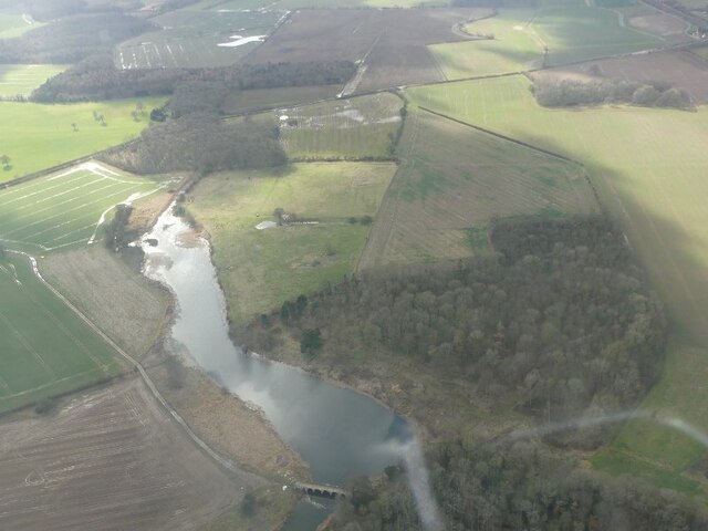
Washdyke Wood, located in Lincolnshire, is a picturesque woodland area known for its natural beauty and rich biodiversity. Covering an area of approximately 50 acres, it is a popular destination for nature enthusiasts and wildlife lovers.

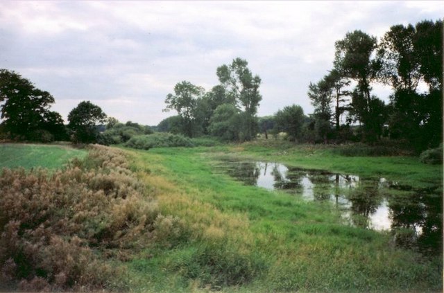
The wood is characterized by a diverse range of tree species, including oak, birch, and beech, which create a dense canopy providing shade and shelter for the flora and fauna that call it home. The forest floor is covered with a carpet of wildflowers, including bluebells, primroses, and wood anemones, creating a vibrant and colorful display during the spring months.

Washdyke Wood is also home to a variety of wildlife, including deer, rabbits, squirrels, and a wide range of bird species. Birdwatchers can spot woodpeckers, owls, and various songbirds that inhabit the wood. The tranquil atmosphere and peaceful surroundings make it an ideal spot for birdwatching and nature photography.

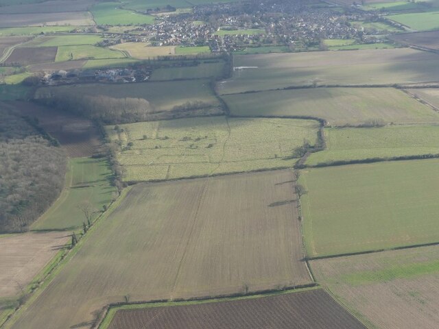
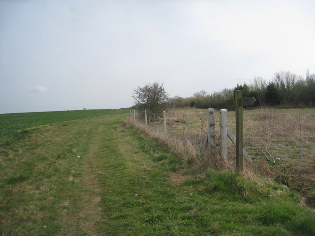
The wood is crisscrossed with well-maintained footpaths, allowing visitors to explore and enjoy the natural surroundings. There are also picnic areas and benches scattered throughout the wood, providing opportunities for visitors to relax and take in the beauty of the landscape.

Washdyke Wood is managed and maintained by local conservation organizations, ensuring the preservation of its natural habitat. It plays a crucial role in the local ecosystem, providing a habitat for numerous species and contributing to the overall biodiversity of the area.

Overall, Washdyke Wood is a hidden gem in Lincolnshire, offering a peaceful retreat in nature and a chance to connect with the natural world.

If you have any feedback on the listing, please let us know in the comments section below.

Washdyke Wood Images

Images are sourced within 2km of 53.597871/-0.27157986 or Grid Reference TA1412. Thanks to Geograph Open Source API. All images are credited.

Newsham Lake, near Habrough: aerial 2022
Across Nuncotham to Keelby: aerial 2022 For Nuncotham Cistercian Priory see <a href="https://www.geograph.org.uk/photo/6352204">TA1511 : Site of Nuncotham Cistercian Priory: aerial 2019 (1)</a> and <span class="nowrap"><a title="https://www.british-history.ac.uk/vch/lincs/vol2/pp151-153" rel="nofollow ugc noopener" href="https://www.british-history.ac.uk/vch/lincs/vol2/pp151-153">Link</a><img style="margin-left:2px;" alt="External link" title="External link - shift click to open in new window" src="https://s1.geograph.org.uk/img/external.png" width="10" height="10"/></span>
Across Nuncotham to Keelby: aerial 2022
Habrough and railway crossing: aerial 2022 (1)
Habrough north of the A180: aerial 2022
Habrough: aerial 2022
Newsham Lake and Bridge: aerial 2022
Entrance to Churchside Close
The beginning of the footpath to Stallingborough Adjacent to the eastbound platform at Habrough station.
The beginning of the footpath to Stallingborough
Adjacent to the eastbound platform at Habrough station.
Footbridge on the footpath from Habrough to Stallingborough The footpath runs alongside the railway for the entire distance.
Footbridge on the footpath from Habrough to Stallingborough
The footpath runs alongside the railway for the entire distance.
Foxhole Wood seen across the railway Taken from the Habrough to Stallingborough footpath which runs alongside the railway for the entire distance.
Foxhole Wood seen across the railway
Taken from the Habrough to Stallingborough footpath which runs alongside the railway for the entire distance.
Fallen Tree at Nuncotham This, like the ruins of Nuncotham Priory amidst which it once stood, will soon be lost to sight.
Fallen Tree at Nuncotham
This, like the ruins of Nuncotham Priory amidst which it once stood, will soon be lost to sight.
Bridleway to Habrough The farmer has driven his tractor across the field to mark the way.
Bridleway to Habrough
The farmer has driven his tractor across the field to mark the way.
Bridleway to Keelby At least the farmer has driven his tractor across this field to mark the way which isn't the case in the next field.
Bridleway to Keelby
At least the farmer has driven his tractor across this field to mark the way which isn't the case in the next field.
The Grange A neat grey brick farmhouse.
The Grange
A neat grey brick farmhouse.
Another bridleway to Keelby This one goes via New Farm Cottages.
Another bridleway to Keelby
This one goes via New Farm Cottages.
Field edge near Roxton Wood A wide verge has been left as well as an uncultivated area. The fringe of Roxton Wood can be seen on the right of the photograph, Foxhole Wood in the distance in the centre.
Field edge near Roxton Wood
A wide verge has been left as well as an uncultivated area. The fringe of Roxton Wood can be seen on the right of the photograph, Foxhole Wood in the distance in the centre.
Former Occupation Crossing Long since not used.
Former Occupation Crossing
Long since not used.
Looking back to Habrough On the footpath to Stallingborough.
Looking back to Habrough
On the footpath to Stallingborough.
Show me another place!

Washdyke Wood is located at Grid Ref: TA1412 (Lat: 53.597871, Lng: -0.27157986)

Administrative County: Lincolnshire

District: West Lindsey

Police Authority: Lincolnshire

What 3 Words

///jams.invoices.reinstate. Near Keelby, Lincolnshire

Related Wikis

Habrough railway station

Habrough railway station serves the village of Habrough and the town of Immingham in North East Lincolnshire, England. It was built by the Great Grimsby...

Habrough

Habrough ( HAY-b(ə-)rə) is a village and civil parish in North East Lincolnshire, England, 8 miles (13 km) north-west of Grimsby and 3 miles (5 km) inland...

Brocklesby

Brocklesby is a village and civil parish in the West Lindsey district of Lincolnshire, England. It is situated 1 mile (1.6 km) south from Habrough, 4...
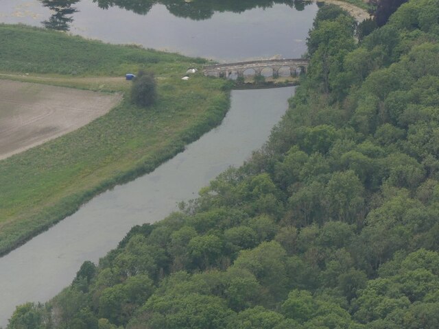
Newsham Bridge

Newsham Bridge is a Grade I listed structure in Brocklesby Park, part of the estate of the Earls of Yarborough in West Lindsey, Lincolnshire, England....

Nuncotham Priory

Nuncotham Priory was a priory of Cistercian nuns in Brocklesby, Lincolnshire, England. The priory of Nuncotham in Brocklesby parish was founded by Alan...

Newsham Abbey

Newsham Abbey was an abbey in Newsham, a small hamlet north of Brocklesby village in Lincolnshire, England, and one of nine within the historical county...

Barton line

The Barton line is a railway line in North and North East Lincolnshire, England. It runs from Barton-upon-Humber south east to Cleethorpes and was designated...

Brocklesby railway station

Brocklesby railway station was a station near Brocklesby, Lincolnshire. It was formally closed by British Rail on 3 October 1993. The station was located...

Nearby Amenities

Located within 500m of 53.597871,-0.27157986
Power: tower
Lat/Long: 53.6015808/-0.2714342
Power: tower
Lat/Long: 53.6002532/-0.2679539
Habrough Grange
Place: farm
Source: Bing
Lat/Long: 53.6011044/-0.2665728
Ivy Cottage
Place: isolated_dwelling
Lat/Long: 53.5978607/-0.2783484
Material: wood
Power: pole
Lat/Long: 53.600468/-0.2661001
Frequency: 50
Material: wood
Phases: 3
Power: pole
Transformer: distribution
Voltage: 11000;400
Lat/Long: 53.6005149/-0.2661906
Material: wood
Power: pole
Lat/Long: 53.6005547/-0.2662677
The data included in this document is from www.openstreetmap.org. The data is made available under ODbL.

Have you been to Washdyke Wood?

Leave your review of Washdyke Wood below (or comments, questions and feedback).