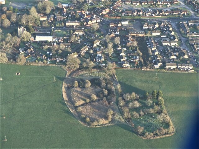
Ash Holt

Wood, Forest in Lincolnshire East Lindsey

England

Ash Holt

The Ivy public house and Corndolly café
The Ivy public house and Corndolly café Credit: David Lally

Ash Holt is a small village located in the district of North Kesteven, Lincolnshire, England. Situated in the heart of the county, Ash Holt is known for its picturesque woodlands and lush forests, providing a serene and peaceful environment for its residents and visitors.

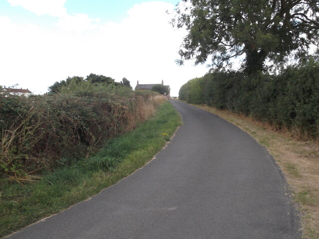
The village is surrounded by a rich and diverse natural landscape, with numerous walking trails and paths that allow people to explore the beauty of the area. The woodlands in Ash Holt are particularly notable, offering a haven for wildlife and a popular spot for nature enthusiasts. The forests are home to a variety of flora and fauna, including oak, birch, and beech trees, as well as a range of bird species and small mammals.

Ash Holt is a close-knit community, with a small population that enjoys a strong sense of community spirit. The village has a primary school, a village hall, and a local pub, providing essential amenities for its residents. Although relatively secluded, Ash Holt is within easy reach of nearby towns and cities, offering a balance between peaceful rural living and access to urban facilities.

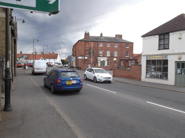
The village is well-connected by road, with the A15 running nearby, providing easy access to Lincoln and other neighboring towns. Public transport options are limited, with a few bus services operating in the area. However, the village's rural location adds to its charm, providing a tranquil escape from the hustle and bustle of city life.

Overall, Ash Holt, Lincolnshire, is a scenic and idyllic village that offers a close connection to nature and a tight-knit community, making it an attractive place to reside or visit for those seeking a peaceful retreat in the heart of rural England.

If you have any feedback on the listing, please let us know in the comments section below.
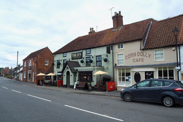
Ash Holt Images

Images are sourced within 2km of 53.272103/-0.28717869 or Grid Reference TF1476. Thanks to Geograph Open Source API. All images are credited.

The Ivy public house and Corndolly café
The Turnor Arms
The Turnor Arms
The sign of The Turnor Arms See: <a href="https://www.geograph.org.uk/photo/6933995">TF1378 : The Turnor Arms</a>
The sign of The Turnor Arms
Cut Mark: Langton by Wragby, Rising Sun Farm Cut bench mark on the frontage of the farm building, facing the A158.  See <a title="https://www.geograph.org.uk/photo/6972663" href="https://www.geograph.org.uk/photo/6972663">Link</a> for a wider view and <span class="nowrap"><a title="https://www.bench-marks.org.uk/bm23078" rel="nofollow ugc noopener" href="https://www.bench-marks.org.uk/bm23078">Link</a><img style="margin-left:2px;" alt="External link" title="External link - shift click to open in new window" src="https://s1.geograph.org.uk/img/external.png" width="10" height="10"/></span> for details of the mark.
Cut Mark: Langton by Wragby, Rising Sun Farm
Cut bench mark on the frontage of the farm building, facing the A158. See Link for a wider view and LinkExternal link for details of the mark.
Langton by Wragby, Rising Sun Farm There is a cut bench mark on the frontage of the farm building at the far end, facing the A158.  See <a title="https://www.geograph.org.uk/photo/6972661" href="https://www.geograph.org.uk/photo/6972661">Link</a> for a close-up view and <span class="nowrap"><a title="https://www.bench-marks.org.uk/bm23078" rel="nofollow ugc noopener" href="https://www.bench-marks.org.uk/bm23078">Link</a><img style="margin-left:2px;" alt="External link" title="External link - shift click to open in new window" src="https://s1.geograph.org.uk/img/external.png" width="10" height="10"/></span> for details of the mark.
Langton by Wragby, Rising Sun Farm
There is a cut bench mark on the frontage of the farm building at the far end, facing the A158. See Link for a close-up view and LinkExternal link for details of the mark.
Extinct hamlet of Strubby, Langton by Wragby, Lincs: aerial 2022 The lost village of Strubby is now represented by Strubby Hall. There is mention in 1316 of Langeton and Strubby.

See <span class="nowrap"><a title="https://www.heritagegateway.org.uk/Gateway/Results_Single.aspx?uid=MLI40348&resourceID=1006" rel="nofollow ugc noopener" href="https://www.heritagegateway.org.uk/Gateway/Results_Single.aspx?uid=MLI40348&resourceID=1006">Link</a><img style="margin-left:2px;" alt="External link" title="External link - shift click to open in new window" src="https://s1.geograph.org.uk/img/external.png" width="10" height="10"/></span>

Not to be confused with Strubby near Withern, Lincs.
Extinct hamlet of Strubby, Langton by Wragby, Lincs: aerial 2022
The lost village of Strubby is now represented by Strubby Hall. There is mention in 1316 of Langeton and Strubby. See LinkExternal link Not to be confused with Strubby near Withern, Lincs.
Ridge and furrow, Langton by Wragby: aerial 2022 (2) See <span class="nowrap"><a title="https://www.heritagegateway.org.uk/Gateway/Results_Single.aspx?uid=MLI88904&resourceID=1006" rel="nofollow ugc noopener" href="https://www.heritagegateway.org.uk/Gateway/Results_Single.aspx?uid=MLI88904&resourceID=1006">Link</a><img style="margin-left:2px;" alt="External link" title="External link - shift click to open in new window" src="https://s1.geograph.org.uk/img/external.png" width="10" height="10"/></span>
Ridge and furrow, Langton by Wragby: aerial 2022 (2)
See LinkExternal link
Ridge and furrow, Langton by Wragby: aerial 2022 (1) See <span class="nowrap"><a title="https://www.heritagegateway.org.uk/Gateway/Results_Single.aspx?uid=MLI88904&resourceID=1006" rel="nofollow ugc noopener" href="https://www.heritagegateway.org.uk/Gateway/Results_Single.aspx?uid=MLI88904&resourceID=1006">Link</a><img style="margin-left:2px;" alt="External link" title="External link - shift click to open in new window" src="https://s1.geograph.org.uk/img/external.png" width="10" height="10"/></span>
Ridge and furrow, Langton by Wragby: aerial 2022 (1)
See LinkExternal link
"Wragby Moats", a Manorian Manor complex: aerial 2022 The remains of a medieval manorial complex. 

See <span class="nowrap"><a title="https://www.heritagegateway.org.uk/Gateway/Results_Single.aspx?uid=09cad9c1-6cbb-4d7a-b6ac-b5ff9c4d1eec&resourceID=19191" rel="nofollow ugc noopener" href="https://www.heritagegateway.org.uk/Gateway/Results_Single.aspx?uid=09cad9c1-6cbb-4d7a-b6ac-b5ff9c4d1eec&resourceID=19191">Link</a><img style="margin-left:2px;" alt="External link" title="External link - shift click to open in new window" src="https://s1.geograph.org.uk/img/external.png" width="10" height="10"/></span> and <span class="nowrap"><a title="https://www.heritagegateway.org.uk/Gateway/Results_Single.aspx?uid=MLI43631&resourceID=1006" rel="nofollow ugc noopener" href="https://www.heritagegateway.org.uk/Gateway/Results_Single.aspx?uid=MLI43631&resourceID=1006">Link</a><img style="margin-left:2px;" alt="External link" title="External link - shift click to open in new window" src="https://s1.geograph.org.uk/img/external.png" width="10" height="10"/></span>

See also <a href="https://www.geograph.org.uk/photo/5021809">TF1377 : Wragby moats: aerial 2016</a> and <a href="https://www.geograph.org.uk/photo/5021793">TF1377 : Wragby and its moats: aerial 2016</a>.
"Wragby Moats", a Manorian Manor complex: aerial 2022
The remains of a medieval manorial complex. See LinkExternal link and LinkExternal link See also TF1377 : Wragby moats: aerial 2016 and TF1377 : Wragby and its moats: aerial 2016.
The Turnor Arms, Wragby
Entrance off the B1202
Farm track near Kingthorpe
Buildings at Hoop Lane Farm
Road to Langton Hill Farm
Road by Coultas Wood
Field path near Langton by Wragby
Minor road towards the Rising Sun Farm
Show me another place!

Ash Holt is located at Grid Ref: TF1476 (Lat: 53.272103, Lng: -0.28717869)

Administrative County: Lincolnshire

District: East Lindsey

Police Authority: Lincolnshire

What 3 Words

///intruding.epic.jazz. Near Wragby, Lincolnshire

Nearby Locations

Ash Holt Langton by Wragby

Related Wikis

Langton by Wragby

Langton by Wragby is a small village and civil parish in the East Lindsey district of Lincolnshire, England. It lies approximately 1 mile (1.6 km) south...

Wragby railway station

Wragby railway station was a railway station that served the town of Wragby, Lincolnshire, England between 1874 and 1960, on the Louth to Bardney line...

Kingthorpe railway station

Kingthorpe railway station was a railway station that served the village of Kingthorpe, Lincolnshire, England between 1874 and 1956, on the Louth to Bardney...

Kingthorpe

Kingthorpe is a hamlet in the West Lindsey district of Lincolnshire, England. The hamlet is in the civil parish of Apley, and is 10 miles (16 km) east...

Wragby

Wragby ( RAG-bee) is a town and civil parish in the East Lindsey district of Lincolnshire, England. It is situated at the junction of the A157 and A158...

Goltho

Goltho is a hamlet in the West Lindsey district of Lincolnshire, England. The population (including Bullington) was 157 at the 2011 census. It is situated...

St George's Church, Goltho

St George's Church is a redundant Anglican church in the deserted village of Goltho, Lincolnshire, England. It is recorded in the National Heritage List...

Apley

Apley is a hamlet and civil parish in the West Lindsey district of Lincolnshire, England. It is situated 1 mile (1.6 km) west from the hamlet of Kingthorpe...

Nearby Amenities

Located within 500m of 53.272103,-0.28717869
Power: pole
Lat/Long: 53.2678828/-0.2863527
Power: pole
Lat/Long: 53.2686708/-0.2849052
Power: pole
Lat/Long: 53.2693002/-0.2837462
Power: pole
Lat/Long: 53.269754/-0.2828756
Power: pole
Lat/Long: 53.2703213/-0.2818569
Power: pole
Lat/Long: 53.2711216/-0.2803756
Holme Hill
Place: locality
Source: Bing
Lat/Long: 53.2717049/-0.2946668
Note: End of Public Highway
Lat/Long: 53.2751649/-0.2823027
Langton Wood
Place: locality
Source: Bing
Lat/Long: 53.2689166/-0.2872492
The data included in this document is from www.openstreetmap.org. The data is made available under ODbL.

Have you been to Ash Holt?

Leave your review of Ash Holt below (or comments, questions and feedback).