Burnt Wood
Wood, Forest in Hertfordshire North Hertfordshire
England
Burnt Wood

Burnt Wood is a small village located in the county of Hertfordshire, England. Situated within a dense forest area, it is known for its natural beauty and tranquil surroundings. The village is named after the burnt appearance of the trees in the area, which were charred during a large forest fire many years ago.
The village is home to a close-knit community, with a population of around 500 residents. The houses in Burnt Wood are predominantly traditional cottages, giving the village a quaint and picturesque charm. The village is surrounded by lush greenery, with a variety of wildlife making their homes in the nearby forest.
Despite its rural setting, Burnt Wood has good transport links, with a main road passing through the village, connecting it to nearby towns and cities. This allows residents to easily access amenities and services outside of the village.
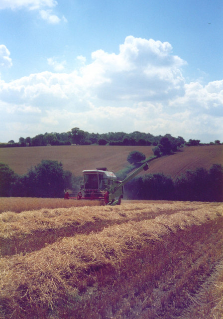
The forest surrounding Burnt Wood offers numerous opportunities for outdoor activities such as hiking, birdwatching, and nature walks. The area is also popular among photographers and artists due to its stunning landscapes and scenic views.
The village has a small primary school, providing education to the local children. Additionally, there is a village hall which serves as a community center, hosting various events and gatherings throughout the year.
Overall, Burnt Wood is a peaceful and idyllic village, offering residents and visitors a chance to escape the hustle and bustle of city life and immerse themselves in nature's beauty.
If you have any feedback on the listing, please let us know in the comments section below.
Burnt Wood Images
Images are sourced within 2km of 51.875176/-0.34826529 or Grid Reference TL1320. Thanks to Geograph Open Source API. All images are credited.


Burnt Wood is located at Grid Ref: TL1320 (Lat: 51.875176, Lng: -0.34826529)
Administrative County: Hertfordshire
District: North Hertfordshire
Police Authority: Hertfordshire
What 3 Words
///rear.tigers.undulation. Near Kimpton, Hertfordshire
Nearby Locations
Related Wikis
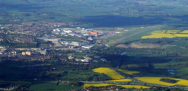
Luton Airport
London Luton Airport (IATA: LTN, ICAO: EGGW) is an international airport located in Luton, Bedfordshire, England, situated 1.7 miles (2.7 km) east of the...

Court Line Flight 95
Court Line Aviation Flight 95 was an international charter flight from London Luton Airport, Bedfordshire, England, to Munich-Riem Airport, West Germany...

Chiltern Green
Chiltern Green is a hamlet located in Bedfordshire, England. It is in the civil parish of Hyde. The settlement lent its name to Chiltern Green railway...
King's Walden
King's Walden is a civil parish in the English county of Hertfordshire. The name includes an apostrophe, but this is often omitted. The main settlement...
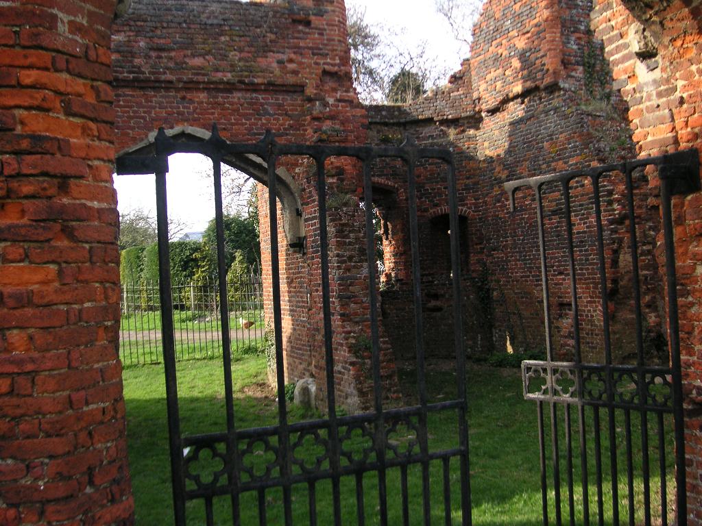
Someries Castle
Someries Castle (sometimes spelt Summeries castle) is a Scheduled Ancient Monument, in the Parish of Hyde, near the town of Luton, Bedfordshire, England...
Wigmore, Luton
Wigmore is a suburb of Luton about 2 miles (3.2 km) east north-east of the town centre, and a ward of the Borough of Luton, in the ceremonial county of...

Breachwood Green Mill, King's Walden
Breachwood Green Mill is a Grade II listed tower mill at King's Walden, Hertfordshire, England which has been converted to residential accommodation....
Vauxhall Park, Luton
Vauxhall Park is a suburb in east Luton, Bedfordshire, England. The area is roughly bounded by Crawley Green Road to the north, London Luton Airport to...
Nearby Amenities
Located within 500m of 51.875176,-0.34826529Have you been to Burnt Wood?
Leave your review of Burnt Wood below (or comments, questions and feedback).