Eign Hill

Settlement in Herefordshire

England

Eign Hill

Hereford Station The north end of Hereford Station with Class 158 diesel multiple unit No 158841 departing with a train for the north. The platform on the left is a bay platform.
Hereford Station Credit: Rob Newman

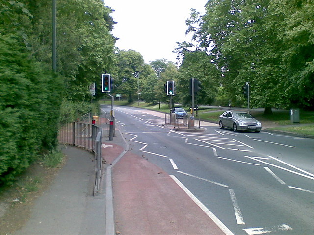
Eign Hill is a picturesque area located in Herefordshire, a county in the West Midlands region of England. Situated on the outskirts of Hereford, the hill offers breathtaking panoramic views of the surrounding countryside and the city itself. Rising approximately 200 meters above sea level, it is a popular destination for locals and tourists alike.

The hill is covered with a mixture of fields, woodlands, and hedgerows, creating a diverse and vibrant natural environment. Its fertile soil supports a variety of flora and fauna, making it an ideal spot for nature enthusiasts and wildlife lovers. Visitors can often spot rabbits, foxes, and a wide range of bird species while exploring the area.

Eign Hill is also home to a number of walking trails, providing opportunities for hikers to enjoy the stunning scenery and embrace the tranquility of the countryside. The paths are well-maintained and cater to different fitness levels, making them accessible to people of all ages. Along the way, walkers can encounter historical landmarks, such as ancient burial mounds, reminding them of the area's rich cultural heritage.

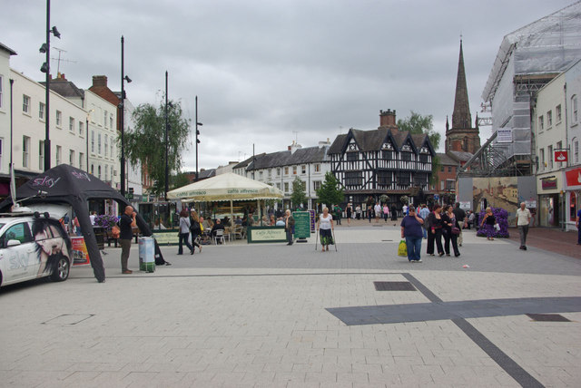
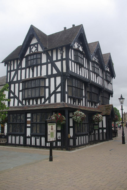
The hill's proximity to Hereford allows visitors to easily access the city's amenities and attractions. Hereford Cathedral, dating back to the 11th century, is a must-see for history enthusiasts, while the city center offers a range of shops, restaurants, and cafes for those looking to relax and indulge in local cuisine.

In conclusion, Eign Hill in Herefordshire offers a captivating blend of natural beauty, recreational opportunities, and historical significance, making it a must-visit destination for anyone seeking a peaceful retreat or an adventure in the heart of the English countryside.

If you have any feedback on the listing, please let us know in the comments section below.

Eign Hill Images

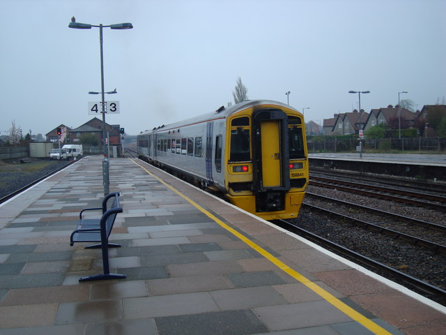
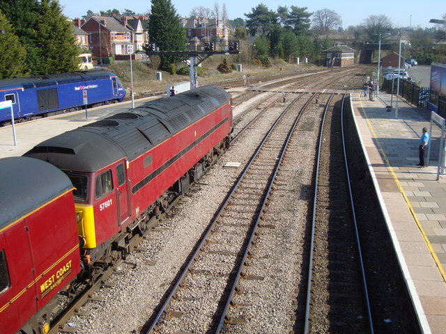
Images are sourced within 2km of 52.052066/-2.6909309 or Grid Reference SO5239. Thanks to Geograph Open Source API. All images are credited.
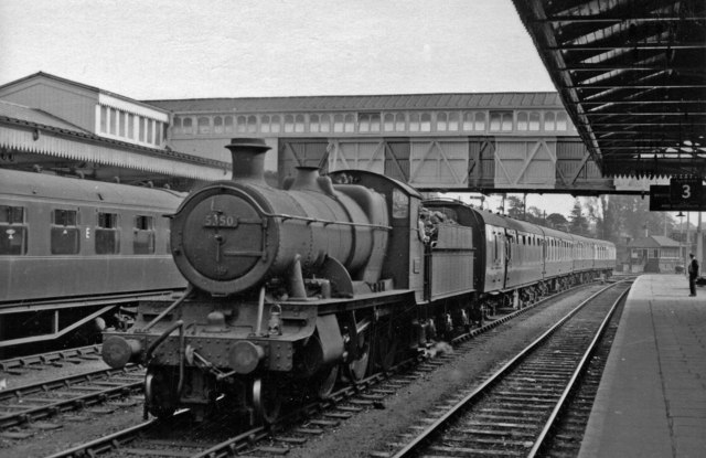
Hereford Station The north end of Hereford Station with Class 158 diesel multiple unit No 158841 departing with a train for the north. The platform on the left is a bay platform.
Hereford Station
The north end of Hereford Station with Class 158 diesel multiple unit No 158841 departing with a train for the north. The platform on the left is a bay platform.
Hereford Station, South End West Coast Railways Class 57 No 57601 waits for the signal to move off southwards from Hereford. View taken from the station footbridge
Hereford Station, South End
West Coast Railways Class 57 No 57601 waits for the signal to move off southwards from Hereford. View taken from the station footbridge
Chimneys, Hereford Railway Station Ornate brick chimneys at Hereford railway station
Chimneys, Hereford Railway Station
Ornate brick chimneys at Hereford railway station
Penn Grove Road, Hereford
Aylestone Hill, Hereford
Hereford Station, with 2-6-0 on pilot duty View southward, towards Newport etc.; ex-GW & LNW Joint Shrewsbury - Hereford - Abergavenny - Newport main line, ex-GW main line from Worcester and Birmingham, also branch from Gloucester via Ross-on-Wye (closed 11/64) and ex-Midland line to Hay and Brecon (closed 12/62). The pilot on the Up centre road with coaches is Churchward 43XX 2-6-0 No. 5350 (built 7/18, withdrawn 12/59).
Hereford Station, with 2-6-0 on pilot duty
View southward, towards Newport etc.; ex-GW & LNW Joint Shrewsbury - Hereford - Abergavenny - Newport main line, ex-GW main line from Worcester and Birmingham, also branch from Gloucester via Ross-on-Wye (closed 11/64) and ex-Midland line to Hay and Brecon (closed 12/62). The pilot on the Up centre road with coaches is Churchward 43XX 2-6-0 No. 5350 (built 7/18, withdrawn 12/59).
High Town, Hereford This open pedestrianised space once lay outside the city's Saxon walls to the north of the cathedral but is now at the heart of the shopping area. The spire belongs to St Peter's Church.
High Town, Hereford
This open pedestrianised space once lay outside the city's Saxon walls to the north of the cathedral but is now at the heart of the shopping area. The spire belongs to St Peter's Church.
The Old House A Hereford icon. This half-timbered house dates from 1621 and is now a museum.
The Old House
A Hereford icon. This half-timbered house dates from 1621 and is now a museum.
Steam Locomotive at Hereford, 1985 BR Standard Class 4 4-6-0 No 75069, based on the Severn Valley Railway, waits at Hereford station to work 'The Red Dragon' charter train.
Steam Locomotive at Hereford, 1985
BR Standard Class 4 4-6-0 No 75069, based on the Severn Valley Railway, waits at Hereford station to work 'The Red Dragon' charter train.
Northbound Freight Train at Hereford Diesel electric locomotive No 66250, hauling a northbound freight train through one of the centre roads at Hereford Station, slows to a halt to allow a change of driver.
Northbound Freight Train at Hereford
Diesel electric locomotive No 66250, hauling a northbound freight train through one of the centre roads at Hereford Station, slows to a halt to allow a change of driver.
Arriva Trains Wales Multiple Unit at Hereford Class 175 diesel multiple unit No 175114 approaches Hereford station with a southbound Arriva Trains Wales service.
Arriva Trains Wales Multiple Unit at Hereford
Class 175 diesel multiple unit No 175114 approaches Hereford station with a southbound Arriva Trains Wales service.
Stanier 8F at Hereford, 1991 Preserved steam locomotive Stanier 8F 2-8-0 No 8233, in LMS livery, [owned by the Stanier 8F Locomotive Society and normally based on the Severn Valley Railway] brings the stock for the 'Welsh Marches Express' into Hereford station in the autumn of 1991.
Stanier 8F at Hereford, 1991
Preserved steam locomotive Stanier 8F 2-8-0 No 8233, in LMS livery, [owned by the Stanier 8F Locomotive Society and normally based on the Severn Valley Railway] brings the stock for the 'Welsh Marches Express' into Hereford station in the autumn of 1991.
Class 66 at Hereford With Northbound Freight Class 66 diesel-electric locomotive No 66018 slows for a crew change at Hereford with a northbound freight
Class 66 at Hereford With Northbound Freight
Class 66 diesel-electric locomotive No 66018 slows for a crew change at Hereford with a northbound freight
An unusual sight in Commercial Street An attention-seeking 1964 VW Camper with post-Christmas shoppers in Hereford.
An unusual sight in Commercial Street
An attention-seeking 1964 VW Camper with post-Christmas shoppers in Hereford.
Camp Camper 1 1964 VW dolled-up for the Christmas sales.
Camp Camper 1
1964 VW dolled-up for the Christmas sales.
Camp Camper 2 A slightly different angle to <a href="https://www.geograph.org.uk/photo/2745828">SO5140 : Camp Camper 1</a> to show off the eye-shadow!
Camp Camper 2
A slightly different angle to SO5140 : Camp Camper 1 to show off the eye-shadow!
Gingerbread House I've never noticed this tiny timber-framed building before today!
Its incongruous location is to the rear of the Maylord Shopping Centre and Butter Market in Hereford city centre.
Gingerbread House
I've never noticed this tiny timber-framed building before today! Its incongruous location is to the rear of the Maylord Shopping Centre and Butter Market in Hereford city centre.
RSPCA charity shop Hereford Located at 22 Commercial Road, Hereford. The shop sells a wide range of new and donated items.
RSPCA charity shop Hereford
Located at 22 Commercial Road, Hereford. The shop sells a wide range of new and donated items.
Show me another place!

Eign Hill is located at Grid Ref: SO5239 (Lat: 52.052066, Lng: -2.6909309)

Unitary Authority: County of Herefordshire

Police Authority: West Mercia

What 3 Words

///oiled.topped.burns. Near Hereford, Herefordshire

Nearby Locations

Eign Hill Scots Hole

Related Wikis

Herefordshire Council

Herefordshire Council is the local authority for the county of Herefordshire in England. It is a unitary authority, combining the powers of a district...

Bishop of Hereford's Bluecoat School

The Bishop of Hereford's Bluecoat School (BHBS) is a mixed comprehensive secondary school in the Tupsley district of Hereford, England. It is a voluntary...

Harold Street drill hall

The Harold Street drill hall is a former military installation in Hereford, Herefordshire. == History == The building was designed as a local militia barracks...

Williams' Hospital

The Williams' Hospital was an almshouse in the English town of Hereford. The hospital was founded in 1601 by Richard Williams who was an attendant of...

Nearby Amenities

Located within 500m of 52.052066,-2.6909309
Source: bing
Traffic Calming: bump
Lat/Long: 52.0540092/-2.685928
Post Box
Collection Times: Mo-Fr 17:00; Sa 11:30
Post Box Type: pillar
Ref: HR1 10
Royal Cypher: VR
Royal Cypher Wikidata: Q33102356
Lat/Long: 52.049228/-2.6909628
Place Of Worship
Hampton Park United Reformed Church
Addr City: Hereford
Addr Postcode: HR1 1UJ
Addr Street: Hampton Dene Road
Denomination: presbyterian
Fhrs Id: 488784
Religion: christian
Source Addr: FHRS Open Data
Lat/Long: 52.0517431/-2.6872268
Bus Stop
Bus: yes
Public Transport: platform
Lat/Long: 52.0516545/-2.688352
Post Box
Old Eign Hill
Collection Times: Mo-Fr 17:15; Sa 12:00
Operator: Royal Mail
Ref: HR1 150
Lat/Long: 52.0517433/-2.6881866
Bus Stop
Vineyard Road
Bus: yes
Local Ref: NK
Naptan AtcoCode: 2090A19450
Naptan Bearing: S
Naptan CommonName: Vineyard Road
Naptan Indicator: S-bound
Naptan Landmark: o/s Vineyards Hill House
Naptan NaptanCode: heramapw
Naptan PlusbusZoneRef: HEREFRD
Naptan Street: Vineyard Road
Naptan Verified: no
Public Transport: platform
Source: naptan_import
Lat/Long: 52.0512974/-2.6931574
Bus Stop
Hampton Grange
Bus: yes
Naptan AtcoCode: 2090A0106098
Naptan Bearing: E
Naptan CommonName: Hampton Grange
Naptan Indicator: opp
Naptan Landmark: Hampton Grange
Naptan NaptanCode: heratgaw
Naptan PlusbusZoneRef: HEREFRD
Naptan Street: Hampton Park Road
Naptan Verified: no
Public Transport: platform
Source: naptan_import
Lat/Long: 52.0493131/-2.6896268
Bus Stop
Gorsty Lane
Bus: yes
Naptan AtcoCode: 2090A146901
Naptan Bearing: NW
Naptan CommonName: Gorsty Lane
Naptan Indicator: adj Hampton Dene Crossroads
Naptan Landmark: Hampton Dene Crossroads.Hampton Dene Primary Sch
Naptan NaptanCode: heragjat
Naptan PlusbusZoneRef: HEREFRD
Naptan Street: Gorsty Lane
Naptan Verified: no
Public Transport: platform
Source: naptan_import
Lat/Long: 52.0540515/-2.684989
Bus Stop
Lincoln Close
Bus: yes
Naptan AtcoCode: 2090A19442
Naptan Bearing: NW
Naptan CommonName: Lincoln Close
Naptan Indicator: adj
Naptan Landmark: opp No 99 Church Road
Naptan NaptanCode: heramapg
Naptan PlusbusZoneRef: HEREFRD
Naptan Street: Church Road
Naptan Verified: no
Public Transport: platform
Source: naptan_import
Lat/Long: 52.0556139/-2.6868798
Bus Stop
Hampton Dene Road
Bus: yes
Local Ref: NK
Naptan AtcoCode: 2090A19444
Naptan Bearing: SW
Naptan CommonName: Hampton Dene Road
Naptan Indicator: NK
Naptan Landmark: o/s 87/89 Hampton Dene Road. School
Naptan NaptanCode: heramapj
Naptan PlusbusZoneRef: HEREFRD
Naptan Street: Hampton Dene Road
Naptan Verified: no
Public Transport: platform
Source: naptan_import
Lat/Long: 52.0540476/-2.6856598
Bus Stop
Old Eign Hill Post Office
Bus: yes
Naptan AtcoCode: 2090A19446
Naptan Bearing: W
Naptan CommonName: Old Eign Hill Post Office
Naptan Indicator: opp
Naptan Landmark: opp Post Office
Naptan NaptanCode: heramapm
Naptan PlusbusZoneRef: HEREFRD
Naptan Street: Old Eign Hill Road
Naptan Verified: no
Public Transport: platform
Source: naptan_import
Lat/Long: 52.0515874/-2.6881743
Bus Stop
Quarry Road
Bus: yes
Naptan AtcoCode: 2090A19448
Naptan Bearing: W
Naptan CommonName: Quarry Road
Naptan Indicator: opp
Naptan Landmark: opp Quarry Road Junction
Naptan NaptanCode: heramapt
Naptan PlusbusZoneRef: HEREFRD
Naptan Street: Old Eign Road
Naptan Verified: no
Public Transport: platform
Source: naptan_import
Lat/Long: 52.0520037/-2.6907766
Bus Stop
St. Margaret's Road
Bus: yes
Naptan AtcoCode: 2090A19452
Naptan Bearing: S
Naptan CommonName: St. Margaret's Road
Naptan Indicator: opp
Naptan Landmark: o/s No 10 Vineyard Road
Naptan NaptanCode: heramata
Naptan PlusbusZoneRef: HEREFRD
Naptan Street: Vineyard Road
Naptan Verified: no
Public Transport: platform
Source: naptan_import
Lat/Long: 52.0496344/-2.6931025
Gorsty Lane
Local Ref: NK
Naptan AtcoCode: 2090A20282
Naptan Bearing: SE
Naptan BusStopType: CUS
Naptan CommonName: Gorsty Lane
Naptan Indicator: NK
Naptan Landmark: Hampton Dene School
Naptan NaptanCode: herapdpa
Naptan PlusbusZoneRef: HEREFRD
Naptan Street: Gorsty Lane
Naptan Verified: no
Source: naptan_import
Lat/Long: 52.0541241/-2.6848735
Post Box
Brand: Royal Mail
Brand Wikidata: Q638098
Brand Wikipedia: en:Royal Mail
Collection Times: Mo-Fr 09:00; Sa 07:00
Description: Near Tupsley Vicarage, Church Road
Operator: Royal Mail
Operator Wikidata: Q638098
Ref: HR1 24D
Lat/Long: 52.0553583/-2.6864793
Generator Method: photovoltaic
Generator Output Electricity: yes
Generator Source: solar
Generator Type: solar_photovoltaic_panel
Location: roof
Power: generator
Lat/Long: 52.0545967/-2.6963577
Generator Method: photovoltaic
Generator Output Electricity: yes
Generator Source: solar
Generator Type: solar_photovoltaic_panel
Location: roof
Power: generator
Lat/Long: 52.0489375/-2.6929727
Generator Method: photovoltaic
Generator Output Electricity: yes
Generator Source: solar
Generator Type: solar_photovoltaic_panel
Location: roof
Power: generator
Lat/Long: 52.0489607/-2.6922753
Generator Method: photovoltaic
Generator Output Electricity: yes
Generator Source: solar
Generator Type: solar_photovoltaic_panel
Location: roof
Power: generator
Lat/Long: 52.0498596/-2.6863879
Generator Method: photovoltaic
Generator Output Electricity: yes
Generator Source: solar
Generator Type: solar_photovoltaic_panel
Location: roof
Power: generator
Lat/Long: 52.0507487/-2.685889
Generator Method: photovoltaic
Generator Output Electricity: yes
Generator Source: solar
Generator Type: solar_photovoltaic_panel
Location: roof
Power: generator
Lat/Long: 52.0508361/-2.6863959
Generator Method: photovoltaic
Generator Output Electricity: yes
Generator Source: solar
Generator Type: solar_photovoltaic_panel
Location: roof
Power: generator
Lat/Long: 52.0497953/-2.6851273
Generator Method: photovoltaic
Generator Output Electricity: yes
Generator Source: solar
Generator Type: solar_photovoltaic_panel
Location: roof
Power: generator
Lat/Long: 52.0500559/-2.6865757
Generator Method: photovoltaic
Generator Output Electricity: yes
Generator Source: solar
Generator Type: solar_photovoltaic_panel
Location: roof
Power: generator
Lat/Long: 52.0510274/-2.6876593
Crossing
Crossing: uncontrolled
Lat/Long: 52.0535378/-2.6842636
Natural: peak
Note: Highest point in The Quarry. No tree cover - natural bowl - used as meeting point and seating area
Lat/Long: 52.0555929/-2.691747
Generator Method: photovoltaic
Generator Output Electricity: yes
Generator Source: solar
Generator Type: solar_photovoltaic_panel
Location: roof
Power: generator
Lat/Long: 52.0487017/-2.6863557
Generator Method: photovoltaic
Generator Output Electricity: yes
Generator Source: solar
Generator Type: solar_photovoltaic_panel
Location: roof
Power: generator
Lat/Long: 52.0487577/-2.6878926
Generator Method: photovoltaic
Generator Output Electricity: yes
Generator Source: solar
Generator Type: solar_photovoltaic_panel
Location: roof
Power: generator
Lat/Long: 52.0501582/-2.684741
Generator Method: photovoltaic
Generator Output Electricity: yes
Generator Source: solar
Generator Type: solar_photovoltaic_panel
Location: roof
Power: generator
Lat/Long: 52.0501615/-2.6843253
Generator Method: photovoltaic
Generator Output Electricity: yes
Generator Source: solar
Generator Type: solar_photovoltaic_panel
Location: roof
Power: generator
Lat/Long: 52.0515932/-2.6851434
Generator Method: photovoltaic
Generator Output Electricity: yes
Generator Source: solar
Generator Type: solar_photovoltaic_panel
Location: roof
Power: generator
Lat/Long: 52.0534455/-2.685248
Generator Method: photovoltaic
Generator Output Electricity: yes
Generator Source: solar
Generator Type: solar_photovoltaic_panel
Location: roof
Power: generator
Lat/Long: 52.0525861/-2.6971543
Generator Method: photovoltaic
Generator Output Electricity: yes
Generator Source: solar
Generator Type: solar_photovoltaic_panel
Location: roof
Power: generator
Lat/Long: 52.0517581/-2.696524
Generator Method: photovoltaic
Generator Output Electricity: yes
Generator Source: solar
Generator Type: solar_photovoltaic_panel
Location: roof
Power: generator
Lat/Long: 52.0506679/-2.6962182
Generator Method: photovoltaic
Generator Output Electricity: yes
Generator Source: solar
Generator Type: solar_photovoltaic_panel
Location: roof
Power: generator
Lat/Long: 52.0506398/-2.6947913
Generator Method: photovoltaic
Generator Output Electricity: yes
Generator Source: solar
Generator Type: solar_photovoltaic_panel
Location: roof
Power: generator
Lat/Long: 52.0506448/-2.694912
Generator Method: photovoltaic
Generator Output Electricity: yes
Generator Source: solar
Generator Type: solar_photovoltaic_panel
Location: roof
Power: generator
Lat/Long: 52.0504567/-2.6917899
Generator Method: photovoltaic
Generator Output Electricity: yes
Generator Source: solar
Generator Type: solar_photovoltaic_panel
Location: roof
Power: generator
Lat/Long: 52.0510835/-2.6921466
Generator Method: photovoltaic
Generator Output Electricity: yes
Generator Source: solar
Generator Type: solar_photovoltaic_panel
Location: roof
Power: generator
Lat/Long: 52.0493945/-2.6914439
Generator Method: photovoltaic
Generator Output Electricity: yes
Generator Source: solar
Generator Type: solar_photovoltaic_panel
Location: roof
Power: generator
Lat/Long: 52.0488617/-2.694566
Bicycle Rental
Capacity: 5
Name Signed: no
Network: Beryl - Hereford
Official Name: The Knoll
Operator: Beryl
Operator Wikidata: Q106575369
Payment App: yes
Payment App Android: cc.beryl.basis
Payment App Ios: 1386768364
Payment Cash: no
Payment Credit Cards: no
Payment Cryptocurrencies: no
Payment Debit Cards: no
Payment Electronic Purses: no
Ref Gbfs: beryl_hereford:2339
Lat/Long: 52.0554352/-2.68681
Defibrillator
Defibrillator Location: On wall
Emergency: defibrillator
Indoor: no
Lat/Long: 52.051813/-2.6881096
The data included in this document is from www.openstreetmap.org. The data is made available under ODbL.

Have you been to Eign Hill?

Leave your review of Eign Hill below (or comments, questions and feedback).