Egypt

Settlement in Buckinghamshire

England

Egypt

Burnham Beeches Burnham Beeches is owned by the Corporation of London. This ancient woodland is a National Nature Reserve.
Burnham Beeches Credit: David Hawgood

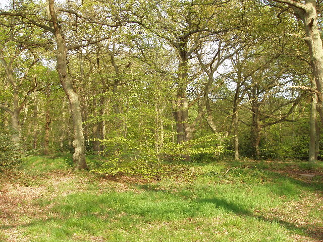
Egypt is a small village located in the county of Buckinghamshire, England. Situated approximately 45 miles northwest of London, Egypt is known for its picturesque countryside and charming rural setting. The village is nestled within the stunning Chiltern Hills, offering residents and visitors breathtaking views and ample opportunities for outdoor activities.

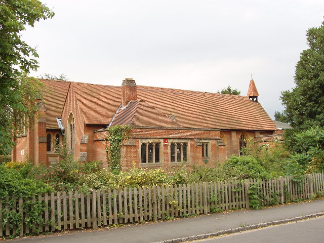
Egypt is a historically rich area, with evidence of human settlement dating back to the Bronze Age. The village is home to several notable landmarks, including the St. Mary and All Saints Church, a Grade II listed building that dates back to the 12th century. The church's medieval architecture and beautiful stained glass windows attract visitors interested in exploring the region's heritage.

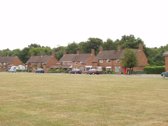
The village of Egypt is relatively small, with a close-knit community that takes pride in maintaining its traditional charm. Local amenities include a village hall, a primary school, and a few small businesses serving the needs of residents. Despite its peaceful and rural setting, Egypt benefits from its proximity to larger towns such as High Wycombe and Aylesbury, which offer a wider range of services and recreational facilities.

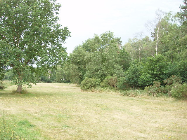
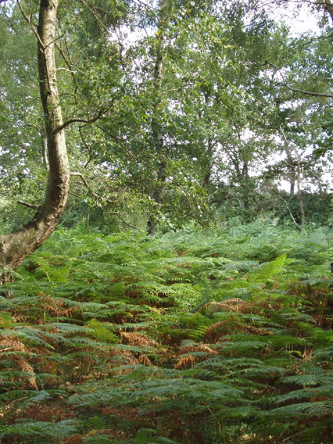
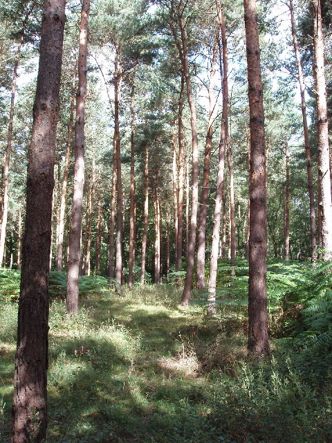
The surrounding countryside provides ample opportunities for nature enthusiasts, with numerous walking and cycling trails crisscrossing the area. The Chiltern Hills, designated as an Area of Outstanding Natural Beauty, are particularly popular among hikers and nature lovers. The nearby Hughenden Manor, a historic house and park managed by the National Trust, also attracts visitors interested in exploring the region's history and enjoying its beautiful gardens.

If you have any feedback on the listing, please let us know in the comments section below.
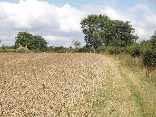
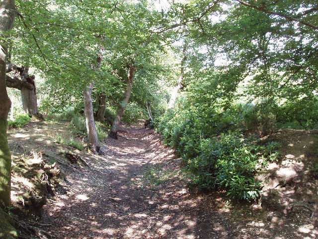
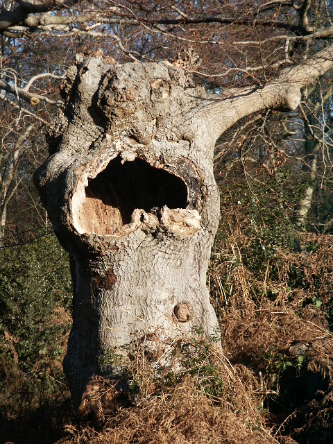
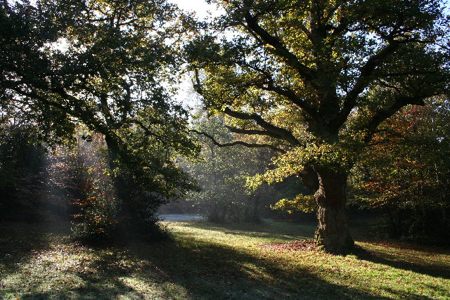
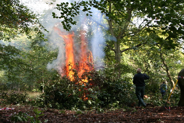
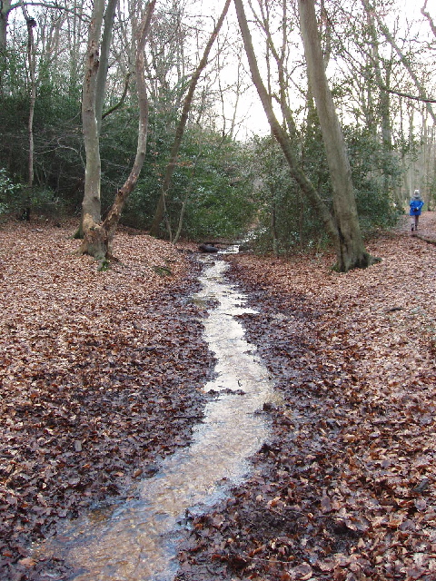
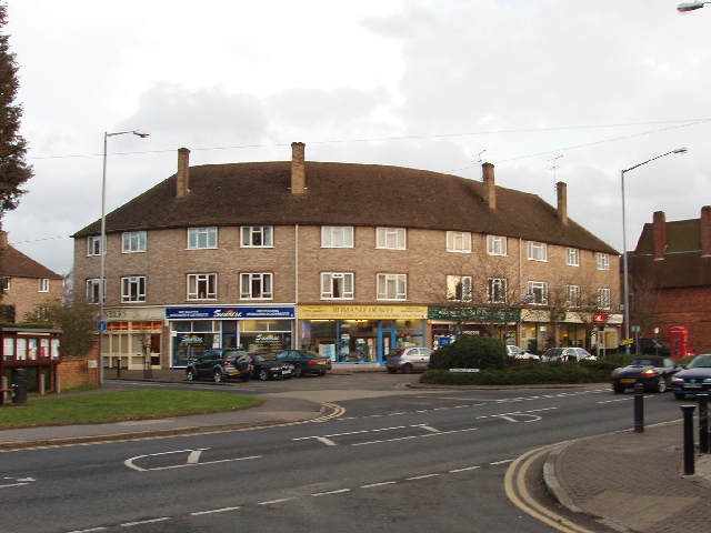
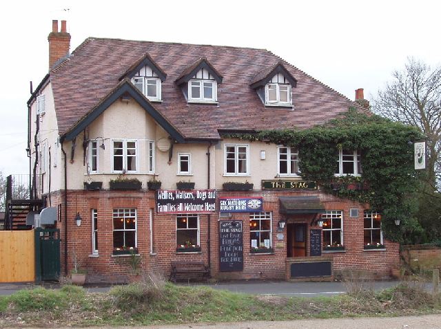
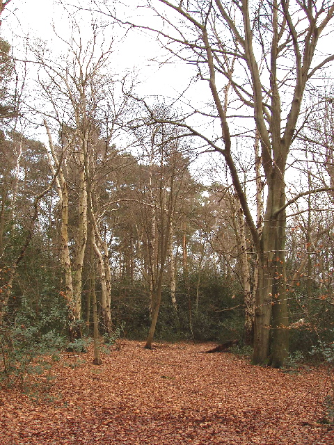
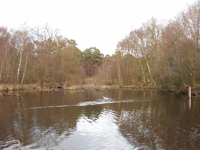
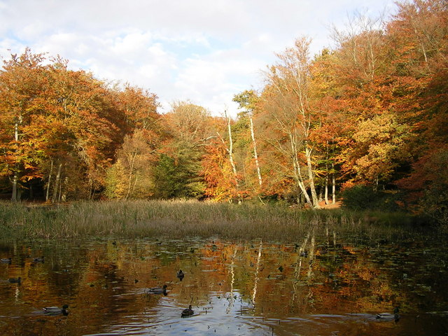
Egypt Images

Images are sourced within 2km of 51.562425/-0.61719 or Grid Reference SU9585. Thanks to Geograph Open Source API. All images are credited.

Burnham Beeches Burnham Beeches is owned by the Corporation of London. This ancient woodland is a National Nature Reserve.
Burnham Beeches
Burnham Beeches is owned by the Corporation of London. This ancient woodland is a National Nature Reserve.
Jones Way across the green at Hedgerley Hill This open grassland with a football pitch and children's play area has houses all around it, and the houses back onto woodland.
Jones Way across the green at Hedgerley Hill
This open grassland with a football pitch and children's play area has houses all around it, and the houses back onto woodland.
Stoke Wood reservoir, near Farnham Common A small reservoir holding water for local needs; it is owned by Thames Water
Stoke Wood reservoir, near Farnham Common
A small reservoir holding water for local needs; it is owned by Thames Water
Mobile phone radio mast, near Farnham Common This mast is tucked into the corner of a field next to Brockhurst Wood
Mobile phone radio mast, near Farnham Common
This mast is tucked into the corner of a field next to Brockhurst Wood
Church of St John the Evangelist, Farnham Common Historically this area was in the parish of Farnham Royal, this church was built when the population here grew.
Church of St John the Evangelist, Farnham Common
Historically this area was in the parish of Farnham Royal, this church was built when the population here grew.
East Burnham Common in Burnham Beeches This area was bought by the City of London to preserve it for public enjoyment
East Burnham Common in Burnham Beeches
This area was bought by the City of London to preserve it for public enjoyment
Egypt Woods, near Farnham Common These woods are privately owned by the Portman Burtley estate, which has provided permissive paths by arrangement with the Forestry Commission. The woods are just North of Burnham Beeches.
Egypt Woods, near Farnham Common
These woods are privately owned by the Portman Burtley estate, which has provided permissive paths by arrangement with the Forestry Commission. The woods are just North of Burnham Beeches.
Conifers in Egypt Woods, near Farnham Common The woods are mainly deciduous, with beeches like the adjacent Burnham Beeches, also oak and birch. But at the Northern edge of the woods are a stand of conifers.
Conifers in Egypt Woods, near Farnham Common
The woods are mainly deciduous, with beeches like the adjacent Burnham Beeches, also oak and birch. But at the Northern edge of the woods are a stand of conifers.
Abbey Park Farm across a cornfield, by Littleworth Common
Hartley Court Moat (Hardicanutes), Burnham Beeches This was a moated homestead dating from the 12th to 14th Centuries. This moat protected the inner enclosure of 0.6 hectares. There is also a shallower ditch and a low bank which would have been surmounted by a fence protecting an outer enclosure of almost 4 hectares.
Hartley Court Moat (Hardicanutes), Burnham Beeches
This was a moated homestead dating from the 12th to 14th Centuries. This moat protected the inner enclosure of 0.6 hectares. There is also a shallower ditch and a low bank which would have been surmounted by a fence protecting an outer enclosure of almost 4 hectares.
Old tree in Burnham Beeches Taken on Boxing Day walk Christmas 2004, while the Tsunami was underway unbeknown to us.
Old tree in Burnham Beeches
Taken on Boxing Day walk Christmas 2004, while the Tsunami was underway unbeknown to us.
Burnham Beeches
Burnham Beeches
Rhododendron Clearance in Burnham Beeches Rhododendrons are being cleared and burned in the Moat area to create suitable conditions for the re-establishment of heathland flora and fauna.
Rhododendron Clearance in Burnham Beeches
Rhododendrons are being cleared and burned in the Moat area to create suitable conditions for the re-establishment of heathland flora and fauna.
Stream in Burnham Beeches View looking south-west in late afternoon. The shallow stream over gravel takes an overflow from the dam at Upper Pond, and flows into Middle Pond.
Stream in Burnham Beeches
View looking south-west in late afternoon. The shallow stream over gravel takes an overflow from the dam at Upper Pond, and flows into Middle Pond.
Shops in Farnham Common These shops are on Beaconsfield Road, the A355 from Slough to Beaconsfield, at the junction with Rosewood Way. Photo taken from the end of Beeches Road.
Shops in Farnham Common
These shops are on Beaconsfield Road, the A355 from Slough to Beaconsfield, at the junction with Rosewood Way. Photo taken from the end of Beeches Road.
The Stag, Burnham Beeches - walkers welcome! This public house (marked on the OS map) is opposite a large public car park for those walking in Burnham Beeches. A sign on the pub says "Wellies, walkers, dogs and families -  all welcome here".
The Stag, Burnham Beeches - walkers welcome!
This public house (marked on the OS map) is opposite a large public car park for those walking in Burnham Beeches. A sign on the pub says "Wellies, walkers, dogs and families - all welcome here".
Burnham Beeches - birch, beech and holly Walking through the woods from "The Stag" to here, many of the trees were oaks, with some large fir trees. Here they have changed to being a mixture of birch and beech. There are holly bushes under the trees in both areas.
Burnham Beeches - birch, beech and holly
Walking through the woods from "The Stag" to here, many of the trees were oaks, with some large fir trees. Here they have changed to being a mixture of birch and beech. There are holly bushes under the trees in both areas.
Upper pond, Burnham Beeches View looking north-east from the dam at the end of the pond. There are ducks on the pond.
Upper pond, Burnham Beeches
View looking north-east from the dam at the end of the pond. There are ducks on the pond.
Show me another place!

Egypt is located at Grid Ref: SU9585 (Lat: 51.562425, Lng: -0.61719)

Unitary Authority: Buckinghamshire

Police Authority: Thames Valley

What 3 Words

///lined.kicked.stable. Near Farnham Royal, Buckinghamshire

Related Wikis

Egypt, Buckinghamshire

Egypt is a hamlet in the South Bucks district of Buckinghamshire, England. It is located within Farnham Royal civil parish, just to the north of Farnham...

Farnham Common

Farnham Common is a village in Buckinghamshire, England, 3 miles north of Slough and 3 miles south of Beaconsfield, on the A355 road. It adjoins the ancient...

Burnham Beeches

Burnham Beeches is a 374.6-hectare (926-acre) biological Site of Special Scientific Interest situated west of Farnham Common in the village of Burnham...

Caldicott School

Caldicott Preparatory School is a prep school for boys aged 7–13 in southern Buckinghamshire, England. == About Caldicott == Caldicott Preparatory School...

Hedgerley

Hedgerley is a village and civil parish in South Bucks district in Buckinghamshire, England. The parish is centred 3 miles (4.8 km) south-east of Beaconsfield...

Burnham Beeches Golf Club

Burnham Beeches Golf Club is a golf club, located in Burnham, Buckinghamshire, England. Established in 1891, it is the oldest golf club in Buckinghamshire...

South Bucks

South Bucks was one of four local government districts in the non-metropolitan county of Buckinghamshire, in South East England. The district was formed...

Dorneywood

Dorneywood is an 18th-century house near Burnham in southern Buckinghamshire, England. Originally a Georgian farmhouse, it has Victorian and later additions...

Nearby Amenities

Located within 500m of 51.562425,-0.61719
Turning Circle
Turning Circle: knuckle
Lat/Long: 51.5609257/-0.614308
Turning Circle
Turning Circle: knuckle
Lat/Long: 51.5629649/-0.613473
Turning Circle
Turning Circle: hammer
Lat/Long: 51.5615177/-0.6119416
Traffic Signals
Lat/Long: 51.5636708/-0.6151902
Turning Circle
Turning Circle: circle
Lat/Long: 51.5621077/-0.6141556
Turning Circle
Turning Circle: y-head
Lat/Long: 51.5595695/-0.6132217
Turning Circle
Turning Circle: square
Lat/Long: 51.5638369/-0.6120853
Crossing
Lat/Long: 51.5607706/-0.6152517
Fuel
Hughes Garage
Lat/Long: 51.5600548/-0.6150349
Post Box
Collection Times: Mo-Fr 09:00; Sa 07:00
Operator: Royal Mail
Ref: SL2 57D
Lat/Long: 51.5591084/-0.6151632
Farnham Common
Place: village
Wikidata: Q612624
Lat/Long: 51.559106/-0.6128104
Post Box
Operator: Royal Mail
Post Box Type: wall
Ref: SL2 10D
Royal Cypher: GR
Royal Cypher Wikidata: Q33102273
Lat/Long: 51.5631772/-0.6194791
Bus Stop
Templewood Lane
Bus: yes
Public Transport: platform
Shelter: no
Lat/Long: 51.5582057/-0.6153993
Bus Stop
The Royal Oak
Bus: yes
Public Transport: platform
Shelter: no
Lat/Long: 51.5604196/-0.6151824
Bus Stop
The Royal Oak
Bus: yes
Naptan AtcoCode: 040000001256
Naptan NaptanCode: bucdajda
Public Transport: platform
Shelter: no
Lat/Long: 51.5612185/-0.6153388
Bus Stop
Barn Close
Bench: yes
Bus: yes
Naptan AtcoCode: 040000001253
Naptan NaptanCode: bucdajap
Public Transport: platform
Shelter: yes
Lat/Long: 51.5630242/-0.6151315
Bus Stop
Barn Close
Bench: yes
Bus: yes
Naptan AtcoCode: 040000001254
Naptan NaptanCode: bucdajat
Public Transport: platform
Shelter: yes
Lat/Long: 51.563246/-0.615313
Bus Stop
Clare Drive
Bus: yes
Public Transport: platform
Shelter: no
Lat/Long: 51.5656789/-0.6167251
Bus Stop
Clare Drive
Bus: yes
Public Transport: platform
Shelter: no
Lat/Long: 51.5667221/-0.6177054
Turning Loop
Lat/Long: 51.5648932/-0.612156
Direction: 170
Generator Method: photovoltaic
Generator Output Electricity: yes
Generator Solar Modules: 28
Generator Source: solar
Generator Type: solar_photovoltaic_panel
Location: roof
Power: generator
Lat/Long: 51.5642287/-0.6119419
Direction: 180
Generator Method: photovoltaic
Generator Output Electricity: yes
Generator Solar Modules: 9
Generator Source: solar
Generator Type: solar_photovoltaic_panel
Location: roof
Power: generator
Lat/Long: 51.5645885/-0.6122132
Direction: 175
Generator Method: photovoltaic
Generator Output Electricity: yes
Generator Solar Modules: 14
Generator Source: solar
Generator Type: solar_photovoltaic_panel
Location: roof
Power: generator
Lat/Long: 51.5645043/-0.6124704
Direction: 185
Generator Method: photovoltaic
Generator Output Electricity: yes
Generator Solar Modules: 8
Generator Source: solar
Generator Type: solar_photovoltaic_panel
Location: roof
Power: generator
Lat/Long: 51.5648734/-0.6129773
Direction: 165
Generator Method: photovoltaic
Generator Output Electricity: yes
Generator Solar Modules: 18
Generator Source: solar
Generator Type: solar_photovoltaic_panel
Location: roof
Power: generator
Lat/Long: 51.5649091/-0.6196345
Direction: 170
Generator Method: photovoltaic
Generator Output Electricity: yes
Generator Solar Modules: 16
Generator Source: solar
Generator Type: solar_photovoltaic_panel
Location: roof
Power: generator
Lat/Long: 51.564874/-0.6188371
Direction: 185
Generator Method: photovoltaic
Generator Output Electricity: yes
Generator Solar Modules: 6
Generator Source: solar
Generator Type: solar_photovoltaic_panel
Location: roof
Power: generator
Lat/Long: 51.5643463/-0.617025
Direction: 185
Generator Method: photovoltaic
Generator Output Electricity: yes
Generator Solar Modules: 6
Generator Source: solar
Generator Type: solar_photovoltaic_panel
Location: roof
Power: generator
Lat/Long: 51.5643747/-0.6172823
Direction: 200
Generator Method: photovoltaic
Generator Output Electricity: yes
Generator Solar Modules: 16
Generator Source: solar
Generator Type: solar_photovoltaic_panel
Location: roof
Power: generator
Lat/Long: 51.5638341/-0.616657
Direction: 195
Fixme: survey for the extra panels: thermal?
Generator Method: photovoltaic
Generator Output Electricity: yes
Generator Solar Modules: 12
Generator Source: solar
Generator Type: solar_photovoltaic_panel
Location: roof
Power: generator
Lat/Long: 51.5588109/-0.6190775
Direction: 185
Generator Method: photovoltaic
Generator Output Electricity: yes
Generator Solar Modules: 24
Generator Source: solar
Generator Type: solar_photovoltaic_panel
Location: roof
Power: generator
Lat/Long: 51.5590012/-0.6196537
Direction: 200
Fixme: survey for the extra 2 panels: thermal?
Generator Method: photovoltaic
Generator Output Electricity: yes
Generator Solar Modules: 8
Generator Source: solar
Generator Type: solar_photovoltaic_panel
Location: roof
Power: generator
Lat/Long: 51.5594515/-0.6182646
Direction: 220
Generator Method: photovoltaic
Generator Output Electricity: yes
Generator Solar Modules: 16
Generator Source: solar
Generator Type: solar_photovoltaic_panel
Location: roof
Power: generator
Lat/Long: 51.5583093/-0.6190905
Direction: 165
Generator Method: photovoltaic
Generator Output Electricity: yes
Generator Solar Modules: 6
Generator Source: solar
Generator Type: solar_photovoltaic_panel
Location: roof
Power: generator
Lat/Long: 51.5652997/-0.6146087
Direction: 255
Generator Method: photovoltaic
Generator Output Electricity: yes
Generator Solar Modules: 8
Generator Source: solar
Generator Type: solar_photovoltaic_panel
Location: roof
Power: generator
Lat/Long: 51.5653219/-0.6146588
Crossing
Lat/Long: 51.5636736/-0.6150403
Crossing
Lat/Long: 51.5635726/-0.6151828
Turning Circle
Turning Circle: square
Lat/Long: 51.5643701/-0.6147791
Direction: 165
Fixme: survey for pnel types
Generator Method: photovoltaic
Generator Output Electricity: yes
Generator Solar Modules: 14
Generator Source: solar
Generator Type: solar_photovoltaic_panel
Location: roof
Power: generator
Lat/Long: 51.5627387/-0.6133708
Direction: 180
Generator Method: photovoltaic
Generator Output Electricity: yes
Generator Solar Modules: 16
Generator Source: solar
Generator Type: solar_photovoltaic_panel
Location: roof
Power: generator
Lat/Long: 51.5628074/-0.6140877
Turning Circle
Turning Circle: knuckle
Lat/Long: 51.5629808/-0.6147627
Turning Circle
Turning Circle: knuckle
Lat/Long: 51.5617025/-0.6139236
Direction: 90
Fixme: survey for panel count
Generator Method: photovoltaic
Generator Output Electricity: yes
Generator Solar Modules: 8
Generator Source: solar
Generator Type: solar_photovoltaic_panel
Location: roof
Power: generator
Lat/Long: 51.5615693/-0.6148944
Turning Circle
Turning Circle: knuckle
Lat/Long: 51.5603183/-0.6132001
Direction: 180
Generator Method: photovoltaic
Generator Output Electricity: yes
Generator Solar Modules: 14
Generator Source: solar
Generator Type: solar_photovoltaic_panel
Location: roof
Power: generator
Lat/Long: 51.5640964/-0.6128342
Barrier: kissing_gate
Lat/Long: 51.5590862/-0.6151632
The data included in this document is from www.openstreetmap.org. The data is made available under ODbL.

Have you been to Egypt?

Leave your review of Egypt below (or comments, questions and feedback).